List of cultural monuments in the Äußere Neustadt (Dresden, L – Z)
The list of cultural monuments in the Äußere Neustadt contains the cultural monuments of the district Äußeren Neustadt in the Dresden district of Neustadt . This district is divided into the districts of Innere Neustadt , Äußere Neustadt, Leipziger Vorstadt , Radeberger Vorstadt and Albertstadt . The Äußere Neustadt is also called Antonstadt .
The notes are to be observed.
This list is a partial list of the list of cultural monuments in Dresden .
This list is a partial list of the list of cultural monuments in Saxony .
Due to the high number of cultural monuments, the list, arranged alphabetically by address, has been divided into the following two sub-lists:
- List of cultural monuments in the Äußere Neustadt (Dresden, A – K)
- List of cultural monuments in the Äußere Neustadt (Dresden, L – Z)
This partial list of cultural monuments of L-Z .
Legend
- Image: shows a picture of the cultural monument and, if applicable, a link to further photos of the cultural monument in the Wikimedia Commons media archive
- Designation: Name, designation or the type of cultural monument
-
Location: If available, street name and house number of the cultural monument; The list is basically sorted according to this address. The map link leads to various map displays and gives the coordinates of the cultural monument.
- Map view to set coordinates. In this map view, cultural monuments are shown without coordinates with a red marker and can be placed on the map. Cultural monuments without a picture are marked with a blue marker, cultural monuments with a picture are marked with a green marker.
- Dating: indicates the year of completion or the date of the first mention or the period of construction
- Description: structural and historical details of the cultural monument, preferably the monument properties
-
ID: is awarded by the State Office for the Preservation of Monuments in Saxony. It clearly identifies the cultural monument. The link leads to a PDF document from the State Office for the Preservation of Monuments in Saxony, which summarizes the information on the monument, contains a map sketch and often a detailed description. For former cultural monuments sometimes no ID is given, if one is given, this is the former ID. The corresponding link leads to an empty document at the state office. The following icon can also be found in the ID column
 ; this leads to information on this cultural monument at Wikidata .
Outer Neustadt (L - Z)
| image | designation | location | Dating | description | ID |
|---|---|---|---|---|---|
 More pictures |
Apartment building in open development | Lärchenstrasse 9 (map) |
around 1890 (tenement) | Residential building with a historicized plastered facade, dominated by side elevations and balconies, accentuating facade decorations, significant in terms of building history |
09215563 |
 More pictures |
Group of houses in corner location (Dammweg 1 / 1b and Lößnitzstraße 8) | Loessnitzstrasse 8 (map) |
around 1930 (apartment building) | distinctive five-storey building group enlivened by expressionist design elements, such as triangular window roofs, etc., example of small apartments and housing developments around 1930, especially significant in terms of architectural history |
09214635 |
 |
Residential building in closed development | Louisenstrasse 4 (map) |
1860 (residential building) | Typical plastered building with historicizing facade, example of the few remaining residential buildings from the period after 1850, part of Antonstadt, of importance in terms of building history and urban development |
09214917 |
 |
Apartment building in closed development | Louisenstrasse 8 (map) |
around 1890 (tenement) | with shops and remarkable hallway equipment, representative residential building from the late 19th century with a historicizing clinker-sandstone facade, part of Antonstadt, of importance in terms of building history and urban development |
09214918 |
 |
Apartment building with back building in closed development | Louisenstrasse 9 (map) |
around 1910 (tenement) | Distinctive plastered building in the reform style of the time around 1910, part of Antonstadt, important in terms of building history and urban development |
09214785 |
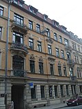 |
Apartment building in closed development | Louisenstrasse 10 (map) |
around 1890 (tenement) | with shop, characteristic late-founding building with historic clinker-sandstone facade, part of Antonstadt, of importance in terms of building history and urban development |
09214919 |
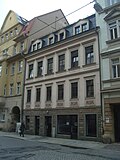 |
Residential building in closed development | Louisenstrasse 11 (map) |
around 1865 (residential building) | Typical plastered building with historicizing facade, example of the few remaining residential buildings from the period after 1850, part of Antonstadt, of importance in terms of building history and urban development |
09214777 |
 |
Apartment building in closed development | Louisenstrasse 12 (map) |
around 1890 (tenement) | with shop, characteristic and largely authentically preserved late-founding tenement house with historic facade, part of Antonstadt, significant in terms of building history and urban development history |
09214920 |
 |
Apartment building in closed development | Louisenstrasse 13 | around 1885 (tenement) | with shops, characteristic historicizing plastered building with broken corner, originated in the late 19th century, as part of a striking perimeter block development and the Antonstadt, significant in terms of building history and urban development history |
09306527 |
 More pictures |
Fire station Louisenstrasse; Fire station Dresden-Neustadt | Louisenstrasse 14; 16 (card) |
1916 (fire station) | Fire station; Distinctive, strictly symmetrical plastered building with sparing decoration, built in 1916 by Hans Erlwein in the style of reform architecture , part of Antonstadt, of importance in terms of building history and urban development, as well as an urban fire station with fire service and urban history value.
"Städtisches Spritzenhaus", used by the Dresden fire brigade until April 2016 (relocation to the new Albertstadt fire station ), continued use by the rescue service |
09214786 |
 |
Apartment house in a corner and closed development | Louisenstrasse 15 (map) |
around 1885 (tenement) | with shops, characteristic historicizing plastered building with broken corner, originated in the late 19th century, as part of a striking perimeter block development and the Antonstadt, significant in terms of building history and urban development history |
09214784 |
 |
Apartment house in a corner and closed development | Louisenstrasse 19 (map) |
around 1890 (tenement) | with shop, characteristic historicized plastered building with broken corner, as part of a striking perimeter block development and the Antonstadt, significant in terms of building history and urban development history |
09214921 |
 |
Apartment building in closed development | Louisenstrasse 21 (map) |
around 1890 (tenement) | with shops, characteristic late-founding building with a historic clinker-sandstone facade, part of Antonstadt, of importance in terms of building history and urban development |
09214922 |
| Back building in open development | Louisenstrasse 22 (map) |
Mid 19th century (rear building) | Small plastered building with an angled floor plan, probably still part of the development of the "New Annex on the Sande", the name of the suburban quarter of Antonstadt in the 18th and early 19th centuries, of local historical importance |
09215269 |
|
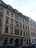 |
Tenement house with rear building in closed development | Louisenstrasse 26 (map) |
around 1900 (tenement) | largely originally preserved Wilhelminian style building , part of Antonstadt, of architectural and site development significance |
09218856 |
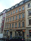 |
Apartment building in closed development | Louisenstrasse 28 (map) |
around 1895 (tenement) | shows balanced clinker-sandstone facade of historicism with structural elements in neo-baroque design language, part of the Antonstadt, of architectural and urban development historical importance |
09214923 |
 |
Apartment building in a formerly closed development | Louisenstrasse 29 (map) |
around 1890 (tenement) | with shop, historicizing clinker-sandstone facade, building from the end of the 19th century, part of a striking block development in Antonstadt, of significance in terms of building history and urban development |
09214924 |
 |
Apartment building in closed development | Louisenstrasse 37 (map) |
1870/1880 (tenement house) | with shops, simple, simplified plastered construction, part of one of the most important streets in Antonstadt, of significance in terms of urban development |
09214951 |
 |
Residential building in closed development | Louisenstrasse 38 (map) |
around 1865 (residential building) | with shop, plastered building typical of the time with historicizing facade, example of the few remaining residential buildings from the period after 1850, part of Antonstadt, of significance in terms of building history and urban development history |
09214926 |
 More pictures |
XXII. District school; Epiphany School; Dreikönigschule grammar school | Louisenstrasse 40; 42 (card) |
inscribed 1888 (school), inscribed 1894 (school) | Two school buildings; Generous complex from the late 19th century, the elongated block on Louisenstraße characteristic, historicizing public building of its time, especially with Renaissance forms, of architectural, social and artistic importance |
09214787 |
 |
XIII. District School | Louisenstrasse 41 (map) |
around 1860 (school) | School with outbuildings and toilets; Plastered buildings typical of the time with late classical facade design, of architectural and socio-historical importance |
09214927 |
 |
Residential building in closed development | Louisenstrasse 44 (map) |
around 1850 (residential building) | with shop, characteristic plastered building with historicizing facade, example of the few remaining residential houses from around 1850, part of Antonstadt, of importance in terms of building history and urban development |
09214778 |
 |
Residential building in closed development | Louisenstrasse 46 (map) |
around 1850 (residential building) | Characteristic plastered building with a simple facade, an example of the few remaining residential buildings from around 1850, part of Antonstadt, of significance in terms of building history and urban development |
09214779 |
 More pictures |
Germaniabad; Nordbad | Louisenstrasse 48 (map) |
1894–1895 (indoor swimming pool) | Swimming pool; Elongated building with numerous ancillary rooms in the second back courtyard of the apartment building Louisenstrasse 48, Dresden's oldest swimming pool, of architectural, social and local significance. In operation until the 1970s, afterwards it fell into disrepair, until 1997 renovation and recommissioning of the pool. |
09214780 |
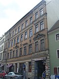 |
Apartment building with side entrance to the north bath and rear building, in closed development | Louisenstrasse 48 (map) |
around 1895 (tenement) | with shops, a characteristic late founding building with a historic clinker-sandstone facade, storeys with symmetrically arranged decorative and structural elements, part of the Antonstadt, important in terms of building history and urban development |
09214781 |
 |
Apartment building in closed development | Louisenstrasse 49 (map) |
around 1885 (tenement) | with shop, Gründerzeit plastered building with historicizing facade, part of one of the most important streets in Antonstadt, of significance in terms of urban development |
09214925 |
 |
Apartment building in closed development | Louisenstrasse 51 (map) |
around 1895 (tenement) | with shops, shows a late historical clinker-sandstone facade with an elaborate structure in the neo-renaissance style, part of the Antonstadt, important in terms of building history and urban development |
09214928 |
 |
Apartment building in closed development | Louisenstrasse 53 (map) |
1909–1910 (tenement) | Residential building with facade in reform style, built between 1909–1910, part of Antonstadt, of significance in terms of building history and urban development |
09214963 |
 |
Apartment building in closed development | Louisenstrasse 54 (map) |
around 1890 (tenement) | with shop, characteristic, Wilhelminian-style clinker-sandstone facade, residential building from the end of the 19th century, ceiling painting in the entrance area as decorative painting, part of the Antonstadt, important in terms of building history and urban development |
09214964 |
 |
Apartment building in closed development | Louisenstrasse 55 (map) |
1913–1914 (tenement) | with shop, residential building with facade in reform style, built 1913–1914, client was Neustädter theater director Emil Winter-Tymian, relief with bust on the central axis, building part of Antonstadt, important in terms of building history, personal history and urban development history |
09214776 |
 |
Apartment building in closed development | Louisenstrasse 57 (map) |
around 1890 (tenement) | characteristic late founding building with historic clinker-sandstone facade, enlivened by ornamentation, strikingly different colored stones, part of the Antonstadt, of architectural and urban development-historical importance |
09214774 |
 |
Apartment building in closed development | Louisenstrasse 58 (map) |
around 1885 (tenement) | with shop, building with a characteristic historicizing plastered sandstone facade, enlivened by the flat internal structure and ornamental roofing on the second floor, part of a striking perimeter block and the Antonstadt, significant in terms of building history and urban development history |
09214929 |
 |
Rädler School (formerly) | Louisenstrasse 59 (map) |
1789 (school), E. 19th century (rear building) | School building (former) with rear annex and rear building; first school facility on the site of today's Äußere Neustadt, apart from that it is probably the oldest surviving object in the quarter, two-story building with a mansard roof , extension designed in the same way, today used as a restaurant, the striking rear building was built at the end of the 19th century or around 1900, construction, Significant in terms of social and urban development history. Building from the time the district was built, medallion with the inscription “Pray and work” above the portal. |
09214773 |
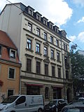 |
Apartment building in closed development | Louisenstrasse 61 (map) |
around 1890 (tenement) | Shop on the ground floor, building with characteristic historicizing plastered sandstone facade, the side entrance axis highlighted by balconies and a field with ornamentation, part of Antonstadt, significant in terms of building history and urban development history |
09214775 |
 |
Two-storey classicist house in closed development | Louisenstrasse 64 (map) |
1840 (residential building) | The two-storey classicist building, typically the roofing over the central entrance and the hanging plates under the eaves, is one of the oldest buildings in Antonstadt, of particular importance in terms of architectural history and urban development |
09214782 |
 |
Apartment house in a formerly closed development | Louisenstrasse 65 (map) |
around 1900 (tenement) | with a shop, a characteristic late 19th-century building with a historic clinker-sandstone facade, enlivened by ornamentation, part of Antonstadt, of importance in terms of building history and urban development |
09214930 |
 |
Apartment building in closed development | Louisenstrasse 66 (map) |
around 1880 (tenement) | Shop on the ground floor, building with characteristic historicizing plastered sandstone facade, the side entrance axis and the center highlighted, part of Antonstadt, significant in terms of building history and urban development history |
09214965 |
 |
Apartment building in closed development | Louisenstrasse 67 (map) |
marked 1900 (tenement house) | Residential building with historic facade design and comparatively elaborate hallway and staircase furnishings, built in 1900, enlivened by stucco decor and decorative painting from the time it was built, part of Antonstadt, significant in terms of building history and urban development history |
09214931 |
 |
Double apartment building in corner location, closed development (no.70b on Martin-Luther-Straße) | Louisenstrasse 70; 70b (card) |
around 1875 (double tenement house) | Shops on the ground floor, building with a simple historical plastered sandstone facade, part of Antonstadt, significant in terms of building history and urban development |
09214952 |
 |
Apartment building in closed development | Louisenstrasse 72 (map) |
marked 1897 (tenement house) | with a shop, a characteristic late 19th-century building with a historic clinker-sandstone facade, enlivened by ornamentation, part of Antonstadt, of importance in terms of building history and urban development |
09214932 |
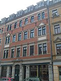 |
Double tenement house in closed development | Louisenstrasse 74; 74b (card) |
around 1895 (tenement) | with distinctive shop fronts, characteristic late 19th-century building with a historic clinker-sandstone facade, enlivened by wrought-iron head anchors, the painted ornamentation in the fields of the side axes probably only whitewashed, part of Antonstadt, important in terms of building history and urban development history |
09214933 |
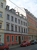 |
Apartment building in closed development | Louisenstrasse 76 (map) |
around 1865 (tenement) | Typical plastered building with historicizing facade, example of the few remaining residential buildings from the period after 1850, part of Antonstadt, of importance in terms of building history and urban development |
09214934 |
 |
Apartment house in a corner and closed development | Louisenstrasse 79 (map) |
around 1865 (tenement) | Typical plastered building with a simple historicizing facade, example of the few remaining residential buildings from the period after 1850, part of Antonstadt, of significance in terms of building history and urban development history |
09214935 |
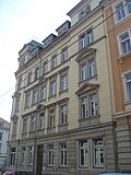 |
Apartment house in a corner and closed development | Louisenstrasse 80 (map) |
around 1880 (tenement) | once with a shop or bar on the ground floor, building with characteristic historicizing plastered sandstone facade, the corner highlighted by structure and more elaborate decorative and structural elements, part of Antonstadt, important in terms of building history and urban development history |
09214938 |
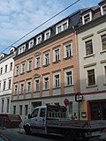 |
Apartment building in closed development | Louisenstrasse 81 (map) |
around 1880 (tenement) | early historicism building with finely plastered structure and sparingly used sand elements, as window roofing, consoles and sills, part of the Antonstadt, significant in terms of building history and urban development history |
09214937 |
 |
Residential building in closed development | Louisenstrasse 85 (map) |
1855 (residential house) | still two-storey building, type with a raised center, the openings of which close with segmental arches, compare with houses in Prießnitzstrasse, belongs to the older buildings in Antonstadt, of architectural and particular importance in terms of urban development |
09215270 |
 |
Apartment house in a corner and closed development | Louisenstrasse 87 (map) |
marked 1899, on the weather vane (tenement) | Shops, characteristic late 19th century building, highlighted by a historic clinker-sandstone facade, with bay windows, corner accentuations and fittings ornamentation in the style of the German Renaissance, over the corner a hood with a lantern, part of Antonstadt, important in terms of architectural, artistic and urban development |
09214783 |
 |
Residential house in closed development, with rear building | Louisenstrasse 89 (map) |
1854 (residential building), around 1854 (rear building) | largely originally preserved Antonstadt house, significant in terms of building history and urban development history. After 1850, the Antonstadt transformed into a densely populated district with a high proportion of workers. Apart from that, very different people lived here, as the example of Louisenstrasse 89 shows. According to research in the historical address books, in the years after its completion, in addition to noble women, a retired artillery captain, a civil servant, an accountant, a teacher and a so-called “economic fourier” are mentioned as residents of the house, to name just a few. |
09214953 |
 |
Residential building in closed development | Louisenstrasse 91 (map) |
1855 (residential house) | largely originally preserved Antonstadt house, significant in terms of building history and urban development history. |
09214954 |
 |
Residential building in closed development | Louisenstrasse 93 (map) |
1855 (residential house) | largely originally preserved Antonstadt house, significant in terms of building history and urban development history. |
09214955 |
 |
Residential house in a corner and closed development | Louisenstrasse 95 (map) |
1856 (residential house) | largely originally preserved Antonstadt house, significant in terms of building history and urban development history. |
09214956 |
 More pictures |
Material entirety Martin-Luther-Platz with Martin-Luther-Kirche | Martin-Luther-Platz 1; 2; 2a; 3; 4; 5; 6; 7; 8th; 9; 10; 11; 12; 14 (card) |
1880–1930 (place), 1880–1930 (totality) | Material entity Martin-Luther-Platz with the historicizing church of the same name Martin-Luther-Platz 2a (ID-Nr. 09214565), the surrounding representative Wilhelminian-era residential development Martin-Luther-Platz 1 - ID-Nr. 09214552, No. 2 - ID No. 09214558, No. 3 - ID No. 09214553, No. 4 - ID No. 09214559, No. 5 - ID No. 09214554, No. 6 - ID No. 09214560, No. 7 - ID No. 09214555, No. 8 - ID No. 09214561, No. 9 - ID No. 09214556, No. 10 - ID No. 09214562, No. 11 - ID No. 09214557, No. 12 - ID No. 09214563, No. 14 - ID No. 09214564, Martin-Luther-Straße 12 - ID No. 09214942, number 17 - ID no. 09214753, number 23 - ID no. 09214945, Pulsnitzer Straße 1 - ID No. 09214757, number 2, 4 - ID no. 09214957, number 10 - ID no. 09214754 and war memorial Martin-Luther-Platz, ID-Nr. 09299860 (all individual monuments) as well as the park-like design in front of and behind the church (parts of the whole), complex in terms of building history and urban development significant and unique. |
09301958 |
 |
Individual monument of the material entity Martin-Luther-Platz: War memorial, | Martin-Luther-Platz | around 1920 (war memorial 1st World War) | Individual monument of the whole of Martin-Luther-Platz; Group of figures on a stepped base and pedestal; artistically significant (see also ID No. 09301958) |
09299860 |
 |
Residential development Martin-Luther-Platz: apartment building in corner location and closed development (individual monument for ID No. 09301958) | Martin-Luther-Platz 1 (map) |
1880–1881 (tenement house) | Individual monument of the whole of Martin-Luther-Platz; representative, late-founding residential building with historicistic plastered sandstone facade, corner and central axis emphasized by balconies, part of the striking layout of Martin-Luther-Platz, significant in terms of building history and urban development. |
09214552 |
 |
Residential development Martin-Luther-Platz: tenement house in closed development (individual monument for ID no.09301958) | Martin-Luther-Platz 2 (map) |
around 1895 (tenement) | Individual monument of the whole of Martin-Luther-Platz; representative, late-founding residential building with historic clinker stone facade, central entrance axis accentuated by balconies, part of the striking layout of Martin-Luther-Platz, significant in terms of building history and urban development |
09214558 |
 More pictures |
Martin Luther Church (individual monument for ID No. 09301958) | Martin-Luther-Platz 2a (map) |
1883–1887 (church) | Individual monument of the material entity Martin-Luther-Platz: single-nave church with furnishings and short transept, polygonal choir and high tower, two flank towers and distinctive portal on the western front, inside galleries, furnishings (altar, pulpit etc.) including Vasa Sacra ; characteristic neo-Romanesque building with numerous early Gothic details, remarkable example of church architecture in the second half of the 19th century, historically and artistically significant, in connection with the unmistakable layout of Martin-Luther-Platz also of urban planning importance. |
09214565 |
 |
Residential development Martin-Luther-Platz: tenement house in closed development (individual monument for ID no.09301958) | Martin-Luther-Platz 3 (map) |
around 1885 (tenement) | Individual monument of the whole of Martin-Luther-Platz; representative, late-founding residential building with historicistic plastered sandstone facade, which emphasizes the slightly warped central axes through balconies, part of the striking layout of the Martin-Luther-Platz, significant in terms of building history and urban development |
09214553 |
 |
Residential development Martin-Luther-Platz: tenement house in closed development (individual monument for ID no.09301958) | Martin-Luther-Platz 4 (map) |
around 1895 (tenement) | Individual monument of the whole of Martin-Luther-Platz; representative, late-founding residential building with historic clinker stone facade, accentuated side elevation with gate passage through balconies, part of the striking layout of Martin-Luther-Platz, significant in terms of building history and urban development |
09214559 |
 |
Residential development Martin-Luther-Platz: parish hall of the Martin-Luther-Kirche (single monument for ID-Nr. 09301958) | Martin-Luther-Platz 5 (map) |
1886–1887 (parish hall), 1886–1887 (statue) | Individual monument of the whole of Martin-Luther-Platz; Martin Luther's sculpture on the facade, extraordinarily representative, late-founding building with historical clinker brick facade, highlighted central and side projections, rich ornamentation, deviates more clearly from the design of the neighboring houses, part of the striking layout of Martin-Luther-Platz, architectural history , artistically and in terms of urban planning |
09214554 |
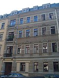 |
Residential development Martin-Luther-Platz: tenement house in closed development (individual monument for ID no.09301958) | Martin-Luther-Platz 6 (map) |
around 1895 (tenement) | Individual monument of the whole of Martin-Luther-Platz; representative, late-founding residential building with historic clinker stone facade, accentuated side elevation with gate passage through balconies, part of the striking layout of Martin-Luther-Platz, significant in terms of building history and urban development |
09214560 |
 |
Residential development Martin-Luther-Platz: tenement house in closed development (individual monument for ID no.09301958) | Martin-Luther-Platz 7 (map) |
around 1895 (tenement) | Individual monument of the whole of Martin-Luther-Platz; representative, late-founding residential building with a historicistic plastered sandstone facade, side elevation with entrance accented by balconies, deviates more clearly from the neighboring houses in terms of design, part of the striking layout of Martin-Luther-Platz, significant in terms of building history and urban development |
09214555 |
 |
Residential development Martin-Luther-Platz: tenement house in closed development (individual monument for ID no.09301958) | Martin-Luther-Platz 8 (map) |
around 1894 (tenement) | Individual monument of the whole of Martin-Luther-Platz; representative, late-founding residential building with historicist plastered sandstone facade, entrance axis emphasized by balconies, original hallway equipment with painting (as decorative painting) and stucco decor, part of the striking layout of Martin-Luther-Platz, significant in terms of building history, artistry and urban planning |
09214561 |
 |
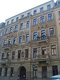
Residential development Martin-Luther-Platz: tenement house in closed development (individual monument for ID no.09301958) | Martin-Luther-Platz 9 (map) |
around 1895 (tenement) | Individual monument of the whole of Martin-Luther-Platz; extraordinarily representative, late founding construction, historicistic plastered sandstone facade, with bay window, tail gable and fittings motif based on the model of the German Renaissance , rich jewelry, formally differs more clearly from the neighboring houses, part of the striking complex of the Martin Luther Square, significant in terms of building history, artistry and urban planning |
09214556 |
 |
Residential development Martin-Luther-Platz: tenement house in closed development (individual monument for ID no.09301958) | Martin-Luther-Platz 10 (map) |
1894–1895 (tenement house) | Individual monument of the whole of Martin-Luther-Platz; Representative, late-founding residential building with historicist plastered stone facade, central axis more clearly emphasized, original hall fittings with painting (as decorative painting) and stucco decoration, part of the striking layout of Martin-Luther-Platz, significant in terms of building history, artistry and urban development. |
09214562 |
 |
Residential development Martin-Luther-Platz: tenement house in closed development (individual monument for ID no.09301958) | Martin-Luther-Platz 11 (map) |
around 1895 (tenement) | Individual monument of the whole of Martin-Luther-Platz; extraordinarily representative, late founding construction, historicistic plastered sandstone facade, with bay window, tail gable and fittings motif based on the model of the German Renaissance, rich jewelry, formally differs more clearly from the neighboring houses, part of the striking complex of the Martin Luther Square, significant in terms of building history, artistry and urban planning |
09214557 |
 |
Residential development Martin-Luther-Platz: tenement house in closed development (individual monument for ID no.09301958) | Martin-Luther-Platz 12 (map) |
1894 (tenement house) | Individual monument of the whole of Martin-Luther-Platz; representative, late-founding residential building with historic clinker-sandstone facade, rich architectural decoration, part of the striking layout of the Martin-Luther-Platz, significant in terms of building history and urban development |
09214563 |
 |
Residential development Martin-Luther-Platz: apartment building in corner position and closed development (individual monument for ID No. 09301958) | Martin-Luther-Platz 14 (map) |
around 1895 (tenement) | Individual monument of the whole of Martin-Luther-Platz; representative, late-founding residential building with historic clinker-sandstone facade, rich architectural decoration, part of the striking layout of the Martin-Luther-Platz, significant in terms of building history and urban development |
09214564 |
 |
Apartment building in half-open development | Martin-Luther-Strasse 6 (map) |
around 1860 (residential building) | Apartment building in half-open development |
09214939 |
 |
Apartment building in closed development | Martin-Luther-Strasse 8 (map) |
marked 1889 (tenement house) | remarkable hallway equipment |
09214940 |
 |
Apartment building in closed development | Martin-Luther-Strasse 10 (map) |
1894 (tenement house) | striking historicizing building with characteristic clinker stone facade, striking residential building of its time, part of the Äußere Neustadt (Antonstadt), significant in terms of building history and urban development history |
09214941 |
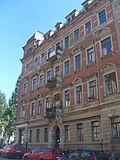 |
Residential development Martin-Luther-Platz: apartment building in corner location, closed development (individual monument for ID No. 09301958) | Martin-Luther-Strasse 12 (map) |
around 1890 (tenement) | Individual monument of the whole of Martin-Luther-Platz; Apartment house in a corner |
09214942 |
 |
Apartment building in closed development | Martin-Luther-Strasse 13 (map) |
around 1885 (tenement) | Apartment building in closed development; with stores |
09214752 |
 |
Residential house in semi-open development | Martin-Luther-Strasse 16 (map) |
around 1860 (residential building) | Residential house in semi-open development |
09214943 |
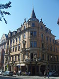 |
Residential development Martin-Luther-Platz: tenement house with shops in corner location and closed development (individual monument to ID No. 09301958) | Martin-Luther-Strasse 17 (map) |
marked 1896 (tenement house) | Individual monument of the whole of Martin-Luther-Platz; Plafond framed by stucco profiles in the hallway with decorative painting, the walls partly paneled, floor tiles, etc., representative residential building of historicism, characteristic clinker-stone facade, corner tower, rich building decoration, as a concise structural testimony of its time, important from an architectural point of view, because of its artistic effort valuable, also part of an unmistakable square and therefore also of importance in terms of urban planning |
09214753 |
 |
Residential building in closed development | Martin-Luther-Strasse 18 (map) |
around 1860 (residential building) | Residential building in closed development |
09214944 |
 |
Residential development Martin-Luther-Platz: tenement house with shops in closed development (single monument for ID-Nr. 09301958) | Martin-Luther-Strasse 23 (map) |
around 1890 (tenement) | Individual monument of the whole of Martin-Luther-Platz; Corridor furnishing with ceiling painting (as decorative painting) representative residential building of historicism, characteristic clinker brick facade, side elevations, rich architectural decoration, as a concise structural testimony of its time, important in terms of building history, because of its design effort, artistically valuable, also part of an unmistakable square and thus also of urban planning Concern |
09214945 |
 |
Apartment building in closed development | Martin-Luther-Strasse 25 (map) |
around 1890 (tenement) | Apartment building in closed development; with stores |
09214946 |
 |
Apartment building in closed development | Martin-Luther-Strasse 29 (map) |
around 1890 (tenement) | Apartment building in closed development; with stores |
09214947 |
 |
Residential building with side gate | Martin-Luther-Strasse 31 (map) |
around 1850 (residential building) | Residential house with side gates in half-open development |
09214948 |
 |
Residential house in semi-open development | Martin-Luther-Strasse 33 (map) |
around 1860 (residential building) | Residential house in semi-open development |
09214949 |
 |
Apartment house in a corner | Martin-Luther-Strasse 37 (map) |
around 1885 (tenement) | Apartment building in corner location and closed development; with stores |
09214950 |
 |
Residential house in open development | Nordstrasse 33 (map) |
re. 1871 (residential building) | Residential house in open development |
09215524 |
 More pictures |
Unity of Dr. Becker houses with several individual monuments | Paulstrasse 1; 3; 5; 7; 9; 11; 13; 15; 17 (map) |
marked 1907–1908 (residential complex) | Physical entirety of Dr. Becker houses with the following individual monuments: three groups of buildings, a war memorial as well as the outdoor facilities as totality parts; Residential complex of the Dresdner Spar- und Bauverein on Paulstrasse and Königsbrücker Strasse, complex in terms of building history, urban development history and artistically significant. |
09214670 |
 More pictures |
Dr. Becker Houses: group of buildings and enclosure (individual monument for ID No. 09214670) | Paulstrasse 1; 3 (card) |
1907–1914 and designated 1907–1908 (apartment building) | Individual monument of the whole of the Dr. Becker houses; Parts of a residential complex of the Dresdner Spar- und Bauverein on Paulstraße and Königsbrücker Straße, striking examples of the reform style architecture after 1900, significant in terms of building history and urban development history as well as artistically |
09214671 |
 More pictures |
Dr. Becker houses: row of houses and enclosure (single monument for ID no.09214670) | Paulstrasse 5; 7; 9; 11 (card) |
1907–1914 (apartment building) | Individual monument of the whole of the Dr. Becker houses; Parts of a residential complex of the Dresdner Spar- und Bauverein on Paulstraße and Königsbrücker Straße, striking examples of the reform style architecture after 1900, significant in terms of building history and urban development history as well as artistically |
09218865 |
 More pictures |
Dr. Becker Houses: group of buildings, war memorial for those who fell in World War I and enclosure (individual memorial for ID No. 09214670) | Paulstrasse 13; 15; 17 (map) |
1907–1914 (apartment building), around 1920 (WWI war memorial) | Individual monument of the whole of the Dr. Becker houses; Parts of a residential complex of the Dresdner Spar- und Bauverein on Paulstraße and Königsbrücker Straße, striking examples of the reform style architecture after 1900, significant in terms of building history and urban development history as well as artistically |
09218866 |
| New bridge | Prießnitzgrund | around 1840 (bridge) | Bridge; Arch bridge made of sandstone ashlar masonry over the Prießnitz , remarkable the crenellated parapet, significant in terms of local history and landscape design |
09217055 |
|
 |
Apartment building in half-open development | Prießnitzstrasse 3 (map) |
around 1900 (tenement) | Apartment building in half-open development |
09215106 |
 |
Apartment building in closed development | Prießnitzstrasse 5 (map) |
around 1900 (tenement) | Apartment building in half-open development |
09215107 |
 |
Dresdner Dairy Gebrüder Pfund | Prießnitzstrasse 6 (map) |
around 1895 (villa) | Villa of the Pfund family, with garden and enclosure |
09215108 |
 |
Dresdner Dairy Gebrüder Pfund | Prießnitzstrasse 7 (map) |
1900–1901 (residential and commercial building) | Residential and commercial building in half-open development; Part of the Pfunds dairy complex, plastered facade with natural stone plinth, simple Art Nouveau shapes in the window frames and balcony grilles, significant in terms of both building history and local history |
09215105 |
 |
Dresdner Dairy Gebrüder Pfund | Prießnitzstrasse 8 (map) |
1862 (villa) | Villa with enclosure; House for lawyer and general partner of Pfund´s dairy |
09215109 |
 |
Dresdner Dairy Gebrüder Pfund | Prießnitzstrasse 10 (map) |
around 1860 (villa) | Villa with enclosure; House for middle-class civil servants of the Pfund brothers |
09215110 |
 |
Dresdner Dairy Gebrüder Pfund | Prießnitzstrasse 10a (map) |
1896–1897 (club house) | So-called. Clubhouse; two-storey building with a rectangular floor plan with a hall |
09215111 |
 |
Apartment building in closed development | Prießnitzstrasse 11 (map) |
1876 (tenement house) | Villa of the Pfund family, with garden and enclosure |
09215112 |
 |
Dresdner Dairy Gebrüder Pfund | Prießnitzstrasse 12 (map) |
around 1865 (villa) | Villa with enclosure; Apartments for middle officials of the pound company |
09215113 |
 |
Dresdner Dairy Gebrüder Pfund | Prießnitzstrasse 14 (map) |
around 1864 (villa) | Villa with enclosure; Apartments for middle officials of the pound company |
09215114 |
 |
Double tenement house in closed development | Prießnitzstrasse 15; 17 (map) |
around 1862 (double tenement house) | Double tenement house in closed development |
09218867 |
 |
Dresdner Dairy Gebrüder Pfund | Prießnitzstrasse 16 (map) |
around 1864 (residential building) | Residential house in corner location and open development; |
09215115 |
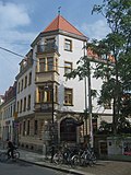 |
Apartment building in a corner, semi-open development | Prießnitzstrasse 18 (map) |
marked 1895 (tenement house) | the corner bay and the portal with date are conspicuous |
09215116 |
 |
Apartment building in closed development | Prießnitzstrasse 19 (map) |
around 1890 (tenement) | Villa of the Pfund family, with garden and enclosure |
09215117 |
 |
Apartment building in closed development | Prießnitzstrasse 21 (map) |
around 1890 (tenement) | Villa of the Pfund family, with garden and enclosure |
09215118 |
 |
Residential building in closed development | Prießnitzstrasse 22 (map) |
around 1855 (residential building) | still two-storey building, type with a raised center, the openings of which close with segmental arches, compare with Louisenstrasse 85 and neighboring houses, belongs to the older buildings in Antonstadt, of architectural and particular importance for urban development |
09215119 |
 |
Residential building in closed development | Prießnitzstrasse 24 (map) |
around 1855 (residential building) | still two-storey building, type with a raised center, the openings of which close with segmental arches, compare with Louisenstrasse 85 and neighboring houses, belongs to the older buildings in Antonstadt, of architectural and particular importance for urban development |
09215120 |
 |
Apartment building in closed development | Prießnitzstrasse 25 (map) |
1890 (tenement house) |
09215122 |
|
 |
Residential building in closed development | Prießnitzstrasse 26 (map) |
around 1855 (residential building) | still two-storey building, type with a raised center, the openings of which close with segmental arches, compare with Louisenstrasse 85 and neighboring houses, belongs to the older buildings in Antonstadt, of architectural and particular importance for urban development |
09215121 |
 |
Residential building in closed development | Prießnitzstrasse 27 (map) |
around 1865 (residential building) |
09215123 |
|
 |
Residential building in closed development | Prießnitzstrasse 30 (map) |
1861 (residential building) | with shop |
09215124 |
 |
Apartment building in closed development | Prießnitzstrasse 32 (map) |
re. 1897 (tenement) |
09215125 |
|
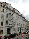 |
Apartment building in closed development | Prießnitzstrasse 33 (map) |
around 1910 (tenement) |
09215126 |
|
 |
Apartment building in closed development | Prießnitzstrasse 34 (map) |
around 1895 (tenement) |
09215127 |
|
 |
Apartment building in closed development | Prießnitzstrasse 35 (map) |
re. 1899 (tenement house) |
09215128 |
|
 |
Apartment building in closed development | Prießnitzstrasse 36 (map) |
around 1895 (tenement) |
09215129 |
|
 |
Apartment building in closed development | Prießnitzstrasse 38 (map) |
around 1895 (tenement) | with shop |
09215130 |
 |
Apartment building in half-open development | Prießnitzstrasse 40 (map) |
around 1895 (tenement) |
09215132 |
|
 |
Apartment building in a corner, closed development | Prießnitzstrasse 41 (map) |
around 1890 (tenement) |
09215133 |
|
 |
Apartment building in a corner, closed development | Prießnitzstrasse 43 (map) |
around 1890 (tenement) | with shop, seat of the Dresden Secession 89 artists' association . |
09215134 |
 |
Apartment building in closed development | Prießnitzstrasse 45 (map) |
around 1890 (tenement) |
09215135 |
|
 |
Apartment building in half-open development | Prießnitzstrasse 46 (map) |
around 1890 (tenement) |
09215136 |
|
 |
Apartment building in closed development | Prießnitzstrasse 47 (map) |
around 1885 (tenement) |
09215137 |
|
 |
Late Biedermeier house in closed development | Prießnitzstrasse 50 (map) |
around 1860 (residential building) |
09215138 |
|
 |
Apartment house in a corner and closed development | Prießnitzstrasse 51 (map) |
around 1890 (tenement) | with shop |
09215139 |
| Late Biedermeier house in a corner location (see also Hohnsteiner Straße 2) | Prießnitzstrasse 52 (map) |
around 1860 (residential building) |
09215140 |
||
 |
Residential house in open development | Prießnitzstrasse 53 (map) |
around 1865 (residential building) |
09215141 |
|
 |
Apartment building in closed development | Prießnitzstrasse 56 (map) |
around 1865 (tenement) |
09215142 |
|
 |
Residential house in open development | Prießnitzstrasse 63 (map) |
around 1860 (residential building) |
09215144 |
|
 |
Apartment building in open development | Prießnitzstrasse 65 (map) |
around 1885 (tenement) |
09215145 |
|
 |
Apartment building in open development | Prießnitzstrasse 67 (map) |
around 1875 (tenement) |
09215146 |
|
 |
Residential development Martin-Luther-Platz: apartment building in corner location, closed development (individual monument for ID No. 09301958) | Pulsnitzer Strasse 1 (map) |
re. 1895 (tenement) | Individual monument of the whole of Martin-Luther-Platz; Apartment house in a corner |
09214757 |
 |
Residential development Martin-Luther-Platz: double apartment building in a formerly closed development, on the facade election advertising of the SPD from 1932 (single monument for ID No. 09301958) | Pulsnitzer Strasse 2; 4 (card) |
around 1890 (double tenement house) | Individual monument of the whole of Martin-Luther-Platz; Double tenement house |
09214957 |
 |
Residential building in closed development | Pulsnitzer Strasse 5 (map) |
around 1875 (residential building) |
09214958 |
|
 |
Residential building in closed development | Pulsnitzer Strasse 7 (map) |
around 1875 (residential building) |
09214959 |
|
 |
Apartment building in closed development | Pulsnitzer Strasse 9 (map) |
around 1890 (tenement) |
09214960 |
|
 |
Residential development Martin-Luther-Platz: tenement house in semi-open development (individual monument for ID no. 09301958) | Pulsnitzer Strasse 10 (map) |
re. 1896 (or 1886) | Individual monument of the whole of Martin-Luther-Platz; Apartment building in half-open development |
09214754 |
 |
Residential building in closed development | Pulsnitzer Strasse 11 (map) |
2nd V. 19th century (residential building) |
09214755 |
|
 More pictures |
Totality of old Jewish cemetery | Pulsnitzer Strasse 12 (map) |
1751 (cemetery) | Material entirety Old Jewish cemetery in a very grown and creative unit with the following individual monuments: all tombs and enclosure walls including entrance gates and ornamental grids (ID no. 09214675) as well as the overgrown grave fields, structured path system and distinctive planting as a whole; Burial place laid out according to special religious regulations, significant in terms of building history, local history, Sepulkral history and personal history. |
09305795 |
 More pictures |
Old Jewish cemetery: countless gravestones, enclosure wall including entrance gates and decorative grilles (individual monuments to ID no. 09305795) | Pulsnitzer Strasse 12 (map) |
1751 (enclosure) | Individual features of the entity age Jewish cemetery; Burial place laid out according to special religious regulations, significant in terms of building history, local history, Sepulkral history and personal history |
09214675 |
 |
Apartment house in a corner and closed development | Pulsnitzer Strasse 13 (map) |
marked 1899, built in 1899 AS (tenement house) | A shop on the ground floor, a striking historic building with a characteristic clinker stone facade, original hall furnishings dominated by ceiling painting (as decorative painting) and stucco decor, significant in terms of building and urban development history |
09214756 |
 |
Residential house in semi-open development | Pulsnitzer Strasse 14 (map) |
around 1870 (residential building) | Residential house in semi-open development |
09214961 |
 More pictures |
Apartment building in closed development | Rothenburger Strasse 1 (map) |
1869 (tenement house) | With a shop, representative residential building of historicism, emphasis on the center, as a concise architectural testimony of its time in terms of building history and as part of an unmistakable street, important in terms of urban planning, with the abundance of facade decoration also of artistic importance |
09214884 |
 More pictures |
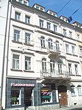
Apartment building in closed development | Rothenburger Strasse 5 (map) |
1865–1866 (tenement house) | Representative residential building of historicism, as a concise structural testimony of its time, significant in terms of building history, also part of an unmistakable street and thus also of importance in terms of urban planning |
09214885 |
 More pictures |
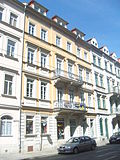
Apartment building in closed development | Rothenburger Strasse 7 (map) |
1865–1866 (tenement house) | with shop, representative residential building of historicism, as a concise architectural testimony to its time in terms of building history and as part of an unmistakable street, important from an urban point of view, with the abundance of facade decoration also artistically important |
09214886 |
 More pictures |
Apartment building in closed development | Rothenburger Strasse 9 (map) |
1866–1867 (tenement) | with shop, representative residential building of historicism, as a concise architectural testimony to its time in terms of building history and as part of an unmistakable street, important from an urban point of view, with the abundance of facade decoration also artistically important |
09214887 |
 More pictures |
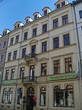
Apartment building in closed development | Rothenburger Strasse 10 (map) |
1869 (tenement house) | Representative residential building of historicism, as a concise structural testimony of its time, significant in terms of building history, also part of an unmistakable street and thus also of importance in terms of urban planning |
09214888 |
 More pictures |
Apartment building in closed development | Rothenburger Strasse 11 (map) |
1869 (tenement house) | Distinctive residential building of historicism, emphasis on the center, the lateral templates and the ground floor, as a concise structural testimony of its time, important in terms of architectural history, also part of an unmistakable street and thus also of importance from an urban planning perspective |
09214889 |
 More pictures |
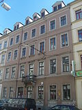
Apartment building in closed development | Rothenburger Strasse 12 (map) |
1868 (tenement house) | Representative residential building of historicism, as a concise structural testimony of its time, significant in terms of building history, also part of an unmistakable street and thus also of importance in terms of urban planning |
09214890 |
 More pictures |
Apartment building in closed development | Rothenburger Strasse 13 (map) |
1866 (tenement house) | representative historicizing residential building from the pre-founding years, emphasis on the center, largely original facade decoration preserved almost down to the last detail, also original furnishings in the entrance area and stairwell with painting (as decorative painting), reconstruction based on numerous findings, probably the oldest painting in a historicizing Dresden apartment building, Building significant in terms of architecture, art history and art |
09214891 |
 More pictures |
Apartment building in closed development | Rothenburger Strasse 14 (map) |
1865 (tenement house) | Representative residential building of historicism, as a concise structural testimony of its time, significant in terms of building history, also part of an unmistakable street and thus also of importance in terms of urban planning |
09214892 |
 More pictures |
Apartment building in closed development | Rothenburger Strasse 15 (map) |
1866 (tenement house) | with shops, representative residential building of historicism, as a concise structural testimony of its time, significant in terms of building history, also part of an unmistakable street and thus also of importance in terms of urban planning |
09214893 |
 More pictures |
Apartment building in closed development | Rothenburger Strasse 16 (map) |
1865 (tenement house) | Representative residential building of historicism, as a concise structural testimony of its time, significant in terms of building history, also part of an unmistakable street and thus also of importance in terms of urban planning |
09214894 |
 More pictures |
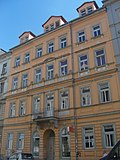
Apartment building in closed development | Rothenburger Strasse 17 (map) |
1864–1865 (tenement house) | Representative residential building of historicism, as a concise structural testimony of its time, significant in terms of building history, also part of an unmistakable street and thus also of importance in terms of urban planning |
09218877 |
 More pictures |
Apartment building in closed development | Rothenburger Strasse 18 (map) |
1868 (tenement house) | Representative residential building of historicism, as a concise structural testimony of its time, significant in terms of building history, also part of an unmistakable street and thus also of importance in terms of urban planning |
09214895 |
 More pictures |
Apartment building in closed development | Rothenburger Strasse 19 (map) |
1868 (tenement house) | Representative residential building of historicism, as a concise structural testimony of its time, significant in terms of building history, also part of an unmistakable street and thus also of importance in terms of urban planning |
09214896 |
 More pictures |
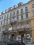
Apartment building in closed development | Rothenburger Strasse 20 (map) |
1864–1865 (tenement house) | Representative historicizing residential building from the pre-founding years, emphasis on the middle and the first upper floor as a bel étage, largely original facade decoration preserved almost to the last detail, as a concise structural testimony of its time, significant in terms of building history, with the abundance of facade decoration also of artistic importance. |
09214897 |
 More pictures |
Apartment building in closed development | Rothenburger Strasse 21 (map) |
1865 (tenement house) | with a shop, representative residential building of historicism, as a concise structural testimony of its time, significant in terms of building history, also part of an unmistakable street and thus also of importance in terms of urban planning |
09214898 |
 More pictures |
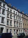
Apartment building in closed development | Rothenburger Strasse 22 (map) |
around 1870 (tenement) | Representative residential building of historicism, as a concise structural testimony of its time, significant in terms of building history, also part of an unmistakable street and thus also of importance in terms of urban planning |
09214899 |
 More pictures |
Apartment building in closed development | Rothenburger Strasse 23 (map) |
1865 (tenement house) | Representative residential building of historicism, as a concise structural testimony of its time, significant in terms of building history, also part of an unmistakable street and thus also of importance in terms of urban planning |
09214900 |
 More pictures |
Apartment building in closed development | Rothenburger Strasse 24 (map) |
around 1870 (tenement) | with shops, representative residential buildings of historicism, as a concise architectural testimony to its time in terms of building history and as part of an unmistakable street, important from an urban point of view, with the abundance of facade decoration also of artistic importance |
09214901 |
 More pictures |
Apartment building in closed development | Rothenburger Strasse 26 (map) |
around 1870 (tenement) | Representative historicizing building from the early founding years, as a concise structural testimony of its time, significant in terms of architectural history, as part of an unmistakable street, also of importance for urban planning |
09218878 |
 More pictures |
Apartment building in a corner and in a closed development | Rothenburger Strasse 28 (map) |
1865 (tenement house) | Representative residential building of historicism, as a concise structural testimony of its time, significant in terms of building history, also part of an unmistakable street and thus also of importance in terms of urban planning |
09214902 |
 More pictures |
Apartment building in a corner and in a closed development | Rothenburger Strasse 30 (map) |
1873 (tenement) | Representative historicizing building from the early founding years, as a concise structural testimony of its time, significant in terms of architectural history, as part of an unmistakable street, also of importance for urban planning |
09214903 |
 More pictures |
Apartment building in closed development | Rothenburger Strasse 32 (map) |
1873 (tenement) | representative historicizing building from the early founding years, as a concise structural testimony to its time and as part of an unmistakable street, significant in terms of architectural history and urban development, with the abundance of facade decoration also of artistic importance |
09214904 |
 More pictures |
Apartment building in half-open development, with one side facing the school entrance (probably designed in this way in connection with the school building) | Rothenburger Strasse 33 (map) |
around 1875 (tenement) | Representative historicizing building from the early founding years, as a concise structural testimony of its time, significant in terms of architectural history, as part of an unmistakable street, also of importance for urban planning |
09214912 |
 More pictures |
Apartment building in closed development | Rothenburger Strasse 34 (map) |
1874 (tenement house) | Representative historicizing building from the early founding years, as a concise structural testimony of its time, significant in terms of architectural history, as part of an unmistakable street, also of importance for urban planning |
09214905 |
 More pictures |
V. Citizens' School (formerly): School building | Rothenburger Strasse 35 (map) |
1874 (school) | Set back from the street, elongated building, one of the city's older Wilhelminian schools, especially of social and historical importance |
09214911 |
 More pictures |
Apartment building in closed development | Rothenburger Strasse 36 (map) |
around 1870 (tenement) | Representative historicizing building from the early founding years, as a concise structural testimony of its time, significant in terms of architectural history, as part of an unmistakable street, also of importance for urban planning |
09218879 |
 More pictures |
Apartment building in half-open development, with one side facing the school entrance (probably designed in connection with the school building) | Rothenburger Strasse 37 (map) |
around 1875 (tenement) | Representative historicizing building from the early founding years, as a concise structural testimony of its time, significant in terms of architectural history, as part of an unmistakable street, also of importance for urban planning |
09214913 |
 More pictures |
Apartment building in closed development | Rothenburger Strasse 38 (map) |
around 1870 (tenement) | representative historicizing building from the early founding years, as a concise structural testimony to its time and as part of an unmistakable street, significant in terms of architectural history and urban development, with the abundance of facade decoration also of artistic importance |
09214906 |
 More pictures |
Apartment building in closed development | Rothenburger Strasse 39 (map) |
around 1880 (tenement) | Representative historicizing building from the early founding years, as a concise structural testimony of its time, significant in terms of architectural history, as part of an unmistakable street, also of importance for urban planning |
09218880 |
 More pictures |
Apartment building in closed development | Rothenburger Strasse 40 (map) |
1875–1876 (tenement house) | representative historicizing building from the early founding years, emphasis on the middle and the first floor as a bel étage, largely original facade decoration preserved almost to the last detail, as a concise structural testimony to its time and as part of an unmistakable street, significant in terms of building history and urban development, with the abundance of facade decoration also of artistic importance |
09214907 |
 More pictures |
Apartment building in closed development | Rothenburger Strasse 41 (map) |
1874 (tenement house) | with shops, a representative historicizing building from the early founding years, as a concise structural testimony to its time, significant in terms of building history, as part of an unmistakable street, also of importance for urban planning |
09214908 |
 More pictures |
Apartment building in closed development | Rothenburger Strasse 42 (map) |
1873 (tenement) | with shops, a representative historicizing building from the early founding years, as a concise structural testimony to its time, significant in terms of building history, as part of an unmistakable street, also of importance for urban planning |
09214909 |
 More pictures |
Apartment building in a corner and in a closed development | Rothenburger Strasse 43 (map) |
1876 (tenement house) | with shops, representative historicizing building from the early founding years, as a concise structural testimony to its time and as part of an unmistakable street, significant in terms of building history and urban development, with the abundance of facade decoration also of artistic importance |
09214846 |
 More pictures |
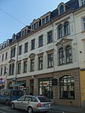
Apartment building in closed development | Rothenburger Strasse 44 (map) |
1878 (tenement house) | With a shop zone, representative historicizing building from the early founding years, as a concise structural testimony to its time and as part of an unmistakable street, significant in terms of architectural history and urban development, with the abundance of facade decoration also of artistic importance |
09214910 |
 More pictures |
Apartment building in a corner location in a closed development | Rothenburger Strasse 46 (map) |
1873 (tenement) | with shops, representative historicizing building from the early founding years, as a concise structural testimony to its time and as part of an unmistakable street, significant in terms of building history and urban development, with the abundance of facade decoration also of artistic importance |
09214847 |
 |
Apartment buildings as part of a square development | Schlesischer Platz 2; 4; 8 (card) |
around 1912 (tenement) | Apartment buildings as part of a square development (see also Antonstraße 18 and Schlesischer Platz 6) |
09214393 |
 |
Hansa-Hotel (former) | Schlesischer Platz 6 (map) |
around 1912 (hotel) | Hotel building as part of a square development (see also Antonstraße 18 and Schlesischer Platz 2, 4, 8) |
09215104 |
 More pictures |
Apartment building in a corner, closed development | Schönbrunnstrasse 1 (map) |
around 1890 (tenement) |
09215194 |
|
 More pictures |
Apartment building in closed development | Schönbrunnstrasse 1b (map) |
around 1880 (tenement) |
09215195 |
|
 More pictures |
Apartment building in a corner, closed development | Schönbrunnstrasse 2 (map) |
around 1885 (tenement) |
09215196 |
|
 More pictures |
Apartment building in a corner, closed development | Schönbrunnstrasse 3 (map) |
around 1890 (tenement) |
09215197 |
|
 More pictures |
Apartment building in closed development | Schönbrunnstrasse 4 (map) |
around 1885 (tenement) |
09215198 |
|
 More pictures |
Apartment building in closed development | Schönbrunnstrasse 5 (map) |
around 1878 (according to address book) |
09215199 |
|
 More pictures |
Apartment house in a corner and closed development | Schönbrunnstrasse 8 (map) |
around 1878 (tenement) |
09218881 |
|
 |
Classicist double house in open development | Schönbrunnstrasse 13; 15 (card) |
1862 (twin house) |
09214848 |
|
 |
Rental villa with enclosure | Schönbrunnstrasse 16 (map) |
around 1865 (rental villa) |
09215201 |
|
 |
Apartment building in closed development | Schönfelder Strasse 1 (map) |
around 1890 (tenement) | with shop |
09215180 |
 |
Two-storey house in a closed development | Schönfelder Strasse 4 (map) |
1858 (residential house) | with shop |
09215189 |
 |
Apartment building in closed development | Schönfelder Strasse 5 (map) |
around 1890 (tenement) |
09215181 |
|
 |
Two-storey residential building in open development | Schönfelder Strasse 6 (map) |
around 1860 (residential building) |
09215190 |
|
 |
Apartment building in closed development (currently unused) | Schönfelder Strasse 7 (map) |
around 1890 (tenement) |
09215182 |
|
 |
Two-storey house in a closed development | Schönfelder Strasse 8 (map) |
around 1860 (residential building) |
09215191 |
|
 |
Apartment building in closed development | Schönfelder Strasse 11 (map) |
around 1885 (tenement) |
09215183 |
|
 |
Apartment building in closed development | Schönfelder Strasse 13 (map) |
around 1885 (tenement) | Characteristic and largely authentically preserved late-founding apartment building, forms a striking ensemble with neighboring houses, significant in terms of building history and urban development history |
09215184 |
 |
Residential building in closed development | Schönfelder Strasse 14 (map) |
around 1855 (residential building) |
09215192 |
|
 |
Apartment building in closed development | Schönfelder Strasse 15 (map) |
around 1900 (tenement) | with shop, characteristic and largely authentically preserved late-founding apartment building with historicizing clinker-stone-plaster facade, forms a striking ensemble with neighboring houses, significant in terms of building history and urban development history |
09215185 |
 |
Residential building in closed development | Schönfelder Strasse 16 (map) |
around 1855 (residential building) |
09215193 |
|
 |
Apartment building in closed development | Schönfelder Strasse 17 (map) |
around 1890 (tenement) | Characteristic and largely authentically preserved late-founding tenement house with a historicizing clinker stone facade, forms a striking ensemble with neighboring houses, important in terms of building history and urban development history |
09215186 |
 |
Apartment building in closed development | Schönfelder Strasse 19 (map) |
marked 1903 (tenement house) | Characteristic and largely authentically preserved late-founding tenement house with a historicizing clinker stone facade, forms a striking ensemble with neighboring houses, important in terms of building history and urban development history |
09215187 |
 |
Apartment building in a corner and closed development | Schönfelder Strasse 21 (map) |
around 1880 (tenement) | with shop |
09215188 |
 More pictures |
Apartment building in closed development | Schwepnitzer Strasse 1 (map) |
around 1890 (tenement) | Idiosyncratic and comparatively representative for a side street from the Wilhelminian style residential building with a historicizing facade, loosening up of the building through a clearly recessed center, behind the elaborate entrance door a spacious staircase, the entrance axis also emphasized by balconies, the strongly protruding window frames, building historically and artistically significant |
09214763 |
 More pictures |
Apartment building in a corner, closed development | Schwepnitzer Strasse 2 (map) |
around 1876 (according to address book) | Characteristic, historicizing plastered sandstone facade, special accent due to broken corner with balcony, part of a conspicuous Wilhelminian style quarter, of importance in terms of building history and urban development history |
09214764 |
 More pictures |
Apartment building in closed development | Schwepnitzer Strasse 3 (map) |
around 1890 (tenement) |
09214765 |
|
 More pictures |
Apartment building in a corner, closed development | Schwepnitzer Strasse 5 (map) |
around 1890 (tenement) |
09214767 |
|
 More pictures |
Apartment building in closed development | Sebnitzer Strasse 3 (map) |
around 1895 (tenement) |
09215215 |
|
 More pictures |
Apartment building in closed development | Sebnitzer Strasse 5 (map) |
around 1895 (tenement) |
09215216 |
|
 |
Apartment house in a formerly closed development | Sebnitzer Strasse 6 (map) |
around 1900 (tenement) |
09215218 |
|
 More pictures |
Apartment house in a formerly closed development | Sebnitzer Strasse 7 (map) |
around 1895 (tenement) |
09215217 |
|
 |
Apartment building in closed development | Sebnitzer Strasse 10 (map) |
re. 1902 (tenement) |
09215221 |
|
 More pictures |
Apartment building in a corner, closed development | Sebnitzer Strasse 11 (map) |
around 1885 (tenement) |
09214762 |
|
 |
Apartment building in closed development | Sebnitzer Strasse 12 (map) |
around 1900 (tenement) | original hallway and staircase furnishings with stucco decor |
09215222 |
 |
Apartment building in closed development | Sebnitzer Strasse 14 (map) |
around 1900 (tenement) | Corridor and staircase furnishings with completely preserved, original Art Nouveau painting as decorative painting and stucco decor, significant in terms of building history and artistically |
09215223 |
 |
Apartment building in closed development | Sebnitzer Strasse 16 (map) |
around 1900 (tenement) |
09215224 |
|
 |
Apartment building in half-open development | Sebnitzer Strasse 17 (map) |
around 1875 (tenement) |
09215219 |
|
 |
Apartment building in half-open development | Sebnitzer Strasse 18 (map) |
around 1900 (tenement) |
09215225 |
|
 |
Apartment building in half-open development | Sebnitzer Strasse 19 (map) |
around 1875 (tenement) |
09215220 |
|
 |
Apartment building in half-open development | Sebnitzer Strasse 24 (map) |
around 1895 (tenement) |
09215227 |
|
 |
Apartment building in half-open development | Sebnitzer Strasse 25 (map) |
09215226 |
||
 |
Apartment building in closed development | Sebnitzer Strasse 26 (map) |
around 1895 (tenement) |
09215228 |
|
 |
Workers' houses with back buildings, courtyard area and children's play areas | Sebnitzer Strasse 27; 29; 29a; 29b; 29c; 31 (card) |
1889–1890 (residential building) | as early examples of social housing in Dresden of particular importance in terms of building history, local history and social history |
09215179 |
 |
Apartment building in closed development | Sebnitzer Strasse 28 (map) |
around 1895 (tenement) |
09215229 |
|
 |
Apartment building in closed development | Sebnitzer Strasse 30 (map) |
around 1867 (tenement) |
09215173 |
|
 |
Apartment building in closed development | Sebnitzer Strasse 32 (map) |
around 1867 (tenement) |
09215174 |
|
 |
Apartment building in closed development, with rear building | Sebnitzer Strasse 33 (map) |
around 1900 (tenement) | possibly designed based on the houses of the »Johannes-Verein«. The Johannes-Verein was under the protectorate of Queen Carola and had social tasks. |
09215230 |
 |
Apartment building in closed development | Sebnitzer Strasse 34 (map) |
around 1867 (tenement) |
09215175 |
|
 |
Apartment building in closed development, with rear building | Sebnitzer Strasse 35 (map) |
around 1900 (tenement) | possibly designed based on the houses of the »Johannes-Verein« |
09215231 |
 |
Residential house with restaurant on the ground floor in a corner and closed development | Sebnitzer Strasse 36 (map) |
around 1860 (residential building) |
09215232 |
|
 |
Apartment building in closed development | Sebnitzer Strasse 37 (map) |
around 1900 (tenement) |
09215234 |
|
 |
Residential building in closed development | Sebnitzer Strasse 38 (map) |
around 1860 (residential building) |
09215233 |
|
 |
Apartment building in closed development | Sebnitzer Strasse 39 (map) |
around 1900 (tenement) |
09215235 |
|
 |
Residential building in closed development | Sebnitzer Strasse 41 (map) |
around 1867 (residential building) |
09215178 |
|
 |
Apartment building in closed development | Sebnitzer Strasse 45 (map) |
around 1895 (tenement) |
09215238 |
|
 |
Apartment building in closed development | Sebnitzer Strasse 47 (map) |
around 1895 (tenement) |
09215237 |
|
 |
Apartment building in half-open development | Sebnitzer Strasse 48 (map) |
around 1895 (tenement) |
09215240 |
|
 |
Apartment building in half-open development | Sebnitzer Strasse 49 (map) |
around 1895 (tenement) |
09215236 |
|
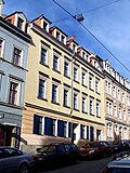 |
Apartment building in closed development | Sebnitzer Strasse 50 (map) |
around 1867 (tenement) |
09215239 |
|
 |
Apartment building in closed development | Sebnitzer Strasse 52 (map) |
around 1867 (tenement) | with shop |
09215177 |
 |
Apartment building in closed development | Sebnitzer Strasse 54 (map) |
around 1875 (tenement) | with shop |
09215176 |
 |
Apartment building in half-open development | Sebnitzer Strasse 57 (map) |
around 1900 (tenement) | rich facade decoration and stucco decoration inside |
09215241 |
 |
Georg Vetter Wood and Coal Dealer (formerly): Residential house in closed development | Sebnitzer Strasse 59 (map) |
1928 (according to information from a resident) |
09215242 |
|
 |
Apartment building in open development | Stauffenbergallee 11 (map) |
around 1895 (tenement) | characteristic late founding residential building with historicizing clinker stone facade, enlivened by various décor, of importance in terms of building history and urban development history |
09304396 |
 |
Apartment building in closed development | Talstrasse 2 (map) |
around 1900 (tenement) |
09215249 |
|
 |
Apartment building in closed development | Talstrasse 3 (map) |
around 1867 (tenement) |
09215243 |
|
 |
Apartment building in closed development | Talstrasse 4 (map) |
around 1900 (tenement) |
09215250 |
|
 |
Apartment building in closed development with rear building | Talstrasse 6 (map) |
around 1900 (tenement) |
09215244 |
|
 |
Apartment building in closed development | Talstrasse 7 (map) |
around 1900 (tenement) |
09215252 |
|
 |
Apartment building in closed development with two rear buildings and paving in the second courtyard | Talstrasse 8 (map) |
around 1900 (tenement) | (last rear building only single-storey part) |
09215245 |
 |
Apartment building in half-open development | Talstrasse 9 (map) |
around 1900 (tenement) | Residential building from the end of the 19th century with a characteristic clinker-sandstone facade and historicizing architectural decorations, accented entrance and balcony axis, part of the remarkable Wilhelminian-style district of Antonstadt, significant in terms of building and urban development |
09215246 |
 |
Apartment building in half-open development | Talstrasse 10 (map) |
around 1900 (tenement) |
09215248 |
|
 |
Apartment house in a formerly closed development | Talstrasse 15 (map) |
around 1885 (tenement) |
09215251 |
|
 |
Apartment building in closed development | Talstrasse 16 (map) |
around 1875 (tenement) |
09215247 |
|
 More pictures |
Residential complex Timaeusstraße: 11 houses in a residential complex of the Heimstättengenossenschaft Sachsenland (single monument for ID No. 09214550 , Alaunstraße 73, 75) | Timaeusstrasse 1; 3; 5; 7; 9; 11; 13; 15; 17; 19; 21 (card) |
1936–1939 (apartment building) | Individual monument of the whole of the Timaeusstrasse residential complex; Significant in terms of building and urban development history |
09214551 |
| Residential complex Timaeusstraße: Houses of a residential complex of the Heimstättengenossenschaft Sachsenland (single monument for ID-Nr. 09214550, Alaunstraße 73, 75) | Timaeusstrasse 2; 4 (card) |
1936–1939 (apartment building) | Individual monument of the whole of the Timaeusstrasse residential complex; Significant in terms of building and urban development history |
09218890 |
|
| Residential complex Timaeusstraße: four houses in a residential complex of the Heimstättengenossenschaft Sachsenland (single monument for ID-Nr. 09214550, Alaunstraße 73 and 75) | Timaeusstrasse 6; 8th; 10; 12 (card) |
1936–1939 (apartment building) | Individual monument of the whole of the Timaeusstrasse residential complex; Significant in terms of building and urban development history |
09218891 |
|
| Residential complex Timaeusstraße: House of a residential complex of the Heimstättengenossenschaft Sachsenland (single monument for ID-Nr. 09214550, Alaunstraße 73 and 75) | Timaeusstraße 14 (map) |
1936–1939 (apartment building) | Individual monument of the whole of the Timaeusstrasse residential complex; Significant in terms of building and urban development history |
09218892 |
|
 |
Residential complex Timaeusstraße: four houses in a residential complex of the Heimstättengenossenschaft Sachsenland (single monument for ID-Nr. 09214550, Alaunstraße 73 and 75) | Timaeusstrasse 16; 18; 20; 22 (card) |
1936–1939 (apartment building) | Individual monument of the whole of the Timaeusstrasse residential complex; Significant in terms of building and urban development history |
09218893 |
Former cultural monuments
| image | designation | location | Dating | description | ID |
|---|---|---|---|---|---|
 More pictures |
Rental villa | Eschenstrasse 4 (map) |
|
||
 More pictures |
Rental villa with enclosure | Eschenstrasse 8 (map) |
|
||
 |
Apartment building in closed development | Förstereistraße 19a (map) |
|
||
| Secret Annex | Pulsnitzer Strasse 09a (map) |
|
|||
 More pictures |
Residential building | Scheunenhofstrasse 3 (map) |
former Wendt coal merchant; The house came in Erich Kästner's autobiography When I was a little boy before, his mother brought the laundry there to be washed. The house was demolished in 2016. |
|
|
| Secret Annex | Schönfelder Strasse 15a (map) |
|
|||
 |
Apartment building in closed development | Talstrasse 5 (map) |
|
Remarks
- This list is not suitable for deriving binding statements on the monument status of an object. As far as a legally binding determination of the listed property of an object is desired, the owner can apply to the responsible lower monument protection authority for a notice.
- The official list of cultural monuments is never closed. It is permanently changed through clarifications, new additions or deletions. A transfer of such changes to this list is not guaranteed at the moment.
- The monument quality of an object does not depend on its entry in this or the official list. Objects that are not listed can also be monuments.
- Basically, the property of a monument extends to the substance and appearance as a whole, including the interior. Deviating applies if only parts are expressly protected (e.g. the facade).
Detailed memorial texts
- ↑ a b c d The residential building is in the Äußere Neustadt, more precisely in the Antonstadt. The Antonstadt is one of the last closed quarters of the 19th century in Europe. In contrast to Dresden's old town, the area between Königsbrücker Strasse, Bischofsweg, Prießnitzstrasse and Bautzner Strasse was largely spared during the bombing raid on February 13, 1945. As early as 1745, Oberland master builder Julius Heinrich Schwarze (1706–1775) had drawn up a development plan for the Antonstadt, at that time still called "New Extension on the Sand". However, larger settlements only took place after Dresden was destroyed by the Prussians in 1760, when homeless citizens settled here. Over time, the appearance of the extension was shaped by low two-story houses. With the industrialization after 1850, Antonstadt transformed into a densely populated quarter with a high proportion of workers. Besides that, very different people lived here. The initially three-story houses / apartment buildings were followed around 1865 by four-story, often very representative examples. The property to be assessed here is a largely originally preserved residential building in Antonstadt, which was built in the mid-1850s and is already a four-story building (including the attic). It thus documents a section in the development of residential building architecture in the middle of the 19th century, which explains its significance in terms of building history. The residential buildings that were built at that time still had simple, mostly horizontally structured facades with late Classicist elements, such as grooved ground floors, originally certainly present at Louisenstraße 95, straight window roofs , occasional triangular gables , etc. The building shows how the Antonstadt was developed from 1850 onwards. Therefore it is also important in terms of urban development history.
- ↑ On the ceiling pavement in the large passage of the stately tenement house at Martin-Luther-Platz 10, a particularly magnificent and at the same time humorous depiction of the Heavenly Gate is shown in a heavy, baroque-looking stucco frame. The focus of the painting, created in 1896, is Peter surrounded by saints and angels. The surprised company looks at a tethered balloon that emerges from the clouds and slowly moves towards the gate (from: Müller, Michael: Decor and image motifs in Dresden residential buildings from the early days. In: Aesthetics and Science. Contributions to restoration and preservation of monuments. Workbook 8. State Office for the Preservation of Monuments of Saxony no year [2006], p. 169, edited).
- ↑ Subject entity of Dr. Becker houses with the following individual monuments: three groups of buildings, war memorial for those who fell in World War I and enclosure (individual monument on Paulstrasse 1/3 with Königsbrücker Strasse 78 - ID No. 09214671, Paulstrasse 5–11 - ID- No. 09218865 and Paulstraße 13–17 - ID No. 09218866) as well as the outdoor facilities as parts of the whole; Residential complex of the Dresdner Spar- und Bauverein on Paulstraße and Königsbrücker Straße, on the whole symmetrically structured, with a recessed middle row of houses and two flanking structures over an L-shaped floor plan, a striking example of the objectified building method or reform style architecture after 1900 with well-proportioned building cubes, pronounced roof landscapes and restrained, only accentuating tree decorations, work of the architecture office Schilling & Graebner, which is particularly well-known in Saxony, but also beyond that, complex in terms of building history and urban development history as well as artistically significant, named after Dr. Becker, chairman of the board of the housing cooperative "Dresdner Bau- und Sparverein" (founded 1883).
- ↑ The tenement house Rothenburger Straße 20 in Dresden, OT Äußere Neustadt, built in 1864–1865 probably by the building contractor Johann Traugott Wehnert, who, according to the address book, was the owner of the property in 1864, is a representative and historicizing house from the early years that is characteristic of the time. Particular emphasis is placed on the central axis above the entrance and the first floor as a bel étage. Most of the original facade decoration has been preserved down to the last detail. As a concise structural testimony to its time, the lavishly designed building is significant in terms of architecture and history, and with the abundance of facade decoration it is also artistically important. Stylistically, the facade design moves between late classicism and neo-renaissance . The monument quality is enhanced by the increased informative value together with the neighboring buildings that were built at the same time. Many of the buildings on Rothenburger Strasse have already been recognized in the specialist literature.
swell
Web links
Individual evidence
-
↑ For the new construction of the Albertstadt fire station, see:
- Juliane Weigt: The new fire station in Albertstadt should go into operation in 2016. In: Dresdner Latest News . May 22, 2014, accessed August 7, 2016 .
- Christoph Springer: Last day in the 100-year-old fire station in Dresden-Neustadt. In: Dresdner Latest News. April 6, 2016, accessed August 7, 2016 .
- ↑ King Albert as a politician with special consideration of social and economic policy (accessed on February 15, 2020)
- ↑ Una Giesecke: Erich Kästner's childhood place, protected as a monument, is being demolished In: There ! Dresden weekly newspaper. October 17, 2016, accessed July 5, 2020 .
