List of cultural monuments in Cossebaude
The list of cultural monuments in Cossebaude includes all cultural monuments of the Dresden district of Cossebaude with Neu-Leuteritz . The notes are to be observed.
This list is a partial list of the list of cultural monuments in Dresden .
This list is a partial list of the list of cultural monuments in Saxony .
Legend
- Image: shows a picture of the cultural monument and, if applicable, a link to further photos of the cultural monument in the Wikimedia Commons media archive
- Designation: Name, designation or the type of cultural monument
-
Location: If available, street name and house number of the cultural monument; The list is basically sorted according to this address. The map link leads to various map displays and gives the coordinates of the cultural monument.
- Map view to set coordinates. In this map view, cultural monuments are shown without coordinates with a red marker and can be placed on the map. Cultural monuments without a picture are marked with a blue marker, cultural monuments with a picture are marked with a green marker.
- Dating: indicates the year of completion or the date of the first mention or the period of construction
- Description: structural and historical details of the cultural monument, preferably the monument properties
-
ID: is awarded by the State Office for the Preservation of Monuments in Saxony. It clearly identifies the cultural monument. The link leads to a PDF document from the State Office for the Preservation of Monuments in Saxony, which summarizes the information on the monument, contains a map sketch and often a detailed description. For former cultural monuments sometimes no ID is given, if one is given, this is the former ID. The corresponding link leads to an empty document at the state office. The following icon can also be found in the ID column
 ; this leads to information on this cultural monument at Wikidata .
Cossebaude
| image | designation | location | Dating | description | ID |
|---|---|---|---|---|---|
 |
Villa with enclosure | Albertplatz 1 (map) |
around 1900 (villa) | representative facility in Art Nouveau style , decorative framework, characterizing the square and of architectural significance |
09275144
|
 |
Gasthof Osterberg | Am Osterberg 12 (map) |
around 1880 (inn) | Inn (former) with Elbe-side terrace, boiler house and former beer bar; distinctive building visible from afar, with a tower on the side, built in the style of the romantic castle, inside an impressive hall, significant in terms of building history and city history. |
09275142
|
| Rental villa | August-Bebel-Strasse 2 (map) |
Late 19th century (rental villa) | Simple, historicized plastered building on a natural stone base, in the Wilhelminian expansion area and thus documenting the gradual urbanization of Cossebaude, significant in terms of building history and urban development history. |
09275012
|
|
| Rental villa | August-Bebel-Strasse 8 (map) |
1895/1900 (villa) | Historicizing building with clinker facade on natural stone base, in the Wilhelminian expansion area and thus documenting the gradual urbanization of Cossebaude, significant in terms of building history and urban development history. |
09275063
|
|
| Rental villa with enclosure | August-Bebel-Strasse 10 (map) |
1895/1900 (villa) | Simple, historicizing building, plastered ground floor, upper floor with clinker brick facade, in the Wilhelminian expansion area and thus documenting the gradual urbanization of Cossebaude, significant in terms of building history and urban development history. |
09275060
|
|
| Rental villa with outbuildings and fencing | August-Bebel-Strasse 17 (map) |
1895/1900 (rental villa) | Simple, historicizing plastered building, in the Wilhelminian expansion area and thus documenting the gradual urbanization of Cossebaude, significant in terms of building history and urban development history. |
09275053
|
|
| Rental villa with outbuildings and fencing | August-Bebel-Strasse 18 (map) |
1895-1900 (rental villa) | Simple, historicized plastered building on a natural stone base, in the Wilhelminian expansion area and thus documenting the gradual urbanization of Cossebaude, significant in terms of building history and urban development history. |
09275055
|
|
 |
Rental villa with outbuildings and fencing | Bahnhofstrasse 3 (map) |
Late 19th century (villa) | Clinker building on a natural stone base with historicizing elements, in the Wilhelminian expansion area and thus documenting the gradual urbanization of Cossebaude, significant in terms of building history and urban development history. |
09275008
|
 More pictures |
Cossebaude School | Bahnhofstrasse 5 (map) |
inscribed 1893 (school), around 1950 (seated statue), 1920s (fountain) |
School building, gymnasium, plastic, fountain in the yard; Plastic figure of the Cinderella, both buildings with historicizing plastered façades, school with a representative face, a complex that is significant in terms of both building history and local history. |
09275009
|
 |
Cossebaude station | Bahnhofstrasse 8 (map) |
around 1880 (reception building) |
Reception building of the train station and neighboring building; Distinctive historicizing building with slightly raised side wings and a lower connecting wing, part of the railway line to Berlin , important in terms of building history and traffic history. |
09275230
|
 |
Power station (former) | Bahnhofstrasse 15 (map) |
1899-1900 (factory building) | Factory building; striking, historicizing clinker brick building, the last older industrial building in Cossebaude, significant in terms of building history and local history. |
09275557
|
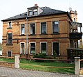 |
Rental villa | Bergstrasse 3 (map) |
1890s (rental villa) | historicizing building with turrets and clinker brick facade, historically important |
09275223
|
 |
villa | Bergstrasse 4 (map) |
around 1890 (villa) | picturesque, late historical, country house- like half-timbered building , historically important |
09275221
|
 |
Double apartment building in open development with enclosure | Bismarckplatz 1; 2 (card) |
1910s (double tenement house) |
Plastered building with reform style elements, characterized by side elevations with slanted gables and bay windows, of architectural significance. |
09275062
|
 |
Rental villa in a corner with outbuildings and fencing | Bismarckplatz 3 (map) |
1895/1900 (rental villa) | Historic building with clinker brick facade, historically significant, defining the square. |
09275049
|
 |
Rental villa with fencing in a corner | Bismarckplatz 4 (map) |
1920s (rental villa) | clear and functional design, simple plastered facade enlivened by wooden shutters and wine trellis, of architectural significance. |
09275051
|
| Rental villa with enclosure | Bismarckplatz 5 (map) |
1920s (rental villa) | Typical building from the 1920s, traditionally designed with a plastered facade, glazed balconies and hipped roof, remarkable entrance area with bay window, of architectural significance. |
09275061
|
|
| House and side building of a former farm with courtyard gate | Brauergasse 1 (map) |
1st half of the 19th century (farmhouse) |
Buildings with gable roofs and partly with half-timbering, as a testimony to rural architecture and folk architecture of the time, significant in terms of architectural history. |
09275013
|
|
 |
Residential house in open development with retaining wall | Breitscheidstrasse 1 (map) |
around 1900 (residential building) | Building with a plastered facade and historicizing elements, characterized by side elevations with tail gables, significant in terms of architectural history. |
09275202
|
 |
Residential house in open development and retaining wall | Breitscheidstrasse 3 (map) |
1880s (residential house) | Typical, historicizing building from the end of the 19th century with plastered facade, mansard roof and wooden balconies, significant in terms of building history. |
09275203
|
| Residential house in open development | Breitscheidstrasse 7 (map) |
1870s (residential building) | small, historicizing building from the Wilhelminian era with clinker brick facade and wooden balcony, significant in terms of architectural history |
09275204
|
|
 |
Residential house in open development | Breitscheidstrasse 9 (map) |
1880s (residential house) | Typical building from the 1880s with clinker brick facade, expanded gable roof and bay window, significant in terms of architectural history |
09275205
|
| Double house with gate pillars at No. 10 | Dresdner Strasse 8; 10 (card) |
marked 1928 (double dwelling) | with built-in shops, example of reform architecture around 1925, two-storey residential building with a mansard floor and simple plastered facade, partially enlivened by wooden shutters, significant in terms of building history. |
09275014
|
|
| Landhaus Halleur; later Cossebaude municipal office | Dresdner Strasse 11a (map) |
after 1900 (villa) | Villa; Objectified construction of the architecture after 1900 with plastered facade and natural stone base, named after the first owner Dr. med. Halleur, temporarily municipal administration, used by the district administration for a few years , especially important in terms of local history. |
09275116
|
|
| Apartment house in open development and in a corner | Dresdner Strasse 14 (map) |
Late 19th century (tenement house) | with shop, typical, historicizing clinker facade with plastered ground floor, the dominant effect of the broken corner increased by a striking tower-like structure, in the Wilhelminian expansion area and thus documenting the gradual urbanization of Cossebaude, significant in terms of building history and urban development history. |
09275016
|
|
| Residential house in open development and corner location with outbuildings | Dresdner Strasse 22 (map) |
1890s (residential building) | The clinker brick facade that characterizes the street scene, the corner location emphasized by striking gables and turrets, in the Wilhelminian style expansion area and thus documenting the gradual urbanization of Cossebaude, significant in terms of building history and urban development history. |
09275103
|
|
| Residential house in open development | Dresdner Strasse 24 (map) |
1875 (residential building) | historicizing plastered facade, characterized by a gabled central projection , in the Wilhelminian expansion area and thus documenting the gradual urbanization of Cossebaude, significant in terms of building history and urban development history. |
09275104
|
|
| Residential house in open development and corner location | Dresdner Strasse 26 (map) |
2nd quarter of the 19th century (residential building) |
Typical of the time, small house with plastered facade, significant in terms of building history |
09275105
|
|
| Apartment house in open development and corner location | Dresdner Strasse 37 (map) |
1890s (tenement) | with shop, historicizing building typical of the time with a tower-like elevation to emphasize the corner location, in the Wilhelminian era extension area and thus documenting the gradual urbanization of Cossebaude, significant in terms of building history and urban development history. |
09275112
|
|
| Apartment house in open development and corner location | Dresdner Strasse 39 (map) |
1890s (tenement) | With a shop, historic clinker brick building typical of the time, striking gables and turrets to emphasize the corner location, in the Wilhelminian expansion area and thus documenting the gradual urbanization of Cossebaude, significant in terms of building history and urban development history. |
09275111
|
|
| Apartment house in open development and corner location | Dresdner Strasse 40 (map) |
1890s (tenement) | Typical of the time, historicizing clinker brick building, in the Wilhelminian expansion area and thus documenting the gradual urbanization of Cossebaude, significant in terms of building history and urban development history. |
09275109
|
|
| Apartment building in open development | Dresdner Strasse 41 (map) |
marked 1892 (tenement house) | Historical building typical of the time with plastered facade and mansard roof, representative central projectile with gable and acroteries, in the Wilhelminian expansion area and thus documenting the gradual urbanization of Cossebaude, significant in terms of building history and urban development history. |
09275110
|
|
 |
Red villa | Dresdner Strasse 42 (map) |
marked 1892 (manufacturer's villa) | Factory owner's villa of the Winschild and Langelott cement factory with enclosure; Representative building with clinker brick facade and tower in historicizing design, in the Wilhelminian expansion area and thus documenting the gradual urbanization of Cossebaude, significant in terms of building history and urban development history. |
09275228
|
| Railway maintenance office, now a residential building | Eichbergstrasse 1 (map) |
1880/1890 (railway maintenance) | Railway building typical of the time with historicizing clinker brick facade, significant in terms of building history and traffic history. |
09275201
|
|
 |
Rental villa | Eichbergstrasse 3 (map) |
Late 19th century (rental villa) | Historic building from the end of the 19th century with plastered facade and structure with natural stone elements, enlivened by floating gables and corner bay windows, significant in terms of building history and urban development history. |
09275225
|
| House and barn | Eichbergstrasse 10 (map) |
2nd half of the 19th century (farmhouse) |
Rural property, half-timbered building with saddle roofs, one-door barn, as evidence of rural architecture and folk architecture of its time, significant in terms of building history. |
09275222
|
|
 More pictures |
Unity of the mountain cemetery Cossebaude with individual monuments | Friedhofsweg (map) |
1919 (cemetery) | Material entirety Bergfriedhof : cemetery in its grown functional and design unit with numerous individual monuments; Significant in terms of building history and sepulkral, garden art and local history, particularly significant are the grave field schemes with hedge framing specially designed for this cemetery. |
09304054
|
 More pictures |
Bergfriedhof: Ceremonial hall with a morgue that was added later as well as monumental graves (individual monuments to ID no. 09304054) | Friedhofsweg (map) |
1924 (celebration hall), 1970 (morgue), inscribed 1895 (war memorial German-French war), 1945 (high cross with memorial stone) |
Individual monuments of the mountain cemetery as a whole: Ceremony hall with later added morgue, some monumental graves especially in the area of the forest cemetery, complex from the war memorial 1866 and 1870/71 in the form of an obelisk as well as wooden crosses for war victims of the 2nd World War in the grave area III D and so-called high cross with memorial stone »The nameless dead of 1945« in the curve of Linden-Allee; Significant in terms of building history and sepulkral-historically, in terms of gardening and local history, particularly significant are the grave field schemes with hedge framing specially designed for this cemetery. |
09301742
|
| Vineyard wall with arched gate and several gates | Gnome Rise (Map) |
marked 1742 (vineyard wall) | Traditional testimony to the cultivation of wine in Cossebaude, especially shaping the townscape and significant in terms of local history. |
09275295
|
|
 |
Bismarck Tower | Gnome Rise (Map) |
1913 (Bismarck Tower) | Monument with surrounding viewing platform; Small, but nevertheless monumental complex with a tower-like monument, more restrained than the Bismarck Towers by Wilhelm Kreis and designed in the spirit of reform architecture at the beginning of the 20th century, a striking example of the monument cult in the Wilhelmine Empire , significant in terms of building history and local history as well as artistically. |
09275163
|
 |
White lock | Gnome Rise 4 (Map) |
1898–1907 (villa) | Villa with terrace; Picturesque, castle-like building with three crenellated towers, the highest towers over the entire property like a donjon, next to the castle terrace with partially preserved battlements, at the feet of the towers massive, almost square, two-storey living area, enlivened by ornamental frameworks, supporting struts, bay windows, etc., to the west On another crenellated wall with an archway, a small slim tower, inside the hall (salon) and five other rooms stucco decor, villa buildings as a characteristic and for Dresden rather rare example of so-called romantic historicism , which has been medieval castle architecture since the first half of the 19th century revived (further examples Eckberg Castle and the abandoned Altfranken Castle ), significant in terms of building history, to which artistically and town planning is of importance, a widely visible landmark of Cossebaude, singular in its form. |
09275191
|
| Portal and parts of the enclosure | Gnomenstieg 11 (map) |
around 1885 (gate entrance) | in the style of the German Neo-Renaissance , originally belonging to the so-called Gnomenstieg 13 coffee mill , historically and artistically significant. |
09275161
|
|
| Summer house or villa, so-called "coffee mill" | Gnomenstieg 13 (map) |
around 1885 (summer house / weekend house) | Summer house or villa with enclosure and portal; Building with a wooden gallery, belvedere and neo-renaissance decoration, significant in terms of building history, local history and artistically. |
09275160
|
|
| Residential building | Gohliser Strasse 3 (map) |
2nd quarter of the 19th century (residential building) | Rural house with a simple plastered facade and gable roof, as a testament to rural architecture of its time, significant in terms of building history. |
09275183
|
|
| Residential house in open development | Grenzstrasse 14 (map) |
around 1890 (residential building) | with historicizing clinker brick facade and plaster structure, in the Wilhelminian style extension area and thus documenting the gradual urbanization of Cossebaude, significant in terms of building history and urban development history. |
09275180
|
|
| Tenement house with enclosure in open development | Grenzstrasse 18 (map) |
around 1890 (tenement) | With a historicizing plastered facade, natural stone plinth and mansard roof, in the Wilhelminian style extension area and thus documenting the gradual urbanization of Cossebaude, significant in terms of building history and urban development history. |
09275179
|
|
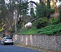 |
retaining wall | Ugly Street (map) |
1890s (retaining wall) | running along the street from number 1 to 1b and before number 3 to the intersection with Liebknechtstraße - in 2 districts, characterizing the townscape and significant in terms of local history. |
09275152
|
 |
Old mansion | Haute Street 2 (map) |
Core sure 17th century (mansion) |
Mansion with courtyard wing and enclosure wall; The wall runs along the street to property number 1, a picturesque property, manor house with a gable roof, wood-paneled upper floor and wine trellis, important in terms of local history and architectural history. |
09275151
|
 |
villa | Haute Street 3 (map) |
1890s (villa) | historicizing plastered building with ornamental half-timbered gables and natural stone plinth, significant in terms of building history and local development. |
09275150
|
 |
villa | Haute Street 4 (map) |
1890s (villa) | historicizing plastered building with ornamental half-timbered gables and natural stone plinth, significant in terms of building history and site development history, |
09275149
|
 |
Residential house, part of the side building, cellar, well, enclosure and archway | Hauptstrasse 1 (map) |
1607 Dendro (residential house) | representative property, important in terms of local history and urban development, as a testimony to rural architecture and folk architecture of its time, of architectural significance. |
09275001
|
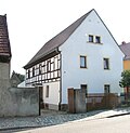 |
Former farmhouse with gate pillars and fencing | Hauptstrasse 3 (map) |
1st half of the 19th century (farmhouse) |
Half-timbered house typical of the time with solid ground floor and gables, saddle roof, as a testimony to rural architecture and folk architecture of its time, significant in terms of building history. |
09275002
|
 |
Residential stable house (No. 4d) and moving house (No. 4a / 4b) as well as the entrance to a former three-sided courtyard | Hauptstrasse 4a; 4b; 4d (card) |
inscribed 1839 (stable house), mid-19th century (moving house), inscribed 1798 (archway) |
Building with a half-timbered upper floor, massive ground floor and saddle roofs, half-timbered buildings as evidence of rural architecture and folk architecture of their time, significant in terms of architectural history. |
09275045
|
 |
Farmhouse of a former courtyard with an archway | Hauptstrasse 5 (map) |
marked 1800 (farmhouse) |
Building with a massive, facing gable, wood-paneled upper floor and saddle roof, as a testimony to rural architecture and folk architecture of its time, significant building history. |
09275003
|
 |
Stable house of a former three-sided courtyard | Hauptstrasse 6 (map) |
marked 1839 (stable house) |
Half-timbered building with a gable roof and rear extension, as a testimony to rural architecture and folk building methods of its time, significant in terms of architectural history. |
09275044
|
 |
Former three-sided courtyard with a residential building, two side buildings and an archway | Hauptstrasse 7 (map) |
1st half of the 19th century (farmhouse) |
Residential house with tailcoat roof and wood-paneled upper floor, side building on the courtyard side with a wide cantilevered saddle roof, courtyard complex as a testimony to rural architecture and folk architecture of its time. |
09275004
|
 |
Former farmhouse | Hauptstrasse 8 (map) |
1st half of the 19th century (farmhouse) |
Building with half-timbering on the upper floor and facing gable, tailcoat roof , half-timbered house as evidence of rural architecture and folk architecture of its time, significant in terms of architectural history. |
09275043
|
| Residential house and side building of a former three-sided courtyard with gate passage and wall | Hauptstrasse 9 (map) |
marked 1800 (farmhouse) |
Building partly with half-timbering, complex as a testimony to rural architecture and folk architecture of its time, significant in terms of building history. |
09275005
|
|
 |
Farmhouse with attached house and barn of a former three-sided farm | Hauptstrasse 11 (map) |
End of the 19th century (farmhouse) |
The plastered building that defines the street scene with historicizing elements, significant in terms of building history. |
09275006
|
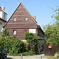 |
Residential stable house | Hauptstrasse 14 (map) |
marked 1839 (stable house) |
Half-timbered building with wood-paneled facing gable, saddle roof, massive ground floor, evidence of rural architecture and folk architecture of its time, significant in terms of architectural history. |
09275042
|
 |
Rental villa with enclosure, rear building and pigeon house | Hauptstrasse 16 (map) |
marked 1925 (rental villa) | Typical plastered building enlivened by wooden shutters and round corner bay windows, the rear building is an older, rural building, significant in terms of architectural history. |
09275041
|
| Residential stable house and pull-out house of a former four-sided courtyard | Hauptstrasse 18 (map) |
marked 1800 (stable house) |
Residential stable and moving house of a former four-sided courtyard; Both buildings with half-timbered upper storey, complex as evidence of rural architecture and folk architecture of their time, significant in terms of architectural history. |
09275040
|
|
 |
Rental villa with enclosure | Heinrich-Mann-Strasse 3 (map) |
1895/1900 (rental villa) | Historical plastered building typical of the time, characterized by a central elevation, in the Wilhelminian expansion area and thus documenting the gradual urbanization of Cossebaude, significant in terms of building history and urban development history. |
09275072
|
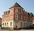 |
Apartment building in open development and corner location with rear building and enclosure | Heinrich-Mann-Strasse 7 (map) |
1895/1900 (tenement) | with shop, typical building with clinker brick facade and plastered ground floor, corner location emphasized by a tower-like structure, in the Wilhelminian style expansion area and thus documenting the gradual urbanization of Cossebaude, significant in terms of building history and urban development history. |
09275058
|
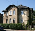 |
Residential house in open development with fencing | Heinrich-Mann-Strasse 11 (map) |
3rd quarter of the 19th century (residential building) |
simple building with plastered facade, significant in terms of architectural and urban development |
09275106
|
| Residential house in open development with rear building | Heinrich-Mann-Strasse 19 (map) |
around 1890 (residential building) | Residential building with a plastered facade typical of the time, an industrial building in the back with historicizing clinker brick facade, in the Wilhelminian style expansion area and thus documenting the gradual urbanization of Cossebaude, significant in terms of building history and urban development history. |
09275173
|
|
| Residential house with enclosure in open development | Heinrich-Mann-Strasse 20 (map) |
2nd half of the 19th century (residential building) |
Characteristic, suburban property from the second half of the 19th century, distinctive gable end design with two side arched windows in the top of the roof, elaborate entrance door, parts of the older furnishings have also been preserved inside, documents the gradual urbanization of Cossebaude, of importance in terms of building history and urban development history. |
09275107
|
|
| Residential house in open development | Heinrich-Mann-Strasse 23 (map) |
1880/1890 (residential building) | Typical, suburban property with a historicizing plastered facade, in the Wilhelminian style extension area and thus documenting the gradual urbanization of Cossebaude, significant in terms of building history and urban development history. |
09275175
|
|
| Residential house in open development and corner location | Heinrich-Mann-Strasse 27 (map) |
around 1890 (residential building) | Typical of the time, historicizing house with plastered facade and structured natural stone elements, corner location emphasized by a tower-like structure, in the Wilhelminian expansion area and thus documenting the gradual urbanization of Cossebaude, significant in terms of building history and urban development history. |
09275176
|
|
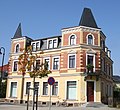 |
Apartment house in a corner and open development | Käthe-Kollwitz-Strasse 1 (map) |
1895/1900 (tenement) | Distinctive, historicizing tenement building on the corner of Bahnhofstrasse and opposite the train station, forms the urban development entrance to the Wilhelminian expansion area of Cossebaude, accentuated by tower structures, enlivened by clinker bricks and different colors, significant in terms of building history and urban development history. |
09275067
|
 |
Rental villa with outbuildings and fencing | Käthe-Kollwitz-Strasse 3 (map) |
1893/1900 (rental villa) | historicizing clinker brick facade, partly plastered, in the Wilhelminian expansion area and thus documenting the gradual urbanization of Cossebaude, significant in terms of building history and urban development history. |
09275068
|
 |
Rental villa with enclosure | Käthe-Kollwitz-Strasse 5 (map) |
1895/1900 (rental villa) | Historical clinker brick facade typical of the time, in the Wilhelminian expansion area and thus documenting the gradual urbanization of Cossebaude, significant in terms of building history and urban development history. |
09275069
|
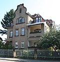 |
Villa with outbuildings and fencing | Käthe-Kollwitz-Strasse 6 (map) |
1900/1905 (villa) | simple plastered facade characterized by a central projection with tail gable, in the Wilhelminian expansion area and thus documenting the gradual urbanization of Cossebaude, significant in terms of building history and urban development history. |
09275070
|
 |
Residential house in open development | Käthe-Kollwitz-Strasse 7 (map) |
1905/1910 (residential building) | Simple plastered building from the beginning of the 20th century, natural stone base zone, in the Wilhelminian expansion area and thus documenting the gradual urbanization of Cossebaude, significant in terms of building history and urban development history. |
09275101
|
 |
Residential house in open development and fencing | Käthe-Kollwitz-Strasse 10 (map) |
1890s (residential building) | with shop, historicizing clinker brick facade, characterized by a central projection with a representative gable, in the Wilhelminian style expansion area and thus documenting the gradual urbanization of Cossebaude, significant in terms of building history and urban development history. |
09275102
|
 |
Residential house in open development | Krumme Gasse 3 (map) |
1890 (residential building) | Simple plastered building typical of the time from the end of the 19th century, with a gable roof and central projectile, of architectural significance |
09275081
|
 |
two houses in open development | Krumme Gasse 4 (map) |
1st half of the 19th century (eastern residential building), 2nd half of the 19th century (western residential building) |
Small, rural residential buildings, simple plastered facades, some with weather shells, saddle roofs, of architectural significance. |
09275082
|
 |
Farmhouse with enclosure wall | Krumme Gasse 5 (map) |
marked 1656 (farmhouse) |
Hooked courtyard, wooden-paneled gables and towed, rear area, saddle roofs, half-timbered buildings as evidence of rural architecture and folk architecture of their time, significant in terms of building history. |
09275073
|
 |
Wettin tower | Krumme Gasse 7 (map) |
1880–1881 (observation tower) |
Observation tower; artificial, historicizing ruin, significant in terms of building history and local history |
09275294
|
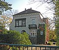 |
villa | Liebknechtstrasse 27 (map) |
around 1905 (villa) | representative plastered building with natural stone base and mansard roof, of importance in terms of building history and local development. |
09275146
|
 |
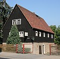
Pohlerhaus | Liebknechtstrasse 34 (map) |
1910s (villa) | Villa with enclosure; Picturesque, historicizing villa building with Art Nouveau elements, complex structure enlivened by various bay windows, turrets, balconies and ornamental frameworks, significant in terms of building history and site development. |
09275145
|
 |
Farmhouse | Meißner Strasse 2 (map) |
marked 1837 (farmhouse) |
simple farmhouse with wood-clad upper floor and gable, as a testimony to rural architecture and folk architecture of its time, significant in terms of building history. |
09275186
|
 |
Fruit juice factory Wilhelm Leske | Meißner Strasse 10 (map) |
around 1910 (administration building) |
Former factory building; Part of the building on the street probably residential and administrative building, simple, plastered building typical of the time, significant in terms of building history. |
09275188
|
 |
Residential house in open development | Meißner Strasse 18 (map) |
around 1910 (residential building) | Residential building around 1910 with a simple plastered facade, characterized by a high, expanded mansard roof, significant in terms of building history and the history of the site. |
09275189
|
 |
Former waterworks | Meißner Strasse 22 (map) |
marked 1898 (waterworks) |
Today used as a residential building, typical plastered building with clinker brick structure from the end of the 19th century in a historicizing design language, building significant in terms of local history and technology. |
09275192
|
 |
Residential house in open development | Obere Bergstrasse 3 (map) |
around 1870 (residential building) | simple, rural house with plastered facade and extended pitched roof, significant in terms of building history |
09275220
|
| Rental villa | Obere Bergstrasse 4 (map) |
marked 1905 (rental villa) | Representative villa building with echoes of the Art Nouveau and Heimatstil, enlivened by colored plaster structure, ornamental framework, tower construction, tail gable and bay window, significant in terms of building history and local development. |
09275219
|
|
 |
Residential house in open development | Obere Bergstrasse 5 (map) |
1870s (residential building) | typical, suburban residential building with plastered facade and extended pitched roof, of architectural significance. |
09275218
|
 |
Rental villa | Obere Bergstrasse 7 (map) |
after 1900 (rental villa) | Representative villa construction around 1905 with Art Nouveau elements, enlivened by ornamental framework, gable, glazed wooden loggia and bay window, significant in terms of building history and the history of the site. |
09275216
|
| Rental villa and retaining wall | Obere Bergstrasse 10 (map) |
around 1900 (rental villa) | Typical rental villa construction from the beginning of the 20th century with a plastered facade, characterized by a wooden, two-story extension with colored glass windows, Art Nouveau elements, significance in terms of building history and local development. |
09275215
|
|
 |
Residential house in open development with fencing | Obere Bergstrasse 11 (map) |
around 1900 (residential building) | representative, suburban residential building from the turn of the century with a wooden entrance porch, characterized by the addition of a tower, partially glazed wooden loggias and ornamental frameworks, significance in terms of building history and development. |
09275214
|
| Residential house in open development with an enclosure wall | Obere Bergstrasse 16 (map) |
around 1900 (residential building) | Typical plastered building from the turn of the century with echoes of the Swiss house style, enlivened by ornamental half-timbering, gables, bay windows and glazed wooden loggia, significance in terms of building history and local development. |
09275212
|
|
| Rental villa with enclosure | Obere Bergstrasse 18 (map) |
1890s (rental villa) | characteristic, late historical rental villa construction, enlivened by the tower construction, ornamental framework, gables, bay windows and glazed wooden balconies, significance in terms of building history and local development. |
09275211
|
|
| Residential house in open development | Obere Bergstrasse 26 (map) |
around 1925 (residential building) | Broad-based residential building around 1925, with a simple plastered facade typical of the time, of architectural significance |
09275209
|
|
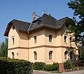 |
Rental villa | Schulstrasse 1 (map) |
Late 19th century (rental villa) | Historical plastered facade typical of the time, in the Wilhelminian expansion area and thus documenting the gradual urbanization of Cossebaude, significant in terms of building history and urban development history. |
09275010
|
 |
Rental villa with enclosure | Schulstrasse 4 (map) |
1895/1900 (rental villa) | characteristic plastered facade with historicizing natural stone integration, in the Wilhelminian expansion area and thus documenting the gradual urbanization of Cossebaude, significant in terms of building history and urban development history. |
09275066
|
| Rental villa with enclosure | Schulstrasse 5 (map) |
Late 19th century (rental villa) | Simple plastered construction enlivened by floating gables and partially glazed wooden loggia, in the Wilhelminian expansion area and thus documenting the gradual urbanization of Cossebaude, significant in terms of building history and urban development history. |
09275019
|
|
 |
Rental villa with enclosure and gate entrance | Schulstrasse 7 (map) |
Late 19th century (rental villa) | Representative rental villa construction with historicizing design, in the Wilhelminian expansion area and thus documenting the gradual urbanization of Cossebaude, significant in terms of building history and urban development history. |
09275018
|
 |
Rental villa with enclosure | Schulstrasse 9 (map) |
Late 19th century (rental villa) | Simple plastered building enlivened by floating gables , corner blocks and glazed wooden loggia, in the Wilhelminian expansion area and thus documenting the gradual urbanization of Cossebaude, significant in terms of building history and urban development history. |
09275017
|
 |
House with extension, former blacksmith shop | Talstrasse 2 (map) |
18th century (residential building) | Rural building with a plastered half-timbered upper floor, of local historical importance, as a testimony to rural architecture and folk architecture of its time, also significant in terms of architectural history. |
09275293
|
 |
Two-sided courtyard with residential building, side extension and enclosure | Talstrasse 3 (map) |
1st half of the 19th century and older (farmhouse) |
Residential house and side extension half-timbered building, complex as a testimony to rural architecture and folk architecture of its time. |
09275022
|
 |
Former farmhouse with side building | Talstrasse 4 (map) |
1st half of the 19th century (farmhouse) |
Rural house with half-timbered on the upper floor and facing gable, complex as a testimony to rural architecture and folk architecture of its time, significant in terms of building history. |
09275039
|
 |
Stable house of a former farm | Talstrasse 5a (map) |
marked 1811 (stable house) |
on the upper floor and facing gable, half-timbered, part of the village center of Cossebaude, as a testimony to rural architecture and folk architecture of its time, significant in terms of building history, also of importance in terms of urban development history. |
09275023
|
| Side building of a former farm | Talstrasse 6 (map) |
1st half of the 19th century (side building) |
Half-timbered house as a testimony to rural architecture and folk architecture of its time, significant in terms of building history. |
09275038
|
|
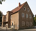 |
Old school | Talstrasse 7 (map) |
inscribed on the inscription panel 1805 (school) |
Former School; massive, two-storey plastered building from the beginning of the 19th century with two courtyard-side stair extensions, of local and architectural significance. |
09275224
|
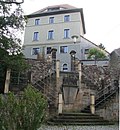 |
Stone house; Old chapel ; Dorotheenkapelle | Talstrasse 7a (map) |
15th century (groin vault), first document. Mentioned in 1498 (chapel), 13th century (ring wall), 18th / 19th century. Century (staircase), after 1918 (war memorial 1st World War) |
Residential house with the so-called Old Chapel , side extension, enclosure wall with gate, staircase with war memorial ; Residential house as a tower-like structure with a former chapel on the ground floor and a side extension, the enclosure is the former ring wall of a rampart from the 13th century, an outstanding and unique testimony to the settlement and building history in the Meißnisches Land . |
09275025
|
 |
Manor with main building (No. 8), farm building (No. 8b) and side wine cellar | Talstrasse 8; 8b (card) |
marked 1878 (winegrower's house), marked 1723 (wine cellar) |
Plastered buildings with saddle roofs, complex as a testimony to rural architecture and folk architecture of its time, significant in terms of building history. |
09275037
|
 |
Parish hall and side building with enclosure wall and free-standing bell tower | Talstrasse 9 | marked 1850 (parish hall), 1904 (bell tower) |
Formerly the location of the fiscal wine press, today a church and community hall, a site as a testimony to rural architecture and folk architecture of its time, important in terms of building history, but also of local importance. |
09275024
|
 |
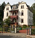
Rental villa with side building and enclosure | Talstrasse 16 (map) |
Late 19th century (rental villa) | Historicizing rental villa construction with a plastered façade typical of the time, enlivened by floating gables and glazed wooden veranda, of importance in terms of building history and the history of local development. |
09275036
|
 |
Rental villa with enclosure | Talstrasse 18 (map) |
Late 19th century (rental villa) | historicizing plastered building from the end of the 19th century, characterized by side elevations and wooden balconies, significance in terms of building history and local development. |
09275035
|
 |
Farmhouse (former) with enclosure, retaining wall and small archway | Talstrasse 19 (map) |
1608 Dendro (roof structure), marked 1861 (gate entrance) |
characteristic rural property of its time, as one of the oldest architectural testimonies of folk architecture in Dresden, of particular importance in terms of architectural history, documents an early phase of the village expansion of Cossebaude, which is significant in terms of local development and cultural history. |
09275028
|
| Wine cellar | Talstrasse 21 (map) |
18th century (wine cellar) | Located close to the residential building (ruin), of documentary value for the history of viticulture in the southern Elbe area near Dresden. |
09275029
|
|
 |
House of a former two-sided courtyard | Talstrasse 25 (map) |
1st half of the 19th century (farmhouse) |
Building on the courtyard side with half-timbering, gable roof, as a testimony to rural architecture and folk architecture of its time, significant in terms of architectural history. |
09275031
|
 |
Former farmhouse | Talstrasse 27 (map) |
1st half of the 19th century (farmhouse) |
Building with a solid ground floor and facing gable, half-timbered on the courtyard side on the upper floor, as a testimony to rural architecture and folk architecture of its time, significant in terms of building history. |
09275032
|
 |
Farmhouse with side wing and side building | Talstrasse 28 (map) |
1st half of the 19th century (farmhouse) |
Half-timbered house with a sloping roof , complex of residential house with annex and side building as evidence of rural architecture and folk architecture of its time, significant in terms of building history. |
09275083
|
 |
barn | Talstrasse 32b (map) |
marked 1789 (barn) | evidently related to viticulture in Cossebaude, important structural testimony to the development of Cossebaude, significant in terms of local history and social history. |
09275503
|
 |
Former farm with house, stable, side building and retaining wall | Talstrasse 33 (map) |
1st half of the 19th century (farmhouse) |
Half-timbered house with boarded gable, courtyard as a testimony to rural architecture and folk architecture of its time. |
09275033
|
 |
Duplex house | Talstrasse 36; 36a (card) |
around 1910 (twin house) |
Typical residential building with plastered facade in the style of the reform architecture of the time around 1910, natural stone plinth, of importance in terms of building history and urban development history. |
09275099
|
 |
Farmhouse with courtyard entrance | Talstrasse 41 (map) |
1st half of the 19th century (farmhouse) |
Typical courtyard from the first half of the 19th century, as a testimony to rural architecture and folk architecture of its time, significant in terms of building history. |
09275084
|
 |
Farmhouse | Talstrasse 45 (map) |
1st half of the 19th century (farmhouse) |
Small farmhouse with a plastered and boarded-up facade and a sloping roof, as a testimony to rural architecture and folk architecture of its time, significant in terms of architectural history. |
09275085
|
 |
Farmhouse | Talstrasse 47 (map) |
1st half of the 19th century (farmhouse) |
Small, typical of the time, plastered farmhouse with a gable roof, as a testimony to rural architecture and folk building methods of its time, significant in terms of building history. |
09275086
|
 |
House and side building of a farm | Talstrasse 49 (map) |
1st half of the 19th century (farmhouse) |
Residential house with a high basement and half-timbering on the upper floor, the complex as a testimony to rural architecture and folk architecture of its time, significant in terms of building history. |
09275087
|
 |
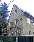
Residential building with outbuildings and wall along the street | Talstrasse 50 (map) |
around 1850 (residential building) | Typical, historic plastered building with clinker brick structure, evidence of rural architecture, significant in terms of building history. |
09275091
|
 |
Farmhouse | Talstrasse 51 (map) |
1st half of the 19th century (farmhouse) |
Plastered, rural house, on the courtyard side with a large overhang of the roof, as a testimony to rural architecture and folk architecture of its time, historically significant. |
09275088
|
 More pictures |
Impersonal entity Hübel shear Weinberg / Kriegel shear vineyard with single monuments and impersonal entity parts | Talstrasse 60 (map) |
17th century (vineyard) | Totality of the Hübelscher Weinberg / Kriegelscher Weinberg with the individual monuments: mansion, sogn. "Bergkellerhaus", quarry stone wall along the street and bridge on parcel 537/1 (see also Obj. 09275095, same address), vineyard (garden monument) and outbuildings (former barn) on the street and axis from the gate in the enclosure of the property and stairs and path on the opposite parcel 537/1 as totality parts; Entire property of documentary value for the history of viticulture in the southern Elbe region near Dresden, the most impressive vineyard complex in Cossebaude, the baroque viticulture manor house with significant interiors of architectural and artistic importance. The entire complex, along with the neighboring vineyards, is also of landscape value. |
09303772
|
 More pictures |
Manor house, so-called »Bergkellerhaus«, quarry stone wall along the road and bridge (individual monuments to ID no. 09303772) | Talstrasse 60 (map) |
marked 1767 (viticulture manor house), somewhat indistinctly marked on the portal 1757 (enclosure), around 1800 (pedestrian bridge) |
Individual features of the entity Hübelscher Weinberg / Kriegelscher Weinberg: mansion, so-called »Bergkellerhaus«, quarry stone wall along the road and bridge on the opposite parcel; Manor house and "mountain cellar house" with half-timbered, entire property of documentary value for the history of wine growing in the southern Elbe area near Dresden, the most impressive vineyard complex in Cossebaude, the baroque wine-growing manor house with significant interior design of architectural and artistic importance, the entire complex with the neighboring vineyards also of landscaping value. |
09275095
|
 More pictures |
Totality of the electoral vineyard; Royal Hinterberg with individual monuments | Talstrasse 62 (map) |
17th century (vineyard) | Unity of the electoral vineyard with the following individual monuments: winegrower's house , two outbuildings, quarry stone wall along the property (individual monument list ID No. 09275096) and vineyard (garden monument); of importance for the history of viticulture in the southern Elbe area near Dresden, plant with the neighboring vineyards of landscaping value. |
09306541
|
 More pictures |
Winegrower's house, two outbuildings and quarry stone wall along the property (individual monuments to ID no. 09306541); now Weinbau Fehrmann | Talstrasse 62 (map) |
End of the 18th century (winegrower's house) | Individual features of the totality of the Electoral Vineyard: winegrower's house, two outbuildings and quarry stone wall along the property; of importance for the history of viticulture in the southern Elbe area near Dresden, plant with the neighboring vineyards of landscaping value. |
09275096
|
 |
Unity of vineyard | Talstrasse 62b; 62c (card) |
17th century (vineyard) | Totality of vineyard; of importance for the history of viticulture in the southern Elbe area near Dresden, with the neighboring vineyards of landscape design importance. |
09279096
|
 |
Totality of the former Weinbergschänke with several individual monuments | Talstrasse 64; 66 (card) |
17th century (vineyard) | Material entirety of the former Weinbergschänke with the following individual monuments: rural house (no. 64), country house with corner tower (no. 66), road-side fence / retaining wall (individual monument list ID no. 09275156) and vineyard (garden monument); significant for the history of viticulture in the southern Elbe valley near Dresden, as well as the landscape-shaping importance with the neighboring vineyards. |
09306542
|
 |
Former Weinbergschänke: rural house, country house with corner tower and street-side fence / retaining wall (individual monuments to ID no. 09306542) | Talstrasse 64; 66 (card) |
1897–1898 (country house), 18th century (residential building) |
Individual features of the whole of the former Weinbergschänke: rural dwelling house (no. 64), country house with corner tower (no. 66) and street-side enclosure / retaining wall; significant for the history of viticulture in the southern Elbe valley near Dresden, as well as the landscape-shaping importance with the neighboring vineyards. |
09275156
|
 |
Former inn | Talstrasse 65 (map) |
2nd half of the 19th century (inn) | today residential house, as a testimony to rural architecture and folk architecture of its time, significant in terms of building history. |
09275090
|
 |
Farmhouse | Talstrasse 67 (map) |
1st half of the 19th century (farmhouse) |
Small house with high hipped mansard roof, simple, plastered facade enlivened with wooden shutters, natural stone plinth, of architectural significance. |
09275093
|
 |
Residential house in open development | Talstrasse 69 (map) |
3rd quarter of the 19th century (residential building) | Presumably an earlier vineyard house, structured plastered facade, natural stone plinth, saddle roof, view marked by a central projectile with inscription and a dwelling, of architectural significance. |
09275094
|
 More pictures |
Totality of the Talstrasse residential complex with a double dwelling and two apartment buildings as individual monuments | Talstrasse 101; 105; 107; 109; 111; 113; 115; 117; 119 (card) |
1919–1920 (residential complex) | The totality of the Talstrasse residential complex with one double dwelling (individual monument list ID no. 09275097, Talstrasse 105/107) and two apartment buildings (see individual monument list ID no. 09275119, Talstrasse 101 and ID no. 09275098, Talstrasse 109–119, odd) as individual monuments; Part of a residential complex of the Dresden Land building cooperative with three buildings, traditional design, significant in terms of building history and urban development history. |
09305329
|
 More pictures |
Double residential building with several entrances (single monument for ID no.09305329) | Talstrasse 101 (map) |
1919–1920 apartment building |
Individual monument of the whole of the Talstrasse residential complex: double residential building with several entrances; Part of a residential complex of the Dresden Land building cooperative with three buildings, traditional design, see also Talstrasse 105/107 and 109–119 odd, significant in terms of building history and urban development history. |
09275119
|
 More pictures |
Semi-detached house (single monument for ID no.09305329) | Talstrasse 105; 107 (card) |
marked 1919–1920 (double house) |
Individual monument belonging to the whole Talstrasse residential complex: semi-detached house; Part of a residential complex of the Dresden Land building cooperative with three buildings, traditional design, see also Talstrasse 101 and 109–119 odd, significant in terms of building history and urban development history. |
09275097
|
 More pictures |
Multi-family house (single monument for ID no.09305329) | Talstrasse 109; 111; 113; 115; 117; 119 (card) |
1919-1920 apartment building |
Individual monument of the whole of the Talstrasse residential complex, apartment building with six entrances; Part of a residential complex of the Dresden Land building cooperative with three buildings, traditional design, see also Talstrasse 101 and 105/107, significant in terms of building history and urban development history. |
09275098
|
 |
Semi-detached house in open development with fencing | Weinbergstrasse 6; 8 (card) |
Rural house with elements of reform style architecture, characterized by a mighty roof with boarded gables, plastered facade enlivened by wooden shutters and vine trellises, of importance in terms of building history and local development. |
09275079
|
|
 |
villa | Weinbergstrasse 12 (map) |
around 1910 (villa) | Characteristic villa building of reform style architecture around 1910 with elements of Art Nouveau, mansard roof, plastered facade with distinctive gable, decorative, wooden porch, natural stone plinth and vine trellis, of importance in terms of building history and site development. |
09275078
|
 |
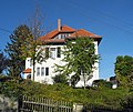
Villa with enclosure | Weinbergstrasse 14 (map) |
around 1910 (villa) | representative villa building with plastered facade and mansard hipped roof, in the style of reform architecture around 1910, of importance in terms of building history and local development. |
09275077
|
 |
Villa with enclosure and garden pavilion | Weinbergstrasse 18 (map) |
around 1910 (villa), 1911 (garden pavilion) | Natural stone pavilion, representative villa building with plastered facade characterized by a dominant roof with varying dormer shapes and bay windows, in the style of reform architecture around 1910, of importance in terms of building history and local development. |
09275074
|
 |
Villa with enclosure | Weinbergstrasse 20 (map) |
around 1910 (villa) | Characteristic villa building with plastered facade, enlivened by wooden shutters, paneling and bay windows, dominant roof, in the style of reform architecture around 1910, of importance in terms of building history and local development. |
09275075
|
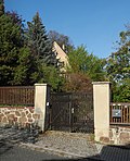 |
Villa with enclosure | Weinbergstrasse 22 (map) |
around 1910 (villa) | Simple villa construction typical of the time with a plastered facade, characterized by a dominating roof, in the style of reform architecture around 1910, of importance in terms of building history and the history of local development. |
09275076
|
 |
Vineyard between Weinbergstrasse and Gnomenstieg | Weinbergstrasse 42a (map) |
17th and 18th century (vineyard) | Significant in terms of local history and landscape design, also of significance for the history of wine growing in the southern Elbe region near Dresden. |
09275200
|
 |
Farmhouse with barn | Weinbergstrasse 47 (map) |
2nd half of the 19th century (farmhouse) |
Typical farmhouse of the time with half-timbered upper storey, boarded gable and crooked hip roof, complex as a testimony to rural architecture and folk architecture of its time, significant in terms of building history. |
09275164 |
Remarks
- This list is not suitable for deriving binding statements on the monument status of an object. As far as a legally binding determination of the listed property of an object is desired, the owner can apply to the responsible lower monument protection authority for a notice.
- The official list of cultural monuments is never closed. It is permanently changed through clarifications, new additions or deletions. A transfer of such changes to this list is not guaranteed at the moment.
- The monument quality of an object does not depend on its entry in this or the official list. Objects that are not listed can also be monuments.
- Basically, the property of a monument extends to the substance and appearance as a whole, including the interior. Deviating applies if only parts are expressly protected (e.g. the facade).
Detailed memorial texts
- ↑ Individual memorials of the mountain cemetery as a whole: celebration hall with later added mortuary, some monumental graves especially in the area of the forest cemetery, complex from the war memorial of 1866 and 1870/71 in the form of an obelisk and wooden crosses for victims of the Second World War in grave area III D and the so-called high cross with memorial stone »The nameless dead of 1945« in the curve of Linden-Allee (individual monument list ID No. 09301742), furthermore with enclosure fences including gate system and wooden gate (parts of the whole) and cemetery design (garden monument); with a distinctive lime tree avenue (summer linden trees) that opens up the cemetery, structured path system including stairs made of concrete steps, different grave field schemes, structure and space-creating planting (especially cut linden trees and hedges) and views of the Radebeul Elbe slopes.
-
↑
Monument text
south of the Lotzebach valley in the lower area of the Cossebauder Talstraße stands the two-storey house Talstraße 19, which at first glance seems inconspicuous. Its simple plastered facade, which apparently dates to the 19th century, does not suggest that this building is actually one the oldest structural evidence in Cossebaude and thus also in Dresden. The roof structure could be dendrochronologically dated to the winter of 1608, so that the building was probably erected in the course of the following year and thus in a phase of village expansion that is documented by written sources. The records of the then village owner Dr. Martin Aichmann report for the period from 1608 to 1614 about the settlement of twelve winegrowers who settled down as cottagers in the corridor bordering on the south of Cossebaude. This development is most likely related to the electoral efforts to promote viticulture, which led to the establishment of a first terraced vineyard, the so-called Cossebauder Hinterbergen, by Aichmann from Württemberg.
The roof and the wall on the upper floor, as the last remains of the original building, document this early period. The massive outer walls, on the other hand, are the result of the fossilization of the half-timbered building in the 19th century - the year 1861 in the keystone of the gate indicates this conversion. The second change, documented by inscriptions, refers to a subsequent extension of the house in 1743, which, based on evidence, must date before the fossilization of the outer walls. In order to be able to preserve the structurally valuable roof structure in situ and at the same time meet modern living requirements, a new roof structure, which absorbs the thermal insulation, was built over the old roof as part of a complete renovation carried out after 2005.
As one of the oldest architectural evidence of folk building in Dresden, the former farmhouse at Talstrasse 19 is of particular importance in terms of architectural history. In addition, against the background of the preserved written sources, the house documents not only an early phase of the village expansion of Cossebau, but also the targeted promotion of viticulture by the elector in the early 17th century, which explains its importance in terms of local development and cultural history (LfD / 2014). -
↑
Monument text
The complex Talstraßen 64, 66 in Dresden OT Cossebaude, with its rural residential house (number 64), country house including corner tower (number 66), vineyard and enclosure / retaining wall on the street, is a cultural monument (material entirety) whose preservation is primarily due to its historical There is a public interest in conservation. It includes the flst. 950, 951, 952, 953/1 and 953/2.
From the construction file of the property at Talstrasse 66, Flst. 953/1 shows that including Flst. 953/2 was originally a vineyard parcel. A country house with a tower extension was built on this from 1897-1898 by the architect Bernhard Anke, which has been preserved to this day. At that time, the property at the entrance to Hässigestrasse still belonged to Oberwartha . It was then turned over to Cossebaude and over time has received parcel 953, which was apparently only divided into parcels 953/1 and 953/2 after the fall of the Wall. On an old postcard, probably from the beginning of the 20th century, you can clearly see that the slope at this point in the Lotzebach Valley, overlooked by the nearby Liebenecke elevation, was used for wine-growing and was divided into different areas, starting with the Hübelschen Weinberg Talstraße 60 with its still representative main building, Talstrasse 62, which was laid out as an electoral vineyard, and the complex to be assessed here. Another old postcard, produced around the same time, shows the building at Talstraße 66 as a vineyard tavern in Cossebauder Grund and in great detail the impressive vineyard in the background, apparently with fruit trees. The tavern advertised with the "special serving of fruit and berry wines". According to the current owners, it was closed around 1930.
The rural building at Talstrasse 64 with a crooked roof , parcel 952, which most likely already stood in 1785/86, could have been the former winegrower's house of a shared vineyard with Talstrasse 66. At the beginning of the 20th century Talstraße 66 belonged to Anna Verw Kolbe, b. Vogel before it came into the possession of the businessman August Heinrich Carl Kirsch. Kirsch may have been the founder of the tavern. On the river. 952, Talstrasse 64, the Flst. 953/1, Talstraße 66 and the Flst. 950, 951 and 953/2 have survived to this day vineyard terraces with walls and stairs, a common area with great probability, which is more than 200 years old. On the Saxon mile sheet from 1785, at the location of today's Talstrasse 64 and 66, one can see terraces arranged one above the other as path signatures.
The valley road 64/66 including the Flst. 953/2, 950 and 951 are a reminder that up to the phylloxera disaster in 1891, wine-growing in Cossebaude and Oberwartha had been practiced for over 700 years, which explains their historical significance as a cultural monument. The protected southern hillside location was ideal for this. In a document from the Meißner cathedral chapter from 1311, a cultivated vineyard located in Cossebaude is mentioned, which certainly existed as early as the middle of the 13th century. Viticulture is documented for Oberwartha from 1266. The settlement area of Cossebaude / Oberwartha is one of the oldest wine-growing locations in Saxony, along with Meißen, first mentioned in 1161. This started later in today's Radebeul ( Kötzschenbroda , first mentioned in 1286). In 1604 the village of Cossebaude came into the possession of the Württemberg secret councilor Dr. Aichmann, who introduced terrace viticulture in the Meißner Elbe Valley.
The public interest in preservation of the property to be assessed arises from the old age and the importance of the site and viticulture history of the complex, whose history definitely goes back to the end of the 18th century. Its status as a monument appears to be understandable to at least a broader group of experts, as there are comparable vineyard ensembles in other federal states, including Baden-Württemberg (e.g. within the Lake Constance region of Birnau-Maurach-Seefelden ) or in Rhineland-Palatinate (in Kobern-Gondorf and Winningen in the Moselle valley ) are recognized as monuments. The impressive effect and clarity of Talstraße 64/66 is enhanced by the landscape interaction with the neighboring vineyards, the private Hübelschen vineyard and the Talstraße 62 facility, which once belonged to the Wettins .
Viticulture was carried out on Cossebauder and Oberwarthaer Flur in the entire Lotzebachtal and on the mountains north of it. The slopes of Talstrasse 60, 62 and 64/66 have been preserved as largely authentic areas as a relatively contiguous area and a smaller area between Weinbergstrasse and Gnomstieg. The valley roads 60, 62 and 64/66 appear more open and unobstructed than the rest of the valley and the surrounding mountains due to the outdated and partially restored terraces of the vineyards. Here they have a decisive influence on the landscape and thus make it appear more original (LfD / 2014).
swell
Web links
Commons : Cultural heritage monuments in Cossebaude - Collection of images, videos and audio files