List of cultural monuments in Friedrichstadt (Dresden)
The list of cultural monuments in Friedrichstadt (Dresden) includes all cultural monuments in the Dresden district of Friedrichstadt . The notes are to be observed.
This list is a partial list of the list of cultural monuments in Dresden .
This list is a partial list of the list of cultural monuments in Saxony .
Legend
- Image: shows a picture of the cultural monument and, if applicable, a link to further photos of the cultural monument in the Wikimedia Commons media archive
- Designation: Name, designation or the type of cultural monument
-
Location: If available, street name and house number of the cultural monument; The list is basically sorted according to this address. The map link leads to various map displays and gives the coordinates of the cultural monument.
- Map view to set coordinates. In this map view, cultural monuments are shown without coordinates with a red marker and can be placed on the map. Cultural monuments without a picture are marked with a blue marker, cultural monuments with a picture are marked with a green marker.
- Dating: indicates the year of completion or the date of the first mention or the period of construction
- Description: structural and historical details of the cultural monument, preferably the monument properties
-
ID: is awarded by the State Office for the Preservation of Monuments in Saxony. It clearly identifies the cultural monument. The link leads to a PDF document from the State Office for the Preservation of Monuments in Saxony, which summarizes the information on the monument, contains a map sketch and often a detailed description. For former cultural monuments sometimes no ID is given, if one is given, this is the former ID. The corresponding link leads to an empty document at the state office. The following icon can also be found in the ID column
 ; this leads to information on this cultural monument at Wikidata .
Friedrichstadt
| image | designation | location | Dating | description | ID |
|---|---|---|---|---|---|
 |
Apartment building in closed development | Adlergasse 1 (map) |
around 1890 (tenement) | Apartment building in closed development; historicizing clinker- sandstone facade, with shop fittings, historically important. |
09218582
|
 |
Apartment house in a corner and closed development | Adlergasse 1a (map) |
around 1900 (tenement) | Apartment building (Weißeritzstraße 38 together with Adlergasse 1a), striking corner house with a wide street front to Seminarstraße, of importance in terms of building history and urban development history. |
09218769
|
| Tenement house, originally in closed development | Adlergasse 2 (map) |
around 1860 (tenement) | Simple workers' house that characterizes the district, six-axis facade typical of the time, of architectural and socio-historical importance. |
09218584
|
|
 |
Apartment building in closed development | Adlergasse 3 (map) |
around 1890 (tenement) | clinker-sandstone facade typical of the time, of architectural significance |
09218585
|
 |
Apartment building in a formerly closed development | Adlergasse 5 (map) |
around 1890 (tenement) | clinker-sandstone facade typical of the time, of architectural significance |
09218586
|
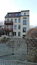 |
Apartment building in a formerly closed development | Adlergasse 9 (map) |
around 1890 (tenement) | historicizing clinker brick facade, of architectural significance |
09218587
|
| Apartment building in half-open development | Adlergasse 13 (map) |
around 1898 (tenement) | historicizing plastered facade with stylistic elements of neo-Gothic, of importance in terms of building history and urban development history. |
09218588
|
|
 |
Apartment house in a corner and closed development | Adlergasse 14 (map) |
around 1870 (tenement) | characteristic historicized plastered building with broken corner, of architectural and urban significance. |
09218589
|
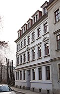 |
Apartment building in a formerly closed development | Adlergasse 16 (map) |
around 1895 (tenement) | Apartment building with side wing; Typical of the time, historicizing plastered construction, of architectural significance. |
09218590
|
 |
Tenement house | Adlergasse 23 (map) |
around 1860 (tenement) | Part of the suburban workers' houses, once part of a block development, of architectural and socio-historical importance. |
09218591
|
 More pictures |
Asylum for the sick; Municipal madhouse and infirmary; Nursing home Löbtauer Straße (individual monuments to ID no.09305191) | Altonaer Strasse 2; 2a (card) |
1886–1900 (nursing home) | Individual features of the collective asylum for sick people: five nursing homes, three times only gable building parts preserved; Significant in terms of building history and social history, today a retirement home and hospital. |
09218693
|
 |
Apartment house in a corner and semi-open development | Altonaer Strasse 16 (map) |
around 1899 (tenement) | characteristic residential building with clinker brick facade typical of the time, important in terms of building history and urban development. |
09218592
|
 |
Residential house (with three house numbers) in open development, with fencing | Altonaer Strasse 17; 19; 21 (card) |
before 1903 (residential building) | Palais-like residential building for the Johann Meyer Foundation, facade with neo-baroque echoes, of importance in terms of building history and the street scene. |
09218593
|
 |
Apartment building in closed development | Altonaer Strasse 18 (map) |
around 1898 (tenement) | historicizing clinker-sandstone facade with a rich structure, of architectural significance, hallway with remains of the original painting. |
09218594
|
 |
Apartment building in closed development | Altonaer Strasse 20 (map) |
around 1898 (tenement) | striking building with historicizing clinker-sandstone facade with elements of the neo-renaissance style , significant in terms of building history, hallway with original painting ( stencil painting ). |
09218931
|
 |
Apartment building in closed development | Altonaer Strasse 22 (map) |
around 1898 (tenement) | striking building with historicizing clinker-sandstone facade with elements of neo-renaissance style, significant in terms of building history. |
09218951
|
 |
Apartment house in a corner and closed development | Altonaer Strasse 24 (map) |
around 1898 (tenement) | characteristic residential building with clinker brick facade typical of the time, important in terms of building history and urban development. |
09218952
|
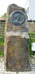 |
Bramsch monument | At the Bramschkontor (map) |
1920 (monument) | Memorial for Johann Ludwig Bramsch ; On the occasion of the celebrations for the 100th anniversary of the Dresden compressed yeast and grain spirit factory JL Bramsch in July 1920, of local historical importance. |
09306466
|
 |
Electoral wax bleach; Menagerie gardens | Am Bramschkontor 1 (map) |
1770–1778 (residential building), 1770–1778 (outbuilding) | Two residential and farm buildings, associated garden, three gates and enclosure walls; Part of the former electoral wax bleaching , characteristic plastered buildings with a crooked hip roof , of architectural and local significance (see also Am Bramschkontor 2 [formerly Friedrichstrasse 56]). |
09218675
|
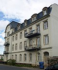 |
Bramsch yeast and spirits factory (formerly) | Am Bramschkontor 2 (map) |
around 1905 (residential and office building), around 1770 (enclosure) | Residential and administration building of the former yeast and spirits factory, older gate system with side gate and enclosure wall; Residential and administrative buildings in stylized neo-baroque forms, gate system originally part of the electoral menagerie, complex of architectural and local significance despite its rudimentary character (see also Am Bramschkontor 1 and Friedrichstrasse 58a and 60b). |
09218673
|
 |
Apartment building in formerly half-open development | Bauhofstrasse 11 (map) |
around 1865 (tenement) | Apartment building in a formerly half-open development; simple workers' house located on the former municipal road construction yard, of architectural and socio-historical importance. |
09218595
|
 |
Residential house in a formerly closed development | Bauhofstrasse 15 (map) |
around 1865 (residential building) | Suburban residential building with a simple, but characteristic plastered facade, of architectural and socio-historical importance. |
09218596
|
 |
Residential house in a formerly closed development | Bauhofstrasse 17 (map) |
around 1865 (residential building) | Suburban residential building with a simple, but characteristic plastered facade, of architectural and socio-historical importance. |
09218597
|
 |
Residential house in a formerly closed development | Bauhofstrasse 21 (map) |
around 1865 (residential building) | Suburban residential building with a simple, but characteristic plastered facade, of architectural and socio-historical importance. |
09218598
|
 |
Residential house in a formerly closed development | Bauhofstrasse 23 (map) |
around 1865 (residential building) | Suburban residential building with a simple, but characteristic plastered facade, of architectural and socio-historical importance. |
09218599
|
 |
Apartment building in closed development | Behringstrasse 11 (map) |
1897–1898 (tenement house) | striking yellow clinker brick facade with Baroque style elements, of importance in terms of building history and urban development history |
09218600
|
 |
Apartment building in closed development | Behringstrasse 13 (map) |
marked 1893 (tenement house) | historicizing clinker-sandstone facade, of importance in terms of building history and urban development history. |
09218601
|
 |
Apartment building in closed development | Behringstrasse 14 (map) |
around 1890 (tenement) | striking, historicizing clinker-sandstone facade with stylistic elements of the neo-renaissance, of architectural and urban development-historical importance. |
09218602
|
 |
Apartment building in closed development | Behringstrasse 16 (map) |
around 1890 (tenement) | historicizing clinker-sandstone facade, of importance in terms of building history and urban development history. |
09218603
|
 More pictures |
Administration building of the railway | Behringstrasse 22 (map) |
1894–1895 (administration building) | Administration building of the railway in open development; Construction of the state railways, a striking and artistically sophisticated building with a historicizing clinker brick facade, of architectural and railway historical importance. |
09218604
|
 |
Apartment building in closed development | Behringstrasse 36 (map) |
around 1897 (tenement) | characteristic clinker-sandstone facade, part of a striking block development, of importance in terms of building history and urban development history. |
09218605
|
 |
Apartment building in closed development | Behringstrasse 38 (map) |
around 1897 (tenement) | characteristic clinker-sandstone facade, part of a striking block development, of importance in terms of building history and urban development history. |
09218953
|
 |
Apartment building in closed development | Behringstrasse 40 (map) |
around 1897 (tenement) | characteristic clinker-sandstone facade, part of a striking block development, of importance in terms of building history and urban development history. |
09218954
|
 |
Apartment building in closed development | Behringstrasse 42 (map) |
around 1897 (tenement) | characteristic clinker-sandstone facade, part of a striking block development, of importance in terms of building history and urban development history. |
09218955
|
 |
Apartment building in closed development | Behringstrasse 44 (map) |
around 1897 (tenement) | characteristic clinker-sandstone facade, part of a striking block development, of importance in terms of building history and urban development history. |
09218956
|
 |
Apartment building in closed development | Behringstrasse 46 (map) |
around 1897 (tenement) | characteristic clinker-sandstone facade, part of a striking block development, of importance in terms of building history and urban development history. |
09218957
|
 |
Apartment building in closed development | Behringstrasse 48 (map) |
around 1897 (tenement) | characteristic clinker-sandstone facade, part of a striking block development, of importance in terms of building history and urban development history. Entrance hall with neo-baroque painting. |
09218958
|
 |
Apartment building in closed development | Berliner Strasse 8 (map) |
around 1880 (tenement) | historicizing plastered building with richly structured facade, of importance in terms of building history and urban development history. |
09218606
|
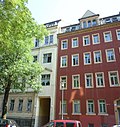 |
Apartment building in closed development | Berliner Strasse 10 (map) |
around 1880 (tenement) | historicizing plastered building with a reduced facade, of importance in terms of building history and urban development history. |
09218607
|
 |
Apartment building in closed development | Berliner Strasse 12 (map) |
around 1880 (tenement) | historicizing clinker-sandstone facade, of importance in terms of building history and urban development history. |
09218608
|
 |
Apartment building in closed development | Berliner Strasse 16 (map) |
around 1880 (tenement) | historicizing clinker-sandstone facade, of importance in terms of building history and urban development history. |
09218609
|
 |
Apartment building in closed development | Berliner Strasse 18 (map) |
marked 1883 (tenement house) | representative building with an elaborate historicist plastered sandstone facade, of importance in terms of building history and urban development history. |
09218610
|
 |
Apartment building in closed development | Berliner Strasse 20 (map) |
around 1880 (tenement) | restrained plastered sandstone facade, of importance in terms of building history and urban development history. |
09218611
|
 |
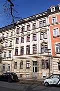
Tenement house with rear building (courtyard wing) in closed development | Berliner Strasse 22 (map) |
marked 1888 (tenement house) | Stately apartment building with the highest claim to representation in this street, of importance in terms of building history and urban development history. |
09218612
|
 |
Apartment building in closed development | Berliner Strasse 24 (map) |
around 1890 (tenement) | historicizing plastered sandstone facade, of importance in terms of building history and urban development history. |
09218613
|
 |
Apartment house in a corner and closed development | Berliner Strasse 26 (map) |
marked 1879 (tenement house) | characteristic, historicizing plastered sandstone facade, special accent due to corner projections with balcony axis, of importance in terms of building history, urban development history and the street scene. |
09218614
|
 |
Apartment house in a corner and closed development | Berliner Strasse 28 (map) |
around 1885 (tenement) | characteristic, historicizing plastered sandstone facade, special accent due to broken corner with bay window, of importance in terms of architectural history, urban development history and the street picture. |
09218615
|
| Apartment building in closed development | Berliner Strasse 30 (map) |
around 1890 (tenement) | historicizing plastered sandstone facade, of importance in terms of building history and urban development history. |
09218616
|
|
 |
Apartment building in closed development | Berliner Strasse 32 (map) |
around 1895 (tenement) | historicizing plastered sandstone facade, of importance in terms of building history and urban development history. |
09218617
|
| Apartment building in closed development | Berliner Strasse 34 (map) |
around 1895 (tenement) | Typical building with historicizing facade, of importance in terms of building history and urban development. |
09218618
|
|
| Apartment building in half-open development | Berliner Strasse 36 (map) |
around 1895 (tenement) | Historicizing plastered sandstone facade, of architectural and urban development history, built as an official residence for the Dresden-Friedrichstadt freight and marshalling yard. |
09218619
|
|
 |
Official residence in open development | Berliner Strasse 65 (map) |
1895–1896 (official residence) | one of the civil servants' houses for the Dresden-Friedrichstadt marshalling yard, later the Erich Heckels family home and office of the artist group "Brücke" , of architectural, local and art historical significance. |
09218620
|
| Apartment building in closed development | Berliner Strasse 72 (map) |
around 1890 (tenement) | Typical building with historicizing facade, of importance in terms of building history and urban development. |
09218621
|
|
 |
Apartment building in closed development | Berliner Strasse 74 (map) |
around 1890 (tenement) | Typical building with historicizing facade, of importance in terms of building history and urban development. |
09218622
|
| Apartment building in closed development | Berliner Strasse 76 (map) |
Late 19th century (tenement house) | Typical building with historicizing facade, of importance in terms of building history and urban development. |
09218623
|
|
 |
Apartment building in closed development | Berliner Strasse 78 (map) |
Late 19th century (tenement house) | characteristic and largely authentically preserved historicizing building, of importance in terms of architectural and urban development history. |
09218624
|
 |
Apartment building in closed development | Berliner Strasse 80 (map) |
Late 19th century (tenement house) | Typical building with historicizing facade, of importance in terms of building history and urban development. |
09218625
|
 |
Apartment building in closed development | Berliner Strasse 82 (map) |
Late 19th century (tenement house) | Typical building with historicizing facade, of importance in terms of building history and urban development. |
09218626
|
 |
Apartment building in half-open development | Berliner Strasse 84 (map) |
around 1897 (tenement) | striking building with historicizing facade, significant in terms of architectural and urban development history. |
09218627
|
 |
Medical college | Bodelschwinghstrasse 1; 3 (card) |
1928 (technical school), 1928 (adjoining building) | Main building (No. 3) and auxiliary building (No. 1) of the former homeless shelter for men, built by Paul Wolf , later an infection hospital, today a medical college and enclosure; clinker brick building typical of the time with expressionist influence, of architectural and socio-historical importance. |
09218628
|
 |
Apartment building in closed development | Bräuergasse 1 (map) |
around 1895 (tenement) | characteristic clinker-sandstone facade, of importance in terms of building history and urban development history. |
09218629
|
| Royal Lymph Institute (formerly) |
Bremer Strasse 16 (map) |
around 1910 (Lymphanstalt), around 1910 (Laboratory) | Residential and administrative building as well as laboratory building at the rear; Plastered buildings erected in the local style, of architectural and local significance. |
09218630
|
|
 More pictures |
Totality of the outer Matthäusfriedhof | Bremer Strasse 18 (map) |
1851 (cemetery) | Overall entity of the outer Matthew cemetery in its grown functional and design unit with the following individual monuments: Parentation hall over an L-shaped floor plan, new residential and administrative building, memorials for Soviet war victims in grave fields 17, 37 and J as well as for German war victims of the First and Second World Wars in grave field 20 with garden design, five graves and remains of the enclosure wall including gate system and gates (individual monuments ID No. 09218631), with a structured path system, remains of the structure and space-forming planting (garden monument) as well as two fountains in the hippodrome-shaped area northwest of the residential and administrative building (Entity parts); Significant in terms of building history, local history, personal history and sepulkral history. |
09305639
|
 More pictures |
Outer Matthäusfriedhof: Parentation hall, new residential and administrative building, memorials for war victims (individual memorials for ID No. 09305639) |
Bremer Strasse 18 (map) |
Early 20th century (tomb), marked 1861 (parentation hall), 1905 (cemetery administration), after 1945 (reminder and memorial for Soviet citizens), after 1918 (reminder and memorial for Germans) | Individual monuments of the material entity outer Matthäusfriedhof: Parentation hall over L-shaped floor plan by Carl Adolf Canzler , new residential and administrative building, memorials for Soviet war victims in grave field 17, 37 and J as well as for German war victims of the First and Second World War in grave field 20 with garden design, five graves and remains of the enclosure wall including gate and gates; Significant in terms of building history, local history, personal history and sepulkral history. |
09218631
|
 More pictures |
Totality of the New Catholic Cemetery | Bremer Strasse 20 (map) |
1875 (cemetery) | Totality of the new Catholic cemetery in its grown functional and design unit with the following individual monuments: gatehouse including chapel, administration and apartment of the cemetery master, morgue, monumental graves, memorials with their garden design for fallen soldiers of the 1st and 2nd World War in grave field H, for Victims of National Socialism and the bombing raids on Dresden in grave field K, for Czechoslovak victims of National Socialism in grave field I and for victims of fascism from 13 nations and the USA in grave field N, well basin with figure, structured path system, structure and space-creating planting (garden monument) as well as the enclosure wall including gate system and gates (individual monuments ID no. 09218632); Significant in terms of building history and local history as well as garden art. |
09305641
|
 More pictures |
New Catholic cemetery: gatehouse including chapel, administration and apartment of the cemetery master , morgue, monumental graves and memorials (individual monuments to ID No. 09305641) |
Bremer Strasse 20 (map) |
1875 (cemetery gate house), around 1920 (morgue) | Individual monuments of the new Catholic cemetery: gatehouse including chapel, administration and apartment of the cemetery master, morgue, monumental graves, memorials with their garden design for fallen soldiers of the 1st and 2nd World War in grave field H, for victims of National Socialism and the bombing raids Dresden in Grabfeld K, for Czechoslovak victims of National Socialism in Grabfeld I and for victims of fascism from 13 nations and the USA in Grabfeld N, fountain basin with a figure, articulating path system, structure and space-forming planting (garden monument) and enclosure wall including gate and gates; Significant in terms of building history and local history. |
09218632
|
 |
Rhenania-Ossag Mineralölwerke |
Bremer Strasse 40 (map) |
1928 (residential and office building) | Residential and administrative building in open development, with a northern extension; clinker brick construction typical of the time between New Objectivity and Expressionism, of importance in terms of building history and local history. |
09218633
|
 |
Apartment building in closed development | Cottaer Strasse 7 (map) |
around 1895 (tenement) | characteristic clinker-sandstone facade, part of a striking block development, of importance in terms of building history and urban development history. |
09218636
|
 |
Apartment building in closed development | Cottaer Strasse 9 (map) |
around 1895 (tenement) | characteristic clinker-sandstone facade, part of a striking block development, of importance in terms of building history and urban development history. |
09218959
|
 |
Apartment building in closed development | Cottaer Strasse 11 (map) |
around 1895 (tenement) | characteristic clinker-sandstone facade, part of a striking block development, of importance in terms of building history and urban development history. |
09218960
|
 |
Apartment house in a corner and closed development | Cottaer Strasse 13 (map) |
around 1895 (tenement) | Plastered building with broken corner, part of a striking block development from the Wilhelminian era, of importance in terms of urban development. |
09218961
|
 |
Residential house in open development |
Cottaer Strasse 25 (map) |
around 1860 (residential building) | Characteristic plastered building, one of the oldest residential buildings in the former urban expansion area of Friedrichstadt, of importance in terms of building history and urban development. |
09218638
|
 |
Residential house in open development |
Cottaer Strasse 27 (map) |
around 1890 (residential building) | Historicizing building from the end of the 19th century with a plastered facade typical of the time, significant in terms of building history and urban development history. |
09218639
|
 |
Reichsbahnausbesserungswerk Dresden (RAW) (formerly) | Emerich-Ambros-Ufer 48; 50; 52 (card) |
1890–1894 (administration building), around 1955 (VdN / OdF) | Three administrative buildings of a former Reichsbahn repair shop and OdF monument; representative, free-standing clinker buildings with elaborately structured facades, of architectural and railway historical significance. |
09218640
|
 |
Reichsbahnausbesserungswerk (RAW) Dresden (formerly) | Emerich-Ambros-Ufer 54; 56 (map) |
1893–1894 (railway workers' house) | Railway house in open development; Workers 'and officials' residence of a former Reichsbahn repair shop, large clinker brick building with an elaborately decorated, multi-colored facade, of architectural and railway historical importance. |
09218641
|
 |
Reichsbahnausbesserungswerk (RAW) Dresden (formerly) | Emerich-Ambros-Ufer 58; 60 (card) |
1893–1894 (railway workers' house) | Railway house in open development; Workers 'and officials' residence of a former Reichsbahn repair shop, large clinker brick building with an elaborately decorated, multi-colored facade, of architectural and railway historical importance. |
09218642
|
 |
Reichsbahnausbesserungswerk (RAW) Dresden (formerly) | Emerich-Ambros-Ufer 66; 68 (card) |
1893–1894 (railway workers' house) | Railway house in open development; Workers 'and officials' residence of a former Reichsbahn repair shop, large clinker brick building with an elaborately decorated, multi-colored facade, of architectural and railway historical importance. |
09218644
|
 |
Reichsbahnausbesserungswerk (RAW) Dresden (formerly) | Emerich-Ambros-Ufer 70; 72 (card) |
1893–1894 (railway workers' house) | Railway house in open development; Workers 'and officials' residence of a former Reichsbahn repair shop, large clinker brick building with an elaborately decorated, multi-colored facade, of architectural and railway historical importance. |
09218645
|
| Reichsbahnausbesserungswerk (RAW) Dresden (formerly) | Emerich-Ambros-Ufer 88 (map) |
around 1900 (railway house) | Railway house in open development; Residential house of a former Reichsbahn repair shop, clinker brick construction typical of the time, of architectural and railway history of importance. |
09210587
|
|
| Reichsbahnausbesserungswerk (RAW) Dresden (formerly) | Emerich-Ambros-Ufer 90 (map) |
around 1900 (railway house) | Railway house in open development; Residential house of a former Reichsbahn repair shop, clinker brick construction typical of the time, of architectural and railway history of importance. |
09210588
|
|
 More pictures |
Residential house and back building in open development |
Floßhofstrasse 2; 2b (card) |
around 1880 (residential building), around 1895 (rear building) | Plastered building, largely preserved in its original form, with a historicizing facade, of importance in terms of building history and urban development. |
09218646
|
 More pictures |
Apartment house in a corner and open development |
Floßhofstrasse 6 (map) |
around 1890 (tenement) | characteristic, historicizing plastered building, of importance in terms of building history and urban development history. |
09218647
|
 |
Double house in a corner and open development | Flügelweg 2 (map) |
1903–1904 (twin house) | Double house of the railway housing cooperative in a corner and open development (Flügelweg 2 and Hamburger Straße 59); See also Flügelweg 4/6 and 8, for the employees of the workshop station Dresden-Friedrichstadt built typical house with clinker-plaster facade, of architectural, railway and social history. |
09210591
|
 |
Semi-detached house in open development | Wing path 4; 6 (card) |
1901–1902 (twin house) | Double house of the railway housing cooperative, see also Flügelweg 2 and 8 and Hamburger Straße 59, typical house built for the employees of the workshop station Dresden-Friedrichstadt with clinker-plaster facade, of architectural, railway and social history. |
09218962
|
 |
Residential house in open development |
Flügelweg 8 (map) |
1902–1903 (residential building) | Residential building of the railway housing cooperative, see also Flügelweg 2, 4 and 6 and Hamburger Straße 59, typical residential building with clinker plaster facade built for the employees of the Dresden-Friedrichstadt workshop station, of architectural, railway and social history. |
09218963
|
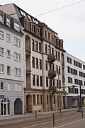 |
Apartment building in closed development | Friedrichstrasse 14 (map) |
around 1900 (tenement) | Typical building with historicizing facade, significant in terms of building history and urban development history |
09218648
|
 More pictures |
Manufactory house | Friedrichstrasse 26 (map) |
1726 start of construction (residential house) | Residential house in closed development; Half-timbered residential building, symmetrical facade structure, one of the few remaining baroque town houses in Dresden from the 18th century, of importance in terms of architectural and urban development history. |
09218652
|
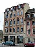 |
Apartment building with a shop area in closed development | Friedrichstrasse 27 (map) |
1897–1898 (tenement house) | characteristic, historicizing tenement building with clinker-sandstone facade, of importance in terms of building history and urban development. |
09218354
|
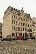 |
Apartment building in a formerly closed development | Friedrichstrasse 28 (map) |
marked 1901 (tenement house) | Distinctive building with facade design typical of the time and Art Nouveau elements, of importance in terms of building history and urban development history. |
09218653
|
 |
Residential house with two side wings in closed development |
Friedrichstrasse 29 (map) |
1670 core building (residential building) | one of the oldest houses in Friedrichstadt with a unique interior of a town house from the 17th century, of architectural, historical and artistic importance. |
09218654
|
 |
Residential building in closed development | Friedrichstrasse 31 (map) |
1927 (residential building) | Residential house built in 1927 as a replacement for a residential building from the 18th century, simple plastered facade with two large arched gates, of architectural and urban development significance. |
09218656
|
 |
Residential house in open development | Friedrichstrasse 32 (map) |
around 1875 (residential building) | Typical plastered building located in the rear part of the property, of architectural significance. |
09218655
|
 |
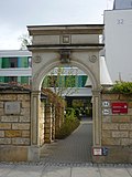
Residential house in semi-open development | Friedrichstrasse 33 (map) |
around 1740 (residential building) | Residential house in half-open development with rear courtyard development; Baroque four-wing building with inner courtyard, one of the few surviving town houses in Dresden from the 18th century, of significance in terms of building history and urban development. |
09218657
|
 |
kindergarten | Friedrichstrasse 34 (map) |
around 1955 (kindergarten) | striking, high-quality building from the reconstruction phase of the early fifties, of architectural and social significance. |
09218658
|
 |
Duckwitz House | Friedrichstrasse 36 (map) |
1878 (kindergarten) | Kindergarten; Significant example of the reconstruction by Arno Kiesling (1889–1963) in the early 1950s and worth mentioning in terms of local history as one of the few rebuilt houses in Friedrichstadt, of architectural and social significance. |
09218659
|
 |
Apartment house in a corner location and formerly closed development | Friedrichstrasse 37 (map) |
around 1895 (tenement) | striking corner house with historicizing clinker-sandstone facade, of importance in terms of building history and urban development history. |
09218660
|
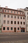 |
Residential building in closed development | Friedrichstrasse 38 (map) |
around 1765 (residential building) | one of the few preserved baroque town houses in Dresden from the 18th century, of architectural and urban development significance |
09218661
|
 More pictures |
Material entirety city hospital Friedrichstadt ; Marcolini Palace ; Fountain of Neptune | Friedrichstrasse 39; 41 (card) |
1867–1937 (hospital complex), 1740–1753 (hospital garden) | Totality of Friedrichstadt City Hospital: Hospital complex consisting of numerous individual monuments: Medical Center, House A (Marcolini Palace) to House U as well as gardens; Establishment of the hospital as a cultural monument of particular architectural, historical and artistic density. |
09305645
|
 |
Friedrichstadt City Hospital; Medical center (individual monument for ID no.09305645) | Friedrichstrasse 39 (map) |
1884 (hospital); 1953-1954, re. 1954, reconstruction (hospital); 1954 (sgraffito) | Individual monument belonging to the city hospital Friedrichstadt: Medical center with sgraffito in the entrance area; Reconstruction of the civil servants' residence, which was destroyed in 1945 and emerged from the brewery in 1884, stylization of the facade in the sense of the architecture of the "National Cultural Heritage" in free adaptation to the architecture of the Marcolini Palace, of architectural and historical importance. |
09218662
|
 |
Residential house in closed development with courtyard and rear building | Friedrichstrasse 40 (map) |
around 1780 (residential building), around 1860 (transverse wing), around 1870 (side wing) |
one of the few preserved baroque town houses in Dresden from the 18th century, of architectural and urban development significance. |
09218663
|
 More pictures |
Friedrichstadt City Hospital; Marcolini Palace; Fountain of Neptune | Friedrichstrasse 41 (map) |
1867 (house P), 1872–1878 (house N), 1892 (house M), 1895 (pathology with chapel), 1920s (kitchen wing), 1926–1928 (northern extension, gatehouse to house N), 1927–1928 ( House S), 1935–1937 (north wing house M) | Individual features of the totality of the Friedrichstadt City Hospital: House A (Marcolinipalais) to House U and gardens; Establishment of the hospital as a cultural monument of particular architectural, historical and artistic density. |
09218664
|
 |
Residential house in half-open development and side wing | Friedrichstrasse 42 (map) |
around 1860 (residential building) | Typical building with historicizing facade, of importance in terms of building history and urban development. |
09218665
|
 More pictures |
Totality of the inner Matthäusfriedhof | Friedrichstrasse 43 (map) |
1724–1732 (cemetery) | Totality of the inner Matthäusfriedhof: cemetery in its grown functional and design unit with a hall church with a retracted, square west tower (individual monuments ID No. 09218666), cemetery administration, burial hall, 17 tombs, two integrated round benches between the grave fields A and B, a dividing path system and a cemetery three entrances on Friedrichstrasse with decorative grilles (individual monuments ID no. 09218964); of importance in terms of building history, local history and Sepulchral history. |
09305648
|
 More pictures |
Matthäuskirche ; Inner Matthäusfriedhof (individual monument for ID no.09305648) |
Friedrichstrasse 43 (map) |
1728–1732 (church) | Individual monument belonging to the entity Inner Matthew Cemetery: Matthäuskirche - hall church with retracted, square west tower; large plastered building with high, hipped roof to the east, tower with bell storey and dome, interior modernized, significant evidence of baroque church architecture, of importance in terms of building history, history and the appearance of the street. Church, probably by Matthäus Daniel Pöppelmann , who was also buried in the church, reconstructed from 1974 after destruction in 1945. |
09218666
|
 More pictures |
Inner Matthäusfriedhof (individual monument for ID no.09305648) | Friedrichstrasse 43 (map) |
1724 (cemetery), around 1890 (cemetery administration), end of the 19th century (funeral hall) | Individual features of the totality of the inner Matthäusfriedhof: cemetery administration, laying out hall, 17 tombs, two integrated round benches between the grave fields A and B, structured path system and enclosure wall including three entrances with ornamental grilles located on Friedrichstrasse; of importance in terms of building history, local history and Sepulchral history. |
09218964
|
| Richter's garden | Friedrichstrasse 44 (map) |
1772 (residential house), around 1825 (garden house), 1981 (memorial plaque) | Residential house, outbuildings (so-called gardener's house), garden house and garden as well as enclosure with memorial plaque; Residential building, birthplace of the painter Adrian Ludwig Richter , together with Friedrichstrasse 46, the last structural reminder of the numerous garden plots and country houses in the district, of significance in terms of building history, local history and local history. |
09218667
|
|
 |
Residential house in open development and memorial plaque | Friedrichstrasse 46 (map) |
1841 or 1842 (residential house), 1982 (memorial plaque) | Plastered building with belvedere tower on the back, of architectural and local significance. Former Home of Johann Andreas Schubert and August Röckel with a memorial plaque on the outer wall. |
09218668
|
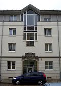 |
Catholic hospital pen; Essenius house |
Friedrichstrasse 48 (map) |
1747 (portal) | Portal of the front building; Baroque sandstone portal, of technical and artistic importance. Former Katholisches Krankenhausstift, Esseniussches Haus , only the portal and basement of the front building have been preserved, which were integrated into a new building (1999). |
09218670
|
| Residential house in semi-open development | Friedrichstrasse 52 (map) |
1730 (residential building) | Baroque town house, built by Matthäus Daniel Pöppelmann, of architectural and urban development significance. |
09218671
|
|
 More pictures |
Population age Catholic cemetery ; also Inner Catholic Cemetery | Friedrichstrasse 54 (map) |
since 1721 (cemetery) | Material entirety of the cemetery in its grown functional and design unit with St. Michael's Chapel, gatehouse, 156 monumental grave sites, enclosure wall with entrance gate (individual monuments ID No. 09218669, same address), morgue and structured path system (material parts); Second oldest of the preserved Dresden city cemeteries, of extraordinary cultural and historical status, as numerous personalities were buried here who belonged to the court or were connected to it and because of the outstanding artistic quality of numerous tombs. |
09210017
|
 More pictures |
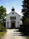
Old (inner) Catholic cemetery: Chapel of St. Michael, gatehouse and numerous graves (individual monuments to ID No. 09210017) |
Friedrichstrasse 54 (map) |
1740–1742 (cemetery gate house), 1842 (cemetery chapel), 17th – 20th centuries Century (tomb), around 1740 (enclosure) |
Individual features of the totality of the old Catholic cemetery: Chapel St. Michael, gatehouse, 156 monumental grave sites and enclosure wall with entrance gate; Second oldest of the preserved Dresden city cemeteries, of extraordinary cultural and historical status, as numerous personalities were buried here who belonged to the court or were connected to it and because of the outstanding artistic quality of numerous tombs. |
09218669
|
 More pictures |
Stock houses | Friedrichstrasse 57; 59; 61; 63 (map) |
1887–1895 (residential building) | Four houses and two rear houses of a row of houses; Erected by the non-profit building association, early example of the building association movement, representative plastered buildings with an elaborate structure, significant in terms of building history and urban development. |
09218674
|
 |
Electoral wax bleach; Menagerie gardens | Friedrichstrasse 58a (map) |
1770–1778 (residential building), 1770–1778 (outbuilding) | Two residential and farm buildings, associated garden, three gates and enclosure walls; Part of the formerly electoral wax bleaching, characteristic plastered buildings with a crooked hip roof, of architectural and local significance (see also Am Bramschkontor 2 [formerly Friedrichstrasse 56]). |
09218675
|
 |
Ostravorwerk (formerly) | Friedrichstrasse 60 (map) |
1568 (Vorwerk), 18th century (stable), 18th century (barn) | Western barn (ruin) and eastern cowshed of the former Ostravorwerk; structural remains of the Vorwerk destroyed in 1945, historically significant. |
09218676
|
 |
Portico Villa | Friedrichstrasse 62 (map) |
1835 (villa) | Villa; Residential house of the Ostragut tenant Portikus, of architectural and local significance. |
09218677
|
 |
Home of the Hegereiters; Hegereiterhaus | Friedrichstrasse 64 (map) |
1720–1730 (residential building) | picturesque half-timbered building of architectural and local historical importance. |
09218678
|
 More pictures |
XXI. District school; Girls school | Froebelstrasse 1 (map) |
1886–1887 (school) | School-building; Preserved construction of a complex from III originally constructed from five buildings in the pavilion system. and XXI. District school, girls' school, important in terms of local history. |
09305918
|
 |
Five houses in a group of houses in open development, with parts of the enclosure | Froebelstrasse 47; 49 (card) |
marked 1906 (residential building) | Plastered buildings designed according to a uniform concept with baroque facades, of importance in terms of building history and urban development history. |
09218732
|
 |
Four houses in a group of houses in open development | Froebelstrasse 51; 53; 55; 57 (card) |
1905 (residential building) | Palais-like building group with a Baroque facade, designed according to a uniform concept, of importance in terms of building history and urban development history. |
09218643
|
 |
Apartment building in closed development | Gambrinusstrasse 1 (map) |
around 1897 (tenement) | Characteristic late-founding building with a historic clinker-sandstone facade, emphasized in the middle, massive and load-bearing ground floor through ashlar, floors above with symmetrically arranged decorative and dividing elements, of architectural significance. |
09218689
|
 |
Apartment building in closed development | Gambrinusstrasse 2 (map) |
around 1897 (tenement) | characteristic late-founding building with historical clinker-sandstone facade, massive and load-bearing ground floor due to ashlar, floors above with asymmetrically arranged decorative and structural elements, of architectural significance. |
09218688
|
 |
Apartment building in closed development | Gambrinusstrasse 3 (map) |
around 1897 (tenement) | Characteristic late-founding building with a historic clinker-sandstone facade, emphasized in the middle, massive and load-bearing ground floor through ashlar, floors above with symmetrically arranged decorative and dividing elements, of architectural significance. |
09218965
|
 |
Apartment building in closed development | Gambrinusstrasse 4 (map) |
around 1897 (tenement) | characteristic late-founding building with historical clinker-sandstone facade, massive and load-bearing ground floor due to ashlar, floors above with asymmetrically arranged decorative and structural elements, of architectural significance. |
09218972
|
 |
Apartment building in closed development | Gambrinusstrasse 5 (map) |
around 1897 (tenement) | Characteristic late-founding building with a historic clinker-sandstone facade, emphasized in the middle, massive and load-bearing ground floor through ashlar, floors above with symmetrically arranged decorative and dividing elements, of architectural significance. |
09218966
|
 |
Apartment building in closed development | Gambrinusstrasse 6 (map) |
around 1897 (tenement) | characteristic late-founding building with historical clinker-sandstone facade, massive and load-bearing ground floor due to ashlar, floors above with asymmetrically arranged decorative and structural elements, of architectural significance. |
09218973
|
 |
Apartment building in closed development | Gambrinusstrasse 7 (map) |
around 1897 (tenement) | Characteristic late-founding building with historic clinker-sandstone facade, wide gate passage, ground floor that is massive and load-bearing thanks to ashlar, floors above with symmetrically arranged decorative and dividing elements, of architectural significance. |
09218967
|
 |
Apartment building in closed development | Gambrinusstrasse 8 (map) |
around 1895 (tenement) | characteristic late-founding building with historical clinker-sandstone facade, massive and load-bearing ground floor due to ashlar, floors above with asymmetrically arranged decorative and structural elements, of architectural significance. |
09218974
|
 |
Apartment building in closed development | Gambrinusstrasse 9 (map) |
around 1897 (tenement) | with original corridor furnishings with painting (as decorative painting) and stucco decoration, characteristic late-founding building with historic clinker-sandstone facade, solid and load-bearing ground floor due to ashlar, floors above with asymmetrically arranged decorative and structural elements, of architectural significance. |
09218968
|
 |
Apartment building in closed development | Gambrinusstraße 10 (map) |
around 1897 (tenement) | characteristic late-founding building with historical clinker-sandstone facade, massive and load-bearing ground floor due to ashlar, floors above with symmetrically arranged decorative and structural elements, of architectural significance. |
09218975
|
 |
Apartment building in closed development | Gambrinusstraße 11 (map) |
around 1897 (tenement) | characteristic late-founding building with historical clinker-sandstone facade, massive and load-bearing ground floor due to ashlar, floors above with asymmetrically arranged decorative and structural elements, of architectural significance. |
09218969
|
 |
Apartment building with back building in closed development | Gambrinusstrasse 12 (map) |
around 1897 (tenement) | Characteristic plastered building with historicizing facade, inside the two buildings still parts of the decorative painting from the time of origin, significant in terms of building history. |
09218976
|
 |
Apartment building in closed development and rear building | Gambrinusstraße 13 (map) |
marked 1896 (tenement house) | Distinctive late-founding building with a characteristic clinker stone facade, in the entrance area original hall furnishings with painting (as decorative painting) and stucco decoration, part of a closed, preserved street of its time, significant in terms of building history. |
09218970
|
 |
Apartment building in closed development | Gambrinusstrasse 14 (map) |
around 1897 (tenement) | characteristic late-founding building with historical clinker-sandstone facade, massive and load-bearing ground floor due to ashlar, floors above with symmetrically arranged decorative and structural elements, of architectural significance. |
09218977
|
 |
Apartment building in closed development | Gambrinusstrasse 15 (map) |
around 1897 (tenement) | with original hallway equipment with painting (as decorative painting) and stucco decoration, characteristic late-founding building with clinker-sandstone facade, historically and in parts also artistically important. |
09218971
|
 |
Apartment house in a corner and closed development | Gambrinusstrasse 16 (map) |
around 1897 (tenement) | Characteristic late-founding building with historic clinker-sandstone facade, massive and load-bearing ground floor due to ashlar, floors above with symmetrically arranged decorative and structural elements, of importance in terms of building history and urban development. |
09210594
|
 |
Material entirety of the Pennricher Strasse assembly group with numerous individual monuments | Gohliser Strasse 35; 37; 39; 41; 45 (card) |
1919–1925 (settlement) | Material entirety of the Pennricher Straße building group with the following individual monuments: row of houses consisting of five apartment buildings (ID No. 09210597, Gohliser Straße 35, 37, 39, 41, 45), double dwelling (ID No. 09306506, Hühndorfer Straße 1, 3), row of houses consisting of nine apartment buildings (ID No. 09210586, Pennricher Straße 8, 10, 12, 14, 16, 16b, 18, 18b, 20), a double dwelling (ID No. 09210596, Unkersdorfer Straße 1, 3), row of houses consisting of four Apartment buildings (ID No. 09218736, Unkersdorfer Straße 2, 4, 6, 6b), duplex (ID No. 09218735, Unkersdorfer Straße 5, 5b) as well as all enclosures as a whole, in the area between Pennricher-, Gohliser- and Unkersdorfer Straße Located settlement of the small housing association Dresden, entire system of U-shaped assembly group as well as individual buildings, traditionally designed with perforated facade, hipped or mansard roofs with crested, bat dormers, standing roof houses , risalits etc., accentuated by classicistic Motifs such as lintels with hanging plates and triangular gables with arched windows, significant in terms of building history, social history and urban development history. |
09306507
|
 |
Pennricher Strasse assembly group: Row of houses consisting of five apartment buildings (individual features for ID no. 09306507) | Gohliser Strasse 35; 37; 39; 41; 43 (map) |
1919–1920 (apartment building) | Individual features of the aggregate Pennricher Straße building group: Row of houses consisting of five apartment buildings; Part of a settlement of the Dresden Small Housing Association, connected to Pennricher Straße 8 by a gatehouse, traditionally designed buildings with perforated façades, hipped or mansard roofs with crested, bat dormers, standing roof houses, risalits, etc., of importance in terms of building history, social history and urban development history. |
09210597
|
| Urban nursing homes | Gohliser Strasse 38; 40; 42; 44; 46; 48; 50 (card) |
around 1925 (apartment building) | Residential complex consisting of two rows of houses at right angles to each other with fences on Gohliser and Pennricher Strasse as well as a transformer house in the inner courtyard; Built as urban nursing homes by the city's building construction department, traditional plastered and clinker buildings with hipped roofs and pointed bay windows, these and the stone setting around the house entrances as expressionist echoes, significant in terms of building history and urban development history. |
09210599
|
|
 |
Dresden- Friedrichstadt depot | Hamburger Strasse 39b; 41 (card) |
1935 (railway depot), around 1970, western workshop (railway depot) | Administration building with gatehouse (No. 39b), two workshops and ancillary building (No. 41); Remarkable railway depot, especially from the 1930s, characteristic industrial architecture of this time, in the traditional to functionalist style, large hall in the center of the facility with monumental-looking rows of high rectangular openings, clinker brick facades, western hall with a folding roof built in GDR times, the facility is important in terms of both building history and industrial history . |
09218690
|
 |
Double apartment building in open development | Hamburger Strasse 56; 58 (card) |
around 1900 (double tenement house) | Typical plastered building with historicizing facade, of importance in terms of building history and urban development history. |
09210595
|
| Double house in a corner and open development |
Hamburger Strasse 59 (map) |
1903–1904 (twin house) | Double house in corner location and open development (Flügelweg 2 and Hamburger Straße 59); See also Flügelweg 4/6 and 8, for the employees of the workshop station Dresden-Friedrichstadt built typical house with clinker-plaster facade, of architectural, railway and social history. |
09210591
|
|
 |
King Anton Monument | Hohenthalplatz (map) |
1835 (monument) | Monument; three-tiered plinth with a high pedestal and portrait bust of Ernst Rietschel , historically and artistically important for King Anton of Saxony . |
09218634
|
 |
Hohenthalhaus (former) | Hohenthalplatz 7 (map) |
1779 (donated), around 1855 (main building preserved) | Hospital building; Donated as an official hospital, later an old people's home, public building with a representative plastered facade, of architectural and local significance. |
09218635
|
 |
Apartment building in closed development | Institutsgasse 4 (map) |
around 1900 (tenement) | characteristic late founding building with historic clinker-sandstone facade, of architectural importance. |
09218691
|
| Apartment building in a formerly closed development | Institutsgasse 6 (map) |
around 1900 (tenement) | characteristic late founding building with historic clinker-sandstone facade, of architectural importance. |
09306460
|
|
 More pictures |
Friedrichstadt town house | Löbtauer Strasse 2 (map) |
1907–1908 (town hall) | Administration building; As a town house with apartments by Hans Erlwein , a striking building of objectified architecture after 1900, monumental effect despite the simple facade design, dominated by massive arched openings in the base, central cartouche and pilaster structure above the first floor, work of the important Dresden city planning council Erlwein, free-standing after war damage, architectural history and artistically significant. |
09218692
|
 More pictures |
Population asylum for sick people; Municipal madhouse and infirmary; Löbtauer Strasse nursing home | Löbtauer Strasse 31; 33 (card) |
1886/1900 (nursing home) | The collective asylum for sick people, with the following individual monuments (ID no. 09218693): five nursing homes, three times only gable-facing parts of the building have been preserved; Significant in terms of building history and social history, today a retirement home and hospital. |
09305191
|
 More pictures |
Asylum for the sick; Municipal madhouse and infirmary; Nursing home Löbtauer Straße (individual monuments to ID no.09305191) | Löbtauer Strasse 31; 33 (card) |
1886–1900 (nursing home) | Individual features of the collective asylum for sick people: five nursing homes, three times only gable building parts preserved; Significant in terms of building history and social history, today a retirement home and hospital. |
09218693
|
 |
Cavillery; Urban covering shop (formerly) |
Lübecker Strasse 47; 47a (card) |
around 1905 (covering shop) | Residential and administrative buildings as well as functional building at the rear; striking ensemble of a typical local facility, highlighted in terms of design by clinker brick elements such as corner pilasters and arches as well as apex stones, significant in terms of building history and local history. Former Residential and administrative building of the municipal cover shop, with transformer house. |
09303112
|
| Reconstruction relief | Magdeburger Strasse 1 | 1951 (relief) | Reconstruction relief; currently in storage, significant in terms of local history and art history. |
09218699
|
|
 More pictures |
King Albert Harbor; Alberthafen Dresden-Friedrichstadt | Magdeburger Strasse 58 (map) |
1891–1896 (harbor), 1891–1896 (south quay), 1896 (administration building), 1896 (freight yard), 1896 (recovery and storage shed, north quay) | Hafenbahnhof, administration building, storage building of the former Elblagerhaus-Aktiengesellschaft, re. 1905, on the Südkai, Südkai as well as recovery and storage sheds and storage buildings with a tower on the north side of the now significantly reduced harbor basin, two bridges for road and rail traffic and a cultural center (Fischhaus on Schlachthofstraße); Parts of what was once the most important Saxon inland port, the buildings are also striking examples of industrial architecture around 1900 and around 1955, in their entirety also significant for the history of construction, transport and economic history, the two bridges are remarkable examples of civil engineering, most of the buildings are also of importance for urban planning . |
09218700
|
 |
Four multi-family houses in a residential complex | Manitiusstrasse 1; 3; 5 (card) |
1926–1928 (apartment building) | characteristic group of houses from housing and settlement construction around 1925 with expressionistic echoes, of importance in terms of building history and urban development history. |
09218701
|
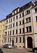 |
Apartment building in closed development | Manitiusstrasse 7 (map) |
around 1908 (tenement) | Plastered building with facade structure typical of the time, with ornamental glazing in the stairwell, of architectural significance. |
09218702
|
 |
Apartment building in closed development | Manitiusstrasse 10 (map) |
around 1905 (tenement) | distinctive building with façade design typical of the time and Art Nouveau elements, of significance in terms of building history. |
09218746
|
 |
Apartment building in a formerly closed development | Manitiusstrasse 12 (map) |
around 1905 (tenement) | distinctive plastered building with historicizing facade, of architectural significance. |
09218703
|
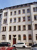 |
Apartment building in closed development | Menageriestraße 1 (map) |
1902 (tenement) | distinctive plastered building with historicizing facade and art nouveau forms, of architectural significance. |
09218704
|
 |
Apartment house in a corner and closed development | Menageriestraße 1a (map) |
1902 (tenement) | representative, historicizing building from the end of the 19th century with a plastered facade typical of the time and Art Nouveau forms, of importance in terms of building history and urban planning. |
09218705
|
 |
Apartment building in a formerly closed development | Menageriestraße 4 (map) |
around 1900 (tenement) | Plastered building with historicizing facade, of architectural significance. |
09218706
|
|
More pictures |
Aggregate urban slaughterhouse and cattle yard ; today Messe Dresden | Knife ring 1; 2; 3; 4; 5; 6; 7; 8a; 8b; 8c; 8e; 8f; 8g; 8k; 25; 26; 27 (card) |
1906–1910 (slaughterhouse) | The urban slaughterhouse and cattle yard with numerous individual monuments: shop building (Messering 1, 2, 3), exhibition building (Messering 4), administration building (Messering 5) and various pavilion buildings (individual monuments ID No. 09218718), a large part of the area is now a trade fair (Knife ring 6) used; Unique architectural, urban and economic-historical area, one of the most important works of the probably most important Dresden city planning officer, Hans Erlwein, one of the most important slaughterhouses in Germany. Information on individual buildings, see Städtischer Vieh- und Schlachthof (Dresden) . |
09302689
|
 More pictures |
Municipal slaughter and cattle yard; today Messe Dresden (individual memorials for ID no.09302689) | Knife ring 1; 2; 3; 4; 5; 6; 7; 8a; 8b; 8c; 8e; 8f; 8g; 8k; 25; 26; 27 (card) |
1906–1910 (slaughterhouse), around 1926 (extension with residential houses), inscribed 1906–1910 (animal sculpture), 1906–1910 (group of figures), 1906–1910 (painting) | Individual features of the entity urban slaughterhouse and cattle yard: shop building (Messering 1, 2, 3), show office building (Messering 4), administration building; Unique architectural, urban and economic-historical area, one of the most important works of the probably most important Dresden city planning officer, Hans Erlwein, one of the most important slaughterhouses in Germany. |
09218718
|
 |
Urban nursing homes | Pennricher Strasse 2; 2 B; 4; 4b; 6 (card) |
around 1925 (apartment building) | Residential complex consisting of two rows of houses at right angles to each other with fences on Gohliser and Pennricher Strasse as well as a transformer house in the inner courtyard; Built as urban nursing homes by the city's building construction department, traditional plastered and clinker buildings with hipped roofs and pointed bay windows, these and the stone setting around the house entrances as expressionist echoes, significant in terms of building history and urban development history. |
09210599
|
 |
Pennricher Strasse assembly group: Row of houses consisting of nine apartment buildings (individual monuments for ID No. 09306507) | Pennricher Strasse 8; 10; 12; 14; 16; 16b; 18; 18b; 20 (card) |
1919–1920 (apartment building) | Individual features of the aggregate Pennricher Straße building group: row of houses consisting of nine apartment buildings; Part of a settlement of the small housing association Dresden, Pennricher Straße 14 and 16 connected by a gatehouse, traditionally designed buildings with perforated facades, hipped or mansard roofs with crested, bat dormers, standing roof houses, risalits, etc., of importance in terms of building history, social history and urban development history. |
09210586
|
 More pictures |
Well house | Pieschener Allee (map) |
around 1910 (fountain house) | Pavilion-like building with an almost octagonal floor plan, evidence of the local water supply, especially important from a local history. |
09305739
|
 More pictures |
Tree-lined avenue | Pieschener Allee (map) |
around 1700 (avenue) | Historically preserved, double-row lime tree avenue northeast of the former large Ostragehege, parallel to the Elbe, significant in terms of landscape design and urban development. |
09210600
|
 |
Apartment building in closed development | Roßthaler Strasse 1 (map) |
around 1870 (tenement) | characteristic Wilhelminian style building with a balanced, historicizing facade design, of architectural significance. |
09218707
|
 |
Residential house in open development |
Schäferstrasse 46 (map) |
around 1860 (residential building) | Simple plastered building, relic of the former development on the north side of Schäferstrasse, of architectural significance. |
09218709
|
 |
House in a corner and formerly closed development | Schäferstrasse 50 (map) |
around 1860 (residential building) | Simple plastered building with a balanced facade, relic of the former development on the north side of Schäferstrasse, historically important. |
09218710
|
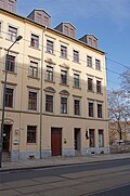 |
Residential house in a formerly closed development | Schäferstrasse 56 (map) |
around 1865 (residential building) | Evidence of pre-foundational residential development, of importance in terms of building history. |
09218711
|
 |
Residential building in closed development | Schäferstrasse 58 (map) |
1862–1863 (residential house) | Plastered building with a balanced facade, evidence of pre-prehistoric residential development, of architectural significance. |
09218978
|
| Residential building in closed development | Schäferstrasse 60 (map) |
around 1865 (residential building) | Evidence of pre-foundational residential development, of importance in terms of building history. |
09218979
|
|
 |
Residential building in closed development | Schäferstrasse 62 (map) |
around 1865 (residential building) | Evidence of pre-foundational residential development, of importance in terms of building history |
09218980
|
 |
Apartment building in a formerly closed development | Schäferstrasse 69 (map) |
around 1895 (tenement) | characteristic late founding building with historic clinker-sandstone facade, of architectural importance. |
09218712
|
 |
Apartment building in closed development | Schäferstrasse 71 (map) |
around 1895 (tenement) | characteristic late founding building with historic clinker-sandstone facade, of architectural importance. |
09218981
|
 |
Apartment house in a corner and closed development | Schäferstrasse 73 (map) |
around 1885 (tenement) | characteristic late founding building with historic clinker-sandstone facade, of architectural importance. |
09218713
|
 |
Residential complex of three houses in closed development and in a corner |
Schäferstrasse 75; 77 (card) |
around 1910 (double house), around 1910 (residential house) | On the corner of Schäferstrasse and Vorwerkstrasse, a uniformly designed assembly group in the reform style of the time around 1910, of importance in terms of building history and urban planning. Group of houses, wide triangular gable , open staircase with elements of Art Nouveau and Art Deco . |
09218714
|
 |
Apartment building in closed development | Schäferstrasse 79 (map) |
around 1880 (tenement) | Historicizing plastered sandstone facade typical of the time, of architectural significance. |
09218715
|
 |
Semi-detached house in closed development | Schäferstrasse 81; 83 (map) |
around 1910 (director's residence) | Uniformly designed facade in the reform style of the time around 1910, of importance in terms of building history and urban planning. |
09218716
|
 |
Apartment house in a corner and open development | Schäferstrasse 101 (map) |
shortly before 1900 (tenement) | characteristic late founding building with historic clinker-sandstone facade, of importance in terms of building history and urban development. |
09218717
|
 More pictures |
Municipal Main Market Hall; Wholesale market hall | Schweriner Strasse 56 (map) |
1893–1895 (market hall) | Market hall; Representative hall construction with strongly developed facades, which are emphasized by risalits with baroque gables, significant in terms of architectural history, urban planning and the street scene. Großmarkthalle, formerly the main market hall, built under Edmund Bräter , partially destroyed in 1945 and rebuilt in a simplified manner without a clock tower. |
09218719
|
 |
Roßthaler Hof | Schweriner Strasse 63 (map) |
around 1895 (residential and commercial building) | Residential and commercial building in a corner and formerly closed development; representative late-historical building with characteristic ashlar and clinker facade, significant in terms of building history and urban development. Corner house of a partially destroyed block development (roof structure burned out on August 16, 2012) is currently being restored. |
09218720
|
 |
Apartment building in closed development | Seminarstrasse 8 (map) |
1901 (tenement) | Distinctive building with a well-developed Art Nouveau facade, of architectural and artistic importance. |
09218721
|
 |
Apartment building in a formerly closed development | Seminarstrasse 9 (map) |
1876 (tenement house) | Typical building with historicizing facade, of architectural significance. |
09218722
|
 |
Double tenement house in closed development | Seminarstrasse 10; 12 (card) |
around 1910 (double tenement house) | representative plastered building with facade design in the reform style of the time around 1910, of importance in terms of building history. |
09218723
|
 More pictures |
Poor school and secondary school; III. Citizen school; 48th school | Seminarstrasse 11; 11a; 11b (card) |
marked 1785 (school), 1871 (school building on the street) | Two schoolhouses and a gymnasium: first schoolhouse from 1785, three-storey with a flat hipped roof, remodeled in 1827 by Samuel Rößler, further changes around 1880, second schoolhouse in 1871 cube-shaped with gym, the building in the courtyard is the oldest school building in Dresden; Significant in terms of building history and social history, as well as important evidence of the history of the school system in Saxony. Today used by the Dresden School Museum, among others . |
09218724
|
 |
Apartment building in closed development | Seminarstrasse 13 (map) |
around 1875 (tenement) | Typical plastered building with a historicizing facade, of architectural significance. |
09218725
|
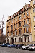 |
Apartment building in a formerly closed development | Seminarstrasse 14 (map) |
around 1900 (tenement) | representative, historicizing building from the end of the 19th century with clinker and stone facade typical of the time, of architectural significance. |
09218726
|
 |
Apartment building in half-open development | Seminarstrasse 15 (map) |
around 1895 (tenement) | striking building with historicizing clinker-sandstone facade, of architectural significance. |
09218727
|
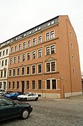 |
Apartment building in a formerly closed development | Seminarstraße 22 (map) |
around 1890 (tenement) | Simple building from the late Wilhelminian era with a historicizing facade, of architectural importance. |
09218728
|
 |
Apartment building in closed development | Seminarstrasse 24 (map) |
around 1890 (tenement) | Simple building from the late Wilhelminian era with a historicizing facade, of architectural importance. |
09218729
|
 |
Apartment building in closed development | Seminarstrasse 26 (map) |
around 1890 (tenement) | Plastered building with historicizing facade in the tradition of the city palace of the Dresden School , of architectural significance. |
09218730
|
 |
Apartment house in a corner and closed development | Seminarstrasse 28 (map) |
marked 1892 (tenement house) | Historicizing building from the end of the 19th century with a plastered facade typical of the time, of architectural and urban significance. |
09218731
|
 |
Five houses in a group of houses in open development, with parts of the enclosure | Semmelweisstrasse 2; 4; 6 (card) |
marked 1906 (residential building) | Plastered buildings designed according to a uniform concept with baroque facades, of importance in terms of building history and urban development history. |
09218732
|
 |
Five tenement houses in a row | Semmelweisstrasse 13; 15; 17; 19; 21 (card) |
around 1925 (tenement) | characteristic tenement houses of the 1920s, restrained yet expressive facade design, important in terms of building history and urban development. |
09218733
|
|
More pictures |
Übigauer Allee | Übigauer Fährweg (map) |
from 1725 (avenue) | Avenue; the avenue running from south-east to north-west is located in the main axis of Übigau Castle and thus represents an important connection between this and the landscape, of importance in terms of urban history and landscape design. |
09218734
|
 |
Pennricher Strasse assembly group: Double dwelling (individual features for ID no.09306507) | Unkersdorfer Strasse 1; 3 (card) |
1919–1920, 1925 (twin house) | Individual features of the aggregate Pennricher Strasse sub-assembly: double residential building; Part of a settlement of the Dresden Small Housing Association, traditionally designed building with a perforated facade, risalits, mansard roof with forelock, roof core, standing roof houses, bat dormers, etc., of importance in terms of architectural, social and urban development. |
09210596
|
 |
Pennricher Straße assembly group: row of houses consisting of four apartment buildings (individual monuments to ID no. 09306507) | Unkersdorfer Strasse 2; 4; 6; 6b (card) |
marked 1925 (apartment building) | Individual features of the aggregate Pennricher Straße building group: row of houses consisting of four apartment buildings; Part of a settlement of the Dresden Small Housing Association, traditionally designed buildings with perforated facades, mansard hipped roofs, bat dormers, standing attic houses, risalits, clock towers, etc., of importance in terms of building history, social history and urban development history. |
09218736
|
 |
Pennricher Strasse assembly group: Double dwelling (individual features for ID no.09306507) | Unkersdorfer Strasse 5; 5b (card) |
1919–1920, 1925 (twin house) | Individual features of the aggregate Pennricher Strasse sub-assembly: double residential building; Part of a settlement of the Dresden Small Housing Association, traditionally designed building with a perforated facade, risalits, mansard roof with forelock, roof core, standing roof houses, bat dormers, etc., of importance in terms of architectural, social and urban development. |
09218735
|
| Apartment building in closed development | Vorwerkstrasse 13 (map) |
around 1900 (tenement) | Plastered building with a historicizing facade in the tradition of the Dresden School, of architectural significance. |
09218737
|
|
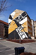 |
Apartment building in half-open development | Vorwerkstrasse 15 (map) |
around 1900 (tenement) | Plastered building with a historicizing facade in the tradition of the Dresden School, of architectural significance. |
09218740
|
 |
Residential complex of three houses in closed development and in a corner |
Vorwerkstrasse 30 (map) |
around 1910 (double house), around 1910 (residential house) | On the corner of Schäferstrasse and Vorwerkstrasse, a uniformly designed assembly group in the reform style of the time around 1910, of importance in terms of building history and urban planning. |
09218714
|
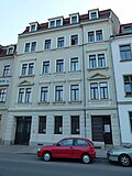 |
Apartment building in closed development | Wachsbleichstrasse 1 (map) |
around 1880 (tenement) | characteristic late founding building with a historicizing plastered facade, of architectural significance. |
09218739
|
 |
Two residential and commercial buildings in closed development | Wachsbleichstrasse 2; 2b (card) |
marked 1898 (residential and commercial building) | representative buildings with elaborate façades in the style of the German neo-Gothic and early Renaissance, of importance in terms of architectural history, architectural design and urban development. House entrance with seating niche portal around 1898. |
09218747
|
 |
Residential building in closed development | Wachsbleichstrasse 3 (map) |
marked 1864 (residential building) | Plastered construction with a balanced facade, important in terms of building history |
09218748
|
 |
Residential building in closed development | Wachsbleichstrasse 4 (map) |
around 1850 (residential building) | Plastered building with a balanced late Biedermeier facade, important in terms of building history. |
09218749
|
 |
Apartment building in closed development | Wachsbleichstrasse 5 (map) |
around 1890 (tenement) | characteristic late founding building with historicizing clinker-sandstone facade, of architectural significance. |
09218750
|
 More pictures |
17. District School (formerly); 17. Elementary school | Wachsbleichstrasse 6 (map) |
1881 (school) | School building, gymnasium, roofed connecting wing and outbuilding (toilet house), built by Theodor Friedrich ; representative, Wilhelminian style school building with richly structured plastered sandstone facade, of architectural, local and social history. |
09218751
|
 |
Apartment building in closed development | Wachsbleichstrasse 7 (map) |
around 1890 (tenement) | Late founding construction with an economical historicizing clinker-sandstone facade, of architectural significance. |
09218982
|
 |
Apartment building in closed development | Wachsbleichstrasse 9 (map) |
around 1890 (tenement) | characteristic late founding building with historicizing clinker-sandstone facade, of architectural significance. |
09218983
|
 |
Apartment house in a corner location and formerly closed development | Wachsbleichstrasse 14 (map) |
around 1875 (tenement) | characteristic late-founding tenement house, corner building of a war-destroyed, closed development, important in terms of urban planning, significant building history. |
09218752
|
 |
Secret Annex | Wachsbleichstrasse 19 (map) |
around 1885 (rear building) | Typical clinker brick building, structural remnants of a war-destroyed rear building in Wachsbleichstrasse, of architectural and social significance. |
09218754
|
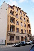 |
Apartment building in a formerly closed development | Wachsbleichstrasse 22 (map) |
around 1910 (tenement) | Representative plastered building in the reform style of the time around 1910, one of the last houses on the western edge of Wachsbleichstrasse due to war losses, of importance in terms of building history and urban development. |
09218755
|
 |
Residential house in a formerly closed development | Wachsbleichstrasse 25 (map) |
around 1860 (residential building) | Plastered building with a balanced, historicizing facade, of architectural significance. |
09218756
|
 |
House in a corner and formerly closed development | Wachsbleichstrasse 27 (map) |
around 1865 (residential building) | Plastered building with a balanced, historicizing facade, important in terms of building history and urban development. |
09218757
|
 |
Four multi-family houses in a residential complex | Wachsbleichstrasse 45 (map) |
1926–1928 (apartment building) | characteristic group of houses from housing and settlement construction around 1925 with expressionistic echoes, of importance in terms of building history and urban development history. |
09218701
|
 More pictures |
Bienertsche Hafenmühle (formerly) | Waltherstrasse 2 (map) |
1913 (mill) | Mill building, silo with tower extension (silo or water tower), machine and boiler house (parts of the building preserved) and loading hall; Under Theodor and Erwin Bienert, built by Lossow & Kühne , facade structure through a simple colossal order, distinctive roof designs, accentuation by means of a towering tower, mill technology fundamentally renewed after 1991, system at the time of creation of one of the largest mill locations in Germany, of industrial history, also significant from an architectural point of view and as a landmark of western Dresden important for the city skyline. |
09218759
|
 More pictures |
Tram station Waltherstrasse | Waltherstrasse 9; 9a; 9b; 9c; 11; 11b; 11c; 11d (card) |
1926 (tram depot) | Street station consisting of entrance hall and side halls, street-side apartment block as well as administration and workshop building; Largest tram station in Dresden with a remarkable architectural-historical, for Dresden rare expressionist and Art Deco-influenced building design, of architectural and local significance. |
09218760
|
 |
Apartment building in a formerly closed development | Waltherstrasse 23 (map) |
around 1895 (tenement) | characteristic late founding building with historic clinker-sandstone facade, of architectural importance. |
09218761
|
 |
Berlin train station ; Dresden-Friedrichstadt train station | Waltherstrasse 31; 36 (card) |
1893 (administration building) | Two administration buildings of the former Berlin train station; representative building from the end of the 19th century with clinker brick facade typical of the time, of architectural, railway and cultural history. |
09218763
|
 |
Berlin train station; Dresden-Altstadt railway maintenance office; Cargo center |
Waltherstrasse 34 (map) |
1873–1875 (freight yard) | Expedition building of the former Berlin train station with goods shed and ramps; characteristic building from the end of the 19th century with clinker brick facade typical of the time, of architectural, railway and cultural-historical importance, unchanged condition. |
09218764
|
 More pictures |
Yenidze Tobacco and Cigarette Factory | Weißeritzstrasse 3 (map) |
1907–1909 (tobacco factory) | Former Yenidze cigarette factory, built by Martin Hammitzsch , manufacturing and administration building with preserved parts of the historical enclosure; Mosque-like six- or seven-story industrial building with turrets, »minarets«, colored facade design, oriental-style architectural decorations and a glass dome that can be seen from afar, one of Dresden's landmarks, uniquely designed factory building, significant in terms of architectural, artistic and urban planning. |
09218766
|
 |
Apartment building in a formerly closed development | Weißeritzstrasse 22 (map) |
around 1905 (tenement) | Plastered building opposite the former Wettin train station with a representative facade, of architectural and urban significance. |
09218768
|
 |
Apartment house in a corner and closed development | Weißeritzstrasse 38 (map) |
around 1900 (tenement) | Apartment building (Weißeritzstraße 38 together with Adlergasse 1a), striking corner house with a wide street front to Seminarstraße, of importance in terms of building history and urban development history. |
09218769
|
 |
Apartment building in closed development | Weißeritzstrasse 40 (map) |
around 1895 (tenement) | representative building from the late Wilhelminian era with historicizing clinker-sandstone facade, significant in terms of building history and urban development history. |
09218770
|
 |
Apartment building in half-open development | Weisseritzstrasse 42; 44 (map) |
around 1895 (tenement) | striking building from the late Wilhelminian era with a historicizing clinker-sandstone facade, significant in terms of building history and urban development history. |
09218771
|
 |
Apartment building in a formerly closed development | Weißeritzstrasse 48 (map) |
around 1890 (tenement) | historicizing clinker brick facade, of architectural significance |
09218587
|
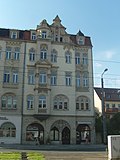 |
Two residential and commercial buildings in closed development | Weißeritzstrasse 52 (map) |
marked 1898 (residential and commercial building) | representative buildings with elaborate façades in the style of the German neo-Gothic and early Renaissance, of importance in terms of architectural history, architectural design and urban development. |
09218747
|
 More pictures |
Residential house in formerly half-open development | Wölfnitzstrasse 4 (map) |
around 1865 (residential building) | characteristic plastered building with historicizing facade, of architectural significance. |
09218774
|
 More pictures |
Residential house in a formerly closed development | Wölfnitzstrasse 11 (map) |
around 1865 (residential building) | Plastered building with a balanced, historicizing facade, of architectural significance. |
09218775
|
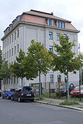 More pictures |
Apartment building in formerly half-open development | Wölfnitzstrasse 17 (map) |
around 1905 (tenement) | distinctive plastered construction, facade design with echoes of the reform style, important in terms of building history and urban planning. |
09218776
|
 More pictures |
Municipal slaughter and cattle yard; today Messe Dresden (individual memorials for ID no.09302689) | To fair 1; 3; 5; 9 (card) |
1906–1910 (slaughterhouse), around 1926 (extension with residential houses), inscribed 1906–1910 (animal sculpture), 1906–1910 (group of figures), 1906–1910 (painting) | Individual features of the urban slaughterhouse and cattle yard: former market halls (for trade fair 1, 5 and 9), preserved head structure (for trade fair 3); Unique architectural, urban and economic-historical area, one of the most important works of the probably most important Dresden city planning officer, Hans Erlwein, one of the most important slaughterhouses in Germany. |
09218718 |
Remarks
- This list is not suitable for deriving binding statements on the monument status of an object. As far as a legally binding determination of the listed property of an object is desired, the owner can apply to the responsible lower monument protection authority for a notice.
- The official list of cultural monuments is never closed. It is permanently changed through clarifications, new additions or deletions. A transfer of such changes to this list is not guaranteed at the moment.
- The monument quality of an object does not depend on its entry in this or the official list. Objects that are not listed can also be monuments.
- Basically, the property of a monument extends to the substance and appearance as a whole, including the interior. Deviating applies if only parts are expressly protected (e.g. the facade).
Detailed memorial texts
- ↑ a b c asylum for sick people with the following individual monuments: five nursing homes, three times only gable-facing building parts preserved, from north to south on Löbtauer Straße extension building, house for physically ailing women and house for physically ailing men and women, rear house for mentally ailing ones Men and a house for mentally ailing women as well as a boiler house and a small morgue on Altonaer Straße, a house at the entrance to Löbtauer Straße, the outdoor facilities in front of and between the buildings and the preserved parts of the enclosure wall as a whole; Today a senior citizen's home and hospital, a pavilion system of an infirmary from the late 19th century, as a striking example of this building task, significant in terms of building history and social history, and also a valuable local document for a section of the history of Dresden's welfare system, due to its effect in the urban space from an urban planning point of view.
-
^ Monument text
administrative building of the state railways. Erected 1894–1895. Similar to the type of free-standing residential building, three-storey with a hipped roof . A clinker brick building whose facade structure stems from the appeal of the different colors of the material: pink-red clinker bricks on the ground floor, yellow-orange ones on the upper floors and dark red ones in the rich structure of the cornices, bands and the carpet-like patterns of the windowless wall surfaces. The street view is symmetrical, three-axis central projection. Round-arched and basket-arched windows on the ground floor, the side views without windows. The back is structured by the powerfully stepping stairwell. The arched portal and arched windows in stepped reveals. The dormers in the hipped roof with suspected pinnacles. A significant building by the General Directorate of the State Railways (see Elbhafen and Reichsbahnausbesserungswerk) (monument topography Dresden-Friedrichstadt 1994, edited). -
↑ a b Entity of Friedrichstadt City Hospital with individual monuments: Medical Center, House A (Marcolini Palace with wings, courtyard, two side buildings, connecting corridor and former orangery), House M (gynecological clinic), House N (surgery), House P (formerly royal women's clinic), House R (formerly Ear, Nose and Throat Clinic), House S, House U (pathology with lecture hall and former hospital chapel), farm building, kitchen wing, transformer house, fencing of the entire area and garden with path system as well as structure and space-creating planting ( Garden monument), equipped with Neptune's fountain, cooper or vintner's fountain, two water basins, vases, the statues of "Tomyris" and "Themistocles" as well as two female herms, buildings with sculptural decorations, four lion figures, three herms on the street side of house A, Free-standing portal and dolphin fountain in the courtyard as well as two rows of sandstone bollards (individual monuments ID No. 09218662, Friedrichstrasse 39 and ID No. 09218664, Fri edrichstrasse 41); Establishment of the hospital as a cultural monument of particular architectural, historical and artistic density.
Conversion of a previously existing small palace (built in 1727 by Johann Christoph von Naumann ) by Johann Christoph Knöffel from 1746 for Heinrich von Brühl , an orangery and side wings were created; from 1774 owned by Camillo Marcolini , remodeled by Johann Daniel Schade and Johann Gottfried Kuntsch . Fountain of Neptune by Lorenzo Mattielli based on a design by Zacharias Longuelune . -
↑ Monument text
chapel. This was rebuilt in 1914–17, in the attached apse the extremely impressive crucifixion group from Permoser's grave († 1732), created by Balthasar Permoser himself. The pedestal formed as a rock, on top of it the dramatically moving group, the figures almost life-size. - The gravestones mainly made of sandstone, in addition to some baroque, also many classicist stones and various of the royal Saxon court sculptor Franz Pettrich . - Simple sarcophagus for Balthasar Permoser († 1732), the associated crucifixion group in the chapel today. - Gravestone for Field Marshal General Johann Georg Chevalier de Saxe († 1774), son of Augustus the Strong: sarcophagus with coat of arms and ermine coat on a high pedestal. - Gravestone for Johann Graf Renard († 1746) with an inscription panel surrounded by trophies, coats of arms, military equipment and putti. - Tomb of the Elsner family (formerly Roos), around 1750: on a low substructure an obelisk with drapery and halo, on the side small, fully plastic figures of the Spes and a putto with a censer. - Gravestone of the Longo family, around 1750: above a high pedestal, a strongly moved top with three rococo cartridges. - Wall grave for Ignatius Count von Accoramboni († 1793): above a stepped substructure with family coat of arms, the writing plate framed by pilasters and triangular gables, on the side the life-size, fully plastic figures of Caritas and Fortitudo . - Gravestone for the painter and director of the Dresden Art Academy Johann Baptist Casanova († 1795) by Traugott Leberecht Pochmann and Franz Pettrich: Above a high plinth with inscriptions, a strongly moved, proud female figure, holding a paint can in her right hand, at her feet Shield with the initials IBC - tombstone for Caroline Pettrich († 1803) and Juliane Pettrich († 1806), designed and executed by Franz Pettrich: on a sarcophagus adorned with putti, poppy garland and inscription, a slumbering female figure with poppy flowers in hand. - Gravestone for the Royal Saxon court organist Johann Anton Dreissig († 1815): stele (made of sandstone) with the bust of the deceased (made of iron). - Wall grave for Bishop Johannes Aloysius Schneider († 1818), by Franz Pettrich: Portikusarchitektur, the relief depicting the coronation of the deceased in front of the Heavenly Gate by Fides , Spes and Caritas. - Gravestone of Major Marie Therese von Dreßler and Scharfenstein († 1820), by Franz Pettrich: on a simple pedestal, side reliefs with putti, a reclined, young girl in Greek costume and hairstyle kneels, her head tilted, one with both hands Holding a lily branch.– Numerous tombs of Polish emigrants, 19th century. - ↑ a b c The urban slaughterhouse and cattle yard, with the following individual monuments: shop building (Messering 1, 2, 3), show building (Messering 4), administration building (Messering 5), gatehouse and gatekeeper houses with plastic (Messering 6), restaurant building with ancillary building (Messering 7), market hall for pigs and calves (Messering 8a / 8b / 8c and Zur Messe 1, previously Messering 8), market hall for large cattle (Messering 8e / 8f / 8g, Zur Messe 5), market hall for sheep and administration buildings, preserved Head building (Zur Messe 3), three feeding stalls (1st 2nd feeding stalls, Zur Messe 9 and 3rd feeding stalls, Messering 8k), building parts of the slaughterhouses and the cold store, connecting hall between the slaughterhouses and cold store, stables for foreign cattle (Zur Messe 9), Overstand barn building for small cattle, boiler house and machine house (boiler house), workshop building, official slaughterhouse, hides and tallow acceptance, tallow melt with farm building and residential house, sewage treatment, residential houses with Plasti k in the garden (Messering 25, 26, 27), public lavatories (formerly), fountain house (in the track loop) and various pavilion buildings (individual monuments ID no. 09218718) as well as the area of the area (subject aggregate part); Much of the area is now used as a trade fair (Messering 6), a unique architectural, urban and economic-historical area, one of the most important works of the most important Dresden city planning councilor Hans Erlwein, one of the most important slaughterhouses in Germany.
-
↑ Monument
text Roßthaler Straße 1, probably built 20–30 years earlier than Schweriner Straße 63, is also a respectable, probably Wilhelminian-style and largely unchanged building from the time it was built. It shows a balanced and harmonious facade design. The ground floor is highlighted by plaster grooves. Above all, the central axis and the first floor are emphasized by means of the window frames. It can be assumed that the four-storey building was also used as a hotel for a long time (inscriptions on the facade). As a largely unchanged and exemplary example of Wilhelminian style architecture, the Roßthaler Straße 1 building is significant in terms of architectural history. The public interest in preservation arises primarily from its exemplary character and the fact that the building's monumental quality is recognized at least by a broad group of experts. Similar objects can be found in the monument topographies of all federal states (LfD / 2009).
literature
- Volker Helas (edit.), State Office for the Preservation of Monuments Saxony (ed.): Monument topography of the Federal Republic of Germany. Monuments in Saxony: City of Dresden. Friedrichstadt . Verlag der Kunst, Dresden and Basel 1994, ISBN 3-364-00280-0 .
swell
Web links
Commons : Cultural heritage monuments in Friedrichstadt (Dresden) - Collection of images, videos and audio files