List of cultural monuments in the Leipzig suburb (A – H)
The list of cultural monuments in the Leipziger Vorstadt contains the cultural monuments of the Leipziger Vorstadt district in the Dresden district of Neustadt . This district is divided into the districts of Innere Neustadt , Äußere Neustadt , Leipziger Vorstadt, Radeberger Vorstadt and Albertstadt . The suburban settlement Neudorf and the quarter Scheunenhofviertel also belong to the Leipziger Vorstadt . The notes are to be observed.
This list is a partial list of the list of cultural monuments in Dresden .
This list is a partial list of the list of cultural monuments in Saxony .
Due to the high number of cultural monuments, the list, arranged alphabetically by address, has been divided into the following two sub-lists:
- List of cultural monuments in the Leipzig suburb (A – H)
- List of cultural monuments in the Leipzig suburb (I – Z)
This partial list of cultural monuments of A-H .
Legend
- Image: shows a picture of the cultural monument and, if applicable, a link to further photos of the cultural monument in the Wikimedia Commons media archive
- Designation: Name, designation or the type of cultural monument
-
Location: If available, street name and house number of the cultural monument; The list is basically sorted according to this address. The map link leads to various map displays and gives the coordinates of the cultural monument.
- Map view to set coordinates. In this map view, cultural monuments are shown without coordinates with a red marker and can be placed on the map. Cultural monuments without a picture are marked with a blue marker, cultural monuments with a picture are marked with a green marker.
- Dating: indicates the year of completion or the date of the first mention or the period of construction
- Description: structural and historical details of the cultural monument, preferably the monument properties
-
ID: is awarded by the State Office for the Preservation of Monuments in Saxony. It clearly identifies the cultural monument. The link leads to a PDF document from the State Office for the Preservation of Monuments in Saxony, which summarizes the information on the monument, contains a map sketch and often a detailed description. For former cultural monuments sometimes no ID is given, if one is given, this is the former ID. The corresponding link leads to an empty document at the state office. The following icon can also be found in the ID column
 ; this leads to information on this cultural monument at Wikidata .
Leipzig suburb
| image | designation | location | Dating | description | ID |
|---|---|---|---|---|---|
 More pictures |
Grumbt Villa | Alexander Pushkin Square 1 (map) |
1888 (villa) | Villa with garden and enclosure; extremely representative historicist building with original equipment, including painting (as decorative painting), sophisticated facade design is based on the Italian Renaissance , building history and artistically significant |
09214500 |
| Aggregate assembly Bärwalder Straße, with numerous individual monuments | Bärwalder Strasse 1; 2; 3; 4; 5; 6; 7; 8th; 9; 10; 11; 12; 13; 14; 15; 16; 17; 18; 19; 21; 23; 25; 27; 29; 31 (card) |
1926–1931 (settlement), 1926–1931 (row house), 1926–1931 (population) | Material entirety of the Bärwalder Straße construction group, with buildings (individual monuments) and the green spaces as elements of the totality; Settlement of the small housing association and the Heimstättenverein Dresden-Nordost, roughly between Hechtstraße, Oberauer Straße, Bärnsdorfer Straße and Seifersdorfer Straße consisting of 14 rows of houses of the small housing association on different floor plans and of 18 row house groups of the Heimstättenverein, settlement significant in terms of building history and urban development history as well as urban planning. |
09301952 |
|
 |
Individual monument of the group of buildings Bärwalder Straße (object 09301952): row of houses (Bärwalder Straße 1/3/5/7 and Hechtstraße 91/93/95/97) | Bärwalder Strasse 1; 3; 5; 7 (card) |
1926–1939, marked 1926 (apartment building) | Settlement of the small housing association and the home association Dresden-Nordost; Convex curved row of houses, significant in terms of building history and urban development history |
09215399 |
 |
Individual monument of the sub-assembly Bärwalder Straße (object 09301952): Building complex with high-rise (Bärwalder Straße 2/4/6 and Hechtstraße 99/101/103/105) | Bärwalder Strasse 2; 4; 6 (card) |
1926–1930 (apartment building) | Settlement of the small housing association and the home association Dresden-Nordost; over an acute-angled floor plan, significant in terms of building history and urban development history |
09215397 |
 |
Individual monument of the group of buildings Bärwalder Straße (object 09301952): row of houses (Bärwalder Straße 8/10/12, Hechtstraße 107/109/111/113/115/117/119/121/123/125, Niederauer Platz 4–9 and Ottendorfer Straße 17/19/21/23/25) | Bärwalder Strasse 8; 10; 12 (card) |
1926–1930 (apartment building) | Settlement of the small housing association and the home association Dresden-Nordost; extends from Niederauer Platz over Ottendorfer Straße to Hechtstraße, significant in terms of building history and urban development |
09215402 |
 |
Individual monument of the sub-assembly Bärwalder Straße (object 09301952): row of houses | Bärwalder Strasse 9; 11; 13; 15 (card) |
1926–1930 (apartment building) | Settlement of the small housing association and the home association Dresden-Nordost; Significant in terms of building history and urban development history |
09215400 |
 |
Individual monument of the group of buildings Bärwalder Straße (object 09301952): row of houses (Bärwalder Straße 14/16/18 and Niederauer Platz 1–3) | Bärwalder Strasse 14; 16; 18 (card) |
1926–1930 (apartment building) | Settlement of the small housing association and the home association Dresden-Nordost; on a right-angled floor plan, of architectural significance and of urban development history |
09215403 |
 |
Individual monument of the sub-assembly Bärwalder Straße (object 09301952): row of houses | Bärwalder Strasse 17; 19; 21; 23; 25; 27; 29; 31 (card) |
1926–1930 (apartment building) | Settlement of the small housing association and the home association Dresden-Nordost; Significant in terms of building history and urban development history |
09215401 |
 More pictures |
Line splitter of the Deutsche Reichspost | Bischofsplatz 1 (in front) (map) |
around 1925 (line distributor) | Line splitter; Polygonal metal housing on an artificial stone base with ventilation hood, of rarity and documentation value as well as of significance in terms of technology history. |
09306744 |
 More pictures |
Apartment building in closed development | Bischofsplatz 4 (map) |
Late 19th century (tenement house) | with shops, a striking building with a historicizing clinker facade, characterizing the square and significant in terms of building history |
09214461 |
 |
Römmler-houses: residential complex of the small housing cooperative - construction group Bischofsplatz (Bischofsplatz 12/14/16 and Johann-Meyer-Straße 2-6b) | Bischofsplatz 12; 14; 16 (card) |
1913–1914 (apartment building) | Building complex consisting of three fanned out wings with gate and connecting structures, characterizing the street scene and significant in terms of building history, named after the photographer Emil Römmler (1842–1941; Verlag Römmler & Jonas ), who provided the financing. |
09215329 |
 More pictures |
Railway bridges; Signal box; Görlitz – Dresden railway line | Bischofsweg (map) |
1844 (railway bridge) | Two railway bridges and signal box; juxtaposed arch bridge of natural stone and steel girder bridge as well as interlocking of the railway Görlitz-Dresden (SAE. GD, 6212), urban and technology historically important examples of the city transformation 1900, as part of the compound of Silesia also railroad historically important. |
09214463 |
 |
Houses of the Johann Meyer Foundation: Two workers' houses (each with two entrances) and extensions for sanitary facilities | Buchenstrasse 24; 24a; 26; 26a (card) |
1873–1876 (workers' house) | Together with the twin houses Buchenstrasse 25/27 and Hechtstrasse 75/77 as well as the corner house Hechtstrasse 73, first examples of social housing in Dresden, significant in terms of building history and social history, named after Johann Meyer . |
09214807 |
 |
Two workers' houses (each with two entrances) and extensions for sanitary facilities | Buchenstrasse 25; 25a; 27; 27a (card) |
around 1881 (workers' house) | together with the twin houses Buchenstrasse 24/26 and Hechtstrasse 75/77 as well as the corner house Hechtstrasse 73, first examples of social housing construction in Dresden, significant in terms of building history and social history |
09214808 |
 |
Façade and door of a tenement house in closed development | Bürgerstrasse 13 (map) |
around 1890 (tenement) | Part of a late Wilhelminian style quarter with a plastered facade typical of the time, significant in terms of building history and urban development history |
09215464 |
 |
Apartment building in closed development | Bürgerstrasse 15 (map) |
around 1890 (tenement) | Part of a late Wilhelminian style quarter with a plastered facade typical of the time, significant in terms of building history and urban development history |
09215463 |
 |
Apartment building in closed development | Bürgerstrasse 17 (map) |
around 1890 (tenement) | simple plastered façade typical of the time, part of a late 19th century district, significant in terms of building history and urban development history |
09215462 |
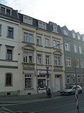 |
Apartment building in closed development | Bürgerstrasse 19 (map) |
around 1890 (tenement) | with a shop, part of a late 19th-century district with a plastered facade typical of the time, significant in terms of building history and urban development history |
09215461 |
 More pictures |
Apartment building in closed development | Conradstrasse 1 (map) |
around 1880 (tenement) | simple plastered construction forms a striking ensemble with neighboring houses, significant in terms of building history and urban development history |
09215058 |
 More pictures |
Apartment building in half-open development | Conradstrasse 3 (map) |
around 1880 (tenement) | Simple, historicizing plastered building from the late Wilhelminian era , significant in terms of building history and urban development history |
09215059 |
 More pictures |
Apartment building in closed development | Conradstrasse 6 (map) |
around 1890 (tenement) | representative, red brick building in the style of historicism , part of a closed row of houses from the late Wilhelminian era , significant in terms of building history and urban development history |
09215060 |
 More pictures |
Apartment house in a corner and closed development | Conradstrasse 10 (map) |
around 1890 (tenement) | Simple plastered building with a historicizing facade and economical decor in the style of the late Wilhelminian era, significant in terms of building history and urban development history |
09215061 |
| Railway workers' residential courtyard in Leipziger Vorstadt: row of houses in a residential complex | Conradstrasse 11; 13; 15; 17; 19; 21; 23 (card) |
1927–1929 (residential complex) | A high-quality example of residential complex architecture from the 1920s, curved row of houses with seven multi-family houses, characterized by accentuating brick elements, entrance to the courtyard through two gates in the south and a row of houses running parallel to this quarter on the east side of Hansastrasse, see also Hansastrasse 7-48, Großenhainer Strasse 2–18b and Fritz-Hofmann-Straße 10, significance in terms of architectural and urban development history |
09215325 |
|
 More pictures |
Apartment house in a corner and closed development | Conradstrasse 12 (map) |
marked 1896 (tenement house) | striking building with historicizing red clinker brick facade, significant in terms of building history and defining the street scene |
09215062 |
 More pictures |
Apartment building in closed development | Conradstrasse 14 (map) |
around 1898 (tenement) | representative, historicizing building from the end of the 19th century with clinker stone facade typical of the time, significant in terms of building history and urban development history |
09215063 |
 More pictures |
Apartment building in closed development | Conradstrasse 16 (map) |
around 1898 (tenement) | characteristic and largely authentically preserved late-founding tenement house, significant in terms of building history and urban development history |
09215064 |
 More pictures |
Apartment building in closed development | Conradstrasse 18 (map) |
around 1898 (tenement) | Distinctive building with historicizing facade, part of a closed row of houses from the late Wilhelminian era, significant in terms of building history and urban development |
09215065 |
 More pictures |
Apartment building in closed development | Conradstrasse 20 (map) |
around 1898 (tenement) | Historicizing building from the end of the 19th century with a clinker stone facade typical of the time, significant in terms of building history and urban development history |
09215295 |
 More pictures |
Apartment house in a corner and closed development | Conradstrasse 22 (map) |
marked 1897 (tenement house) | Distinctive building with historicizing facade, part of a closed row of houses from the late Wilhelminian era, significant in terms of building history and urban development |
09215066 |
 |
Consolidation of the embankment reinforcement | Eisenbahnstrasse (map) |
around 1900 (railway embankment) | between Antonstrasse and Leipziger Strasse as well as a small piece on the Uferstrasse, from wall, brickwork, stairs, end pillars / bridgeheads of the two railway bridges over Eisenbahnstrasse and Leipziger Strasse as well as signal box (all parts of the whole), arose in connection with the renovation of the Dresden Railway 1900, still a well-preserved section in the urban area, significant in terms of traffic and urban development |
09218845 |
 |
Railway bridge | Eisenbahnstrasse (map) |
1899 (railway bridge) | Elaborately designed sheet metal girder bridge with pendulum supports on the Dresden-Pieschen-Dresden-Neustadt railway line (see also LDV, line number 6246), important in terms of building and railway history, has become rare in the cityscape of Dresden . |
09215393 |
 More pictures |
Old Leipzig train station; Dresden-Neustadt freight yard | Eisenbahnstrasse 1; 2 (card) |
1852–1857 (station building), around 1857 (remains of the locomotive shed), 1852–1857 (goods shed), around 1890 (service building), around 1940 (service building) | Preserved parts of the reception hall complex, four service buildings, five goods arches and open hall (goods floor); The former from group three slightly bent buildings, buildings of the freight yard adjoin to the west, the eastern reception hall complex begins south with part of the former departure hall (including the so-called »Green Villa«), behind it a ruinous, semicircular connecting structure and finally preserved wing of the former arrival hall, as the oldest Location of a train station in Dresden of singular traffic-historical value, also significant in terms of building history and local history. |
09215003 |
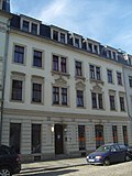 |
Apartment building in closed development | Eisenberger Strasse 1 (map) |
around 1890 (tenement) | Part of a late Wilhelminian style quarter with a plastered facade typical of the time, significant in terms of building history and urban development history |
09215348 |
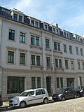 |
Apartment building in closed development | Eisenberger Strasse 3 (map) |
around 1890 (tenement) | with shops, part of a late Wilhelminian style quarter with a plastered facade typical of the time, significant in terms of building history and urban development history |
09215349 |
 |
Apartment building in closed development | Eisenberger Strasse 5 (map) |
around 1890 (tenement) | with a shop, part of a late 19th-century district with a plastered facade typical of the time, significant in terms of building history and urban development history |
09215350 |
 |
Apartment building in closed development | Eisenberger Strasse 8 (map) |
around 1890 (tenement) | with a shop, part of a late 19th-century district with a plastered facade typical of the time, significant in terms of building history and urban development history |
09214462 |
 |
Apartment house in a corner and closed development | Eisenberger Strasse 9 (map) |
around 1890 (tenement) | Representative, street-defining building with typical, late founding clinker facade, significant in terms of building history and urban development history |
09215346 |
 |
Apartment building in closed development | Eisenberger Strasse 10 (map) |
around 1890 (tenement) | Part of a late Wilhelminian style quarter with a plastered facade typical of the time, significant in terms of building history and urban development history |
09215347 |
 |
Apartment building in closed development | Eisenberger Strasse 11 (map) |
around 1890 (tenement) | Part of a late Wilhelminian style quarter with a plastered facade typical of the time, significant in terms of building history and urban development history |
09215353 |
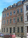 |
Apartment building in half-open development | Eisenberger Strasse 12 (map) |
around 1890 (tenement) | with historicizing clinker brick facade typical of the time, part of a late founding quarter, significant in terms of building history and urban development history |
09215351 |
 |
Apartment building in closed development | Eisenberger Strasse 13 (map) |
around 1890 (tenement) | Part of a late Wilhelminian style quarter with a plastered facade typical of the time, significant in terms of building history and urban development history |
09215352 |
 |
Apartment house in a corner and closed development | Eisenberger Strasse 15 (map) |
around 1890 (tenement) | Part of a late Wilhelminian style quarter with a plastered facade typical of the time, significant in terms of building history and urban development history |
09218832 |
 |
Gehestraße building group: Housing complex (Eisenberger Straße 16/18, Gehestraße 1 / b / c / d and Hallesche Straße 2) of the small housing association Dresden - Gehestraße building group | Eisenberger Strasse 16; 18 (card) |
1911 (apartment building) | Complex of a staggered row of houses, front gardens on both sides and crossbars, reform style architecture, significant in terms of building history |
09215360 |
 |
Apartment house in a corner and closed development | Eisenberger Strasse 17 (map) |
around 1890 (tenement) | simple clinker brick facade typical of the time, part of a late founding quarter, significant in terms of building history and urban development history |
09215354 |
 |
Railway bridges and signal box | Erfurter Strasse (map) |
1897–1898 (railway bridge), around 1900 (signal box) | two elaborately designed sheet metal girder bridges with cast iron pendulum supports and a signal box with clinker brick facade of the Dresden-Pieschen-Dresden-Neustadt railway line (see LDV, line number 6246), urban development testimony to the expansion of the Dresden railway network around 1900, important in terms of building history and railway history |
09215356 |
 |
Double tenement house in a corner and closed development | Erfurter Strasse 1 (map) |
around 1910 (tenement) | representative plastered building in the upside-down position, largely authentically preserved reform style architecture, significant in terms of building history and characterizing the square |
09215355 |
 |
Residential complex of the butcher's guild: Housing complex (Erfurter Strasse 3/5/7/9/11/13 and Hallesche Strasse 1) | Erfurter Strasse 3; 5; 7; 9; 11; 13 (card) |
marked 1928 (apartment building) | Row of houses swinging inwards with a plastered façade typical of the time, built by the Dresden butchers' guild for its members at the end of the 1920s, significant in terms of building history |
09215357 |
 |
Dresden-Neustadt freight yard | Erfurter Strasse 15 (map) |
around 1900 (administration building) | Service and administration building; single-storey, simple building with clinker brick facade, significant in terms of local history and traffic history |
09216582 |
 More pictures |
Apartment house in a corner and semi-open development | Erlenstrasse 2 (map) |
3rd quarter of the 19th century (tenement) | distinctive plastered building of the »Oppellvorstadt«, with shop, significant in terms of building history and urban development history |
09214867 |
 |
Apartment building in half-open development | Erlenstrasse 4 (map) |
around 1895 (tenement) | Simple plastered building with historicizing facade, significant in terms of building history and urban development history |
09214862 |
 |
Apartment building with back building in closed development | Erlenstrasse 6 (map) |
around 1895 (tenement) | simple plastered building, forms a striking ensemble with neighboring houses, significant in terms of building history and urban development history |
09214863 |
 |
Apartment building in closed development | Erlenstrasse 7 (map) |
around 1895 (tenement) | Simple building with a historicizing facade, part of a closed row of houses from the late Wilhelminian era, significant in terms of building history and urban development history |
09214868 |
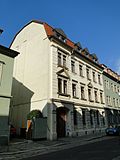 |
Apartment building in half-open development | Erlenstrasse 8 (map) |
around 1895 (tenement) | striking building with historicizing facade, significant in terms of architectural and urban development history |
09214864 |
 More pictures |
Apartment house in a corner location and formerly closed development | Erlenstrasse 9 (map) |
around 1895 (tenement) | characteristic and largely authentically preserved late-founding tenement house, significant in terms of building history and urban development history |
09214869 |
 |
Apartment building in half-open development | Erlenstrasse 10 (map) |
around 1880 (tenement) | characteristic plastered building of the so-called Oppellvorstadt from the late 19th century, significant in terms of building history and urban development history |
09214865 |
 More pictures |
Apartment building in half-open development | Erlenstrasse 12 (map) |
around 1880 (tenement) | characteristic plastered building of the so-called Oppellvorstadt from the late 19th century, significant in terms of building history and urban development history |
09214866 |
 |
Apartment building in closed development | Erlenstrasse 15 (map) |
around 1895 (tenement) | Distinctive building with historicizing facade, part of a closed row of houses from the late Wilhelminian era, significant in terms of building history and urban development |
09214870 |
 |
Apartment building in closed development | Erlenstrasse 16 (map) |
around 1895 (tenement) | characteristic and largely authentically preserved late-founding tenement house, significant in terms of building history and urban development history |
09214872 |
 |
Apartment house in a corner location and formerly closed development | Erlenstrasse 17 (map) |
around 1895 (tenement) | Distinctive building with historicizing facade, part of a closed row of houses from the late Wilhelminian era, significant in terms of building history and defining the street scene |
09214871 |
 |
Apartment building in closed development | Erlenstrasse 18 (map) |
around 1895 (tenement) | characteristic and largely authentically preserved late-Wilhelminian-era tenement house, part of a closed row of houses from the late Wilhelminian-era, significant in terms of building history and urban development history |
09214873 |
 |
Apartment building in closed development | Erlenstrasse 20 (map) |
around 1895 (tenement) | largely authentically preserved late Wilhelminian style apartment building, part of a closed row of houses from the late Wilhelminian era, significant in terms of building history and urban development history |
09214874 |
 |
Apartment house in a corner and closed development | Erlenstrasse 22 (map) |
around 1895 (tenement) | Distinctive building with historicizing facade, part of a closed row of houses from the late Wilhelminian era, with one of the few remaining typical corner pubs in the district, significant in terms of building history and urban development history |
09214875 |
 |
Bridge Eschenstrasse; Görlitz – Dresden railway line | Eschenstrasse (map) |
around 1900, arch bridges (railway bridge), around 1910, girder bridges (railway bridge) | Railway bridges across Eschenstrasse; Several side-by-side bridge structures of different construction (two arch bridges with zone vaults and two parallel girder bridges made of solid wall girders) in good original condition on the Görlitz – Dresden railway line (Saxon GD, 6212), urban development testimony to the expansion of the Dresden railway junction around 1900, from railway history, special architectural history and cityscape-defining importance. |
09214634 |
 |
Apartment building in closed development | Fichtenstrasse 1 (map) |
around 1890 (tenement) | characteristic and largely authentically preserved late-founding tenement house, significant in terms of building history and urban development history |
09215068 |
 |
Parish hall of the Pauligemeinde | Fichtenstrasse 2 (map) |
1899–1900 (parish hall) | Rectory and parish hall in a corner and semi-open development; Inside, the community hall and apartments, a representative, historic building with a tower-crowned corner bay and characteristic clinker-sandstone façade, Gothic ornamental elements dominate, the decoration especially on the bay window and the main axes of the building, a striking example of architecture shortly before the turn of the century, forms with Paulikirche Significant ensemble of church architecture of that time, as well as buildings with design requirements, historically, town-planning and artistically significant |
09215069 |
 |
Apartment building in closed development | Fichtenstrasse 6 (map) |
around 1890 (tenement) | Distinctive building with historicizing facade, part of a closed row of houses from the late Wilhelminian era, significant in terms of building history and urban development |
09215070 |
 |
Apartment building in closed development | Fichtenstrasse 10 (map) |
around 1890 (tenement) | Characteristic building from the late 19th century, largely original hallway furnishings with stucco decoration and paintings (as decorative painting), of importance in terms of building history and urban development |
09215073 |
 |
Double tenement house (Hechtstrasse 34 and Fichtenstrasse 11b) in a corner and closed development | Fichtenstrasse 11b (map) |
marked 1914 (double tenement house) | Plastered building with shop and bay window, corner area particularly characterized in terms of color and architecture, in the reform style of the time around 1910, significant in terms of building history and urban development history and shaping the street scene |
09214799 |
 |
Apartment building in closed development | Fichtenstrasse 14 (map) |
around 1890 (tenement) | Distinctive building with historicizing facade, part of a closed row of houses from the late Wilhelminian era, significant in terms of building history and urban development |
09215074 |
 |
Apartment building in closed development | Fichtenstrasse 17 (map) |
around 1890 (tenement) | characteristic and largely authentically preserved late-Wilhelminian-era tenement house, part of a closed row of houses from the late Wilhelminian-era, significant in terms of building history and urban development history |
09215075 |
 |
Apartment building in closed development | Fichtenstrasse 19 (map) |
around 1890 (tenement) | Distinctive building with historicizing facade, part of a closed row of houses from the late Wilhelminian era, significant in terms of building history and urban development |
09215076 |
 |
Apartment house in a corner and closed development | Friedensstrasse 1 (map) |
around 1900 (tenement) | striking plastered building with historicizing facade, part of a closed row of houses from the late Wilhelminian era, significant in terms of building history and urban development history |
09214821 |
 More pictures |
Totality of the Inner Neustädter Friedhof in its evolved functional and design unit with several individual monuments | Friedensstrasse 2 (map) |
1731–1732 (cemetery) | Totality of the inner Neustädter Friedhof in its grown functional and design unit with the following individual monuments: Parentation hall, office building, gatehouse and nine mostly baroque crypt houses, monumental graves, enclosure wall including three entrances and gates as well as a row of oaks with stalked oaks standing outside on Conradstrasse (see object 09214810 , same address), also cemetery design, water extraction points in the form of hand lever pumps, all largely preserved fencing grids and all field marker stones (all parts of the entity); Significant in terms of building history, artistry, personal history and local history. |
09301866 |
 More pictures |
Individual monuments of the totality of the Innerer Neustädter Friedhof: Parentation hall, office building, gatehouse and nine mostly baroque crypt houses (individual monuments to ID No. 09301866) | Friedensstrasse 2 (map) |
around 1740 (crypt), 1799–1800 (parentation hall) | Individual monuments of the whole Innerer Neustädter Friedhof (object 09301866): Parentation hall, chancellery building, gatehouse and nine mostly baroque crypt houses, monumental tombs, fencing wall including three entrances and gates as well as a row of oak stalk standing outside on Conradstrasse; Significant in terms of building history, artistry, personal history and local history. |
09214810 |
 |
Apartment building in closed development | Friedensstrasse 3 (map) |
around 1900 (tenement) | Distinctive building with historicizing facade, part of a closed row of houses from the late Wilhelminian era, significant in terms of building history and urban development |
09214822 |
 |
Apartment building in closed development | Friedensstrasse 4 (map) |
around 1900 (tenement) | Distinctive building with historicizing facade, part of a closed row of houses from the late Wilhelminian era, significant in terms of building history and urban development |
09214826 |
 |
Apartment building in closed development | Friedensstrasse 5 (map) |
around 1900 (tenement) | Historicizing building from the end of the 19th century with a plastered facade typical of the time, significant in terms of building history and urban development history |
09214823 |
 |
Apartment building in closed development | Friedensstrasse 6 (map) |
marked 1898 (tenement house) | Distinctive building with historicizing facade, part of a closed row of houses from the late Wilhelminian era, significant in terms of building history and urban development |
09214827 |
 |
Apartment building in closed development | Friedensstrasse 8 (map) |
around 1895 (tenement) | representative, historicizing building from the end of the 19th century with clinker and stone facade typical of the time, forms a plot of land with Helgolandstr. 5a-g, significant in terms of building history and urban development history |
09214825 |
 |
Apartment building in closed development | Friedensstrasse 10 (map) |
around 1900 (tenement) | representative, historicizing building from the end of the 19th century with clinker stone facade typical of the time, significant in terms of building history and urban development history |
09214828 |
 |
Apartment building in closed development | Friedensstrasse 11 (map) |
around 1900 (tenement) | Simple building with a historicizing facade, part of a closed row of houses from the late Wilhelminian era, significant in terms of building history and urban development history |
09215296 |
| Apartment building in closed development | Friedensstrasse 12 (map) |
around 1900 (tenement) | characteristic and largely authentically preserved late-founding tenement house, significant in terms of building history and urban development history |
09214829 |
|
| Apartment building in closed development | Friedensstrasse 13 (map) |
marked 1900 (tenement house) | Distinctive building with historicizing facade, part of a closed row of houses from the late Wilhelminian era, significant in terms of building history and urban development |
09214824 |
|
 |
Apartment building in closed development | Friedensstrasse 14 (map) |
around 1900 (tenement) | characteristic and largely authentically preserved late-founding tenement house, significant in terms of building history and urban development history |
09305711 |
 |
Apartment building in closed development | Friedensstrasse 15 (map) |
around 1900 (tenement) | Typical building with historicizing facade, significant in terms of building history and urban development history |
09215297 |
 |
Apartment building in closed development | Friedensstrasse 16 (map) |
around 1900 (tenement) | Simple building with a historicizing facade, part of a closed row of houses from the late Wilhelminian era, significant in terms of building history and urban development history |
09214835 |
 |
Apartment building in closed development | Friedensstrasse 18 (map) |
around 1900 (tenement) | characteristic building with historicizing facade, part of a closed row of houses from the late Wilhelminian era, significant in terms of building history and urban development history |
09214836 |
 |
Apartment building in closed development | Friedensstrasse 19 (map) |
around 1900 (tenement) | characteristic and largely authentically preserved late-founding tenement house, significant in terms of building history and urban development history |
09215298 |
 |
Apartment building in closed development | Friedensstrasse 20 (map) |
marked 1900 (tenement house) | representative, historicizing building from the end of the 19th century with clinker stone facade typical of the time, significant in terms of building history and urban development history |
09214837 |
 |
Houses in a residential complex (Ottostraße 1/3/5/7, Friedensstraße 21 / 21b and Rudolfstraße 20/22) | Friedensstrasse 21 / 21b (map) |
1920s (apartment building) | typical residential architecture of the 1920s, significant in terms of building history |
09215301 |
 |
Apartment building in closed development | Friedensstrasse 22 (map) |
around 1900 (tenement) | Distinctive building with historicizing facade, part of a closed row of houses from the late Wilhelminian era, significant in terms of building history and urban development |
09214838 |
 |
Apartment house in a corner and closed development | Friedensstrasse 23 (map) |
around 1905 (tenement) | Simple plastered building with historicizing facade, part of a closed row of houses from the late Wilhelminian era, on the ground floor formerly the “Casablanca” cinema, significant in terms of building history and urban development history |
09215299 |
 |
Apartment house in a corner and closed development | Friedensstrasse 24 (map) |
around 1900 (tenement) | Distinctive building with historicizing facade, part of a closed row of houses from the late Wilhelminian era, significant in terms of building history and urban development |
09214839 |
 |
Apartment house in a corner and closed development | Friedensstrasse 33b (map) |
marked 1897 (tenement house) | with shop, striking building with historicizing facade, part of a closed row of houses from the late Wilhelminian era, significant in terms of building history and urban development history |
09214831 |
 |
Apartment building in closed development | Friedensstrasse 35 (map) |
around 1895 (tenement) | characteristic and largely authentically preserved late-founding tenement house, significant in terms of building history and urban development history |
09214832 |
 |
Apartment building in closed development | Friedensstrasse 37 (map) |
around 1895 (tenement) | Historicizing building from the end of the 19th century with a clinker stone facade typical of the time, significant in terms of building history and urban development history |
09214833 |
 |
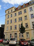
Apartment building in a formerly closed development | Friedensstrasse 39 (map) |
around 1895 (tenement) | striking building with historicizing facade, significant in terms of architectural and urban development history |
09214834 |
 |
Apartment house in a corner and closed development | Fritz-Hoffmann-Strasse 1 (map) |
around 1910 (tenement) | simple plastered construction, significant in terms of building history and urban development history |
09214841 |
 |
Apartment house in a corner and closed development | Fritz-Hoffmann-Strasse 2 (map) |
around 1910 (tenement) | Distinctive building with historicizing facade, part of a closed row of houses from the late Wilhelminian era, significant in terms of building history and urban development |
09214842 |
 |
Apartment building in closed development | Fritz-Hoffmann-Strasse 7 (map) |
around 1910 (tenement) | characteristic and largely authentically preserved late-founding tenement house, significant in terms of building history and urban development history |
09214843 |
 |
Apartment house in a corner location and formerly closed development | Fritz-Hoffmann-Strasse 8b (map) |
around 1910 (tenement) | Distinctive building with historicizing facade, part of a closed row of houses from the late Wilhelminian era, characterizing the street scene, significant in terms of building history and urban development history |
09214844 |
 |
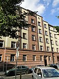
Apartment building in closed development | Fritz-Hoffmann-Strasse 9 (map) |
around 1910 (tenement) | Historicizing building from the end of the 19th century with a clinker stone facade typical of the time, significant in terms of building history and urban development history |
09214845 |
 |
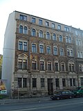
Railway workers 'residential courtyard in Leipziger Vorstadt: Row of houses (row of houses at Hansastraße 22/24/26/28/30/32/34/36/38/40/42/44/46/48 and Fritz-Hoffmann-Straße 10) from the railway workers' residential courtyard in Leipziger Suburb | Fritz-Hoffmann-Strasse 10 (map) |
1927–1929 (residential complex) | A high-quality example of residential complex architecture from the 1920s, characterized by accentuating brick elements, see also Hansastraße 7–37, Conradstraße 11–23 and Großenhainer Straße 2-18b, of importance in terms of urban development and architectural history |
09218576 |
 |
Apartment building in a formerly closed development | Fritz-Reuter-Strasse 3 (map) |
around 1895 (tenement) | Simple building typical of the time with historicizing facade, significant in terms of building history and urban development history |
09214876 |
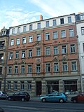 |
Apartment building in closed development | Fritz-Reuter-Strasse 4 (map) |
marked 1900 (tenement house) | striking clinker brick building with historicizing facade, part of a closed row of houses, significant in terms of building history and urban development history |
09214877 |
 |
Apartment building in closed development | Fritz-Reuter-Strasse 6 (map) |
around 1900 (tenement) | striking clinker brick building with historicizing facade, part of a closed row of houses, significant in terms of building history and urban development history |
09214878 |
 |
Apartment building in closed development | Fritz-Reuter-Strasse 8 (map) |
around 1900 (tenement) | Typical building of the time with historicizing facade, part of a closed row of houses from the late Wilhelminian era, significant in terms of building history and urban development history |
09214879 |
 |
Apartment building in closed development | Fritz-Reuter-Strasse 10 (map) |
marked 1899 (tenement house) | characteristic and largely authentically preserved late-founding tenement house, significant in terms of building history and urban development history |
09214880 |
| Double tenement house (Helgolandstrasse 8 and Fritz-Reuter-Strasse 10a) in closed development and corner location | Fritz-Reuter-Strasse 10a (map) |
1900, according to address book (double tenement house) | A building that shapes the street image with a historicizing facade, part of a closed row of houses from the late Wilhelminian era, significant in terms of building history and urban development history |
09214858 |
|
 |
Apartment house in a corner and closed development | Fritz-Reuter-Strasse 11 (map) |
around 1895 (tenement) | Distinctive building with historicizing facade, part of a closed row of houses from the late Wilhelminian era, significant in terms of building history and urban development |
09214881 |
 |
Apartment building in closed development | Fritz-Reuter-Strasse 12 (map) |
around 1900 (tenement) | representative, historicizing building from the end of the 19th century with clinker stone facade typical of the time, significant in terms of building history and urban development history |
09214882 |
 |
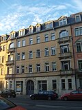
Apartment building in closed development | Fritz-Reuter-Strasse 13 (map) |
around 1900 (tenement) | with shop, simple building with historicizing clinker brick facade, part of a homogeneous quarter from the late Wilhelminian era, significant in terms of building history and urban development history |
09300954 |
 |
Apartment building in closed development | Fritz-Reuter-Strasse 14 (map) |
around 1900 (tenement) | with shops, building with a historicizing facade, part of a closed row of houses from the late Wilhelminian era, significant in terms of building history and urban development history |
09214883 |
 |
Apartment building in closed development | Fritz-Reuter-Strasse 15 (map) |
around 1900 (tenement) | Typical building with clinker facade, part of a homogeneous square from the late Wilhelminian era, on the ceilings of the gate passage baroque decorative painting under a new coat of paint, significant in terms of building history and urban development history |
09300953 |
 |
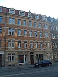
Apartment building in closed development | Fritz-Reuter-Strasse 16 (map) |
around 1900 (tenement) | Distinctive building with historicizing facade, part of a closed row of houses from the late Wilhelminian era, significant in terms of building history and urban development |
09215084 |
 |
Apartment building in closed development | Fritz-Reuter-Strasse 17 (map) |
around 1900 (tenement) | Typical building with clinker facade, part of a homogeneous area from the late Wilhelminian era, significant in terms of building history and urban development history |
09300955 |
 |
Apartment house in a corner and closed development | Fritz-Reuter-Strasse 18 (map) |
around 1900 (tenement) | representative, historicizing building from the end of the 19th century with a clinker stone facade typical of the time, characterizing the street scene, significant in terms of building history and urban development history |
09215085 |
 |
Apartment building in closed development | Fritz-Reuter-Strasse 19 (map) |
around 1900 (tenement) | Simple building with a clinker facade, part of a homogeneous quarter from the late Wilhelminian era, significant in terms of building history and urban development history |
09300956 |
 |
Apartment house in a corner and closed development | Fritz-Reuter-Strasse 21 (map) |
around 1895 (tenement) | representative, historicizing building from the end of the 19th century with clinker stone facade typical of the time, also part of a closed, preserved late founding area, significant in terms of building history and urban development history |
09215086 |
 |
Villa with enclosure | Fritz-Reuter-Strasse 37 (map) |
1st quarter of the 20th century (villa) | distinctive villa building that shapes the square, significant in terms of building history and local history |
09215087 |
 More pictures |
Residential complex (Großenhainer Straße 38/40/42 and Fritz-Reuter-Straße 57/59/61) | Fritz-Reuter-Strasse 57; 59; 61 (map) |
around 1925 (residential complex) | Simple plastered buildings with references to Expressionism , sparing colored accents, the facade on Großenhainer Str. 42 as the main display side with relief and a distinctive curve, significant in terms of building history and local history |
09215470 |
 |
Gehestraße building group: Housing complex (Eisenberger Straße 16/18, Gehestraße 1 / b / c / d and Hallesche Straße 2) of the small housing association Dresden - Gehestraße building group | Gehestraße 1; 1b; 1c; 1d (card) |
1911 (apartment building) | Complex of a staggered row of houses, front gardens on both sides and crossbars, reform style architecture, significant in terms of building history |
09215360 |
 |
Apartment house in a corner and closed development | Gehestraße 13 (map) |
around 1900 (tenement) | with a shop, part of a turn-of-the-century district with historicizing clinker brick facade typical of the time, significant in terms of building history and urban development history |
09215468 |
 |
Apartment building in closed development | Gehestraße 15 (map) |
around 1895 (tenement) | Part of a turn-of-the-century district with historic clinker brick facade typical of the time, significant in terms of building history and urban development history |
09215469 |
 |
Apartment building in closed development | Gehestraße 17 (map) |
around 1900 (tenement) | Part of a turn-of-the-century district with historic clinker brick facade typical of the time, significant in terms of building history and urban development history |
09215465 |
 |
Apartment building in closed development | Gehestraße 19 (map) |
around 1895 (tenement) | Part of a turn-of-the-century district with a historicizing plastered facade typical of the time, significant in terms of building history and urban development history |
09215466 |
 |
Apartment building in a corner and closed development | Gehestraße 21 (map) |
around 1900 (tenement) | representative plastered building, part of a quarter of the turn of the century, with a historicizing facade typical of the time, significant in terms of building history and urban development history |
09215467 |
 More pictures |
Central slaughterhouse and cattle market (formerly) | Gothaer Strasse 9; 12; 16 (card) |
1870–1873 (pig sales hall), marked 1889–1890 (cattle sales hall), 1870–1873 (stock exchange building), 1870–1873 (slaughterhouse), 1870–1873 (administration building) | Headquarters (Gothaer Straße 9), small cattle slaughterhouse (Gothaer Straße 12), cattle and pig slaughterhouse (Gothaer Straße 16), sales hall for cattle (since 1998 concert hall), sales hall for pigs and horse exchange; Significant historical supply complex, striking buildings in the style of historicism, clear testimony to the industrial architecture of its time and the local history in the late 19th century, significant in terms of building history and urban development history. |
09215289 |
 More pictures |
Petrikirche | Großenhainer Platz 5 (map) |
1889–1890 (church), 1958 (organ), 1909 (relief) | Church with furnishings; Hall church with transept, west tower and sacristy in the form of a ambulatory, historicizing, neo-Gothic clinker brick building visible from afar, testimony to church architecture in the late 19th century, significant in terms of building history, artistry and urban planning. Ev.-luth. St. Petri Church, built according to plans by Julius Zeißig , burned out by the air raids on Dresden in 1945, rebuilt from 1951 to 1955, renovated in 1992. |
09215095 |
 |
Railway workers 'residential courtyard in Leipziger Vorstadt: Group of residential buildings (Großenhainer Strasse 2 and Hansastraße 7) from the railway workers' residential courtyard in Leipziger Vorstadt | Großenhainer Strasse 2 (map) |
1927–1929 (apartment building) | Very high quality example of brick expressionism from the 1920s, see also Hansastraße 9–37, Conradstraße 11–23, Fritz-Hoffmann-Str. 10 and Großenhainer Straße 4-18, of importance in terms of building history and urban development history |
09218837 |
 |
Remise building (former) | Großenhainer Strasse 3 (map) |
around 1910 (Remisen building) | Simple plastered building around 1910, example of reform architecture , significant in terms of building history |
09215332 |
| Railroad workers 'courtyard Leipziger Vorstadt: Row of houses and rear building of the railroad workers' courtyard in Leipziger Vorstadt | Grossenhainer Strasse 4; 4b; 6; 6b; 8th; 8b; 10; 10b; 12; 12b; 14; 14b; 16; 16b; 18; 18b (card) |
1927–1929 (residential complex) | A high-quality example of residential complex architecture from the 1920s, characterized by accentuating brick elements, see also Hansastraße 7–37, Conradstraße 11–23, Fritz-Hoffmann-Straße 10 and Großenhainer Straße 2, important in terms of urban development and architectural history |
09215326 |
|
 |
Villa with enclosure | Großenhainer Strasse 21 (map) |
1859 (villa) | simple, historic plastered building, significant in terms of building history |
09215331 |
 |
Villa with enclosure | Grossenhainer Strasse 25 (map) |
1859 (villa) | simple, historic plastered building, significant in terms of building history |
09215096 |
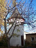 |
Pigeon house | Grossenhainer Strasse 30 (map) |
1886–1900 (pigeon house) | Tower-like design, distinctive and historically significant functional architecture from the late 19th century with a rarity |
09302965 |
 More pictures |
Residential and commercial building with fencing and in open development | Großenhainer Strasse 32 (map) |
1900–1902 (residential and commercial building) | representative plastered building with typical Art Nouveau decoration, since 1897 the headquarters of the Jehmlich organ building company , of local and architectural significance |
09215425 |
 |
Villa with enclosure | Großenhainer Strasse 34 (map) |
around 1895 (manufacturer's villa) | striking historicizing building, probably built as a manufacturer's villa, historically and artistically significant |
09215426 |
 |
Apartment building in open development | Grossenhainer Strasse 35 (map) |
around 1885 (tenement) | striking building with historicizing facade, significant in terms of architectural history |
09215427 |
 More pictures |
Residential complex (Großenhainer Straße 38/40/42 and Fritz-Reuter-Straße 57/59/61) | Grossenhainer Strasse 38; 40; 42 (card) |
around 1925 (residential complex) | Simple plastered buildings with references to Expressionism, sparing colored accents, the facade on Großenhainer Str. 42 as the main display side with relief and a distinctive curve, significant in terms of building history and local history |
09215470 |
 |
Double apartment building in open development | Grossenhainer Strasse 41; 43 (map) |
around 1900 (double tenement house) | striking building with historicizing facade, significant in terms of architectural history |
09215429 |
 |
Residential complex | Grossenhainer Strasse 61; 63 (map) |
around 1925 (apartment building) | Distinctive plastered buildings that characterize the street scene with expressionist gate designs from the period of construction, shop fittings, etc., of importance in terms of building history |
09215430 |
 |
Apartment building in closed development | Grossenhainer Strasse 65 (map) |
around 1905 (tenement) | Distinctive building with typical, representative facade design and Art Nouveau elements, significant in terms of building history |
09214547 |
 |
Apartment building in closed development | Grossenhainer Strasse 67 (map) |
around 1905 (tenement) | Distinctive building with a simple plastered facade, forms a striking ensemble with neighboring houses, significant in terms of building history and urban development history |
09215432 |
 |
Apartment building in closed development | Grossenhainer Strasse 69 (map) |
marked 1905 (tenement house) | with shop, forms a representative ensemble that characterizes the square with neighboring houses, art nouveau appeal, significant in terms of building history |
09215433 |
 |
Apartment building in closed development | Grossenhainer Strasse 71 (map) |
around 1905 (tenement) | with shop, forms a distinctive ensemble with neighboring houses, historically significant |
09215434 |
 |
Apartment building in closed development | Grossenhainer Strasse 73 (map) |
around 1905 (tenement) | with shop, distinctive building with facade design typical of the time and Art Nouveau elements, forms a striking ensemble with neighboring houses, significant in terms of building history and urban development history |
09215435 |
 |
Apartment house in a corner and closed development | Grossenhainer Strasse 75 (map) |
around 1905 (tenement) | with shop, representative, plaza-defining design, forms a striking ensemble with neighboring houses from the beginning of the 20th century, significant in terms of building history and urban development history |
09215436 |
 |
Apartment building in half-open development | Hafenstrasse 2 (map) |
around 1890 (tenement) | Simple plastered building with historicizing facade, significant in terms of building history and urban development history |
09215369 |
 |
Housing complex (Erfurter Strasse 3/5/7/9/11/13 and Hallesche Strasse 1) | Hallesche Strasse 1 (map) |
marked 1928 (apartment building) | Row of houses swinging inwards with a plastered façade typical of the time, built by the Dresden butchers' guild for its members at the end of the 1920s, significant in terms of building history |
09215357 |
 |
Gehestraße building group: Housing complex (Eisenberger Straße 16/18, Gehestraße 1 / b / c / d and Hallesche Straße 2) of the small housing association Dresden - Gehestraße building group | Hallesche Strasse 2 (map) |
1911 (apartment building) | Complex of a staggered row of houses, front gardens on both sides and crossbars, reform style architecture, significant in terms of building history |
09215360 |
 |
Double tenement house in closed development | Hallesche Strasse 3; 5 (card) |
around 1900 (double tenement house) | Part of a turn-of-the-century district with a historicizing plastered facade typical of the time, significant in terms of building history and urban development history |
09215367 |
 |
Apartment building in closed development | Hallesche Strasse 4 (map) |
around 1900 (tenement) | Part of a turn-of-the-century district with historic clinker brick facade typical of the time, significant in terms of building history and urban development history |
09215361 |
 |
Apartment building in closed development | Hallesche Strasse 6 (map) |
around 1900 (tenement) | Part of a turn-of-the-century district with a historicizing plastered facade typical of the time, significant in terms of building history and urban development history |
09215362 |
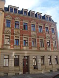 |
Apartment building in half-open development | Hallesche Strasse 7 (map) |
around 1895 (tenement) | Part of a turn-of-the-century district with historic clinker brick facade typical of the time, significant in terms of building history and urban development history |
09215368 |
 |
Apartment building in closed development | Hallesche Strasse 8 (map) |
around 1900 (tenement) | Part of a turn-of-the-century district with historic clinker brick facade typical of the time, significant in terms of building history and urban development history |
09215363 |
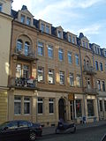 |
Apartment building in closed development | Hallesche Strasse 9 (map) |
marked 1900 (tenement house) | with a shop, part of a turn-of-the-century district with historicizing clinker brick facade typical of the time, significant in terms of building history and urban development history |
09215364 |
 |
Apartment building in closed development | Hallesche Strasse 11 (map) |
around 1900 (tenement) | Part of a turn-of-the-century district with historic clinker brick facade typical of the time, significant in terms of building history and urban development history |
09215365 |
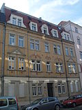 |
Apartment building in closed development | Hallesche Strasse 13 (map) |
around 1900 (tenement) | Part of a turn-of-the-century district with historic clinker brick facade typical of the time, significant in terms of building history and urban development history |
09215366 |
 |
Double house (Hallesche Strasse 15 and Weimarien Strasse 20) in a residential complex | Hallesche Strasse 15 (map) |
1920s (duplex) | Plastered facades with expressionistic shapes, an architecturally high-quality example of residential complex architecture of the 1920s, of importance in terms of building history |
09215380 |
 |
Soft stone | Hansastrasse (map) |
1991–1993 (copy of the original from 1550) | Copy of the soft picture stone on Koenigsbrücker Strasse, of importance in terms of urban history |
09218835 |
 More pictures |
Old Leipzig train station; Dresden-Neustadt freight yard | Hansastrasse 3 (map) |
1852–1857 (station building), around 1857 (remains of the locomotive shed), 1852–1857 (goods shed), around 1890 (service building), around 1940 (service building) | Preserved parts of the reception hall complex, four service buildings, five goods arches and open hall (goods floor); The former from group three slightly bent buildings, buildings of the freight yard adjoin to the west, the eastern reception hall complex begins south with part of the former departure hall (including the so-called »Green Villa«), behind it a ruinous, semicircular connecting structure and finally preserved wing of the former arrival hall, as the oldest Location of a train station in Dresden of singular traffic-historical value, also significant in terms of building history and local history. |
09215003 |
 |
Railway workers 'residential courtyard in Leipziger Vorstadt: Group of residential buildings (Großenhainer Strasse 2 and Hansastraße 7) from the railway workers' residential courtyard in Leipziger Vorstadt | Hansastrasse 7 (map) |
1927–1929 (apartment building) | Very high quality example of brick expressionism from the 1920s, see also Hansastraße 9–37, Conradstraße 11–23, Fritz-Hoffmann-Str. 10 and Großenhainer Straße 4-18, of importance in terms of building history and urban development history |
09218837 |
| Row of houses in the railway yard in Leipziger Vorstadt | Hansastrasse 9; 11; 13; 15; 17; 19; 21; 23; 25; 27; 29; 31; 33; 35; 37 (card) |
1927–1929 (residential complex) | A high-quality example of residential complex architecture from the 1920s, characterized by accentuating brick elements, see also Hansastraße 7, Conradstraße 11–23, Fritz-Hoffmann-Straße 10 and Großenhainer Straße 2–18b, of importance in terms of urban development and architectural history |
09215324 |
|
 |
Apartment building in semi-open development and enclosure | Hansastraße 10 (map) |
around 1903 (tenement) | striking building with historicizing facade and remarkable hallway design (groin vaults, wall pilasters), significant in terms of building history and urban development history |
09215319 |
 |
Apartment house in a corner and closed development | Hansastraße 14 (map) |
around 1903 (tenement) | with shop, striking building with historicizing facade, part of a closed row of houses from the late Wilhelminian era, significant in terms of building history and urban development history |
09215320 |
 |
Apartment building in closed development | Hansastrasse 16 (map) |
around 1903 (tenement) | with shops, a striking building with a historicizing facade, part of a closed row of houses from the late Wilhelminian era, significant in terms of building history and urban development history |
09215321 |
 |
Apartment building in closed development | Hansastraße 18 (map) |
around 1903 (tenement) | with shop, striking building with historicizing facade, part of a closed row of houses from the late Wilhelminian era, significant in terms of building history and urban development history |
09215322 |
 |
Apartment house in a corner and closed development | Hansastraße 20 (map) |
around 1903 (tenement) | A representative building with a historicizing facade, part of a closed row of houses from the late Wilhelminian era, significant in terms of building history and urban development history |
09215323 |
 |
Railway workers 'residential courtyard in Leipziger Vorstadt: Row of houses (row of houses at Hansastraße 22/24/26/28/30/32/34/36/38/40/42/44/46/48 and Fritz-Hoffmann-Straße 10) from the railway workers' residential courtyard in Leipziger Suburb | Hansastrasse 22; 24; 26; 28; 30; 32; 34; 36; 38; 40; 42; 44; 46; 48 (card) |
1927–1929 (residential complex) | A high-quality example of residential complex architecture from the 1920s, characterized by accentuating brick elements, see also Hansastraße 7–37, Conradstraße 11–23 and Großenhainer Straße 2–18b, of significance in terms of urban development and architectural history |
09218576 |
 |
Residential building in closed development | Hartigstrasse 2 (map) |
around 1925 (residential building) | Plastered facades with forms of brick expressionism from the 1920s, important in terms of building history |
09215418 |
 |
Residential complex | Hartigstrasse 4; 6; 8th; 8b (card) |
around 1925 (residential building) | Plastered and clinker brick facades, high-quality example of the residential complex architecture of the 1920s, of architectural significance |
09215420 |
 |
Residential building in closed development | Hartigstrasse 10 (map) |
marked 1926 (residential building) | Plastered facade with decor typical of the 1920s, significant in terms of building history |
09215419 |
 |
Apartment building in closed development | Hartigstrasse 11 (map) |
around 1900 (tenement) | with a shop, part of a turn-of-the-century district with historicizing clinker brick facade typical of the time, significant in terms of building history and urban development history |
09215421 |
 More pictures |
Apartment house in a corner and closed development | Hartigstrasse 12 (map) |
around 1900 (tenement) | Original hallway equipment with ceiling and wall painting as decorative painting and stucco decoration, part of a quarter of the turn of the century with a historicizing plastered facade typical of the time, significant in terms of building history, urban development history and artistically |
09215422 |
 |
Apartment building in closed development | Hartigstrasse 14 (map) |
around 1900 (tenement) | Part of a turn-of-the-century district with historic clinker brick facade typical of the time, significant in terms of building history and urban development history |
09215424 |
 More pictures |
Apartment building in closed development | Hechtstrasse 9 (map) |
around 1880 (tenement) | Simple plastered building with historicizing facade, part of a closed row of houses from the late Wilhelminian era, significant in terms of building history and urban development history |
09214788 |
 More pictures |
Apartment building in closed development | Hechtstrasse 11 (map) |
around 1890 (tenement) | Simple plastered building with historicizing facade, part of a closed row of houses from the late Wilhelminian era, significant in terms of building history and urban development history |
09214789 |
 More pictures |
Apartment building in closed development | Hechtstrasse 13 (map) |
around 1880 (tenement) | with a shop, simple plastered building with a historicizing facade, part of a closed row of houses from the late Wilhelminian era, significant in terms of building history and urban development history |
09214790 |
 More pictures |
Apartment building in closed development | Hechtstrasse 15 (map) |
around 1880 (tenement) | Simple building with historicizing facade, significant in terms of building history and urban development history |
09214791 |
 More pictures |
Apartment building in half-open development | Hechtstrasse 16 (map) |
around 1880 (tenement) | with shop, plastered building with historicizing facade, significant in terms of building history and urban development history |
09214792 |
 More pictures |
Apartment building in closed development | Hechtstrasse 23 (map) |
around 1880 (tenement) | with shop, characteristic and largely authentically preserved late-founding tenement house, significant in terms of building history and urban development history |
09214794 |
 |
Apartment building with back building in closed development | Hechtstrasse 26 (map) |
around 1880 (tenement) | with shop, striking property from the Wilhelminian era, significant in terms of building history and urban development history |
09214795 |
 |
Apartment building in closed development | Hechtstrasse 28 (map) |
around 1880 (tenement) | with shop, striking building with historicizing facade, part of a closed row of houses from the late Wilhelminian era, significant in terms of building history and urban development history |
09214796 |
 |
Apartment building in closed development, courtyard building and mural (courtyard at Hechtstrasse No. 28) | Hechtstrasse 30 (map) |
around 1885 (tenement) | Typical historical building of a tenement house with shops, former horse shop of Erich Kästner's uncle, clinker-faced facade during the construction period, mural of a fool on the rear of the southern courtyard building, significant in terms of building history, local history and personal history |
09214797 |
 |
Apartment building in closed development | Hechtstrasse 32 (map) |
around 1880 (tenement) | Simple building with historicizing facade, significant in terms of building history and urban development history |
09214798 |
 |
Double tenement house (Hechtstrasse 34 and Fichtenstrasse 11b) in a corner and closed development | Hechtstrasse 34 (map) |
marked 1914 (double tenement house) | Plastered building with shop and bay window, corner area particularly characterized in terms of color and architecture, in the reform style of the time around 1910, significant in terms of building history and urban development history and shaping the street scene |
09214799 |
 |
Apartment building in a corner and closed development | Hechtstrasse 35 (map) |
around 1895 (tenement) | with shop, striking building with historicizing facade, part of a closed row of houses from the late Wilhelminian era, significant in terms of building history and urban development history |
09214800 |
 |
Apartment building in closed development | Hechtstrasse 38 (map) |
around 1880 (tenement) | with shop, typical building with historicizing plaster facade, significant in terms of building history and urban development history |
09214801 |
 |
Apartment building in closed development | Hechtstrasse 39 (map) |
around 1895 (tenement) | with shop, characteristic building with historicizing clinker brick facade, part of a closed row of houses from the late Wilhelminian era, significant in terms of building history and urban development history |
09214802 |
 |
Apartment building in corner location and formerly closed development | Hechtstrasse 70 (map) |
around 1895 (tenement) | A building that shapes the street image with a historicizing facade, significant in terms of building history and urban development history |
09214803 |
 |
Double apartment building in open development | Hechtstrasse 71; 71b (card) |
around 1900 (double tenement house) | Imposing building with historicizing clinker brick facade, characterizing the street scene and significant in terms of building history |
09214804 |
 |
Houses of the Johann Meyer Foundation: Workers' house and rear building in a corner, with parts of the enclosure | Hechtstrasse 73 (map) |
1873 (workers' house) | Together with the twin houses Buchenstrasse 24/26 and 25/27 as well as Hechtstrasse 75/77 first examples of social housing construction in Dresden, back building for the sanitary facilities, fencing with sandstone pillars, significant building and social history |
09214805 |
 |
Houses of the Johann Meyer Foundation: Two workers' houses, each with two entrances and extensions for sanitary facilities | Hechtstrasse 75; 75a; 77; 77a (card) |
1873–1876 (workers' house) | together with the corner house number 73 and the twin houses Buchenstrasse 24/26 and 25/27 first examples of social housing construction in Dresden, significant in terms of building history and social history |
09214806 |
 More pictures |
Totality of the New Neustädter Friedhof | Hechtstrasse 78; 78a (card) |
1862, inauguration (cemetery) | Entity of the New Neustädter Friedhof: in its evolved functional and design unit with administration buildings, structured path system, structure-forming and space-forming planting (garden monument) and cemetery wall including gates and gates (ID No. 09214809); Structurally, artistically, landscape design, local history and personal history of importance, built according to plans by Schilling & Graebner . |
09306008 |
 More pictures |
Individual features of the entity New Neustädter Friedhof: Administration building including enclosure, consecration hall (celebration hall) and morgue (individual features for ID No. 09306008) | Hechtstrasse 78; 78a (card) |
1911–1913 (celebration hall), 1911–1913 (morgue), 1911–1913 (cemetery administration), 1862, inauguration (cemetery design), 1868 (marshal oak) | Individual features of the entity New Neustädter Friedhof: administration building (s) including enclosure, consecration hall (celebration hall) and morgue, monumental grave sites as well as dividing path system, structure and space-defining planting as well as cemetery wall including gate systems and gates; Structurally, artistically, landscape design, local history and personal history of importance, built according to plans by Schilling & Graebner. |
09214809 |
 |
Individual monument of the sub-assembly Bärwalder Straße (object 09301952): row of houses | Hechtstrasse 85; 87; 89 (card) |
1926–1930 (apartment building) | Settlement of the small housing association and the home association Dresden-Nordost; Significant in terms of building history and urban development history |
09304395 |
 |
Individual monument of the group of buildings Bärwalder Straße (object 09301952): row of houses (Bärwalder Straße 1/3/5/7 and Hechtstraße 91/93/95/97) | Hechtstrasse 91; 93; 95; 97 (card) |
1926–1939, marked 1926 (apartment building) | Settlement of the small housing association and the home association Dresden-Nordost; Convex curved row of houses, significant in terms of building history and urban development history |
09215399 |
 |
Individual monument of the sub-assembly Bärwalder Straße (object 09301952): Building complex with high-rise (Bärwalder Straße 2/4/6 and Hechtstraße 99/101/103/105) | Hechtstrasse 99; 101; 103; 105 (card) |
1926–1930 (apartment building) | Settlement of the small housing association and the home association Dresden-Nordost; over an acute-angled floor plan, significant in terms of building history and urban development history |
09215397 |
 |
Individual monument of the group of buildings Bärwalder Straße (object 09301952): row of houses (Bärwalder Straße 8/10/12, Hechtstraße 107/109/111/113/115/117/119/121/123/125, Niederauer Platz 4–9 and Ottendorfer Straße 17/19/21/23/25) | Hechtstrasse 107; 109; 111; 113; 115; 117; 119; 121; 123; 125 (card) |
1926–1930 (apartment building) | Settlement of the small housing association and the home association Dresden-Nordost; extends from Niederauer Platz over Ottendorfer Straße to Hechtstraße, significant in terms of building history and urban development |
09215402 |
 |
Individual monument of the sub-assembly Bärwalder Straße (object 09301952): row of houses | Hechtstrasse 127; 129; 131; 133; 135 (card) |
marked 1935 (apartment building) | Settlement of the small housing association and the home association Dresden-Nordost; Significant in terms of building history and urban development history |
09215394 |
 |
Apartment building in closed development | Helgolandstrasse 1 (map) |
1897, according to address book (tenement) | Distinctive building with historicizing facade, part of a closed row of houses from the late Wilhelminian era, significant in terms of building history and urban development history. |
09214850 |
 |
Apartment building in closed development | Helgolandstrasse 3 (map) |
1897, according to address book (tenement) | striking building with historicizing clinker facade, part of a closed row of houses from the late Wilhelminian era, significant in terms of building history and urban development history |
09214851 |
 |
Apartment building (No. 5) and three rear buildings built together (No. 5a, 5b, 5c) and four workshop buildings (No. 5d, 5e, 5f, 5g) | Helgolandstrasse 5; 5a; 5b; 5c; 5d; 5e; 5f; 5g (card) |
before 1900 (apartment building), 1898, according to address book (rear building), 1899 (number 5d, 5e), according to address book, 1901 (number 5g), according to address book, 1905 (number 5f), according to address book | historicizing clinker brick facades, rear buildings and workshop buildings in the interior of the quarter between Conradstrasse, Friedensstrasse, Fritz-Reuter-Strasse and Helgolandstrasse, forms a plot of land with Friedenstrasse. 8, in this form unique courtyard development in Dresden, significant in terms of building history and urban development history |
09214852 |
 |
Apartment building in closed development | Helgolandstrasse 7 (map) |
1897, according to address book (tenement) | striking building with historicizing clinker facade, part of a closed row of houses from the late Wilhelminian era, significant in terms of building history and urban development history |
09214853 |
 |
Double tenement house (Helgolandstrasse 8 and Fritz-Reuter-Strasse 10a) in closed development and corner location | Helgolandstrasse 8 (map) |
1900, according to address book (double tenement house) | A building that shapes the street image with a historicizing facade, part of a closed row of houses from the late Wilhelminian era, significant in terms of building history and urban development history |
09214858 |
 |
Apartment house in a corner and closed development | Helgolandstrasse 9 (map) |
designated 1896–1897 (tenement house) | representative, historicizing building from the end of the 19th century with clinker stone facade typical of the time, also part of a closed, preserved late founding area, significant in terms of building history and urban development history |
09214857 |
 |
Apartment building in closed development and corner location | Helgolandstrasse 9b (map) |
1900, according to address book (apartment building) | striking building with historicizing clinker facade, part of a closed row of houses from the late Wilhelminian era, significant in terms of building history and urban development history |
09214860 |
 |
Apartment building in closed development | Helgolandstrasse 10 (map) |
1900, according to address book (apartment building) | Typical building with a historicizing clinker facade, part of a closed row of houses from the late Wilhelminian era, significant in terms of building history and urban development history |
09214859 |
 |
Apartment building in closed development | Helgolandstrasse 12 (map) |
1901, according to address book (apartment building) | Largely originally preserved residential building from the turn of the century with characteristic historicizing clinker-sandstone facade and hallway and staircase furnishings from the time it was built, also part of a homogeneously preserved quarter from the imperial era , significant in terms of building history and urban development history |
09217746 |
 |
Apartment building and back building in closed development | Helgolandstrasse 14 (map) |
1901, according to address book (apartment building) | striking building with historicizing clinker facade, part of a closed row of houses from the late Wilhelminian era, significant in terms of building history and urban development history. |
09304706 |
Remarks
- This list is not suitable for deriving binding statements on the monument status of an object. As far as a legally binding determination of the listed property of an object is desired, the owner can apply to the responsible lower monument protection authority for a notice.
- The official list of cultural monuments is never closed. It is permanently changed through clarifications, new additions or deletions. A transfer of such changes to this list is not guaranteed at the moment.
- The monument quality of an object does not depend on its entry in this or the official list. Objects that are not listed can also be monuments.
- Basically, the property of a monument extends to the substance and appearance as a whole, including the interior. Deviating applies if only parts are expressly protected (e.g. the facade).
Detailed memorial texts
- ↑ Material entirety of the Bärwalder Straße construction group, with the following individual monuments: Bärwalder Straße 1, 2, 3, 4, 5, 6, 7, 8, 9, 10, 11, 12, 13, 14, 15, 16, 17, 18, 19, 21, 23, 25, 27, 29, 31 (ID No. 09215399, ID No. 09215397, ID No. 09215402, ID No. 09215400, ID No. 09215403, ID No. 09215401), Hechtstrasse 85, 87, 89, 91, 93, 95, 97, 99, 101, 103, 105, 107, 109, 111, 113, 115, 117, 119, 121, 123, 125, 127, 129, 131, 133, 135 (ID No. 09304395, ID No. 09215399, ID No. 09215397, ID No. 09215402, ID No. 09215394), Niederauer Platz 1, 2, 3, 4, 5, 6, 7, 8 , 9 (ID-Nr. 09215402, ID-Nr. 09215403), Niederauer Straße 2, 4, 6, 8, 10, 12, 14, 16, 18, 20 (Obj 09215406, ID-Nr. 09215407), Ottendorfer Straße 14, 16, 17, 18, 19, 20, 21, 22, 23, 25 (ID No. 09215402, ID No. 09215408), Seifersdorfer Straße 9, 11, 13, 15, 17, 19, 21, 23 (ID-Nr. 09215410) Niederauer Straße 23 (ID-Nr. 09304394) also with the following 18 terraced house groups (98 single-family houses) as total parts: Bärnsdorfer Straße 116, 118, 120 , 122, 124, 126, 128, 130, 132, 134, 136, 138, 140, 142, 144, 146, 148, 150, 152, 154, 156, 158, 160, 162, 164, 166, 168, 170 , 172, 174, 176, 178, 180, 182, 184, 186, 188, 190, 192, 194, Berbisdorfer Straße 1, 3, 5, 7, 9, Ebersbacher Weg 1, 2, 3, 4, 5, 6 , Medinger Weg 1, 2, 3, 4, 5, Naunhofer Weg 1, 2, 3, 4, 5, 6, 7, Niederauer Straße 1, 3, 5, 7, 9, 11, 13, 15, 17, 19 , 21, 25, 27, 29, 31, 33, 35, 37, 39, 41, 43, 45, Oberauer Straße 2, Seifersdorfer Straße 2, 4, 6, 8, 10, Wilschdorfer Straße 13, 14, 15, 16 , Würschnitzer Weg 1, 2, 3, as well as the double dwelling house Oberauer Straße 4/6 and the green areas as a whole; Settlement of the small housing association and the Heimstättenverein Dresden-Nordost, roughly between Hechtstraße, Oberauer Straße, Bärnsdorfer Straße and Seifersdorfer Straße consisting of 14 rows of houses of the small housing association on different floor plans and of 18 row house groups of the Heimstättenverein, settlement significant in terms of building history and urban development history as well as urban development.
- ↑ As early as the 1880s, there were the first underground line sections in urban telephone networks. With the rapidly growing number of telephone connection lines in urban areas, the need to transfer overhead lines to underground cable networks increased, and at the beginning of the 20th century improved cable insulation promoted the extensive expansion of underground cable networks. The radial telephone cable networks of the Reichspost consisted of a hierarchical distribution system: main cables from the headquarters were fanned out into several cables at spatially favorable nodes in so-called line distributors or in the smaller cable distributors downstream of these. Those were transferred to the connection cables to the individual call stations in terminal distributors. The combination of the cables at the branching points enabled the greatest possible economic utilization of the line system, since a reserve of unused wires only had to be kept in the foothills of the cable network. At the branch points, the cables were fed from a cable well to the ground-level switchgear. Metal housings of various sizes and shapes protected them and provided access for maintenance and expansion work on the cable network. Initially there was a large number of housing shapes, but after the First World War, the Reichspost pushed for standardization, typified housings such as the line splitter, an octagonal metal housing on an artificial stone base with a ventilation hood, were created on Bischofsplatz. Although the technical equipment of the line distributor is probably from more recent times, the original functional use of the system remained. As an above-ground visible installation of a predominantly underground infrastructure with great importance for the social development of the 20th century, the present splitter housing is not only of technical historical value. Once characterized the cityscape of streets and squares in large numbers, such evidence of telecommunications history is now of great rarity and documentation value.
- ↑ a b End point of the first German long-distance railway Leipzig – Dresden, the buildings were originally used for freight and passenger traffic, from 1901 exclusively for freight traffic, the buildings have not been used for freight traffic since the 1990s, the condition of most parts of the building is in great need of renovation. New alternative use of the site in planning.
- ↑ The cemetery, which was laid out outside the fortification ring in 1732, originally comprised a square field with a side length of 105 m, the so-called 1st field, with tombs on all four sides, later extended several times to the east. - Small classical cemetery chapel by Christian Traugott Weinlig , around 1790. Flat-roofed hall, above the altar marble relief by Johannes Schilling depicting an angel putting a wreath on a man kneeling in front of him, a woman bends over to it (Joh. 10). - A wealth of historically interesting tombs, figural tombstones and crypt buildings from the Baroque , Rococo and Classicism (material almost without exception sandstone) are preserved in the cemetery , some with magnificent wrought iron gates and borders: crypt structure and memorial for the court sculptor Johann Gottfried Knöffler († 1779) and his wife Sophie Charlotte, b. Thomae († 1782), small free-standing building on the west side, inside the former partially gilded sarcophagus (around 1761?) Standing on lion paws and created by Knöffler himself. - Tomb Gregory late Baroque style building on the west side, above the basket arch portal with beautiful wrought iron fence a richly framed rococo - cartridge with the year 1754. In the interior wall several graves. At the cemetery wall on Conradstrasse there is an approx. 130-year-old row of oak stems, which has an important design significance for the cemetery. laid out according to plans by Johann Georg Maximilian von Fürstenhoff , expanded in 1759, 1846 and in the 20th century, numerous baroque tombstones and crypt houses have been preserved.
- ↑ a b Cemetery in its grown functional and design unit with the following individual monuments: administration building (s) including enclosure, consecration hall (celebration hall) and morgue, monumental graves, resting places of the deaconesses in grave fields A, E, AII and EII, complex with war memorials from 1866 and 1870–1871 in Grabfeld VS, memorial for children of Polish and Soviet citizens who died 1933–1945 in grave field P, grave site for 428 war victims from 1945 in grave field H, the "Marshal Oak" erected in honor of chief forester marshal in grave field BII and Wooden cross between grave fields NII and QII, dividing path system, structure and space-forming plants (garden monument) as well as cemetery wall including gates and gates; In terms of building history, artistically, landscape design as well as local history and personal history of importance.
- ^ The 1897 building at Helgolandstrasse 1 in Dresden, OT Leipziger Vorstadt appears as a plastered building typical of the time. With its eye-catching, but also simplified decorative and structuring elements, it is an exemplary example of the historicism that ended at the end of the 19th century, which is characterized by the imitation of earlier styles. The four-storey building has 5 axes and is closed off by a mansard roof with 5 dormers . The outer axes with double windows emerge slightly as risalits . The facade is structured by strong cornices and characterized by different window roofs. Decorative elements such as the floral decoration of the triangular gable fields on the first floor, the profiled consoles under the sills and the curved hoods over the two outer dormers, which are also provided with volutes, enliven the facade. As an exemplary example of the architecture of historicism, the building to be assessed here is significant in terms of architectural history. Its historical informative value is increased by the effective arrangement of buildings that were built at the same time - also in connection with the entire quarter between Gutschmidstrasse, Johann-Meyer-Strasse, Conradstrasse and Friedensstrasse. In addition to its testimonial value for the architecture shortly before and around 1900, the property to be assessed here documents the increasing expansion of Dresden during the time of the Wilhelmine Empire in connection with the surrounding buildings and is therefore also of importance in terms of urban development history. The public interest in preserving the building results from the weight of the importance of the building and urban development history and from the fact that such buildings are registered nationwide as monuments and are accepted as such by large parts of the population.
- ↑ The 1901 apartment building at Helgolandstrasse 14 in Dresden, OT Leipziger Vorstadt appears as a clinker brick building typical of the time. With its eye-catching, but also simplified decorative and structuring elements, it is an exemplary example of the historicism that ended at the end of the 19th century, which is characterized by the imitation of earlier styles. Embedded in the sequence of pilaster strips on the upper floors, there are Gothic-style quatrains on the parapets of the first floor. The two volutes, originally Renaissance motifs, on the northern dormer window also have an invigorating effect. Apart from that, the facade shows segmented arches made of red bricks, various ribbons and stylized apex stones. An embossed sandstone cladding gives the ground floor the weight of a plinth. Inside there are some elements of the original interior in the entrance area and in the stairwell, such as stucco decor, decorative painting and etched glass. As an exemplary example of the architecture of historicism, the apartment building to be assessed here is significant in terms of architectural history. Its historical informative value is increased by the effective arrangement of buildings that were built at the same time - also in connection with the entire quarter between Gutschmidstrasse, Johann-Meyer-Strasse, Conradstrasse and Friedensstrasse. In addition to its testimonial value for the architecture shortly before and around 1900, the property to be assessed here documents the increasing expansion of Dresden during the time of the Wilhelmine Empire in connection with the surrounding buildings and is therefore also of importance in terms of urban development history. The public interest in preservation of the building results from the weight of the building and urban development historical importance and from the fact that such buildings are registered nationwide as monuments and are accepted as such by large parts of the population (LfD / 2013).