List of cultural monuments in the Wilsdruffer suburb
The list of cultural monuments in Wilsdruffer Vorstadt contains the cultural monuments of the Wilsdruffer Vorstadt district in Dresden's Old Town I district .
This district is divided into the districts of Innere Altstadt , Pirnaische Vorstadt , Seevorstadt and Innere Wilsdruffer Vorstadt . In addition, the cultural monuments of the outer Wilsdruffer suburb, which is part of the old town II district, are recorded here.
The notes are to be observed.
This list is a partial list of the list of cultural monuments in Dresden .
This list is a partial list of the list of cultural monuments in Saxony .
Legend
- Image: shows a picture of the cultural monument and, if applicable, a link to further photos of the cultural monument in the Wikimedia Commons media archive
- Designation: Name, designation or the type of cultural monument
-
Location: If available, street name and house number of the cultural monument; The list is basically sorted according to this address. The map link leads to various map displays and gives the coordinates of the cultural monument.
- Map view to set coordinates. In this map view, cultural monuments are shown without coordinates with a red marker and can be placed on the map. Cultural monuments without a picture are marked with a blue marker, cultural monuments with a picture are marked with a green marker.
- Dating: indicates the year of completion or the date of the first mention or the period of construction
- Description: structural and historical details of the cultural monument, preferably the monument properties
-
ID: is awarded by the State Office for the Preservation of Monuments in Saxony. It clearly identifies the cultural monument. The link leads to a PDF document from the State Office for the Preservation of Monuments in Saxony, which summarizes the information on the monument, contains a map sketch and often a detailed description. For former cultural monuments sometimes no ID is given, if one is given, this is the former ID. The corresponding link leads to an empty document at the state office. The following icon can also be found in the ID column
 ; this leads to information on this cultural monument at Wikidata .
Inner Wilsdruffer suburb
| image | designation | location | Dating | description | ID |
|---|---|---|---|---|---|
 |
Apartment building with a shop area on the ground floor in a corner and closed development | Alfred-Althus-Strasse 2; 2a (card) |
marked 1895, 1896 (apartment building) | Representative Wilhelminian style residential building with historicizing facade, accentuation of the two corners by balconies, diverse decoration especially on the corners as well as on the first and second floors, highlighted entrances, historically and artistically significant. |
09213821 |
 More pictures |
City poor house; Municipal supply house; Elsa Fenske Home | Alfred-Althus-Strasse 9 (map) |
1877–1878 (poor house), 1st quarter of the 20th century (hospital garden) | Building, formerly a rear building, with a garden and enclosure in front; The street side of the striking building is accentuated by a central projectile, the high roof with belvedere, since 1952 Elsa-Fenske-Heim, House 5, important in terms of building history and local history (see Freiberger Straße 18). |
09213824 |
 More pictures |
Queck Fountain | At the Queckbrunnen (map) |
1461 (fountain) | Fountain; consisting of a fountain house with a tent roof and a sculpture of a stork, the oldest in the city, served to supply the tanning community , creatively distinctive, historically and artistically significant as well as singular. In 1870 Julius Koch redesigned it to the present day. |
09213854 |
 |
Shooting house; Shooting plan | Am Schießhaus 19 (map) |
1767 (rifle house) | Schützenhaus, plus the rear firing plan; today a restaurant, originally the house of the Scheibenschützen, well-proportioned baroque building with segmental arch portal, hipped roof, standing dormer windows and high water mark, significant in terms of building history, local history and artistically. |
09213855 |
 More pictures |
Royal stables ; Stables | Am Zwingerteich 2 (map) |
1744–1748 (Marstall), around 1910 (Marstall), 1794–1795, marked 1795 (civil riding hall) |
Riding arena with extensions, stable wing and north-east wing; Today part of the theater workshops, originally a closed four-wing complex, built as a replacement for the Johanneum, which was converted into a gallery, stables for the royal Saxon horses, extremely impressive, mostly classical buildings, architecturally, historically and artistically significant. Formerly a four-winged stable, built by Christian Traugott Weinlig , burned out in 1945, partially rebuilt by 1952, one of the few examples of classicism in Dresden, today part of the theater workshops of the Schauspielhaus. |
09213856 |
 More pictures |
Theater workshops | Am Zwingerteich 2a (map) |
1977–1981 (workshops), 1984–1987 (magazine) | Workshop complex (Am Zwingerteich 2a), warehouse building (Kleine Packhofstrasse 2) and outdoor facilities; The first complex with a front building and two halls, the second building probably a pallet store, an outstanding example of a GDR functional building in terms of design, significance in terms of building history and urban development. |
09304781 |
 More pictures |
The whole of the Duchess Garden with several individual monuments | At the Duchess Garden - (map) |
1841 (Duchess Garden) | The whole of the Duchess Garden with the following individual features: head building of the orangery, walls in the former garden area and cast-iron fence (ID no. 09213976) as well as remains and traces of the garden as a whole; the ruinous head building as a striking testimony to historicizing architecture and as part of the oeuvre of Otto von Wolframsdorf in terms of building history and art history, in addition, in parts also artistically significant, the entire complex significant in terms of urban development history and urban planning. Park and orangery badly damaged in 1945, end building and garden reconstructed in 2019. |
09306834 |
 More pictures |
The Duchess Garden : Head building of the orangery (individual monuments for ID No. 09306834) | At the Duchess Garden - (map) |
1841 (orangery) | Individual features of the whole Duchess Garden: head building of the orangery, walls in the former garden area and cast iron fence; the ruinous head building as a striking testimony to historicizing architecture and as part of the oeuvre of Otto von Wolframsdorf in terms of building history and art history, in addition, in parts also artistically significant, the entire complex significant in terms of urban development history and urban planning. Reconstructed in 2019. |
09213976 |
 More pictures |
Anne's Church | Annenstrasse (map) |
1764–1769 (church), consecrated in 1909 (altar), 16th century (crucifix), inscribed 1909 (baptism) |
Church with furnishings; Hall church with built-in galleries and a classicistic tower on the north-east side, the south-west facade and the interior newly created in the forms of neo-baroque and art nouveau, one of the most important churches in Dresden, significant in terms of building history, art and urban planning. Erected by Johann George Schmidt , the interior also changed several times, including the baroque porch in 1822 by Gottlob Friedrich Thormeyer , from 1906 demolition of the south-west facade and interior fittings in Art Nouveau style by Richard Schleinitz , burned out in 1945 and restored in 1950 ( J. Arthur Bohlig ), tower only reconstructed in 1997. |
09213858 |
 More pictures |
State tax office and customs administration (formerly); later district and city leadership of the SED; today Saxon State Parliament | Bernhard-von-Lindenau-Platz 1 (map) |
1928–1931 (administration building) | Administration building; A complex with a high front building and three wings that enclose an inner courtyard and a wing arranged at right angles, an approximately L-shaped floor plan, only the front building and the two wings on Bernhard-von-Lindenau-Platz and Devrientstraße appear on the outside, historically and significant in terms of urban planning. Former Building of the state tax office and customs administration, built by Barthold and Tiede in the style of New Objectivity . |
09213883 |
 More pictures |
Erlweinspeicher ; Municipal warehouse in the Packhof district | Devrientstrasse 12 (map) |
1913–1914, marked 1914 (Speicher) | Storage building; Free-standing, widely visible building with a distinctive and unmistakable roof landscape, dominated by soaring half-hipped gables, the work of the important city councilor Hans Erlwein, especially important in terms of building history and urban planning, from 2004 to 2006 it was converted into a congress hotel. |
09213884 |
 |
Bridge toll lifting point; Marienbrücke I | Devrientstrasse 20 (map) |
1846–1852 (bridge keeper's house) | Bridge house; Part of the Marienbrücke, though built later, served as a » Städt. Tax revenue «or» Städt. Brückenzoll-Hebstelle ”, creatively striking, historicist small-scale architecture, architectural and local history mean (see also Marienbrücke). |
09210291 |
 More pictures |
6th and 12th district school; professional school | Ehrlichstrasse 1 (map) |
marked 1869 and 1869–1870 (school) | School-building; One-wing building with two risalits, enlivened by decorative and structural elements, historicist building typical of the time in the style of the Italian Renaissance, built by the city planner Theodor Friedrich , significant in terms of building history and local history. |
09213889 |
 |
Apartment building in closed development and corner location | Ehrlichstrasse 2 (map) |
around 1880 (tenement) | Remnants of an originally closed street from the Wilhelminian era, significant in terms of urban development. |
09213890 |
 More pictures |
Maternity hospital ; Elsa Fenske Home | Ehrlichstrasse 3 (map) |
1899 (house C), 1905 (house D), and 1914–1916 (house E), 1937 (garden) | Hospital building with enclosure, front garden and park-like courtyard as well as plastic; Multi-leaf complex around the inner courtyard and along Freiberger-, Ammon- and Ehrlichstraße, from House C (4) on Ehrlichstraße, House E (3) on Ammonstraße and House D (2) on the corner of Ammonstraße and Freiberger Straße, from 1952 Parts of the former municipal supply house (see Alfred-Althus-Straße 9) that have been preserved for several decades belong to it, the inner courtyard is designed as a park-like garden with an amphitheater, the oldest facility in Dresden for accommodating the elderly or needy people, significant building and local history. Former Maternihospital, reconstruction from 1837 by Gottfried Semper (his buildings completely destroyed in 1945), extensions in 1880 (by Theodor Friedrich ), 1899 (by Edmund Bräter ) and 1905 (by Hans Erlwein ), destroyed parts reconstructed in 1995. |
09213920 |
 |
Mother Anna | Freiberger Platz - (map) |
1869 (statue) | Monument; Statue of the Electress Anna of Saxony (1532–1585), bronze on a high pedestal, remarkable work in terms of design and craftsmanship, work of the locally and regionally famous sculptor Robert Henze , artistically and art-historically significant. |
09304263 |
 More pictures |
Swimming pool | Freiberger Platz 1a (map) |
1968–1969 (indoor swimming pool) | Hall building with 50 m water basin and 12 m children's pool, reinforced concrete skeleton construction with rope roof construction, steel-glass facade, first construction of an extraordinarily remarkable type construction project for a few selected locations, e.g. for DHfK Leipzig, Potsdam- Brauhausberg and Sports Center South in Erfurt, The urban planning classification of the hall at Freiberg Platz in Dresden was best achieved in comparison with the other halls, apart from that one of the most innovative buildings of post-war modernism in the GDR in the urban area of Dresden, significant in terms of architectural history and urban planning. Built to designs by Claus Kaiser, Helmut Regel and Joachim Hans Schulz, the largest swimming facility in Dresden. |
09301771 |
 More pictures |
Saxon postal mileage column ; Distance column (copy) |
Freiberger Strasse - (map) |
1997 (copy), original marked 1722 | as evidence of the first comprehensive land survey of great importance in terms of traffic and regional history. Copy of a Saxon distance column marked 1722, made of sandstone, in the typical form (labeled with distance information) obelisk on a base, with coat of arms as well as "AR" monogram and post horn mark. The pillar is a replica of the pillar at Postplatz from 2012. |
09304826 |
 |
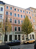
Apartment building in closed development | Grüne Strasse 17 (map) |
around 1885 (tenement) | characteristic residential building from the late 19th century with historicizing architectural decoration, accents through the ground floor structure and window roofing, significant in terms of building history and urban development history. |
09213946 |
 |
Apartment building in closed development | Green Street 19 (map) |
around 1885 (tenement) | Characteristic residential building from the late 19th century with historicizing architectural decorations, accents from the ground floor ashlar, ornaments, consoles, heads, mirrors and window canopies, important in terms of building history and urban development history. |
09213947 |
 |
Apartment building in closed development | Grüne Strasse 30 (map) |
around 1865 (tenement) | characteristic residential building from the second half of the 19th century, with a uniform and symmetrical facade design, clear axiality, central, accentuated entrance, same roofing and window formats, still late classicistic, significant in terms of building history and urban development history. |
09213948 |
 |
Apartment building in closed development | Green Street 32 (map) |
around 1865 (tenement) | characteristic residential building from the second half of the 19th century, with a uniform and symmetrical facade design, clear axiality, central, accentuated entrance, same roofing and window formats, still late classicistic, significant in terms of building history and urban development history. |
09213940 |
 More pictures |
Residential and commercial building in closed development | Jahnstrasse 1 (map) |
marked 1901 (residential and commercial building) | decidedly more elaborate, especially neo-baroque building of historicism, dominated by risalits with tail gables, gallery-like balconies and rich jewelry, historically and artistically significant. |
09213958 |
 |
Publishing house Kaden & Comp. (former) | Jahnstrasse 5a (map) |
1908 (residential and commercial building), 1908 (publishing house) | Residential and commercial building (Wettiner Platz 10) in closed development, as well as the rear building (former publishing house, addresses: Wettiner Platz 10a and Jahnstraße 5a) and connecting corridor in the courtyard; Back building originally the seat of the company Kaden & Comp., Publisher of the Dresdner Volkszeitung, merged with the Sächsische Zeitung in 1946, in the back building today cabaret Breschke and Schuch, complex of architectural and local significance. Used as a theater and office building, including the seat of the Dresden Friedrichstatt Palace . |
09213917 |
 |
Fountain from the former Palais Hoym | Kleine Packhofstrasse - (map) |
1765–1766 (fountain) | Well (stored in Zwingerbauhütte); Belonging to the former Palais Hoym (Landhausstrasse), niche fountain, in it two putti with fish between reeds and rock, high relief, striking Baroque fountain, artistically significant. |
09210347 |
 |
Office building (Kleine Packhofstrasse 1b and Ostra-Allee 25) | Kleine Packhofstrasse 1b (map) |
around 1960 (office building) | Two-wing building in a corner position, characteristic, traditional building from the late 1950s or around 1960, the entrance roof is somewhat reminiscent of " kidney-shaped fashion ", which is significant in terms of architectural history. |
09210326 |
 More pictures |
Theater workshops | Kleine Packhofstrasse 2 (map) |
1977–1981 (workshops), 1984–1987 (magazine) | Workshop complex (Am Zwingerteich 2a), warehouse building (Kleine Packhofstrasse 2) and outdoor facilities; The first complex with a front building and two halls, the second building probably a pallet store, an outstanding example of a GDR functional building in terms of design, significance in terms of building history and urban development. |
09304781 |
 |
Railway embankment fastening |
Könneritzstrasse - (map) |
around 1900 (railway embankment) | Embankment fastening; Significant in terms of urban development history |
09210320 |
 |
Tenement house with shop fitting, upside down and closed development | Konneritzstrasse 11 (map) |
marked 1896 (tenement house) | One of the most representative Wilhelminian style residential buildings in Dresden, particularly rich specimen with a historicizing facade, five storeys, decorative and structural elements of different style models (Romanesque, Renaissance and Baroque), in addition to rich ornamental and figural jewelry, high visual effect due to the position of the head, building history and artistically significant. |
09213980 |
 |
Apartment building in a formerly closed development | Konneritzstrasse 13 (map) |
marked 1896 (tenement house) | One of the most representative Wilhelminian style residential buildings in Dresden with a historicizing facade, accentuating the two side projections with balconies, loggias and rich decorations, baroque style, five-storey, ground floor with rustication, an elaborate entrance, architecturally and artistically significant. |
09213981 |
 |
Residential and commercial building with shop fittings, in a formerly closed area and corner location | Konneritzstrasse 19 (map) |
around 1895 (residential and commercial building) | One of the most representative and creatively remarkable Wilhelminian style houses in Dresden, historicizing facades, with clear emphasis on the corner with a tower dome and two gables, a combination of the ground floor and first floor, the latter originally probably designed with business and office rooms, entrance area, building historically and artistically significant. |
09213982 |
 |
Residential and commercial building with shop fittings, in a formerly closed development | Konneritzstrasse 21 (map) |
around 1895 (residential and commercial building) | one of the most representative and creatively remarkable Wilhelminian style houses in Dresden, historicizing facade, combination of the ground floor and first floor, the latter probably originally with business or office rooms, entrance with a magnificent, wrought-iron gate in the forms of the Rococo, building historically and artistically significant. |
09213983 |
 More pictures |
Totality of the central heating power station with numerous individual monuments: | Power plant center 1; 2; 3; 4; 5; 6; 8th; 10; 12; 14; 16; 18; 20; 22; 24; 26; 28; 30; 32 (card) |
1839, gas preparation plant, 1895, electricity-light-plant, 1900, electricity-west-power plant, 1925–1928, conversion to a thermal power plant | Totality of the central heating power station with numerous individual monuments: machine hall, switchgear house, guy tower, switchgear and phase shift house, reactance house and technical equipment; of great importance for the history of the city, the history of technology and the history of the building, also shaping the cityscape and urban planning due to its brick buildings. |
09305328 |
 More pictures |
Central heating power plant : Electricity west power plant (formerly); Electricity light plant (formerly); Gas preparation facility (formerly) (individual features for ID No. 09305328) | Power plant center 1; 2; 3; 5; 6; 8th; 10; 12; 14; 18; 20; 22; 24; 26; 28; 30; 32 (card) |
1897–1900 (coal-fired power station), 1926–1927 (heating power station), 1860–1866 Dendro (residential and commercial building) | Individual features of the totality Kraftwerk Mitte: machine hall, switchgear house, guy tower including preserved technical equipment, reactance house; Existing buildings of great importance in terms of urban history, technical history and architectural history. |
09213853 |
 More pictures |
Marienbrücke I | Marienbrücke - (map) |
1846–1852 (road bridge) | Road bridge including retaining wall to the Palaisgarten with railing and a seat on the corner to Palaisplatz; Vault bridge over twelve flat arches with bridge houses (see Devrientstrasse 20) and landside staircases, road and railroad bridge combined until 1901, significant testimony to traffic history, striking example of bridge architecture from the middle of the 19th century, important part of the unmistakable Elbe silhouette of Dresden, traffic history and architectural history as well Significant urban development (see also Marienbrücke II). Origin built as a road and railway bridge by Karl Theodor Kunz and Johann Gottlieb Lohse. |
09213965 |
 More pictures |
Marienbrücke II | Marienbrücke - (map) |
1898–1901 (railway bridge) | Railway bridge; Construction of arches and pillars, pillars and landside arches made of sandstone, the middle four bridge parts as lattice girder constructions, significant testimony to traffic history, striking example of bridge architecture around 1900, important part of the unmistakable Elbe silhouette of Dresden, significant in terms of traffic and building history as well as urban planning (see also Marienbrücke I). |
09216624 |
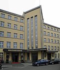 |
Proof of employment Dresden; House of Culture and Education | Maternistraße 17 (map) |
1927–1928 (administration) | Former employment office; later district party school, one-wing building with slightly protruding side wings and central projectile on a triangular floor plan, architecturally remarkable building of objectified architecture from the first third of the 19th century, with echoes of the Bauhaus, historically as well as structurally and artistically significant. |
09213966 |
 |
Double apartment building with shop fittings, in closed development | Maxstrasse 3; 5 (card) |
1861–1862 (double tenement house) | Elaborately designed historicizing residential building from the pre-founding era, balanced and at the same time detailed facade decoration, also part of a coherently preserved street of its time, architecturally and artistically significant. |
09213967 |
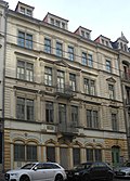 |
Tenement house with shop fittings, in closed development | Maxstrasse 7 (map) |
1861–1862 (tenement house) | Elaborately designed historicizing residential building from the pre-founding era, balanced and at the same time richly detailed facade decoration, also part of a coherently preserved street of its time, architecturally and artistically significant. |
09213969 |
 |
Apartment building in closed development | Maxstrasse 9; 11 (card) |
around 1890 (tenement) | with built-in shops, representative Wilhelminian-style residential building with a historicizing facade, accentuated by side elevations with balconies, diverse jewelry, highlighted entrance, historically and artistically significant. |
09213970 |
 |
Tenement house with shop fittings, in closed development | Maxstrasse 13 (map) |
marked 1893 (tenement house) | Representative Wilhelminian style residential building with historicizing facade, accentuated by side elevation with balconies and passage, multifaceted jewelry, historically and artistically significant, partly a closed line of buildings built around the same time. |
09213971 |
 |
Apartment building in closed development | Maxstrasse 15 (map) |
1894–1895 (tenement house) | with shop fittings, elaborately designed, historicizing residential building from the Wilhelminian era, also part of an extremely striking street, significant in terms of architectural history. |
09213972 |
 |
Commercial college; House of the Dresden merchants ; Merchant house (former) |
Ostra-Allee 9 (map) |
around 1912 (school) | School-building; representative multi-storey building, striking example of objectified architecture after 1900, based on designs by Alexander Hohrath, the latter was a pupil of Wallot, building is significant in terms of architecture, and as a Dresden merchant's house also of local importance. |
09213975 |
 |
Office building (Kleine Packhofstrasse 1b and Ostra-Allee 25) | Ostra-Allee 25 (map) |
around 1960 (office building) | Two-wing building in a corner position, characteristic, traditional building from the late 1950s or around 1960, the entrance roof is somewhat reminiscent of "kidney-shaped fashion", which is significant in terms of architectural history. |
09210326 |
 |
Apartment building in closed development | Ostra-Allee 27 (map) |
around 1865 (tenement) | striking historicizing residential building from the pre-founding era, balanced and at the same time detailed facade decoration, emphasis on the central entrance axis and the side elevations, significant in terms of building history. |
09213978 |
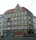 |
Hennig & Co. office building (formerly) | Ostra-Allee 29 (map) |
1909–1910 (residential and commercial building) | Residential and commercial building in closed development and corner location; Characteristic building of its time, with a distinctive cubature and a few, but accentuating decorative and structural elements, an example of reform architecture after 1900, significant in terms of local history and building history as well as artistically. |
09213979 |
 |
Residential and commercial building | Ritzenbergstrasse 3 (map) |
around 1925 (residential and commercial building) | with storage rooms on the ground floor and first floor, in a formerly closed development, characteristic objectified building of its time, especially of architectural importance. |
09213992 |
 |
Apartment building in closed development | Ritzenbergstrasse 5 (map) |
around 1900 (tenement) | with built-in shops, historical building of its time with characteristic clinker-sandstone facade, conspicuous the gabled side elevations, significant in terms of building history. |
09213993 |
 |
Apartment building in a formerly closed development | Schützengasse 3 (map) |
marked 1902 (tenement house) | characteristic late historical building with clinker stone facade, enlivened by different colored stones, significant in terms of architectural history. |
09213996 |
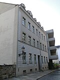 |
Apartment building in a formerly closed development | Schützengasse 11 (map) |
around 1860 (tenement) | characteristic late classical to early historical building, the grooved ground floor is striking, and is significant in terms of architectural history. |
09213997 |
 |
Back building | Schützengasse 14 (map) |
2nd half of the 19th century (rear building) | today in closed development, as one of the older buildings in the district of Wilsdruffer Vorstadt, significant in terms of urban development history. |
09216625 |
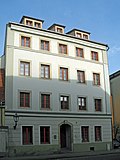 |
Residential house with inner courtyard, in closed development | Schützengasse 16 (map) |
around 1765 (residential building) | Four-wing construction, as one of the oldest buildings in the district of Wilsdruffer Vorstadt, also apparently still baroque in its core, significant in terms of building history and urban development history. |
09213998 |
 |
Residential house with courtyard and back building, in half-open development | Schützengasse 18 (map) |
Late 18th century (residential building) | Three-sided homestead, as one of the oldest buildings in the district of Wilsdruffer Vorstadt, also still baroque in its core, significant in terms of architectural and urban development, today the seat of the Dresden Environmental Center . |
09213999 |
 |
Residential house in a formerly closed development | Schützengasse 24 (map) |
around 1765 (residential building) | as one of the older buildings in the district of Wilsdruffer Vorstadt, it is significant in terms of urban development. |
09214000 |
 |
Residential house in semi-open development | Schützengasse 26 (map) |
around 1870 (residential building) | with shop fitting, as one of the older buildings in the district of Wilsdruffer Vorstadt, significant in terms of urban development history. |
09214001 |
 More pictures |
Volkshaus; Union house | Schützenplatz 14 (map) |
1914–1915 (union building), 1929–1930 (high-rise construction) | Union house; Group of buildings with a towering main wing, an older side building and two rear wings, a dominant high-rise building in reinforced concrete, characteristic architectural evidence of the architecture of their respective time of origin, the older part in the sense of the more objectified architecture around 1910 and the younger part based on the Bauhaus in the 1920s Built years ago, remind us of an important part of the history of the labor movement in the Elbe city, significant in terms of building history and local history. Erected by Carl Fritz Richter in the New Objectivity style. |
09213994 |
 |
Apartment building in a formerly closed development | Schweriner Strasse 23 (map) |
around 1870 (tenement) | with shop fittings, is one of the few remaining buildings from the second half of the 19th century on an important Dresden street of that time, significant in terms of urban development. |
09214002 |
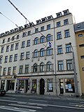 |
Apartment building in closed development | Schweriner Strasse 25 (map) |
around 1875 (tenement) | with shop fittings, is one of the few remaining buildings from the second half of the 19th century on an important Dresden street of that time, significant in terms of urban development. |
09214003 |
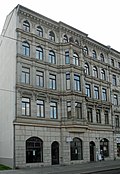 |
Apartment building in a formerly closed development | Schweriner Strasse 33 (map) |
around 1880 (tenement) | with shop fittings, is one of the few remaining buildings from the second half of the 19th century on an important Dresden street of this time, the upper floors with rich historicizing design, important in terms of urban development and architectural history. |
09214004 |
 |
Apartment building in a formerly closed development | Schweriner Strasse 35 (map) |
around 1875 (tenement) | with shop fittings, elaborate and largely authentically traditional, historicist residential building of its time, the striking facade evenly covered with decorative and structural elements, is one of the few remaining buildings from the second half of the 19th century on an important Dresden street of that time, both in terms of architectural history and Significant in terms of urban development history. |
09214005 |
 |
Apartment building in half-open development | Schweriner Strasse 36 (map) |
around 1870 (tenement) | with shop fittings, is one of the few remaining buildings from the second half of the 19th century on an important Dresden street of that time, the historicist decor is striking, significant in terms of urban development. |
09214006 |
 |
Apartment building in a formerly closed development | Schweriner Strasse 42 (map) |
around 1880 (tenement) | with shop fitting, elaborate and largely authentically outdated, historicist residential building of its time, striking the facade evenly covered with decorative and structural elements, typically the clinker stone facade, is one of the few remaining buildings from the second half of the 19th century on one important Dresden street of that time, important in terms of building history and urban development history. |
09214007 |
 |
Apartment building in closed development | Schweriner Strasse 44 (map) |
around 1875 (tenement) | with shop fittings, elaborate and largely authentically traditional, historicist residential building of its time, the striking facade evenly covered with decorative and structural elements, is one of the few remaining buildings from the second half of the 19th century on an important Dresden street of that time, both in terms of architectural history and Significant in terms of urban development history. |
09214008 |
 |
Apartment building in closed development | Schweriner Strasse 46 (map) |
around 1870 (tenement) | with shop fittings, is one of the few remaining buildings from the second half of the 19th century on an important Dresden street of that time, significant in terms of urban development. |
09214009 |
 |
Apartment house in closed development and upside down | Schweriner Strasse 48 (map) |
around 1895 (tenement) | with a shop zone, an elaborate and largely authentically outdated, historicist residential building of its time, the striking facade evenly covered with decorative and structural elements, typically the clinker brick facade, is one of the few remaining buildings from the second half of the 19th century significant Dresden street of that time, significant in terms of building history and urban development history |
09214010 |
 More pictures |
Basteischlößchen | Terrassenufer - (map) |
1912–1913 (restaurant) | Restaurant; Small single-wing building with rounded sides and central projections on both fronts, built in connection with the Italian village as a small separate beer restaurant, clear cubature that inherits local Baroque forms in the spirit of Erlwein, as well as stylized, neoclassical elements such as pilaster strips and triangular gables, stand differently from buildings that were built at the same time of reform architecture and Heimatschutz style for a rather moderate building concept, the architects of which, despite recognizable objectification, did not want to completely dispense with traditional, representative design elements, historically and artistically significant, also significant in terms of urban planning in connection with the Italian village and theater square. |
09214024 |
 |
Monumental walls below the Augustus Bridge | Terrassenufer - (map) |
Marked 1817 (wall with consoles), 2nd half of the 19th century or around 1910 (retaining wall), after 1912–1913 (stairs) |
Monument worthy walls between the Augustusbrücke and the cut at the level of the rehearsal stage / Semperoper; Wall with brackets; Wall section in front of Basteischlösschen (before 1850), retaining wall between the bank and the course of the road, and small stairs at Basteischlösschen; formerly parts of a harbor and numerous landing stages, of relevance for the view of the old town on the Elbe, especially important in terms of urban development history and urban planning. |
09299889 |
 More pictures |
Playhouse | Theaterstrasse 2 (map) |
designated 1912–1913 (theater) | Theater building; Rank theater with pilaster-structured entrance front and raised stage, architecturally distinctive building of its time with remarkable facade design and equipment, built by the nationwide famous architecture office William Lossow and Max Hans Kühne , one of the most important theaters in Saxony, historically and artistically significant, also with its impressive building cubes and as The building opposite the Zwinger, which characterizes the townscape, is of importance in terms of urban planning. Burned out in 1945, rebuilt by 1948, facade decorations by Georg Wrba and Oskar Döll , among others . |
09213974 |
 |
Dresden town house | Theaterstrasse 11; 13; 15 (card) |
1922–1923 (town hall) | Administration building; Curved single-wing building with an unmistakable wave-shaped facade, exterior and interior largely preserved, the staircase and the hall behind the main entrance are remarkable in terms of design, reinforced concrete skeleton construction, the most striking expressionist building in Dresden, one of the few public buildings of this style in the city, both in terms of architectural history and local history as well as artistically significant, also singular in its form. Reinforced concrete skeleton construction by Ludwig Wirth, with artificial stone cladding, today the city district office. |
09213894 |
 |
Publishing house Kaden & Comp. (former) |
Wettiner Platz 10; 10a (card) |
1908 (residential and commercial building), 1908 (publishing house) | Residential and commercial building (Wettiner Platz 10) in closed development, as well as the rear building (former publishing house, addresses: Wettiner Platz 10a and Jahnstraße 5a) and connecting corridor in the courtyard; Back building originally the seat of the company Kaden & Comp., Publisher of the Dresdner Volkszeitung, merged with the Sächsische Zeitung in 1946, in the back building today cabaret Breschke and Schuch, complex of architectural and local significance. |
09213917 |
 More pictures |
Wettiner Gymnasium ; Carl Maria von Weber Academy of Music | Wettiner Platz 13 (map) |
1884 (school) | School-building; Three-wing building with main portal in the middle projecting, striking staircase behind the main portal, one of the few remaining representative school buildings from the early days of Dresden, architect: Theodor Friedrich , significant in terms of building history and local history as well as artistically. |
09213918 |
Outer Wilsdruffer suburb
The outer Wilsdruffer Vorstadt is located in the district of Altstadt II.
| image | designation | location | Dating | description | ID |
|---|---|---|---|---|---|
 |
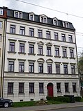
Apartment building in half-open development | Freiberger Strasse 59 (map) |
around 1895 (tenement) | characteristic historical building of the Wilhelminian era with axially structured facade, center emphasized by balconies, significant in terms of building history. |
09216704 |
 |
Apartment building in half-open development | Freiberger Strasse 65 (map) |
around 1895 (tenement) | characteristic historic building of the Wilhelminian style with an axially structured facade, center emphasized by special window coverings and arched portal, base level emphasized by grooves, balanced and finely coordinated facade decoration, significant in terms of building history. |
09216705 |
| Apartment building in closed development | Rosenstrasse 97 (map) |
around 1895 (tenement) | characteristic historical building from the early Wilhelminian era with an axially structured facade, center emphasized by a portal and striking window roofing on the first floor, significant in terms of building history. |
09216716 |
|
 |
Consumption Association Forward for Dresden and the surrounding area (formerly) | Rosenstrasse 99 (map) |
1902-1903 (administration building) | Administration building; Architecturally striking building, historicist, with Art Nouveau echoes, from the beginning of the 20th century, emphasis on the corner by the tower construction, especially significant in terms of architectural history. |
09216717 |
 |
Apartment building in open development | Rosenstrasse 103c (map) |
around 1895 (tenement) | characteristic historical building of the Wilhelminian style with axially structured facade, side risalit with gabled dwelling, emphasis on the first floor, significant in terms of building history. |
09216718 |
Remarks
- This list is not suitable for deriving binding statements on the monument status of an object. As far as a legally binding determination of the listed property of an object is desired, the owner can apply to the responsible lower monument protection authority for a notice.
- The official list of cultural monuments is never closed. It is permanently changed through clarifications, new additions or deletions. A transfer of such changes to this list is not guaranteed at the moment.
- The monument quality of an object does not depend on its entry in this or the official list. Objects that are not listed can also be monuments.
- Basically, the property of a monument extends to the substance and appearance as a whole, including the interior. Deviating applies if only parts are expressly protected (e.g. the facade).
Detailed memorial texts
-
↑
Monument text
In 1718 a poor house was founded and built. From 1834–1836 this was demolished and replaced by the new construction of a city poor house, the front building that has not existed since 1945 to the still preserved building. Two and a half decades later, in 1862, the facility developed into the municipal supply house. The present building (back then) was built between 1877 and 1878. In this context, the institute garden was probably created, which was probably given its current design as a reform garden at the beginning of the 20th century. 1910–1911 the rear building was expanded. In 1941 the city converted the supply house into an old people's home. Already in 1945 it was merged with the women's home, the former maternity hospital. The whole thing was named Elsa-Fenske -Heim in 1952. The preserved building has a risalit set asymmetrically in front of the facade with round and basket-arch windows and two triangular gables. From a stylistic point of view, the tall and very representative building is comparable to some of the barracks in Albertstadt, which were influenced by the classical style. The garden is enlivened by a central path, a horseshoe-shaped design with a formerly cut linden hedge and bowl well and two lawns in front of the building, planted with fruit trees and old ornamental shrubs (mainly lilac) (LfD / 2015). -
↑ a b
Monument text
The layout of the newer buildings of the theater workshops consists of the actual workshop complex, Am Zwingerteich 2a, which was handed over in 1981, as well as an elongated building, Kleine Packhofstraße 2, a warehouse building and the outdoor facilities. The striking complex Am Zwingerteich 2a, consisting of a workshop building and two halls, was built from 1977–1981 by VEB (B) Gesellschaftbau Dresden, with the significant involvement of architects Eberhard Pfau and Torsten E. Gustavs. In 1983 he received the GDR architecture prize. The building on Kleine Packhofstrasse was built between 1984 and 1987 (verbal information from Torsten E. Gustavs). It is not described in the authoritative article on the object (in: Architektur der DDR 1984, no. 3, pp. 144–150) and only appears as a graphic representation. The workshop complex in particular is an outstanding example of a GDR functional building, which explains its significance in terms of building history. This is not surprising, since the location in the center of Dresden, in the immediate vicinity of the Zwinger, required a structural design that had to go beyond what is required of such buildings. Although it is consistently modern and partly futuristic in design, it exists alongside the older lead buildings in the area. The architects achieved this by increasing the meaning of the Zwinger, the varied structure and graduation of the building, refined surface structures, the setting back of the building line and the embedding in green outdoor areas. The elongated, unspectacular and yet demanding building on Kleine Packhofstrasse forms a creative and functional connection with the workshop complex and thus a unit of monument value against the background of the historical building value. This results not only from the historical, but also from the urban significance of the complex. Without a doubt, the newer buildings of the theater workshops lead to an unmistakable urban history. There is hardly any other place where theater workshops combine buildings from different architectural eras with such tension. The public interest in conservation arises primarily from the weight of the reasons for protection and the fact that the monumental quality of the facility to be assessed here and the necessity of its conservation are in any case recognized by a broad group of experts. At the same time, buildings of this quality have already been recorded and treated as monuments several times (LfD / 2013). - ↑ In 1722, the Electorate of Saxony began to erect the Saxon post-mile pillars. Elector Friedrich August I wanted to build a modern traffic and transport control system in the electorate in order to promote trade and economy. He entrusted Magister Adam Friedrich Zürner (1679–1742) with the implementation. The system of post mile pillars comprised distance pillars, quarter milestones, half and full mile pillars. The distance columns should be set up in the cities in front of the city gates, later only on the marketplaces. Quarter milestones, half and full mile pillars were set up along the Poststrasse. They received a consecutive numbering (row number), starting from the beginning of the measurement. The all-mile columns were set up outside the cities on the post roads at a distance of 1 mile (= 9.062 km). The distance pillars were marked with the monogram "AR" for "Augustus Rex", the Electoral Saxon and Polish-Lithuanian double coat of arms and the Polish royal crown. The full mile, half mile columns and quarter milestones were all similarly labeled, none of them had a coat of arms, but the monogram "AR". The distances were given in hours (1 hour = ½ post mile = 4.531 km). This mile system was the first European traffic management system. As part of the nationally significant postal system, the pillar considered here is of great importance for the history of traffic (LfD / 2013).
- ↑ a b Summary of the central heating power station with the following individual monuments: machine hall with eastern extension (central power station 1), connection to the switch house, switch house with control room, guy tower and northern extension including preserved technical equipment (central station 6-24, even numbers, without 16) , Coal shed / later mech. Workshop (power plant center 26), switching and phase-shifting house including upstream transformer chambers (power plant center 28/30/32), residential and commercial building (power plant center 2), reactance house (power plant center 3) and new switchgear / new heating center (power plant center 5/7) (see also the list of individual monuments - Obj. 09213853) as well as the following items: structural expansions of the connecting structure between the machine hall and the switch house, intermediate building at the new switch house (power station center 7?), Social building (power station center 16), fencing with gatekeeper's house (power station center 4) and open spaces between the buildings including historical paving and rail fragments; Extensively preserved building ensemble, which has grown since the end of the 19th century and is clearly characterized by historicism and the New Objectivity style, former power station location today one of the most important industrial monuments of Dresden, as a testimony to the city's gas, electricity and heat supply history of great city history, technical and architectural significance, and with its brick-built buildings that still form an unmistakable ensemble, it shapes the cityscape and is significant in terms of urban planning. Expanded to the present form by Paul Wolff , today the location of the Dresden State Operetta , theater of the young generation and the KraftWerk - Dresden Energy Museum after renovation .
literature
- Old town. In: Georg Dehio (Hrsg.): Handbook of German art monuments. Dresden. Updated edition. Deutscher Kunstverlag, Munich / Berlin 2005, pp. 3–92.
swell
Web links
Commons : Cultural monuments in the district of Altstadt I - collection of images, videos and audio files
