Netřebice
| Netřebice | ||||
|---|---|---|---|---|
|
||||
| Basic data | ||||
| State : |
|
|||
| Region : | Jihočeský kraj | |||
| District : | Český Krumlov | |||
| Area : | 1336 ha | |||
| Geographic location : | 48 ° 48 ' N , 14 ° 27' E | |||
| Height: | 635 m nm | |||
| Residents : | 464 (Jan. 1, 2019) | |||
| Postal code : | 382 32 | |||
| License plate : | C. | |||
| traffic | ||||
| Street: | I / 3 : Velešín - Kaplice | |||
| Railway connection: | St. Valentin – České Budějovice | |||
| structure | ||||
| Status: | local community | |||
| Districts: | 3 | |||
| administration | ||||
| Mayor : | Jiří Opekar (as of 2018) | |||
| Address: | Netřebice 6 382 32 Velešín |
|||
| Municipality number: | 545643 | |||
| Website : | www.obecnetrebice.cz | |||
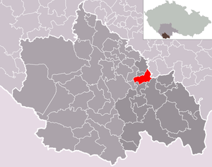
| Location of Netřebice in the Český Krumlov district | ||||

|
||||
Netřebice (German Netrobitz , also Netrowitz ) is a municipality in the Czech Republic . It is located seven kilometers northwest of Kaplice and belongs to the Okres Český Krumlov .
geography
The place is located 635 m above sea level. M. on the left above the Maltschtal in the northeast of the Poluška Mountains. The European route 55 / State route 3 between Velešín and Kaplice runs through Netřebice . In the north and east, the Summerauerbahn bypasses the place that has a stop in the Výheň district.
Neighboring towns are Zvíkov and Korbel in the north, Hřeben in the northeast, Výheň in the east, Vavřín and Rozpoutí in the southeast, Kaplice-nádraží, Osovský and Rejty in the south, Střítež and Dolní Pláně in the southwest, V Háji and Zubčice in the west and Zubčická Lhotí in the north .
Community structure
The municipality Netřebice consists of the districts Dlouhá ( Dluhe ), Netřebice and Výheň ( Wihen ) and the layers Hřeben and Vavřín.
The municipality is divided into the cadastral districts of Dlouhá and Netřebice.
Neighboring communities
| Zubčice | Zvíkov | |

|
Svatý Jan nad Malší | |
| Věžovatá Pláně | Střítež u Kaplice | Kaplice |
history
In 1358 the village Netrziebiczie villa was first mentioned in a document.
Attractions
- Chapel at the school
- open bell tower on the village square
- historical brake stone north of the village on the left of Europastraße 55
- Memorial stone for 44 unknown victims of the transport from Auschwitz to Mauthausen in January 1945, south of the village in the direction of Kaplice-nádraží on the left of the European route 55 on the road to Vavřín
Web links
- Netřebice . In: Online encyclopedia encyklopedie.ckrumlov.cz about Český Krumlov (information about the municipality).
Individual evidence
- ↑ http://www.uir.cz/obec/545643/Netrebice
- ↑ Český statistický úřad - The population of the Czech municipalities as of January 1, 2019 (PDF; 0.8 MiB)
- ↑ http://www.uir.cz/casti-obce-obec/545643/Obec-Netrebice
- ↑ http://www.uir.cz/katastralni-uzemi-obec/545643/Obec-Netrebice
- ↑ Brake stone in Netřebice on smircikrize.euweb.cz (European stone monuments).

