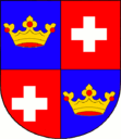
Chvalšiny
| Chvalšiny | ||||
|---|---|---|---|---|
|
||||
| Basic data | ||||
| State : |
|
|||
| Region : | Jihočeský kraj | |||
| District : | Český Krumlov | |||
| Area : | 2795 ha | |||
| Geographic location : | 48 ° 52 ' N , 14 ° 12' E | |||
| Height: | 671 m nm | |||
| Residents : | 1,254 (Jan 1, 2019) | |||
| Postal code : | 382 08 | |||
| License plate : | C. | |||
| traffic | ||||
| Street: | Český Krumlov - Prachatice | |||
| structure | ||||
| Status: | local community | |||
| Districts: | 4th | |||
| administration | ||||
| Mayor : | Jiří Borský (as of 2018) | |||
| Address: | Chvalšiny 38 382 08 Chvalšiny |
|||
| Municipality number: | 545546 | |||
| Website : | www.chvalsiny.cz | |||
| Location of Chvalšiny in the Český Krumlov district | ||||

|
||||
Chvalšiny (German Kalsching ) is a municipality in the Okres Český Krumlov in the Czech Republic .
geography
Chvalšiny is located on the Chvalšinský potok ( Kalschingbach ) in the south of the Blanský les . Neighboring places are Borová (mistletoe) and Brloh (Berlau) in the north, Loučej (Lutschau) and Křemže (Krems) in the northeast, Zlatá Koruna (Goldenkron) in the east, Vyšny, Novosedly and Kájov (Gojau) in the southeast, Boletice ( Poletitz ), Kladenské Rovné (Ruben) and Skláře in the south and Borová and Třebovice in the northwest. To the northeast rises the 1084 m high Kleť and in the southeast in front of Křenov there is a botanical garden ( botanická zahrada ).
Community structure
The municipality consists of the districts Borová ( mistletoe ), Červený Dvůr ( Rothenhof ), Chvalšiny ( Kalsching ) and Hejdlov ( Hödlwald ). Basic settlement units are Borová, Borovští Uhlíři ( mistletoe logs ), Červený Dvůr, Chvalšiny, Hejdlov and Střemily ( judges' court ).
The municipality is divided into the cadastral districts Borová u Chvalšin, Chvalšiny and Střemily.
Neighboring communities
| Ktiš | Brloh pod Kletí | Křemže |

|
||
| Boletice Training Area | Kájov |
history
Based on archaeological finds in the former fortress of Poletitz to the south, it is assumed that the area around Kalsching was settled by Slavic tribes as early as the 10th and 11th centuries. It belonged to the Goldenkron Monastery to the east and was first mentioned in 1281 when Margrave Otto von Brandenburg, in his capacity as guardian of King Wenzel II, who was not yet of age, confirmed the ownership of Kalsching to the monastery. It was raised to a town as early as 1293. During the Hussite Wars , Ulrich II von Rosenberg succeeded in appropriating the Goldenkron monastery property and incorporating it into his rule Krumau . During the reigns of Wok II. Von Rosenberg and Peter IV. Von Rosenberg , the late Gothic St. Mary's Church was built from 1487–1507, whose net vaults in the nave show the artistic influence of the Bavarian-Swabian construction works around Hans Wechselberger and Wolfgang Wiesinger from Braunau . In 1567 Wilhelm von Rosenberg granted Kalsching the brewing privilege. His successor Peter Wok von Rosenberg , the last Rosenberger in the male line, gave Kalsching large forests in 1600. After he had to sell the Krumau rule two years later due to excessive indebtedness, Kalsching was subject to the Bohemian Chamber until 1622 . That year, Emperor Ferdinand II gave Kalsching together with the Krumau rule to his court chamber president Hans Ulrich von Eggenberg for his services in the Catholic League . During the reign of the Eggenbergers, Kalsching received privileges for a weekly market and two annual markets in 1641, and two more weekly markets were added in 1685.
After the Eggenbergs died out in 1719, Kalsching fell to the Schwarzenbergs . During the reign of Josef Adams von Schwarzenberg, the Rotenhof palace was built not far from Kalsching from 1756 to 1760 according to plans by Josef Fortini. It served as the Schwarzenbergs' summer residence from the middle of the 19th century.
After the abolition of patrimonial Kalsching formed an independent municipality. From 1850 there was a district court in Kalsching ( judicial district Kalsching ), which existed until the end of the Second World War. From 1855 to 1868 Kalsching was the seat of a district office, whose official business was then assigned to the district office in Krumau. In 1930 the population was 1,412 (1,340 of them German). For 1991 there are 1,002 inhabitants.
Attractions
- The late Gothic St. Mary's Church was built in 1487–1507.
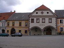
- The medieval buildings on the market square were destroyed by several fires in the 17th to 19th centuries. Some buildings still contain late Gothic saddle portals.
- The Schwarzenberg Canal Museum also serves as a local museum. It is located in the building that housed the town hall until 1848 and then the district court.
- Stations of the Cross with a chapel
Personalities
- Joseph Rosenauer (1735–1804), forest engineer in the service of the Schwarzenbergs
- Helmut Schläger (1924–1969), German building researcher and underwater archaeologist
- Karl Brdlik (1874–1948), Sudeten German teacher and local researcher
literature
- Joachim Bahlcke , Winfried Eberhard, Miloslav Polívka (eds.): Handbook of historical places . Volume: Bohemia and Moravia (= Kröner's pocket edition . Volume 329). Kröner, Stuttgart 1998, ISBN 3-520-32901-8 , pp. 245f.
Web links
- Chvalšiny . In: Online encyclopedia encyklopedie.ckrumlov.cz about Krummau (with the history of the municipality).
- Museum of the Schwarzenberg Alluvial Canal in Chvalšiny . In: Online encyclopedia encyklopedie.ckrumlov.cz about Krummau .
Individual evidence
- ↑ http://www.uir.cz/obec/545546/Chvalsiny
- ↑ Český statistický úřad - The population of the Czech municipalities as of January 1, 2019 (PDF; 0.8 MiB)
- ↑ http://www.uir.cz/casti-obce-obec/545546/Obec-Chvalsiny
- ↑ http://www.uir.cz/zsj-obec/545546/Obec-Chvalsiny
- ↑ http://www.uir.cz/katastralni-uzemi-obec/545546/Obec-Chvalsiny


