Põhja-Tallinn
Põhja-Tallinn (literally North Tallinn ) is a district of the Estonian capital.
53,881 Tallinn residents live in Põhja-Tallinn (as of December 31, 2011). The area is 17.3 km². The municipality is located (north) west of the city center on the Tallinn Bay.
The municipality includes the District parts ( Estonian asumid ) Kopli (German brick coupling ), Paljassaare , Kalamaja ( Fischermay ) Kelmiküla and Pelgulinn .
In addition to Tallinn's city center and Toompea, Põhja-Tallinn is one of the oldest parts of the city. The Paljassaare and Kopli peninsulas have been known for their beaches and harbors since the Middle Ages. The German Baltic cemetery Kopli kalmistu was in Kopli . Some of the one to two-story wooden houses in Kalamaja are of great architectural and historical value.
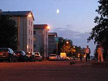
A challenge for the city are numerous socially disadvantaged and homeless people, especially in Kopli, as well as old Soviet industrial facilities.
population
In terms of population, Põhja-Tallinn is one of Tallinn's mixed-language districts. While a high proportion of ethnic Estonians live in the districts of Kelmiküla, Kalamaja and Pelgulinn, the Russian-speaking residents dominate in the large apartment blocks of Pelguranna, Karjamaa and Kopli. Overall, in 2020 the proportion of residents with Estonian mother tongue in Põhja-Tallinn reached 50.3%, the relative majority. The Russian-speaking residents made up 39.3% of the population in 2020.
gallery
Web links
- Official website (Estonian)
- Peeteli Church and street children project in Kopli (German)
- Tourism in Kalamaja and on the Bay of Kopli (English) ( page no longer available )
Individual evidence
Coordinates: 59 ° 27 ' N , 24 ° 41' E


