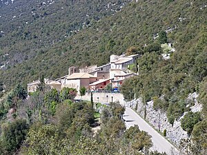
Saint-Léger-du-Ventoux
| Saint-Léger-du-Ventoux | ||
|---|---|---|

|
|
|
| region | Provence-Alpes-Cote d'Azur | |
| Department | Vaucluse | |
| Arrondissement | Carpentras | |
| Canton | Vaison-la-Romaine | |
| Community association | Vaison Ventoux | |
| Coordinates | 44 ° 13 ' N , 5 ° 17' E | |
| height | 355-1,901 m | |
| surface | 19.29 km 2 | |
| Residents | 34 (January 1, 2017) | |
| Population density | 2 inhabitants / km 2 | |
| Post Code | 84390 | |
| INSEE code | 84110 | |
 Place view |
||
Saint-Léger-du-Ventoux is a French municipality with 34 inhabitants (at January 1, 2017) in the department of Vaucluse in the region Provence-Alpes-Cote d'Azur . Saint-Léger-du-Ventoux is one of the most populous communes in the Vaucluse department. It belongs to the canton of Vaison-la-Romaine in the Arrondissement of Carpentras .
geography
The municipality is located on Mont Ventoux , the highest mountain in the Provencal Prealps . At the top of the mountain there is the special situation that four communities meet there: Saint-Léger-du-Ventoux, Bédoin , Brantes and Beaumont-du-Ventoux . The summit belongs to the municipality of Bédoin, but less than fifty meters further you are again in the area of Saint-Léger, in between there is still a narrow strip to Brantes. The place is only about one kilometer from the border with the Drôme department on the banks of the Toulourenc river .
history
Before Christianization, a deity named Touleronco was worshiped here, named after the Toulourenc river. In 1254 the place was called "De Sancto Lauderio", in 1363 it was then called "Sant Leydier". In 1550 the village is mentioned in a document as "Sanctus Loderius". Since July 18, 1953, the place has its current name Saint-Léger-du-Ventoux.
Population development
| year | 1962 | 1968 | 1975 | 1982 | 1990 | 1999 | 2008 |
| Residents | 36 | 30th | 28 | 33 | 31 | 24 | 30th |
