Entrechaux
| Entrechaux | ||
|---|---|---|

|
|
|
| region | Provence-Alpes-Cote d'Azur | |
| Department | Vaucluse | |
| Arrondissement | Carpentras | |
| Canton | Vaison-la-Romaine | |
| Community association | Vaison Ventoux | |
| Coordinates | 44 ° 13 ' N , 5 ° 8' E | |
| height | 210-463 m | |
| surface | 14.91 km 2 | |
| Residents | 1,112 (January 1, 2017) | |
| Population density | 75 inhabitants / km 2 | |
| Post Code | 84340 | |
| INSEE code | 84044 | |
 View from the village square to the Donjon Hill |
||
Entrechaux is a French commune with 1,112 inhabitants (at January 1, 2017) in the department of Vaucluse in the region Provence-Alpes-Cote d'Azur .
geography
Entrechaux is about 6 km southeast of Vaison-la-Romaine , between the Ouvèze river and Mont Ventoux . In the northeast, the Toulourenc flows into the Ouvèze as a left tributary and at the same time forms the border with the neighboring municipality of Mollans-sur-Ouvèze and the Drôme department . Other surrounding communities are Malaucène , Crestet , Saint-Marcellin-lès-Vaison , Saint-Romain-en-Viennois and Faucon . The next major city is Carpentras in the south, 19 km away .
traffic
The départementale D13 route runs straight through the town coming from Mollans-sur-Ouvèze in a south-westerly direction. From the D13, the D54 branches off to the west in the direction of Crestet.
history
In ancient times , Gauls from the Celtic tribe of the Vocontier settled the area around Entrechaux. An inscription was found under the altar of the Notre-Dame-de-Nazareth chapel, which is probably one of the oldest of this people.
The first documentary mention goes back to the year 1108. In a papal letter, the Bishop of Vaison is confirmed as a co-owner of Entrechaux. The donjon was built in the 10th or 11th century .
Population development
| year | 1962 | 1968 | 1975 | 1982 | 1990 | 1999 | 2006 | 2008 |
|---|---|---|---|---|---|---|---|---|
| Residents | 615 | 635 | 637 | 724 | 809 | 869 | 989 | 1.012 |
Attractions
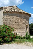
After the steep slopes of the castle hill ( Château d'Entrechaux ), on which the bishops of Vaison resided, the village developed further down the plain. The traces of the dwellings attached to the rocks have practically disappeared, but there are still remnants of the 20 m high donjon and the wall. The Saint-Laurent church, built on the rampart, is very dilapidated, whereas the village has been restored. To the east of the village are the Notre-Dame-de-Nazareth d'Entrechaux and Saint-André chapels . The chapel of Saint-Laurent d'Entrechaux to the west dates from the 11th century .
literature
- Jules Courtet: Dictionnaire géographique, géologique, historique, archéologique et biographique du département du Vaucluse . Avignon 1876.
- Robert Bailly: Dictionnaire des communes du Vaucluse . A. Barthélemy, Avignon 1986.
Web links
- Official website (French)
Individual evidence
- ↑ The community on annuaire-mairie.fr
- ↑ a b History of Entrechaux. entrechaux.info, accessed December 19, 2011 (French).
- ↑ Stefan Brandenburg, Ines Mache: Provence. The complete guide for individual travel and discovery in Provence, the Camargue and Marseille. 6th updated edition. Reise Know-How Verlag Rump, Bielefeld 2008, ISBN 978-3-8317-1665-4 , p. 217.
- ↑ Michel Albarède et al .: Vaucluse (= Encyclopédies du Voyage ). Gallimard Loisirs, Paris 2007, ISBN 2-7424-1900-4 , p. 311 .


