
Sturgeon (Elbe)
| sturgeon | ||
 Disturbance barrier |
||
| Data | ||
| Water code | EN : 5976 | |
| location | Germany , Schleswig-Holstein | |
| River system | Elbe | |
| Drain over | Elbe → North Sea | |
| River basin district | Elbe | |
| source | In Willingrade 54 ° 1 '46 " N , 10 ° 6' 45" O |
|
| Source height | 32 m | |
| muzzle | 4 km northwest of Glückstadt in the Elbe Coordinates: 53 ° 49 '13 " N , 9 ° 23' 35" E 53 ° 49 '13 " N , 9 ° 23' 35" E |
|
| Mouth height | 0 m | |
| Height difference | 32 m | |
| Bottom slope | 0.37 ‰ | |
| length | 87 km | |
| Catchment area | 1781 km² | |
| Discharge at the Willenscharen A Eo gauge : 484 km² Location: 58.6 km above the estuary |
NNQ (July 1, 1941) MNQ 1984–2014 MQ 1984–2014 Mq 1984–2014 MHQ 1984–2014 HHQ (February 26, 2002) |
640 l / s 2.25 m³ / s 5.93 m³ / s 12.3 l / (s km²) 27.9 m³ / s 45.4 m³ / s |
| Drain |
MQ |
21.7 m³ / s |
| Left tributaries | Brokstedter Au , Mühlenbek , Bramau , Hörnerau , Krempau | |
| Right tributaries | Schwale , Aalbek , Bünzau , Mühlenbarbeker Au , Rantzau , Bekau , Wilsterau | |
| Medium-sized cities | Neumunster , Itzehoe | |
| Navigable | from Kellinghusen | |
The sturgeon ([ ˈʃtøɐ ], regional [ ˈstø lat ], Latinized Sturia ) is a right tributary of the Elbe in Schleswig-Holstein, influenced by tides . In terms of the type of flowing water , it is marshland .

course
The Stör rises approx. 15 km southeast of Neumünster near Willingrade in the Segeberg district . Shortly after its headwaters, it is dammed up for the paper mill, which is now a listed building .
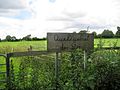
Sign to the headwaters

The first ditch that bears the name “Stör”
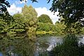
The barrage to the paper mill


It then crosses the outskirts of Neumünster, the southern district of Rendsburg-Eckernförde and the district of Steinburg, where it flows into the Elbe about 4 km northwest of Glückstadt . In the community of Heiligenstedten it reaches the marshland; already from Itzehoe its course begins to meander. The river has a length of about 87 km and an average water flow of 21.7 m³ / s at the confluence with the Lower Elbe.


From Itzehoe (river kilometer 53) to the mouth, the Stör can be used by professional shipping, although it is becoming less important. Sport shipping, on the other hand, also uses the Stör above Itzehoe. The Stör barrage , built two kilometers above the estuary in 1975, protects the lowlands along the Stör from the effects of storm surges . The structure has two 22 m wide shipping openings with mitred gate locks.
Ebb and flow affect the water level of the sturgeon for more than half of its length from its mouth to above Kellinghusen (river kilometer 32); it is the only tributary of the Lower Elbe in which the tidal movement swings freely and the tidal limit is not defined by a transverse structure. The mean tidal range at the Stör barrage is about 2.75 meters. The tidal area from Kellinghusen to the source has a catchment area of 1,160 km². The entire catchment area covers 1,781 km².
Tributaries
Tributaries in the upper reaches are the Sünderbek , Geilenbek , Schwale (at river kilometer 8), Aalbek (river kilometer 12), Bünzau (river kilometer 18), Brokstedter Au , Kirchweddelbach (r), Bullenbach (r), Rensinger Graben (l), Quarnstädter Graben ( r), Mühlenbek (l), Bramau (river kilometer 34.8), in the middle reaches the Hörnerau (river kilometer 35), Mühlenbarbeker Au , Ihlenbek (r), Rantzau (river kilometer 42.9), Moorwetter , Lübsche Wetter , Bekau (river kilometer 60 ) and in the lower reaches Große Feldwetter (r), Wilsterau (r, river kilometer 63.5), Kampritt Wetter (r), Klosterwetter (l), Groß-Kampen-Wetter (r), Altenfelder Wetter (r), Große Wetter (l ), Neuenbrooker Wetter (l), Krempau (l, river kilometer 75.8) and the Wetter near Wewelsfleth (r). In addition, the Breitenburg Canal is connected to the Stör (river kilometer 49.5).
Fault crossings

Downstream of the town Itzehoe there are few Störquerungen: Save the Störbrücke the Federal Highway 23 are Wilster- and Krempermarsch only by the bascule bridge in Heiligenstedten that Störfähre Else in Beidenfleth and over the Störsperrwerk extending federal highway 431 connected above the Störmündung.
Former castle complexes
There were various low castles on the Stör . The oldest are Esesfeld Castle near Heiligenstedten and Wittorf Castle in Neumünster at the confluence of the Schwale, both of which date from the 9th century. In the centuries that followed, Itzehoe Castle was built in the then Störschleife in Itzehoe and the Breitenburg near today 's Breitenburg Castle. Castles were also built on the tributaries of the Stör, such as the Kaaksburg from the 9th century at the confluence of the Mühlenau and the Bekau, the Bori castle below the confluence of the Höllenau and the Bünzau or the stone castle built at the end of the 13th century Kremperau.
Legal classification
The Stör (St) is a 50.2 km long federal waterway in the area of responsibility of the Hamburg Waterways and Shipping Office from BWaStr-km 0.00 ( Rensing gauge ) to km 51.19 (confluence with the Elbe at km 678.51).
From 1882 to 1898, the Stör below Itzehoe was expanded; punctures, flattened curves and bank revetments were made. Further measures were taken from 1950 to 1954.
It is not classified as a federal inland waterway until Itzehoe (km 23.70); from Itzehoe to its mouth it is a class III inland waterway . It is one of the inland waterways on which the shipping routes regulations apply.
The sturgeon is assigned to the Elbe river basin district according to Section 7 (1) No. 6 WHG .
Construction work
Construction work not carried out
For the construction of the Eider Canal , a possible route from Kiel to the Lower Elbe , which led through the Stör was investigated in 1774 . The glacial channel from Obereider, Bothkamper , Bordesholmer and Einfelder See should be used for this. After the watershed at Einfelder See, the Lower Elbe would have been reached via the two rivers Schwale and Stör.
Realized construction measures
For several years (as of 2016) the upper reaches of the Stör has been renatured . The listed weir west of Störkathen is no longer functional and continuous. Concrete floor falls are replaced by floor slides . In the area of the municipalities of Arpsdorf , Ehndorf and Padenstedt , more than twenty new meanders were created in the straightened Stör . The renaturation has so far ended at the dammed ponds of the old paper mill east of Neumünster .
Planned construction work
Structural measures are planned in the Kellinghusen area to prevent flooding. The reopening of the filled in disturbance loop is being discussed for the inner city area of Itzehoe.
Between Kellinghusen and Sarlhusen, the sturgeon is to be renatured over a length of eleven kilometers by 2015.
Reintroduction of the sturgeon

Since 2009 attempts have been made to reintroduce the almost extinct European sturgeon . A memorial stone in the Itzeho city harbor commemorates the first exposure of 53 specimens during the Störschipper Festival.
Individual evidence
- ↑ a b Archived copy ( Memento from March 7, 2016 in the Internet Archive )
- ^ German Hydrological Yearbook Elbe Region, Part III 2014. (PDF) ISSN 0949-3654. Free and Hanseatic City of Hamburg, Hamburg Port Authority, p. 159 , accessed on October 4, 2017 (German, at: dgj.de).
- ↑ Environmental information and data on hydrology from the catchment area of the upper sturgeon
- ↑ a b Lengths (in km) of the main shipping lanes (main routes and certain secondary routes) of the federal inland waterways ( Memento of the original from January 21, 2016 in the Internet Archive ) Info: The archive link was automatically inserted and not yet checked. Please check the original and archive link according to the instructions and then remove this notice. , Federal Waterways and Shipping Administration
- ↑ Directory E, serial no. 56 der Chronik ( Memento from July 22, 2016 in the Internet Archive ), Federal Waterways and Shipping Administration
- ↑ The river basin units of Germany according to the WHG
- ^ Manfred Jessen-Klingenberg : The Schleswig-Holstein Canal - Eider Canal. Prehistory, origin, meaning . In: Communications from the Kiel Society for City History . Vol. 85, Issue 3/2010, p. 118.
- ↑ The sturgeon is being renatured
- ^ Renaturation Association Padenstedt eV
- ↑ On the Stör, the dismantling of the barrages cannot continue ( memento from August 19, 2016 in the Internet Archive )
- ↑ private initiative StörAuf eV
- ↑ The river should meander again
- ↑ Sturgeon migration: mini transmitter in the stomach
literature
- Klaus Bielenberg: The drainage system. The sturgeon. In: Heimatbuch -ommission (Hrsg.): Heimatbuch des Kreis Steinburg. Vol. 2, Augustin, Glückstadt 1925, pp. 297-304.
- Walter C. Bröcker: Sailing trips on the Stör. In: Heimatbuch -ommission (Hrsg.): Heimatbuch des Kreis Steinburg. Vol. 2, Augustin, Glückstadt 1925, pp. 105–113.
- M. Eckoldt (ed.): Rivers and canals. The history of the German waterways. DSV-Verlag 1998.
- Home association for the Steinburg district (ed.): Steinburger Yearbook 2011. The sturgeon in the Steinburg district. Itzehoe 2010.
- Peter Janetzko: The Störtal between Itzehoe and Kellinghusen on the topographic map 25 No. 2023 (Itzehoe). In: Heimatverband Kreis Steinburg (Ed.): Steinburger Jahrbuch 1977. Itzehoe 1976, pp. 43–50.
- Peter Janetzko: The tidal limit area in the river system of Stör and Bramau from a geological point of view. In: Heimatverband Kreis Steinburg (ed.): Steinburger Jahrbuch 1978. Itzehoe 1977, pp. 157–163.
- Helmut Temmler: On the geological development in the area of Itzehoer Neustadt since the Ice Age (Middle Pleistocene). A contribution to the history of the sturgeon river. In: Heimatverband Kreis Steinburg (ed.): Steinburger Jahrbuch 1973. Itzehoe 1972, pp. 33–53.
Web links
- Disturbance at OpenStreetMap
- Description of the sturgeon and its tributaries with information about water sports
- Description of the sturgeon with lots of aerial photos and tips for canoeists
- Fishing in the sturgeon and its tributaries with many photos that should not only be of interest to anglers.
- Renaturation Association Padenstedt eV