Forbach (Baden)
| coat of arms | Germany map | |
|---|---|---|

|
Coordinates: 48 ° 41 ′ N , 8 ° 21 ′ E |
|
| Basic data | ||
| State : | Baden-Württemberg | |
| Administrative region : | Karlsruhe | |
| County : | Rastatt | |
| Height : | 332 m above sea level NHN | |
| Area : | 131.82 km 2 | |
| Residents: | 4736 (Dec. 31, 2018) | |
| Population density : | 36 inhabitants per km 2 | |
| Postal code : | 76596 | |
| Area code : | 07228 | |
| License plate : | RA, bra | |
| Community key : | 08 2 16 013 | |
| Community structure: | 10 districts | |
| Address of the municipal administration: |
Landstrasse 27 76596 Forbach |
|
| Website : | ||
| Mayoress : | Katrin Buhrke (independent) | |
| Location of the municipality of Forbach in the Rastatt district | ||
Forbach is a municipality in the northern part of the Black Forest in the Baden-Württemberg district of Rastatt .
geography


location
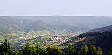
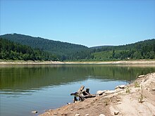
The core town of Forbach is located in the middle Murg Valley on the Murg . The station has the altitude mark 303 m above sea level. NN . The districts of Kirschbaumwasen ( 434 m above sea level ) and Raumünzach ( 392 m above sea level ) are located a little upstream, the places Gausbach ( 300 m above sea level ) and Langenbrand ( 270 m above sea level ) a little downstream. Erbersbronn ( 514 m above sea level ) and Hundsbach ( 714 m above sea level ) are located in side valleys above the core town in the south-west and Bermersbach ( 410 m above sea level ) above Forbach on a hill in the north-west. The places Herrenwies ( 761 m above sea level ) and Schwarzenbach are located on the Schwarzenbachtalsperre west of the core town.
The next larger cities are Gernsbach and Gaggenau , about 10 km and 14 km further north in the Murg Valley, and Baden-Baden in the northwest , about 12 km away. In the west, beyond the Black Forest main ridge and already in the Upper Rhine Plain, Bühl is about 17 km away, upstream in the south, Baiersbronn is about 20 km and the city of Freudenstadt is about 26 km away.
The northern part of the Black Forest National Park established in 2014 mainly belongs to the Forbach municipality.
mountains
The highest elevation Forbach is at 1054.1 m above sea level. NHN the Hohe Ochsenkopf , also the highest mountain in the Rastatt district. The Badener Höhe and the Mehliskopf are partly on the Forbach municipal area.
Community structure
The municipality of Forbach included the former municipalities of Bermersbach , Gausbach and Langenbrand with a total of 28 villages, hamlets, Zinken, farms and houses. The village of Bermersbach, the Gasthaus Rote Lache and the houses Wolfsheck belonged to the former community of Bermersbach . The Forbach community within the limits of June 30, 1974 included the village of Forbach, the hamlets of Erbersbronn, Hundsbach -Aschenplatz, Hundsbach-Viehläger, Kirschbaumwasen , the settlements of Herrenwies , Hundsbach-Biberach, Hundsbach-Mitte and Raumünzach , the Schindelbronn, Seebachhof and courtyards Trabronn and the Badener Höhe, Kaltenbach, St. Anton, Sasbach, Schneiderskopf and Tauchert houses. The village Gausbach and the houses Röhret belonged to the former community of Gausbach. The village of Langenbrand, the Breitwies ( Weisenbachfabrik ) and Wolfsheck settlements and the Langenbrand-Bermersbach railway station belonged to the former municipality of Langenbrand . In the municipality of Forbach in the area June 30, 1974, was deserted Glad wells. The Tauchert residential area was reclassified to Baiersbronn on January 1, 1977.
history
Until the 17th century
Forbach was first mentioned in 1360 in a will from Ebersteiner Heinrich II.
In 1387 Forbach was half Eberstein and half margrave. Count Wolfram sold to his uncle, Margrave Rudolf VII. For 8,000 guilders a. a. half of all its villages. From then on Forbach was half liable to Eberstein and half to Baden. In 1404, when the property was divided between Margrave Bernhard and Eberstein Count Bernhard and Wolf, the parish of Forbach was assigned to Margrave Bernhard.
In 1455, Margrave Karl sold his forests in the Birkenau to the Hartmannsbrunnen and the red water with fishing rights for 250 guilders to several citizens in Forbach, Gausbach and Bermersbach . Margrave Philipp confirmed the forest sale of 1455 in 1532 and demanded interest of 65 guilders for 50 years from the parishes of Forbach, Bermersbach and Gausbach.
In 1543 Forbach received a village order , which specified in a few dozen articles what was lawful and permitted and what was not permitted and what had to be done to protect against enemies and other dangers. In 1569, Count Philipp von Eberstein sold his forest property, including sawmills and rafting rights, to the Murgschifferschaft for 3500 guilders . In 1624 the Ebersteinerin Maria married the Count of Wolkenstein, who with Maria also got half of Forbach.
Incorporations
On July 1, 1974, Bermersbach , Gausbach and Langenbrand were incorporated .
Religions
From 1555 the religious conflict did not stop in Forbach; In the hundred years up to 1655, the Forbachers changed their denomination eight times . Finally, the Roman Catholic Church prevailed, to which most of the Forbachers still belong today. A Protestant church building was only built shortly before the First World War .
politics
Municipal council
After the local elections on May 26, 2019, the municipal council has 14 members - in addition to the mayor as chairman. The choice brought the following result:
- 4 seats / CDU
- 4 seats / FWG
- 4 seats / SPD
- 2 seats / GREEN
mayor
In March 2014, attorney Katrin Buhrke won the election with 64.75 percent of the vote, incumbent Kuno Kussmann, CDU (in office since 1998) was able to score 33.12 percent.
Town twinning
Forbach has had partnership relationships with the French community of Andilly since 1963 and also with the Italian community of Montemaggiore al Metauro since 2007 . On April 24th, 2008 the partnership certificate was signed in Italy.
coat of arms
A right-swept blue hatchet in silver with a black handle, accompanied at the top and bottom by two red roses with blue velvet. As a symbol of the community's abundance of wood, this coat of arms appeared for the first time in a seal engraved in 1722. In the escutcheon for sealing the homage protocol from 1811, the roses were missing as a reference to the rose symbol of the Eberstein house. Around 1850 the roses returned to the coat of arms. In 1901 the municipal council adopted the colors of the coat of arms.
Economy and Infrastructure
On the Draberg near Forbach is the transmitter Murgtal of the Südwestrundfunk.
traffic
Forbach has five stops on the Murg Valley Railway ( Rastatt - Freudenstadt ) in the Karlsruhe Transport Association . These are served by the lines S81 ( Karlsruhe - Freudenstadt ) and S8 ( Karlsruhe - Eutingen im Gäu (- Herrenberg )) of the Karlsruhe Stadtbahn .
The federal road 462 ( Rastatt - Rottweil ) connects the community with the national road network. The connection road to Baden-Baden leads over the Rote Lache .
Established businesses
The Rudolf-Fettweis-Werk , a hydropower plant owned by EnBW , is the last major employer in Forbach , along with the municipal administration and the Mittelbaden Forbach Clinic (formerly the district hospital). Originally part of E. Holtzmann & Cie. Wolfsheck paper mill, which belongs to the company, was closed in 2007.
education
Forbach has a primary school in the center of town. There are also two parish and one Roman Catholic kindergarten in town.
Culture and sights
The covered wooden bridge over the Murg was built in 1778–1779. It crosses the river with a span of 37.8 m without intermediate piers and is therefore flood-proof in contrast to its predecessor buildings. The first construction lasted until 1954, in the following year the bridge was rebuilt true to the original and renovated in 1976. It is passable by car.
The aqueduct over the Murg ( ▼ ) is the oldest preserved rammed concrete bridge in Germany . It led branched water above a Murgschleife to the power station of the former paper mill. The canal bridge was built in 1885 and has been a listed building since 1979.
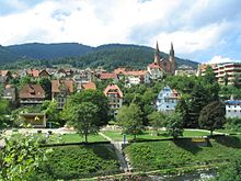
The Catholic parish church of St. John the Baptist towers over the Forbach town center with its two 50 m high towers on its double tower facade . The basilica was built between 1886 and 1891 in the neo-Romanesque style according to plans by the architect Adolf Williard .
The Westweg long-distance hiking trail runs through Forbach and leads past many sights.
Museums
The Murg Valley Museum , which deals with the living conditions of earlier generations in the region, is located in the festival hall (former school) in the Bermersbach district . The museum is run by the Heimatverein Bermersbach.
Personalities
- Günther Becker (1924–2007), composer
- Hans Wolfgang Kölmel (* 1944), neurologist
- Manfred Gotta (* 1947), entrepreneur and copywriter, lives in Forbach-Hundsbach
- Rüdiger Seidt (* 1965), sculptor
- Michael Brecht (* 1965), trade unionist
- Peter Maria Schnurr (* 1969), cook
- Matthias Fritz (* 1969), former professional soccer player
- Conny Mayer-Bonde (* 1972), university professor and politician (CDU), member of the German Bundestag
Individual evidence
- ↑ State Statistical Office Baden-Württemberg - Population by nationality and gender on December 31, 2018 (CSV file) ( help on this ).
- ↑ Map services of the Federal Agency for Nature Conservation ( information )
- ^ The state of Baden-Württemberg. Official description by district and municipality. Volume V: Karlsruhe District Kohlhammer, Stuttgart 1976, ISBN 3-17-002542-2 . Pp. 161-163
- ↑ Tauchert at LEO BW, accessed on October 20, 2014.
- ^ Federal Statistical Office (ed.): Historical municipality directory for the Federal Republic of Germany. Name, border and key number changes in municipalities, counties and administrative districts from May 27, 1970 to December 31, 1982 . W. Kohlhammer, Stuttgart / Mainz 1983, ISBN 3-17-003263-1 , p. 483 .
- ^ Federal Statistical Office (ed.): Historical municipality directory for the Federal Republic of Germany. Name, border and key number changes in municipalities, counties and administrative districts from May 27, 1970 to December 31, 1982 . W. Kohlhammer, Stuttgart / Mainz 1983, ISBN 3-17-003263-1 , p. 483 .
- ↑ Diethard Steinbrecher: History of timber construction using the example of timber bridge construction in America and Europe ; in: Wolfgang Rug (Hrsg.): Timber construction in the inventory - Historic wooden structures: Berlin, Vienna, Zurich 2018
- ^ "In the valley of the Murg" association: A wooden bridge over the Murg. ( Memento of the original from March 29, 2013 in the Internet Archive ) Info: The archive link was inserted automatically and has not yet been checked. Please check the original and archive link according to the instructions and then remove this notice. Retrieved May 21, 2013
- ^ Community Forbach: The wooden bridge to Forppach. Retrieved May 21, 2013
- ^ "In the valley of the Murg" association: churches in Forbach . ( Memento of the original from May 20, 2012 in the Internet Archive ) Info: The archive link was inserted automatically and has not yet been checked. Please check the original and archive link according to the instructions and then remove this notice. Retrieved May 21, 2013
- ^ Forbach parish: Churches and chapels in Forbach . Retrieved May 21, 2013


