
Jaun
| Jaun | |
|---|---|
 |
|
| State : |
|
| Canton : |
|
| District : | Gruyère |
| BFS no. : | 2138 |
| Postal code : | 1656 |
| Coordinates : | 587 443 / 162250 |
| Height : | 1015 m above sea level M. |
| Height range : | 887–2224 m above sea level M. |
| Area : | 55.21 km² |
| Residents: | 644 (December 31, 2018) |
| Population density : | 12 inhabitants per km² |
| Website: | www.jaun.ch |
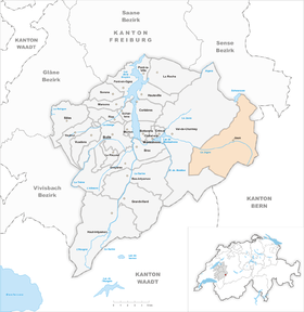
 Jaun |
|
| Location of the municipality | |
  |
|
Jaun (in the highest Alemannic local dialect Jùu [jʊu̯] , French : Bellegarde, Franco-Provencal : ) is a political municipality in the Gruyère district of the Swiss canton of Friborg . It is the only German-speaking municipality in the Gruyère district.
geography
Jaun is 1015 m above sea level. M. , 17 km east of the district capital Bulle (linear distance). The village extends in the upper Jauntal (French Vallée de la Jogne ) west of the Jaunpass , slightly elevated on the northern valley slope of the Jaunbach , in the Freiburg Alps between the Chörblispitz in the north and the Gastlosen in the south.
The area of the 55.2 km² municipal area covers a section of the Freiburg Alps on both sides of the Jauntal. The central part of the area is traversed by the Jaunbach (also called Jäunli in the upper reaches) from east to west. The valley mostly has a flat depression 200 to 500 m wide, only at the narrow point of Kappelboden do the slopes rise steeply on both sides of the stream. A karst spring rises in the village of Jaun , the water of which flows into the Jaunbach after a cascade . South of the Jaunbach, the area includes the valleys of the Sattelbach , the Kleiner Montbach and the eastern flank of the Ruisseau du Gros Mont with the Hochmatt mountain ( 2152 m above sea level ). The southern border runs over the Kalkgipfel of the Wandfluh ( 2133 m above sea level ), the Sattelspitzen ( 2123 m above sea level ) and the Gastlosen ( 1996 m above sea level ).
In the east, the municipality does not extend to the watershed on the Jaunpass ; the border runs along the western slope of the Bäderhorn . To the north of the Jauntal , the municipality extends to the ridge with Vanils des Raveires , Maischüpfenspitz (French: Vanil d'Arpille or Petit Brun , 2085 m above sea level ), Schopfenspitz (French: Gros Brun , 2104 m above sea level ), Chörblispitz ( 2102 m above sea level ) and Schafberg , on the 2223 m above sea level. M. the highest point of Jaun is reached. The Euschelspass ( 1567 m above sea level ) is located between Chörblispitz and Schafberg . A small portion of the community area lies north of this pass in the catchment area of the Schwarzsee . The eastern part of the Schwarzsee, some houses from Gypsera, the Riggisalp and the summit of the Kaiseregg to the east ( 2185 m above sea level ) belong to Jaun. In 1997, 2% of the municipal area was accounted for by settlements, 38% for forests and woodlands, 42% for agriculture and around 18% was unproductive land.
Jaun includes the hamlets Im Fang (French La Villette , 922 m above sea level ) at the confluence of the Kleiner Montbach in the Jaunbach, Zur Eich ( 943 m above sea level ) west of the village, Kappelboden ( 1020 m above sea level) . ), Oberbach ( 1025 m above sea level ) and Weibelsried ( 1050 m above sea level ) in the Jauntal east of the village as well as numerous individual farms and alpine huts. Neighboring communities of Jaun are Val-de-Charmey and Plaffeien in the canton of Friborg and Saanen and Boltigen in the canton of Bern .
Population and language
With 644 inhabitants (as of December 31, 2018), Jaun is one of the smaller communities in the canton of Friborg. 89.5% of the residents are German-speaking, 9.8% French-speaking and 0.3% speak Serbo-Croatian (as of 2000). Jaun is the only German-speaking village in the Gruyère district. The language border crosses the Jaun valley west of the hamlet Im Fang. The population of Jaun was 877 in 1880, and 825 in 1900. In the course of the 20th century, the population fluctuated between 750 and 850 for a long time, but fell significantly in the 1960s. The population has remained fairly stable since then.
The Alemannic Jaun dialect was documented in the early 20th century by Karl Stucki, who was then working as a Germanist for the Swiss Idiotikon , in his work The dialect of Jaun in the canton of Friborg - phonology and inflection .
Economy and tourism
Jaun was a predominantly agricultural village until the second half of the 20th century . A mill has been in operation near Jaun since the 16th century. When farming in the Jauntal was no longer profitable, it was given up in the 19th century. In the 19th century, coal and saltpeter were also mined in the municipality . From 1912 to 1932, car and motorcycle races were held in Jaun every year.
Even today, livestock and dairy farming play an important role in the livelihood structure of the population, and Gruyère made from raw milk with a protected designation of origin ( AOC ) can also be made in Jaun . Further jobs are available in local small businesses (wood processing) and in the service sector. The village is the location of a private power station that uses the hydropower of the karst river. Since Jaun developed into a holiday resort with summer and winter tourism in the 1960s, the industry has also been geared towards the needs of tourists. On the northern slope of the Gastlosen, three ski lifts and a 4-seater chairlift are in operation in winter, providing access to around 25 km of alpine ski slopes. The new toboggan run from Bärghus am Musersbergli next to the mountain station of the chairlift is one of the longest in the region at 6 km. In the summer months, extensive hikes can be undertaken on the surrounding alpine meadows and mountain peaks.
traffic
The community is very well developed in terms of traffic. It is located on the main road from Bulle over the Jaunpass to Boltigen . Because the street was often buried in avalanches in the past , it was partly relocated to a gallery. The village is connected to the public transport network by the Transports publics Fribourgeois bus routes , which run from Bulle to Boltigen and from Freiburg via La Roche to Jaun.
history

Some traces point to a settlement of the Jaun valley as early as the Mesolithic . The German name "Jaun" is mentioned for the first time in 1397 in the phrase die here from Youne ; it is traced back to a Celtic river name * Jagonia , which means "the cold one". The French name "Bellegarde" - "beautiful view" - is, however, a typical castle name (pomp name) of the Middle Ages; it was first mentioned in a document in 1228 in the old Franco-Provencal sound of Balavarda .
Since the upper Jauntal was settled from the Simmental in the 12th century , the village is now German-speaking. In the Middle Ages Jaun belonged to the dominion of Corbières , but became the seat of a branch line of the Lords of Corbières in 1249 when the rule was divided between three brothers. The previously existing Bellavuarda Castle was therefore expanded. In 1285 the rule of Corbières-Jaun came under the suzerainty of the Counts of Savoy . The castle was destroyed in 1407 by an incursion by troops from the Saanenland and the Simmental.
In 1475, Jaun signed a castle law contract with Freiburg. The rule, which at that time was under the protection of the county of Gruyères , passed to Freiburg in 1504. At the beginning of the 16th century, the branch line of the lords of Corbières-Jaun went out. From 1504 to 1798 Jaun was a canton of Friborg. The area around the Abländschen settlement was added to Bern in 1555. In a village fire in 1711 numerous houses were damaged. After the collapse of the Ancien Régime (1798), the village was initially provisional, and from 1848 on it became part of the Gruyères district. Until 1870, when the new road in the Jaunbach gorge above Broc was opened, Jaun was economically oriented more towards the Simmental than towards the Gruyère region. Since 1954, numerous avalanche barriers have been installed on the southern slopes of Schopfenspitz and Chörblispitz. In the past, avalanches often reached the valley floor and destroyed houses on various occasions.
The municipality has been part of the Parc naturel régional Gruyère Pays-d'Enhaut since 2020 .
Attractions


The village of Jaun has two churches. The older church originally dates from the 11th and 12th centuries, was later rebuilt and expanded several times, the current nave dates from 1808 to 1811. Since 1910, this church is no longer used as a house of worship, but serves as a "Cantorama" (house of singing) with a concert hall. The organ, built by Johann Dreher in 1786, was restored and re-inaugurated in 2011.
The new St. Stephan church above the main street was consecrated in 1910. Also noteworthy is the cemetery , which is characterized by a large number of hand-carved crosses with the figure of Christ. In the hamlet of Im Fang is the church of St. Joseph from 1870. There are several chapels in the various districts, namely the Antonius Chapel in Kappelboden, the Marienkapelle in Weibelsried and two other chapels in Im Fang.
In the town center there are numerous characteristic houses from the 17th to 19th centuries, which are similar in style to the Simmental farmhouses. The governor's house dates from 1782.
The ruins of Bellegarde Castle , which was destroyed in 1407, stand on the southern slope on a ledge above the Kappelboden narrow point .

The Jaun waterfall flows directly out of the rock, with no visible inflow. It is believed that the water from this karst spring comes from the Gros Mont region. The brook that sprang from there overcomes a cascade and flows into the Jaunbach after a few meters . Divers have advanced into the cave to a depth of approx. 300 m. The special thing about the underground inlet is that the water flows upwards from the depths. The divers dived down to 80 m. The strong current has prevented any progress so far.
Sports
Jaun is the start and finish point of the annual Trophée des Gastlosen , a popular and competitive race in the field of ski mountaineering .
Sons and daughters of the church
- Marius Cottier (1937–2019), politician and State Councilor of the Canton of Friborg
- Anton Cottier (1943–2006), politician (CVP)
literature
- Moritz Boschung (Ed.): Jaun in the Gruyère region. Deutschfreiburger Heimatverein, Freiburg im Üechtland 1988.
- Jean-François Steiert : Jaun. In: Historical Lexicon of Switzerland .
Web links
- Official website of the municipality of Jaun
- Cantorama - Ancienne Eglise. Jaun. Old church
- Jaun - Vues aeriennes. In: swisscastles.ch. August 1, 2011.
- Michelle Feer: Is Jaundeutsch the fifth national language in Switzerland? (Video, 3:42 minutes) In: Neue Zürcher Zeitung . 5th October 2017 .
- Jan Bräuer: 660 inhabitants but own dialect: Jaun in Switzerland. (mp3 audio, 3.6 MB, 4:07 minutes) In: SWR2 broadcast “Impulse”. April 26, 2019 .
Individual evidence
- ↑ Permanent and non-permanent resident population by year, canton, district, municipality, population type and gender (permanent resident population). In: bfs. admin.ch . Federal Statistical Office (FSO), August 31, 2019, accessed on December 22, 2019 .
- ^ Linguistic Atlas of German-speaking Switzerland , Volume V 1b.
- ↑ Andrea Kucera: Dying languages: The miracle of Jaun. In: Neue Zürcher Zeitung . August 16, 2017. Retrieved April 26, 2019 .
- ^ Karl Stucki : The dialect of Jaun in the canton of Friborg: phonology and inflection. (pdf, 130 MB) In: (= contributions to Swiss German grammar X). Huber & Co., Frauenfeld, 1917, accessed April 26, 2019 .
- ↑ Lexicon of Swiss municipality names . Edited by the Center de Dialectologie at the University of Neuchâtel under the direction of Andres Kristol. Frauenfeld / Lausanne 2005, p. 468.
-
^ Old church Jaun against with organ. In: Radio DRS . October 8, 2011, archived from the original on August 2, 2012 ; accessed on April 26, 2019 . François Seydoux: On the history and restoration / reconstruction of the organ by Johann Dreher from 1786 in the old church Jaun (Cantorama). In: cantorama.ch. March 19, 2012, accessed April 26, 2019 .
Bas-Intyamon | Botterens | Broc | Bull | Châtel-sur-Montsalvens | Corbières | Crésuz | Echarlens | Grandvillard | Gruyères | Hauteville | Haut-Intyamon | Jaun | La Roche | Le Pâquier | Marsens | Morlon | Pont-en-Ogoz | Pont-la-Ville | Riaz | Sâles | Sorens | Val-de-Charmey | Vaulruz | Vuadens
Former municipalities: Albeuve | Avry-devant-Pont | Cerniat | Charmey | Enney | Estavannens | Gumefens | La Tour-de-Trême | Le Bry | Lessoc | Maules | Montbovon | Neirivue | Romance | Rueyres-Treyfayes | Villarbeney | Villars-d'Avry | Villars-sous-Mont | Villarvolard | Vuippens
Canton of Friborg | Districts of the canton of Friborg | Municipalities of the canton of Friborg