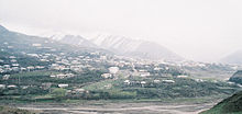
Kurach
Village
|
||||||||||||||||||||||||||
|
||||||||||||||||||||||||||
|
||||||||||||||||||||||||||
Kurach ( Russian Курах , Lezgian Кьурагь ) is a village (selo) in the Republic of Dagestan in Russia with 3235 inhabitants (as of October 14, 2010).
geography
The place is a good 150 km as the crow flies south-southeast of the republic capital Makhachkala in the eastern part of the Greater Caucasus . It is mainly located on the left bank of the Kurach of the same name in the Samur river system .
Kurach is the administrative center of the Kurachsky Rajon and the seat of the rural community (selskoje posselenije) Kurachski selsowet, which also includes the village of Chjurechjur, located just under 5 km southwest in the neighboring valley. The place is almost exclusively inhabited by Lesgiern .
history
The village, known since the Middle Ages, became the center of a de facto independent village community in 1356. In the following centuries it was destroyed several times during incursions by Ottoman , Persian (under Nadir Shah ) and Shirvan troops. At the end of the 18th century, the area became part of the Kasikumuch Khanate with its headquarters in Kumuch , which is just under 100 km northwest , before it became de jure again in 1812 as the Kjuri Khanate with its capital in Kurach, protected by the Russian Empire .
After the official annexation of the area to the Russian Empire as a result of the Caucasus War in 1864, Kurach came to the Kjurinski Okrug (with its seat in Kassumkent ) of the Dagestan Oblast formed in 1861 and became one of the five (later six) administrative sections within this seat. As part of the administrative reorganization of the Dagestani ASSR , which was founded in 1921 , the section was transformed into a canton of the same name on November 22, 1928, and into a Rajon on June 3, 1929.
Population development
| year | Residents |
|---|---|
| 1897 | 1677 |
| 1939 | 2599 |
| 1959 | 2366 |
| 1970 | 3089 |
| 1979 | 3083 |
| 1989 | 2607 |
| 2002 | 3142 |
| 2010 | 3235 |
Note: census data
traffic
Kurach is the end of the regional road 82K-019, which branches off from 82K-009 in the neighboring district of Kassumkent to the northeast. This provides a connection to the federal highway R217 Kawkas (formerly M29, also part of the European route 119 ) to the Azerbaijani border and to the nearest train station Beliji , 60 km as the crow flies in a north-easterly direction on the Rostov-on-Don - Makhachkala - Baku route .
Web links
Individual evidence
- ↑ a b Itogi Vserossijskoj perepisi naselenija 2010 goda. Tom 1. Čislennostʹ i razmeščenie naselenija (Results of the All-Russian Census 2010. Volume 1. Number and distribution of the population). Tables 5 , pp. 12-209; 11 , pp. 312–979 (download from the website of the Federal Service for State Statistics of the Russian Federation)


