
Le Mesnil-Adelée
| Le Mesnil-Adelée | ||
|---|---|---|
.svg)
|
|
|
| region | Normandy | |
| Department | Some | |
| Arrondissement | Avranches | |
| Canton | Isigny-le-Buat | |
| Community association | Communauté d'agglomération Mont-Saint-Michel-Normandie | |
| Coordinates | 48 ° 42 ′ N , 1 ° 4 ′ W | |
| height | 47-231 m | |
| surface | 6.82 km 2 | |
| Residents | 169 (January 1, 2017) | |
| Population density | 25 inhabitants / km 2 | |
| Post Code | 50520 | |
| INSEE code | 50300 | |

Le Mesnil-Adelée is a French municipality with 169 inhabitants (as of January 1 2017) in the department of Manche in the region of Normandy . It belongs to the Arrondissement of Avranches and the canton of Isigny-le-Buat .
In the north-west it borders on Cuves (point of contact), in the north on Le Mesnil-Gilbert , in the north-east on Juvigny les Vallées with Chérencé-le-Roussel , in the east on Le Mesnil-Tove , in the south on Juvigny-les-Vallées with Juvigny- le-Tertre , to the southwest by Reffuveille and to the west by Les Cresnays .
Population development
| year | 1962 | 1968 | 1975 | 1982 | 1990 | 1999 | 2008 | 2015 |
|---|---|---|---|---|---|---|---|---|
| Residents | 334 | 277 | 234 | 194 | 151 | 167 | 191 | 170 |
Attractions
- War memorial
- Saint-Blaise church from the 19th century
- former church

Saint Blaise Church and War Memorial
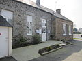
Mairie from Le Mesnil-Adelée


Web links
Commons : Le Mesnil-Adelée - collection of images, videos and audio files