List of architectural monuments in Königswinter
The list of architectural monuments in Königswinter contains the listed buildings in the area of the city of Königswinter in the Rhein-Sieg district in North Rhine-Westphalia (as of December 2015). These architectural monuments are registered in the monuments list of the city of Königswinter; The basis for the admission is the Monument Protection Act North Rhine-Westphalia (DSchG NRW).
| image | designation | location | description | construction time | Registered since |
Monument number |
|---|---|---|---|---|---|---|
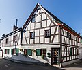
|
Half-timbered house | Oberdollendorf, Alte Winkelgasse 17 map |
Second half of the 18th century | December 27, 1984 | A 1
|
|
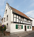 more pictures |
Half-timbered residential building | Koenigswinter, Altenberger Gasse 14 map |
Birth house of the painter Franz Ittenbach | Late 17th century, 19th century (stepped gable) | December 27, 1984 | A 2
|
 more pictures |
Bailey of Drachenburg Castle | Koenigswinter, Drachenfelsstrasse map |
1882-1884 | December 27, 1984 | A 3
|
|
 more pictures |
District Court , courthouse only | Koenigswinter, Drachenfelsstrasse 39 map |
Architect: Franz Bachem | 1889 | February 11, 1985 | A 4
|
|
more pictures |
War memorial from 1813 | Koenigswinter, Drachenfels map |
Replica of the obelisk by Adolf von Vagedes (1814); in memory of the Landsturm in the Siebengebirge of 1813 in the Wars of Liberation | May 2, 1914 (unveiled) | February 11, 1985 | A 5
|
 more pictures |
Drachenfels castle ruins | Koenigswinter, Drachenfels map |
1138-1149 | February 11, 1985 | A 6
|
|
| 1. Cloister building, 2. Propsteig building, courtyard closure and gate | Oberpleis, Siegburger Strasse 5a, 7–9 | Mid-12th century (west wing of the cloister), 1645 (Propsteig building); 18th century (expansion of the provost house, construction of the farmyard, residential house, stables and barn) | February 11, 1985 | A 7
|
||
 more pictures |
Forest service farmstead Stöckerhof | Ittenbach, Zum Stöckerhof 23a map |
State forest ranger of the Siegburg Forestry Office (since 1820); Open three-wing system: service building (1850), built according to the Prussian type ground plan, additional storey in 1899 | 18th century (outbuilding), 1850, 1899 | March 25, 1985 | A 8
|
 more pictures |
Former villa, temporary police building | Koenigswinter, Hauptstrasse 509 map |
Around 1892 | March 25, 1985 | A 9
|
|
 more pictures |
Main building and park of the Frankenforst research estate | Stieldorf-Vinxel, Frankenforster Weg map |
First mentioned in 1475, sold to Heisterbach Abbey in 1733, since 1930 animal research institute at the University of Bonn ; The core of the mansion is a late Classicist villa from 1872, remodeled in 1906 | 1872, 1906 | April 25, 1985 | A 10
|
 more pictures |
Half-timbered residential building | Koenigswinter, Bungertstrasse 21 map |
1718 | May 20, 1985 | A 11
|
|
 more pictures |
Half-timbered house | Koenigswinter, Drachenfelsstrasse 2 map |
18th century, mid 19th century | May 20, 1985 | A 12
|
|
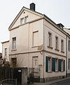
|
Residential building with a classical gable design | Koenigswinter, Grabenstrasse 29 map |
1880s | May 20, 1985 | A 13
|
|
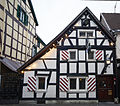 more pictures |
Half-timbered building "Im Tubak" | Koenigswinter, Hauptstrasse 390 map |
originally a post office in Königswinter in a former winery, later a restaurant ("Russian court"); Rear hall extension from the 1920s | 1693 | May 28, 1985 | A 14
|

|
Residential and commercial buildings | Koenigswinter, Hauptstrasse 394 map |
18th century, 19th century | May 28, 1985 | A 15
|
|

|
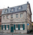
Half-timbered building | Koenigswinter, Hauptstrasse 419 map |
1678 and later | May 31, 1985 | A 16
|
|
 more pictures |
House with ashlar facade (Rebstock house) | Koenigswinter, Hauptstrasse 449 map |
former winery; Facade in latit from the Wolkenburg | 1757, 1780, around 1840 | May 31, 1985 | A 17
|
 more pictures |
Former hotel "Kölner Hof" | Koenigswinter, Rheinallee 5 map |
1835, 1912-1913 | May 31, 1985 | A 18
|
|
 more pictures |
Former hotel "Immenhof" | Koenigswinter, Rheinallee 6 map |
Architect: Carl Bachem | 1850–1851, 1920s | May 31, 1985 | A 19
|
 more pictures |
Former Rheinhotel Düsseldorfer Hof , formerly "Heisterbacher Hof" | Koenigswinter, Rheinallee 14 map |
1764-1767, 1892-1898 | June 4th 1985 | A 20
|
|
 more pictures |
Petersberg hotel complex | Koenigswinter, Petersberg map |
Listed monument: silhouette of the hotel, park; Architect: Heinrich Müller-Erkelenz (1912–1914) | 1888-1891; 1912–1914 (conversion / extension); 1985–1990 (new building) | June 13, 1985 | A 21
|
 more pictures |
Former Benedictine priory | Oberpleis, Siegburger Strasse / Herresbacher Strasse map |
Mid-12th century (west wing of the cloister), 1645 (Propsteig building); 18th century (expansion of the provost house, construction of the farmyard, residential house, stables and barn) | June 14, 1985 | A 22
|
|
 more pictures |
Half-timbered residential building | Niederdollendorf, Rheinstrasse 7 map |
17th or 18th century | June 14, 1985 | A 23
|
|
 more pictures |
Half-timbered residential building | Niederdollendorf, Rheinstrasse 16 map |
Mid 18th century | June 14, 1985 | A 24
|
|

|
Half-timbered building | Niederdollendorf, Hauptstrasse 108 map |
former winery | 1766 | August 1, 1985 | A 25
|
 more pictures |
Half-timbered house | Oberdollendorf, Bachstrasse 151 map |
Late 18th century | September 6, 1985 | A 26
|
|

|
Landscape park below the Drachenburg | Koenigswinter, Drachenburg map |
1879 | 5th August 1985 | A 27
|
|
 more pictures |
Half-timbered house with outbuildings | Oberdollendorf, Bergstrasse 18 map |
1664 | August 14, 1985 | A 28
|
|
 more pictures |
Tower courtyard | Oberdollendorf, Turmstrasse 4 map |
1582, 1649 | August 29, 1985 | A 29
|
|
 more pictures |
Half-timbered house | Oberdollendorf, Alte Winkelgasse 8 map |
1673; 18th century | August 29, 1985 | A 30
|
|
 more pictures |
Myriameter stone | Niederdollendorf, bank of the Rhine river km 647.47 | Sandstone cuboid on a newer concrete base | 1867 | 4th September 1985 | A 31
|
 more pictures |
Half-timbered yard | Eudenbach-Rostingen, Holzweg 12 map |
Late 18th century | September 18, 1985 | A 32
|
|
 more pictures |
Half-timbered residential building | Oberdollendorf, Alte Winkelgasse 3 map |
Early 19th century | September 18, 1985 | A 33
|
|
 more pictures |
Former Cistercian Abbey of Heisterbach Monastery | Oberdollendorf-Heisterbach, Heisterbacher Strasse map |
1202–1237, 18th century and later | October 14, 1985 | A 34
|
|
 more pictures |
House Niederbach | Oberpleis, Niederbach 18 map |
Manor house with former moats and zone of the former farm buildings | 1742 | October 14, 1985 | A 35
|
 more pictures |
Protestant church | Oberpleis, Ittenbacher Strasse 35 map |
Architect: Otto Bartning | 1949 | October 14, 1985 | A 36
|
 more pictures |
Wayside cross | Oberpleis, Ittenbacher Strasse / Dollendorfer Strasse Map |
Trachyte votive cross | 1750 | October 14, 1985 | A 37
|
 more pictures |
House of new luck | Oberpleis-Bennerscheid, Neuglückstraße 37 map |
First half of the 19th century, after 1870 and later | October 14, 1985 | A 38
|
|
 more pictures |
Half-timbered yard | Thomasberg-Bellinghauserhohn, Auelweg 21 Map |
Around 1840 | October 15, 1985 | A 39
|
|

|
Lady Chapel | Heisterbacherrott-Thomasberg, Steinringer Strasse / Im Harperoth map |
Chapel made of quarry stone blocks, on the First grave cross (placed in the 1980s) | 1859 | October 15, 1985 | A 40
|
 more pictures |
Half-timbered chapel | Oberpleis-Wahlfeld, Lützer Weg map |
1885 | October 18, 1985 | A 41
|
|

|
Former "Gut Elsfeld " | Oberpleis-Elsfeld, Elsfeld 1 map |
Mid 19th century | October 23, 1985 | A 42
|
|
 more pictures |
Wayside cross | Map of Oberpleis-Berghausen, Goldbergweg / Berghausener Strasse |
Oak mission cross | 1734 | October 15, 1985 | A 43
|
 more pictures |
Half-timbered house | Stieldorf, Alte Poststrasse 15 map |
18th century | October 22, 1985 | A 44
|
|
 more pictures |
Wayside cross | Römlinghoven, where a forest path joins Flurgasse at the Malteserhof map |
so-called "deer foot cross"; Trachyte votive cross, encircled by a modern concrete wall since 1969 | 1803 | October 22, 1985 | A 45
|
 more pictures |
Art Nouveau facade on residential building | Oberdollendorf, Heisterbacher Strasse 130 map |
1907/08 | October 22, 1985 | A 46
|
|
 more pictures |
So-called "Longenburg Cross" | Niederdollendorf, Friedenstrasse map |
high cross made of trachyte, relief cartouche with alliance coat of arms of the then owners of the Longenburg ; until 1983 on Bergstrasse opposite the former Longenburg | Around 1767 | November 29, 1985 | A 47
|

|
Former hotel "Hof von Holland" | Koenigswinter, Hauptstrasse 435 map |
1695, 1901 | October 22, 1985 | A 48
|
|
 more pictures |
Former Villa Braubach | Koenigswinter, Friedrichsallee 15 map |
Architects: Stein und Happ | Around 1905/1906 | January 13, 1986 | A 49
|
 more pictures |
Evangelical Christ Church | Koenigswinter, Grabenstrasse 10 map |
Architect: Christian Heyden | 1863/1864 | January 13, 1986 | A 50
|
 more pictures |
Castle "Drachenburg | Koenigswinter, Drachenfelsstrasse map |
Architects: Bernhard Tüshaus , Leo von Abbema , Wilhelm Hoffmann | 1882-1884 | January 13, 1986 | A 51
|
 more pictures |
Mausoleum at the former " Haus Heisterberg " | Niederdollendorf, Jugendhof Rhineland map |
After 1870 | January 13, 1986 | A 52
|
|
 more pictures |
Bachem House | Koenigswinter, Drachenfelsstrasse 4 map |
Architect: Theodor Bachem | 1825 | September 22, 1986 | A 53
|
 more pictures |
Former old school | Oberdollendorf, Rennenbergstrasse 3 map |
1847 | October 16, 1986 | A 54
|
|
|
|
Two-storey residential building | Oberdollendorf, Heisterbacher Strasse 56 map |
1893 | February 25, 1987 | A 55
|
|

|
Half-timbered house | Stieldorf-Niederscheuren, Niederscheuren 18a map |
preserved house of a former courtyard in frame construction ; Renewed windows, concrete clad bases | Around 1800 | March 23, 1987 | A 56
|
 more pictures |
" House Felseck " | Königswinter, Am Domstein 9 map |
1899 | March 23, 1987 | A 57
|
|

|
Half-timbered building with clinker infill | Koenigswinter, Grabenstrasse 57 map |
1880s | March 23, 1987 | A 58
|
|
 more pictures |
Half-timbered residential building | Oberdollendorf, Heisterbacher Strasse 113 map |
Second half of the 18th century | March 23, 1987 | A 59
|
|
 more pictures |
Half-timbered yard | Römlinghoven, Malteserstraße 65 map |
17th century, 1739, 19th century | March 23, 1987 | A 60
|
|
 more pictures |
" Malteserhof " | Römlinghoven, Malteserstraße 52 map |
Mid 19th century and later | March 23, 1987 | A 61
|
|
 more pictures |
Fronhof " House of Silesia " | Heisterbacherrott, Dollendorfer Strasse 412 map |
1822, 1922 and later | April 6, 1987 | A 62
|
|
 more pictures |
" Nibelungen Hall " | Koenigswinter, Drachenfelsstrasse 107 map |
Architects: Hans Meier, Werner Behrendt | 1913 | June 10, 1987 | A 63
|
 more pictures |
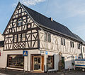
Former old vicarie | Stieldorf, Am Forstkreuz 27 Map |
1725 | June 10, 1987 | A 64
|
|
 more pictures |
Former courtyard, two-storey corner house | Niederdollendorf, Hauptstrasse 112 map |
former winery; on the wall of the house made of trachyte cross from 1750 | 1749 | July 9, 1987 | A 65
|
 more pictures |
Former winery | Oberdollendorf, Heisterbacher Strasse 128 map |
Mid 17th century, 1775 | July 15, 1988 | A 66
|
|
 more pictures |
Former hotel "Westfalenhof" | Koenigswinter, Drachenfelsstrasse 30 map |
1897 | July 26, 1988 | A 67
|
|
 more pictures |
Two-storey half-timbered building | Koenigswinter, Altenberger Gasse 2 map |
1762 | August 1, 1988 | A 68
|
|

|
Gable-independent half-timbered building | Koenigswinter, Hauptstraße 344 / Karolinenstraße map |
End of the 18th century, second half of the 19th century | August 1, 1988 | A 69
|
|
 more pictures |
Two-storey plastered building with a classical facade | Koenigswinter, Hauptstrasse 378/380 map |
1717, 1730 | July 26, 1988 | A 70
|
|
 more pictures |
Two-storey half-timbered building with angled annex "Hotel Wenzel" to the rear | Koenigswinter, Hauptstrasse 457 map |
18./19. Century, 1920s | August 1, 1988 | A 72
|
|
 more pictures |
Adam-Stegerwald-Haus , former "Villa Bartels" | Koenigswinter, Hauptstrasse 487 map |
Architects: Ottomar Stein (1901), HJ Schröder (1927/28) | 1901 and later, 1927/28 | July 26, 1988 | A 73
|
 more pictures |
Two-storey villa on a high basement | Koenigswinter, Rheinallee 18 map |
1886 | August 1, 1988 | A 74
|
|

|
Two-storey Rhine villa | Koenigswinter, Rheinallee 18a map |
Around 1900 | August 1, 1988 | A 75
|
|
 more pictures |
Cemetery and cemetery chapel | Königswinter, Am Palastweiher card |
1810 ff .; Early 20th century (cemetery chapel) | August 1, 1988 | A 76
|
|
 more pictures |
Catholic Church of St. Remigius | Koenigswinter, Hauptstrasse 410 map |
Architect: Johann Georg Leydel | 1779/80 | July 26, 1988 | A 77
|
 more pictures |
Chapel of the Visitation | Stieldorf-Vinxel, Holtorfer- / Vinxeler Straße map |
Plastered quarry stone building with a three-sided apse | 1758, 1945 | August 1, 1988 | A 78
|
 more pictures |
Wayside cross | Stieldorf-Vinxel, in the chapel of the Visitation Card |
Cast iron memorial cross | August 1, 1988 | A 79
|
|
 more pictures |
Romanesque chapel “St. Nicholas" | Heisterbacherrott, Dollendorfer Strasse map |
Second half of the 12th century, 1676 | August 1, 1988 | A 80
|
|

|
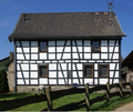
Oven built into half-timbered shed | Heisterbacherrott-Thomasberg, Steinringer Straße 13 / Im Harperoth map |
made of tuff stones from the oven piles | Late 19th century | August 1, 1988 | A 81
|
 more pictures |
Half-timbered yard | Eudenbach-Gratzfeld, Schwirzpohler Strasse 26 Map |
1838 | July 26, 1988 | A 82
|
|
 more pictures |
Half-timbered residential building | Oberpleis-Nonnenberg, Nonnenberger Strasse 118 map |
Around 1800 | August 1, 1988 | A 83
|
|
 more pictures |
Two-storey quarry stone building, former old rectory | Ittenbach, Kirchstrasse 32 map |
1880 | July 26, 1988 | A 84
|
|
 more pictures |
Catholic parish church of St. Margareta | Stieldorf, An der Passionshalle map |
Architect: EF Zwirner (1850) | Late 12th century, 1850 | July 26, 1988 | A 85
|
 more pictures |
Half-timbered courtyard (Hof Ahlefeld) | Eudenbach-Gratzfeld, Gratzfelder Strasse 25 map |
1668 and later | March 17, 1989 | A 86
|
|
 more pictures |
Catholic Parish Church of St. Jude Thaddaeus | Heisterbacherrott, Dollendorfer Strasse 395 map |
Design: Franz Schmitz , Execution: Theodor Roß , Kante (1891) | 1891, 1965 (expansion) | June 9, 1989 | A 87
|
 more pictures |
Catholic parish church of St. Pankratius | Oberpleis, Siegburger Strasse map |
1110–1160 (church with crypt and west tower); around 1220 the choir and transept were rebuilt and the nave was vaulted; the north nave was redesigned in the 15th century; since 1805 parish church in place of the old parish church that was abandoned around 1820; 1891–1894 repairs by H. Wiethase; 1948–1952 repair of war damage by K. Brand | September 20, 1989 | A 88
|
|

|
Wet Memorial | Ittenbach-Margarethenhöhe, In der Gierscheids Wiese map |
1901 | September 20, 1989 | A 89
|
|
 more pictures |
Gut Wintermühlenhof | Königswinter, Ferdinand-Mülhens-Straße map |
Architects: Gerhard Franz Langenberg (1886/87), Ottomar Stein (1905–11) | After 1402 | September 21, 1989 | A 90
|
 more pictures |
Two-winged small courtyard " Pottscheid " | Koenigswinter, Pottscheid map |
Late 19th century; 1923 | September 21, 1989 | A 91
|
|
 more pictures |
" Tomberger Hof " | Koenigswinter, Tomberger Strasse 4 Map |
Medieval; 18th century | 3rd October 1989 | A 92
|
|
 more pictures |
grotto | Römlinghoven, Malteserstrasse map |
1884 | September 25, 1989 | A 93
|
|
 more pictures |
Two-storey half-timbered construction | Oberdollendorf, Bachstrasse 100 map |
19th century | September 25, 1989 | A 94
|
|
 more pictures |
Two-storey half-timbered angle building | Niederdollendorf, Godesberger Strasse 2 map |
1605 and later | September 22, 1989 | A 95
|
|
 more pictures |
Former rectory | Niederdollendorf, Hauptstrasse 89 map |
18th century | September 26, 1989 | A 96
|
|
 more pictures |
Wayside cross | Niederdollendorf, Hauptstrasse 91 map |
Trachyte votive cross | 1876 | September 26, 1989 | A 97
|
 more pictures |
Catholic Parish Church of St. Michael | Niederdollendorf, Hauptstrasse 103 map |
Architect: Theodor Roß (1911) | Late Romanesque (choir tower); 1911 (nave) | September 27, 1989 | A 98
|

|
Two-storey half-timbered corner courtyard | Niederdollendorf, Hauptstrasse 106 map |
Rest of the historical half-timbered buildings in the town center | Second half of the 18th century | September 27, 1989 | A 99
|
 more pictures |
Two-storey half-timbered building, Gasthaus zur Krone | Niederdollendorf, Hauptstrasse 110 map |
1667 | September 27, 1989 | A 100
|
|

|
Two-storey and five-axis restaurant and hall building | Niederdollendorf, Hauptstrasse 113/115 map |
19th century | November 13, 1989 | A 101
|
|
 more pictures |
Wayside cross | Niederdollendorf, Longenburger Strasse / Hauptstrasse map |
Trachyte cross, set into a niche in the wall of the building at 127 Hauptstrasse | 1734 | November 13, 1989 | A 102
|
 more pictures |
Bredershof | Niederdollendorf, Hauptstrasse 128 map |
17th century and later | 3rd October 1989 | A 103
|
|
 more pictures |
Former Villa Peterstal | Niederdollendorf, Hauptstrasse 149/151 map |
1880 | 4th October 1989 | A 104
|
|
 more pictures |
Wayside cross | Niederdollendorf, Hauptstrasse 156 map |
Stone cross | 18th century | 5th October 1989 | A 105
|
 more pictures |
Two-storey, elongated country villa | Niederdollendorf, Hauptstrasse 164 map |
Second half of the 19th century | 5th October 1989 | A 106
|
|
 more pictures |
Two-storey late classicist villa | Niederdollendorf, Hauptstrasse 188–190 map |
Second half of the 19th century and the beginning of the 20th century | 5th October 1989 | A 107
|
|

|
Trachyte memorial cross | Niederdollendorf, Petersbergstrasse (in front of the Catholic kindergarten) map |
1826 | 5th October 1989 | A 108
|
|
| Wayside cross | Niederdollendorf, Petersbergstrasse | Trachyte cross | 1676 | 5th October 1989 | A 109
|
|
 more pictures |
Former Rhineland Youth Farm | Niederdollendorf, Jugendhof Rhineland map |
Architects: Edwin Oppler , Ferdinand Schorbach (1871/72) | 1871/72 (Heisterberg House); 18th century (monument); 1825 (wayside cross); after 1870 (rose garden); Extensions and conversions in the 1920s; Early 20th century (garden pavilion); 1957 remnants of the manor house demolished; from 1958 Jugendhof Rheinland (until 2004) | 4th October 1989 | A 110
|
 more pictures |
Former Rhineland Youth Farm : observation tower | Niederdollendorf, Jugendhof Rhineland map |
Round tower made of basalt | 1871 | 4th October 1989 | A 110
|
 more pictures |
Two-storey half-timbered construction | Niederdollendorf, Rheinstrasse 5 map |
18th century | October 16, 1989 | A 111
|
|
 more pictures |
Two-storey half-timbered building, early 18th century | Niederdollendorf, Rheinstrasse 6 map |
18th century | October 16, 1989 | A 112
|
|
 more pictures |
War memorial and wayside cross | Ittenbach-Hüscheid, Hüscheider Weg map |
Trachyte votive cross and two stone blocks with the names of the fallen | 1886, 20th century | October 10, 1989 | A 115
|
 more pictures |
Second school building in Ittenbach | Ittenbach, Kirchstrasse 9 map |
Quarry stone construction from trachyte blocks | 1885 | October 10, 1989 | A 116
|
 more pictures |
St. Luke pilgrim home | Ittenbach, Kirchstrasse 13 map |
Quarry stone construction from trachyte blocks; Converted into a pilgrimage home in 1950 | Mid 19th century, early 20th century | October 10, 1989 | A 117
|
 more pictures |
Catholic parish church "To the Sorrowful Mother" | Ittenbach, Kirchstrasse 19 map |
1833–1839, 1894, 1969/70 expanded | October 13, 1989 | A 118
|
|
 more pictures |
Wayside cross | Ittenbach, Koenigswinterer Strasse 348 map |
Trachyte votive cross | 1745 | January 30, 1990 | A 119
|
 more pictures |
Former half-timbered courtyard | Ittenbach, Koenigswinterer Strasse 356 map |
1820 | October 13, 1989 | A 120
|
|
 more pictures |
Hotel "Villa Käthe" | Ittenbach, Koenigswinterer Strasse 371 map |
Half-timbered building on a trachyte base with a terrace extension | Around 1905 | October 13, 1989 | A 121
|
 more pictures |
Margarethenhof | Ittenbach-Margarethenhöhe, Koenigswinterer Strasse 407 / Löwenburger Strasse map |
Architect: Franz Bachem | 1894, 1928 | October 16, 1989 | A 122
|
 more pictures |
Former courtyard with an elongated stable house | Ittenbach, Lahrring 31 map |
Second half of the 18th century, 19th century, 1933 | October 26, 1989 | A 123
|
|
| Wayside cross | Ittenbach-Margarethenhöhe, Lahrring | 1826 | October 26, 1989 | A 124
|
||
 more pictures |
Two-storey brick building | Ittenbach-Margarethenhöhe, Lahrring 11 map |
1880 | October 26, 1989 | A 125
|
|
 more pictures |
Revierförsterei VVF - Forsthaus Lohrberg | Ittenbach-Margarethenhöhe, Löwenburger Strasse 2 map |
1907 | October 26, 1989 | A 126
|
|

|
"Aacherhof", a former courtyard complex with a two-storey residential building made of Drachenfelstrachyt | Ittenbach, Zum Stöckerhof 19 map |
Mid-19th century, around 1900 | November 13, 1989 | A 127a
|
|
| "Aacherhof", a former courtyard complex with a two-storey residential building made of Drachenfelstrachyt | Ittenbach, Zum Stöckerhof 19 map |
Mid-19th century, around 1900 | November 13, 1989 | A 127b
|
||
| Former courtyard with a two-storey house made of Drachenfelstrachyte | Ittenbach, Zum Stöckerhof 20 | 1900 | November 13, 1989 | A 127c
|
||
 more pictures |
Pilgrimage chapel on the Petersberg and the so-called " Petersberger Bittweg " with stations 6–12 | Koenigswinter, Petersberg map |
1763-1764 | March 12, 1990 | A 128
|
|

|
Two-storey half-timbered building | Koenigswinter, Altenberger Gasse 1 map |
Mid 18th century | February 26, 1991 | A 129
|
|
 more pictures |
Two-storey baroque half-timbered building | Koenigswinter, Hauptstrasse 451 map |
Facade in stone made of latite from the Wolkenburg ; formerly the hotel "Zum Goldenen Stern" | 1729 | January 22, 1991 | A 130
|
 more pictures |
Two-storey, late classicist plastered half-timbered building | Koenigswinter, Hauptstrasse 473 map |
Second half of the 19th century | May 15, 1991 | A 131
|
|

|
Two-storey half-timbered building | Königswinter, Hermannshof 3 map |
1720 | January 16, 1991 | A 132
|
|
| Vaulted cellar of the former three-story, plastered half-timbered house | Koenigswinter, Klotzstraße 26 map |
1800 | January 22, 1991 | A 133
|
||
 more pictures |
Two-storey brick villa | Koenigswinter, Von-Weiß-Straße 8 map |
1883 | February 26, 1991 | A 134
|
|
 more pictures |
Wayside cross | Römlinghoven, Am Berghang map |
Trachyte votive cross with stone additions | 1756 | January 22, 1991 | A 136
|

|
Wayside cross | Oberdollendorf, An der Luhs map |
Votive cross made of sandstone on the former Bittweg from Oberdollendorf to Petersberg | 1720 | January 22, 1991 | A 137
|
 more pictures |
Wayside cross | Oberdollendorf, An der Luhs map |
Trachyte votive cross on the former Bittweg from Oberdollendorf to Petersberg | 1793, 1846 | January 16, 1991 | A 138
|

|
Wayside chapel | Oberdollendorf, An der Luhs / Petersberger Weg map |
plastered brick building | Late 19th century | January 16, 1991 | A 139
|
 more pictures |
Wayside cross | Oberdollendorf, Bachstrasse / Falltorstrasse map |
baroque votive cross made of trachyte | 1671 | February 26, 1991 | A 140
|
 more pictures |
Wayside cross | Oberdollendorf, Bachstrasse / Turmstrasse map |
Votive cross made of trachyte, cross shaft in sandstone (added in the 19th century) | 1726 (1776) | March 13, 1991 | A 141
|
 more pictures |
Two-storey half-timbered building, former bridge courtyard | Oberdollendorf, Bachstrasse 93 map |
today the Brückenhofmuseum | Mid 17th century and later | February 26, 1991 | A 142
|

|
Two-storey eaves half-timbered building | Oberdollendorf, Bachstrasse 98 map |
Early 18th century | February 26, 1991 | A 143
|
|
 more pictures |
18th century winemaker's farm | Oberdollendorf, Bachstrasse 106 map |
1684 and later | February 26, 1991 | A 144
|
|

|
Former winery of the Merten / Sieg monastery | Oberdollendorf, Bachstrasse 108 map |
Early 17th century and later | February 26, 1991 | A 145
|
|

|
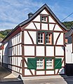
Former winery | Oberdollendorf, Bachstrasse 111 map |
former "Geblgershof" | Essentially the end of the 17th century | February 18, 1991 | A 146
|
 more pictures |
Two-storey, gable-independent post construction | Oberdollendorf, Bachstrasse 123 map |
18th century | February 18, 1991 | A 147
|
|
 more pictures |
Two-storey, eaves-standing storey building | Oberdollendorf, Bachstrasse 127 map |
18th century | January 24, 1991 | A 148
|
|
 more pictures |
Former winery | Oberdollendorf, Bachstrasse 131 map |
1753 | January 24, 1991 | A 149
|
|
 more pictures |
Two-storey post construction | Oberdollendorf, Bachstrasse 133 map |
Late 17th century | January 24, 1991 | A 150
|
|
 more pictures |
Two-story building - Grevenhof | Oberdollendorf, Bachstrasse 147 map |
17./18. century | January 24, 1991 | A 151
|
|
 more pictures |
Two-storey post construction | Oberdollendorf, Bachstrasse 149 map |
18th century | 18th December 1990 | A 152
|
|
 more pictures |
Good Sülz | Oberdollendorf, Bachstrasse 157 map |
1656, late 19th century | 18th December 1990 | A 153
|
|
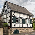 more pictures |
Single-storey half-timbered construction | Oberdollendorf, Bergstrasse 7 map |
1766 | 18th December 1990 | A 154
|
|

|
Two-storey post construction | Oberdollendorf, Bergstrasse 10 map |
17th century | 18th December 1990 | A 155
|
|
 more pictures |
Two-storey half-timbered building in multi-storey construction | Oberdollendorf, Bergstrasse 12 map |
1618 | 18th December 1990 | A 156
|
|
 more pictures |
Two-storey half-timbered building in multi-storey construction | Oberdollendorf, Bergstrasse 20 map |
Second half of the 17th century | March 14, 1991 | A 157
|
|
 more pictures |
Two-storey angular building | Oberdollendorf, Bergstrasse 22 map |
1663, 18th century | March 14, 1991 | A 158
|
|

|
Two-storey, gable-independent post construction | Oberdollendorf, Bergstrasse 28 map |
Late 17th century | March 14, 1991 | A 159
|
|
 more pictures |
Wayside cross | Oberdollendorf, Bergstrasse / Marienstraße map |
Trachyte votive cross | 1690 | March 11, 1991 | A 160
|

|
Wayside chapel | Oberdollendorf, Bergstrasse / Schleifenweg map |
with set pieces made of demolition material from the Heisterbach monastery | 1822 | March 11, 1991 | A 161
|
 more pictures |
Path stick | Oberdollendorf, Caesariusstrasse / Bachstrasse map |
Statue of Mary made of sandstone in front of the stump of a column on a stepped base | Around 1870 | March 11, 1991 | A 162
|
 more pictures |
Wayside cross | Map of Oberdollendorf, Cäsariusstrasse / Oberkasseler Strasse |
Trachyte votive cross | 1705 | March 13, 1991 | A 163
|

|
Wayside cross | Römlinghoven, Cäsariusstraße / Lommerwiese map |
Trachyte votive cross; at this location since 1935 | 1741 | March 11, 1991 | A 164
|
 more pictures |
Two-storey, gable-independent half-timbered construction | Oberdollendorf, Falltorstraße 13 map |
Late 18th century | March 18, 1991 | A 165
|
|

|
Two-storey, elongated post construction | Oberdollendorf, Falltorstraße 21 map |
1715 | March 13, 1991 | A 166
|
|

|
Single-storey post construction | Oberdollendorf, Falltorstrasse 4 map |
Second half of the 18th century | March 13, 1991 | A 167
|
|
 more pictures |
Two-storey angled storey building | Oberdollendorf, Falltorstraße 22 map |
First half of the 18th century | March 18, 1991 | A 168
|
|

|
Two-storey, gable-independent half-timbered building | Oberdollendorf, Falltorstraße 24 map |
Early 19th century, early 20th century | March 18, 1991 | A 169
|
|
 more pictures |
Two-storey building | Oberdollendorf, Falltorstrasse 28 | First half of the 18th century | March 18, 1991 | A 170
|
|

|
Wayside cross | Map of Oberdollendorf, Flurgasse / Römlinghovener Strasse |
Sandstone cross, slotted; Renovated in 1903 after being destroyed | Around 1700 | 17th October 1991 | A 171
|
 more pictures |
Processional cross | Oberdollendorf-Heisterbach, Heisterbacher Straße, map in front of the monastery entrance |
Starting point of the former Bittweg from Heisterbach to Petersberg , built by Abbot Franz Scheffer ; Road cross made of trachyte on a sandstone slab, restored and supplemented several times | 1644 | 17th October 1991 | A 172
|
 more pictures |
Catholic parish church of St. Laurentius | Oberdollendorf, Heisterbacher Strasse 154 / Rennenbergstrasse map |
Around 1200, 1792, 1949, and 1955 expansion (P. Krücken) | October 1, 1991 | A 173
|
|

|
Two-storey, four-axis brick building | Oberdollendorf, Heisterbacher Strasse 49 map |
Around 1900 | 17th October 1991 | A 174
|
|

|
Two-storey brick building | Oberdollendorf, Heisterbacher Strasse 51 map |
Around 1900 | 17th October 1991 | A 175
|
|
 more pictures |
Truss construction | Oberdollendorf, Heisterbacher Strasse 61 map |
18th century, 1881 | May 16, 1991 | A 176
|
|

|
Two-storey half-timbered building | Oberdollendorf, Heisterbacher Strasse 73 map |
Late 18th century | May 16, 1991 | A 177
|
|

|
Two storey villa | Oberdollendorf, Heisterbacher Strasse 99 map |
Around 1920 | 17th October 1991 | A 178
|
|
 more pictures |
Former four-winged winery | Oberdollendorf, Heisterbacher Strasse 115 map |
Second half of the 18th century | 17th October 1991 | A 179
|
|
 more pictures |
Former tannery - "Bauernschänke" | Oberdollendorf, Heisterbacher Strasse 123 / Lindenstrasse map |
gutted inside | 1636 | 5th July 1991 | A 180
|

|
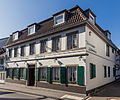
Former winery | Oberdollendorf, Heisterbacher Strasse 129 map |
17th century, 1767 | 5th July 1991 | A 181
|
|
 more pictures |
Former winery "Weinhaus Lichtenberg" | Oberdollendorf, Heisterbacher Strasse 131 map |
At its core 17th century, 1811 | October 10, 1991 | A 182
|
|
 more pictures |
Bungertshof | Oberdollendorf, Heisterbacher Strasse 149 map |
17th century, 19th century, 1903 | 5th July 1991 | A 183
|
|

|
Two-storey half-timbered building | Oberdollendorf, Heisterbacher Strasse 124 map |
1768 | October 8, 1991 | A 184
|
|
 more pictures |
Two-storey half-timbered building | Oberdollendorf, Heisterbacher Strasse 132 map |
Second half of the 18th century, late 19th century | October 8, 1991 | A 185
|
|
 more pictures |
Catholic rectory | Oberdollendorf, Heisterbacher Strasse 156 map |
Half-timbered building on a solid ground floor (1750), brick bars on the church-side gable side (1869) | 1750, 1869 | October 8, 1991 | A 186
|

|
Two-storey, detached brick villa | Oberdollendorf, Heisterbacher Strasse 202 map |
Around 1900 | October 10, 1991 | A 187
|
|

|
Two storey villa | Oberdollendorf, Heisterbacher Strasse 204 map |
Around 1900 | October 10, 1991 | A 188
|
|
 more pictures |
Two-storey plastered villa | Oberdollendorf, Heisterbacher Strasse 210 map |
Around 1900 | October 10, 1991 | A 189
|
|
 more pictures |
Wayside cross | Oberdollendorf, Lindenstrasse map |
Sandstone cross | 1655 | October 11, 1991 | A 190
|
 more pictures |
Two-storey half-timbered construction | Oberdollendorf, Lindenstrasse 5 map |
Late 17th century | October 11, 1991 | A 191
|
|
 more pictures |
Two-storey half-timbered building on a massive ground floor | Oberdollendorf, Lindenstrasse 7 map |
1764 | October 11, 1991 | A 192
|
|

|
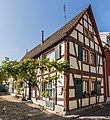
Two-storey half-timbered building | Oberdollendorf, Lindenstrasse 17 map |
Late 18th century | August 22, 1991 | A 193
|
|
 more pictures |
Two-storey, gable-independent post construction | Oberdollendorf, Lindenstrasse 25 map |
1669 | October 2, 1991 | A 194
|
|
 more pictures |
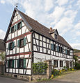
Four-wing, closed courtyard | Oberdollendorf, Lindenstrasse 29 / Bachstrasse map |
1619 | October 2, 1991 | A 195
|
|
 more pictures |
Two-storey post construction on rubble stone base | Oberdollendorf, Lindenstrasse 14 map |
17th century | October 2, 1991 | A 196
|
|
 more pictures |
Two-storey half-timbered construction | Römlinghoven, Malteserstraße 23 map |
former courtyard | 17th century | October 8, 1991 | A 197
|
 more pictures |
Two-storey half-timbered construction | Römlinghoven, Malteserstraße 41 map |
Around 1800 | October 8, 1991 | A 198
|
|
 more pictures |
Two-storey half-timbered building | Römlinghoven, Malteserstraße 49 map |
"House Horbach"; former winegrower's house | 1711 | October 8, 1991 | A 199
|
 more pictures |
Two-storey half-timbered building | Römlinghoven, Malteserstraße 26 map |
Early 19th century | July 23, 1991 | A 200
|
|
 more pictures |
Two-storey building | Römlinghoven, Malteserstraße 40 map |
Late 18th century | May 13, 1991 | A 201
|
|

|
Two-storey half-timbered building | Römlinghoven, Malteserstraße 42 map |
Early 19th century | October 8, 1991 | A 202
|
|

|
Two-storey half-timbered construction | Römlinghoven, Malteserstraße 46 map |
Former winemaker's house | 17th century | December 16, 1991 | A 203
|
 more pictures |
Lady Chapel | Oberdollendorf, Marienstrasse map |
plastered brick building with slated barrel roof | 1813 | October 1, 1991 | A 204
|
 more pictures |
Wayside cross | Oberdollendorf, Marienstraße (extension) map |
Field cross made of trachyte | 1824 | October 1, 1991 | A 205
|
 more pictures |
Single storey half-timbered building | Oberdollendorf, Mühlenstrasse 5 map |
former press house of the Turmhof | 1650 | October 10, 1991 | A 206
|
 more pictures |
Single storey half-timbered building | Oberdollendorf, Mühlenstrasse 8 map |
Early 19th century | October 8, 1991 | A 207
|
|
 more pictures |
Wayside cross | Map of Oberdollendorf, Mühlental / Bachstrasse |
Trachyte votive cross | 1730, 1839 | October 1, 1991 | A 208
|
 more pictures |
Two-story building ("Haus am Mühlenbach") | Oberdollendorf, Mühlental 12/14 map |
former excursion restaurant | 1865 | October 10, 1991 | A 209
|
 more pictures |
Four-wing system "For cooling basic" | Oberdollendorf, Mühlental 22 Map |
Early 18th century, around 1800 | October 10, 1991 | A 210
|
|

|
Single storey quarry stone building - former mill "Am Hellenberg" | Oberdollendorf, Mühlental 24 map |
Used as a grain mill with overshot water wheel until 1914 | 1777 | July 23, 1991 | A 211
|
 more pictures |
graveyard | Map of Oberdollendorf, Rennenbergstrasse |
1852 | July 23, 1991 | A 212
|
|

|
Two-storey half-timbered building | Oberdollendorf, Rennenbergstrasse 9 map |
19th century | May 15, 1991 | A 213
|
|

|
Former girls' school | Oberdollendorf, Rennenbergstrasse 11 map |
Brick building with historicizing jewelry forms | Around 1900 | May 15, 1991 | A 214
|
 more pictures |
Wayside cross | Oberdollendorf, Rennenbergstrasse / Auf dem Schnitzenbusch map |
Votive cross made of sandstone | 1725 | May 16, 1991 | A 215
|
 more pictures |
Wayside cross | Oberdollendorf, Schleifenweg / Ferdinand-Schmitz-Straße 113 map |
Trachyte votive cross; originally a station on the Bittweg from Oberdollendorf to Petersberg | 1721 | May 16, 1991 | A 216
|
 more pictures |
Two-storey half-timbered building | Oberdollendorf, Turmstrasse 7 map |
First half of the 18th century | May 15, 1991 | A 217
|
|

|
Two-storey building | Oberdollendorf, Turmstrasse (to Heisterbacher Strasse 135) map |
19th century | January 16, 1991 | A 218
|
|
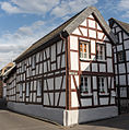
|
Two-storey building | Oberdollendorf, Turmstrasse 16 / Bachstrasse map |
Second half of the 17th century, 19th century | May 16, 1991 | A 219
|
|
 more pictures |
Three-storey half-timbered building (old pastorate) | Oberpleis, Siegburger Strasse 9–11 map |
built using demolition material from the Benedictine priory | Mid 18th century | 5th July 1991 | A 220
|
 more pictures |
Two-storey half-timbered building | Oberdollendorf, Turmstrasse 14 map |
18th century | 5th July 1991 | A 221
|
|

|
Former winery | Oberdollendorf, Mühlenstrasse 17 map |
17./18. Century and later | July 23, 1991 | A 222
|
|

|
Two-storey half-timbered building | Oberdollendorf, Mühlenstrasse 19 map |
17./18. Century and later | July 23, 1991 | A 223
|
|
| Wayside cross | Oberdollendorf, Am Breidenschöppchen (below the Petersberg) | 1773 | August 30, 1991 | A 224
|
||
 more pictures |
Two-storey half-timbered building on a massive ground floor | Koenigswinter, Altenberger Gasse 8 map |
1665 | January 22, 1992 | A 225
|
|
 more pictures |
Three-wing half-timbered courtyard (Gertrudenhof) | Oberpleis, Dollendorfer Strasse 115 map |
19th century | January 18, 1993 | A 226
|
|
 more pictures |
Late classicist villa | Koenigswinter, Hauptstrasse 246 map |
Second half of the 19th century | February 16, 1993 | A 227
|
|

|
Three-story corner building | Koenigswinter, Grabenstrasse 14 map |
Around 1900 | February 16, 1993 | A 228
|
|

|
Two and a half story semi-villa | Koenigswinter, Hauptstrasse 335 map |
1878 | February 16, 1993 | A 229
|
|

|
Two-storey half-timbered building, "Hotel Krone", formerly "Bockhalle" | Koenigswinter, Hauptstrasse 374 map |
18th century | March 10, 1993 | A 230
|
|
 more pictures |
Jewish Cemetery | Koenigswinter, Rheinallee / Clemens-August-Straße map |
16th century and later | March 10, 1993 | A 231
|
|
 more pictures |
Two-storey villa in late classical form ("Haus Rheinau") | Niederdollendorf, Hauptstrasse 200 map |
Country villa with remnants of a park-like garden on heaped land | Second half of the 19th century | March 10, 1993 | A 232
|

|
Two-storey villa in late classical form | Niederdollendorf, Hauptstrasse 204 map |
Around 1878, early 20th century | March 10, 1993 | A 233
|
|
 more pictures |
Wayside cross | Heisterbacherrott, An den Erlen card |
Trachyte cross | Around 1800 | March 10, 1993 | A 234
|
 more pictures |
Wayside cross | Heisterbacherrott, Lauterbachstraße / Gubener Weg map |
Trachyte votive cross | 1734 | March 10, 1993 | A 235
|
 more pictures |
Wayside cross | Heisterbacherrott, map in front of the house at Oelbergstrasse 25 |
Trachyte cross | 18th century | July 14, 1993 | A 236
|
 more pictures |
Two-storey half-timbered construction | Heisterbacherrott, Petrusstrasse 9 map |
presumably a former open- plan barn with a continuous transverse barn | 1817 | July 14, 1993 | A 238
|
 more pictures |
Grave cross | Heisterbacherrott, Petrusstraße 12 map |
Sandstone grave cross | 1734 | July 14, 1993 | A 239
|
 more pictures |
Path stick | Heisterbacherrott, Petrusstraße / Weihergelände map |
Peter shrine (processional altar) | 1790 | July 14, 1993 | A 240
|
 more pictures |
Wayside cross | Heisterbacherrott, Kirchweg map |
Sandstone cross | 1733 | July 14, 1993 | A 241
|
 more pictures |
Wayside cross | Stieldorf-Rauschendorf, Am Frohnacker / Scheurenstrasse map |
Votive Cross | 1884 | July 14, 1993 | A 242
|
 more pictures |
Wayside cross | Stieldorf-Rauschendorf, Am Weißen Kreuz map |
Votive cross made of ashlar | 1883 | July 14, 1993 | A 243
|
 more pictures |
Wayside cross | Stieldorf-Oberscheuren (confluence on the Konne) map |
Sandstone grave cross on barn wall | 1859 | 5th January 1994 | A 246
|

|
Wayside cross | Stieldorf-Oberscheuren / Niederscheuren map |
Andesite votive cross | 1724 | 5th January 1994 | A 247
|

|
Wayside cross | Stieldorf-Rauschendorf, Rotdornstrasse / Am Frohnacker map |
Sandstone grave cross | 1730 | 5th January 1994 | A 248
|
 more pictures |
Heiderhof | Stieldorf-Vinxel, Heiderhof map |
Early 18th century and later, summer residence in 1897 | January 7, 1994 | A 249
|
|
 more pictures |
Wayside cross | Stieldorf-Vinxel, Holtorfer Strasse map |
1846 | January 7, 1994 | A 250
|
|
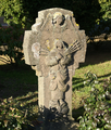 more pictures |
Wayside cross | Stieldorf-Vinxel, Kasseler Weg / Alter Heeresweg map |
1769 | January 7, 1994 | A 251
|
|
 more pictures |
Wayside cross | Stieldorf-Vinxel, Vinxeler Straße / Im Winkel map |
Votive cross made of sandstone | 1726 | January 7, 1994 | A 252
|
 more pictures |
Path stick | Stieldorf-Bockeroth, Bockerother Straße 84/86 map |
1875 | 5th January 1994 | A 253
|
|
 more pictures |
Wayside cross | Stieldorf-Bockeroth, Bockerother Straße 110 map |
Votive cross made of ashlar | 1913 | October 13, 1993 | A 254
|
 more pictures |
Wayside cross | Stieldorf-Bockeroth, Leithecker Strasse / Bockerother Strasse map |
Neighborhood cross made of trachyte | 1735 | October 13, 1993 | A 255
|
 more pictures |
Wayside cross | Stieldorf-Bockeroth, Leithecker Strasse map |
Votive cross made of sandstone | 1907 | 2nd September 1993 | A 256
|
 more pictures |
Wayside cross | Map of Stieldorf-Freckwinkel, Bockerother Strasse |
Memorial cross made of sandstone | 1815, around 1900 | 2nd September 1993 | A 258
|

|
Wayside cross | Stieldorf-Freckwinkel, Siegburger Strasse 305 map |
Votive cross made of sandstone | 1900 | September 1, 1993 | A 259
|
 more pictures |
Wayside cross | Stieldorf-Freckwinkel, Siegburger Strasse 316 map |
Trachyte grave cross embedded in the garden wall | 1778 | September 1, 1993 | A 260
|
 more pictures |
Wayside cross | Stieldorf-Oelinghoven, Im Mutschenbroich map |
19th century | 19th August 1993 | A 261
|
|
 more pictures |
Wayside cross | Stieldorf-Oelinghoven, Im Winkel map |
Trachyte votive cross with a brick protective wall | 1720 | 19th August 1993 | A 262
|
 more pictures |
Path stick | Stieldorf-Oelinghoven, Lichgasse map |
19th century | August 16, 1993 | A 263
|
|

|
Two-storey half-timbered building | Stieldorf-Oelinghoven, Zur Heide 33 map |
Second half of the 18th century | August 16, 1993 | A 264
|
|

|
Marxhof | Stieldorf-Oelinghoven, Zur Heide 36 map |
Late 18th century | August 16, 1993 | A 265
|
|
 more pictures |
graveyard | Stieldorf, An der Passionshalle map |
Cemetery cross from 1848 | 1849 | August 16, 1993 | A 266
|
 more pictures |
Grave cross as a wayside cross | Stieldorf, Friedhofsweg (10) / Rauschendorfer Straße Map |
18th century | August 16, 1993 | A 267
|
|
 more pictures |
Three-wing courtyard | Stieldorf, Im Frieden 5 card |
Late 18th century | August 16, 1993 | A 268
|
|

|
Sutorius inn | Stieldorf, Oelinghovener Strasse 7 map |
Part of a former four-wing courtyard complex; two-storey half-timbered building with brick-faced, rough plastered ground floor | 1789 | August 16, 1993 | A 269
|

|
Wayside cross | Stieldorf, Oelinghovener Strasse / Lichgasse map |
18th century | July 28, 1993 | A 270
|
|
 more pictures |
War memorial | Stieldorf-Stieldorferhohn, map in front of house No. 31 |
Around 1920 | July 28, 1993 | A 271
|
|

|
pump | Stieldorf-Stieldorferhohn, next to building Stieldorerhohn 38 map |
Second half of the 19th century | July 28, 1993 | A 272
|
|
 more pictures |
Wayside cross | Stieldorf-Stieldorferhohn, Thomasberger Strasse / Stieldorferhohn map |
Andesite cross | 1732 | July 28, 1993 | A 273
|

|
Wayside cross | Stieldorf, Zweikreuzenweg / Zum Sonnenberg map |
Trachyte votive cross | 1730 | 19th August 1993 | A 274
|
 more pictures |
Wayside cross | Oberpleis-Hartenberg, Am Liesenberg map |
Votive cross made of sandstone | 1905 | August 18, 1993 | A 275
|
 more pictures |
Grave cross and landmarks | Oberpleis-Hartenberg, Hartenbergstrasse | 1682 | May 19, 1993 | A 276
|
|
 more pictures |
Two-storey villa with a four-storey tower | Oberpleis, Dollendorfer Strasse 34 map |
Second half of the 19th century, beginning of the 20th century | May 19, 1993 | A 277
|
|
 more pictures |
Wayside cross | Oberpleis, Dollendorfer Strasse / Im Dicht map |
Renewed wayside cross | 18th century, 20th century | May 19, 1993 | A 278
|
 more pictures |
Two-storey half-timbered building | Oberpleis, Propsteistraße 1 map |
1804 | October 13, 1993 | A 279
|
|

|
Wayside cross | Oberpleis, Theodor-Storm-Straße / Dollendorfer Straße Map |
Trachyte votive cross | 1725 | October 13, 1993 | A 281
|
 more pictures |
Wayside cross | Bellinghausen-Zweikreuzen, Zweikreuzenweg / Dollendorfer Straße map |
Trachyte cross | 1707 | May 19, 1993 | A 282
|

|
Wayside cross | Oberpleis-Bennerscheid, An den Brunnen card |
Votive cross made of sandstone | 1867 | 2nd September 1993 | A 283
|
 more pictures |
pump | Oberpleis-Bennerscheid, An den Brunnen card |
Second half of the 19th century | September 1, 1993 | A 284
|
|

|
Wayside cross | Oberpleis-Sand, Oberpleiser Strasse map |
1913 | 19th August 1993 | A 285
|
|
 more pictures |
War memorial | Oberpleis-Sand, Oberpleiser Strasse / Pützstücker Strasse Map |
1920 | 19th August 1993 | A 286
|
|

|
Wayside cross | Oberpleis-Sandscheid, Pützstücker Strasse / L 268 | 19th century, 1935 | 19th August 1993 | A 287
|
|
 more pictures |
Wayside cross | Stieldorf-Freckwinkel, Siegburger Strasse 305 / Bockerother Strasse Map |
Sandstone votive cross; attached to the house wall | 1930 | 19th August 1993 | A 288
|
 more pictures |
Two-storey front building of a row of houses (post office building) | Oberdollendorf, Heisterbacher Strasse 53 map |
1903 | August 26, 1994 | A 289
|
|
 more pictures |
Villa with park-like grounds and original fencing | Koenigswinter, Hauptstrasse 330 map |
"Villa Leonhart"; Architect: Franz Josef Krings (1938) | 1893, reconstruction 1938, 1949 | May 23, 1995 | A 290
|
 more pictures |
Villa with coach house and porter's house | Koenigswinter, Hauptstrasse 276/278 map |
1898 | September 29, 1995 | A 291
|
|
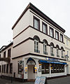
|
Three-storey plastered building | Koenigswinter, Hauptstrasse 396 map |
Around 1880 | September 29, 1995 | A 292
|
|
 more pictures |
Two-storey stone building | Königswinter, Hauptstrasse 398 / Kellerstrasse map |
1799, 1870 | September 29, 1995 | A 293
|
|
 more pictures |
Two-storey baroque house | Koenigswinter, Hauptstrasse 427 map |
18./19. Century and later | September 29, 1995 | A 294
|
|
 more pictures |
Hirschburg | Koenigswinter, Hirschburg map |
Architects: Wilhelm Hoffmann , Gerhard Franz Langenberg | 1895, 1901 | September 29, 1995 | A 295
|

|
Two-storey plastered half-timbered building | Koenigswinter, Meerkatzstrasse 1 map |
Second half of the 18th century | September 29, 1995 | A 296
|
|
 more pictures |
Multi-wing half-timbered courtyard | Oberpleis-Nonnenberg, on the Steinkaule 2 map |
End of the 18th century, second half of the 19th century | October 12, 1995 | A 297
|
|
 more pictures |
Wayside cross | Oberpleis-Berghausen, Bitzerweg 19 map |
carved wooden cross | 1828 | October 12, 1995 | A 298
|
 more pictures |
Wayside cross | Oberpleis-Hasenboseroth, Pelzerweg 3 map |
Votive cross made of sandstone | 1919 | October 12, 1995 | A 299
|
 more pictures |
Wayside cross | Oberpleis, Bittweg | Field cross made of trachyte | 1743 | October 12, 1995 | A 300
|
 more pictures |
Former courtyard with a two-storey half-timbered building ("Pitteschhof") | Thomasberg-Bellinghauserhohn, Auelweg 22 Map |
Around 1840 | October 12, 1995 | A 301
|
|
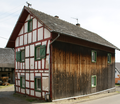 more pictures |
Multi-wing half-timbered courtyard | Bellinghausen, Bellinghausener Strasse 21 map |
Second half of the 19th century | October 12, 1995 | A 302
|
|
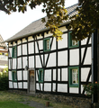 more pictures |
Two-storey half-timbered construction | Bellinghausen, Bellinghausener Strasse 29 map |
Around 1800 | October 12, 1995 | A 303
|
|
 more pictures |
Wayside cross | Bellinghausen, Bellinghausener Strasse map |
Trachyte votive cross embedded in a brick wall | 1782 | October 12, 1995 | A 304
|
 more pictures |
Wayside cross | Bellinghausen-Zweikreuzen, Bellinghausener Strasse / Dollendorfer Strasse map |
Sandstone cross | 1727 | October 16, 1995 | A 305
|
 more pictures |
Wayside cross | Bellinghausen, Bellinghausener Strasse 30 | Votive cross made of sandstone | 1904 | October 16, 1995 | A 306
|
 more pictures |
Wayside cross | Bellinghausen, Bellinghausener Straße (at the barn at Kranzweg 3) map |
Votive cross made of oak | 1802 | October 17, 1995 | A 307
|
 more pictures |
Wayside cross | Oberpleis-Ruttscheid, Im Krägerfeld / Ruttscheider Strasse Map |
Sandstone cross | 1916 | October 17, 1995 | A 309
|
 more pictures |
Wayside cross | Oberpleis-Ruttscheid, Ruttscheider Straße 28 Map |
Votive cross made of sandstone | 1903 | October 17, 1995 | A 310
|
 more pictures |
Small three-wing half-timbered courtyard | Oberpleis-Ruttscheid, Ruttscheider Straße 28 Map |
Second half of the 18th century | October 26, 1995 | A 311
|
|
 more pictures |
Wayside cross | Oberpleis-Ruttscheid, Ruttscheider Straße 37 Map |
Sandstone cross | 19th century | November 10, 1995 | A 312
|
 more pictures |
Wayside cross | Oberpleis-Ruttscheid, Kellersboserother Strasse / Ruttscheider Strasse (58) map |
Sandstone cross | Early 20th century | November 10, 1995 | A 313
|
 more pictures |
Courtyard | Koenigswinter, Drachenfelsstrasse map |
1904 (main building); 18th century (farm building) | November 18, 1997 | A 314
|
|
 more pictures |
Grave cross | Oberpleis-Eisbach, Eisbacher Strasse 32 map |
Trachyte grave cross | 1683 | 2nd December 1996 | A 315
|
 more pictures |
Wayside cross | Oberpleis-Eisbach, Bittweg | Votive cross made of sandstone | 1867 | 2nd December 1996 | A 316
|
 more pictures |
Chapel of Maria Rosary Queen | Map of Oberpleis-Eisbach, Prälat-Buchholz-Strasse |
1871, expanded in 1961 | 2nd December 1996 | A 317
|
|
 more pictures |
Wayside cross | Oberpleis-Herresbach, Herresbacher Strasse / Nonnenberger Strasse map |
Memorial cross made of sandstone | 1915 | 2nd December 1996 | A 318
|
 more pictures |
Wayside cross | Oberpleis, Uckerather Straße / Bittweg map |
Trachyte votive cross | 1736 | 2nd December 1996 | A 319
|
 more pictures |
Chapel of St. Anna | Oberpleis-Pleiserhohn, Zur Sandkaule / Erbstraße map |
1885, renovated in 1977 | 5th December 1996 | A 320
|
|
 more pictures |
Two grave crosses | Oberpleis-Thelenbitze map |
Trachyte | 1664, 1699 | 2nd December 1996 | A 321
|
 more pictures |
Former mill | Oberpleis-Uthweiler, Siegburger Strasse 223 and 223 a map |
four-wing closed Mühlenhofanlage on the Pleisbach | Mid 18th century | 5th December 1996 | A 322a
|
| Former mill | Oberpleis-Uthweiler, Siegburger Strasse 221 map |
Mid 18th century | 5th December 1996 | A 322b
|
||

|
Grave cross | Oberpleis-Pleiserhohn, Zur Sandkaule 7 map |
Trachyte | 1729 | 2nd December 1996 | A 323
|
 more pictures |
Wayside cross | Map of Oberpleis-Uthweiler, Siegburger Strasse / Hauptmannstrasse |
1736 | 2nd December 1996 | A 324
|
|
 more pictures |
Half-timbered barn | Map of Oberpleis-Rübhausen, Arnoldsgarten / Rübhausener Strasse |
18th century | 5th December 1996 | A 325
|
|
 more pictures |
Bönnschenhof | Oberpleis-Wahlfeld, Bönnschenhof 1 card |
18th century and later | 5th December 1996 | A 326
|
|
 more pictures |
Wayside cross | Oberpleis-Wahlfeld, Im Etzenhohn card |
Neo-Gothic grave cross made of sandstone | 1898, 1909 | 2nd December 1996 | A 327
|
 more pictures |
Wayside cross | Oberpleis-Wahlfeld, Bönnschenhof / Lützer Weg map |
made of sandstone; on the house wall of the Bönnschenhof | 1841 | 5th December 1996 | A 328
|
 more pictures |
Wayside cross | Oberpleis-Wahlfeld, Lützer Weg map |
Trachyte votive cross | 1793 | 5th December 1996 | A 329
|
 more pictures |
Residential building with park | Oberpleis-Jüngsfeld, Jüngsfeld 1 card |
5th December 1996 | A 330
|
||

|
Wayside cross | Heisterbacherrott-Thomasberg, Siebengebirgsstraße 73 map |
Trachyte votive cross | 1876 | November 19, 1997 | A 331
|
 more pictures |
Former forester's house in Eudenbach | Eudenbach, Eudenbacher Strasse 1 map |
Type construction of the Prussian Forest Administration of the Royal Siebengebirge Forest | Around 1890 | November 19, 1997 | A 332
|
 more pictures |
Wayside cross | Eudenbach, Eudenbacher Strasse 61 map |
sandstone cross | 1904 | November 19, 1997 | A 333
|
 more pictures |
Catholic parish church of St. Mary of the Assumption | Eudenbach, Eudenbacher Strasse 111 map |
1912 (bag), consecrated 1928 | November 28, 1997 | A 334
|
|
 more pictures |
graveyard | Eudenbach, Eudenbacher Strasse map |
neo-Gothic cemetery cross from 1903 | Early 20th century | November 28, 1997 | A 335
|
 more pictures |
Wayside cross | Eudenbach, Unterdorfstrasse map |
Limed sandstone cross with rusticated base | 1922 | November 28, 1997 | A 336
|
 more pictures |
Wayside cross | Eudenbach, Laubenweg map |
Sandstone cross | Around 1900 | November 28, 1997 | A 337
|

|
Small half-timbered courtyard | Eudenbach-Rostingen, Holzweg 11 map |
First half of the 19th century | December 6, 1997 | A 338
|
|
 more pictures |
Chapel "Exaltation of the Cross" | Map of Eudenbach-Quirrenbach, Cookingbacher Strasse |
1894 | December 6, 1997 | A 339
|
|

|
Wayside cross | Stieldorf-Rauschendorf, Birlinghovener Strasse | 19th century | December 8, 1997 | A 340
|
|
 more pictures |
Wayside chapel | Oberpleis-Hartenberg map |
Early 20th century | February 19, 1998 | A 341
|
|

|
Grave cross | Oberpleis-Hartenberg, Hartenbergstrasse map |
1865 | March 5, 1998 | A 342
|
|

|
Wayside cross | Oberdollendorf-Heisterbach, Heisterbacher Strasse, west of the monastery district of Heisterbach map |
Trachyte cross; on the old Bittweg from Heisterbach to Petersberg | First half of the 18th century | March 18, 1998 | A 343
|
 more pictures |
Müller monument | Koenigswinter, Hauptstrasse / Rheinallee map |
Sculptor: Otto Lessing | 1896 | March 5, 1998 | A 344
|
 more pictures |
Schunck monument | Koenigswinter, Hauptstrasse map |
1912 | March 5, 1998 | A 345
|
|
 more pictures |
Market fountain | Koenigswinter, Drachenfelsstrasse map |
also "Weinbrunnen"; Sculptor: Franz Josef Krings ; Relief plates from 1939 | 1938 | March 18, 1998 | A 346
|

|
Two storey villa | Königswinter, Am Lessing 1 map |
1880s | March 4, 1998 | A 347
|
|
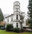 more pictures |
Two storey villa | Königswinter, Am Lessing 6 map |
Around 1900 | March 4, 1998 | A 348
|
|

|
One to two storey villa | Koenigswinter, Drachenfelsstrasse 72 map |
Around 1900 | March 31, 1998 | A 350
|
|

|
Wayside cross | Königswinter, Winzerstraße / Am Palastweiher map |
Trachyte votive cross | 1702 | March 4, 1998 | A 351
|

|
Wayside cross | Koenigswinter, Rheinallee map |
1779 | March 4, 1998 | A 352
|
|

|
Path stick | Koenigswinter, Grabenstrasse / Remigiusstrasse map |
Early 19th century | March 4, 1998 | A 353
|
|
 more pictures |
Wayside cross | Koenigswinter, Hauptstrasse 557 map |
1678 | March 4, 1998 | A 354
|
|
 more pictures |
Wayside cross | Königswinter, Bahnhofsallee map |
Late 18th century | March 4, 1998 | A 355
|
|
 more pictures |
Path stick | Koenigswinter, Von-Weiß-Straße 1 map |
1627, restored in 1849 and 1983 | March 4, 1998 | A 356
|
|
| Drachenfelsbahn | Königswinter, northern slope of Drachenfels | privately owned part of the monument | 1882/1883 | May 20, 1998 | A 357a
|
|
| Drachenfelsbahn | Königswinter, northern slope of Drachenfels | Part of the monument owned by the land | 1882/1883 | March 10, 1999 | A 357b
|
|
 more pictures |
Building consisting of three construction phases | Koenigswinter, Bungertstrasse 4 map |
18th century and later | March 15, 1999 | A 358
|
|
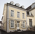 more pictures |
Former home | Koenigswinter, Drachenfelsstrasse 1 map |
Late 18th century, early 20th century | March 15, 1999 | A 360
|
|

|
Two-storey residential and commercial building | Koenigswinter, Drachenfelsstrasse 14 map |
Around 1905 | March 15, 1999 | A 361
|
|

|
Two-storey residential and commercial building | Koenigswinter, Drachenfelsstrasse 15 map |
Late 19th century | March 15, 1999 | A 362
|
|
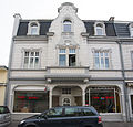
|
Two-storey residential and commercial building | Koenigswinter, Drachenfelsstrasse 16 map |
Around 1905 | March 15, 1999 | A 363
|
|

|
Two-storey corner house "Im Treppchen" | Koenigswinter, Drachenfelsstrasse 20 map |
Late 19th century and later | March 15, 1999 | A 364
|
|
 more pictures |
" Winzerhäuschen " as a two-storey post construction | Koenigswinter, Drachenfelsstrasse 100 map |
18th century | March 15, 1999 | A 365
|
|

|
Two-storey half-timbered building | Koenigswinter, Grabenstrasse 3 map |
First half of the 19th century | March 15, 1999 | A 366
|
|

|
Two storey villa | Koenigswinter, Hubertusstraße 2 map |
Early 20th century | March 15, 1999 | A 367
|
|
 more pictures |
Trafostation | Oberdollendorf-Heisterbach, Kloster Heisterbach map |
1920 | March 15, 1999 | A 368
|
|
 more pictures |
Wayside cross Rosenau | Koenigswinter, Rosenau map |
Andesite votive cross; on the old Bittweg from Ittenbach to Petersberg | 1692, renovated in 1858 | July 1, 1999 | A 369
|

|
Three-storey corner house | Koenigswinter, Drachenfelsstrasse 12 / Hauptstrasse map |
1905 | November 5, 1999 | A 370
|
|

|
Two storey villa | Koenigswinter, Friedrichsallee 14 map |
Architect: C. Bauer | 1933 | February 21, 2000 | A 371
|

|
Two-storey Wilhelminian style terraced house | Koenigswinter, Grabenstrasse 13 map |
Around 1900 | February 21, 2000 | A 373
|
|

|
Three-story residential building | Koenigswinter, Grabenstrasse 23 map |
1906 | February 21, 2000 | A 374
|
|

|
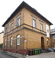
Two-storey half-timbered building | Koenigswinter, Grabenstrasse 59 map |
18th century, second half of the 19th century | February 21, 2000 | A 375
|
|
 more pictures |
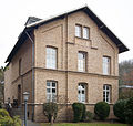
Two storey villa | Koenigswinter, Grabenstrasse 69 map |
Late 19th century | February 21, 2000 | A 376
|
|
 more pictures |
Evangelical rectory | Koenigswinter, Grabenstrasse 8 map |
1873/1874 | February 21, 2000 | A 377
|
|
 more pictures |
Two-storey villa with mezzanine | Koenigswinter, Grabenstrasse 22 map |
1880s | February 21, 2000 | A 378
|
|

|
Three-storey narrow brick building | Koenigswinter, Grabenstrasse 28 map |
Around 1900 | February 21, 2000 | A 379
|
|

|
Three-storey Wilhelminian style terraced house | Koenigswinter, Hauptstrasse 319 map |
Late 19th century | February 18, 2000 | A 380
|
|

|
Three-storey terraced house | Koenigswinter, Hauptstrasse 321 map |
Late 19th century | February 18, 2000 | A 381
|
|

|
Three-story row corner building | Königswinter, Hauptstraße 323, corner building Kaiserstraße Map |
1897 | February 18, 2000 | A 382
|
|
 more pictures |
Siebengebirgsmuseum | Koenigswinter, Klotzstrasse 11 map |
Architect: Master mason JP Meuren | 1732 | February 18, 2000 | A 383
|

|
Former water lifting system | Oberpleis-Pleiserhohn, "Pützbungert" card |
1898 | February 18, 2000 | A 384a
|
|
 more pictures |
Former water lifting system | Oberpleis-Pleiserhohn, "Pützbungert" card |
1898 | February 18, 2000 | A 384b
|
|

|
Three-storey terraced house | Koenigswinter, Hauptstrasse 327 map |
1880s | April 13, 2000 | A 385
|
|

|
Two-storey plastered façade building | Koenigswinter, Hauptstrasse 450 map |
Second half of the 19th century | April 13, 2000 | A 386a
|
|
 more pictures |
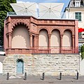
pavilion | Koenigswinter, Rheinallee 5a map |
Belongs to Hauptstrasse 450 ; Garden pavilion in the Moorish style on a square retaining wall | 1906 | April 13, 2000 | A 386b
|
 more pictures |
Two and a half storey semi-detached house | Koenigswinter, Hauptstrasse 317 map |
1880s | May 2, 2000 | A 387
|
|

|
Two-storey plastered building | Koenigswinter, Grabenstrasse 24 map |
1876 | May 2, 2000 | A 388
|
|

|
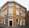
Two-storey plastered building | Koenigswinter, Grabenstrasse 2 map |
Architect: Carl Bachem | 1880s | August 16, 2000 | A 389
|
|
Two and a half storey row corner house | Koenigswinter, Grabenstrasse 16 map |
Around 1900 | August 16, 2000 | A 390
|
|

|
Two and a half storey semi-detached house | Koenigswinter, Hauptstrasse 315 map |
1880s | September 18, 2000 | A 391
|
|
 more pictures |
Wayside cross | Oberdollendorf, corridor “Am Falkenberg” map |
Station cross of the old Bittweg from Oberdollendorf to Petersberg ; Andesite cross | 1724 | March 26, 2001 | A 392
|

|
Three-storey plastered building | Koenigswinter, Hauptstrasse 329 map |
1880s | February 25, 2002 | A 393
|
|

|
Three-storey terraced house | Koenigswinter, Hauptstrasse 331 map |
1890s | February 25, 2002 | A 394
|
|

|
Two and a half storey terraced house | Koenigswinter, Hauptstrasse 333 map |
1890s | February 25, 2002 | A 395
|
|

|
Three-storey gabled residential and commercial building | Koenigswinter, Hauptstrasse 377 map |
Around 1900 | February 25, 2002 | A 396
|
|

|
Two-storey half-timbered building | Koenigswinter, Hauptstrasse 420 map |
Second half of the 18th century | February 25, 2002 | A 397
|
|
 more pictures |
Entrance building of Königswinter station with platform access | Königswinter, Bahnhofsallee map |
1869/1870 | February 25, 2002 | A 398
|
|
 more pictures |
Entrance building of Königswinter-Niederdollendorf station with platform roof supports and railway operations building with loading ramp | Niederdollendorf, Proffenweg 4 map |
1898 | February 25, 2002 | A 399
|
|

|
Two-storey villa on a high basement | Koenigswinter, Hubertusstrasse 1 map |
Early 20th century | February 26, 2003 | A 401
|
|

|
Two-storey corner house | Koenigswinter, Hubertusstrasse 1a / Hauptstrasse map |
Architect: J. Bonn | 1911 | February 26, 2003 | A 402
|

|
Two-storey villa on a high basement | Koenigswinter, Hubertusstraße 3 map |
Early 20th century | March 4, 2003 | A 403
|
|
 more pictures |
One-sided free-standing two-storey building with a two-storey extension at the same time | Niederdollendorf, Heisterbacher Strasse 24 map |
20th century | March 4, 2003 | A 404
|
|
| Former courtyard (parts of historic monument, ovens and walls) | Heisterbacherrott, Petrusstrasse 6 map |
17th century | February 26, 2003 | A 405
|
||
 more pictures |
Laagshof Ittenbach | Ittenbach, Logebachstrasse map |
Architect: Wilhelm Freiherr von Tettau (1905/06) | 1860/1870, 1905/06 (conversion / extension) | July 11, 2003 | A 406
|

|
Former hotel wing with castle tavern on the Drachenfels | Koenigswinter, Drachenfels map |
1936/1937 | April 15, 2004 | A 407
|
|

|
Three-storey plastered building in three axes | Königswinter, Küferweg 1 map |
Around 1905 | September 9, 2004 | A 408
|
|
 more pictures |
Wayside cross | Heisterbacherrott, Oelbergstrasse / Peter-Moll-Weg map |
January 6, 2005 | A 409
|
||

|
Residential building | Koenigswinter, Klotzstrasse 12 map |
Early 18th century | June 20, 2005 | A 410
|
|
 more pictures |
Late classicist villa, two-storey | Koenigswinter, Meerkatzstraße 10 map |
Second half of the 19th century | June 20, 2005 | A 411
|
|
 more pictures |
Two-storey corner building facing the Füllbach alley | Koenigswinter, Wilhelmstrasse 27 map |
1899 | July 12, 2005 | A 412
|
|

|
Former station keeper's house | Königswinter, Küferweg 7 map |
Around 1900 | September 16, 2011 | A 413
|
|

|
Residential buildings | Königswinter, Küferweg 3 map |
1880s | May 20, 2009 | A 414
|
|
 more pictures |
Former post office in Königswinter | Koenigswinter, Hauptstraße 310 map |
1902 | December 20, 2012 | A 415
|
Former architectural monuments
| image | designation | location | description | construction time | Registered since |
Monument number |
|---|---|---|---|---|---|---|

|
Former half-timbered winery with a solid ground floor | Koenigswinter, Hauptstrasse 443 map |
after a fire in 1990 only preserved as a ruin, demolished in November 2014; New building planned | 1658, 19th century | August 1, 1988 | A 71
|

|
Two-storey corner building "Hotel Rheineck" | Niederdollendorf, Rheinufer 108 / Fährstrasse map |
the building was demolished in 2005 | 1900 | November 29, 1989 | A 113
|

|
Two-storey terraced houses in 2 or 3 axes | Niederdollendorf, Rheinufer 106, 106a u. 106b card |
Architect: H. Bonn; the buildings were demolished in 1997 | 1905/1906 | 5th July 1991 | A 135a-c
|
| Wayside cross | Heisterbacherrott, Oelbergstrasse 61 | Votive cross made of wood on a barn; the cross has been removed | 1818 | July 14, 1993 | A 237
|
|
| Two-storey half-timbered building | Koenigswinter, Bungertstrasse 25 map |
by fire on 14./15. March 2010 destroyed and then canceled | 18th century | March 15, 1999 | A 359
|
literature
- Angelika Schyma : City of Königswinter. (= Monument topography Federal Republic of Germany , monuments in the Rhineland , Volume 23.5.) Rheinland-Verlag, Cologne 1992, ISBN 3-7927-1200-8 .
- Provincial Association of the Rhine Province (ed.), Edmund Renard : Die Kunstdenkmäler des Siegkreises . Printed and published by L. Schwann, Düsseldorf 1907, ( online ), ISBN 3-590-32120-2 , pp. 50-76 (Heisterbach), 103-104 (Ittenbach), 104-116 (Königswinter), 144-150 (Niederdollendorf), 152–155 (Oberdollendorf), 160–175 (Oberpleis).
Web links
- List of monuments of the city of Königswinter (PDF; 125 kB) at www.koenigswinter.de, creation date: September 2, 2013
Individual evidence
- ↑ a b Beautification Association for the Siebengebirge (ed.): Nature Park Echo of the VVS ( page no longer available , search in web archives ) Info: The link was automatically marked as defective. Please check the link according to the instructions and then remove this notice. , Volume 13, No. 1, April 2013, p. 6.
- ↑ a b Landeskonservator Nordrhein-Westfalen (Ed.): Yearbook of Rheinische Denkmalpflege 39 , Michael Imhof Verlag, Petersberg 2004, ISBN 3-937251-23-5 , pp. 287/288.
- ↑ a b Willi Zerres: The Pleiserhohn water lifting machine from 1898 ( Memento of the original from September 24, 2015 in the Internet Archive ) Info: The archive link was automatically inserted and not yet checked. Please check the original and archive link according to the instructions and then remove this notice.
- ↑ The excavator does a great job , General-Anzeiger , November 4, 2014
- ^ First drafts for the fire ruin , General-Anzeiger , June 7, 2013
- ^ F. Wilhelm Gassen, Kreis der Heimatfreunde Niederdollendorf eV: Niederdollendorf: a journey through time in the history of the homeland (= City of Königswinter, The Mayor: Königswinter in Past and Present , Issue 11). Königswinter 2008, ISBN 978-3-932436-13-0 , p. 202.
- ↑ Half-timbered house in Königswinter burns down - police find body , General-Anzeiger , March 15, 2010
- ^ Residents complain about "Schandfleck" , Kölnische Rundschau / Bonner Rundschau, August 7, 2010
