Marolles-en-Hurepoix
| Marolles-en-Hurepoix | ||
|---|---|---|

|
|
|
| region | Île-de-France | |
| Department | Essonne | |
| Arrondissement | Palaiseau | |
| Canton | Brétigny-sur-Orge | |
| Community association | Cœur d'Essonne agglomeration | |
| Coordinates | 48 ° 34 ' N , 2 ° 18' E | |
| height | 77-89 m | |
| surface | 6.47 km 2 | |
| Residents | 5,388 (January 1, 2017) | |
| Population density | 833 inhabitants / km 2 | |
| Post Code | 91630 | |
| INSEE code | 91376 | |
| Website | http://www.marolles-en-hurepoix.fr/ | |
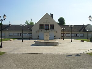
 Marolles-en-Hurepoix town hall |
||
Marolles-en-Hurepoix is a French village with 5388 inhabitants (as of January 1 2017) in the department of Essonne in the region of Ile-de-France ; it belongs to the Arrondissement of Palaiseau and the canton of Brétigny-sur-Orge . The inhabitants are called Marollais .
geography
Marolles-en-Hurepoix is about 33 kilometers south of Paris. Marolles-en-Hurepoix is surrounded by the neighboring municipalities of Brétigny-sur-Orge in the north, Leudeville in the east, Saint-Vrain in the south and southeast, Cheptainville in the southwest, Guibeville in the west and La Norville in the northwest.
Population development
| year | 1962 | 1968 | 1975 | 1982 | 1990 | 1999 | 2006 | 2011 |
| Residents | 1,401 | 1,578 | 2.711 | 3,549 | 4.126 | 4,669 | 4,731 | 4,870 |
Attractions
- Notre-Dame-de-l'Assomption church
- Beaulieu Castle, built around 1480
- Marolles Castle, built between 1481 and 1680, rebuilt in 1788
- Gaillon Palace, built in 1588
- Tournelles Castle
Community partnerships
We have partnerships with the following municipalities:
- Southam , UK, since 1992
- Lakamané , Mali, since 1994
- Coppenbrügge , Lower Saxony, Germany, since 1994
Personalities
- Friedrich Burgmüller (1806–1874), composer
- Émile Levassor (1843-1897), engineer
literature
- Le Patrimoine des Communes de l'Essonne. Flohic Éditions, Volume 1, Paris 2001, ISBN 2-84234-126-0 , pp. 146-148.
Web links
Commons : Marolles-en-Hurepoix - Collection of images, videos and audio files
