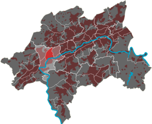
Nützenberg (district)
|
Nützenberg (12) district of Wuppertal |
|
|---|---|
| Coordinates | 51 ° 15 '11 " N , 7 ° 6' 47" E |
| surface | 1.48 km² |
| Residents | 5701 (Dec. 31, 2016) |
| Population density | 3852 inhabitants / km² |
| Proportion of foreigners | 25.0% (Dec. 31, 2016) |
| Post Code | 42115 |
| prefix | 0202 |
| Borough | Elberfeld-West |
| Transport links | |
| Highway |
|
| Federal road |
|
| bus | 600 611 619 629 NE1 |
| Source: Wuppertal statistics - spatial data | |
The Wuppertal residential district Nützenberg is one of seven quarters in the Elberfeld-West district . The Nützenberg survey gives its name to the residential area .
geography
The 1.48 km² residential area is located in the west of Wuppertal. To the east of the residential quarter is the Brill quarter , the border of the quarter going over the top of the Nützenberg and the Nützenbergpark . In the southeast the area borders on the Arrenberg district . In the south is the residential area of the Zoo , the Düsseldorf – Elberfeld railway line on the flank of the Kiesberg is taken as the border . The area of the Wupper together with the main Elberfeld plant of Bayer AG is part of the quarter. In the southwest the area extends to the Sonnborn railway bridge and borders there in the west on the Sonnborn district . The western border is initially Friedrich-Ebert-Straße (in this area Bundesstraße 228 ) and further north is Varresbecker Straße ( Bundesstraße 7 ). In the northwest lies the Varresbeck district , Varresbecker Strasse and Otto-Hausmann-Ring form the border here.

