
Mahlberg
| coat of arms | Germany map | |
|---|---|---|

|
Coordinates: 48 ° 17 ' N , 7 ° 49' E |
|
| Basic data | ||
| State : | Baden-Württemberg | |
| Administrative region : | Freiburg | |
| County : | Ortenau district | |
| Height : | 180 m above sea level NHN | |
| Area : | 16.59 km 2 | |
| Residents: | 5061 (December 31, 2018) | |
| Population density : | 305 inhabitants per km 2 | |
| Postal code : | 77972 | |
| Area code : | 07825 | |
| License plate : | OG, BH , KEL, LR, WOL | |
| Community key : | 08 3 17 073 | |
| LOCODE : | DE MAB | |
City administration address : |
Rathausplatz 7 77972 Mahlberg |
|
| Website : | ||
| Mayor : | Dietmar Benz | |
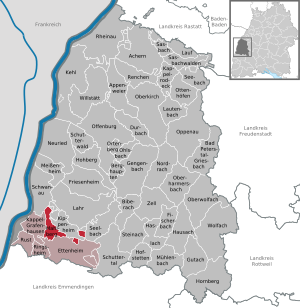
| Location of the city of Mahlberg in the Ortenau district | ||
  |
||


Mahlberg is a small town in the southwest of Baden-Württemberg and belongs to the Ortenau district .
geography
Mahlberg lies between the foothills of the Black Forest and the Rhine in the Upper Rhine Plain between the cities of Freiburg im Breisgau in the south (approx. 40 km) and Offenburg in the north (approx. 26 km).
Neighboring communities
Immediate neighboring communities are Kippenheim in the north (followed by Lahr ), Kappel-Grafenhausen in the west beyond the federal highway 5 and Ettenheim in the southeast (with the district Altdorf).
City structure
The formerly independent municipality of Orschweier, in which about a third of the total population lives, belongs to Mahlberg. The town of Mahlberg and the homestead Allmendhöfe belong to the town of Mahlberg within the limits of September 30, 1973. The village of Orschweier, south of Mahlberg, and the residential area of the Orschweier train station belong to the former municipality of Orschweier. In the Mahlberg district was the village of Altenmahlberg, which had been dissolved in Mahlberg.
A few years ago, an intermunicipal industrial area called "DYNA5" was identified and developed with the neighboring community of Ettenheim.
climate
The climate can be classified as an oceanic climate using the Köppen and Geiger climate classification. However, it has similarities as a humid, subtropical , humid climate , as the average temperatures in July and August are just under 22 ° C. Most of the precipitation falls in May, while there is a mild Mediterranean climate in the late summer months . Mahlberg is currently one of the warmest regions in Germany with an annual mean temperature of 11.9 ° C.
| Mahlberg | ||||||||||||||||||||||||||||||||||||||||||||||||
|---|---|---|---|---|---|---|---|---|---|---|---|---|---|---|---|---|---|---|---|---|---|---|---|---|---|---|---|---|---|---|---|---|---|---|---|---|---|---|---|---|---|---|---|---|---|---|---|---|
| Climate diagram | ||||||||||||||||||||||||||||||||||||||||||||||||
| ||||||||||||||||||||||||||||||||||||||||||||||||
|
Average monthly temperatures and precipitation for Mahlberg
Source: [2]
|
||||||||||||||||||||||||||||||||||||||||||||||||||||||||||||||||||||||||||||||||||||||||||||||||||||||||||||||||||||||||||||||||||||||||||||||||||||||
history
Until the 19th century
Mahlberg was first mentioned in a document in 1215. Already in 1223 the place of emperors Frederick II. The town rights conferred. At that time Mahlberg was an imperial castle and the seat of an imperial school. At that time the place belonged to the domain of the gentlemen von Geroldseck . After their extinction in the middle of the 15th century, the city became part of the margraviate of Baden-Baden , and common rule was agreed with the Counts of Nassau-Saarbrücken . After the joint ownership of Baden and Nassau was dissolved in 1629, the city then became a center of Baden-Baden rule.
After the Reichsdeputationshauptschluss , Mahlberg initially became the seat of the Oberamt of the same name, which belonged to the Landvogtei Hochberg. In 1806 it was placed directly under the province of Middle Rhine as a sovereign office. When it was reorganized again in 1809, it was subordinated to the Kinzigkreis with its seat in Offenburg as the Mahlberg office . Finally, the Mahlberg Office was combined with the Office Ettenheim in 1813. The new office took its seat in Ettenheim . From this point on, Mahlberg as a city no longer had any significance in the administrative history of Baden. In 1900 there were 962 mostly Catholic residents in Mahlberg. Since 1924 the city belonged to the district office of Lahr, which in 1939 became the district of Lahr .
20th century
In 1935 Mahlberg lost its town charter in the course of the National Socialist central administrative “cleanup”, but got it back in 1950 after the then Prime Minister of Baden Leo Wohleb (before Baden-Württemberg was founded) had advocated it. With the dissolution of the Lahr district, Mahlberg fell to the new Ortenau district .
Incorporations

The previously independent municipality of Orschweier was incorporated into the town of Mahlberg on October 1, 1973 as part of the municipal reform in Baden-Württemberg. This was preceded by - ultimately unsuccessful - negotiations with the neighboring communities of Ettenheim and Kippenheim.
politics
Associations
Mahlberg is one of the smallest towns in Baden-Württemberg and is still independent. A water and wastewater association connects them with the larger neighboring town of Ettenheim, as well as a joint "Intercommunal Industrial Area DYNA5". It also belongs to the agreed administrative community of the city of Ettenheim with the communities of Kappel-Grafenhausen , Ringsheim and Rust (Baden) .
Municipal council

The council consists of three councilors and eleven councilors. In the local elections on June 7, 2009, with a turnout of 47.3% (- 2.5), the following result was achieved:
| CDU | 56.5% | + 3.3 | 8 seats | ± 0 |
| SPD | 26.0% | - 1.2 | 4 seats | ± 0 |
| other | 17.6% | - 0.4 | 2 seats | ± 0 |
In the local elections on May 26, 2019 , the voter turnout was 51.2% (2014: 39.56%):
| Party / list | Seats | +/- | Share of votes | % p |
| Christian Democratic Union of Germany (CDU) | 4 seats | - 2nd | 31.1% | - 9.0 |
| BürgerForum Mahlberg + Orschweier (BFMO) | 4 seats | ± 0 | 31.0% | + 3.9 |
| Social Democratic Party of Germany (SPD) | 2 seats | ± 0 | 11.6% | - 5.4 |
| Free Voter Association (FWV) | 4 seats | + 2 | 26.3% | + 10.5 |
mayor
In September 2010 Dietmar Benz was confirmed for a third term of office with 96.05% of the votes. In a new re-election on September 23, 2018, he was able to unite 85.5% of the valid votes.
coat of arms
- The blazon of the Mahlberg coat of arms reads: "In blue bars, two silver, six-pointed stars above a golden six-mountain ."
- The blazon of Orschweier's coat of arms reads: "In red a gold-stemmed, green-tipped, golden rose with four green leaves, covered by a golden cross , each with a six-pointed golden star."
partnership
Mahlberg maintains a partnership with the French municipality of Malaucène in the Provence-Alpes-Côte d'Azur region . Malaucène is located on the western foothills of the Maritime Alps and about 40 km northeast of the city of Avignon in the Rhône Valley .


Culture and sights
- the castle, which can be seen from afar, was built in 1630 by the margraves of Baden (today: Barons von Türckheim-Böhl) as a landmark of southern Ortenau ,
- the Evangelical Parish Church from 1687 in the old town center with furnishings largely dating from the 18th century ,
- the Katharinenkapelle with its still preserved octagonal floor plan,
- St. Leopold Church
- the Radbrunnenhof,
- various fountains, including one from Roman times in the process of being secured.
Museums
The Upper Rhine Tobacco Museum has existed in a former cigar factory since 1992 , where the tradition and importance of tobacco production is shown in its individual operations. The cultivation of tobacco was an important branch of agriculture in the Upper Rhine Plain for 200 years .
Economy and Infrastructure
traffic
Mahlberg can be reached via the Ettenheim / Mahlberg motorway exit (No. 57a) of the A 5 ( Basel - Karlsruhe ), where the Mahlberg-Ost and Mahlberg-West motorway service stations are also located. Bundesstrasse 3 ( Buxtehude - Weil am Rhein ) runs through the district of Mahlberg .
In the Orschweier district there is a train station on the Rhine Valley Railway . This is served every hour by the Regional Express or the regional train to Offenburg and Basel . From December 22nd, 1893 to August 31st, 1966 the Rhein-Ettenheimmünster local railway operated . The station building itself is the work of the architect Friedrich Eisenlohr .
Renewable Energies
Mahlberg has its own solar power plant on the roof of the school with an output of 33 kWp. It was the first community in the Ortenau district to be awarded the title “Solar Commune” by the German Environmental Aid. In addition, since June 2002 two of the largest and most powerful series-produced wind turbines in the world, each with an output of 2.5 megawatts, have been installed in the district since June 2002 . However, one of them has been out of service for years. In the meantime Mahlberg has subsidized several private solar systems and has leased additional roof areas (such as the fire station and the tobacco dryers of the tobacco museum) for solar systems.
education
In 2010, the previous secondary school in Mahlberg was dissolved in favor of a "Werk- und Realschule" operated jointly with the neighboring community of Kippenheim, in order to avoid the closure of one of the two secondary schools threatened by the Baden-Württemberg state government. The four-class Mahlberger elementary school with two first "branch" classes in the Orschweier district was maintained under self-administration. Mahlberg is also the sponsor of the "Hansjakob- Förderschule " for the Ortenau southern district, which is housed in the Orschweier school building and is partly financed by the neighboring southern district communities Ettenheim, Ringsheim, Rust and Kappel-Grafenhausen.
Personalities
sons and daughters of the town
- Josef Loreye (1767–1844), Roman Catholic priest, Lyceum director in Rastatt
- Johann Samuel Huber (1778–1858), theologian, general superintendent of the Evangelical Lutheran Church in Moscow
- Friedrich Landolin Karl von Blittersdorf (1792–1861), Baden civil servant
- Fidel Binz (1850–1920), sculptor from Baden
- Karl Kromer (1865–1939), composer and musician
- Josef Naudascher (1930–2014), honorary citizen of the city of Mahlberg
Other known residents
- Johann Heinrich David von Hennenhofer (1793–1850), Baden diplomat, lived temporarily in Mahlberg in retirement.
- Wolfram Siebeck (1928–2016), columnist and gastro critic, had one of his domiciles in Mahlberg Castle since the late 1980s.
- Christina Obergföll (* 1981), javelin thrower, World Champion in Athletics World Championships 2013 in Moscow, European record in javelin throw; A street in the village is named after her
Associated with Mahlberg
The Luxembourg Grand Duke Henri von Nassau also bears the title of Herr von Mahlberg in his name .
literature
- Hermann Rieder: The city of Mahlberg through the ages, a local history , Stückle, Ettenheim 1956
- Josef Naudascher: Mahlberg, Orschweier. The past in the picture , Stückle, Ettenheim 1985
- Albert Köbele and Klaus Siefert: Ortssippenbuch Mahlberg-Orschweier 1651–1976 . Grafenhausen: Köbele 1977 (= Badische Ortssippenbücher 39)
Web links
Individual evidence
- ↑ State Statistical Office Baden-Württemberg - Population by nationality and gender on December 31, 2018 (CSV file) ( help on this ).
- ^ The state of Baden-Württemberg. Official description by district and municipality. Volume VI: Freiburg region Kohlhammer, Stuttgart 1982, ISBN 3-17-007174-2 . Pp. 312-314
- ^ Mahlberg in: Meyers Großes Konversations-Lexikon, Volume 13. Leipzig 1908, p. 163.
- ^ Federal Statistical Office (ed.): Historical municipality directory for the Federal Republic of Germany. Name, border and key number changes in municipalities, counties and administrative districts from May 27, 1970 to December 31, 1982 . W. Kohlhammer, Stuttgart / Mainz 1983, ISBN 3-17-003263-1 , p. 513 .
- ↑ Baden-Württemberg State Statistical Office
- ↑ [id = 996281 & publish [start] = City of Mahlberg - public announcement of the results of the election of the municipal council on May 26, 2019], accessed on August 7, 2019
- ↑ http://www.badische-zeitung.de/mahlberg/96-05-prozent-fuer-dietmar-benz--35910618.html
- ↑ https://wahlen.kdrs.de/AGS317073/317073mg-230918.htm City of Mahlberg - Final result of the mayoral election 2018
- ↑ http://schloss-mahlberg.de/schloss.php
- ^ Abendblatt.de: Influential, these Luxembourgers (March 18, 2016) ; accessed on December 17, 2018

Achern | Appenweier | Bad Peterstal-Griesbach | Berghaupten | Biberach | Durbach | Ettenheim | Fischerbach | Friesenheim | Gengenbach | Gutach (Black Forest Railway) | Haslach im Kinzigtal | Hausach | Hofstetten | Hohberg | Hornberg | Kappel-Grafenhausen | Kappelrodeck | Throat | Kippenheim | Lahr / Black Forest | Run | Lautenbach | Mahlberg | Meißenheim | Mühlenbach | Neuried | Nordrach | Oberharmersbach | Oberkirch | Oberwolfach | Offenburg | Ohlsbach | Oppenau | Ortenberg | Ottenhöfen in the Black Forest | Renchen | Rheinau | Ringsheim | Rust | Sasbach | Sasbachwalden | Schuttertal | Schutterwald | Schwanau | Seebach | Seelbach | Steinach | Willstätt | Wolfach | Zell am Harmersbach
Rheinau (municipality-free area)