Podosinovets (Kirov)
| Urban-type settlement
Podossinowez
Подосиновец
|
||||||||||||||||||||||||||||||||
|
||||||||||||||||||||||||||||||||
|
||||||||||||||||||||||||||||||||
Podosinovets ( Russian Подоси́новец ) is an urban-type settlement in Kirov Oblast in Russia with 4029 inhabitants (as of October 14, 2010).
geography
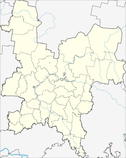
The place is located about 240 km as the crow flies northwest of the Kirov Oblast Administrative Center on the right bank of the Jug , at the confluence of the Pushma .
Podossinowez is the administrative center of the Rajons Podossinowski and seat of the municipality Podossinowskoje gorodskoje posselenije. Since the incorporation of the rural communities Oktjabrskoje selskoje posselenije and Shchetkinskoje selskoje posselenije in 2012, 60 villages, of which only three have more than 100 inhabitants (as of October 14, 2010): Borok (8 km southeast), Oktyabr (a good 30 km east-southeast) and Shchetkino (a good 20 km east-southeast).
history
The place was first mentioned in 1626. Its name goes back to the well-known fortified settlement Ossinowez, mentioned in 1486, further upstream on the Jug; Podossinowez means "Lower Ossinowez". From the end of the 18th century Podossinowez belonged to the Ujesd Nikolsk of the Vologda governorate and gained some economic importance with its landing stage through the river navigation on the Jug. With the construction of the further east running railway line ( Perm -) Vjatka - Kotlas this declined, but on April 10, 1924 the place became the administrative seat of a newly created Rajons named after him.
Since 1965 the place has received the status of an urban-type settlement.
Population development
| year | Residents |
|---|---|
| 1939 | 1522 |
| 1959 | 2482 |
| 1970 | 2955 |
| 1979 | 3562 |
| 1989 | 4378 |
| 2002 | 4235 |
| 2010 | 4029 |
Note: census data
traffic
At Podosinovets the regional road 33K-028 crosses the Jug and leads its left bank up to the border of the Vologda Oblast , from there to Kitschmengski Gorodok , where it joins the Nizhny Novgorod - Veliky Ustyug connection 75 km away . First down the right bank of the Jug, the 33N-160 leads to the northern neighboring district of Lusa . In an easterly direction there is a road to Pinjug to the road under construction Kirov - Kotlas - Arkhangelsk .
In the urban-type Demjanowo settlement eight kilometers to the north is the Podossinowez railway station , the end point of a 32 km long branch line from the Panassjuk station on the Kirov - Kotlas line that went into operation in the 1960s .
Web links
Individual evidence
- ↑ a b Itogi Vserossijskoj perepisi naselenija 2010 goda. Tom 1. Čislennostʹ i razmeščenie naselenija (Results of the All-Russian Census 2010. Volume 1. Number and distribution of the population). Tables 5 , pp. 12-209; 11 , pp. 312–979 (download from the website of the Federal Service for State Statistics of the Russian Federation)

