
Putten (Gelderland)
 flag |
 coat of arms |
| province |
|
| mayor | Henk Lambooij ( SGP ) |
| Seat of the municipality | Putt |
|
Area - land - water |
87.5 km 2 85.21 km 2 2.29 km 2 |
| CBS code | 0273 |
| Residents | 24,184 (Jan 31, 2019) |
| Population density | 276 inhabitants / km 2 |
| Coordinates | 52 ° 15 ′ N , 5 ° 36 ′ E |
| height | 11 m NAP |
| Important traffic route |
|
| prefix | 0341 |
| Postcodes | 3853, 3881-3882 |
| Website | Homepage of putti |
 |
|
_IMG_4745.JPG) |
|
Putten ( ) is a village and a municipality in the province of Gelderland ( Netherlands ). It has 24,184 inhabitants (as of January 31, 2019).
Location and economy
Putten lies west of the Veluwe . In the west it is bounded by Nijkerk , in the south by Voorthuizen (Gem. Barneveld ) and in the north by Ermelo . The next motorway junction is on the A28 (Strand Nulde) four kilometers west of the village. Putten has a small train station on the Amersfoort - Harderwijk railway line , which continues to Zwolle . The train station is two kilometers west of the village.
At the train station there is a larger industrial area where all kinds of small businesses and trading companies have settled. There are many farms west of the village. But the most important branch of the economy is tourism.
politics
Distribution of seats in the municipal council
The municipal council has been formed as follows since 1982:
| Political party | Seats | |||||||||
|---|---|---|---|---|---|---|---|---|---|---|
| 1982 | 1986 | 1990 | 1994 | 1998 | 2002 | 2006 | 2010 | 2014 | 2018 | |
| Wij Putten a | - | - | - | - | - | - | - | 4th | 5 | 5 |
| ChristenUnie | - | - | - | - | - | 4th | 4th | 5 | 4th | 4th |
| CDA | 6th | 7th | 7th | 5 | 5 | 5 | 4th | 4th | 4th | 4th |
| Gemeentebelangen b | 2 | 3 | 3 | 5 | 4th | 4th | 5 | 3 | 2 | 3 |
| SGP | 3 | 1 | 1 | 1 | 1 | 2 c | 2 | 2 | 3 | 3 |
| VVD | 3 | 3 | 3 | 2 | 3 | 2 | 2 | 1 | 1 | - |
| PvdA | 1 | 2 | 2 | 1 | 1 | 1 | 2 | - a | - | - |
| GroenLinks | - | - | - | - | 1 | 1 | - a | - | - | |
| D66 | - | - | - | 1 | - | 0 | 0 | - | ||
| GPV | - | - | - | 4th | 3 | - | - | - | - | - |
| RPF | 1 | 3 | 3 | - | - | - | - | - | ||
| Molded putti | - | 1 | - c | - | - | - | - | |||
| Progressive putting | 1 | - | - | - | - | - | - | - | - | - |
| total | 17th | 19th | 19th | 19th | 19th | 19th | 19th | 19th | 19th | 19th |
mayor
Henk Lambooij ( SGP ) has been the acting mayor of the municipality since June 15, 2011 . His colleagues include the alderman Nico Gerritsen (SGP), Gerbert Priem ( ChristenUnie ), Roelof Koekkoek (Wij Putten) and the community secretary Ferdinand Contant.
Touristic
- To the west of Putten is the Nulde Beach , a recreation area with a marina and many water sports. It is located on the Nuldernauw, a Randmeer (Dutch sea - the lake) between Gelderland and the province of Flevoland . This body of water is a holdover from the Zuiderzee .
- To the east of the village are the beautiful forests of the Veluwe . The village has several campsites and guest houses. The Schovenhorst country estate is particularly worth seeing. Vanenburg Castle is a new building from the end of the 19th century and serves as a conference center.
- On the 2nd Wednesday in October there is a fair ( Ossenmarkt = German: Ochsenmarkt) with many festivities.
- Since 1992 there has been a memorial (with an exhibition) for the terrible events of October 1944 (closed on Sundays).
- In the center is the Oude Kerk (Old Church), 15. – 16. Century, heavily restored around 1900; Visible from time to time (Wednesdays) in the summer months.
history
_1965,_MiNr_1141.jpg)
Putten was first mentioned in a deed of donation from the Werden monastery from 855. For a long time it was a simple farming village. Nijkerk and Voorthuizen also belonged to the parish of Putten until 1416 . Putti was destroyed several times in the wars of the 15th, 16th and 17th centuries. When the village was connected to the railway in 1863, tourism emerged, a development that continued until after the Second World War. In the 20th century, commuters also settled in the village who had a job in the surrounding towns.
In October 1944 the Putten case occurred here , a war crime committed by the Wehrmacht , in which 661 people were abducted to concentration camps and the village was then burned down. 552 people were killed. The occasion was an attack by a resistance group on a car with German officers. A memorial was erected in 1947 to commemorate the victims and was ceremoniously unveiled by Queen Juliana in 1949 .

War memorial in the Herdenkingshof

War memorial next to the church (de Oude Kerk)

Windmill on Halvinkhuizerweg
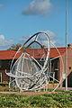
Artwork "Nacimiento"


_IMG_4737.JPG)
_IMG_4727.JPG)
Web links
- Website of the municipality (Dutch, German, English)
- Website about the events in Putten in October 1944 (Dutch, German, English)
- Website of the Putten Tourist Association (Dutch)
Individual evidence
- ↑ Bevolkingsontwikkeling; regio per maand . In: StatLine . Centraal Bureau voor de Statistiek (Dutch)
- ↑ Result of the local elections: 2014 2018 , accessed on July 20, 2018 (Dutch)
- ↑ Allocation of seats in the municipal council: 1982–2002 2006 2010 2014 2018 , accessed on July 20, 2018 (Dutch)
- ↑ Ruud van Gijzel: Lambooij nieuwe burgemeester Putten. In: Omroep Gelderland. May 30, 2011, accessed July 20, 2018 (Dutch).
- ↑ Samenstelling Gemeente Putten, accessed on July 20, 2018 (Dutch)
Aalten | Apeldoorn | Arnhem | Barneveld | Berg en Dal | Berkelland | Beuningen | Bronckhorst | Hum | Boers | Culemborg | Doesburg | Doetinchem | Druten | Duiven | Ede | Elburg | Epe | Ermelo | Harderwijk | Hattem | Herd | Hay | Lingewaard | Lochem | Maasdriel | Montferland | Neder-Betuwe | Nijkerk | Nijmegen | Nunspeet | Oldebroek | Oost Gelre | Oude IJsselstreek | Overbetuwe | Putti | Renkum | Rheden | Rozendaal | Scherpenzeel | Tiel | Voorst | Wageningen | West Betuwe | West Maas en Waal | Westervoort | Wijchen | Winterswijk | Zaltbommel | Zevenaar | Zutphen