
Rougnat
| Rougnat | ||
|---|---|---|

|
|
|
| region | Nouvelle-Aquitaine | |
| Department | Creuse | |
| Arrondissement | Aubusson | |
| Canton | Auzances | |
| Community association | Chénérailles, Auzances / Bellegarde and Haut Pays Marchois | |
| Coordinates | 46 ° 3 ' N , 2 ° 30' E | |
| height | 430-669 m | |
| surface | 41.01 km 2 | |
| Residents | 494 (January 1, 2017) | |
| Population density | 12 inhabitants / km 2 | |
| Post Code | 23700 | |
| INSEE code | 23164 | |

Rougnat is a municipality in the Massif Central in France . It belongs to the Nouvelle-Aquitaine region , the Creuse department , the Aubusson arrondissement and the Auzances canton .
geography
The former route nationale 696 and today's D996 departmental road leads via Rougnat. The neighboring municipalities are Reterre in the north-west, Fontanières in the north, Charron , Auzances and Le Compas in the south, Bussière-Nouvelle in the south-west and Arfeuille-Châtain in the west. The village is affected by the Chat Cros river in the west and the Cher in the east . This takes in the stream that flows through the largest lake in the municipality, the Étang du Crouzet .
Population development
| year | 1962 | 1968 | 1975 | 1982 | 1990 | 1999 | 2008 | 2012 |
|---|---|---|---|---|---|---|---|---|
| Residents | 896 | 856 | 764 | 676 | 631 | 541 | 556 | 524 |
Attractions
- Saint-Laurent Church, Monument historique

Saint Laurent Church
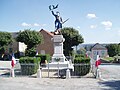
War memorial


Web links
Commons : Rougnat - collection of images, videos and audio files