Chénérailles
| Chénérailles | ||
|---|---|---|

|
|
|
| region | Nouvelle-Aquitaine | |
| Department | Creuse | |
| Arrondissement | Aubusson | |
| Canton | Gouzon | |
| Community association | Chénérailles, Auzances / Bellegarde and Haut Pays Marchois | |
| Coordinates | 46 ° 7 ' N , 2 ° 11' E | |
| height | 487-553 m | |
| surface | 7.77 km 2 | |
| Residents | 760 (January 1, 2017) | |
| Population density | 98 inhabitants / km 2 | |
| Post Code | 23130 | |
| INSEE code | 23061 | |
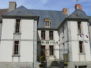
 Chénérailles Town Hall |
||
Chénérailles is a commune in France . It was the chief town (chief lieu) of the canton of Chénérailles and was defeated in 2015 to the canton of Gouzon . It belongs to the Nouvelle-Aquitaine region , the Creuse department and the Aubusson arrondissement . It is bordered by Saint-Dizier-la-Tour to the north, Saint-Chabrais to the east, Issoudun-Létrieix to the south and Saint-Pardoux-les-Cards to the west . All of the small lakes , including the Étang des Brochets, are located in the municipal marker.
Attractions
- Saint-Barthélemy Church, Monument historique
Population development
| year | 1962 | 1968 | 1975 | 1982 | 1990 | 1999 | 2008 | 2013 |
|---|---|---|---|---|---|---|---|---|
| Residents | 770 | 729 | 674 | 685 | 794 | 759 | 736 | 766 |
Web links
Commons : Chénérailles - Collection of images, videos and audio files

