Slip
|
Nature reserve slides
|
||
|
Slide rocks |
||
| location | Dettingen an der Erms and Bad Urach in the Reutlingen district , Baden-Württemberg | |
| surface | 226.5 ha | |
| Identifier | 4.112 | |
| WDPA ID | 165270 | |
| Geographical location | 48 ° 29 ' N , 9 ° 22' E | |
|
|
||
| Sea level | from 570 m to 750 m | |
| Setup date | October 15, 1983 | |
| administration | Regional Council Tübingen | |
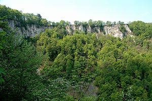
Slides is a with Regulation of the Regional Council Tübingen been trained from 15 October 1983 Nature Reserve with the number 4112. In the amending ordinance of 9 December 1997, climbing operations on the rocks in the protected area are regulated more precisely.
location
The nature reserve is located in the Mittlere Kuppenalb natural area . It is located on the Albtrauf south of Dettingen an der Erms , west of Bad Urach , north of the Bleichstetten district and east of the St. Johann stud farm . The Urach waterfall is located in the center of the area. The NSG is part of both the FFH area No. 7522-341 Uracher Talspinne and the bird sanctuary No. 7422-441 Middle Swabian Alb . The nature reserve lies entirely in the Swabian Alb biosphere area .
Origin of name and history
In the area of today's Rutschenhof-Brünnele, a water source that rises in a natural sinkhole, traces of settlement have been found that are related to the pre-Christian settlement of the Round Mountain . The steep edge of the Albhochwiese still bore the name "uff Lange Velsen" in the Urach forest description from 1520 and was later called "Angelfelsen". It was only with the construction of the wooden slide (later an iron slide), which began in 1680, that today's name "slide rock" became common. The logs felled on the Alb plateau were lowered into the Brühltal via smooth tubes, at great speed and with a din that could be heard from far away, and floated over the Erms and finally the Neckar to Stuttgart.
In order to accommodate the teams of oxen that were needed to cart the logs in, the so-called slide farm was built in 1681, which was expanded to include a foal stable in 1815, but was demolished in 1828 after it was sold by the state to the municipality of Bleichstetten. Today there is a barbecue area and a refuge there.
Protection purpose
According to the ordinance, the protection purpose is the preservation of habitats whose use is difficult due to the high relief energy and which have therefore remained close to nature:
- geological formations that shape the landscape, such as rock formations and tufa formations (waterfalls);
- dry and warm to humid mixed deciduous forest communities, rock sites with dry grass and wall joint communities as well as relictic, moisture-bound plant communities;
- Habitats, some of which are extremely rare for insects and amphibians, as well as narrower habitats, in particular for bat species endangered by human disturbance and very rare, sometimes rock-dwelling bird species;
- Grassland to complete the forest / meadow habitat because of the existing interrelationships that are necessary for the maintenance of the faunistic communities.
Flora and fauna
The area is home to the endangered plants deer-tongue fern and pentagon . The endangered beetle species, alpine buck, is common in the area's beech forests.
See also
literature
- Regional Council Tübingen (ed.): The nature reserves in the administrative district of Tübingen . Thorbecke, Stuttgart 2006, ISBN 978-3-7995-5175-5 .
Web links
- Profile of the nature reserve in the protected area directory of the LUBW with protected area ordinance and map
Individual evidence
- ↑ Gestütshof St. Johann bei Urach, Geschichtsblätter Reutlingen (1976, No. 14). Pages 76-102. Hornung, Wilhelm


