Saint Géry-verse
| Saint Géry-verse | ||
|---|---|---|
|
|
||
| region | Occitania | |
| Department | Lot | |
| Arrondissement | Cahors | |
| Canton | Causse et Vallées | |
| Community association | Grand Cahors | |
| Coordinates | 44 ° 29 ′ N , 1 ° 35 ′ E | |
| height | 110-351 m | |
| surface | 31.52 km 2 | |
| Residents | 863 (January 1, 2017) | |
| Population density | 27 inhabitants / km 2 | |
| Post Code | 46090 and 46330 | |
| INSEE code | 46268 | |
 The site of Saint-Géry |
||
Saint Géry-Vers is a French commune with 863 inhabitants (as of January 1, 2017) in the Lot department in the Occitanie region . It belongs to the Arrondissement of Cahors and the canton of Causse et Vallées . It was created as Commune nouvelle with effect from January 1, 2017 by merging the previous municipalities of Vers and Saint-Géry .
structure
| District | former INSEE code |
Area (km²) | Population as of January 1, 2017 |
|---|---|---|---|
| Saint-Géry (administrative headquarters) | 46268 | 13.58 | 446 |
| verse | 46331 | 17.94 | 417 |
location
The municipality is located about 12 kilometers east of Cahors in the Causses du Quercy Regional Nature Park . The municipality is the river Lot crossed, in the - coming from the north - the river verse in the same locality verse opens. Neighboring municipalities are Bellefont-La Rauze in the northwest, Cabrerets in the north, Bouziès in the east, Saint-Cirq-Lapopie and Esclauzels in the southeast, Arcambal in the south and Lamagdelaine in the west.
Attractions
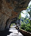
- In the steep cliffs of the Lot Valley there are caves and grottoes that were inhabited in prehistoric times. They are registered as a monument historique .
- Church Notre-Dame-de-Veles historique from the 13th century, Monument
- Watermill on the River Vers
Web links
Individual evidence
- ↑ current population according to INSEE
- ↑ Entry No. 46268 in the Base Mérimée of the French Ministry of Culture (French)
- ↑ Entry no. PA00095281 in the Base Mérimée of the French Ministry of Culture (French)


