Santa Bárbara (Antioquia)
| Santa Bárbara | ||
|---|---|---|
|
Coordinates: 5 ° 52 ′ N , 75 ° 34 ′ W Santa Bárbara on the map of Colombia
|
||
|
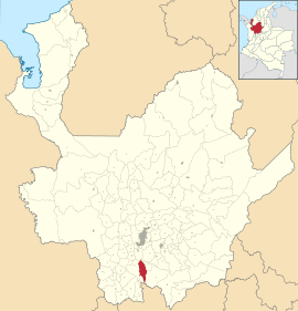
Location of the municipality of Santa Bárbara on the map of Antioquia
|
||
| Basic data | ||
| Country | Colombia | |
| Department | Antioquia | |
| City foundation | 1733 | |
| Residents | 21,413 (2019) | |
| City insignia | ||
| Detailed data | ||
| surface | 491 km 2 | |
| Population density | 44 people / km 2 | |
| height | 1800 m | |
| City Presidency | Mónica Ocampo (2016-2019) | |
| Website | ||
| Park in Santa Bárbara | ||
| Church of Santa Bárbara | ||
| Santa Bárbara Canyon | ||
Santa Barbara is a municipality ( municipio ) in the Department of Antioquia in Colombia .
geography
Santa Bárbara is located in the Suroeste sub-region in Antioquia, 53 km from Medellín , at an altitude of approximately 1800 m above sea level. NN on the west side of the Central Cordillera of the Colombian Andes and has an average temperature of 19 ° C. The municipality is divided into 42 veredas and two corregimientos in the rural part . The municipality borders Caldas in the north, Montebello and Abejorral in the east, Fredonia and La Pintada in the west and Aguadas in Caldas in the south .
population
The municipality of Santa Bárbara has 21,413 inhabitants, of which 10,228 live in the urban part (cabecera municipal) of the municipality (as of 2019).
history
The area of today's Santa Bárbara was opened up for the Spaniards around 1540 by Hernán Rodríguez de Souza. The origins of today's place go back to a village called Sitio Viejo . The first parish was founded in 1733. Since 1816 the town center has been at its current location. Santa Bárbara received the status of a municipality in 1822.
economy
The main industry in Santa Bárbara is agriculture . In particular, fruit is grown. There is also animal husbandry ( cattle and pigs ), the timber industry and the food industry .
Web links
- Alcaldía Municipal de Santa Bárbara, Antioquia. Alcaldía de Santa Bárbara - Antioquia, accessed on May 14, 2019 (Spanish, website of the municipality of Santa Bárbara).
Individual evidence
- ↑ a b c Nuestro municipio. Alcaldía de Santa Bárbara - Antioquia, accessed on May 14, 2019 (Spanish, information on the municipality).
- ↑ ESTIMACIONES DE POBLACIÓN 1985 - 2005 Y PROYECCIONES DE POBLACIÓN 2005 - 2020 TOTAL DEPARTAMENTAL POR ÁREA. (Excel; 1.72 MB) DANE, May 11, 2011, accessed on May 14, 2019 (Spanish, extrapolation of the population of Colombia).


