
Děčín: Difference between revisions
Tags: Reverted Mobile edit Mobile web edit |
m →Notable people: direct link |
||
| (18 intermediate revisions by 4 users not shown) | |||
| Line 3: | Line 3: | ||
| other_name = |
| other_name = |
||
| settlement_type = [[Statutory city (Czech Republic)|Statutory city]] |
| settlement_type = [[Statutory city (Czech Republic)|Statutory city]] |
||
<!-- images |
<!-- images --> |
||
| image_skyline = Děčín (Tetschen), Czech Republic.jpg |
| image_skyline = Děčín (Tetschen), Czech Republic.jpg |
||
| image_caption = View over the Elbe Valley |
| image_caption = View over the Elbe Valley |
||
| Line 37: | Line 37: | ||
| elevation_m = 135 |
| elevation_m = 135 |
||
<!-- population --> |
<!-- population --> |
||
| population_as_of = |
| population_as_of = 2023-01-01 |
||
| population_footnotes = <ref>{{cite web |title=Population of Municipalities – 1 January |
| population_footnotes = <ref>{{cite web |title=Population of Municipalities – 1 January 2023|url=https://www.czso.cz/csu/czso/population-of-municipalities-1-january-2023|publisher=[[Czech Statistical Office]]|date=2023-05-23}}</ref> |
||
| population_total = |
| population_total = 47180 |
||
| population_density_km2 = auto |
| population_density_km2 = auto |
||
<!-- time zone(s) --> |
<!-- time zone(s) --> |
||
| Line 55: | Line 55: | ||
| footnotes = |
| footnotes = |
||
}} |
}} |
||
'''Děčín''' ({{IPA-cs|ˈɟɛtʃiːn}}; {{lang-de|Tetschen}}, |
'''Děčín''' ({{IPA-cs|ˈɟɛtʃiːn}}; {{lang-de|Tetschen}}, 1942–1945: ''Tetschen–Bodenbach'') is a city in the [[Ústí nad Labem Region]] of the [[Czech Republic]]. It has about 47,000 inhabitants. It is the 7th largest municipality in the country by area. Děčín is an important traffic junction. |
||
==Administrative |
==Administrative division== |
||
Děčín is made up of 35 city parts and villages: |
Děčín is made up of 35 city parts and villages:<ref>{{cite web |title=Části obcí|url=http://www.uir.cz/casti-obce|work=Územně identifikační registr ČR|language=cs|access-date=2023-11-14}}</ref> |
||
{{div col|colwidth=12em}} |
{{div col|colwidth=12em}} |
||
* |
*Děčín I-Děčín |
||
* |
*Děčín II-Nové Město |
||
*Děčín III-Staré Město |
*Děčín III-Staré Město |
||
*Děčín IV-Podmokly |
*Děčín IV-Podmokly |
||
| Line 96: | Line 96: | ||
*Děčín XXXV-Lesná |
*Děčín XXXV-Lesná |
||
{{div col end}} |
{{div col end}} |
||
==Etymology== |
|||
The name is derived from the personal Slavic name Děk.<ref>{{cite book |last=Profous|first=Antonín|title=Místní jména v Čechách I: A–H|url=https://mjc.ujc.cas.cz/search.php|pages=371|year=1947|language=cs}}</ref> |
|||
==Geography== |
==Geography== |
||
Děčín is located |
Děčín is located about {{convert|18|km}} northeast of [[Ústí nad Labem]] and {{convert|40|km|abbr=on}} southeast of [[Dresden]]. The municipal territory borders Germany in the north. With an area of {{convert|117.70|km2|abbr=on}}, Děčín is the 7th largest municipality in the country by area. It lies in the transition zone between the [[Elbe Sandstone Mountains]] in the north and the [[České Středohoří|Central Bohemian Uplands]] in the south. The highest point is a [[contour line]] on the slopes of [[Děčínský Sněžník]] at {{convert|702|m|ft|abbr=on}} above sea level. |
||
The city proper lies at the confluence of the rivers [[Elbe]] and [[Ploučnice]]. Most of the built-up area is situated in the river valley with an elevation of {{convert|135|m|ft|abbr=on}}, which makes it the lowest city in the country. The entire area of the city falls into [[Protected areas of the Czech Republic|protected landscape areas]] České středohoří and Labské pískovce. |
|||
==History== |
==History== |
||
[[File:Schloss Tetschen 1855.jpg|thumb|Děčín Castle, 1855]] |
[[File:Schloss Tetschen 1855.jpg|thumb|Děčín Castle, 1855]] |
||
| ⚫ | |||
The Děčín area was settled by the [[Slavic peoples|Slavic]] tribe of the [[Děčané]] in the 9th century, whence its name. In the 10th century the [[Přemyslid dynasty|Přemyslid]] dukes of Bohemia had a fortress built on the left bank of the Elbe [[Ford (crossing)|ford]], but after a flood, it was rebuilt on the right bank in 1059.<ref name="EB1911">{{Cite EB1911|wstitle=Tetschen|volume=26|pages=671–672}}</ref> A settlement on the [[trade route]] from the [[Ore Mountains]] in the west to the adjacent [[Upper Lusatia]] region was first mentioned in a 993 deed. King [[Ottokar II of Bohemia]] (1253–1278) had the town of Děčín laid out as an administrative centre of the surrounding estates after calling in German settlers. |
|||
According to archaeological findings, the settlement of the area began at the [[La Tène culture|La Tène times]]. Slavic settlement can be documented since the 7th century. The first written mention of Děčín is from 993, when the Děčín province existed and it is assumed that Děčín was its administrative centre. Děčín was founded at the [[ford (crossing)|ford]] over the Elbe in the places where the trade route led. The [[Přemyslid dynasty|Přemyslid]] dukes of Bohemia had a [[gord (archaeology)|gord]] built for the protection of the waterway. The gord was replaced by a stone castle in the first half of the 13th century. In the second half of the 13th century, King [[Ottokar II of Bohemia]] founded a new royal city under the castle.<ref name=history>{{cite web |title=Historie|url=https://www.mmdecin.cz/historie|publisher=City of Děčín|language=cs|access-date=2023-04-13}}</ref> |
|||
Lords of Wartenberg acquired Děčín in 1305. They made the city their family seat, but had to sell it due to debts. From 1511 to 1515, the estate was owned by Mikuláš Trčka of Lípa, who then sold it to the Salhausen family. In 1534, Knights of Bünau purchased the estate. They had rebuilt a part of the castle into a comfortable Renaissance residence.<ref name=turatlas>{{cite web |title=Zámek Děčín|url=https://turistickyatlas.cz/vse/misto/7513_zamek-decin.html|website=turistickyatlas.cz|language=cs|access-date=2023-04-13}}</ref> During their rule, the city experienced rapid development. Trade, transport on the Elbe and handicrafts flourished. Stone quarries, a lime factory and a brickyard were established.<ref name=history/> |
|||
It was under the control of the Lords of [[Stráž pod Ralskem|Wartenberg]] from 1305 until 1534, when it was bought by the rich Lord Rudolf von Bünau. This family introduced [[Protestantism]] to the region and the town flourished; however the Protestant belief was suppressed by the [[House of Habsburg|Habsburg]] kings in the course of the [[Counter-Reformation]], and the Bünaus were driven out upon the 1620 [[Battle of White Mountain]]. In 1628 they sold the town to the Barons of [[Thun und Hohenstein|Thun]];<ref name="EB1911"/> it was devastated several times during the [[Thirty Years' War]]. |
|||
The Knights of Bünau introduced [[Protestantism]] to the region, however the Protestant belief was suppressed by the [[House of Habsburg|Habsburg]] kings in the course of the [[Counter-Reformation]], and the Bünaus were driven out upon the 1620 [[Battle of White Mountain]]. In 1628, they sold the estate to the [[Thun und Hohenstein]] family.<ref>{{cite EB1911|wstitle=Tetschen|volume=26|pages=671–672}}</ref> This family owned Děčín until 1918.<ref name=history/> The city suffered during the [[Thirty Years' War]]. In 1631 it was occupied by the [[Electorate of Saxony|Saxons]] and in 1639 and 1648 it was conquered by the [[Swedish Empire|Swedish army]].<ref name=turatlas/> As a result of the war, Děčín turned into a small insignificant town.<ref name=history/> |
|||
In the 18th century, Děčín (''Tetschen'') followed fashion and became a [[spa town]] under Baron Johann Joseph Thun. He searched the area for a suitable spring and found one in the nearby village of Horní Žleb (''Obergrund'') in 1768. The centre of a busy trading hub was not, however, the ideal place to build a spa. The idea was eventually dropped in 1922. In the 21st century the town's spa past has been largely forgotten. |
|||
[[File:podmokly-czech-rep-shield.jpg|thumb|120px|Podmokly coat of arms]] |
|||
| ⚫ | |||
In the 1768, a spring of mineral water was discovered in the nearby village of Horní Žleb (today part of Děčín). Count Johann Joseph Thun founded here a small spa in 1777. The spa prospered and the Thun family built additional infrastructure. Due to the development of industry and traffic, which brought noise to the area, the spa began to decline, and in 1906 the Thuns sold it. In 1922, the spa were definitively closed.<ref>{{cite web |title=Českosaské Švýcarsko – kolébka turistiky|url=https://www.ceskesvycarsko.cz/cs/blog/ceskosaske-svycarsko-kolebka-turistiky|website=ceskesvycarsko.cz|language=cs|access-date=2023-04-13}}</ref> |
|||
In August 2002, [[extreme weather]] conditions led to extensive [[2002 European flood|flooding all across Europe]], and Děčín was also badly hit. Water levels rose from their usual two meters to 12 meters; five barges broke loose from their moorings and threatened to break apart a town bridge and float toward [[Dresden]] before demolition experts sank them with explosives. At one point 1,600 people were evacuated. The historic center and also many of the tourist spots are at higher elevations, so they were left undamaged, preserving part of the city's economic base. But many lower lying buildings were ruined. |
|||
A new development of Děčín took place in the 18th century. The biggest impetus to the development of industry was the construction of a railway from Prague to Dresden in 1851. Děčín on the left bank of the Elbe and the village of Podmokly ({{lang-de|Bodenbach}}) on the right bank became an important transport hubs. The growth of industry triggered the construction of apartments and an influx of residents. Between 1890 and 1914, population of Podmokly raised to 20,000 inhabitants. Podmokly was promoted to a town in 1901.<ref name=history/> |
|||
| ⚫ | Following [[World War I]], since 1918, the area was part of [[Czechoslovakia]]. Upon the 1938 [[Munich Agreement]], both towns were annexed by [[Nazi Germany]] and incorporated into the [[Reichsgau Sudetenland]]. Under [[German occupation of Czechoslovakia|German occupation]], a [[Gestapo]] prison<ref>{{cite web|url=https://www.bundesarchiv.de/zwangsarbeit/haftstaetten/index.php?action=2.2&tab=7&id=1030|title=Gestapogefängnis Tetschen-Bodenbach|website=Bundesarchiv.de|access-date=7 November 2021|language=de}}</ref> and a [[Forced labour under German rule during World War II|forced labour]] camp were located in the city.<ref>{{cite web|url=https://www.bundesarchiv.de/zwangsarbeit/haftstaetten/index.php?action=2.2&tab=7&id=100000833|title=Arbeitserziehungslager Tetschen|website=Bundesarchiv.de|access-date=7 November 2021|language=de}}</ref> After the war, the ethnic [[Sudeten Germans|German]] population was [[Expulsion of Germans from Czechoslovakia|expelled]] under terms of the 1945 [[Potsdam Agreement]] and the [[Beneš decrees]]. Both towns were merged in 1942. After 1945, the neighbouring municipalities gradually also merged with Děčín.<ref name=history/> |
||
Děčín was badly hit by the [[2002 European flood]].<ref>{{cite web |title=Povodně 2002: pět utržených lodí se řítilo po Labi na děčínské mosty|url=https://sever.rozhlas.cz/povodne-2002-pet-utrzenych-lodi-se-ritilo-po-labi-na-decinske-mosty-6878209|publisher=[[Czech Radio]]|language=cs|date=2012-08-15|access-date=2023-04-12}}</ref> |
|||
==Demographics== |
==Demographics== |
||
| Line 132: | Line 142: | ||
|source=Censuses<ref>{{cite web |title=Historický lexikon obcí České republiky 1869–2011 – Okres Děčín|url=https://www.czso.cz/documents/10180/20537734/130084150421.pdf/5bbc0a08-952e-4a91-920e-fffcf7434bab?version=1.2|publisher=Czech Statistical Office|pages=1–2|language=cs|date=2015-12-21}}</ref><ref>{{cite web |title=Population Census 2021: Population by sex|url=https://vdb.czso.cz/vdbvo2/faces/en/index.jsf?page=vystup-objekt-parametry&z=T&f=TABULKA&sp=A&skupId=4429&katalog=33515&pvo=SLD21001-OB-OK|work=Public Database|publisher=[[Czech Statistical Office]]|date=2021-03-27}}</ref>}} |
|source=Censuses<ref>{{cite web |title=Historický lexikon obcí České republiky 1869–2011 – Okres Děčín|url=https://www.czso.cz/documents/10180/20537734/130084150421.pdf/5bbc0a08-952e-4a91-920e-fffcf7434bab?version=1.2|publisher=Czech Statistical Office|pages=1–2|language=cs|date=2015-12-21}}</ref><ref>{{cite web |title=Population Census 2021: Population by sex|url=https://vdb.czso.cz/vdbvo2/faces/en/index.jsf?page=vystup-objekt-parametry&z=T&f=TABULKA&sp=A&skupId=4429&katalog=33515&pvo=SLD21001-OB-OK|work=Public Database|publisher=[[Czech Statistical Office]]|date=2021-03-27}}</ref>}} |
||
==Economy== |
|||
| ⚫ | |||
The largest employer based in Děčín is ČEZ Distribuce, a part of [[ČEZ Group]] engaged in the distribution of electricity. The largest industrial companies are [[Constellium|Constellium Extrusions Děčín]], a manufacturer of aluminium products, and Chart Ferox, a manufacturer of gas storage systems.<ref>{{cite web |title=Registr ekonomických subjektů|url=https://www.czso.cz/csu/res/registr_ekonomickych_subjektu|work=Business Register|publisher=Czech Statistical Office|language=cs|access-date=2023-04-12}}</ref> |
|||
Nearby, there is an important border crossing of the [[Dresden–Děčín railway|Elbe Valley railway]] en route to [[Dresden]] in [[Germany]]. Děčín station is about 83 minutes north of [[Prague]] by rail. A parallel highway along the Elbe across the border to [[Bad Schandau]] was laid out by the Germans in 1938. All cargo transported by rail, road, and water passes through the city. |
|||
Tourism is a significant part of the city's economy. The city benefits from its location in protected landscape areas and the proximity of the [[Bohemian Switzerland]] National Park.<ref name=history/> |
|||
Products made in Děčín include sheet-metal, food, textiles, chemicals, soap, beer and preserved fish; the city is also home to printing and publishing companies. |
|||
| ⚫ | |||
Děčín is a significant junction of land, rail and water transport, situated near an important Czech-German border crossing. The city is located at the intersection of roads I/13 (from [[Teplice]] to [[Liberec]]) and I/62 (from Ústí nad Labem to the Czech-German border), which are parts of the [[European route E442]]). |
|||
[[Děčín main railway station]] is located on one of the most important Czech railway lines, which leads from Prague to Děčín via Ústí nad Labem, and [[Děčín–Dresden-Neustadt railway|continues to Dresden]], [[Berlin]], [[Hamburg]] and [[Kiel]]. Other lines that lead from or through the city are Ústí nad Labem–Liberec, Děčín–[[Kadaň]], and Děčín–[[Rumburk]].<ref>{{cite web |title=Detail stanice Děčín|url=https://www.cd.cz/stanice/decin-hln/5455659|publisher=[[České dráhy]]|language=cs|access-date=2023-04-12}}</ref> |
|||
There are two public river ports.<ref>{{cite web |title=Veřejné přístavy|url=https://www.lavdis.cz/vodni-cesty/verejne-pristavy|publisher=Státní plavební správa|language=cs|access-date=2023-04-12}}</ref> |
|||
==Sights== |
==Sights== |
||
* Synagogue, 1907 |
|||
* Renaissance-era bridge |
|||
* Holy Rood Church, 1687–1691 |
|||
* "Sheep's Bridge", 1620 |
|||
===Děčín Castle=== |
===Děčín Castle=== |
||
| Line 151: | Line 164: | ||
In 1932, financial problems forced the Thun und Hohenstein family to sell the castle to the [[Czechoslovakia|Czechoslovak]] state. It served as army barracks, then it was appropriated by occupying Germans as a military garrison during World War II. Lastly, it was occupied by [[Soviet Union|Soviet]] troops, who invaded from the east and rousted the Germans.<ref name=castle/> |
In 1932, financial problems forced the Thun und Hohenstein family to sell the castle to the [[Czechoslovakia|Czechoslovak]] state. It served as army barracks, then it was appropriated by occupying Germans as a military garrison during World War II. Lastly, it was occupied by [[Soviet Union|Soviet]] troops, who invaded from the east and rousted the Germans.<ref name=castle/> |
||
[[File:Kaiserin Elisabeth Brücke Děčín (Tetschen), Czech Republic.jpg|thumb|[[Empress Elisabeth Bridge]], c. 1890]] |
|||
The Soviet Army departed in 1991, leaving the castle in a state of disrepair. In 2005, the government completed a restoration of a large part of the castle and opened it as a museum and venue for private gatherings and public events.<ref name=castle/> |
The Soviet Army departed in 1991, leaving the castle in a state of disrepair. In 2005, the government completed a restoration of a large part of the castle and opened it as a museum and venue for private gatherings and public events.<ref name=castle/> |
||
=== |
===Sacral monuments=== |
||
[[File:Decin CZ Rose Garden 09.jpg|thumb|Church of the Exaltation of the Holy Cross and the Long Ride]] |
|||
In the river Elbe near the left bank stands a {{convert|6|m²|2|abbr=on}} basalt [[hunger stone]], which is visible only when water levels are low. This is usually an indicator of drought in the region. It is known as the Hunger Stone, because in olden times, when it appeared, all boat traffic on the river had to come to a halt because of low water levels. |
|||
The Church of the Exaltation of the Holy Cross is one of the most important monuments of the city. It was built in the early Baroque style in 1687–1691 by the Thun und Hohenstein family as a castle church. A covered corridor on pillared arcades connects the church with the castle. The Chapel of Our Lady of the Snows adjoins the church from the south side.<ref>{{cite web |title=Povýšení sv. Kříže s kaplí Panny Marie Sněžné|url=https://pamatkovykatalog.cz/kostel-povyseni-sv-krize-s-kapli-panny-marie-snezne-12163439|publisher=National Heritage Institute|language=cs|access-date=2023-04-12}}</ref> |
|||
The Church of Saints Wenceslaus and Blaise was built in the Baroque style in 1754–1778. It replaced a church destroyed by a fire in 1749.<ref>{{cite web |title=Kostel sv. Václava a sv. Blažeje|url=https://pamatkovykatalog.cz/kostel-sv-vaclava-a-sv-blazeje-22051922|publisher=National Heritage Institute|language=cs|access-date=2023-04-12}}</ref> |
|||
The Church of Saint Francis of Assisi in Děčín-Podmokly is a neo-Romanesque building. It was built in 1856–1858. The interior was painted by [[Joseph von Führich]].<ref>{{cite web |title=Kostel sv. Františka z Assisi|url=https://pamatkovykatalog.cz/kostel-sv-frantiska-z-assisi-12168085|publisher=National Heritage Institute|language=cs|access-date=2023-04-12}}</ref> |
|||
The Evangelical church in Děčín-Podmokly was built in 1881–1884. It is a three-nave [[Eclecticism|eclectic]] building.<ref>{{cite web |title=Evangelický kostel|url=https://pamatkovykatalog.cz/evangelicky-kostel-12175131|publisher=National Heritage Institute|language=cs|access-date=2023-04-12}}</ref> |
|||
The Church of Saint Wenceslaus is located in Děčín-Rozbělesy. Built in 1723–1783, it was designed by [[Kilian Ignaz Dientzenhofer]].<ref>{{cite web |title=Kostel sv. Václava|url=https://pamatkovykatalog.cz/kostel-sv-vaclava-12280779|publisher=National Heritage Institute|language=cs|access-date=2023-04-12}}</ref> |
|||
The synagogue in Děčín-Podmokly was built in 1906–1907 in a faux Oriental style with [[Art Nouveau]] elements. During World War II, it lost its function and served as a warehouse. In 1994, it was returned to the local Jewish community. Today the former synagogue serves cultural and social purposes.<ref>{{cite web |title=Synagog|url=https://www.idecin.cz/en/synagog|work=Tourist Portal of the City of Děčín|access-date=2023-04-12}}</ref> |
|||
===Bridges=== |
|||
| ⚫ | |||
Staroměstský Bridge ("Old Town Bridge") dates from 1574. This stone bridge replaced an older stone bridge, destroyed during the 1561 floods. The bridge is decorated by a Baroque sculpture group of Saints Vitus, Wenceslaus and John of Nepomuk, created by [[Michael Brokoff]] in 1714.<ref name=bridges>{{cite web |title=Mosty|url=https://www.idecin.cz/mosty|work=Tourist Portal of the City of Děčín|language=cs|access-date=2023-04-13}}</ref> |
|||
''Ovčí můstek'' ("Sheep Bridge") is a small Renaissance bridge from 1561. The bridge is significantly arched to protect it from floods.<ref name=bridges/> |
|||
Tyrš Bridge is one of the main landmarks of Děčín. This steel bridge was built in 1933 on the site of the older [[Empress Elisabeth Bridge]], which was no longer suitable for increased traffic. The steel structure is supported by modified pillars from the original bridge. The bridge was named in honor of the local native [[Miroslav Tyrš]].<ref name=bridges/> |
|||
===Other=== |
|||
In the river Elbe near the left bank stands a basalt [[hunger stone]], which is visible only when water levels are low. It is one of the oldest hydrological monuments in Central Europe. It is an indicator of drought in the region. The oldest legible record for which the time of origin is verified dates from 1616.<ref>{{cite web |title=Hunger rock|url=https://www.idecin.cz/en/hunger-rock|work=Tourist Portal of the City of Děčín|access-date=2023-04-13}}</ref> |
|||
The most visited tourist destination in the city is [[Děčín Zoo]]. It was founded in 1948.<ref>{{cite web |title=Turisté mají v České republice nejraději zoologické zahrady, technické památky, koupání a Pražský hrad|url=https://www.czechtourism.cz/cs-CZ/a379e3ab-cae1-419c-9094-6a8f4f244128/article/turiste-maji-v-ceske-republice-nejradeji-zoologick|publisher=CzechTourism|language=cs|date=2022-06-24|access-date=2023-04-12}}</ref> |
|||
The interruption of trade meant that people would suffer a lack of food and other supplies. The lowest water levels have been marked on the stone since 1417, and the markings from 1616 on are still legible. The stone carries the inscription, in German, "If you see me, then cry" (''Wenn Du mich siehst, dann weine''). |
|||
==Notable people== |
==Notable people== |
||
{{div col|colwidth=30em}} |
{{div col|colwidth=30em}} |
||
*[[Wenzeslaus of Thun]] (1629–1673), clergyman and bishop |
|||
*[[Anton Kern]] (1710–1747), painter |
*[[Anton Kern]] (1710–1747), painter |
||
*[[Johann Münzberg]] (1799–1878), textile manufacturer in Bohemia |
*[[Johann Münzberg]] (1799–1878), textile manufacturer in Bohemia |
||
*[[Miroslav Tyrš]] (1832–1884), founder of the [[Sokol]] physical education |
*[[Miroslav Tyrš]] (1832–1884), founder of the [[Sokol movement|Sokol]] physical education |
||
*[[Franz, Prince of Thun and Hohenstein]] (1847–1916), Austro-Hungarian politician |
*[[Franz, Prince of Thun and Hohenstein]] (1847–1916), Austro-Hungarian politician |
||
*[[Adolf Wilhelm (philologist)|Adolf Wilhelm]] (1864–1950), Austrian [[classical philologist]] and [[epigrapher]] |
*[[Adolf Wilhelm (philologist)|Adolf Wilhelm]] (1864–1950), Austrian [[classical philologist]] and [[epigrapher]] |
||
| Line 172: | Line 207: | ||
*[[Egon Klepsch]] (1930–2010), German politician |
*[[Egon Klepsch]] (1930–2010), German politician |
||
*[[Wolfgang Jeschke]] (1936–2015), German sci-fi author |
*[[Wolfgang Jeschke]] (1936–2015), German sci-fi author |
||
*[[Bronislava Volková]] (born 1946), Czech-American poet and translator |
|||
*[[Jiří Bartoška]] (born 1947), actor and the president of the [[Karlovy Vary International Film Festival]] |
*[[Jiří Bartoška]] (born 1947), actor and the president of the [[Karlovy Vary International Film Festival]] |
||
*[[Dana Chladek]] (born 1963), American slalom kayaker |
*[[Dana Chladek]] (born 1963), American slalom kayaker |
||
| Line 191: | Line 227: | ||
==Gallery== |
==Gallery== |
||
<gallery> |
<gallery> |
||
| ⚫ | |||
| ⚫ | |||
Děčín, Masarykovo náměstí (2021) (5).jpg|Masarykovo Square |
|||
Pastýřská stěna a nábřeží, Děčín.jpg|[[Pastýřská stěna]] with a restaurant on the top |
|||
Děčín I, roh ulic Nerudova a 28. října.jpg| |
Děčín I, roh ulic Nerudova a 28. října.jpg|28. října Street |
||
Děčín (Tetschen) - Rose Garden.jpg|Děčín Castle's Rose Garden |
|||
| ⚫ | |||
Decin-Long-Ride.jpg|The Long Ride at Děčín Castle |
|||
Děčín - synagoga pohled z Resslovy ulice.jpg|Synagogue in Děčín |
|||
Decin panorama.jpg|Evening in Děčín |
|||
Děčín, kostel svatého Václava a Blažeje Dm255205-4084 positie2 IMG 7469 2018-08-10 18.21.jpg|Church of Saints Wencelaus and Blaise |
Děčín, kostel svatého Václava a Blažeje Dm255205-4084 positie2 IMG 7469 2018-08-10 18.21.jpg|Church of Saints Wencelaus and Blaise |
||
DC-Husovo-nam-kath-Kirche.jpg|Church of Saint Francis of Assisi |
|||
| ⚫ | |||
Synagoga (Děčín).JPG|Former synagogue |
|||
</gallery> |
</gallery> |
||
| Line 207: | Line 240: | ||
==External links== |
==External links== |
||
{{commons category}} |
{{commons category|Děčín}} |
||
{{wikivoyage|Děčín}} |
{{wikivoyage|Děčín}} |
||
{{EB1911 poster|Bodenbach}} |
{{EB1911 poster|Bodenbach}} |
||
*{{official|https://www.mmdecin.cz/}} |
*{{official|https://www.mmdecin.cz/}} |
||
*[https://www.idecin.cz/en Official tourist portal] |
|||
*[https://www.zamekdecin.cz/en Děčín Castle] |
*[https://www.zamekdecin.cz/en Děčín Castle] |
||
*[https://www.zoodecin.cz/EN/index.php?p=clanky/visiting-hours Děčín ZOO] |
|||
*[http://www.virtualczech.cz/kraj-ustecky/929-decin Virtual show] |
*[http://www.virtualczech.cz/kraj-ustecky/929-decin Virtual show] |
||
*[http://www.uni-mannheim.de/mateo/camenaref/bertius/bertius1/jpg/s300.html Tetschen, Bohemia Historical Map of 1615] by [[Petrus Bertius]] |
*[http://www.uni-mannheim.de/mateo/camenaref/bertius/bertius1/jpg/s300.html Tetschen, Bohemia Historical Map of 1615] by [[Petrus Bertius]] |
||
| Line 218: | Line 251: | ||
{{Děčín District}} |
{{Děčín District}} |
||
{{ |
{{authority control}} |
||
{{DEFAULTSORT:Decin}} |
{{DEFAULTSORT:Decin}} |
||
| Line 225: | Line 258: | ||
[[Category:Populated places in Děčín District]] |
[[Category:Populated places in Děčín District]] |
||
[[Category:Elbe Sandstone Mountains]] |
[[Category:Elbe Sandstone Mountains]] |
||
[[Category:Bohemian Switzerland]] |
|||
[[Category:Populated riverside places in the Czech Republic]] |
[[Category:Populated riverside places in the Czech Republic]] |
||
[[Category:Populated places on the Elbe]] |
[[Category:Populated places on the Elbe]] |
||
Revision as of 19:38, 5 January 2024
Děčín | |
|---|---|
,_Czech_Republic.jpg) View over the Elbe Valley | |
 Flag  Coat of arms | |
 Děčín Location in the Czech Republic | |
| Coordinates: 50°46′25″N 14°11′46″E / 50.77361°N 14.19611°E | |
| Country | |
| Region | Ústí nad Labem |
| District | Děčín |
| First mentioned | 993 |
| Government | |
| • Mayor | Jiří Anděl (ANO) |
| Area | |
| • Total | 117.70 km2 (45.44 sq mi) |
| Elevation | 135 m (443 ft) |
| Population (2023-01-01)[1] | |
| • Total | 47,180 |
| • Density | 400/km2 (1,000/sq mi) |
| Time zone | UTC+1 (CET) |
| • Summer (DST) | UTC+2 (CEST) |
| Postal code | 405 02 |
| Website | www |
Děčín (Czech pronunciation: [ˈɟɛtʃiːn]; German: Tetschen, 1942–1945: Tetschen–Bodenbach) is a city in the Ústí nad Labem Region of the Czech Republic. It has about 47,000 inhabitants. It is the 7th largest municipality in the country by area. Děčín is an important traffic junction.
Administrative division
Děčín is made up of 35 city parts and villages:[2]
- Děčín I-Děčín
- Děčín II-Nové Město
- Děčín III-Staré Město
- Děčín IV-Podmokly
- Děčín V-Rozbělesy
- Děčín VI-Letná
- Děčín VII-Chrochvice
- Děčín VIII-Dolní Oldřichov
- Děčín IX-Bynov
- Děčín X-Bělá
- Děčín XI-Horní Žleb
- Děčín XII-Vilsnice
- Děčín XIII-Loubí
- Děčín XIV-Dolní Žleb
- Děčín XV-Prostřední Žleb
- Děčín XVI-Přípeř
- Děčín XVII-Jalůvčí
- Děčín XVIII-Maxičky
- Děčín XIX-Čechy
- Děčín XX-Nová Ves
- Děčín XXI-Horní Oldřichov
- Děčín XXII-Václavov
- Děčín XXIII-Popovice
- Děčín XXIV-Krásný Studenec
- Děčín XXV-Chmelnice
- Děčín XXVI-Bechlejovice
- Děčín XXVII-Březiny
- Děčín XXVIII-Folknáře
- Děčín XXIX-Hoštice nad Labem
- Děčín XXX-Velká Veleň
- Děčín XXXI-Křešice
- Děčín XXXII-Boletice nad Labem
- Děčín XXXIII-Nebočady
- Děčín XXXIV-Chlum
- Děčín XXXV-Lesná
Etymology
The name is derived from the personal Slavic name Děk.[3]
Geography
Děčín is located about 18 kilometres (11 mi) northeast of Ústí nad Labem and 40 km (25 mi) southeast of Dresden. The municipal territory borders Germany in the north. With an area of 117.70 km2 (45.44 sq mi), Děčín is the 7th largest municipality in the country by area. It lies in the transition zone between the Elbe Sandstone Mountains in the north and the Central Bohemian Uplands in the south. The highest point is a contour line on the slopes of Děčínský Sněžník at 702 m (2,303 ft) above sea level.
The city proper lies at the confluence of the rivers Elbe and Ploučnice. Most of the built-up area is situated in the river valley with an elevation of 135 m (443 ft), which makes it the lowest city in the country. The entire area of the city falls into protected landscape areas České středohoří and Labské pískovce.
History

.jpg)
According to archaeological findings, the settlement of the area began at the La Tène times. Slavic settlement can be documented since the 7th century. The first written mention of Děčín is from 993, when the Děčín province existed and it is assumed that Děčín was its administrative centre. Děčín was founded at the ford over the Elbe in the places where the trade route led. The Přemyslid dukes of Bohemia had a gord built for the protection of the waterway. The gord was replaced by a stone castle in the first half of the 13th century. In the second half of the 13th century, King Ottokar II of Bohemia founded a new royal city under the castle.[4]
Lords of Wartenberg acquired Děčín in 1305. They made the city their family seat, but had to sell it due to debts. From 1511 to 1515, the estate was owned by Mikuláš Trčka of Lípa, who then sold it to the Salhausen family. In 1534, Knights of Bünau purchased the estate. They had rebuilt a part of the castle into a comfortable Renaissance residence.[5] During their rule, the city experienced rapid development. Trade, transport on the Elbe and handicrafts flourished. Stone quarries, a lime factory and a brickyard were established.[4]
The Knights of Bünau introduced Protestantism to the region, however the Protestant belief was suppressed by the Habsburg kings in the course of the Counter-Reformation, and the Bünaus were driven out upon the 1620 Battle of White Mountain. In 1628, they sold the estate to the Thun und Hohenstein family.[6] This family owned Děčín until 1918.[4] The city suffered during the Thirty Years' War. In 1631 it was occupied by the Saxons and in 1639 and 1648 it was conquered by the Swedish army.[5] As a result of the war, Děčín turned into a small insignificant town.[4]
In the 1768, a spring of mineral water was discovered in the nearby village of Horní Žleb (today part of Děčín). Count Johann Joseph Thun founded here a small spa in 1777. The spa prospered and the Thun family built additional infrastructure. Due to the development of industry and traffic, which brought noise to the area, the spa began to decline, and in 1906 the Thuns sold it. In 1922, the spa were definitively closed.[7]
A new development of Děčín took place in the 18th century. The biggest impetus to the development of industry was the construction of a railway from Prague to Dresden in 1851. Děčín on the left bank of the Elbe and the village of Podmokly (German: Bodenbach) on the right bank became an important transport hubs. The growth of industry triggered the construction of apartments and an influx of residents. Between 1890 and 1914, population of Podmokly raised to 20,000 inhabitants. Podmokly was promoted to a town in 1901.[4]
Following World War I, since 1918, the area was part of Czechoslovakia. Upon the 1938 Munich Agreement, both towns were annexed by Nazi Germany and incorporated into the Reichsgau Sudetenland. Under German occupation, a Gestapo prison[8] and a forced labour camp were located in the city.[9] After the war, the ethnic German population was expelled under terms of the 1945 Potsdam Agreement and the Beneš decrees. Both towns were merged in 1942. After 1945, the neighbouring municipalities gradually also merged with Děčín.[4]
Děčín was badly hit by the 2002 European flood.[10]
Demographics
|
|
| ||||||||||||||||||||||||||||||||||||||||||||||||||||||
| Source: Censuses[11][12] | ||||||||||||||||||||||||||||||||||||||||||||||||||||||||
Economy
The largest employer based in Děčín is ČEZ Distribuce, a part of ČEZ Group engaged in the distribution of electricity. The largest industrial companies are Constellium Extrusions Děčín, a manufacturer of aluminium products, and Chart Ferox, a manufacturer of gas storage systems.[13]
Tourism is a significant part of the city's economy. The city benefits from its location in protected landscape areas and the proximity of the Bohemian Switzerland National Park.[4]
Transport
Děčín is a significant junction of land, rail and water transport, situated near an important Czech-German border crossing. The city is located at the intersection of roads I/13 (from Teplice to Liberec) and I/62 (from Ústí nad Labem to the Czech-German border), which are parts of the European route E442).
Děčín main railway station is located on one of the most important Czech railway lines, which leads from Prague to Děčín via Ústí nad Labem, and continues to Dresden, Berlin, Hamburg and Kiel. Other lines that lead from or through the city are Ústí nad Labem–Liberec, Děčín–Kadaň, and Děčín–Rumburk.[14]
There are two public river ports.[15]
Sights
Děčín Castle

Děčín Castle is one of the most popular sights in the region. It is located on a hill near the city centre and overlooks the Elbe. Not later than in 1128, it was constructed as a wooden fortress, and replaced by a royal stone castle in the 13th century. In the 16th century, a grand Renaissance palace was constructed on the site, to be renovated in the Baroque style from the 17th century onward.[16]
From 1628, the castle served as the administrative centre of the Thun und Hohenstein family. They built an unusual feature of the castle – the long, straight-walled road leading up to it, known as the "Long Ride" (Dlouhá jízda). The last major renovation was completed in 1803. In 1835, Frédéric Chopin wrote his Waltz in A-flat major, Op. 34 No. 1 here.[16]
In 1932, financial problems forced the Thun und Hohenstein family to sell the castle to the Czechoslovak state. It served as army barracks, then it was appropriated by occupying Germans as a military garrison during World War II. Lastly, it was occupied by Soviet troops, who invaded from the east and rousted the Germans.[16]
The Soviet Army departed in 1991, leaving the castle in a state of disrepair. In 2005, the government completed a restoration of a large part of the castle and opened it as a museum and venue for private gatherings and public events.[16]
Sacral monuments

The Church of the Exaltation of the Holy Cross is one of the most important monuments of the city. It was built in the early Baroque style in 1687–1691 by the Thun und Hohenstein family as a castle church. A covered corridor on pillared arcades connects the church with the castle. The Chapel of Our Lady of the Snows adjoins the church from the south side.[17]
The Church of Saints Wenceslaus and Blaise was built in the Baroque style in 1754–1778. It replaced a church destroyed by a fire in 1749.[18]
The Church of Saint Francis of Assisi in Děčín-Podmokly is a neo-Romanesque building. It was built in 1856–1858. The interior was painted by Joseph von Führich.[19]
The Evangelical church in Děčín-Podmokly was built in 1881–1884. It is a three-nave eclectic building.[20]
The Church of Saint Wenceslaus is located in Děčín-Rozbělesy. Built in 1723–1783, it was designed by Kilian Ignaz Dientzenhofer.[21]
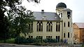
The synagogue in Děčín-Podmokly was built in 1906–1907 in a faux Oriental style with Art Nouveau elements. During World War II, it lost its function and served as a warehouse. In 1994, it was returned to the local Jewish community. Today the former synagogue serves cultural and social purposes.[22]
Bridges

Staroměstský Bridge ("Old Town Bridge") dates from 1574. This stone bridge replaced an older stone bridge, destroyed during the 1561 floods. The bridge is decorated by a Baroque sculpture group of Saints Vitus, Wenceslaus and John of Nepomuk, created by Michael Brokoff in 1714.[23]
Ovčí můstek ("Sheep Bridge") is a small Renaissance bridge from 1561. The bridge is significantly arched to protect it from floods.[23]
Tyrš Bridge is one of the main landmarks of Děčín. This steel bridge was built in 1933 on the site of the older Empress Elisabeth Bridge, which was no longer suitable for increased traffic. The steel structure is supported by modified pillars from the original bridge. The bridge was named in honor of the local native Miroslav Tyrš.[23]
Other
In the river Elbe near the left bank stands a basalt hunger stone, which is visible only when water levels are low. It is one of the oldest hydrological monuments in Central Europe. It is an indicator of drought in the region. The oldest legible record for which the time of origin is verified dates from 1616.[24]
The most visited tourist destination in the city is Děčín Zoo. It was founded in 1948.[25]
Notable people
- Wenzeslaus of Thun (1629–1673), clergyman and bishop
- Anton Kern (1710–1747), painter
- Johann Münzberg (1799–1878), textile manufacturer in Bohemia
- Miroslav Tyrš (1832–1884), founder of the Sokol physical education
- Franz, Prince of Thun and Hohenstein (1847–1916), Austro-Hungarian politician
- Adolf Wilhelm (1864–1950), Austrian classical philologist and epigrapher
- Johann Radon (1887–1956), mathematician
- Julius Arigi (1891–1985), Austro-Hungarian fighter pilot
- Maria Paudler (1903–1990), German actress
- Hans-Georg Münzberg (1916–2000), German engineer
- Egon Klepsch (1930–2010), German politician
- Wolfgang Jeschke (1936–2015), German sci-fi author
- Bronislava Volková (born 1946), Czech-American poet and translator
- Jiří Bartoška (born 1947), actor and the president of the Karlovy Vary International Film Festival
- Dana Chladek (born 1963), American slalom kayaker
- Jaroslava Fabiánová (born 1965), serial killer
- Vladimír Šmicer (born 1973), footballer
- Jan Švec (born 1975), media pedagogue
- Karolína Kurková (born 1984), model
Twin towns – sister cities
 Bełchatów, Poland
 Jonava, Lithuania
 Pirna, Germany
 Přerov, Czech Republic
 Ružomberok, Slovakia
Gallery
-
 Left bank of the Elbe with Pastýřská stěna
 -
 Masarykovo Square
 -
 28. října Street
 -
 Děčín Castle's Rose Garden
 -
 Church of Saints Wencelaus and Blaise
 -
 Church of Saint Francis of Assisi
 -
 Former synagogue

_(5).jpg)

_-_Rose_Garden.jpg)


.JPG)
References
- ^ "Population of Municipalities – 1 January 2023". Czech Statistical Office. 2023-05-23.
- ^ "Části obcí". Územně identifikační registr ČR (in Czech). Retrieved 2023-11-14.
- ^ Profous, Antonín (1947). Místní jména v Čechách I: A–H (in Czech). p. 371.
- ^ a b c d e f g "Historie" (in Czech). City of Děčín. Retrieved 2023-04-13.
- ^ a b "Zámek Děčín". turistickyatlas.cz (in Czech). Retrieved 2023-04-13.
- ^ Chisholm, Hugh, ed. (1911). . Encyclopædia Britannica. Vol. 26 (11th ed.). Cambridge University Press. pp. 671–672.
- ^ "Českosaské Švýcarsko – kolébka turistiky". ceskesvycarsko.cz (in Czech). Retrieved 2023-04-13.
- ^ "Gestapogefängnis Tetschen-Bodenbach". Bundesarchiv.de (in German). Retrieved 7 November 2021.
- ^ "Arbeitserziehungslager Tetschen". Bundesarchiv.de (in German). Retrieved 7 November 2021.
- ^ "Povodně 2002: pět utržených lodí se řítilo po Labi na děčínské mosty" (in Czech). Czech Radio. 2012-08-15. Retrieved 2023-04-12.
- ^ "Historický lexikon obcí České republiky 1869–2011 – Okres Děčín" (in Czech). Czech Statistical Office. 2015-12-21. pp. 1–2.
- ^ "Population Census 2021: Population by sex". Public Database. Czech Statistical Office. 2021-03-27.
- ^ "Registr ekonomických subjektů". Business Register (in Czech). Czech Statistical Office. Retrieved 2023-04-12.
- ^ "Detail stanice Děčín" (in Czech). České dráhy. Retrieved 2023-04-12.
- ^ "Veřejné přístavy" (in Czech). Státní plavební správa. Retrieved 2023-04-12.
- ^ a b c d "Castle History". Děčín Castle. Retrieved 2021-11-07.
- ^ "Povýšení sv. Kříže s kaplí Panny Marie Sněžné" (in Czech). National Heritage Institute. Retrieved 2023-04-12.
- ^ "Kostel sv. Václava a sv. Blažeje" (in Czech). National Heritage Institute. Retrieved 2023-04-12.
- ^ "Kostel sv. Františka z Assisi" (in Czech). National Heritage Institute. Retrieved 2023-04-12.
- ^ "Evangelický kostel" (in Czech). National Heritage Institute. Retrieved 2023-04-12.
- ^ "Kostel sv. Václava" (in Czech). National Heritage Institute. Retrieved 2023-04-12.
- ^ "Synagog". Tourist Portal of the City of Děčín. Retrieved 2023-04-12.
- ^ a b c "Mosty". Tourist Portal of the City of Děčín (in Czech). Retrieved 2023-04-13.
- ^ "Hunger rock". Tourist Portal of the City of Děčín. Retrieved 2023-04-13.
- ^ "Turisté mají v České republice nejraději zoologické zahrady, technické památky, koupání a Pražský hrad" (in Czech). CzechTourism. 2022-06-24. Retrieved 2023-04-12.
- ^ "Partnerská města" (in Czech). Statutární město Děčín. Retrieved 2020-06-21.
External links
- Official website
- Official tourist portal
- Děčín Castle
- Virtual show
- Tetschen, Bohemia Historical Map of 1615 by Petrus Bertius
| International | |
|---|---|
| National | |
| Geographic | |