
Burgstall In the old house
| Burgstall In the old house | ||
|---|---|---|
 Image 1: View of the castle rock from the north |
||
| Creation time : | Late 11th century - early 12th century | |
| Castle type : | Höhenburg, spur location | |
| Conservation status: | Burgstall | |
| Standing position : | probably lower nobility | |
| Construction: | Unknown | |
| Place: | Königstein -Pruihausen- "Mühlberg" | |
| Geographical location | 49 ° 36 '24 " N , 11 ° 39' 42.1" E | |
| Height: | 560 m above sea level NN | |
|
||

The castle stables in the old house are the remnants of an abandoned medieval hilltop castle that once rose on a pointed rock cone on a sloping mountain spur of the Mühlberg. The Burgstall is located northwest of the village of Pruihausen in the municipality of Königstein in the Upper Palatinate district of Amberg-Sulzbach in Bavaria , Germany . Little is known about the small castle, probably a tower castle , to this day.
Geographical location
The Spornburg was located in the central area of the Franconian Alb , about 1000 meters northwest of the village of Pruihausen on the south-east sloping side of the Mühlberg.
Other castles stood nearby in the Middle Ages. Only about 2.50 kilometers to the northeast is a castle stable on the grounds of the Evangelical Simultankirche Sankt Laurentius in Kürmreuth. Another castle stable is located in and around the area of the Catholic side church St. Otto in Schmalnohe , which is located around 2700 meters to the east, the Breitenstein castle ruins are to the southwest and the Alte Bürg castle stable a little further away .
history
To this day, no documentary mention of this small castle complex is known, it could have served as the seat of the local nobility, similar to the nearby castle stables " Alte Bürg " and the " Alte Haus ", which is Ratzenberg Castle.
Only ceramic fragments and iron finds can serve as dating clues, which limit the time the castle was built to the end of the 11th century to the beginning of the 12th century. It was abandoned during the 13th century.
description
The lost hilltop castle stood on a rock cone (Fig. 1), which rises from the sloping and narrow southern slope of the Mühlberg (Fig. 2). The grounds of the castle stables slope steeply on the west and south sides to the agriculturally used corridors that surround the Mühlberg; in the east, the castle had the best natural protection thanks to a vertical rockfall several meters deep (Fig. 4). To the north to 560.7 m above sea level. NN high summit of the Mühlberg, the castle area was separated from the rising mountain by a naturally created, very wide and deep incision (Fig. 3).
The ground plan of this small, probably only one-piece spur castle is roughly triangular. The area is very uneven; The castle area drops sharply to the south (Fig. 4), today you can only see several small terraces that probably once supported buildings. Other traces of construction such as remains of masonry are no longer present above ground.
The castle complex was surrounded by a moat with a wall, which has been preserved most clearly in the northwest (Fig. 5). The moat extended from the north side, where it used a natural depression, to the west side, where it appears as a slope moat, and ends in front of the south area of the castle stables (Fig. 6). The east side of the castle did not need a ditch because of the vertical cliff. In the area of the castle stable there are still fragments of ceramics in several places.
Today the site of the former castle is densely overgrown with forest, only the ring moat with outer wall has survived. The Burgstall, which is freely accessible at all times, can be reached via a hiking trail (sign: blue line horizontal) that runs directly past the castle grounds and runs between Königstein and Pruihausen.
That the Bavarian State Conservation Office as "Medieval castle stables in the old house" covered ground monument to monument number D-3-6335-0007 carries.
photos

Image 2: View of the castle hill from the southwest

Image 3: View of the cut into the terrain with the ring moat, the castle rock on the right
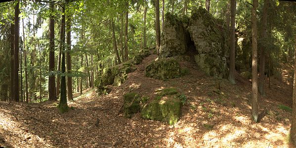
Image 4: South-east side of the castle area, in the foreground a heavily flattened part of the moat

Photo 5: Wall moat on the northwest corner of the castle rock

Photo 6: The end of the ditch on the west side of the castle hill


literature
- Ferdinand Leja: Forgotten castle stables on the Franconian Jura - or where was the “Ratzenberg” castle? In: Contributions to archeology in the Upper Palatinate and Regensburg, Volume 5 . Publishing house Dr. Faustus, Büchenbach 2002, ISSN 1617-4461 , pp. 239-247.
- Armin Stroh : The prehistoric and early historical monuments of the Upper Palatinate . (Material booklets on Bavarian prehistory, series B, volume 3). Verlag Michael Lassleben, Kallmünz 1975, ISBN 3-7847-5030-3 , p. 119.
Web links
References and comments
- ^ The Burgstall on the website of the Bavarian State Office for Monument Preservation
- ↑ Location of the Burgstall in the Bavaria Atlas
- ^ The Burgstall "Altes Haus" on the website of the Bavarian State Office for Monument Preservation
- ↑ Ferdinand Leja: Forgotten castle stables on the Franconian Jura - or where was the "Ratzenberg" castle? In: Contributions to archeology in the Upper Palatinate and Regensburg, Volume 5 , pp. 251 ff.
- ↑ The ceramic finds are edge and wall fragments with fingernail impressions and other decorations, which date from 10/11 and can be dated to the 13th century
- ↑ A large part of the iron finds consists of nails, mainly horseshoe nails , but also includes a bent, square arrowhead with a preserved length of 9.3 centimeters and a knife fragment
- ↑ Source history: Ferdinand Leja: Forgotten castle stables on the Franconian Jura - or where was the "Ratzenberg" castle? In: Contributions to archeology in the Upper Palatinate and Regensburg, Volume 5 , p. 239 ff.
- ↑ The Burgstall “In the old house” on the website of the Bavarian State Office for Monument Preservation


Castles: Schloss Adertshausen (sold) | Allersburg Castle (Alarasbach Castle) | Altenweiher Castle (exited) | Altneuhaus Castle (sold) | Ammerthal Castle | Auerbach Castle (exited) | Axtheid Castle | Castle Boden | Ebermannsdorf Castle | Emhof Palace | Eschenfelden Castle (exited) | Franziskaruhe Castle | Freihung Castle (exited) | Großalbershof Palace (exited) | Hannesreuth Palace | Haselmühl Castle | Haunritz Castle | Heringnohe Castle | Hirschau nursing home | Hammerschloss Hirschbach | Hirschwald hunting lodge (dismissed) | Högen Castle | Hohenburg Castle | Holnstein Castle | Castle mallet | Kalchsreuth Castle (exited) | Kirchenreinbach Castle | Koenigstein Castle | Kümmersbruck Castle | Langenbruck Castle (exited) | Leidersdorf Castle (exited) | Lower Lintach Castle | Upper Lintach Castle | Mendorferbuch Castle (exited) | Castle Moos | Neidstein Castle | Penkhof Palace | Pettenhof Palace (exited) | Upper Schmidmühlen Castle | Lower Schmidmühlen Castle | Steinling Castle | Sinnleithen Castle | Theuern hammer lock | Theuern Castle (exited) | Unterschnaittenbach Castle (exited) | Ursensollen Castle | Vilseck Castle | Hammerschloss Vilswörth | Weissenberg Castle | Winbuch Castle | Wolfsbach Castle | Brick's Castle | Zogenreuth Castle ( dismissed )
Castles and ruins: Allersburg Castle (dismissed) | Ammerthal Castle (exited) | Aschach castle ruins | Breitenstein castle ruins | Dagestein Castle | Eberburg Castle Ruins (Ebermannsdorf Castle) | Festenberg Castle (exited) | Freudenberg Castle (exited) | Burg Gernotenstein (Burg Huwenstein) (dismissed) | Haldenrode Castle (Burg Halwenrode) (dismissed) | Hartenfels Castle (exited) | Hauseck castle ruins | Heimhof Castle | Kastl Monastery Castle | Castle ruin Kürmreuth (Upper Castle) | Lichtenegg castle ruins | Neidstein Castle | Paulsdorf Castle (exited) | Castle ruin Pfaffenhofen (Schweppermannsburg) | Castle ruins Poppberg | Rieden Castle (exited) | Rosenberg Castle (exited) | Roßstein castle ruins | Rupprechtstein castle ruins | Scharfenberg Castle (exited) | Spitz Castle (exited) | Castle ruin Steinamwasser (Burg Strebenstein) | Sulzbach Castle | Werdenstein Castle (exited) | Zant castle ruins
Motten (all gone): Tower Hill The Tower (Berghausen Castle) | Höflas tower hill | Kellerhübl tower hill
Manor houses: Noble seat Hohenkemnath | Hammer seat Ranna
Castle stables (lost, unknown castles and fortifications): Burgstall Alte Bürg | Burgstall Altes Haus (Ratzenberg Castle) | Ammerthal Castle | Ringwall Archenleiten | Burgstall Bärenfall (Brennberg Castle?) | Burgstall Breitenthal (Tower in Weidenthal?) | Section fortification of Bürg | Ringwall Dürrling | Ringwall Ensdorf | Burgstall Ermhof | Ringwall Etsdorf | Castle stable Frohnberg | Burgstall Grünwald | Burgstall Gunzendorf | Burgstall Hagfelsen | Ringwall Hainsburg | Hainsburg section fortification | Burgstall Hausberg | Burgstall In the old house | Ringwall Johannisberg | Kalmusfels section fortification | Ringwall Kleiner Hubberg | Section fortification Kuhfels | Section fortification Kühlochberg | Burgstall Leherfels | Ringwall Leidersdorf | Burgstall Neumühle | Burgstall Schlossberg | Burgstall Schlössl | Burgstall Schmalnohe | Section fortification Schweinberg | Section fortification Spitziger Berg | Section fortification Steinberg | Ringwall Steinberg | Section fortification Sternsteinberg | Burgstall Theuern | Burgstall Trutziger Kaiser | Burgstall Uschlberg | Burgstall Wolfsbach | Ring wall Zant
Fortified churches: Fortified church Ehenfeld (St. Michael) | Fortified Church Gibbach (St. Martin) | Illschwang fortified church (St. Veit)