
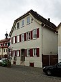
Freudental
| coat of arms | Germany map | |
|---|---|---|

|
Coordinates: 49 ° 1 ' N , 9 ° 4' E |
|
| Basic data | ||
| State : | Baden-Württemberg | |
| Administrative region : | Stuttgart | |
| County : | Ludwigsburg | |
| Height : | 284 m above sea level NHN | |
| Area : | 3.07 km 2 | |
| Residents: | 2486 (December 31, 2018) | |
| Population density : | 810 inhabitants per km 2 | |
| Postal code : | 74392 | |
| Area code : | 07143 | |
| License plate : | LB, VAI | |
| Community key : | 08 1 18 016 | |
| LOCODE : | DE FDL | |
| Address of the municipal administration: |
Schloßplatz 1 74392 Freudental |
|
| Website : | ||
| Mayor : | Alexander Fleig | |
| Location of the Freudental community in the Ludwigsburg district | ||
  |
||


Freudental is a municipality in the Ludwigsburg district in Baden-Württemberg . It belongs to the Stuttgart region and the European metropolitan region of Stuttgart . Apart from the village of Freudental, no other places belong to the community.
geography
Geographical location
FREUDENTAL of the located on the eastern edge Stromberg to Neckarbecken in the upper hollow of the inflow Steinbach the bottom left Enz at a height of 275- 310 m above sea level. NN . The next larger cities are the district town of Ludwigsburg about 16 kilometers in the southeast and Heilbronn about 19 kilometers in the northeast.
Neighboring communities
Freudental borders the city of Bönnigheim in the north, the municipality Erligheim in the northeast, the municipality Löchgau in the southeast and the city Sachsenheim in the southwest . All also belong to the Ludwigsburg district .
Division of space

According to data from the State Statistical Office , as of 2014.
history
Freudental was first mentioned in 1304 in the inventory book of the hospital in Esslingen . Similar to Besigheim and Löchgau , it belonged to the Margraves of Baden , came to Duke Ulrich von Württemberg as a result of the War of the Bavarian Succession in 1504, and from there to Besigheim Vogt Konrad Schenk von Winterstetten. After changing and partly fragmented local rule (1590/92 to 1685 Schaffelitzky von Mukkadell ), the place was again in 1685 in sole ownership of the Württemberg Duke Friedrich Carl , who, however, soon sold Freudental again. In 1710 Baron Johann Gottlob Zobel von Giebelstadt became the heir to the owner of the place. His heirs in turn sold the place in 1727 to the Landeshofmeisterin Wilhelmine von Würben . After this had fallen out with Duke Eberhard Ludwig in 1731 , the latter acquired the place in a settlement in 1733. The place was not in the duchy Württemberg incorporated , but was under the Hofkammergut the Württemberg Kameralverwaltung. With the establishment of the Kingdom of Württemberg , Freudental came to the Oberamt Bietigheim in 1806 and finally to the Oberamt Besigheim in 1810 . When the Württemberg Oberamt Besigheim was dissolved in 1938, Freudental came to the Ludwigsburg district .
Population development
Population figures according to the respective area. The numbers are census results (¹) or official updates from the Baden-Württemberg State Statistical Office (only main residences ).
|
|
Religions
Freudental has been evangelical since the Reformation . Even today there is still a Protestant congregation in the village. There is also a small congregation of the New Apostolic Church . The Catholics are looked after by the Roman Catholic community in Besigheim .
The Jewish community of Freudental existed from the first half of the 18th century and in the middle of the 19th century comprised over 40 percent of the town's inhabitants. From 1832 Freudental was the seat of the Freudental District Rabbinate . Like many other rural Jewish communities, the community experienced its decline towards the end of the 19th century and finally died out due to the persecution of Jews during the Nazi era. The former synagogue Freudental , built in 1770 and the neighboring Judenschlössle , in which the first six Jewish families of the village had their apartment from 1723, as well as the Jewish cemetery (on the Bönnigheim mark), testify to the once important community today . A memorial plaque by the castle commemorates the persecuted and murdered Jewish citizens, and further memorial plaques at the beginning and end of Strombergstrasse have been reminding of the centuries-long Jewish settlement of this so-called " Judengasse " until 1933 .
politics
Municipal council
The local council in Freudental has 12 members. The local elections on May 26, 2019 led to the following final result. The municipal council consists of the elected voluntary councilors and the mayor as chairman. The mayor is entitled to vote in the municipal council.

| Parties and constituencies | % 2019 |
Seats 2019 |
% 2014 |
Seats 2014 |
||
|---|---|---|---|---|---|---|
| BF | Citizens group Freudental e. V. | 53.7 | 6th | 41.47 | 5 | |
| CDU | Christian Democratic Union of Germany | 33.5 | 4th | 38.59 | 5 | |
| SPD | Social Democratic Party of Germany | 12.8 | 2 | 19.94 | 2 | |
| total | 100 | 12 | 100 | 12 | ||
| voter turnout | 69.3% | 60.35% | ||||
badges and flags
The municipal coat of arms shows under a golden shield head, in it a black deer pole, in red the golden capital letter F. On October 9th, 1980 Freudental was also awarded a municipality flag in the colors black and yellow. In fact, the municipality uses a flag in the colors red and yellow.
Partnerships
Freudental maintains partnership relationships with Beucha , which is now part of the city of Brandis in the Leipzig district in Saxony .
Culture and sights


- The Grävenitz Castle was built in 1729 by Paolo Retti for Wilhelmine von Grävenitz . The palace, which was expanded in 1816, was used by the Württemberg court chamber until 1903. a. in use as a hospital, lung sanatorium and retirement home. The complex, which also includes a large palace garden, has been privately owned since 2007 and cannot be visited.
- The Protestant church goes back to an old Lady Chapel and was built in its current form in 1686. The church has a bell from the 13th century, which is one of the oldest bells in the Ludwigsburg district.
- Various buildings in the village are reminiscent of other former mansions. The mouse tower is the remnant of the castle in the middle of the village and served as a local arrest until the middle of the 19th century. The so-called Judenschlössle was built in 1614 as the servants' house of the castle up in the village , after 1723 the first Jewish families of the village were housed in it.
- The synagogue , built in 1770 on the site of the former Upper Palace, is the only remaining synagogue in the Ludwigsburg district.
- The Jewish cemetery was used for burials from 1811 to 1970. Before that, the Jewish cemetery in Alleenfeld had been the burial place of the Jewish community since 1723 .
- The antiquity (on the Bönnigheimer mark) is a round building piled up of flat stones, which served the Württemberg king as a hunting stand.

Protestant church

Old synagogue

Catholic Church
Former rectory

Mouse tower


Monuments


The so-called mare monument is the tombstone for Helene, the horse of King Friedrich of Württemberg . It is located west of the village on Stutenweg.
The first Stolperstein was laid in Freudental on October 6, 2017 by the artist Gunter Demnig . The small brass plate on the sidewalk in front of the Pforzheimer Straße 25 building is reminiscent of Albert Ernst Greiner, who lived there as a foster child. Greiner, who was seriously injured in an accident at work, was transferred to the Württemberg sanatorium in Weißenau in June 1940 and murdered by the National Socialists on December 5 of the same year as part of the T4 euthanasia campaign in the Grafeneck killing center .
Economy and Infrastructure
Due to the very small marking area, agriculture never had a dominant position. Today (2005) there is only one full-time agricultural business and a few part-time businesses that mainly operate viticulture. Freudental was a village of craftsmen and day laborers and has developed into a residential community, especially after the Second World War .
Viticulture
Freudental is a wine-growing place whose vineyards belong to the large Stromberg area in the Württemberg lowlands of the Württemberg wine-growing region and is located on the Württemberg Wine Route .
Public facilities
There is a retirement and nursing home of the district's own shamrock nursing homes .
education
There are two kindergartens and one elementary school in Freudental . The next secondary school is in Löchgau and all other secondary schools in Besigheim and Bönnigheim .
Supply and disposal
The power grid in the community is operated by EnBW Regional AG. There is no natural gas supply. There is a central liquid gas supply in the Wolfsberg and Galgenäcker areas. Until 2005, the Freudental community had a completely self-sufficient drinking water supply. Freudentaler water has been mixed with Lake Constance water since 2006. The drinking water consists of 70% own water and 30% external water from the Lake Constance water supply . Waste disposal is taken over by the waste recycling company of the Ludwigsburg district (AVL), a 100% subsidiary of the Ludwigsburg district.
Transport links
Freudental is connected to the Stuttgart Transport and Tariff Association with three bus stops . There is also a joint bus line with Heilbronn's Hohenloher Hall local transport to Cleebronn. The nearest train connections are the Besigheim train station and the Bietigheim-Bissingen train station , the latter has a direct connection to the Stuttgart S-Bahn .
.jpg)
Sons and daughters of the church
- Max Samuel von Mayer (1797–1862), Rector of the University of Tübingen
- Friederike Kempter (* 1979), actress
literature
- Royal Statistical topograph. Bureau (ed.): Description of the Oberamt Besigheim (series: Die Württemberg Oberamtsbeschreibung from 1824–1886; 32), Stuttgart 1853. Reprinted by Bissinger, Magstadt 1962, ISBN 3-7644-0031-5
Individual evidence
- ↑ State Statistical Office Baden-Württemberg - Population by nationality and gender on December 31, 2018 (CSV file) ( help on this ).
- ↑ State Statistical Office, area since 1988 according to actual use for Freudental.
- ↑ Population development in Baden-Württemberg from 1871 to 2012 ( page no longer available , search in web archives ) Info: The link was automatically marked as defective. Please check the link according to the instructions and then remove this notice.
- ↑ Memorial sites for the victims of National Socialism. A documentation, Vol. I, Bonn 1995, p. 35, ISBN 3-89331-208-0
- ^ A chord between the builder Paolo Retti and the Countess von Würben, b. Grävenitz of April 7, 1729. Printed in: Theodor Boley, Freudental, Brackenheim 1963, p. 11ff. Source: State Archives Ludwigsburg, StAL GL 130 Bü 192.
- ↑ Christina Kehl: The first stumbling block is reminiscent of the "Ernstle" . In: Ludwigsburger Kreiszeitung . October 7, 2017, p. 23 .
- ↑ Christina Kehl: First stumbling block laid. In: LKZ.de (Ludwigsburger Kreiszeitung). October 30, 2017, accessed October 14, 2018 .
- ↑ BDEW (Ed.): Map of the electricity network operator 2012. Frankfurt 2012.
- ↑ Besigheim municipal administration association: Land use plan 2005–2020. Besigheim 2005.
- ↑ Freudental water supply: Water values in the area of the Freudental community. Freudental 2012.
Web links

Affalterbach | Asperg | Benningen am Neckar | Besigheim | Bietigheim-Bissingen | Bönnigheim | Ditzingen | Eberdingen | Erdmannhausen | Erligheim | Freiberg am Neckar | Freudental | Gemmrigheim | Gerlingen | Grossbottwar | Hemmingen | Hessigheim | Ingersheim | Kirchheim am Neckar | Korntal-Münchingen | Kornwestheim | Löchgau | Ludwigsburg | Marbach am Neckar | Markgröningen | Möglingen | Mundelsheim | Murr | Oberriexingen | Oberstenfeld | Pleidelsheim | Remseck am Neckar | Sachsenheim | Schwieberdingen | Sersheim | Steinheim an der Murr | Tamm | Vaihingen an der Enz | Walheim