
Marbach am Neckar
| coat of arms | Germany map | |
|---|---|---|

|
Coordinates: 48 ° 56 ' N , 9 ° 16' E |
|
| Basic data | ||
| State : | Baden-Württemberg | |
| Administrative region : | Stuttgart | |
| County : | Ludwigsburg | |
| Height : | 224 m above sea level NHN | |
| Area : | 18.06 km 2 | |
| Residents: | 16,008 (Dec. 31, 2018) | |
| Population density : | 886 inhabitants per km 2 | |
| Postcodes : | 71672, 71711 | |
| Area code : | 07144 | |
| License plate : | LB, VAI | |
| Community key : | 08 1 18 049 | |
| LOCODE : | DE MNC | |
City administration address : |
Marktstrasse 23 71672 Marbach am Neckar |
|
| Website : | ||
| Mayor : | Jan Trost (independent) | |
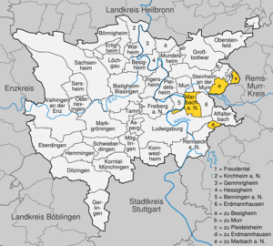
| Location of the city of Marbach am Neckar in the Ludwigsburg district | ||
  |
||

Marbach am Neckar is a city about 20 kilometers north of Stuttgart. It belongs to the district of Ludwigsburg , the Stuttgart region (until 1992 the Middle Neckar region ) and the European metropolitan region of Stuttgart . Marbach is known as Friedrich Schiller's birthplace ; the city is the seat of the Schiller National Museum , the German Literature Archive and the Modern Literature Museum .


geography
Geographical location
Marbach is located in the natural area of the Neckar Basin on the east bank of a loop of the Neckar , the slope of which is interrupted by two deep cuts. The northern of the two cuts is by now widely verdolten traversed Strenzelbach, the southern from Eichgraben. The old town of Marbach is located on the southern slope of the Strenzelbach valley, enthroned about 30 meters above the Neckar, while the newer residential and commercial areas are spread across the slopes further northeast, east and south. Even further south, somewhat isolated by the incision of the Eichgraben, is the Hörnle residential area with around 1,600 inhabitants. The furrow formed by the Strenzelbach shortens a loop of the Murr , which flows into the Neckar just north of the city, and forms an important traffic axis for Marbach and the surrounding area. An uninhabited exclave in the Hardtwald near the Rielingshausen district is included in the Swabian-Franconian Forest Mountains .
Districts
In addition to the immediate vicinity of the core city , the urban area includes a narrow strip that extends southwest along the Neckar and includes the Marbach power station .
In addition, three exclaves belong to the city area. Two of them are the districts of Rielingshausen and Siegelhausen , both of which are spatially separated from Marbach. The third exclave is an uninhabited area in the Hardtwald (also spelled Hartwald) northeast of Rielingshausen, which comprises the lion's share of the forest area of Marbach, while the area of the core city itself is almost free of forests.
Rielingshausen with around 2,400 inhabitants is located about five kilometers northeast of Marbach on a hill between the Murr and the Hartwald. The hamlet of Hinterbirkenhof, a kilometer and a half further north, also belongs to the village. The district is divided by several stream valleys, all of which lead to the Murr. The village center lies in the flat hollow of the Weidenbach, while the Kaisersbach forms a depression between Rielingshausen and the Hinterbirkenhof. The eastern boundary of the marking is formed by the Eichbach, which disappears halfway into a sinkhole . The Sulzbach flows through a wide valley southeast of the village. After it had been straightened during the land consolidation in the 1970s, it was renatured again in the late 1980s. This measure was awarded the cultural landscape award of the Swabian Heimatbund in 1991 .
Siegelhausen, a small hamlet with about 30 inhabitants, is located about five kilometers southeast of the city center off the road between Affalterbach and Hochdorf in the valley of the Strombach, which is also known as the Apfelbach.
geology
The river valleys of the Neckar and Murr have dug themselves into the layers of the upper shell limestone , while the higher areas are formed by the Latvian and Gypsum Keuper . In the side valleys, the transition from the Keuper to the Muschelkalk strata is clearly noticeable through a change in the shape of the valley: Eichgraben, Weidenbach and Eichbach form trough-shaped valleys in the upper reaches, which become notch valleys in the lower reaches . The Sulzbach is an exception: its valley, together with the Strenzelbachfurche on the other side of the Murr, marks the course of the so-called Neckar-Jagst-Furche , an elongated geological fault in which the geological layers are lowered, so that the Sulzbach up to runs to the confluence with the Murr im Keuper.
Division of space

According to data from the State Statistical Office , as of 2014.
Neighboring places
On the western side of the Neckar, Marbach diagonally opposite, is Benningen am Neckar . Northern neighboring towns are Murr and Steinheim an der Murr . Erdmannhausen is to the east of the city center , and a direct road also leads to Affalterbach , which is further south-east . The Ludwigsburg districts of Poppenweiler and Neckarweihingen are located in the south and southwest .
Rielingshausen has direct road connections to Erdmannhausen in the southwest and the Aspach districts of Kleinaspach in the north and Großaspach in the east. Steinheim to the west and Kirchberg an der Murr in the southeast can only be reached via indirect road connections.
The neighboring towns of Siegelhausen are Affalterbach in the north, Hochdorf in the south-west and Bittenfeld in the south-east.
history

Marbach was probably founded as a Franconian royal court around 700. It was first mentioned in a document in 972. Today's old town was built in the late 12th century on a hill southwest of the older settlement core. Around 1302 Marbach became part of Württemberg , became the seat of an office (later the Oberamt Marbach ) and one of the most important cities in Württemberg, with the exception of a brief episode in the Electoral Palatinate in the 15th century. During the Palatinate War of Succession , the site was largely burned down by French troops in 1693. As a result and through the emergence of the royal seat of Ludwigsburg, Marbach lost its importance. In 1759 the poet Friedrich Schiller was born in Marbach. After his death, Marbach developed into a center of veneration for Schiller, as can be seen today in the house where he was born, the Schiller National Museum , the German Literature Archive and the Modern Literature Museum . In 1938, Marbach lost its function as the administrative center when the Marbach district was dissolved. In 1972 Rielingshausen was incorporated after Siegelhausen had already joined the city in 1828.
prehistory
From the Neolithic Age people settled in the Neckar basin and began clearing the primeval forests. Remains of human settlements can be found in the Marbach city area since the 6th millennium BC. Prove.
In 85 AD, the Neckar became the border of the Roman Empire . A fort was built across from today's town of Marbach, in today's Benningen . With the help of dendrochronology it could be established that the timbers of a port facility were felled at the earliest in 107 AD (± 10 years). Around 150 AD, the area to the right of the Neckar was also included in the Roman Empire, the garrison of the fort was relocated to Murrhardt , 25 kilometers to the east, and a Roman road was built between Benningen and Murrhardt. This ran through the Marbach valley basin roughly in the area of today's railway line; a bridge (north of today's railway viaduct) led over the Neckar. In the vicinity of the fort a civilian settlement called vicus murrensis arose , of which the remains of several manors were excavated in the Marbach area.
Alemannic and Franconian times
The Alemannic conquest is assumed around the year 260. At the turn of the 5th to the 6th century, the Alemanni were subjugated by the Franks led by Clovis I and pushed south. The north of Baden-Württemberg was now included in the Franconian settlement area up to the area around Marbach. Marbach again came close to a border, but this time it ran in a west-east direction: along Seltzbach , Murg and Oos over the heights of the northern Black Forest to Engelberg , which, like Asperg , Lemberg and Hagberg, apparently served as border security in Franconia Page served. The place name of Mar (k) bach is supposed to refer to this mark .

There is no evidence of permanent settlement activity on Marbacher Markung up to the 7th century, and no written sources are available about the early days of Marbach. Based on archaeological findings and because of the place name ending in -bach , it is assumed that Marbach was founded around 700 as a Franconian royal court . This was located north of the Strenzelbach (today verdolt under Bottwartalstrasse ) at the Alexander Church . Accordingly, the establishment should be seen in connection with the resurgence of the Alemannic-Franconian conflict under Duke Gotfrid : Due to its Roman infrastructure (fort, roads, bridge), the Benningen-Marbach area offered ideal conditions as a Franconian counter-position to the Alemannic ducal seat near Cannstatt . Military roads from Worms and in the direction of Bavaria also passed the royal court.
The surrounding, previously existing villages were subordinate to the presumed royal court. Marbach thus achieved the function of an administrative center early on, which it maintained until the 20th century. After the duchies of Alemannia (746) and Bavaria (788) were finally incorporated into the Franconian Empire, the Franconian-Alemannic " Mark " became obsolete, but remained as the southern diocesan border of the Diocese of Speyer until the Reformation. The presumed royal court lost its importance, the Neckar bridge fell into disrepair and was not rebuilt. Properties from the surrounding villages were gradually given away to the Lorsch Monastery .
Various rulers from the 10th to the 13th century
Marcbach was first mentioned in a document in 972 in a further deed of donation, with which a deacon Wolvald transferred his court ( curtis ) with all the property belonging to it to the (Franconian) diocese of Speyer. In 1009 King Heinrich II confirmed the apparently already existing market rights for Marbach and allowed the establishment of a mint.
There is no written evidence of ownership in the following centuries. In 1282, Marbach residents were referred to as "citizens" for the first time, so that the city was founded before this point in time. According to earlier opinion, the place belonged to the Counts of Württemberg early on and was expanded by them into a city around 1250. Today's city historiography assumes that Marbach passed to the Margraves of Baden in the course of the investiture dispute around 1100 , whose main possession at that time was Neckar and Murr. At the end of the 12th century, they built a new market settlement with a manor on the hill south of the Strenzelbach, which formed the nucleus of today's city.
In the middle of the 13th century, the Baden margraves withdrew from the Neckar-Murr area, in which now the Counts Hartmann II. And Hartmann III. von Grüningen played a leading role. The Marbach manor was currently being expanded into a castle ( Marbach Castle ) and the founding of the town was probably initiated. After Hartmann III. Had died in 1280 without a male heir, parts of Marbach came as a fief to Count Walram I of Zweibrücken and as an inheritance from Beatrix von Grüningen to her husband, Duke Hermann I of Teck . In 1302, the dukes of Teck sold the city for lack of money to Count Eberhard the illustrious from Württemberg , who endeavored to get the former positions of the Count von Grüningen , who were related to him, back into Württemberg hands.
Under Württemberg rule
Count Eberhard came into conflict with Emperor Heinrich VII due to his expansive policy . In the imperial war against Württemberg, Marbach was destroyed in 1311 and had to submit to the imperial city of Esslingen . However, as early as 1316, Eberhard managed to get his property back. The castle and town were rebuilt.
Under Württemberg rule, Marbach became the seat of an office that was first mentioned in 1380 and, together with Markgröningen, was one of the leading towns in the Neckar basin. The Counts of Württemberg often stayed in Marbach. In 1405, at the instigation of Archbishop Johann II of Mainz, the Marbacher Bund was concluded in the city , an alliance of southwest German princes and imperial cities against King Ruprecht .

The city was quite prosperous at that time, especially since the handicrafts profited from the orders of the sovereign and his court administration; in addition, agriculture and viticulture were the main livelihoods of the approximately 1200 inhabitants. There has been evidence of a Latin school in Marbach since 1392 , to which today's Friedrich-Schiller-Gymnasium goes back. Around 1400 the town was expanded, today's Mittlere and Untere Holdergasse were included in the walls. The castle was converted into a palace and lost its defensive character. Outside the walls on the Strenzelbach were the houses of some craftsmen who were dependent on the water, such as the tanner , on the other side of the stream the separately walled Alexander Church, which was still the parish church.
From the Middle Ages to 1839, Marbach was involved with six other communities in the joint administration of the Hartwald, a larger forest area in the northeast of the office. The present area of Marbach in the Hartwald goes back to this fact.
During the temporary division of Württemberg in the Nürtingen Treaty in 1442, the city came under the Württemberg-Stuttgart line under Count Ulrich the Beloved . He often stayed in Marbach and took care of the expansion of the castle and church. When he during the Mainz Diocesan Feud in Palatine came captivity, he had to reach for his release, in 1463 city and office Marbach into a Palatine fief convert. Only in 1504, through Duke Ulrich's success in the Landshut War of Succession , was this reversed.
Troubled times in the 16th and 17th centuries

The movement of the poor Konrad in 1514 was also well received by the farmers in the Marbach office, and there were several protests. The representatives of fourteen cities in the Württemberg lowlands gathered in Marbach and wrote a catalog of demands to the Duke. Overall, however, the Marbachers behaved rather wait-and-see. Doctor Alexander Seitz, a doctor from Marbach, who had represented the farmers' cause in word and in writing, had to flee to Switzerland after poor Konrad's failure .
In 1519 Marbach (like all of Württemberg) was occupied by troops of the Swabian League and sovereignty was handed over to Emperor Charles V ; Marbach thus became Austrian. In 1525, during the German Peasants' War , a group of peasants entered the city. However, the bailiff managed to get the farmers drunk and drive them away again. Nevertheless, the city was fined after the suppression of the uprising because Marbachers had also participated in the riot. When Duke Ulrich regained control of Württemberg in 1534, he introduced the Reformation . As a result, the city church replaced the Alexander church as a parish church.
In 1546, during the Schmalkaldic War , Marbach was occupied by Imperial Spanish troops who raged in the city, murdering and plundering. As further troop marches subsequently took place and Marbach had to participate in the high war compensation that Duke Ulrich had to pay to the emperor, the city's finances were subsequently shattered.
From 1579, Simon Studion , the preceptor of the Marbach Latin School, carried out archaeological excavations and rediscovered the Roman fort in Benningen. Especially in the times of the Renaissance and the associated return to antiquity , this inspired the belief that Marbach had already originated in Roman times and that its name was derived from the Roman gods Mars and Bacchus (see also section Coat of Arms and Flag ).

The Thirty Years War from 1618 to 1648 made Marbach and the surrounding area difficult to create. Already in the first half of the war billeting caused high costs, in addition to diseases and in 1626 a famine due to a bad harvest . After the defeat of the Protestant side in the Battle of Nördlingen in 1634, imperial troops occupied Württemberg and made the country unsafe. Most of the inhabitants of the surrounding villages fled behind the Marbach city walls, which, however, offered only limited security. Marbach was again burdened by billeting of troops, the city and residents plundered at will. In 1634 80 houses burned down in Marbach, in 1635/36 there was another plague epidemic and famine. From 1634 to 1639 the population of the city decreased from 1765 to 863, that of the office from 1622 to 1639 from 17,694 to 2,271, i.e. to one eighth. After a period of relative calm from 1639 to 1642 the city and the surrounding area in 1642 were once again looted by French and Swedish troops and pillaged , more troops passages followed until 1646. After the war, immigrants came into the country, mainly Swiss, reflecting the loss of population but only partially again was able to compensate.
Destruction and loss of meaning
Before the city and office had recovered from the aftermath of the Thirty Years' War, they felt the Palatinate War of Succession . In 1688 French troops entered the city and looted it for two days. After that, Marbach had to temporarily accommodate and feed imperial troops within its walls. When French troops under Mélac approached the city again at the end of July 1693, many residents fled. The French moved into the now undefended city, plundered, abused and murdered the residents who had not yet fled. Marbach was then set on fire and almost completely burned. Only the Alexander Church and a few other buildings, mostly located outside the walls, survived the destruction. Some of the people who had fled did not return to Marbach, some of the others did not survive the following winter, because both the houses and the supplies had been destroyed. After 1,478 inhabitants in 1692, only 609 were counted in 1695.
The reconstruction, which determines the current appearance of the old town, dragged on over the next ten to fifteen years. From 1709, the newly founded city (from 1718) to the south-west of Ludwigsburg grew into the new center of the area. The palace construction had already started in 1704. Marbach had to accept a reduction in its administrative district, lost central functions and in importance. To make matters worse, it also had to help build up its competition through deliveries of materials and labor . Money was only available again in Marbach for its own town hall in 1763, but the ducal palace was not rebuilt.
Transitional period in the 18th and 19th centuries
Friedrich Schiller was born in Marbach in 1759 . The poet, who in the 19th century became the subject of almost ritual veneration, posthumously made his place of birth well known and determined the self-image of the city (see section Schillerstadt Marbach ).
With the municipal regulation in 1758, the previous offices were given the designation Oberamt, including the Oberamt Marbach (renamed district in 1934). This remained with the reorganization of Württemberg in 1806 (henceforth as a kingdom) and was enlarged to the north in 1810 and 1812 by the offices of Bottwar and Beilstein. In 1816/17 there was a famine as a result of a bad harvest in the year without a summer . This as well as religious tensions between the regional church and the Pietists led to emigration to Russia .
Around this time, the city grew beyond its medieval core for the first time, a suburb in the area of the Upper Gate was created. In 1828, the previously independent community of Siegelhausen was incorporated into Marbach. Another famine in 1846/47 led to new emigrations, now increasingly to America . As a result of the emigration, the population of Marbach fell by over ten percent from 1846 to 1861 to around 2200. In the revolutionary year of 1848, a vigilante group was founded at the instigation of the Frankfurt National Assembly , but it was never involved in fighting. In 1871 Württemberg and with it Marbach became part of the German Empire .
From the German Empire to the Second World War

Since Ludwigsburg was founded, the major transport links have passed Marbach. Other central lines were also planned for the Württemberg Railway , which was under construction from 1844 . So the city received a station on a branch line of the Murrbahn between Backnang and Bietigheim relatively late, namely in 1879, and from 1881 a direct connection to Ludwigsburg . In 1894 Marbach also became the starting point for the Bottwartal Railway to Heilbronn . The station was laid out to the northeast and outside of the city and attracted smaller factories, including several furniture factories and at times a shoe factory. However, Marbach did not develop into a decidedly industrial location, at the turn of the century the number of employees was roughly evenly divided between workers, agriculture / viticulture and trade / trade. The new companies ensured a growth in the population, which made new supply facilities necessary. A waterworks was built in 1896, and in 1906 Marbach received electricity for the first time (see the section on the Marbach power plant ).
In the First World War , the city had 132 fallen dead. The transition to the Weimar Republic took place without much fuss, the municipal council elections saw the SPD , the DDP and the conservative Württemberg parties roughly on par.
From 1919 to 1933 the population increased from around 2900 to 3500. New apartments were built in the east of the city up to about Schwabstrasse, and there was also more construction north of the railway line. In 1928 a gas supply was set up. During the global economic crisis , several Marbach companies closed their operations, resulting in high unemployment. In 1931, Communists and National Socialists each won a seat on the municipal council for the first time.
In the Reichstag election in March 1933 , the National Socialists in Marbach achieved 41.5% of the vote. After the Enabling Act was passed , the local council in Marbach was brought into line and the organizations of the workers' movement were banned; some Marbach communists and social democrats were brought to the Heuberg concentration camp.
During the administrative reform during the Nazi era in Württemberg in 1938, the Marbach Oberamt was dissolved. Marbach lost its function as the administrative center and became part of the Ludwigsburg district . At the same time, as a result of the Neckar canalization, the hydropower plant near Marbach had to be replaced by a new building further upstream. The power plant site was separated from the Neckarweihinger markings (as compensation for the loss of the Oberamt) and allocated to Marbach.
During the Second World War , Marbach's population grew due to the repeated admission of evacuees or air war victims from the larger area; in addition, Polish and French prisoners of war were used in factories and agriculture. The war passed the city itself without any major damage, but shortly before the end of the war German troops blew up several bridges, including the railway viaduct. At the end of April 1945, Marbach was occupied by American troops and became part of the American zone of occupation .
Younger story
After the war, Marbach initially belonged to the state of Württemberg-Baden , which was incorporated into Baden-Württemberg in 1952 . The population continued to grow with the influx of 1850 displaced persons . In order to do justice to this situation, further settlements were built north and south of Erdmannhäuser Straße after 1950. The sewer system, which had previously been postponed several times, was also implemented.
From 1957, the Hörnle settlement was built south of the city for up to 2000 people, in which mainly refugees, but also young families, can find apartments. The Makenhof near the settlement, which had come to Marbach together with the power plant site, was returned to Neckarweihingen.
On May 24, 1965, the British Queen Elisabeth II visited Marbach. Afterwards it was rumored that she did not really want to see the city, but the main and state stud Marbach on the Swabian Alb . Although the anecdote was invented by two Berlin journalists, it is often passed on to this day.
On July 1, 1972, Rielingshausen was incorporated into Baden-Württemberg on the occasion of the municipal reform. Like the sealed houses, the Rielingshausen markings are completely separated from the Marbachs. The city's hopes of being able to form a large community with the involvement of other neighboring towns, however, were dashed. Only a community administration association was founded, which in addition to Marbach also includes Benningen, Affalterbach and Erdmannhausen.
In 1980 the city was connected to the Stuttgart S-Bahn network . In 1989 the Bottwartalbahn was shut down and its tracks were dismantled with the exception of a hairpin to the power plant site.
The increased mobility in the population meant that Marbach developed into a popular residential community in the Stuttgart area. New building areas were repeatedly designated and developed, so that the population increased from 12,000 in 1980 to over 15,000 in 2005; the youngest new development area is Kirchenweinberg Nord above the railway line. On June 30, 2015, Marbach had 15,612 inhabitants.
In 2000 the Marbacher youth culture house planet-x with its educational conception became the only youth house in Germany because of its diverse participation possibilities at the world exhibition Expo 2000 in Hanover.
Schiller town of Marbach
Friedrich Schiller was born in Marbach in 1759 as the son of a (craft) doctor (Feldscher), but moved away at the age of four in early 1764. Despite this rather marginal relationship, the city gradually became a center of veneration for the poet after his death in 1805. In 1812 Schiller's birthplace was subsequently determined and a plaque was put up. A little later, the first foreigners came to Marbach to see the house.

The forerunner of today's German Schiller Society was founded in 1835 under the name Verein für Schillers Denkmal (later Marbacher Schiller Society ). From 1836 to 1840 the Schillerhöhe was laid out south of the city as a festival area. In 1857 the city bought the house where he was born, and two years later, on the 100th birthday, a museum was inaugurated. In 1876 the Schiller Monument was inaugurated by Ernst Rau on the Schillerhöhe, and in 1903 the Schiller National Museum opened on the edge of the square .
Schools have held annual Schiller celebrations since 1859, on November 10th, the poet's birthday. The round anniversaries of the birthday and death are celebrated with special commemorative events.
In 1934 the National Socialists organized a Schiller homage for the German youth , during which greetings and torches were brought to Marbach from five directions from the Reich borders in relay races. The annual Schiller celebrations also served at times for propaganda purposes, but later the rulers changed their minds and forbade the performance of plays such as William Tell , as their content (tyrannicide) now seemed dangerous to them.

After the opening of the German Literature Archive in Marbach in 1955, the city founded the Schiller Prize of the city of Marbach am Neckar in 1959 , which has been awarded every two years since then.
Schiller is still an essential figure of identification for Marbach, which is not only of local patriotic, but also of touristic importance. Numerous institutions are named after the poet, such as the local high school and the adult education center, and the place calls itself "Schillerstadt", which is a title chosen by itself and not given by the state government. Despite the quasi-official use, the name is not part of the official municipality name.
Since 1998 the annual Schiller celebrations have been held on a larger scale as Schiller Week. The year 2005 was celebrated in memory of the 200th anniversary of Schiller's death as the “Schiller Year” with a wealth of special programs and events. Also for the Schiller year 2009, the 250th birthday, special events were carried out under the motto "Marbach ... Frei nach Schiller", including the exhibition "Autopsy Schiller", where numerous personal items of the poet were on display.
Religions
In Marbach there are three Evangelical Lutheran parishes (center, east, west), but they are all assigned to the parish of Marbach. The city is the seat of the Marbach church district of the Evangelical Church in Württemberg , which also operates a diaconal district office in Marbach . Rielingshausen has its own Protestant parish.
The Evangelical Methodist congregation in Marbach celebrates its services in the Erlöserkirche , the Catholic congregation in the Church of the Holy Family . The latter belongs to the dean's office in Ludwigsburg within the Rottenburg-Stuttgart diocese . Other religious communities organized in Marbach are the New Apostolic Church Marbach with parishioners from Marbach, Benningen and Affalterbach, as well as the Jehovah's Witnesses with two assemblies in Marbach.
In its history, Marbach, like the rest of the Murrgau, initially belonged to the diocese of Worms . In 740 the area was assigned to the diocese of Würzburg before it came to the diocese of Speyer in the 9th century , where it remained until the Reformation and within which Marbach was the seat of a rural chapter . The Alexander Church, located outside the city walls and built on the site of the former royal court, was the city's parish church at least until the Reformation. Equipped with relics of St. Alexander , it was also a destination for pilgrimages .

Duke Ulrich had the Reformation introduced in Württemberg in 1534 , which was carried out in the lowlands by the theologian Erhard Schnepf . By 1602 at the latest, the town church became a parish church. The Reformation also led to the disappearance of the Beguines who had previously been present in Marbach for two centuries. In 1547 the Protestant church in Württemberg was reorganized, with Marbach becoming the seat of one of 23 deaneries . This deanery responsible for the offices of Marbach, Großbottwar and Beilstein was subordinate to the Generalate Lorch ; After the reorganization of Württemberg in 1810, it belonged to the Heilbronn Generalate .
As a result of the Reformation, the majority of the population of Marbach is still Protestant, in 1871 it was 99%. In addition, there were always smaller religious communities that were mostly not welcomed by the authorities. From the time of the Reformation to around 1560 there were some Anabaptists in Marbach, some of whom also held their meetings in Siegelhausen. In 1692 there were eleven Catholics and six Calvinists in the city . In the 18th century, the Pietists gained some followers. At the beginning of the 19th century, the conflict in Württemberg between the regional church and the radical Pietists , the separatists, who organized themselves in the Marbacher Harmonie , among others, intensified . In 1817 it organized the emigration of its members to Russia . Jews are only mentioned once, in 1487, in Marbach.
The first Methodist sermons were held in Marbach in 1857. Ten years later, the then 50-member congregation (which also included believers from surrounding places) built a chapel in Wildermuthstrasse. Today's Church of the Redeemer was consecrated in 1963.
In the Third Reich, the German Christians found a considerable number of people in Marbach and at times had up to 300 members. The wave of accession was triggered by their first Württemberg regional conference, which was held in the city in 1934. Marbach also hosted two more Gau meetings in 1935 and 1936 before the movement disintegrated.
Catholics came to the city in large numbers only after the Second World War; they made up the majority of the expellees who had settled in Marbach. The Church of the Holy Family was consecrated in 1953. The Catholic community belongs to the dean's office in Ludwigsburg in the Rottenburg-Stuttgart diocese .
The current district of Rielingshausen received its own parish in the 8th or 9th century. Like Marbach, the place belonged to the diocese of Speyer from the 9th century. In 1453 Count Ulrich the much-loved left the Rielingshausen Church to the Backnang Abbey , which had already been fortunate in the town. Subsequently, the monastery provided the pastor.
In 1534 the Reformation was also introduced in Rielingshausen, so that the population was almost exclusively Protestant in the centuries that followed. 1826–1828 Ludwig Hofacker was pastor in Rielingshausen. The theologian, already known through his work in Stuttgart, attracted up to 2,000 listeners with his rousing Sunday sermons, including many foreigners, far more than the church could handle. It is not least due to Hofacker's influence that there was a pietistic community in Rielingshausen in the 19th century, to which 50 to 60 members belonged in 1849. The old parish church of Rielingshausen, the Peterskirche, has been called Ludwig-Hofacker-Kirche since 1965 .
At the end of the 19th century, various smaller free church communities temporarily gained local members. After the Second World War, Catholics came to Rielingshausen in large numbers for the first time, and their pastor set up a prayer room in his house in 1952. Since 1977 the Catholics in Rielingshausen belong to the parish of Marbach am Neckar (previously Kirchberg an der Murr ). The local New Apostolic Church was consecrated in 1988.
politics
The city of Marbach am Neckar is administered in accordance with the principles of the municipal code for Baden-Württemberg . Administrative bodies are the municipal council and the mayor .
Municipal council
The municipal council consists of the elected voluntary councilors and the mayor as chairman. The mayor is entitled to vote in the municipal council. In Marbach, the municipal council is elected using the spurious selection process . The number of local councils can change due to overhang mandates . After the last election, the municipal council in Marbach has 24 members (previously: 25). The local elections on May 26, 2019 led to the following results (also with results from previous elections):
| Parties and constituencies | % 2019 |
Seats 2019 |
% 2014 |
Seats 2014 |
% 2009 |
Seats 2009 |
|||
|---|---|---|---|---|---|---|---|---|---|
| SPD | Social Democratic Party of Germany | 23.64 | 6th | 29.99 | 7th | 29.01 | 7th | ||
| CDU | Christian Democratic Union of Germany | 18.56 | 4th | 24.48 | 6th | 28.37 | 7th | ||
| FW | Free voters Marbach am Neckar | 27.99 | 7th | 22.87 | 6th | 23.64 | 6th | ||
| Green | Alliance 90 / The Greens | 21.40 | 5 | 16.35 | 4th | 18.98 | 4th | ||
| PULSE | Non-party list solidarity | 8.42 | 2 | 6.32 | 2 | - | - | ||
| total | 100 | 24 | 100 | 25th | 100 | 24 | |||
| voter turnout | 64.34% | 54.54% | 55.40% | ||||||
mayor
The mayor is a full-time civil servant and is directly elected by the citizens for a period of eight years; its tasks are the chairmanship of the municipal council and the management of the administration. The incumbent has been Jan Trost since April 2013.
In the Middle Ages, the administration of the city was in the hands of a (sub) bailiff, who was also responsible as a ducal official for the administration of the entire office, while a so-called senior bailiff often supervised several offices (usually Winnenden and Bottwar) in addition to the Marbach office . The function of senior bailiff ceased to exist at the beginning of the 18th century, but in 1758 the title of the subordinate bailiff changed to senior bailiff. From 1819 Marbach had its own city school, which was elected for life by the citizens from the introduction of the Württemberg constitution in 1819. In 1930, the Württemberg municipal code changed the official designation "Schultheiss" to "Mayor".
The mayors or mayors in office since 1819 were:
|
|
On February 3, 2013, Jan Trost was elected to succeed Herbert Pötzsch, who was no longer running, with 61.16 percent of the vote.
Other options
In all the last elections, the CDU was the strongest party in Marbach, with varying distances ahead of the SPD. The free voters compete in the elections up to the level of the regional assembly and there usually become the third strongest power before the Greens.
badges and flags
The coat of arms of Marbach is split; in front three black stag poles one above the other in gold, behind in gold a white tower entwined with vines and grapes with a red pointed roof.

The stag sticks symbolize the early affiliation to Württemberg , the tower the fortified character of Marbach and the grapes the viticulture practiced in the urban area. The oldest known city seal dates from 1301 and already shows the tower and a plant standing side by side. Next to the tower is the diamond shield of the Dukes of Teck , who were still the city lords at that time. After the transition to Württemberg, their heraldic figure, the stag bars, took the place of the diamonds. With later seals, the Württemberg shield moves to the other side of the tower.

City flag of Marbach

Wild Man Fountain


The first colored coat of arms is from the middle of the 15th century and can be found on a keystone of the choir in the Alexander Church. In this representation, the plant surrounds the tower and is clearly recognizable as a grapevine for the first time. From the late 16th century (e.g. 1575), today's division emerges, with the deer sticks in the front. The current form of the coat of arms was introduced in 1938.
A wild man is occasionally depicted as a shield holder , for example in a drawing by Simon Studion in 1597 , on the Wilde Mann fountain in the old town and in an official seal from the 19th century. This figure goes back to a founding legend of Marbach, according to which a giant once lived at the site of today's settlement, whose house was entwined with wine and the traveler robbed or killed. The idea that the name Marbach is derived from the Roman gods Mars and Bacchus is also reflected in this legend.
The city flag of Marbach is yellow and white, but it is also shown in the reverse color sequence. This unusual (and unheraldic ) color combination is not used by any other municipality in Baden-Württemberg. The flag was mentioned as early as 1871.

The coat of arms of the district Rielingshausen shows an upright black key in gold . The key points to the church saint St. Peter , the colors were probably chosen as a reference to the Württemberg coat of arms. The key as a community symbol is first handed down in the stain seal from 1794.
Town twinning

In 1987 Marbach signed a town partnership with the French town of L'Isle-Adam . L'Isle-Adam is about 30 km northwest of Paris and, like Marbach, is associated with a well-known writer, Honoré de Balzac . The city friendship is promoted through regular student exchanges, annual mutual visits and other activities. The activities are coordinated by the Association of Friends of the Marbach-am-Neckar - L'Isle-Adam partnership .
Friendly relations also exist with Stratford-upon-Avon in Great Britain, which, like Marbach, is the birthplace of a great poet, William Shakespeare . Stratford-upon-Avon is also twin town of L'Isle-Adam.
In 1990, Marbach entered into a twinning relationship with the small US town of Washington ( Missouri ). This is also maintained through regular visits by delegations and student exchanges.
The youngest twin town of Marbach has been the Chinese city of Tongling since 2005 , with which there has been a friendly relationship since 1990. As the women's club in Rielingshausen made a special contribution to deepening these relationships, its first chairwoman Brigitte Wolf was made an honorary citizen of Tongling in 2004.
Culture, sights, tourism
Old town


Marbach has an exceptionally well-preserved old town, the appearance of which mainly goes back to the reconstruction after the destruction in 1693. The old town stretches up the southern slope of the Strenzelbach valley, has a rectangular floor plan of around 350 by 250 meters and is still surrounded on three sides by the city wall with its fortifications. Since 1983 it has been a listed building as a whole .
To the west and north, the old town drops steeply to the Neckar and Strenzelbach; at the height in the south-east it was secured in the Middle Ages by the no longer existing city castle. Three gates gave access to the city: the Lower Gate (also called Niklastor) in the northeast, the Upper Gate in the southeast and the Neckartor in the southwest. In 1847 a fourth entrance, the moat gate, was created through a wall breakthrough in the south. In the layout of the city, the five streets laid out in an east-west direction dominate, especially the wide market street. The latter also houses the most important buildings in the old town, such as the town hall built between 1760 and 1763 and numerous shops.

The eastern end of Marktstrasse is marked by the 40 meter high upper gate tower , which can be climbed. In the southeast corner of the city fortifications, right next to the tower, is the Burgplatz , on which the city castle stood from the 13th century to 1693. The Wendelin chapel from the 15th century can also be found by the gate tower .
Niklastorstraße leads from the market, past the town church , which was rebuilt between 1698 and 1700 , down the slope to Cottaplatz. On the way you pass numerous half-timbered houses from the period after 1693. In a triangular square there are u. a. the special town hall , the diaconate , the Wilder-Mann-Brunnen and Schiller's birthplace .
Beyond the Cottaplatz, which is outside of the former city fortifications, the street Am Alten Markt leads up to the Alexander Church (with a highly romantic organ ). The street name is reminiscent of the original settlement center on the north side of the valley. Today's late Gothic building was started by Aberlin Jörg in 1450 and completed around 1490. A historical fresco in the church commemorates the knights Kaspar Speth and Konrad von Hohenrieth, who died in the battle of Wüstenhausen in 1460. The death shield and tomb of Marbach Vogts Dieter von Angelach († 1464) have also been preserved in the church. In 1859, German emigrants in Moscow donated the large Schiller bell in the tower of the Alexander Church to Schiller's hometown of Marbach am Neckar - named “Concordia” according to the text of Schiller's song from the bell .
tourism
Because of its association with Schiller, Marbach can be described as one of the oldest tourist destinations in Germany. In the early 19th century, visitors came to see Schiller's birthplace. The Schillerhöhe, with its museum and memorial, was the main destination for numerous groups of visitors from 1840 onwards. Today, in addition to the Schiller sites, the well-preserved old town attracts tourists and day-trippers. In 2005, 29,289 overnight stays were counted in Marbach. In the warm seasons the tourist information offers a city tour every Sunday, in the winter half-year every second Sunday, and there are also special tours on various topics.
Marbach is a stop on the German Half-timbered Road , the Württemberg Wine Road and the Swabian Poet Road . The Neckar-Personenschifffahrt maintains a landing stage on the Neckar below the old town. Marbach is also a station on three state cycle paths , the Neckartal cycle path , the Alb-Neckar cycle path and the Stromberg-Murrtal path .
The municipalities of Marbach, Benningen, Murr, Steinheim, Großbottwar, Oberstenfeld and Beilstein have been running the Marbach-Bottwartal tourism association, based in Marbach , since 2003 . The purpose of the company is to coordinate the tourism offers in the region and to market them together for tourism.
Museums

On the Schillerhöhe south of the old town is the Schiller National Museum , which is dedicated to modern German literature. Linked to this is the German Literature Archive Marbach , which collects the estates , texts and documents of German writers from the Enlightenment to the present day. In 2006 the Museum of Modern Literature attached to the archive was opened.
Friedrich Schiller's birthplace in Niklastorstraße houses an exhibition about the poet; The house where mathematician, astronomer, cartographer, geographer and inventor Tobias Mayer was born in Torgasse is showing an exhibition about him. A smaller museum shows Mayer's life and achievements.
Further exhibitions are housed in the technical cultural monument Ölmühle Jäger in the Upper Holdergasse and in the Upper Gate Tower .
In the district of Rielingshausen, the village museum Kelter Rielingshausen was opened in 1994 with a focus on viticulture in the wine press (currently closed).
Monuments
See: List of cultural monuments in Marbach am Neckar
Memorials

The first Stolperstein was laid in Marbach on November 24, 2014 by the artist Gunter Demnig . The small brass plate on the sidewalk in front of Niklastorstr. 12 commemorates the disabled Pauline Stiegler, who lived in the building from 1917 to 1926. An explanatory notice board is also attached to the house wall. Pauline Stiegler was placed in the state welfare institution in Markgröningen in 1933 and gassed by the National Socialists in 1940 as part of the T4 euthanasia campaign in the Grafeneck killing center .
Sports
In Marbach and Rielingshausen there are a large number of sports clubs in which all common sports are practiced. The FC Marbach and HSG Marbach Rielingshausen play football and handball at the district level. A number of other team sports are practiced by TV Marbach . The TVM's basketball department played at times in the 2nd Bundesliga. There is also a tennis club, a swimming club, a table tennis club and much more.
Due to the location on the Neckar, it is possible to practice rowing and canoeing in Marbach; for this purpose there is the Marbach Rowing Club and the Marbach Canoe Club . The former has been successful in the past with championship titles at federal and state level.
Regular events
- Every two years, the city and associations organize the two-day citizens' festival in the city center at the end of June (2009 for the Schiller Year, 2011, ...). In the years in between, the community festival takes place in the Rielingshausen district.
- At the beginning of September, the Holdergasse Festival also takes place every two years in Marbach's old town.
- On the first weekend in September of the year, the winegrowers' cooperative organizes the wine press festival .
- Every four years, the 18th century festival is celebrated for two days at the beginning of May
- Every year around November 10th, the Schiller Weeks take place, which commemorate Friedrich Schiller with numerous cultural events.
- The Civil Courage Festival has been held every November since 2007 .
- A Christmas market is held every year from Thursday to the second Sunday in Advent.
Economy and Infrastructure
traffic
Marbach is located off the major transport routes in the region that run along the Stuttgart – Ludwigsburg – Heilbronn line, and therefore only has secondary connections.

Marbach is on the Backnang – Ludwigsburg railway line . The line S4 (Backnang-Marbach Stuttgart-Schwabstraße ) of the train Stuttgart operates in the 30-minute cycle , the peak times at 15-minute intervals. It creates a direct connection with Ludwigsburg , Backnang and Stuttgart , with the journey time to Stuttgart Hbf being 27 minutes.
The Erdmannhausen stop is located along the railway line that continues to the east and is also used for freight traffic, but it is a good three kilometers from the Marbach district of Rielingshausen.
Until 1968, Marbach was the terminus of the narrow-gauge Bottwartalbahn , which led via Beilstein to Heilbronn Süd . In addition, there was still a connecting line to the Marbach power plant in the city , but it was mainly used for freight traffic.
VVS bus routes connect Marbach with the surrounding towns (including Rielingshausen) and extend to Ludwigsburg, Beilstein , Backnang and Winnenden . The Siegelhausen district is not connected to the bus network.
Directly opposite the old town there is a footbridge to Benningen, which also connects to the cycle path to Ludwigsburg on the left of the Neckar.
Marbach is connected to the neighboring towns by state and district roads. The closest motorway is the A 81 , whose junction in Pleidelsheim is about five kilometers away. The most important road for Marbach is the L 1100, which leads in the Neckar valley towards Ludwigsburg and in the north up the Bottwartal . The L 1124 leads via Rielingshausen to Backnang, the L 1127 via Affalterbach to Winnenden . Smaller roads lead from Marbach to Poppenweiler and Erdmannhausen, from Rielingshausen through the Hartwald to Kleinaspach . Siegelhausen is off the county road between Affalterbach and Hochdorf; a farm road also connects the place with Bittenfeld. There is no road bridge over the Neckar near Marbach; the closest crossing for road traffic is one and a half kilometers away at Benningen.
Today's road network is the result of a historical development. In the Middle Ages, all inter-regional connecting routes led through the old town, which is now traffic-calmed. From the lower gate, paths led to Murr and Benningen (today's Bottwartalstrasse) and to Steinheim (today at the old market), and from the upper gate to Rielingshausen, Erdmannhausen, Affalterbach and Poppenweiler. The road to Rielingshausen was known as the Salt Road because it continued to Schwäbisch Hall . It still passes the Murr today on the so-called welding bridge , which the city of Marbach was obliged to maintain in the Middle Ages. In the Middle Ages, the route to Poppenweiler was the main connection towards Stuttgart. Only after Ludwigsburg was built and the Neckarweihinger Bridge was built, Ludwigsburger Strasse was built in 1724 from Neckartor down into the river valley to Neckarweihingen. In 1873 Grabenstraße was built south of the old town, in 1889 Schillerstraße was built as a connection from the lower gate to the train station. The bypass road running below the old town on the Neckar was not built until 1954 after the Neckar canal.
Authorities, courts, institutions
Marbach is shown as a sub- center. It is the seat of a community administration association that includes Marbach, Affalterbach, Erdmannhausen and Benningen.
In Marbach there is a district court that belongs to the district of Heilbronn and the district of higher regional court Stuttgart .
A hospital with approx. 100 beds is located on the slope to the north opposite the old town. This is one of five hospitals in the district that are operated by Kliniken Ludwigsburg-Bietigheim gGmbH , some of which are district sponsors . The current building was inaugurated in 1908 after there had previously been a smaller hospital in Wildermuthstrasse.
In Marbach and Rielingshausen there is a primary school , in Marbach there is also a special school (Uhlandschule) . In the school center in the south of the city there is a secondary school (Tobias-Mayer-Schule) , the Anne-Frank- Realschule and the Friedrich-Schiller-Gymnasium , which is one of the winners of the German School Prize 2007 . A total of around 3,800 pupils are taught in these schools (as of 2005). The urban youth culture house planet-x , which was inaugurated in March 1998, is in the immediate vicinity of the schools . The Free School Christophine is a public, privately owned primary school.
The city has a stake in the Marbach-Bottwartal music school , although its headquarters are in Steinheim an der Murr. The Schiller Adult Education Center in Ludwigsburg has a branch in Marbach. There is also a city archive and a city library with a branch in Rielingshausen.
The Schillerhöhe Seniorenstift, opened in 1986, offers accommodation and care for 120 elderly people.
media
The daily newspaper in Marbach is the Marbacher Zeitung / Bottwartal Bote . The main shareholders of the newspaper since 2003 have been the Stuttgarter Nachrichten , which also produce the national portion of the newspaper. The local section of the paper, on the other hand, is created in cooperation with the Ludwigsburg editorial office of the Stuttgarter Zeitung and appears at the same time in the Marbach edition of the Stuttgarter Zeitung. The local section is also the official gazette of the city of Marbach and the bulletin of the district of Ludwigsburg. Marbach is also in the circulation area of the Ludwigsburg newspaper , which also reports on local events.
The Marbacher Zeitung appeared for the first time in 1845 and was called Der Postillon until 1925 . On the instructions of the National Socialist regime, it was merged with the other newspapers in the Marbach district, the Bottwartalboten and the Schozachtäler , and renamed the NS-Kreiszeitung in 1936/37 , but this was reversed due to the abandonment of the district headquarters. In 1941 the newspaper had to cease operations due to the war and was able to resume in 1949.
economy
In Marbach there are (as of 2004) around 5,400 employees who are subject to social security contributions, but around 80% of them work outside of Marbach. At the same time there are about 2000 in-commuters, so that there are about 2900 jobs in Marbach. Of these, 62% belong to the service sector , 33% to the manufacturing industry . Marbach could not develop into a real industrial location, medium- sized companies dominate . Wood processing, furniture and leather industries have a long tradition. Many businesses are located along the railway line in the east of the city center. The industrial area near the power station is more recent.
Larger local businesses are u. a. the BBP Kunststoffwerk Marbach Baier GmbH , a company based in Marbach, which in plastic operates processing and 500 employees at various locations busy, and the clamping device manufacturers hornbeam GmbH . At the exit of the Weidenbach valley on the road to Kirchberg an der Murr there is a large quarry .
The Kreissparkasse Ludwigsburg operates three branches and two self-service branches in the city. Marbach is the seat of a regional head office with 13 branches and a commercial customer center.
Marbach power plant

Two and a half kilometers upstream from Marbach there is an industrial site, the so-called Energy and Technology Park Marbach am Neckar , or Powerpark for short . On this site, three of the former four power plants that were once the largest employer in Marbach are still in operation:
- The run-of-river power plant at the barrage was built between 1938 and 1941 as a replacement for the first Marbach power plant, which is still located below Marbach's old town today. It is equipped with two Kaplan turbines and has a total output of three MW . The operator was initially the Technical Works of the City of Stuttgart (TWS). These went into 1997 in the Neckarwerke Stuttgart (NWS). The latter were taken over by EnBW in 2003 .
- The coal-fired steam power plant was built together with the run-of-river power plant and operated by Energie -versorgung Schwaben (EVS), part of EnBW since 1997. The power plant was completed in 1952, after the first expansion phase had already been opened in 1941, and with 100 MW was the first large power plant in Württemberg. This Block I was shut down in 1981; even before that it had only been a cold reserve . The remaining facilities are under monument protection.
- In 1970, the Marbach II gas turbine power plant , which was fired with heavy heating oil, went into operation. This 130 MW plant only generates peak load today and provides minute reserves.
- In 1974, the gas and steam combined cycle power plant Marbach III , which was originally designed as a medium -load power plant , was also fired with heavy heating oil . In 1998, the steam section of the power plant, which was only used for peak load generation due to the oil crisis, was taken out of service and preserved, so the block, like Block II, was only operated as a gas turbine power plant. However, on January 1, 2005, the steam section was reactivated. Since then, Block III with its 265 MW has been used again to generate electricity to a somewhat larger extent. With its 160 meter high chimney, it can be seen from afar despite its location in a narrow valley cut. Rescue measures are occasionally practiced on the building.
The thermal blocks Marbach II and III that are still in operation have a total output of 395 megawatts. The power plant is part of the safety reserve and must therefore always be operational. Within EnBW, it is organizationally assigned to the Heilbronn location.
In 2000, a 17 hectare industrial park was set up on the power plant site, on which various companies have settled. The attempt to establish a fuel cell power plant failed. With the corresponding change in the zoning plan , 21 hectares of power plant expansion area west of the power plant were reduced to 1.5 hectares. In the meantime, however, EnBW has applied for a so-called strategic site safeguard through a larger power plant expansion area for a new natural gas power plant in Marbach, which is being planned in connection with the south German natural gas pipeline .
The first Marbach power plant was built in 1900 in the former Mühlenviertel below the old town. It was built by the city of Stuttgart, which generated electricity here; it was not until 1906 that Marbach itself received electricity from it. This run-of-river power plant drew its water from the Mühlkanal, which was still in existence at the time, was equipped with four Francis turbines and delivered 800 kW of power. By relocating the Neckar in 1938, this power plant was stripped of its foundation, so that it was shut down on October 1, 1938. The power station building still exists today, and the bypass road runs in the bed of the former Mühlkanal.
Agriculture and viticulture
The agricultural area in the Marbach city area is 1,029 hectares and thus 57% of the marking area (as of 2005). Of these, 694 ha are arable land, 142 ha are permanent grassland, 51 ha are orchards and 34 ha are vineyards.
The viticulture is two cooperatives coordinated. The wine cooperative Marbach und Umgebung eG has around 300 members in Marbach and the surrounding towns of Affalterbach, Beihingen, Benningen, Erdmannhausen, Hoheneck, Murr, Neckarweihingen and Poppenweiler. The cooperative's cultivation area is 74 hectares, 70% of which is cultivated with Trollinger vines. The wine growers in the Rielingshausen district, on the other hand, are organized in the Unteres Murrtal eG wine growers' cooperative, to which Kirchberg an der Murr and Steinheim an der Murr also belong. The 100 members cultivate around 31 hectares of vineyards, 80% of which are red grape varieties.
Historically, agriculture and viticulture in Marbach and its districts have a long tradition. Marbach was a farming town until the 19th century , while Rielingshausen and Siegelhausen were predominantly rural. Arable farming was carried out according to the three-field farming principle , with the arable land being divided into three so-called Zelgen .
In 1304 vineyards on the Marbach markings were first mentioned; Even the plant, which can be seen in the first preserved town seal from 1301, probably represents a vine . In later times the vineyards stretched along the slopes of Neckar, Murr, Strenzelbach and Eichgraben. In 1726, 1675 acres of fields, 392 acres of vineyards and 183 acres of meadows were listed in Marbach .
When the city end of the 19th century through its medieval boundaries grew, the farms were from the city center to the surrounding area evacuated . The vineyard area, which was 68 hectares in 1872, decreased drastically to 16 hectares , first due to phylloxera infestation, then due to poor harvests and finally due to the drafting of many wine growers into the First World War, and reached a low of only 9 hectares in the Second World War. The concentration process in agriculture that occurred after the Second World War made it less important as a branch of employment.
The Marbach Agricultural District Association, which later became part of today's Ludwigsburg District Farmers Association, was founded in 1839. In 1895 a winegrowing association was established, in 1950 today's winegrowing cooperative. Today's wine press on the southern outskirts was built in 1970.
The agricultural development in Rielingshausen was similar to that in Marbach. In 1769 there were 825 acres of fields, 176 acres of meadows and 145 acres of vineyards. Viticulture declined here between 1880 and 1920; in 1934 it was 19 hectares. The wine growers' cooperative was founded in 1951; the relocation of farms took place in the 1960s. The wine press, first mentioned in 1350, which has always stood north of the town center, was renovated in the early 1990s and has since housed a local museum.
Siegelhausen has remained an agricultural hamlet to this day. Until the 19th century there was also a wine press and viticulture here.
Marbach and the Neckar
The location on the Neckar near the mouth of the Murr river was of great importance for Marbach's traffic geography and history. In Roman times it was these factors that led to the construction of the fort near Benningen and the bridge over the Neckar. Centuries later, this bridge contributed to the founding of Marbach (see section History ). In Roman times there was a landing stage at the mouth of the Murr.

The Roman bridge probably fell into disrepair in the 9th or 10th century and was not replaced. The traffic to the other side of the Neckar was maintained in the Middle Ages by a ferry . From the 16th century there was also a bridge over the Neckar further downstream near Benningen, which could only be reached from Marbach by taking a detour via the village of Murr.
Shipping on the Neckar was of little importance to Marbach in the Middle Ages, instead the city used water power to operate a flour mill , which stood below the old town and was first mentioned in 1377. In order to be able to operate this mill, the Neckar was dammed by a weir at the level of the Eichgraben and a mill channel was branched off, the course of which roughly corresponded to today's bypass road. Between the weir and the confluence of the Strenzelbach there were three islands ( Fischerwörth , Große Stadtwörth and Mühlwörth ), which separated the canal and the river and were also used for pasture purposes.
The river gained further economic importance through rafting on the Murr, whose rights the city acquired in the middle of the 16th century. The wood was rafted downstream in the direction of Heilbronn, and later also sent to Ludwigsburg as construction and heating material. With the construction of the Murrbahn in the late 19th century, rafting came to an end. The fishing that was carried out on the Neckar and Murr until the 19th century was of lesser importance.
In 1847 a bridge was built over the lower course of the Murr to shorten the route to the Benninger Bridge. As a result, the Marbach ferry lost its importance and ceased operations. From 1877 to 1879 a bridge over the Neckar was built near Marbach itself, but for the railway. The Marbacher Neckar Viaduct crosses the river at a height of 28 meters and is 355 meters long.
In the 19th century, more mills were built on the Neckar, such as a sawmill , an oil mill and a colored wood mill . From 1891 the city of Stuttgart bought the Marbach water rights and the mills. These were demolished and the first Marbach hydropower plant was built in their place (see section Marbach power plant ).

In the 1930s, the Neckar was made navigable. In the course of this, the weir was abandoned in 1938 and the Mühlkanal was filled in, making the islands mainland. In addition, the construction of a new power plant and the Marbach lock began further upstream. A new Neckar island further south was created for the Marbach canal . In order to achieve the necessary damming of the river, the Marbach weir was planned and built in the course of this construction work . As a result of the Second World War, the construction work could not be completed until the 1950s; the shipping route was opened in the Marbach section in 1955. In 1954, the bypass road was built in the course of the old Mühlkanal, after the through traffic in north-south direction had previously run through the old town.
Since the Marbacher railway viaduct had been blown up at the end of the Second World War, the Marbachers working outside had to walk to the railway stop in Benningen and back in the evening every day. To shorten the route, a footbridge was built over the Neckar, which still exists today. The viaduct itself was opened to traffic again in November 1947.
The width of the Neckar at Marbach varies between 40 meters (at the footbridge) and approx. 100 meters (near the lock).
Supply and Disposal
Power supply
The power supply in Marbach was started in 1906. In the core city, the power grid is operated by EnBW Regional AG, and in the Rielingshausen district by Syna GmbH.
Gas supply
In 1928 a gas supply was set up. The gas supply exists only in the core city, operated by Stadtwerke Ludwigsburg-Kornwestheim GmbH.
Water supply
In 1896 a waterworks was built and the first water pipes were laid. With industrialization, the need for water increased at the beginning of the 20th century, new water tanks were built and spring taps outside the city were opened up. After 1945 two wells were drilled in the Neckar valley. In 1969 it was connected to the state water supply . The city now gets its drinking water exclusively from the state water supply.
Sanitation
The Häldenmühle group sewage treatment association is responsible for water purification in the city of Marbach as well as for Murr , Steinheim , Großbottwar , Erdmannhausen and Benningen .
Waste disposal
Waste disposal is taken over by the waste recycling company of the Ludwigsburg district (AVL), a 100% subsidiary of the Ludwigsburg district. AVL is commissioned to carry out the tasks of avoiding, recycling and disposing of waste on behalf of the Ludwigsburg district.
Personalities
Honorary citizen
The following people received honorary citizenship from the city of Marbach am Neckar during their lifetime:
- Karl von Schiller and his wife Luise geb. Locher and their son Friedrich von Schiller (free admission to civil rights in 1833)
- the wife of the latter Mathilde von Schiller, née von Alberti (free admission to civil rights in 1856)
- Johann Georg Fischer (1883), poet, worked at the Realanstalt in Stuttgart
- Friedrich Schwandner (1888), senior medical officer
- Kilian von Steiner (1901), director of the Württembergische Vereinsbank in Stuttgart, major sponsor of the Schiller National Museum
- Otto von Güntter (1909), Privy Councilor, Director of the Schiller National Museum
- Hermann Föhr (1909), medical advisor, senior medical officer
- Paul von Hindenburg (1933), President of the Reich
- Adolf Hitler (1933), Reich Chancellor (revoked on July 22, 2010, although honorary citizenship expires with death anyway)
- Oskar Jenner (1968), factory owner (honorary citizen of Rielingshausen)
- Hermann Zanker (1973), former mayor
- Bernhard Zeller (1985), director of the Schiller National Museum
- Heinz Georg Keppler (1997), Former Mayor
- Herbert Pötzsch (2013), Former Mayor

sons and daughters of the town
- Alexander Seitz (around 1473 to around 1544), medic, revolutionary and playwright
- Wilhelm Holder (1542–1609), Lutheran theologian, Abbot of Maulbronn
- Philipp Joseph Jenisch (1671–1736), architect
- Burkhard David Mauchart (1696–1751), doctor from Württemberg
- Tobias Mayer (1723–1762), mathematician, physicist and astronomer
- Friedrich Schiller (1759–1805), poet
- Carl Urban Keller (1772–1844), lawyer, painter
- Karl Georg von Waechter (1797–1880), lawyer
- Hermann Haffner (1837–1902), politician
- Gottfried Traub (1869–1956, born in Rielingshausen), theologian and politician (DNVP)
- Viktor Ernst (1871–1933), historian
- Heinrich Dipper (1902–1987), administrative lawyer and ministerial official
- Iring Fetscher (1922–2014), political scientist and author
- Rolf Geiger (* 1934), soccer player
- Fritz Aldinger (* 1941), materials scientist
- Bernd Fäthke (* 1941), art historian
- Ulrich J. Sekinger (* 1944), painter and sculptor
- Ben Siebenrock (1951–2018), sculptor
- Wolfgang Ayaß (* 1954), historian
- Thilo Weichert (* 1955), lawyer, data protection officer for the state of Schleswig-Holstein
- Wolfram Scheffler (* 1956), economist
- Manfred Schnalke (* 1965), soccer player
- Jörg Bergen (* 1966) football player and coach.
- Boris von Smercek (* 1968), writer
- Kathrin Blacha (* 1970), handball player
- Jens Bogner (* 1970), pop singer
- Sascha Maier (* 1974), soccer player
- Michael Schreitel (* 1974), cameraman
- Lars Eckstein (* 1975), linguist and literary scholar
- Pia-Luise Aufrecht (* 1977), show jumper
- Sebastian Voigt (* 1978), historian
- Wolfram Berner (* 1978), archivist, historian and musician
- Jessica Tatti (* 1981), politician (Die Linke)
- Phillipp Heyden (* 1988), basketball player
Other personalities associated with the city
- Simon Studion (1543 – around 1605), archaeologist, preceptor at the Marbach Latin School
- Johann Friedrich Richter (1794–1853), Preceptor at the Marbach Latin School
- Ludwig Hofacker (1798–1828), pastor, worked in Rielingshausen in the last years of his life
- Ottilie Wildermuth (1817–1877), writer, spent her childhood and youth in Marbach
- Wilhelm Dodel (1850–1934), from 1878 to 1892 district judge in Marbach, "Swabian Solomon"
- Kurt Pinthus (1886–1975), writer and journalist, spent the last years of his life in Marbach
- Reinhard Wolf (* 1950), geographer, conservationist, non-fiction author, lives in Marbach, member of the board of directors of the Marbach Schiller Club
- Dorothee Roth (* 1955), speaker, language trainer and actress, grew up in Marbach
Simon Studion

Simon Studion (1543–1605?), The "father of Württemberg antiquity", was a preceptor (senior teacher) at the Latin school in Marbach from 1572 to 1605 . In 1579 and in the following years he discovered Roman stone monuments in Marbach and the surrounding area. He gave seven of these antiquities to Duke Ludwig von Württemberg , who exhibited them in Stuttgart. They became the basis of the "Royal State Collection of Patriotic Art and Antiquity Monuments", the forerunner of the Württemberg State Museum .
In a manuscript published in 1597, Studion also went into the Roman antiquities found in Württemberg. At one point he tried to establish a link between the Roman myth of gods and the history of Marbach. The god Vulcan initially wanted to marry Minerva , later he married Venus, who betrayed him with Mars .
In his opinion, there were references to three stone monuments that he had found for this fable. In addition, the Mart-bachenses (= Marbacher) particularly adored Bacchus, as can be seen on the Marbach twelve-gods relief and as the name of the city, which is composed of "Mars" and "Bacchus", reveals. The “Martbachenses” themselves “elegantly expressed” these connections in the image of the Wild Man, for Studion a hybrid of Mars and Bacchus, equipped with the club of the god of war and the vines of the god of wine.
The Ludwigsburg classical philologist Eberhard Kulf judged Studion's fantastic speculations mildly in 1988: “Today we can only be extremely surprised about this way of dealing with the ancient myth and seeing it confirmed by the consecration stones. Studion's contemporaries probably found this argumentation plausible. "
Others
- In 1849, students from Marbach founded the Tübingen student association Landsmannschaft Scottland .
- The asteroid Marbachia , discovered in 1905 , was named after the city of Marbach am Neckar.
Individual evidence
- ↑ State Statistical Office Baden-Württemberg - Population by nationality and gender on December 31, 2018 (CSV file) ( help on this ).
- ↑ Natural areas of Baden-Württemberg . State Institute for the Environment, Measurements and Nature Conservation Baden-Württemberg, Stuttgart 2009.
- ↑ State Statistical Office, area since 1988 according to actual use for Marbach am Neckar.
- ↑ Bernd Becker: Felling dates of Roman construction timbers based on a 2350 year old South German oak tree ring chronology . In find reports from Baden-Württemberg. Volume 6. Konrad Theiss Verlag, Stuttgart 1981, ISBN 3-8062-1252-X , p. 386, doi: 10.11588 / fbbw.1981.0.26390 .
- ↑ Because of the place name in the sense of Grenzbach, city archivist Albrecht Güring believes, contrary to previous doctrines, a border through the Strenzelbachtal or through Marbach is possible.
- ↑ Hans-Ulrich Schäfer: The history of Marbach from the beginnings to the year 1302, in: Albrecht Gühring u. a .: History of the city of Marbach am Neckar, Volume 1 (until 1871), Marbach am Neckar 2002, pp. 37 - 128, here pp. 43, 53 ff. Because of the place name "Mar (k) bach" in the sense of " Grenzbach ", Schäfer and Gühring, contrary to the previous doctrine, consider it likely that the Alemannic-Franconian" tribal border "in the Marbach area ran along the inconspicuous Strenzelbach.
- ↑ Hans-Ulrich Schäfer, in: Albrecht Gühring, pp. 37-41, 45-51, 55-67, 74 ff. Stephan Molitor
- ↑ Hans-Ulrich Schäfer, in: Albrecht Gühring, pp. 86–120.
- ↑ See Württ. Urkundenbuch, Volume VIII, No. 3014, p. 254 WUB online with Sönke Lorenz: Von Baden zu Württemberg. Marbach - an object in the stately interplay of forces at the end of the 13th century . In: Zeitschrift für Württembergische Landesgeschichte (ZWLG), 72/2013, p. 40, and Rolf Götz: Die Dukes von Teck - Dukes without a Duchy (series of publications by the Kirchheim unter Teck City Archives), Kirchheim 2009, p. 33.
- ↑ On Count Ulrich's bedroom in the castle: see Simon Studion .
- ^ Federal Statistical Office (ed.): Historical municipality directory for the Federal Republic of Germany. Name, border and key number changes in municipalities, counties and administrative districts from May 27, 1970 to December 31, 1982 . W. Kohlhammer, Stuttgart / Mainz 1983, ISBN 3-17-003263-1 , p. 453 .
- ↑ Marbach am Neckar: Final results of the 2019 municipal council elections , accessed on April 13, 2020
- ↑ Final results of the mayoral election Status: 04.02.13 / 18:16 In: wahlen.iteos.de , accessed May 14, 2019
- ↑ Oliver von Schaewen: Stolperstein serves the memory. In: Marbacher-Zeitung.de. November 26, 2013, accessed September 19, 2016 .
- ^ Relocation of the Stolperstein for Pauline Stiegler on November 24th in front of the building at Niklastorstrasse 12. City of Marbach am Neckar, November 20th, 2014, accessed on September 19th, 2016 .
- ↑ Website of the Civil Courage Festival , visited on March 29, 2010.
- ↑ Overview of the regional offices of the Kreissparkasse Ludwigsburg ( Memento of the original from April 12, 2013 in the web archive archive.today ) Info: The archive link was inserted automatically and has not yet been checked. Please check the original and archive link according to the instructions and then remove this notice.
- ^ Ernst Weste: Brief history of the electricity supply from Marbach am Neckar. Stuttgart 1973.
- ↑ Zweckverband Landeswasserversorgung (Ed.): LW -wasserspiegel - the customer magazine of the Landeswasserversorgung, issue 17. Stuttgart 2011.
- ↑ Heinrich Münzenmaier (ed.): History of Country Team Scotland at Tübingen from 1849 to 1924 , Stuttgart 1924th
- ↑ Andrea Non-Roth: Hitler is no longer an honorary citizen ( page no longer available , search in web archives ) Info: The link was automatically marked as defective. Please check the link according to the instructions and then remove this notice. . In: Ludwigsburger Kreiszeitung , July 24, 2010. Retrieved July 29, 2010.
- ↑ An altar that Studion found in Benningen is dedicated to Vulkan, the Marbach Viergötterstein shows a relief of the goddess Minerva, and on the base of a giant Jupiter column from Steinheim an der Murr, Studion believed to recognize Venus and Mars in adultery.
- ↑ Eberhard Kulf: The Marbach Latin school teacher Simon Studion (1543-16?) And the beginnings of Württemberg archeology. In: Ludwigsburger Geschichtsblätter , year 42, 1988, pages 45–68, here 58.
literature
- Albrecht Gühring u. a .: History of the City of Marbach am Neckar Vol. 1 (until 1871) , Marbach am Neckar 2002, ISBN 3-89735-189-7
- Albrecht Gühring: Marbach am Neckar. A guide through the Schillerstadt and its districts , Marbach am Neckar, 2nd edition, 2004, ISBN 3-923107-13-7
- Albrecht Gühring u. a .: Rielingshausen. From the Franconian aristocratic residence to the Marbach district . Marbach am Neckar 1996
- Ulrich Hartmann (Ed.): The Ludwigsburg district . 2nd edition, Konrad Theiss Verlag, Stuttgart 1994, ISBN 3-8062-1055-1
- Sönke Lorenz, Peter Rückert (ed.): Economy, trade and traffic in the Middle Ages. 1000 years of market and coinage law in Marbach am Neckar. Tübingen modules for regional history, Vol. 19, Ostfildern 2013
- Hermann Schick: History of the City of Marbach am Neckar Vol. 2 (1871–1959) , Marbach am Neckar 1992
- Karsten Preßler: Finally almost done. For the repair of the Evangelical City Church in the Schiller town of Marbach. Newsletter of the preservation of monuments in Baden-Württemberg, year 2018, issue 3, pp.191-199 (PDF; 9.8 MB)
Web links

Affalterbach | Asperg | Benningen am Neckar | Besigheim | Bietigheim-Bissingen | Bönnigheim | Ditzingen | Eberdingen | Erdmannhausen | Erligheim | Freiberg am Neckar | Freudental | Gemmrigheim | Gerlingen | Grossbottwar | Hemmingen | Hessigheim | Ingersheim | Kirchheim am Neckar | Korntal-Münchingen | Kornwestheim | Löchgau | Ludwigsburg | Marbach am Neckar | Markgröningen | Möglingen | Mundelsheim | Murr | Oberriexingen | Oberstenfeld | Pleidelsheim | Remseck am Neckar | Sachsenheim | Schwieberdingen | Sersheim | Steinheim an der Murr | Tamm | Vaihingen an der Enz | Walheim