
Neckar valley cycle path
| Neckar valley cycle path | |
|---|---|
|
|
|
| overall length | 410 km |
| location |
|
| map | |

|
|
| Cities on the Neckar | |
| Starting point | Villingen-Schwenningen |
| Target point | Mannheim |
| Flooring | Mostly paved paths, partly unpaved forest paths |
| Height difference | approx. 764 m to 89 m / approx. 1069 m ascent, approx. 1675 m of descent |
| difficulty | approx. 65% easy, 34% medium, 1% difficult |
| Traffic volume | mostly car-free |
| Connection to | Heidelberg-Black Forest-Bodensee-Radweg , Odenwald-Madonnen-Weg , Kraichgau-Hohenlohe-Weg , Kocher-Jagst-Radweg , Alb-Neckar-Radweg , Rheinradweg , Burgenstraße , Pan-Europa-Radweg |
| ADFC certification | 4 out of 5 stars |
| Website URL | neckartalradweg-bw.de |
The Neckar Valley Cycle Path is a signposted cycle path along the Neckar . The route runs around 410 km from Villingen-Schwenningen to Mannheim .
Characteristic

The Neckar has a height difference of approx. 650 meters on its route. In the upper section to Oberndorf, the downstream direction also has some gradients. With the exception of a few inclines between Marbach and Heilbronn, the rest of the route has no significant climbs. Most of the route takes place on quiet country roads or on our own bike paths, with some short sections with heavy traffic. Many through-roads run through public roads.
The signposted route crosses the river several times, so that the path leads partly along the left and partly along the right bank. In some cases, there are parallel or alternative routes on the other bank. The path deviates from the river by up to several hundred meters. Most of the route is paved, with some sections with fine gravel and natural forest trails. The signage is consistently present in both directions and is almost always clearly visible. The signpost is predominantly in the form of a stylized bicycle on a blue background with the inscription “Neckartal-Weg”, but other signs can also be found locally.
According to ADFC information are:
- The degree of difficulty: approx. 65% easy, 34% medium, 1% difficult
- The condition of the route: approx. 76% suitable for road bikes, 24% touring bikes are recommended
- The traffic load: approx. 95% no to low, 4% moderate, 1% high
- Ideal for children: 25%
The ADFC designated the Neckar Valley Cycle Path as a 4-star quality cycle route in 2018.
Landscape and culture

The Neckar Valley Cycle Path follows the Neckar from its source on the Baar near Villingen-Schwenningen at 706 m above sea level and follows it to its confluence with the Rhine in Mannheim. Initially, the Neckar flows northeast between the Black Forest and the Swabian Alb , from the "Neckarknie" near Plochingen north-west to north through the metropolitan areas of Stuttgart and Heilbronn, then from Eberbach in the Odenwald west to Heidelberg and finally through the Upper Rhine lowlands north-west to Mannheim. He is Plochingen down by impoundments for Großschifffahrtsweg ( federal waterway removed) with major ports in Stuttgart, Heilbronn and Mannheim. Until shortly before Rottweil, the Neckar is only a small stream, only then does it lead more water through the inflow of several streams. Below Rottweil, the Neckar enters a narrow, wooded valley and then makes its way north for the next 80 km between the ridges of the Black Forest and the Swabian Alb. At Weitingen the valley is spanned by the 127 m high Neckar valley bridge of the A 81. At Rottenburg he joins the Tübingen valley widening . The valley narrows again after Tübingen. From here on, the surrounding plateaus are much more populated. From Plochingen the Neckar is developed as a shipping route and runs to Stuttgart in a further urbanized floodplain, crossed by traffic structures and overbuilt with industry, which is only briefly interrupted by large parks in the area of the Cannstatter Talknick.
Behind Stuttgart he takes the general direction to the north. In a winding and narrow section of the valley through the Ludwigsburg district , the Rems flow from the right at Remseck , then the Murr from the right north of Marbach.After passing the Hessigheim rock gardens , it then reaches the water-rich Enz from the left at Besigheim . In the lowlands around Heilbronn, the Neckar then runs through an open landscape again in a broad floodplain. At Bad Friedrichshall , the Neckar takes two other of its major tributaries one after the other from the right, first its most water-rich tributary, the Kocher, and shortly afterwards its officially longest, the Jagst , which together roughly doubles its water flow .
Between Bad Wimpfen with its Stauferpfalz and Mosbach, the Neckar enters the Odenwald , where again high, wooded slopes line its banks in a gorge-like valley and, above all, deeply cut valleys open on the right. At the last of its prominent knees near Eberbach, it bends west, briefly crosses over to Hessian territory at Hirschhorn and is then the state border between Baden-Württemberg and Hesse for long stretches as far as Neckarsteinach. The Elsenz flows from the left at Neckargemünd , its lower course uses the downward part of the former Maurer valley loop, which stretched far south and left behind by the Neckar after a meander breakthrough. In the city of Heidelberg, which borders the Odenwald in the north and the Königstuhl massif in the south , the Neckar valley is cut deepest between mountains that are over 400 meters higher on both sides. After passing Heidelberg's old town, the river enters the wide Upper Rhine Plain and after another 25 kilometers flows into the Rhine in Mannheim.
The most important historical cities on the cycle path are Rottweil, Rottenburg, Tübingen and Heidelberg. There is also the Ludwigsburg residential palace, which is of cultural and historical significance, Schiller's birthplace in Marbach and the Kaiserpfalz Bad Wimpfen. Between Esslingen am Neckar and Gundelsheim, some of the Württemberg wine is grown on steep terraces. Defiant castles can be found especially on the edge of the Odenwald.
Connecting cycle paths
- About 100 meters east of the “Villingen-Schwenningen Zollhaus” train station, the Römerweg branches off to the south. After 9 km, Donaueschingen and the connection to the Danube Cycle Path are reached. Alternatively, you can also follow the Brigachtal cycle path from Villingen train station, followed by Donaueschingen after 16 km and from here along the Brigach to the confluence with the Breg , which together form the Danube. There is also a train connection between Villingen and Donaueschingen.
- In Mannheim, the Neckar valley cycle path meets the Rhine cycle path , the EuroVelo 15 (also: EV15 ). It connects north to the mouth of the Rhine in Rotterdam or south to the headwaters of the Rhine in the Swiss Alps at the Oberalp Pass .
- The three valleys cycle path runs together with the Neckar valley cycle path from Villingen via Rottweil to Glatt and from here follows the rivers Glatt and Kinzig to Strasbourg on the Rhine.
- Both at Remseck and Heilbronn you come across the Alb-Neckar cycle path , which leads over the Swabian Alb through the Swabian Alb biosphere area from the Ulm Danube to the Neckar.
- The Kocher-Jagst-Radweg is a 330 km long circular route along the Kocher and Jagst rivers that leads to the Neckar near Bad Friedrichshall .
- The Hessian long-distance cycle route R4 begins in Hirschhorn am Neckar and runs with a total length of 385 kilometers from south to north through Hesse, along from Mümling, Nidda and Schwalm to Bad Karlshafen an der Weser.
- The 225 km long 3-country cycle route leads as a circular route through the triangle of Hesse, Baden-Württemberg and Bavaria. The route explores the Odenwald along the Mümling, Neckar and Main rivers.
- The Castle Road Cycle Path runs for approx. 1,200 kilometers parallel to the Castle Road tourist route between Mannheim and Prague .
- The Bergstrasse cycle path begins in Heidelberg and leads to Darmstadt .
Rail connection
Both end points of the Nackar Valley Cycle Path can be easily reached by train. The source can be reached either via Villingen station , which has a connection to the Deutsche Bahn long-distance network , or from there by regional train to Schwenningen station . The estuary can be reached via Mannheim Central Station , a main hub for long-distance rail traffic. Almost the entire length of the Neckar Valley Cycle Path is accompanied by railway lines with passenger traffic:
- from Villingen to Rottweil train station with eight stops
- from Rottweil to Horb with stops in Oberndorf and Sulz
- from Horb to Tübingen main station with six stops.
- There is no accompanying railway line between Tübingen and Nürtingen. The Regional Express to Stuttgart can be used between the two cities.
- From Nürtingen train station , the Filstalbahn accompanies the cycle path to Plochingen train station with stops in Wendlingen and Wernau.
- Plochingen is connected to the Stuttgart S-Bahn network and the S1 line takes you along the Neckar to Stuttgart's main station, Bad Cannstatt and Esslingen am Neckar.
- There is no accompanying railway line between Bad Cannstatt and Besigheim. On this section, however, Ludwigsburg, Marbach and Benningen can be reached by S-Bahn from Stuttgart.
- A regional train with four stops runs from Besigheim to Heilbronn Hauptbahnhof .
- The entire rest of the Neckar Valley Cycle Path is accompanied by the Neckar Valley Railway. Today the S41 light rail runs between Heilbronn and Mosbach and the S1 and S2 S-Bahn trains from Mosbach to Homburg (Saar) Hauptbahnhof and Kaiserslautern Hauptbahnhof via Mannheim Hauptbahnhof .
course
The Neckar Valley Cycle Path is divided into four sections for the description of the course. All information for distance and altitude is approximate.
- Villingen - Rottenburg am Neckar (102 km)
- Rottenburg – Stuttgart- Bad Cannstatt (94.5 km)
- Stuttgart-Bad Cannstatt– Bad Wimpfen (102 km)
- Bad Wimpfen – Mannheim (117.5 km)
From Schwenningen to Rottenburg
| Neckar Valley Cycle Path (Section 1) | |||||||||||||||||||||||||||||||||||||||||||||||||||||||||||||||||||||||||||||||||||||||||
|---|---|---|---|---|---|---|---|---|---|---|---|---|---|---|---|---|---|---|---|---|---|---|---|---|---|---|---|---|---|---|---|---|---|---|---|---|---|---|---|---|---|---|---|---|---|---|---|---|---|---|---|---|---|---|---|---|---|---|---|---|---|---|---|---|---|---|---|---|---|---|---|---|---|---|---|---|---|---|---|---|---|---|---|---|---|---|---|---|---|
|
|||||||||||||||||||||||||||||||||||||||||||||||||||||||||||||||||||||||||||||||||||||||||
- Route length: 102.0 km
- Elevation gain: 516 m
The cycle path marking begins north of the Villingen train station after crossing the Bickensteg and leads in the direction of Zollhaus and Schwenninger Moos , where the Neckar originates near the main European watershed between the Atlantic and Black Sea. Then past the Schwenningen ice rink in the Möglingshöhe city park, where the symbolic Neckar spring is located. From here the cycle path runs along the Neckar brook via Deißlingen and Lauffen to Rottweil . There Neckar and Eschach unite . On the way to Oberndorf there are some inclines to be overcome, as the Neckar has cut deeply into the landscape. Here you pass the villages of Talhausen , Epfendorf and Altoberndorf until you finally reach Oberndorf at kilometer 48. Via Aistaig it then goes to Sulz , from here the route is much more level. Through Fischingen , Neckarhausen and Dettingen you drive on the way to the old fortress town of Horb . From here it goes straight to the more than 2500 year old Rottenburg. Between Börstingen and Bieringen about three kilometers have to be covered on the road without a cycle path, as a golf course directly on the Neckar prevents another route.

Neckar spring in Schwenningen in the Möglinshöhe city park

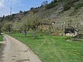
Neckar valley cycle path near Sulz

Neckar valley cycle path near Bad Niedernau


Worth seeing
- The old town of Villingen is located immediately west of the train station. Within the largely preserved city fortifications with three gate towers are among others:
- The late Gothic town hall from 1534.
- The early Gothic cathedral of Our Lady from the 13th to 16th centuries.
- The cathedral fountain.
- In the city history Franciscan Museum there are many finds from Celtic princely grave mounds on Magdalenenberg from the 6th century BC.
- On the way to Schwenningen , the cycle route passes the Schwenninger Moos . Here is the source of the Neckar, which then leads as a trickle to Schwenningen. The symbolic Neckar spring, which received a new spring stone in 2009, is located in the Möglingshöhe city park in Schwenning. In Schwenningen itself is:
- The watch industry museum in the rooms of the former Württemberg watch factory in Bürk
- When leaving the city, the route leads past Schwenningen airfield, which is adjacent to the "International Aviation Museum".
- The historic old town of the oldest city in Baden-Württemberg, Rottweil, lies high above the Neckar . The old town in its current appearance is essentially based on the Staufer . Particularly outstanding are:
- The Black Gate , part of the Hohenstaufen fortification built in 1230
- Next to the black gate is the Pretty Corner
- The old town hall from the 14th century
- The high bridge over the deep moat
- The city museum on Hauptstraße deals with city history and the Swabian-Alemannic carnival with the fool's jump .
- The Heilig-Kreuz-Münster is the main Catholic church in the city of Rottweil.
- The chapel tower of the chapel church is the city's landmark and is considered one of the most beautiful Gothic church towers .
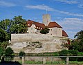
- From the municipal area of Sulz am Neckar, it is possible to make a detour to the Glatt moated castle, which is about two kilometers west of the cycle path. The detour leads from Neckarhausen along the Glatt river to the well-preserved moated castle. It is one of the oldest Renaissance castles in southern Germany and originally dates from the 13th century.
- The silhouette of the historic old town of Horb on a ridge above the Neckar is easy to see from the bike path. It's down on the Neckar
- Ihlinger Tor, also called Lucifer Tower, as it served as a prison for women accused of witchcraft in the Middle Ages.
- The huge high gable specialist building , a former trading house.
- Stubenschens Schlösschen , whose main building, built in 1519, rests on the city wall with its western front.
- Lying on the ridge:
- The former Dominican monastery. The monastery, which burned down in the town fire of 1725, was then rebuilt. Today the tax office is located in the building.
- The Collegiate Church of the Holy Cross . It originally dates from the 13th century but was also destroyed by the city fire and rebuilt in the baroque style in the middle of the 18th century .
- The council and guard house on the market with the market fountain.
- Numerous further half-timbered houses
- The Neckar Valley Bridge in Weitingen has a total length of 900 meters and a height of 127 meters above ground. The federal highway 81 leads over them .
- The Weitenburg is visible from afar from the bike path between Börstingen and Sulzau on the northern slope of the valley . In 1437, the capture of two envoys from Count Ludwig von Württemberg led to a feud with the lord of the castle.
-
Rottenburg am Neckar is one of the oldest settlement areas in Baden-Württemberg. There are already indications of larger settlements from the time before the 13th century when the medieval city emerged. So from Celtic, Roman and early medieval times. the Rottenburger Dom St. Martin is today one of the city's landmarks. There are also:
- The old town with its narrow streets and medieval towers.
- The episcopal ordinariate is housed in the former Jesuit college from the 17th century.
- The monastic care yards such as the Rohrhalder or the Kreuzlinger Hof as well as the former aristocratic palaces such as the Old World and the Haus zum Waldhorn as well as the baroque town hall are also characteristic.
| Neckar Valley Cycle Path (Section 2) | |||||||||||||||||||||||||||||||||||||||||||||||||||||||||||||||||||||||||||||||||||||||||
|---|---|---|---|---|---|---|---|---|---|---|---|---|---|---|---|---|---|---|---|---|---|---|---|---|---|---|---|---|---|---|---|---|---|---|---|---|---|---|---|---|---|---|---|---|---|---|---|---|---|---|---|---|---|---|---|---|---|---|---|---|---|---|---|---|---|---|---|---|---|---|---|---|---|---|---|---|---|---|---|---|---|---|---|---|---|---|---|---|---|
|
|||||||||||||||||||||||||||||||||||||||||||||||||||||||||||||||||||||||||||||||||||||||||
From Rottenburg to Stuttgart-Bad Cannstatt
- Route length: 94.5 km
- Elevation gain: 190 m
Immediately after starting in Rottenburg, the Neckar Valley Cycle Path leads to the university town of Tübingen (kilometer 13). After the places Lustnau , Kirchentellinsfurt , Pliezhausen , Mittelstadt , Neckartenzlingen , Neckartailfingen and Neckarhausen you come to medieval Nürtingen (kilometer 49.5) and after 2 more kilometers to Wendlingen am Neckar with its local recreation area Schäferhäuser See. The recultivated quarry ponds are now a beautiful nature reserve. From here it is a stone's throw to Köngen . The Old Neckar Bridge and the reconstructed Roman fort are impressive here. It is now another 5 km to Wernau . Here the Neckartal cycle path leads along the nature reserve Wernauer Baggerseen. Along the villages of Plochingen , Deizisau and Altbach , the route reaches Esslingen am Neckar and thus the heavily industrialized Stuttgart region. The state capital Stuttgart and the destination Bad Cannstatt are reached via Mettingen , Ober- and Untertürkheim .

Neckar near Tübingen

Neckar near Nürtingen

Esslingen with the city church


Worth seeing
-
With the Eberhard Karls University founded in 1477, Tübingen is one of the classic German university cities. Particularly worth seeing are:
- The completely preserved old town with the town hall.
- The Neckar front with the Hölderlin Tower is one of its most famous landmarks.
- The collegiate church of Tübingen from 1470 is the main Protestant church in the city.
- The Hohentübingen Castle was built in the 11th century, enlarged in the 16th century and is in its present form is a mixture of medieval castle , of modern residence and Wuerttemberg state fortress . In him is the Museum of the University of Tübingen with some unique cultural and Classical Studies Treasures such as the oldest surviving works of art known to mankind, the ivory figures from Vogelherd and Hohle Fels.
- The nuns House Tübingen is one of 30 meters in length, the largest half-timbered houses of the old town Tübingen. Presumably in 1488 Dominican women first lived in the half-timbered house , then Beguines , the "nuns".
- The district town of Nürtingen is located on the Württemberg Wine Road and the Roman Road Neckar-Alb-Aare . It offers an old town at the foot of the Gothic town church St. Laurentius, the symbol of the town. There are also:
- The Salemer Hof, a striking half-timbered building built by Cistercian monks as a nursing courtyard .
- The Latin School is a late baroque building on Marktstrasse. The well-known students Hölderlin and Schelling learned here .
- The block tower is a remnant of the medieval city fortifications. It got its name from the "block" in which suspicious persons were placed in the Middle Ages.
- The town hall combines medieval and modern architecture.
- The city of Plochingen is located at the confluence of the Neckar and Fils rivers and goes back to an Alemannic foundation in the 3rd or 4th century:
- The market square with town hall, market fountain and its half-timbered houses forms the historical center of the city.
- The oldest building in the city is the early Gothic Ottilienkapelle, which dates back to 1328.
- The art toilet "Les Toilettes" (2007) designed by Tomi Ungerer next to the Ottilien Chapel.
- The Hundertwasser house "Living under the rain tower" (1991–1994)
- In the old town of Esslingen am Neckar , in addition to Limburg an der Lahn and Göttingen, there are Germany's oldest half-timbered houses. The former Free Imperial City , surrounded by vineyards, has a long tradition as a trading city. In the Kingdom of Württemberg , she was the first and largest industrial city. The historic old town offers, among other things:
- The old town hall was built around 1420 as a municipal department store and wheelhouse and, with its magnificent half-timbered south gable, is considered the main part of the Alemannic half-timbered building.
- The Schwörhaus was built towards the end of the 13th century. From the balcony the mayor and citizen of the imperial city swore the oath on the constitution of the city from 1376 to 1802 on the Sunday after St. James Day, the so-called day of oath.
- The hospital press is the most powerful town house on the market square. It was built in 1582 as a wine press for the St. Katharinen Hospital in Esslingen.
- Esslingen got a fortification around 1220. As the contrasts with Württemberg grew, the valley was completely sealed off with newer walls. Around 1330 the Obertorvorstadt was included in the fortification. With 28 gates and around 50 towers, Esslingen was considered impregnable. The part of the fortification above the city is called the castle . There, in the 16th century, after the advent of newer firearms, the high watch was equipped with walls more than five meters thick and armed with guns.
- In the center of the old town are the twin towers of the St. Dionys Church . In the immediate vicinity is the former Dominican monastery, whose St. Paul Minster is the oldest completely preserved Dominican church in Germany. The slender tower pyramid of the late Gothic Frauenkirche juts out a little away from the market.
- The city museum in the Yellow House shows the city's history from the early Middle Ages to the present day.
- Bad Cannstatt , which was independent until 1905, owes the "bath" in the place name to numerous mineral springs. The previously famous spa lost its significance in this regard with the onset of industrialization, but still offers a number of places worth seeing today. Amongst other things:
- The Mercedes-Benz Museum , the most visited museum in the city of Stuttgart.
- The Klösterle Beguinage has an integrated Gothic chapel.
- Numerous historical buildings have been preserved in the old town of Bad Cannstatt, including the old dean's office built in 1585 on the market square, the old hospital from 1545 on Brunnenstrasse and the "Crone" inn from 1489 on Marktstrasse.
- The Great Kursaal in the spa gardens was built according to plans by Nikolaus Friedrich von Thouret (1767–1845) in the classicism style.
- The zoological-botanical garden of the city of Stuttgart, the Wilhelma . It has existed in its present form since 1953. Around 8,000 animals of 1,050 species and around 5,000 plant species are shown in the historical palace complex.
| Neckar Valley Cycle Path (Section 3) | |||||||||||||||||||||||||||||||||||||||||||||||||||||||||||||||||||||||||||||||||||||||||||||||||||||||||||||||||||||||||
|---|---|---|---|---|---|---|---|---|---|---|---|---|---|---|---|---|---|---|---|---|---|---|---|---|---|---|---|---|---|---|---|---|---|---|---|---|---|---|---|---|---|---|---|---|---|---|---|---|---|---|---|---|---|---|---|---|---|---|---|---|---|---|---|---|---|---|---|---|---|---|---|---|---|---|---|---|---|---|---|---|---|---|---|---|---|---|---|---|---|---|---|---|---|---|---|---|---|---|---|---|---|---|---|---|---|---|---|---|---|---|---|---|---|---|---|---|---|---|---|---|---|
|
|||||||||||||||||||||||||||||||||||||||||||||||||||||||||||||||||||||||||||||||||||||||||||||||||||||||||||||||||||||||||
From Stuttgart-Bad Cannstatt to Bad Wimpfen
- Route length: 102.0 km
- Elevation gain: 160 m
The third section begins directly in the urban area of Stuttgart. Only from Remseck (km 17) does the cycle path lead through sparsely populated area. Ludwigsburg (kilometer 25) has baroque castles, Marbach (kilometer 33) a medieval city center. From Marbach you can take the route to Heilbronn directly via the Bottwartal . In Besigheim (kilometer 56.5), where the Enz valley branches off into the Black Forest , you will find another historic city center. At 82.5 km, Heilbronn is finally reached and can be crossed on both sides of the Neckar. After crossing Neckargartach (kilometer 86.5) you arrive in Neckarsulm (kilometer 91.5), where you can visit the two-wheeled museum. The route leads around 10 km through the Neckar valley, with a final ascent to the Staufer town of Bad Wimpfen.
Neckar valley cycle path near Marbach

Neckar valley cycle path near Lauffen a. N.
Former Castle and today's town hall of Lauffen

Staufer stele in Besigheim


Worth seeing
- The baroque city of Ludwigsburg is mainly characterized by the magnificent residential palace . Ludwigsburg was created at the beginning of the 18th century when the largest undestroyed baroque palace in Germany was built under Duke Eberhard Ludwig von Württemberg. The city has two other castles to offer. The Favorite hunting and pleasure palace (built 1713–1728) and the Monrepos lake palace (built 1764–1768). In addition, there are in Ludwigsburg:
- Other historic buildings in the city center are the Graevenitz Palace, the two-tower Protestant town church (built 1718-26) and the simple Catholic Trinity Church (built 1721-1727) on the market square with the market fountain. To the north of the market square is the Holzmarkt with an obelisk.
- The Ludwigsburg gatehouses were part of the city fortifications; six of them have been preserved and are under monument protection.
- During the summer months, the Blooming Baroque is a much-visited park landscape around the residential palace. Some of the facilities are reserved for the nationally known fairy tale garden .
-
Marbach am Neckar is known as Friedrich Schiller's birthplace ; the city is the seat of the Schiller National Museum and the German Literature Archive . Marbach has an exceptionally well-preserved old town, the appearance of which mainly goes back to the reconstruction after the destruction in 1693. To the west and north, the old town slopes steeply to the Neckar, at the height in the south-east it was secured in the Middle Ages by the no longer existing city castle. Particularly noteworthy are among others:
- The 40 meter high upper gate tower at the eastern end of Marktstrasse. The Wendelin chapel from the 15th century can be found by the gate tower.
- Niklastorstraße leads from the market, past the town church , which was rebuilt between 1698 and 1700 , down the slope to Cottaplatz. On the way you pass numerous half-timbered houses from the period after 1693. In a triangular square there are u. a. the special town hall , the diaconate , the Wilder-Mann-Brunnen and Schiller's birthplace .
- The Hessigheim rock gardens above a bend in the Neckar, also popularly known as the Swabian Dolomites , are a nature reserve in the Neckar Basin area , a popular climbing area due to its rocks and are among the most important geotopes in Germany .
-
Besigheim lies at the confluence of the Neckar and Enz rivers . The old town is picturesquely situated on a long, steep hill, surrounded on three sides by the two rivers. Besigheim offers one of the best preserved medieval cityscapes in southern Germany.
- The mighty Waldhorn tower has been preserved from the lower castle, which was destroyed in 1693 and demolished in 1750 .
- The opposite pole to this complex is the upper castle. Its main tower, built in 1220, named after a watchman called Schoch Schoch tower is 36 m slightly higher than the horn tower.
- The Gothic Evangelical City Church is right next to the Schochenturm .
- In front of the stone house there has been a Staufer stele since 2011 , which reminds us that the later Staufer - Emperor Friedrich I. Barbarossa in 1153 gave the Margrave Hermann III. von Baden donated the Besigheim manor.
- In the center is the market square with the town hall from 1459. Roman relief panels with scenes from the Mithras cult are walled into the Alemannic half-timbered building of the town hall . The interior wall paintings date from the Renaissance period, the stucco ceilings from the Baroque period, and the town hall clock and porch from the 19th century. The Alemannic market fountain with the shield holder, which shows the Baden coat of arms, is a reminder of the Baden era.
- In Lauffen am Neckar , the birthplace of the poet Friedrich Hölderlin , numerous architectural monuments have been preserved. The historic town center of Lauffen-Stadt and the old Lauffen village have been listed as a historical monument since 1984.
- The Lauffener Rathaus is a former castle of the Counts of Lauffen , which was built in the 11th century, destroyed in the Thirty Years War and rebuilt after 1648 as the seat of the governor, whereby the Romanesque keep was preserved.
- The Regiswindis Church was built in its current form in the 16th century after a fire.
- Next to the Regiswindis Church is the Regiswindis Chapel, a cemetery chapel originally dedicated to Saint Anne , in which the sarcophagus of the local saints made in 1227 is located.
- Also worth seeing is the largely well-preserved, traffic-calmed district of Städtle , mostly with half-timbered buildings that date back to the 15th century. The old wine press , originally planned as a castle , the oriel house , the Vogtshof , the Gasthaus Sonne and the city wall with the old Heilbronner gate from the 13th century, the new Heilbronner gate from 1772 and the old prison should be emphasized .
-
Heilbronn is the sixth largest city in Baden-Württemberg with over 124,000 inhabitants. Due to its location on the Neckar, the imperial city of Heilbronn developed into an important trading center from the late Middle Ages and became one of the centers of early industrialization in Württemberg at the beginning of the 19th century . Heilbronn is known as the city of wine because of its large vineyards . The city is also called Käthchenstadt , after the name of the title character in Heinrich von Kleist's play Das Käthchen von Heilbronn .
- The number of sights is long.
-
Neckarsulm is seamlessly connected to the city of Heilbronn and with 29,500 jobs it is the economically most important city in the district of Heilbronn. The Neckarsulm Audi plant with over 14,000 employees is the largest employer in the city and the region.
- The German Two-Wheeler and NSU Museum in the former Teutonic Order Castle from the 13th century, the symbol of the city, is open all year round and shows objects from the beginnings of the bicycle to racing machines.
- The spa town of Bad Wimpfen , once a medieval Stauferpfalz and later Free Imperial City, is located on the left bank of the Neckar opposite the mouth of the Jagst above the cycle path on a rock spur.
- The historic town center of Wimpfen am Berg is one of the best preserved town centers in southern Germany.
- The most important architectural monument in Bad Wimpfen is the Staufer Kaiserpfalz , built around 1200 .
- The most important churches are the Protestant town church , which was built in the Romanesque style from the 13th century and completed around 1520 as a late Gothic hall church ; as well as the Dominican Church, which began as the church of the Dominican monastery in the 13th century and was given its present form in the 18th century.
- There are numerous historical buildings throughout the old town, including several half-timbered houses from the 15th and 16th centuries. Particularly noteworthy are the old hospital , the Wormser Hof , the town house of the Lords of Ehrenberg
From Bad Wimpfen to Mannheim
| Neckar Valley Cycle Path (Section 4) | |||||||||||||||||||||||||||||||||||||||||||||||||||||||||||||||||||||||||||||||||||||||||||||||||||||||||||||||||
|---|---|---|---|---|---|---|---|---|---|---|---|---|---|---|---|---|---|---|---|---|---|---|---|---|---|---|---|---|---|---|---|---|---|---|---|---|---|---|---|---|---|---|---|---|---|---|---|---|---|---|---|---|---|---|---|---|---|---|---|---|---|---|---|---|---|---|---|---|---|---|---|---|---|---|---|---|---|---|---|---|---|---|---|---|---|---|---|---|---|---|---|---|---|---|---|---|---|---|---|---|---|---|---|---|---|---|---|---|---|---|---|---|---|
|
|||||||||||||||||||||||||||||||||||||||||||||||||||||||||||||||||||||||||||||||||||||||||||||||||||||||||||||||||
- Route length: 117.5 km
- Elevation gain: 170 m
The last, but also the longest section, starting in Bad Wimpfen, is repeatedly accompanied by castles and palaces. There is a castle on almost every elevation around the Neckar Valley. Heidelberg (kilometer 91.5) is one of the cultural highlights of the stage before it goes to Mannheim on the Rhine plain .

Worth seeing
-
Gundelsheim called because of its centuries-long affiliation with the Teutonic Knights German Order of town .
- Horneck Castle was built in 1533 by the Teutonic Order on the ruins of the old Horneck Castle. Since 1960 the castle has housed the home town of Transylvania , a retirement and nursing home , the Transylvanian Museum and the Transylvania Institute, the cultural center of the Transylvanian Saxons.
- In addition to the actual castle buildings, the historical complex also includes several late medieval defense towers .
- The Catholic parish church of St. Nikolaus is the former hospital church of the Teutonic Order.
- The old town of Gundelsheim is rich in historical buildings. Many half-timbered houses date back to the 17th and 18th centuries, including the historic Zum Lamm inn from 1692.
- The Burg Hornberg was a Gaugrafenburg and later a knight's castle on a steep mountain ridge above the Neckar valley above the village Neckarzimmern .
- The market square is particularly worth seeing in Mosbach . In addition to the Mosbach town hall, there is also the Palm'sche Haus , a half-timbered house built in 1610, which is a symbol of the city and one of the most beautiful half-timbered houses in southern Germany. The oldest half-timbered house is the salt house. Next to it is the Gothic collegiate church of St. Juliana, whose beginnings go back to the 13th century, where it was part of the Mosbach monastery .
- In Zwingenberg am Neckar there is the inhabited and well-preserved castle - today Zwingenberg Castle , originally from the 13th century. This was razed in the 14th century and rebuilt in 1403 by the Lords of Hirschhorn . Every year in August the castle festival has been held in the open air since 1983.
- The bike path on the opposite bank of the Neckar offers a beautiful overview of the city of Eberbach . It lies in a widening of the Neckar valley and like Hirschhorn on the romantic castle road that leads from Mannheim to Prague. On a detour over the Neckar, the city offers, among other things:
- The historic old town has four well-preserved towers of the medieval city fortifications.
- The old town hall from 1823 on the market square is one of the most successful works of the Weinbrenner style ( classicism in Baden ).
- The oldest stone building is the Thalheimsche Haus , formerly the Electoral Palatinate cellars, hunting lodge and town hall, today the information center of the Neckartal-Odenwald Nature Park .
- Outstanding half-timbered houses are the former city palace Eberbacher Hof from the 16th century, the old bath house and the neighboring Spohr house .

-
Hirschhorn am Neckar offers a picturesque view of the old town, monastery and castle from the opposite bank of the Neckar. Several points in the city invite you to visit. So
- the Hirschhorn Museum , which houses the remarkable "Natural History and Antiquities Collection" of the Hirschhorn innkeeper Carl Langbein and the environmental education center of the UNESCO Geopark;
- the medieval Hirschhorn Castle extends on a mountain spur above the town. It received its current form in the 16th century through a castle-like reconstruction in the Renaissance style . After that it was used as Kurmainzer's official residence. The castle has been spared major damage to this day and is therefore in a very good state of preservation. Only the inner courtyard and the tower are open to the public.
- Below the castle is the former Carmelite monastery church of the Annunciation , consecrated in 1406, with St. Anne's chapel from 1513. The church is rich in medieval epitaphs by von Hirschhorn and has a Gothic sandstone rood screen . The former monastery building has been preserved to the right of the church.
- Within the old town, which is surrounded by the almost completely preserved city defense system from the 13th and 15th centuries, there are other buildings worth seeing.
- The most important sights of Neckarsteinach are the four castles, which are located west of the settlement center on a mountain spur or on the slope of the Neckar bank: Vorderburg , Mittelburg , Hinterburg and Schadeck (also: Swallow's Nest).
- The Evangelical Church of Neckarsteinach goes back to the original church of the town and was rebuilt in 1483 in the late Gothic style by Blicker XIV. Landschad von Steinach.
- The Catholic Herz-Jesu-Kirche was built in the neo-baroque style between 1906 and 1908 by Friedrich Pützer.
- Neckarsteinach is rich in historical buildings. In addition to remnants of the old city wall from the 14th century, the medieval Bliggergasse should be mentioned, as well as the half-timbered house Ambtmann and the old synagogue in Hirschgasse and the Schönauer Hof , a historic half-timbered ensemble in Kirchenstrasse.
- The former residence of the Electorate of the Palatinate, Heidelberg, is known for its castle ruins above the river and the old town as well as the Ruprecht-Karls-Universität , the oldest university in what is now Germany. Heidelberg is one of the few major German cities that was not destroyed in World War II. A special feature is the baroque old town , which - after the destruction in 1689 and 1693 - was rebuilt on a medieval floor plan. Most of the important buildings are located in the old town, which is 1.6 km long and has one of the longest pedestrian zones in Europe.
-
Ladenburg with its late medieval old town is located on the Bertha Benz Memorial Route and only a few kilometers from the Neckar confluence with the Rhine. In the city there is:
- The Dr. Carl Benz in the almost 100 year old factory building of C. Benz Söhne .
- The market square is the center of the historic old town, which is of supraregional importance thanks to a uniquely closed inventory of superbly restored monuments, including numerous half-timbered houses from the 15th to 18th centuries. The baroque Marian column and the Neunhellerhaus are particularly striking here.
- The St. Gallus Church with a crypt from the 11th century and the Evangelical City Church are right next to each other.
- The square city and university city of Mannheim is the third largest city in the state of Baden-Württemberg with around 300,000 inhabitants. The former royal seat (1720–1778) of the historic Electoral Palatinate forms the economic and cultural center of the European Rhine-Neckar metropolitan region with 2.35 million inhabitants. The list of culture and sights is correspondingly long.
literature
- Neckar Valley Cycle Path: From Villingen-Schwenningen to Mannheim , ADFC -compact spiral 1: 50,000, BVA Bielefelder Verlag 2014, ISBN 978-3-87073-641-5 .
- Cycling map Neckartal-Radweg , 1: 50.000, Publicpress-Verlag, ISBN 978-3-89920-279-3 .
- bikeline Radtourenbuch Neckar-Radweg , 1: 50.000, Verlag Esterbauer, Rodingersdorf, 12th edition 2010, ISBN 978-3-85000-026-0 .
- Ute Freier, Peter Freier: Neckar-Radweg , Bruckmann Verlag Munich, 2007, ISBN 978-3-7654-4580-4 .
- Enchanting Neckar - The bicycle adventure tour , Verlag BoD, ISBN 978-3-8423-4636-9 .
Web links
- Neckar Valley Cycle Path in the Baden-Württemberg cycle route planner
- Route description of the Neckartal cycle path
- Directions and overview map from Esterbauer
- Route description with elevation profile on Radreise-Wiki
Individual evidence
- ↑ Neckartal-Radweg on www.tourismus-bw.de, accessed on March 25, 2018
- ↑ a b Neckartal-Radweg [ID 579] ( Memento from November 14, 2012 in the Internet Archive ), at www.adfc.de, accessed on March 25, 2018
- ↑ ADFC quality cycle routes with 4 stars ( memento from August 25, 2018 in the Internet Archive ), at www.adfc.de, accessed on March 25, 2018
- ↑ 11 stars for Baden-Württemberg: ADFC awards quality cycle routes on www.adfc-bw.de, accessed on March 25, 2018
- ↑ Besigheim 2011 on stauferstelen.net. Retrieved March 23, 2014.
Coordinates: 48 ° 3 ′ 29 ″ N , 8 ° 27 ′ 54 ″ E