
Kathmandu
| Kāṭhamāḍauṁ Kathmandu |
|||
|---|---|---|---|
|
|||
| Coordinates | 27 ° 43 ′ 0 ″ N , 85 ° 19 ′ 0 ″ E | ||
| Symbols | |||
|
|||
| Basic data | |||
| Country | Nepal | ||
| Bagmati | |||
| District | Kathmandu | ||
| ISO 3166-2 | NP-P3 | ||
| height | 1356 m | ||
| surface | 50.7 km² | ||
| Residents | 985,000 (2020) | ||
| density | 19,439.5 Ew. / km² | ||
| founding | 900 AD | ||
| Website | www.kathmandu.gov.np | ||
| politics | |||
| mayor | Vidyas and Shakya | ||
 Kathmandu at the time of the monsoon with thick cloud cover
|
|||


Kathmandu ([ katˈmandu , katmanˈduː ], Nepali काठमाडौं Kāṭhamāḍauṁ , Newari येँ Yẽ , former name Kantipur ) is the capital of the state of Nepal . With around 1 million inhabitants in the urban area and a good 1.4 million in the metropolitan area, it is the largest city in the country and also the seat of the South Asian Association for Regional Cooperation .
location
Kathmandu is located in the center of the densely populated Kathmandu valley, a basin with a diameter of about 30 km at an altitude of 1300 m . The neighboring larger cities in the valley, Lalitpur (Patan), Bhaktapur , Madhyapur Thimi , Kirtipur and numerous smaller cities and communities form the metropolitan area of Kathmandu. The surrounding mountains have heights between 2000 and 2700 m. In the north and even more so in the west, the foothills of the densely built city have already reached the foot of these mountains. The city extends on the north side of the Bagmati . The core area lies between the Vishnumati and Dhobi Khola rivers. The sister city of Lalitpur (Patan) is located on the south side of the Bagmati .
The water from the rivers that converge in the basin is only discharged to the south via the main Bagmati river through a gorge through which no other traffic routes lead. The most important and so far only transport connection to the rest of the country is via a pass in the west of the city. The extreme monsoons lead to numerous landslides every year, so that Kathmandu is repeatedly cut off from the outside world for a few days. A second road connection in the Terai , beginning in Dhulikhel, about 30 km east of Kathmandu, has been under construction since 1997 and is almost complete. This will significantly improve the city's precarious connection situation.
The Araniko Highway leads via Bhaktapur and Dhulikhel to the Sino-Nepalese Friendship Bridge on the border with Tibet . For years, the highway has been largely inaccessible for years due to landslides and poor condition on the last section up to the border with the People's Republic of China, especially during the rainy season. In the further course on the Chinese side, the road as a Friendship Highway to Lhasa is paved throughout and sufficiently developed.
Kathmandu can be reached via Kathmandu Airport. One of three pass roads to Tibet has been spilled. The border bridge on the China-Nepal Highway no longer carries trucks .
climate
| Kathmandu | ||||||||||||||||||||||||||||||||||||||||||||||||
|---|---|---|---|---|---|---|---|---|---|---|---|---|---|---|---|---|---|---|---|---|---|---|---|---|---|---|---|---|---|---|---|---|---|---|---|---|---|---|---|---|---|---|---|---|---|---|---|---|
| Climate diagram | ||||||||||||||||||||||||||||||||||||||||||||||||
| ||||||||||||||||||||||||||||||||||||||||||||||||
|
Monthly average temperatures and rainfall for Kathmandu
Source: wetter.zdf.de ; wetterkontor.de
|
||||||||||||||||||||||||||||||||||||||||||||||||||||||||||||||||||||||||||||||||||||||||||||||||||||||||||||||||||||||||||||||||||||||||||||||||||||||
history

The early history of Kathmandu is described in the Buddhist and Hindu legends. According to them, a first settlement arose at the confluence of the Vishnumati and Bagmati rivers after the valley had previously been drained by Buddha Manjushri or Pradyumna , a son of Krishna , and thus made large areas habitable. The city called "Manju-Patan" stretched from Swayambhunath to Guhyeswari and was ruled by Dharmakara. Other kings were finally followed by the rule of the Kiranti , an east Nepalese mountain people, which lasted around 300 years and lasted until around 300 BC. And turned the Kathmandu Valley into a thriving commercial center.
Early in the 1st millennium AD, power fell into the hands of the Indian Licchavi dynasty, who brought with them Hinduism and the caste system. By Chinese travelers in the 7th century. there are reports that Buddhism and Hinduism coexisted peacefully. The heyday under the Licchavis was followed by a period of instability about which little is known. Some cities were founded in the Kathmandu valley in the 9th century.
The origin of Kathmandu is shrouded in legend. The goddess Mahalakshmi had ordered the king Gunakama Deva around 950 AD in a dream to found a city at the confluence of Vishnumati and Bagmati and to name it Kantipur. Like many other confluences, the place is sacred because Kanesvara, an incarnation of Vishnu , is found there. However, it can be assumed that the city already existed at the time and that it was more a matter of reorganizing urban areas and assigning patron gods. Gunakama Deva moved the royal seat from Patan to Kantipur and built 18,000 houses and the Suvarnapranali gold fountain. He brought protective deities to the city, Chandesvari, Rakta Kali (Kankeshvari), Pacali Bhairava, Indrayani, Maheshvari and Lomri, who are still worshiped in Kathmandu today. A 12th century source mentions a temple called Kasthamandap. This pagoda-shaped temple stood in central Durbar Square until it was destroyed in the 2015 earthquake . The current city name Kathmandu goes back to Kasthamandap, composed of Sanskrit kastha , "wood" and mandap , "pavilion".
In 1382 the entire valley came under the rule of the Newar under Jayastithi Malla , the founder of the Malla dynasty, which is still revered today. Three generations later, the empire was divided between three brothers and one sister, each with the capitals Kantipur, Lalitpur, Bhadgaon and Banepa, which borders the Kathmandu valley to the east. The competition among these four cities led to a flourishing of art. In all three cities, mainly by Newar artists, temple districts with magnificent pagodas and palaces were built. Gutters, water basins and public water points were created. The city's prosperity was based on flourishing trade and customs revenues.
During the reign of Mahendra Malla in the 16th century, the area around the palace was furnished with important, ornate buildings. Around 1560, the three-story Taleju Temple standing on a step pyramid was the first monumental building in the Kathmandu valley and Pashupatinath on the Bagmati bank. King Pratapa Malla had the palace expanded to its present size and u. a. also put on the Rani Pokhari . Pratapa, who considered himself the king of poets, had the "Prayer of Kali" chiseled in 15 languages on a wall of the royal palace in 1654.
In 1768 Kathmandu and Patan were captured by troops of the Prithvi Narayan Shah from Gorkha . The last Malla king had stolen the treasure of Pashupatinath to pay for the defense, and in vain called the British East India Company for help. A year later, Badgaon and Banepa also fell into the hands of the Gurkhas . Kathmandu became the royal seat of the Shah dynasty. The city was expanded according to the European model from the middle of the 19th century. The Kantipath was built on the eastern edge of the city along the city wall with palaces, schools, hospitals and barracks. Today this street represents an important central north-south axis of the city.
The successors of Prithvis Narayan annexed neighboring lands and extended their empire until 1790 in the east to Sikkim and in the west to today's Uttar Pradesh . In 1816 a British observer was stationed in Kathmandu to the displeasure of the Nepali as a result of a lost battle against the English who had colonized India. In the following years the country withdrew into complete isolation; Apart from Indians, no foreigner was allowed to cross the border. In 1948 Nepal was still one of the largest countries in the world unexplored by Europeans.
A period of intrigue followed until 1846 when all prime ministers under the Shah kings were either murdered or driven to suicide.
In 1846 the soldier Jung Bahadur Kunwar came to power through a bloody coup in which dozens of nobles and over a hundred officials were murdered ( Kot massacre ). The Shahs are disempowered, but continue to function as puppet kings until 1951. Kunwar changes his name to Rana (king) and thus establishes the Rana dynasty, which in the following 100 years provides the prime ministers with actual power. Huge palaces in the style of European neoclassicism arose under the Ranas . B. the Singh Durbar, the largest private residence in Asia. In the absence of road links, all goods were carried to Kathmandu until the 1950s, including the first cars, e.g. B. the Rolls-Royce of the Ranas.
Kathmandu was hit by a major earthquake in 1934 that left only a few buildings in the city undamaged. The destruction was taken as an opportunity to create the New Road, one of today's main shopping streets in the city, as a connection between the Kantpath and the Durbar Marg (temple district).

With the help of India, King Tribhuvan came back to power in 1951 and, under his son Mahendra , a freely elected parliament met for the first time in Kathmandu in 1959. However, the king feared losing power and on the grounds that the government had changed ten times in the past four years, he declared a state of emergency in 1960, dissolved parliament and banned all parties. Two years later he introduced the Panchayat, a semi-democratic legislature with little de facto power. In 1972 Mahendra's son Birendra ascended the throne. Popular dissatisfaction peaked in 1979 and for the first time in living memory, violent demonstrations broke out in Kathmandu. The king granted a referendum in which the Panchayat system received a slim majority. Even after elections were held in 1981 (without the participation of parties), the king retained absolute power. In the 1980s, especially in Kathmandu, there were numerous demonstrations and riots that were brutally fought by the police. The unrest culminated in a major uprising in 1990, in which 200 to 300 people were killed on April 6 on Tundikhel. Under pressure, the king was eventually forced to repeal the panchayat system and allow elections, which took place in May 1991.
In June 2001, a tragedy took place in the royal palace. According to the official investigation, Crown Prince Dipendra ran amok and shot 11 members of his family, including his parents, before turning the gun on himself. His successor was Birendra's brother, Prince Gyanendra , who was largely unpopular among the people . On the grounds of the constantly changing and incompetent governments and the escalating civil war (Maoist uprising), the latter deposed the government on February 1, 2005, declared a state of emergency and abolished all democratic freedoms. The municipal council elections in February 2006 were boycotted by all parties. General strikes and numerous demonstrations forced Gyanendra to reinstate parliament. The Maoists took part in the interim government, and parliament withdrew all power from the king. The elections scheduled for autumn 2007 were postponed due to heated arguments over the future of the monarchy.
The city's economy has suffered badly during these uncertain times. In addition to the numerous demonstrations and strikes, as a result of which business life completely collapsed, there were occasional sieges of the city by Maoists and the isolation from the outside world. Tourism, an important source of income for both the city and the whole country, was completely absent for years.
On April 25, 2015, the city was hit by a severe earthquake measuring 7.8. Numerous people were killed and buildings collapsed, including the 61-meter high Dharahara Tower .
Demographics
The following table shows the development of the city's population.
| 1971 (census) | 1981 (census) | 1991 (census) | 2001 (census) | 2006 (estimate) | 2011 (census) |
|---|---|---|---|---|---|
| 150.402 | 235.160 | 421.258 | 671.846 | 777.795 | 975.453 |
The Kathmandu District, which includes about a third of the Kathmandu Valley including Kathmandu, had 1,744,240 inhabitants at the 2011 census.
- View of Kathmandu
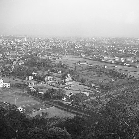
1977

2013


Cityscape


Kathmandu is the political and cultural center of Nepal and by far the largest city in the country. Here you will find all the central institutions of Nepal, the representations of many countries and development organizations as well as the representative buildings of the government and the royal family, which shape the image of the entire city. The old town is characterized by Hindu temples, especially on Durbar Marg; other important religious buildings and shrines can be found in the outer districts of the city: Pashupatinath and Buddhist stupas and shrines (including Bodnath , Swayambhunath , Budhanilkantha ).
The old town has an extremely high density of buildings, but largely still has the original block structure with the inner courtyard buildings typical of the city (Bahal), e.g. B. Bhagwati Bahal, Khache Bahal, Om Bahal and the like. v. a. The quiet, large Bahals can usually only be reached through narrow, low and inconspicuous entrances and form a strong contrast to the dense crowd and noise in the alleys. The valley with the three royal cities Kathmandu, Patan and Bhaktapur has been classified as a World Heritage Site by UNESCO since 1979 .
The structural fabric of the residential buildings, in the old town often in the Newarian style with artistically carved windows, is usually very poor, and despite the protection status, they are threatened with decay. Dilapidated or demolished houses are being replaced, as in the rest of the country, by the simplest concrete buildings, on which a few more storeys are then added. This development is progressing rapidly. Therefore, the original Kathmandu will no longer exist in a few years.

The cityscape is also shaped by a large, undesigned green area (tundikhel) in the city center, directly east of the old town, around which the main traffic of the city runs clockwise. There are only a few developed wide streets in the city area, for example from the center to the east to the airport , which is located directly on the outskirts. In addition, there is the luck of planning a wide ring road leading around Kathmandu and Lalitpur. Apart from a few exceptions, all traffic takes place on narrow, mostly single-lane streets and alleys, on which pedestrians move at the same time. When it comes to urban development, development almost always lags behind: first, the houses are built haphazardly; thereafter, the remaining trails will be expanded to small roads that are hardly accessible for vehicles and even less for emergency vehicles. With the number of privately owned vehicles on the rise, traffic regularly collapses during peak hours. The traffic emissions contribute to the fact that Kathmandu is one of the cities with the highest air pollution, since the boiler location makes air exchange difficult. For a few years now, they have been in the process of replacing at least the numerous two-stroke engines (Tempos) with battery-powered, clean “Sapha” -Tempos. Since these make up a large part of the traffic, this contributes to a noticeable and visible improvement in air quality, at least in the city center. The Kathmandu trolleybus contributed to this in public transport, but has since been shut down.
Kathmandu was also a stop on the so-called hippie trails . The city was mentioned in the same breath together with Kabul and Khaosan Road in Bangkok in the 1960s and 1970s . Traces of it can be found in different names of restaurants and z. B. in the still common name for a small street near Durbar Square : Freak Street. Otherwise nothing is left of the flair of this time and many tourists who associate the city with the old mysticism and magic experience a disappointment.
The Thamel district has developed into a tourist area and is dominated by western tourists in the dry and travel season (October to April).
The only zoo in Nepal is located in the neighboring town of Lalitpur .
administration
The administrative name of the city is Kathmandu Maha-Nagarpalika ( romanization kaaThmaa Dau mahaanagarpaalikaa ) (English Kathmandu Metropolitan City ). Until 2017 it was the only city in the country with this highest possible level of administration. On the next lower level, Kathmandu is divided into 32 districts (wards).
When classifying the wards, less attention was paid to the urban districts that have grown than to more or less the same size or population. Grown districts that also play an important role for orientation are Teku, Kalimati, Balaju (industrial area), Putalisadak, Dillibazar, Gyaneswar (German Embassy), Lazimpat (embassy district), Thapathali, Chabahil, Baneswar, Min Bhawan and many others.
Facilities
- Government, Administration: Parliament, Ministries, Supreme Court, National Archives, Central Bank . Most of these facilities are housed in former Rana palaces.
- Educational institutions: Tribhuvan University (main campus on the southwestern outskirts in neighboring Kirtipur), Birendra Intl. Convention Hall, Hermann Hesse Study Center
- Hospitals: Bir Hospital, Nepal Mediciti hospital, Grande International Hospital, Army Hospital, Birandra Police Hospital, Kanti Children's Hospital, Teaching Hospital, Prasuti Griha Maternity Hospital, Kathmandu Model Hospital, Cholera Hospital, Eye Hospital, Chest Hospital, Ayurveda Hospital, Kantipur Hospital, National Dental Hospital, Til Ganga Hospital
- Transport: Bus stations: Central Bus Terminal Gongabu (on the northern ring road), Ratna Park bus station (east side of Tundikhel), Airport: Tribhuvan International Airport (right on the eastern edge of the city, approx. 5 km from the center)
- Foreign representations (L: in Lalitpur)
Embassies: Egypt (L), Australia, Bangladesh, China, Denmark, Germany, France, Great Britain, India, Israel, Italy, Japan, Myanmar (L), North Korea (L), Norway (L), Pakistan, Russia, Switzerland ( L), Sri Lanka, South Korea, Thailand, USA
Consulates: Finland, Canada, Mexico, New Zealand, Netherlands (L), Austria, Philippines, Slovakia (L), Spain, Turkey.
- International institutions and aid organizations: American Library, British Council , CARE Nepal, Caritas, CIDA (Canada), CRS, CWIN, DFID, DVS, GIZ (formerly GTZ / DED), GVS, Helvetas, ICIMOD, ITDGA, IUCN, JOCV / JICA (Japan), SAARC, SCF (US), SCF (Japan), SCF (GB), SNV (Netherlands), SSSP, SADC (Switzerland), UMN (Mission), UNO, UNFPA, UNICEF, US Peace Corps, USAID, French Cultural Center, Goethe Institute, Indian Library, Keshar Library, Russian Library, Nepal Research Center
religion

Like Nepal in general, Kathmandu is predominantly Hindu. Influences from Buddhism can, however, be seen in temples. Christians and Muslims are also present in Kathmandu, but they are in the minority. One of the oldest Hindu temples is Gokarna Mahadev, 15 kilometers to the northeast .
Twin cities
-
 Eugene , United States
-
 Matsumoto , Japan
-
 Minsk , Belarus
-
 Pyongyang , North Korea
-
 Xi'an , People's Republic of China
-
 Yangon , Myanmar
Sons and daughters
- Chöying Drölma (* 1971), Buddhist nun and singer
- Manisha Koirala (born 1970), actress
- Dichen Lachman (born 1982), Australian actress
- Dechen Shak-Dagsay (* 1959), mantra singer
- Anthony Francis Sharma (1937–2015), Catholic bishop
- Jagjit Shrestha (* 1993), football player
- Manjushree Thapa (* 1968), writer
- Daya Vaidya (* 1973), American actress
literature
- Hans-Georg Behr , photos: Bruno Barbey : Kathmandu: Newar do not mourn. In: Geo-Magazin. Hamburg 1979.2, pp. 122-148. Informative report about the customs of the Newar . ISSN 0342-8311
Web links
- German Embassy in Kathmandu
- Kathmandu Post
- Kathmandu Valley on the UNESCO World Heritage Center website ( English and French ).
- Herbert W. Jardner, ritual shrines in the Kathmandu valley
Individual evidence
- ↑ a b Kathmandu Population 2020
- ↑ China's Nepalese friendship road leads to the heart of India's market The Guardian, April 23, 2013. Retrieved June 8, 2013.
- ^ DB Shrestha, CB Singh: The History of Ancient and Medieval Nepal . DB Shrestha & CB Singh, Kathmandu 1976, Introduction, p. 3 .
- ↑ John Whelpton: A History of Nepal . Cambridge University Press, Cambridge 2005, ISBN 0-521-80470-1 , Chapter 1: Environment, state and society in the central Himalayas to 1743, p. 6 ( limited preview in Google Book search).
- ^ Kathmandu - national capital, Nepal. In: britannica.com . April 25, 2015, accessed May 6, 2015 .
- ^ DB Shrestha, CB Singh: The History of Ancient and Medieval Nepal . DB Shrestha & CB Singh, Kathmandu 1976, Introduction, p. 4 .
- ↑ John Whelpton: A History of Nepal . Cambridge University Press, Cambridge 2005, ISBN 0-521-80470-1 , Chapter 1: Environment, state and society in the central Himalayas to 1743, p. 13 ( limited preview in Google Book search).
- ^ DB Shrestha, CB Singh: The History of Ancient and Medieval Nepal . DB Shrestha & CB Singh, Kathmandu 1976, Introduction, p. 7 .
- ^ Information from the German Research Center for Geosciences. Retrieved April 30, 2015.
- ↑ More than 1500 dead after earthquake in Nepal. FAZ.NET , April 25, 2015, accessed on April 25, 2015 .
- ↑ Pravakar Pradhan and Ranjith Perera (2005): Urban Growth and Its Impact on the Livelihoods of Kathmandu Valley, Nepal (= UMP-Asia Occasional Paper. No. 63). pdf ( Memento of April 29, 2005 in the Internet Archive ), p. 14.
- ^ Federal VDC Relation. In: UN Nepal Information Platform: Common Data Repository. Accessed January 1, 2019 .