List of municipalities in the Schwarzwald-Baar district
The list of municipalities in the Schwarzwald-Baar district gives an overview of the 20 smallest administrative units in the Schwarzwald-Baar district . Ten of the parishes are cities . The district towns of Villingen-Schwenningen and Donaueschingen are medium- sized towns and large district towns , the other eight towns are small towns .
In its present form, the Schwarzwald-Baar district was created in the course of the district reform carried out in 1973 . The district was formed from the following parts: the former Villingen district (except for one municipality), the majority of the former Donaueschingen district , three communities in the Rottweil district and one community each in the Hochschwarzwald , Konstanz and Tuttlingen districts ;
description
The district can be further divided into the following agreed administrative communities (VVG) and municipal administration associations (GVB):
- GVB Donaueschingen with the cities of Donaueschingen , Bräunlingen and Hüfingen ;
- VVG Furtwangen with the city of Furtwangen in the Black Forest and the community of Gütenbach ;
- GVB Raumschaft Triberg with the city of Triberg in the Black Forest and the communities Schönwald in the Black Forest and Schonach in the Black Forest ;
- VVG Villingen-Schwenningen with the city of Villingen-Schwenningen and the communities Brigachtal , Dauchingen , Mönchweiler , Niedereschach , Tuningen and Unterkirnach ;
The cities of Bad Dürrheim , Blumberg , St. Georgen in the Black Forest and Vöhrenbach , like the municipality of Königsfeld in the Black Forest, are not members of an administrative community or a community administration association.
The district has a total area of 1,025.24 km² . The largest areas within the district are the cities of Villingen-Schwenningen with 165.47 km², Donaueschingen with 104.63 km² and Blumberg with 98.68 km². Each city has an area of over 80 or 70 km² and two cities have an area of over 60 or 50 km². One municipality is over 40 km², two municipalities and a city have an area larger than 30 km² and two municipalities have an area of over 20 km². Four municipalities are over 10 km² and one is smaller than 10 km². The smallest areas have the communities of Unterkirnach with 13.17 km², Dauchingen with 10.04 km² and Mönchweiler with 9.6 km².
The major district towns of Villingen-Schwenningen with 85,181 inhabitants and Donaueschingen with 22,526 inhabitants, followed by the town of St. Georgen in the Black Forest with 12,958 inhabitants, have the largest share of the population of the district of 212,381 inhabitants. The cities of Bad Dürrheim and Blumberg have over 10,000 inhabitants. Three municipalities and three cities have between 5,000 and 10,000 inhabitants. The remaining two cities and seven municipalities have between 1,000 and 5,000 inhabitants. The three smallest municipalities in terms of population are Unterkirnach with 2582 inhabitants, Schönwald in the Black Forest with 2444 and Gütenbach with 1137 inhabitants.
The entire Schwarzwald-Baar district has a population density of 207 inhabitants per km². The largest population density within the district has the city of Villingen-Schwenningen with 515 inhabitants per km² and the communities Dauchingen with 375 and Mönchweiler with 310. Five communities, including three cities, have a population density of over 200. In all of these places the population density is higher than the district average of 207 or is exactly on this (city of Donaueschingen ). Eight municipalities, including four cities, have between 100 and 200 inhabitants per km² and four municipalities have a population density below 100. These four municipalities are the city of Bräunlingen with 94, the municipalities of Schönwald im Schwarzwald with 88 and Gütenbach with 61 and the city of Vöhrenbach with 55 inhabitants per km².
Legend
- Municipality : Name of the municipality or city and information about the district to which the eponymous place of the municipality belonged before the regional reform
- Subsites : Enumerated are the formerly independent municipalities of the administrative unit. The year of incorporation is also given. This is also noted for the suburbs that belonged to a different district than the main town of today's municipality before the regional reform
- VVG / GVB : Shows the affiliation to one of the administrative communities or the municipal administration association
- Coat of arms : coat of arms of the municipality or city
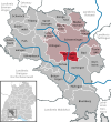
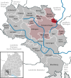
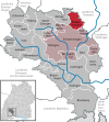
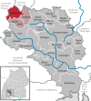
- Map : Shows the location of the municipality or city in the district
- Area : Area of the city or municipality, given in square kilometers
- Population : Number of people living in the municipality or city (as of December 31, 2018)
- Population density : The population density is given, calculated on the area of the administrative unit, given in population per km² (as of December 31, 2018)
- Altitude : Altitude of the eponymous town or town in meters above sea level
- Image : Image from the respective municipality or city
Communities
| local community | Sub-locations | VVG / GVB | coat of arms | map | surface | Residents | EW density |
height | image |
|---|---|---|---|---|---|---|---|---|---|
| Schwarzwald-Baar district |  |
 |
1,025.24 | 212.381 | 207 |

|
|||
|
Bad Dürrheim (town) (belonged to the district of Villingen before the regional reform) |
Bad Dürrheim all the formerly independent municipalities that belonged to the urban area today belonged to the district of Donaueschingen: Biesingen (1971) Hochemmingen (1972) Oberbaldingen (1971) Öfingen (1971) Sunthausen (1972) Unterbaldingen (1972) |
 |
 |
62.09 | 13,260 | 214 | 703 |

|
|
|
Blumberg (town) (belonged to the Donaueschingen district before the regional reform) |
Blumberg Achdorf (1972) Epfenhofen (1971) Fützen (1975) Hondingen (1972) Kommingen (1971) Nordhalden (1971; belonged to the district of Konstanz before the regional reform) Riedböhringen (1972) Riedöschingen (1972) |
 |
 |
98.68 | 10.127 | 103 | 704 |

|
|
|
Bräunlingen (town) (belonged to the Donaueschingen district before the regional reform) |
Bräunlingen Döggingen (1971) Mistelbrunn (1972) Unterbränd (1972) Waldhausen (1972) |
GVB Donaueschingen |
 |
 |
62.1 | 5,828 | 94 | 693 |

|
|
Brigachtal (belonged to the Villingen district before the regional reform) |
Kirchdorf Klengen Überauchen (merger 1974) |
VVG Villingen- Schwenningen |
 |
 |
22.8 | 5,137 | 225 | 705 | |
|
Dauchingen (belonged to the district of Villingen before the regional reform) |
Dauchingen | VVG Villingen- Schwenningen |
 |
 |
10.04 | 3,767 | 375 | 732 | |
|
Donaueschingen (large district town) (belonged to the district of Donaueschingen before the regional reform) |
Donaueschingen Aasen (1972) Grüningen (1972) Heidenhofen (1972) Hubertshofen (1972) Neudingen (1975) Pfohren (1972) Wolterdingen (1971) |
GVB Donaueschingen |
 |
 |
104.63 | 22,526 | 215 | 686 |

|
|
Furtwangen im Schwarzwald (town) (belonged to the Donaueschingen district before the regional reform) |
Furtwangen in the Black Forest Linach (1972) Neukirch (1971) Rohrbach in the Black Forest (1973) Schönenbach (1971) |
VVG Furtwangen in the Black Forest |
 |
 |
82.57 | 9.091 | 110 | 870 |
 
|
|
Gütenbach (belonged to the Donaueschingen district before the regional reform) |
Guttenbach | VVG Furtwangen in the Black Forest |
 |
 |
18.49 | 1,137 | 61 | 826 |

|
|
Hüfingen (town) (belonged to the Donaueschingen district before the regional reform) |
Hüfingen Behla (1972) Fürstenberg (1971; City) Hausen vor Wald (1972) Mundelfingen (1975) Swamp ears (1970) |
GVB Donaueschingen |
 |
 |
58.53 | 7,799 | 133 | 684 |

|
|
Königsfeld in the Black Forest (belonged to the district of Villingen before the regional reform) |
Königsfeld in the Black Forest Buchenberg (1975) Burgberg (1974) Erdmannsweiler (1974) Neuhausen (1975) Weiler (1973) |
 |
 |
40.24 | 6,027 | 150 | 763 |
 
|
|
|
Mönchweiler (belonged to the district of Villingen before the regional reform) |
Mönchweiler | VVG Villingen- Schwenningen |
 |
 |
9.6 | 2,977 | 310 | 757 | |
|
Niedereschach (belonged to the Villingen district before the regional reform) |
Niedereschach Fischbach (1974) Kappel (1974) Schabenhausen (1971) |
VVG Villingen- Schwenningen |
 |
 |
33.07 | 5,917 | 179 | 625 |

|
|
Schonach in the Black Forest (belonged to the district of Villingen before the regional reform) |
Schonach in the Black Forest Rohrhardsberg (1971) |
GVB Raumschaft Triberg |
 |
 |
36.71 | 4,045 | 110 | 885 |
 
|
|
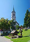
Schönwald in the Black Forest (belonged to the Villingen district before the regional reform) |
Schönwald in the Black Forest | GVB Raumschaft Triberg |
 |
 |
27.81 | 2,444 | 88 | 1,000 |
|
|
St. Georgen im Schwarzwald (town) (belonged to the Villingen district before the regional reform) |
St. Georgen in the Black Forest Brigach (1972) Langenschiltach (1973) Oberkirnach (1974) Peterzell (1974) Stockburg (1974) |
 |
 |
59.85 | 12,958 | 217 | 862 | ||
|
Triberg im Schwarzwald (city) (belonged to the district of Villingen before the regional reform) |
Triberg in the Black Forest Gremmelsbach (1974) Nussbach (1973) |
GVB Raumschaft Triberg |
 |
 |
33.32 | 4,794 | 144 | 684 |

|
|
Tuningen (belonged to the Tuttlingen district before the regional reform) |
Tuning | VVG Villingen- Schwenningen |
 |
 |
15.59 | 2,931 | 188 | 743 | |
|
Unterkirnach (belonged to the district of Villingen before the regional reform) |
Unterkirnach | VVG Villingen- Schwenningen |
 |
 |
13.17 | 2,582 | 196 | 815 | |
|
Villingen-Schwenningen (large district town) (parts of today's municipality belonged to the districts of Villingen, Rottweil and Donaueschingen before the regional reform) |
Villingen in the Black Forest (district of Villingen) Schwenningen am Neckar (district of Rottweil) (merged 1972) Herzogenweiler (1972; district of Villingen) Marbach (1974; district of Villingen) Mühlhausen near Schwenningen (1970 to Schwenningen am Neckar; district of Rottweil) Obereschach (1971 to Villingen in the Black Forest; district of Villingen) Pfaffenweiler (1972; district of Villingen) Rietheim (1972; district of Villingen) Tannheim (1972; district of Donaueschingen) Weigheim (1975; district of Rottweil) Weilersbach (1975; district of Villingen) |
VVG Villingen- Schwenningen |
 |
 |
165.47 | 85.181 | 515 | 704 |
 
|
|
Vöhrenbach (town) (belonged to the district of Donaueschingen before the regional reform) |
Vöhrenbach Hammereisenbach-Bregenbach (1971) Langenbach (1971) Urach (1971; belonged to the Upper Black Forest district before the regional reform) |
 |
 |
70.47 | 3,853 | 55 | 797 |

|
See also
Individual evidence
- ↑ State Statistical Office Baden-Württemberg - Population by nationality and gender on December 31, 2018 (CSV file) ( help on this ).
- ↑ State Statistical Office Baden-Württemberg - Population by nationality and gender on December 31, 2018 (CSV file) ( help on this ).

