List of cultural monuments in Deidesheim
In the list of cultural monuments in Deidesheim , all cultural monuments of the Rhineland-Palatinate city of Deidesheim are listed. The basis is the list of monuments of the state of Rhineland-Palatinate (as of September 26, 2017).
Monument zones
| designation | location | Construction year | description | image |
|---|---|---|---|---|
| Monument zone cemetery | Platanenweg / Friedhofsweg location |
1593 | Mentioned for the first time in 1593, expanded in 1849, walling from the 18th and 19th centuries, some of them possibly older; Cemetery chapel, baroque hall building, marked 1619, extension 1965; |
 more pictures more pictures
|
| Jewish cemetery monument zone | Plane path location |
1718 | First mentioned in 1718, extended in 1908, portal in 1888, living fence; 95 tombstones, 1712 to 1933, one of the oldest Jewish cemeteries in the district |
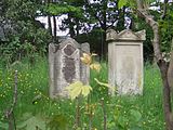 more pictures more pictures
|
| Monument zone town center | Bahnhofstrasse, Bennstrasse, Bleichstrasse, Grottenmauergasse, Heumarktstrasse, Johannes-Mungenast-Strasse, Ketschauerhofstrasse, Kirchgasse, Kirschgartenstrasse, Königsgarten, Marktplatz, Pfarrgasse, Prinz-Ruprecht-Strasse, Schloßstrasse, Spitalgasse, Stadtmauergasse, Wassergasse, Weedgasse, Weinstrasse location |
from the 12th century | Area of the medieval town including the city wall moat, with church, town hall, market square, farm estate, farmsteads, small farms; the fine structure has been preserved since at least the 18th century, building stock from the 12th and 13th to the 20th century, mostly from the 18th century; one of the most significant cultural monuments in the district thanks to its diversity and quality |

|
| Heidenlöcher monument zone | northwest of the place on the Kirchberg district Auf der Altmühle location |
9th or 10th century | Remains of a late Carolingian refugee castle, 9th or 10th century; Bordered by a circular wall on an oval ground plan, of which remains have been preserved, two gates, foundation walls of around 65 buildings |
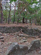 more pictures more pictures
|
Individual monuments
| designation | location | Construction year | description | image |
|---|---|---|---|---|
| City fortifications | Burggasse 7/9, Heumarktstraße 20, Spitalgasse 9, Spitalgasse 21, 23, Spitalgasse 37, Stadtmauergasse 8–56 (even numbers) and 62, Stadtmauergasse 34, 46, Weinstraße 63, 66 | from 1350 | City wall with moat, built from 1350, parts of the wall and six towers have been preserved:
|
 more pictures more pictures
|
| synagogue | Bahnhofstrasse 19 location |
1852 | former synagogue; Yellow sandstone block construction with hipped roof, neo-Romanesque motifs, 1852 |
 more pictures more pictures
|
| sculpture | Bahnhofstrasse, at No. 23 location |
around 1900 | Figure niche with group of sandstone sculptures, around 1900 |

|
| Old customs house | Bennstrasse, corner of Kaisergarten Lage |
late 18th century | Garden shed, late baroque building with hipped roof, late 18th century |
 more pictures more pictures
|
| Powder tower | Burggasse, behind No. 7/9 Lage |
second half of the 14th century | two-storey round tower of the city fortifications, second half of the 14th century |
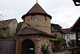 more pictures more pictures
|
| Door run | Grottenmauergasse, at No. 13 location |
1717 | former gate drive, marked 1717 | |
| Door run | Grottenmauergasse, at No. 20 location |
1763 | Gate run, marked 1763 |

|
| Fountain | Grottenmauergasse, at No. 24 location |
1714 | Shoring of a former draw well, marked 1714 | |
| Door run | Heumarktstraße, at No. 1 location |
1516 | Gate drive, late Gothic, marked 1516 |
 more pictures more pictures
|
| Courtyard | Heumarktstrasse 3 location |
16th to 18th century | extensive winery, 16th to 18th century; late baroque high cellar, probably from the late 18th century over remains of the 16th century, renaissance gate drive, marked 1596, former open hall to the courtyard, early 19th century, outbuildings in the core from the 18th century |
 more pictures more pictures
|
| Residential building | Heumarktstrasse 9 location |
late 18th or early 19th century | Hochkellerhaus, late 18th or early 19th century, older in core (partly medieval?), Goalpost formerly marked 1786 |

|
| Residential building | Heumarktstrasse 10 location |
1761 | Residential building with side wing, late baroque plastered buildings, gate drive marked 1761 |
 more pictures more pictures
|
| Residential building | Heumarktstrasse 11 location |
1700 | Double house, partly half-timbered, marked 1700, over older remains, gate drive marked 1594 |
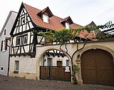 more pictures more pictures
|
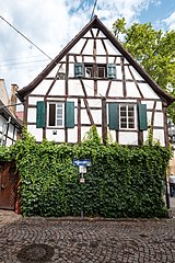
| Residential building | Heumarktstrasse 12 location |
around 1800 | single-storey half-timbered house, around 1800, above a high cellar, probably from the 16th century; defining streets and squares |
 more pictures more pictures
|
| Door run | Heumarktstraße, at No. 14 Lage |
1710 | Gate run, marked 1710; Door frames, marked 1744 |

|
| Gate system | Heumarktstraße, at No. 15 Lage |
1758 | Gate system, man gate and gate drive, marked 1758 |
 more pictures more pictures
|
| Door run | Heumarktstraße, at No. 17 Lage |
1748 | Gate run, marked 1748 |

|
| Residential building | Heumarktstraße 18 location |
1806 | Neighboring baroque hipped roof building, marked 1806, above the high cellar, marked 1597, gate system, marked 1842; Wappenstein, marked 1725; defining the streetscape |
 more pictures more pictures
|
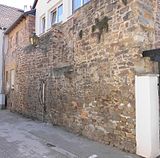
| city wall | Heumarktstrasse, in No. 20 position |
second half of the 14th century | in the wall of the rear annex on Stadtmauergasse part of the city fortifications, second half of the 14th century |
 more pictures more pictures
|
| Residential building | Heumarktstrasse 21 location |
18th century | Late baroque double house above the high cellar, 18th century, gate around 1600 |

|
| Gate | Heumarktstraße, at No. 23 Lage |
1709 | Man gate, late baroque, marked 1709 |
 more pictures more pictures
|
| Ketschauer Hof | Ketschauerhofstrasse 1 location |
1770-72 | former Ketschauer Hof; representative winery; 1770–72, architect Franz Wilhelm Rabaliatti , after a fire of 1815 restoration 1816–20, remodeling with expansion and heightening marked 1849, architect allegedly Hermann Nebel , Koblenz; large-volume hipped roof building with baroque and late classicist motifs, 18th century cellar; Coat of arms reliefs, one marked 1569; Grave slab from 1430; single-storey economy, marked 1822, further economy, marked 1817 and 1853 |
 more pictures more pictures
|
| Catholic parish church of St. Ulrich | Kirchgasse 1 location |
1444 | late Gothic three-aisled basilica, quarry stone; Choir marked 1473 (completion?), Nave marked 1444 and 1461, tower marked 1464, baroque pointed helmet 1728, stair turret 16th century, Gothic sacristy, former Ölberg chapel, around 1480; grave slabs from the 16th to 18th centuries on the exterior; defining the townscape |
 more pictures more pictures
|
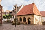
| Ossuary | Kirchgasse, at No. 1 location |
Late 15th century | former ossuary; Quarry stone building with hipped roof, end of the 15th century |
 more pictures more pictures
|
| Cemetery cross | Kirchgasse, at No. 1 location |
after 1554 | former cemetery cross, sandstone, after 1554 |
 more pictures more pictures
|
| Courtyard | Kirchgasse 9 location |
18th century | Dreiseithof, 18th century; late baroque half-hipped roof, partly timber-frame, gate system marked 1752 |
 more pictures more pictures
|
| Courtyard | Kirchgasse 10 location |
1783 | today Weingut Privy Councilor Dr. from Bassermann-Jordan ; late Baroque high cellar house, marked 1783, outbuildings from the late 18th and early 19th centuries, Rococo coat of arms stone, marked 1768, two former lintels marked 1616 and 1767; Below the residential building at Pfarrgasse 6, a cellar that is now connected to the other cellars, marked 1536 |
 more pictures more pictures
|
| Residential building | Königsgarten 9 location |
1820s | Hipped roof construction, 1820s, conversion with additional storeys, expressionist motifs, 1929, architect Wendel Kerbeck ; defining the townscape |
 more pictures more pictures
|
| Andrew Fountain | Marketplace location |
1851 | also market fountain ; Cast iron trough, New Renaissance, 1851, allegedly designed by Hermann Nebel, Koblenz; Gienanth ironworks, Eisenberg |
 more pictures more pictures
|
| Dienheimer Hof | Marktplatz 1 location |
early 19th century | former Dienheimer Hof; angular classicist half-hip roof building with a single-storey extension, early 19th century, probably with older remains, courtyard gate marked 1806, late historical wine press house with half-hip roof, marked 1893; Renaissance gate in the garden wall, around 1600 |
 more pictures more pictures
|
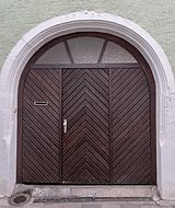
| Door run | Marktplatz, at No. 7 location |
around 1600 | Gate drive, around 1600 (marked 1792 when the house was rebuilt); Well shaft in the cellar, 16th century |
|
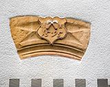
| Spoilage | Marktplatz, at No. 8 location |
1595 | Former keystone with coat of arms, marked 1595 |
 more pictures more pictures
|
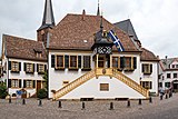
| historical town hall | Marktplatz 9 location |
second quarter of the 16th century | Half-hip roof construction, second quarter of the 16th century, renovation in 1709; Ground floor with a previously open hall, marked 1532, outside staircase and porch, marked 1724, city arms marked 1821; Extension with a crooked hipped roof, building from the 18th century to the south |
 more pictures more pictures
|
| villa | Niederkircher Strasse 8 location |
1897 | representative late-historic villa with hipped roof or mansard hipped roof, marked 1897, single-storey farm building with a former wine press house |

|
| Josef Biffar winery | Niederkircher Strasse 13 and 15 location |
second half of the 19th century | Winzergut, second half of the 19th century; No. 13 late classical red sandstone building, cellar marked 1879, No. 15 representative neo-renaissance villa with mansard roof, 1899, architect Wilhelm Schulte I , Neustadt, in the Borkenhaus garden |
 more pictures more pictures
|
| Residential building | Pfarrgasse 1 location |
1554 | single-storey plastered building with a late Gothic core, marked 1554 and 1839 (molded over and probably with a cellar) |

|
| portal | Pfarrgasse, at No. 2 location |
second half of the 17th century | Rectangular portal, probably from the second half of the 17th century | |
| Gate | Pfarrgasse, to No. 3 location |
in the garden wall: Gothic pointed arch gate, now walled up |

|
|
| Door run | Roßmühle, at No. 5 location |
around 1600 | Gate drive, Renaissance, around 1600 | |
| War memorial | Schlossstrasse location |
around 1930 | War memorial 1914/18 and 1939/45, monumental complex, expanded around 1930 by Ludwig Kern , Speyer, after 1945 |
 more pictures more pictures
|
| Deidesheim Castle | Schlossstrasse 2, 4, 6, 6a location |
13th or 14th century | former prince-bishop's palace; Remains of the medieval castle, 13th or 14th century; Remains of the palace, 1739–46, architect Johann Georg Stahl , Bruchsal; two courtyards with two aligned residential buildings with half-hip roofs, beginning of the 19th century (marked 1810 and 1817), farm wing of no. 4 marked 1808, no. 6 1820; No. 2 Dreiseithof, stately classicist house with a crooked hip roof, around 1830 |
 more pictures more pictures
|
| Lintel | Spitalgasse, at No. 1 location |
1763 | Lintel, marked 1763 |
|
| Residential building | Spitalgasse 7 location |
around 1820 | Half-timbered double house, around 1820 |
 more pictures more pictures
|
| Rothenturm | Spitalgasse, at No. 9 Lage |
second half of the 14th century | three-quarter-round, two-storey tower of the city fortifications, second half of the 14th century; Conversion to residential buildings in the 18th century |
 more pictures more pictures
|
| city wall | Spitalgasse, between No. 21 and 23 location |
second half of the 14th century | 10 m long section of the city wall with console stones, second half of the 14th century |
 more pictures more pictures
|
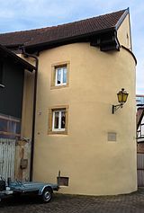
| Multentower | Spitalgasse, at No. 37 Lage |
second half of the 14th century | almost free-standing, plastered tower of the city fortifications, second half of the 14th century; expanded for residential use in the 18th or 19th century |
 more pictures more pictures
|
| city wall | Stadtmauergasse, in No. 8–56 (even numbers) and 62 position |
second half of the 14th century | Structural remains of the city fortifications in the foundations and rear walls, second half of the 14th century | |
| Door run | Stadtmauergasse, at No. 15 location |
1595 | Gate drive, late Gothic, marked 1595 |
 more pictures more pictures
|
| relief | Stadtmauergasse, at No. 16 location |
at 200 | Roman relief stone, Minerva, around 200 AD | |
| Residential building | Stadtmauergasse 16a location |
around 1830/40 | sandstone-integrated plastered building, in the core around 1830/40, extension and neo-Renaissance remodeling 1882–84; vaulted cellar under the garden, 1882; defining the streetscape |
 more pictures more pictures
|
| Door run | Stadtmauergasse, at No. 17 location |
around 1600 | late Gothic gate tour, around 1600; former door frames, around 1600 | |
| Residential building | Stadtmauergasse 26 location |
1775 | small late baroque row house, marked 1775 |
 more pictures more pictures
|
| City wall tower | Stadtmauergasse, in No. 34 position |
second half of the 14th century | in the rear part of the house remains of a city wall tower; Quarry stone round tower with slot openings, second half of the 14th century; Changes through residential use | |
| Residential building | Stadtmauergasse 46 location |
after 1689 | small, simple house, built on the city fortifications after the fire of 1689; rear included parts of the city wall and a semicircular city wall tower | |
| basement, cellar | Turmstrasse, to No. 1 location |
17th and 18th centuries | barrel vaulted cellars, 17th and 18th centuries; former keystone, marked 1629 | |
| Door run | Weedgasse, at No. 9/11 location |
1591 | Gate run, marked 1591 | |
| Protestant parish church | Weedgasse 10/12 location |
1874 | simple hall construction, 1874 (conversion of a barn, 1864, architect Heinrich Erfle , Bad Dürkheim), extension 1956, architect Fritz Höckelsberger , Deidesheim; neo-Romanesque tower, 1890/91, architect Conrad Rettinger , Neustadt an der Weinstrasse |
 more pictures more pictures
|
| Residential building | Weingasse 5 location |
1803 | Neighboring plastered building, 1803, on remains around 1600 |

|
| Door run | Weingasse, at No. 11 location |
1707 | Gate run, marked 1707 |
 more pictures more pictures
|
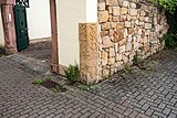
| Gate fragment | Weingasse, at No. 14 location |
around 1600 | Gateway fragment, Renaissance sandstone pillar, around 1600 |
 more pictures more pictures
|
| Gate system | Weingasse, between No. 16 and 22 location |
1493 | Remains of the late medieval gate system, two sandstone pillars, one marked 1493 | |
| Door run | Weingasse, at No. 24 location |
1631 | Renaissance post and basket arch, marked 1631 and 1775 |

|
| Residential building | Weingasse 26 location |
18th century | Late Baroque L-shaped house, 18th century, probably over older remains, Renaissance gate drive, marked 1600, wooden gallery on the courtyard side |
 more pictures more pictures
|
| Residential building | Weingasse 28 location |
1721 | late baroque house with gate drive, marked 1721, probably over remnants of the 17th and 18th centuries |
 more pictures more pictures
|
| villa | Weinstrasse 3 location |
1886-89 | representative villa, 1886–89, architects Schaepers and Voss, Mannheim; Late historical sandstone-integrated brick building with a half-hipped roof, economy with half-timbered knee stick and half-hipped roof, marked 1886 |
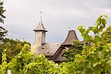 more pictures more pictures
|
| Residential building | Weinstrasse 4 location |
around 1850 | Home of the Eckel winery; Large-volume, single-storey plastered building over high cellar, cross roof, around 1850 |

|
| villa | Weinstrasse 5 location |
1890 | sophisticated late historical villa, 1890, architect Fr. Huber, Neustadt; cubic hipped roof, garden pavilion with tent roof, 1789 |
 more pictures more pictures
|
| Winning Winery | Weinstrasse 10 location |
1847-49 | Winzergut, 1847–49, architect Hermann Nebel, Koblenz; two-and-a-half-story cubic sandstone building, hipped roof with viewing platform, garden with grotto and neo-baroque putti group; Packing hall, 1905 |
 more pictures more pictures
|
| Residential building | Weinstrasse 14 location |
1824 | Neighboring plastered building with half-hip roof, side wing with gate drive, marked 1824 | |
| Reichsrat von Buhl winery | Weinstrasse 16 and 18 location |
around 1770 | stately late baroque winegrower's farm; No. 16 wing with hipped roof, around 1770; No. 18 angular building with hipped roof, marked 1789; Gate system late 18th century; Outbuildings in the 18th and 19th centuries; defining the streetscape |
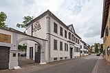 more pictures more pictures
|
| Courtyard | Weinstrasse 19 location |
1783 | late baroque winery; Angular construction, partly half-timbered, with gate drive, marked 1783 |

|
| Residential building | Weinstrasse 20 location |
late 18th century | late baroque winegrower's house with gate drive, late 18th century |

|
| Georg Siben Erben winery | Weinstrasse 21 location |
around 1830/40 | Dreiseithof, around 1830/40; historicizing sandstone block construction, cowshed with a dome vault |
 more pictures more pictures
|
| Courtyard | Weinstrasse 23 location |
18th or 19th century | former winery, 18th or 19th century; late baroque hipped roof building on an L-shaped floor plan, doorway marked 1777, extension around 1890, staircase tower with hipped roof; late baroque hipped roof barn |
 more pictures more pictures
|
| Spoilage | Weinstrasse, to No. 25 location |
1593 | Stone with a stonemason's mark on an outbuilding, marked 1593 | |
| Courtyard | Weinstrasse 26 location |
1738 | late baroque courtyard; Sandstone-integrated plastered building, marked 1738, open gallery in the courtyard, doorway probably from 1595, barn over remains from 1595 |

|
| Door run | Weinstrasse, at No. 27 location |
around 1600 | Gate drive, around 1600 |
 more pictures more pictures
|
| Door run | Weinstrasse, at No. 28 location |
1775 | Gate drive, late baroque, marked 1775 |
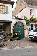
|
| Deidesheimer Hof | Weinstrasse 29 location |
1703 | baroque courtyard, which was remodeled in the early 20th century; stately angular building, marked 1703, niche figure around 1710; defining the plaza |
 more pictures more pictures
|
| Residential and guest house Zur Kanne | Weinstrasse 31 location |
around 1710 | late baroque mansard gable roof, around 1710 on older remains, remodeled in 1731 and shortly after 1876; rear archway and vestments of a former garden gate, around 1600; defining the plaza |
 more pictures more pictures
|
| Residential building | Weinstrasse 32 location |
around 1900 | Wilhelminian style yellow sandstone building with a mansard hipped roof, around 1900 |
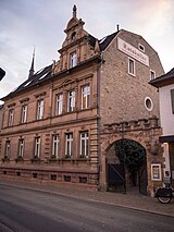 more pictures more pictures
|
| Courtyard | Weinstrasse 34 location |
16th and 17th centuries | former courtyard, in the core from the 16th and 17th centuries, today's appearance from the 18th century with changes; Residential house with late Gothic doorway, marked 1546; former kitchen, 16th century; near the barn, 18th century, cellar exit marked 1630 |
 more pictures more pictures
|
| Adelshof the evil brain of Böhl | Weinstrasse 35 location |
before 1500 | probably part of the former aristocratic court of the evil brain of Böhl; Complex of two residential houses, possibly medieval in the core, changed in the 16th century, around 1700 and later; Hipped roof building, partly half-timbered, marked 1700, basement exit marked 1561 (?), Rear residential house, partly half-timbered, probably around 1700, with late Gothic biforie, 14th century, doorway with coat of arms, marked 1598 |
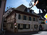 more pictures more pictures
|
| Citizens' hospital with hospital chapel | Weinstrasse 39/41 location |
second half of the 15th century | former citizen hospital, sacristy extension, 1745, architect Johann Georg Stahl, Bruchsal; late Gothic hospital chapel, second half of the 15th century, roof turret 18th or 19th century; two priest gravestones, 18th century; So-called Pfründnerbau with hipped roof, the core of the 16th century, rebuilt after 1945 in a simplified manner; Bridge over the Spitalgasse; so-called kitchen and dwelling, 1743/44, architect Johann Georg Stahl; Quarry stone wall, gate with spoilage from the 16th century |
 more pictures more pictures
|
| Dietz-Matti winery | Weinstrasse 40 location |
1487 | Four-sided courtyard; Large-volume corner house, possibly late Gothic in the core, marked 1487, half-timbered upper floor around 1700 |
 more pictures more pictures
|
| Courtyard | Weinstrasse 49 and 51 location |
late 18th century | former winery, late 18th century; No. 51 late baroque building with hipped roof, classicist gate systems; No. 49 former retirement part, increase in 1840/50, shed around 1880; defining the streetscape |
 more pictures more pictures
|
| Residential building | Weinstrasse 50 location |
late 18th century | Late baroque house with a half-hip roof, late 18th century, gate, cast iron, around 1880 |
 more pictures more pictures
|
| Kimich winery | Weinstrasse 54 location |
1816 | Late Classicist plastered building above the high cellar, gate drive, 1816; Garden pavilion, cast iron, around 1870/80; Closing wall 18th century; defining the streetscape |
 more pictures more pictures
|
| Mehling winery | Weinstrasse 55 location |
18th century | Four-sided courtyard; late baroque row house on an L-shaped floor plan, 18th century, outbuildings in the core from the 18th century; with no. 60 characterizing the street scene |
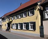
|
| Courtyard | Weinstrasse 57 location |
1715 | late baroque courtyard, marked 1715; Baroque house, some with ornamental framework, early 18th century, quarry stone barn, some with framework |
 more pictures more pictures
|
| Courtyard | Weinstrasse 60 location |
18th century | Winery, 18th century; Late baroque row house with hipped roof, large quarry stone high cellar in the courtyard |
 more pictures more pictures
|
| City wall tower | Weinstrasse, to No. 63 location |
second half of the 14th century | in the barn on Spitalgasse tower of the city fortifications; round two-storey quarry stone tower, second half of the 14th century |
 more pictures more pictures
|
| Residential building | Weinstrasse 80 location |
around 1860 | large-volume, sandstone-integrated plastered building with knee floor, around 1860; defining the streetscape |
 more pictures more pictures
|
| Vineyard cottage | north of the place; Corridor width earth location |
18th century | Vineyard house, trullo, small round building with a cantilever dome, 18th century |
 more pictures more pictures
|
| Hahnenböhler Cross | north of the place; Hallway in the Hahnenböhl location |
1886 | iron double cross on limestone rock, marked 1886 |
 more pictures more pictures
|
| Wayside cross | north of the place; Hallway in the Herrgottsacker location |
around 1925 | Road cross, yellow sandstone, probably around 1925, fencing during construction |
 more pictures more pictures
|
| Loogfels A | north of the village at the entrance to Margarethental Lage |
1770 | Loogfels, marked 1770 |
 more pictures more pictures
|
| Wayside cross | north of the village on the L 516 ; Hallway in the mouse cave location |
late 19th century | Road cross, red sandstone, late 19th century |
 more pictures more pictures
|
| White cross | northeast of the village; Corridor monastery garden location |
Mid 18th century | Road cross, sandstone, mid-18th century, metal body 1892 |
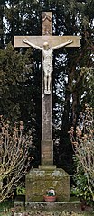 more pictures more pictures
|
| Wayside cross | northeast of the village on the L 527 ; Corridor plant garden location |
late 13th century | Niche cross, red sandstone, cross from a Gothic tombstone, late 13th century |
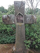 more pictures more pictures
|
| Wayside cross | northeast of the village on the L 528 ; Hallway at the Gutenberg location |
1900 | Road cross, sandstone, 1900, metal body 1932 |
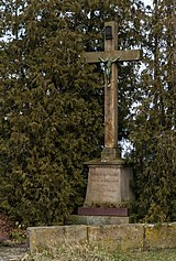 more pictures more pictures
|
| Wayside shrine | northwest of the village; Hallway Grainhübel location |
1431 | Wayside shrine, crucifixion group with St. Katharina and Barbara, sandstone, 1431; two small atonement crosses on the side, 15th or 16th century |
 more pictures more pictures
|
| Wayside shrine | northwest of the village; Hallway sweeping location |
1816 | Tuscan column with post-baroque top, yellow sandstone, marked 1816 |
 more pictures more pictures
|
| Menhir | northwest of the village; Waldberg district location |
Loogfels No. 255 |
 more pictures more pictures
|
|
| Weinbiet stone | southeast of the village; District Book Taler way location |
Loogfels |
 more pictures more pictures
|
|
| Water tank | southwest of the village; Hallway In Kraft Location |
1898 | Baroque yellow sandstone block, 1898 (or 1907?), two bronze panels, 1920, architect Ch. Lenz, Nuremberg |

|
| Wayside cross | southwest of the village; Hallway in the mill location |
1905 | Way cross, sandstone, body made of sheet metal, 1905 |

|
| Kaffenstein | southwest of the village and south of the Stabenberg; Haberäcker Lage District |
1654 | Loogfels, designated 1694, 1705, 1714, 1769, 1176, 1779, 1818, 1826; Nearby rock slab with monograms, inscribed 1654, 1680, 1826 |

|
| Loogfels | west of the village; District Wall Trail location |
1545 | Loogfels zu Gimmeldingen , marked 1545; adjacent another boundary stone |
 more pictures more pictures
|
| Michael's Chapel | to the west above Deidesheim on a slope nose halfway up the Kirch- or Martenberg; District Auf der Altmühle location |
around 1470 | pilgrimage chapel rebuilt after it fell into disrepair in 1952; small hall building, expanded around 1470, 1662/63, roof turret 1952; small remains of the seven stations of the cross, before 1718 |
 more pictures more pictures
|
| Token | west of the village on the Stabenberg ; Mittelberg district location |
1930s | Loogfels, 1930s (?) |
 more pictures more pictures
|
| Schwehrstein | west of the village on the southern slope of the Stabenberg Lage |
Loogfels |
 more pictures more pictures
|
|
| Woman's shoe | west of the village on the Vorderen Stoppelberg; District of Vorderer Stoppelberg location |
also Christophel shoe ; Loogfels No. 147 |
 more pictures more pictures
|
|
| Loogfels No. 102 | west of the village on the Kreuzberg; District Speckschlag location |
1528 | Loogfels, inscribed 1528, 1676, 1764 |
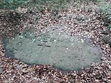 more pictures more pictures
|
| Gymnastics Memorial | west of the village on the forest mountain ; Waldberg district location |
1928 | tower-like quarry stone building with arcades, 1928; halfway up the memorial stone for the victims of the Second World War, 1957 |
 more pictures more pictures
|
| Nonnenbrunz | west of the village at Teufelsberg; District Speckschlag location |
1818 | Loogfels No. 101, marked 1818 |
 more pictures more pictures
|
| Pan stone | west of the village in the Forster valley; District pan location |
1488 | also Forster Pfann ; Loogfels No. 202, inscribed 1488, 1784, 1789, 1818 |
 more pictures more pictures
|
| Loogfels No. 203 | west of the village and east of the pan stone; District pan location |
1534 | Loogfels No. 203, marked 1534 |
 more pictures more pictures
|
literature
- Georg Peter Karn, Rolf Mertzenich: Bad Dürkheim district. City of Bad Dürkheim, municipality of Haßloch, municipalities of Deidesheim, Lambrecht, Wachenheim (= cultural monuments in Rhineland-Palatinate. Monument topography of the Federal Republic of Germany . Volume 13.1 ). Wernersche Verlagsgesellschaft, Worms 1995, ISBN 3-88462-119-X .
- General Directorate for Cultural Heritage Rhineland-Palatinate (Ed.): Informational directory of cultural monuments in the Bad Dürkheim district (PDF; 5.1 MB). Mainz 2017.