List of cultural monuments in Magdeburg's old town
In the list of cultural monuments in old town , all cultural monuments of Magdeburg's old town are listed. The basis is the monument register of the state of Saxony-Anhalt, which was created on the basis of the Monument Protection Act of October 21, 1991 and has been continuously updated since then (status: December 31, 2019).
Monuments
| location | designation | description |
Registration |
Identification type | image |
|---|---|---|---|---|---|
| different places |
City fortifications | Remnants of the Magdeburg city fortifications | 094 71129 | monument | |
| Elbe bank area |
city wall | city wall | 094 06384 | monument |

|
| Albrechtstrasse 7 (map) |
school | 094 71024 | monument |

|
|
| Alter Markt 1, 1a, 2–10 (map) |
old market | space | 094 82654 | Monument area |

|
| Alter Markt 1, 1a, Breiter Weg 20, 21, 22 and other houses (map) |
Residential and commercial buildings, built between 1953 and 1957 | 094 17409 | monument |

|
|
| Alter Markt 1, 1a (map) |
House sign | There are two house signs, a city coat of arms and a house sign “Zum Weißen Lamm”. | 094 76741 | monument |

|
| Alter Markt 2, 3, 4, 5, Hartstrasse 2, 3 (map) |
Group of houses | The group of houses is on the south side of the square. It is an elongated block in the neo-historical style with four floors. The roof is eaves and carries small roof houses. Behind the risalits are the stairwells, above the risalits are triangular gables. There are old house signs above the entrances, which were reused in the construction in 1955. The architects were Johannes Kramer and Max Wiegleb. | 094 76740 | monument |

|
| Alter Markt 6 (map) |
Magdeburg Town Hall | The old town hall was rebuilt from 1957 to 1969 after being destroyed in the Second World War. | 094 06326 | monument |

|
| Alter Markt 7 (map) |
Sculpture, equestrian statue of St. George slaying the dragon | The rice statue of St. George slaying the dragon was originally located as a portal cult at the guild house built between 1666 and 1680, which later became the stock exchange. This building was destroyed in 1945, the sculpture was preserved. It is one of the few cultural monuments of the 17th century in Magdeburg. | 094 71030 | monument |

|
| Alter Markt 9, 10 (map) |
House sign | There are two house signs, "To the blue lily" and "To the wild man". | 094 71409 | monument |

|
| Old market 12, 13, in the passage to Schwertfegergasse |
House sign on the building Alter Markt 12, 13 | 14 historical house symbols and a historical city coat of arms | 094 06418 | monument |

|
| Alter Markt 13, 14, on the north side of the market through the new market hall on the corner of the former Buttergasse, access via Alter Markt 13 |
Butter Alley | Cellar vault from the 12th / 13th centuries century | 094 06314 | monument |

|
| Old Market (map) |
Eulenspiegelbrunnen | The Eulenspiegel Fountain was built in 1970. | 094 70996 | monument |

|
| Old Market (map) |
Magdeburg rider | The Magdeburg rider was created around 1240. | 094 06409 | monument |

|
| Old fisherman's bank (map) |
Magdalenenkapelle | chapel | 094 06293 | monument |

|
| Am Buckauer Tor 2, Carl-Miller-Straße 6, Hallische Straße 3, Sternstraße 12, 13-17 (map) |
barracks | The former train barracks was built from 1884 to 1887. | 094 70955 | monument |

|
| At Buckauer Tor (map) |
Street train | 094 76843 | monument |

|
|
| Am Dom 2 (map) |
portal | It is a large baroque portal made of sandstone. | 094 70989 | monument |

|
| At the cathedral (map) |
Street train | 094 76823 | monument |

|
|
| Am Krökentor 1b, 2, 3 (map) |
Otto von Guericke vocational schools | School, built 1902–1907 in neo-baroque style | 094 17421 | monument |

|
| Am Krökentor 8 (map) |
Enclosure wall of the shot parade ground | Brick wall, enclosure, rest of the enclosure of the shot parade area | 094 17421 | monument |

|
| Bahnhofstrasse, Hallische Strasse (map) |
Hallische Strasse underpass | Underpass from 1870 to 1872 | 094 71166 | monument |

|
| Bahnhofstrasse 9 (map) |
Magdeburg main station | railway station | 094 06349 | monument |

|
| Bahnhofstrasse 17 (map) |
Faber skyscraper | office building | 094 06375 | monument |

|
| Bahnhofstrasse 35 (map) |
Residential building | 094 16636 | monument |

|
|
| Bahnhofstrasse 35–37, 45, 46; Behringstrasse 1–4 and other houses (map) |
district | south of the historic old town, the border of which is marked by Danzstrasse | 094 70817 | Monument area |

|
| Bahnhofstrasse 36 (map) |
Residential building | 094 16781 | monument |

|
|
| Bahnhofstrasse 37 (map) |
Residential building | 094 16782 | monument |

|
|
| Bahnhofstrasse 45 (map) |
Residential building | 094 16637 | monument |

|
|
| Bahnhofstrasse 46 (map) |
Residential and commercial building | 094 16783 | monument |

|
|
| Behringstrasse 1, 2, 3, 4 (map) |
Group of houses | 094 71016 | monument |

|
|
| Behringstrasse 1 (map) |
Residential building | 094 16638 | monument |

|
|
| Behringstrasse 2 (map) |
Residential building | 094 16639 | monument |

|
|
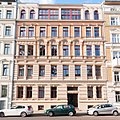
| Behringstrasse 3 (map) |
Residential building | 094 16784 | monument |
|
|
| Behringstrasse 4 (map) |
Residential building | 094 16640 | monument |

|
|
| At Hauptwache 4 (card) |
Bank building | Office of the Savings Banks and Giro Association for Saxony, Thuringia and Anhalt | 094 17411 | monument |

|
| At the main guard (card) |
monument | The monument was created in 1907 for Otto von Guericke by Carl Echtermeier . | 094 06145 | monument |

|
| At the main guard (card) |
space | 094 71162 | monument |

|
|
| Bölschestraße 1a – b, 2, 3 (map) |
Street train | 094 18280 | Monument area |

|
|
| Bölschestraße 1a, 1b (map) |
Residential building | 094 16641 | monument |

|
|
| Bölschestrasse 2 (map) |
Residential building | 094 16642 | monument |

|
|
| Bölschestrasse 3 (map) |
Residential building | The former Helenenbad was built between 1886 and 1888. In the courtyard there was a public bath for households that did not have a bathroom. Nothing essential has been preserved from this public bath. It is a five-story house with a mansard roof. The facade is decorated with plaster ornamentation. In the middle of the facade there is a risalit-like bay window from the second to the fourth floor; this bay window carries a gable over the middle axis of three axes. | 094 16785 | monument |

|
| Brandenburger Strasse 6 (map) |
Residential and commercial building | 094 16786 | monument |

|
|
| Brandenburger Strasse 8 (map) |
school | 094 16787 | monument |

|
|
| Brandenburger Strasse 9, 10 (map) |
University building | 094 16788 | monument |

|
|
| Broad way 16 (map) |
Gate system over the confluence with Bärstraße with relief start of construction | 094 06170 | monument |

|
|
| Wide path 27, 28, 29, 30 (map) |
House sign of the brewery Zum Roten or Braunen Adler | Former house sign of the brewery Zum red or brown eagle showing a Brandenburg double eagle | 094 71046 | monument |

|
| Broad way (map) |
Catherine portal | Portal of the Church of Saint Catherine from 1668 | 094 06324 | monument |

|
| Wide path 109 (map) |
Magdeburg City Library | formerly Brenninkmeyer textile department store | 094 71041 | monument |

|
| Broad way 128 (map) |
Department store | formerly Centrum department store | 107 15036 | monument |

|
| Breiter Weg 174, Goldschmiedebrücke 7, 9, 11, 13, 15, 17, 19, Krügerbrücke 1, Ulrichplatz 3–6 (map) |
Residential and commercial building | 094 71127 | monument |

|
|
| Broad way 178 (map) |
Residential building | built 1728–1730 | 094 06331 | monument |

|
| Breiter Weg 179 (map) |
Residential building | built 1728–1730 | 094 71039 | monument |

|
| Breiter Weg 180, Himmelreichstraße 2 (map) |
Residential and commercial building | 094 71040 | monument |

|
|
| Wide path 193, 202, Leiterstraße |
basement, cellar | 094 06315 | monument | ||
| Breiter Weg 193 (map) |
Portal of the house to the golden cross | Late Baroque portal, originally at the other location as the entrance to the Zum Güldene Kreuz building, moved to today's location after the Second World War | 094 06338 | monument |

|
| Wide path 203–206 |
Inscription board | in memory of striking workers shot in 1919 | 094 06152 | monument |

|
| Wide path 203–206 |
Inscription board | in memory of Friedrich Wilhelm von Steuben | 094 17955 | monument |

|
| Breiter Weg 203, 204, 205, 206, Max-Josef-Metzger Strasse 5, 6 (map) |
Main Post Office | The building was built from 1895 to 1899 as the main post office. Today are in this building the Justice Center to the District Court Magdeburg , Social Court Magdeburg , Labor Court Magdeburg , Administrative Court Magdeburg , Higher Administrative Court of Magdeburg and the Attorney Magdeburg. | 094 06351 | monument |

|
| Broad way 212 (map) |
Bank building Breiter Weg 212 | Three-storey bank building erected in 1902 in neo-renaissance style. Headquarters of the Volksbank Magdeburg . | 094 16643 | monument |

|
| Wide way 212a (map) |
Residential and commercial building Breiter Weg 212a | Four-storey residential and commercial building built in the neo-baroque style in 1905. | 094 16644 | monument |

|
| Breiter Weg 227–229, 229a, 230–232, 232a, 233–256 (map) |
Street train | 094 18277 | monument |

|
|
| Breiter Weg 227 (map) |
Residential and commercial building | 094 16645 | monument |

|
|
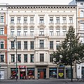
| Broad way 228 (map) |
Residential and commercial building | 094 16646 | monument |
|
|
| Breiter Weg 229, 229a (map) |
Residential and commercial building | 094 16647 | monument |

|
|
| Wide path 230 (map) |
Residential and commercial building | 094 16648 | monument |

|
|
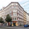
| Breiter Weg 231 (map) |
Residential and commercial building | 094 82667 | monument |
|
|
| Wide path 232 (map) |
Residential and commercial building | 094 82668 | monument |

|
|
| Breiter Weg 232a, Hallische Strasse 4, Hasselbachplatz 1–5, Otto-von-Guericke-Strasse 56 (map) |
space | 094 17882 | Monument area |

|
|
| Wide path 232a (map) |
Residential and commercial building | 094 17898 | monument |

|
|
| Breiter Weg 250 (map) |
Residential building | 094 16649 | monument |

|
|
| Wide path 252 (map) |
Residential building | 094 16650 | monument |

|
|
| Wide path 253 (map) |
Residential and commercial building | monument |

|
||
| Wide path 255 (map) |
Residential and commercial building | 094 16652 | monument |

|
|
| Wide way 256 (map) |
Residential building | 094 16651 | monument |

|
|
| Bürgelstrasse 1, 2 (map) |
Street row Bürgelstrasse 1, 2 | Street row from the 19th century | 094 18281 | monument |

|
| Bürgelstrasse 1 (map) |
Residential building | 094 16653 | monument |

|
|
| Bürgelstrasse 2 (map) |
Residential building | monument |

|
||
| Carl-Miller-Strasse (map) |
Bank reinforcement along the latch | monument | |||
| Danzstrasse 1 (map) |
Commercial building | 094 82786 | monument |

|
|
| Danzstrasse 11, 11a, 12, 13 (map) |
Street train | monument |

|
||
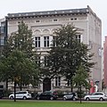
| Danzstrasse 12 (map) |
Residential building | 094 16654 | monument |
|
|
| Danzstrasse (map) |
Fountain | The Immermannbrunnen was built in 1899, but it was originally located in front of the city theater on today's Otto-von-Guericke-Straße. The fountain is reminiscent of Karl Leberecht Immermann , a writer, lyric poet and playwright. In 1996 it was installed here in Danzstrasse, this year it was the 200th anniversary of Immermann's birthday. In front of a semicircular wall there is a pool, in the middle there is a bronze bust of Immerman. On the wall there are bronze scenes from the writer's works. The sculptor was Carl Echtermeier . | 094 75328 | monument |

|
| Domplatz 1, 1a, 2–9 (map) |
space | monument |

|
||
| Domplatz 1 (map) |
City gate | monument |

|
||
| Domplatz 1a (map) |
Bailiwick | monument |

|
||
| Domplatz 1b, between Fürstenwall, Remtergang and Domplatz 1b, 2-4 (map) |
Park | monument |

|
||
| Domplatz 1b (map) |
Sculptures | eight damaged ones that were recovered from the rubble after the Second World War on the west side of the Möllenvogteigarten | 094 82772 | monument |

|
| Domplatz 1b, Fürstenwall 3a, Fürstenwall, Große Klosterstraße, Gustav-Adolf-Straße 2, Max-Otten-Straße, Ratswaageplatz 1, Remtergang, Schleinufer, Tränsberg, Wallonerberg 2, 3, 5 (map) |
Remains of the city fortifications | monument |

|
||
| Domplatz 1b (map) |
garden | 094 76781 | monument |

|
|
| Domplatz 2, 3 (map) |
palace | 094 06327 | monument |

|
|
| Domplatz 2, 3 (map) |
Garden shed | monument |

|
||
| Domplatz 4 (map) |
City Palace | Knaut'sches Palais | 094 06334 | monument |

|
| Domplatz 4 |
Wall with late Gothic tracery | monument |

|
||
| Domplatz 5 (map) |
Deanery | 094 06333 | monument |

|
|
| Cathedral Square (map) |
Star gate | Gate system | 094 71182 | monument |

|
| Domplatz 6 (map) |
State Parliament of Saxony-Anhalt | Administration building, today part of the parliament complex | 107 15043 | monument |

|
| Domplatz 7 (map) |
State Parliament of Saxony-Anhalt | Winneberg'sches Palais, originally a residential building, today the seat of the state parliament | 094 06328 | monument |

|
| Domplatz 8 (map) |
State Parliament of Saxony-Anhalt | Former house, today part of the state parliament | monument |

|
|
| Domplatz 9 (map) |
State Parliament of Saxony-Anhalt | Former house, today part of the state parliament of Saxony-Anhalt | monument |

|
|
| Cathedral Square (map) |
Dom | 094 06290 | monument |

|
|
| Einsteinstrasse 1–4, 4a, 5, 8–12 (map) |
Street train | 094 18279 | Monument area |

|
|
| Einsteinstrasse 1 (map) |
Residential building | 094 16655 | monument |

|
|
| Einsteinstrasse 2 (map) |
Residential and commercial building | 094 16790 | monument |

|
|
| Einsteinstrasse 3 (map) |
Residential building | 094 16656 | monument |

|
|
| Einsteinstrasse 4, 4a (map) |
Residential building | 094 16657 | monument |

|
|
| Einsteinstrasse 5 (map) |
Residential building | 094 16658 | monument |

|
|
| Einsteinstrasse 8 (map) |
Residential and commercial building | 094 16791 | monument |

|
|
| Einsteinstrasse 9 (map) |
Residential building | 094 16659 | monument |

|
|
| Einsteinstrasse 10 (map) |
Residential building | monument |

|
||
| Einsteinstrasse 11 (map) |
Residential building | monument |

|
||
| Einsteinstrasse 12 (map) |
Residential building | 094 16662 | monument |

|
|
| Einsteinstrasse 15 (map) |
Residential building | monument |

|
||
| Erich-Weinert-Strasse 27 (map) |
AMO culture house | 094 06167 | monument |

|
|
| Ernst-Reuter-Allee 42 (map) |
Fire station | 107 15030 | monument |
![Fire station [8]](https://upload.wikimedia.org/wikipedia/commons/thumb/6/63/Ernst-Reuter-Allee_42_%28Magdeburg-Altstadt%29.1.ajb.jpg/120px-Ernst-Reuter-Allee_42_%28Magdeburg-Altstadt%29.1.ajb.jpg)
|
|
| Ernst-Reuter-Allee, Maybachstrasse (map) |
Railway bridge | Railway bridge over Ernst-Reuter-Allee, demolition planned | 094 18268 | monument |

|
| Ernst-Reuter-Allee, Zentraler Platz (map) |
plastic | The rescue act of Captain Igor Belikow , created by Heinrich Apel . | 094 16017 | monument |

|
| Ernst-Reuter-Allee (map) |
park | monument |

|
||
| Erzbergerstrasse 13 (map) |
House on Erzbergerstrasse 13 | The four and a half storey house was built in 1897 neo-baroque style. | 094 17405 | monument |

|
| Erzbergerstrasse (map) |
Halberstadt Bastion | The Halberstadt bastion was built between 1680 and 1713, but only remnants remain. The casemates are still well preserved. | 094 17408 | monument |

|
| Faßlochsberg 11, 11a (map) |
Residential building | The university building is a three and a half story structure. | 094 16746 | monument |

|
| Faßlochsberg 11b (map) |
Residential building | Residential building | 094 71393 | monument |

|
| Feuerbachstrasse 1, 2, Geißlerstrasse 1–4, Harnackstrasse 1–12, Planckstrasse 1–10, Schellingstrasse 2–4, Sternstrasse 19–25, Seumestrasse 1–4, Steubenallee 1–3, Steubenpark (map) |
Sterngelände | district | 094 71098 | Monument area |

|
| Feuerbachstrasse (map) |
Feuerbachstrasse | Street train | 094 18286 | Monument area |

|
| Fürstenwall 3 (map) |
Residential building | 094 82773 | monument |

|
|
| Fürstenwall 3a (map) |
Tower behind the exit of the Möllenvogtei | Defense tower | 094 71096 | monument |

|
| Fürstenwall 3b (map) |
Fürstenwall house 3b | three-storey house in the style of the Italian early Renaissance from around 1850 | 094 70015 | monument |

|
| Fürstenwall (map) |
Bastion Cleve | Bastion of Magdeburg Fortress | 107 15009 | monument |

|
| Fürstenwall (map) |
Fürstenwall | Part of the historic city fortifications | 094 70723 | monument |

|
| Fürstenwall (map) |
Kiek in de Köken | Defense tower | 094 70998 | monument |

|
| Fürstenwall, south of the "Kiek in de Köken" tower at the end of the plastic garden (map) |
Editha monument | Monument to Queen Editha created by Hans Grimm in 1937 | 107 15032 | monument |

|
| Fürstenwallstrasse 10 (map) |
House sign Fürstenwallstraße 10 | The sign is made of sandstone and carries a banner with an inscription. | 094 71161 | monument |

|
| Fürstenwallstrasse 10 (map) |
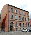
Fürstenwallstrasse 10 | The administrative building of the Royal Weights Office was built in 1891. It is a three-story house with a flat gable roof. | 094 76830 | monument |
|
| Fürstenwallstrasse 19 (map) |
Residential building | 094 82774 | monument |

|
|
| Fürstenwallstrasse 20 (map) |
Administration building | Upper Presidential Building of the Province of Saxony, built 1842–1844 | 094 82775 | monument |

|
| Geisslerstrasse 1-3 (map) |
Street line | 094 18282 | Monument area |

|
|
| Geisslerstrasse 1 (map) |
Residential building | 094 82682 | monument |

|
|
| Geisslerstrasse 2 (map) |
Residential building | 094 82683 | monument |

|
|
| Geisslerstrasse 3 (map) |
Residential building | 094 82684 | monument |

|
|
| Geisslerstrasse 4 (map) |
school | The Hegelgymnasium uses the buildings of the former Bismarck School (Geißlerstraße / Schleinufer) and the former Viktoriaschule (Harnackstraße). The Viktoriaschule was built in 1913-1919 based on a competition design by the Stuttgart architect Emil Bercher. | 094 82697 | monument |

|
| Geisslerstrasse, Sternstrasse 26 (map) |
Gas station | The petrol station was built in 1930 as a "standard station for supplying vehicles". The client was the German-American Petroleum Society, which later became ESSO in Hamburg. The gas station also had other functional rooms such as a newspaper kiosk and a toilet. It is a single-storey low-rise building, this is faced with red bricks. | monument |

|
|
| Goldschmiedebrücke 13, corner of Regierungsstrasse (map) |
Plaque | The memorial plaque for Georg Philipp Telemann was installed in 1967. The occasion was the 200th anniversary of the death of the composer, who was born in Magdeburg. The sculptor was Ernst Rossdeutscher . The plaque is a medallion with the portrait of the composer. Beneath the relief are Teleman's life data, above the inscription: "Who can use many things does better / than who only writes for a few". The memorial plaque originally attached to a house is now free on a stele in the street. | 094 71173 | Small monument |

|
| Great Klosterstrasse (map) |
monument | The memorial was created for Georg Philipp Telemann in 1981 by Eberhard Roßdeutscher . The occasion was the composer's 300th birthday. The monument consists of a relief wall. In front of it are five stylized organ pipes with the composer and the four temperaments in allegorical form. | 094 06175 | monument |

|
| Large monastery road |
Pilgrimage chapel to the Mount of Olives | Fragment of the former chapel | 094 71002 | monument |

|
| Large monastery road |
Remains of a Romanesque wall | temporarily part of the pedagogy of the monastery of our dear women | 094 06322 | monument |

|
| Gustav-Adolf-Strasse 2 (map) |
City fortifications Gustav-Adolf-Straße | City fortifications from the 13th century south of the Mark barracks | 094 76837 | monument |

|
| Gustav-Adolf-Strasse 37 (map) |
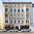
Residential and commercial building Gustav-Adolf-Straße 37 | neo-baroque residential and commercial building from 1897 | 094 17422 | monument |
|
| Haeckelstrasse 2 (map) |
Residential building | 094 76765 | monument |

|
|
| Haeckelstrasse 6 (map) |
Residential building | 094 16664 | monument |

|
|
| Haeckelstrasse 7 (map) |
Residential building | 094 71203 | monument |

|
|
| Haeckelstrasse 9 (map) |
Residential building | 094 76766 | monument |

|
|
| Haeckelstrasse 9a (map) |
Residential building | 094 76767 | monument |

|
|
| Hallische Strasse 4 (map) |
space | space | 094 77056 | Monument area |

|
| Hallische Strasse 7 (map) |
Residential building | 094 71013 | monument |

|
|
| Hallische Strasse 9 (map) |
Residential and commercial building | 094 71169 | monument |

|
|
| Hallische Strasse 11 (map) |
Residential building | 094 71170 | monument |

|
|
| Hallische Strasse |
Fortress area | monument | |||
| Hallische Strasse |
park | monument | |||
| Hammersteinweg (map) |
Lift bridge | Lift bridge over the Elbe | 094 70958 | monument |

|
| Hammersteinweg |
cavalier | Cavalier I "Scharnhorst" of the Magdeburg fortress south of the old town on the Elbe | 094 06401 | monument |

|
| Hammersteinweg, formerly Schleinufer 24 (map) |
Water tower | 094 17087 | monument |

|
|
| Harnackstrasse 1-12 (map) |
Street train | monument |

|
||
| Harnackstrasse 1 (map) |
Residential building | monument |

|
||
| Harnackstrasse 2 (map) |
Residential building | monument |

|
||
| Harnackstrasse 3 (map) |
Residential building | monument |

|
||
| Harnackstrasse 4 (map) |
Residential building | monument |

|
||
| Harnackstrasse 5 (map) |
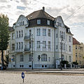
Residential building | monument |
|
||
| Harnackstrasse 6, 7 (map) |
Residential building | monument |

|
||
| Harnackstrasse 8, 9 (map) |
Residential building | monument |

|
||
| Harnackstrasse 11 (map) |
Residential building | monument |

|
||
| Harnackstrasse 12 (map) |
Residential building | monument |

|
||
| Hartstraße 1 |
Magdeburg city arms | monument |

|
||
| Hartstraße 2 |
House sign | monument |

|
||
| Hartstraße 3 |
House sign | monument |

|
||
| Hasselbachplatz 1, 2, 3, 4, 5 (map) |
space | space | 094 76880 | Monument area |

|
| Hasselbachplatz 1 (map) |
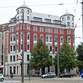
Residential and commercial building | Residential and commercial building | 094 82699 | monument |
|
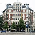
| Hasselbachplatz 2 (map) |
Residential and commercial building | monument |
|
||
| Hegelstrasse 1-10, 15-42 (map) |
Street train | monument |

|
||
| Hegelstrasse 1 (map) |
Residential building | monument |

|
||
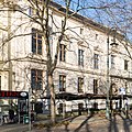
| Hegelstrasse 2 (map) |
Residential building | monument |
|
||
| Hegelstrasse 3 (map) |
Residential building | 1881-1882 by the Magdeburg factory owner (Müller & Kalkow) Gustav Adolf Müller and his wife Caroline Müller retired | monument |

|
|
| Hegelstrasse 5 (map) |
Domgymnasium Magdeburg | school | 094 82704 | monument |

|
| Hegelstrasse 6, 7 (map) |
Residential building Hegelstraße 6, 7 | five and a half storey house from 1882 | 094 16674 | monument |

|
| Hegelstrasse 8 (map) |
Residential building Hegelstrasse 8 | four and a half storey house from 1881 | 094 16675 | monument |

|
| Hegelstrasse 9 (map) |
Residential building | 094 16676 | monument |

|
|
| Hegelstrasse 15 (map) |
Residential building | monument |

|
||
| Hegelstraße 16 |
Residential building | monument |

|
||
| Hegelstrasse 19 (map) |
Residential building | monument |

|
||
| Hegelstrasse 20 (map) |
Residential building | monument |

|
||
| Hegelstrasse 21 (map) |
Residential building | monument |

|
||
| Hegelstrasse 22 (map) |
school | monument |

|
||
| Hegelstrasse 25 (map) |
former state archive | monument |

|
||
| Hegelstrasse 26 (map) |
Residential building | monument |

|
||
| Hegelstrasse 27 (map) |
Residential building | monument |

|
||
| Hegelstrasse 28 (map) |
Residential building | monument |

|
||
| Hegelstrasse 29 (map) |
Residential building | monument |

|
||
| Hegelstrasse 30 (map) |
Residential building | monument |

|
||
| Hegelstrasse 31 (map) |
Residential building | monument |

|
||
| Hegelstrasse 32 (map) |
Residential building | monument |

|
||
| Hegelstrasse 33 (map) |
Residential building | monument |

|
||
| Hegelstrasse 34 (map) |
Residential building | monument |

|
||
| Hegelstrasse 35 (map) |
Residential building | monument |

|
||
| Hegelstrasse 36 (map) |
Residential building | monument |

|
||
| Hegelstrasse 37 (map) |
Residential building | monument |

|
||
| Hegelstrasse 40 (map) |
House at Hegelstrasse 40 | three and a half storey house from 1889 | 094 16683 | monument |

|
| Hegelstrasse 41 (map) |
Residential building at Hegelstrasse 41 | three-and-a-half-storey house in the neo-renaissance style from 1890 | 094 16684 | monument |

|
| Hegelstrasse 42 (map) |
Palais am Fürstenwall | State Chancellery Saxony-Anhalt | monument |

|
|
| Hegelstrasse (map) |
monument | Monument to Karl Friedrich Friesen | monument |

|
|
| Hegelstrasse (map) |
War memorial | 094 71414 | monument |

|
|
| Hegelstrasse (map) |
park | monument |

|
||
| Heydeckstrasse 9, 10, 11, 12 (map) |
Street train | Street train | 107 15039 | Monument area |

|
| Heydeckstrasse 12 (map) |
Residential building | monument |

|
||
| Hohepfortewall 1 (map) |
barracks | monument |

|
||
| Hohepfortewall 37, formerly Walther-Rathenau-Straße 88 (map) |
Administration building | Administration building | 094 17445 | monument |

|
| Jakobstrasse (map) |
monument | The monument was unveiled on November 10, 1886, created by the Berlin sculptor Emil Hundrieser . The memorial is on the side of the St. John's Church. The larger than life bronze statue of Martin Luther is on a pedestal about three meters high. The figure is wearing a long coat and a Bible is in the right hand. The left hand lies on the heart, the gaze goes into the distance. On the front of the shaft there is the inscription "God's word with us in eternity", a quote from Luther. The date “10. November 1883 ”, the 400th birthday of Luther. | 094 06147 | monument |

|
| Jakobstraße, corner of Peterstraße |
Cellar vault | Romanesque cellar vault from the 12th century | monument | ||
| Johannisbergstrasse 1 (map) |
church | 094 70972 | monument |

|
|
| Johannisbergstrasse 1 (map) |
sculpture | The sculpture “Mourning Magdeburg” is a replica of a figure from the Luther monument in Wormers . The Luther monument in Worms was created from 1856 to 1668 by the sculptor Ernst Rietschel , while the “Magdeburg Trauende” was created by Adolf Donndorf . The sculpture commemorates, among other things, the commitment to Protestantism and the destruction of Magdeburg in the Thirty Years War in 1631. | 094 71180 | monument | |
| Johannisbergstrasse (map) |
Lower castle | The medieval vaulted cellar is located below the choir of the St. Johannis Church. | 094 76852 | monument |

|
| Keplerstrasse 2 (map) |
Residential building | 094 16687 | monument |

|
|
| Keplerstrasse 5, 5a, 6, 6a, 7, 7a, 8, 9, 9a, 10, 13 (map) |
Street train | Keplerstrasse connects Bahnhofstrasse in the west with Schleinufer in the east. | monument |

|
|
| Keplerstrasse 6 (map) |
Residential building | 094 76768 | monument |

|
|
| Keplerstrasse 6a, Otto-von-Guericke-Strasse 47 (map) |
House at Keplerstrasse 6a, Otto-von-Guericke-Strasse 47 | Seven and a half storey house from 1951 | 094 06236 | monument |

|
| Keplerstrasse 7a (map) |
Residential and commercial building | 094 16688 | monument |

|
|
| Keplerstrasse 8 (map) |
Residential building | 094 16689 | monument |

|
|
| Keplerstrasse 9, 9a (map) |
Residential and commercial building | 094 16690 | monument |

|
|
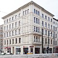
| Keplerstrasse 10 (map) |
Residential building | 094 16691 | monument |
|
|
| Kleine Schulstrasse 24 (map) |
school | 094 17440 | monument |

|
|
| Kölner Platz |
Heraldic panel | The coat of arms shows the city arms of Berlin and Magdeburg. It was located in the station area in the former western fortress ring of the old town between the railway bridges on Ernst-Reuter-Allee. The coat of arms is stored in Münchenhofstrasse 68 on the company premises of Schuster GmbH. | 094 06247 | monument | |
| Leibnizstrasse 9 (map) |
Residential building | 094 76653 | monument |

|
|
| Leibnizstrasse 16-28, 31-35 (map) |
Street train | 094 18278 | monument |

|
|
| Leibnizstrasse 16 (map) |
Residential building | 094 16692 | monument |

|
|
| Leibnizstrasse 17 (map) |
Residential building | 094 16693 | monument |

|
|
| Leibnizstrasse 18 (map) |
Residential building | 094 16694 | monument |

|
|
| Leibnizstrasse 19 (map) |
Residential building | 094 16695 | monument |

|
|
| Leibnizstrasse 20 (map) |
Residential building | 094 16696 | monument |

|
|
| Leibnizstrasse 21 (map) |
Residential building | 094 16697 | monument |

|
|
| Leibnizstrasse 22 (map) |
Residential building | 094 76662 | monument |

|
|
| Leibnizstrasse 23 (map) |
school | 094 16698 | monument |

|
|
| Leibnizstrasse 24 (map) |
Residential building | 094 71097 | monument |

|
|
| Leibnizstrasse 25 (map) |
Residential building | 094 16699 | monument |

|
|
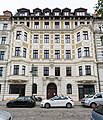
| Leibnizstrasse 26 (map) |
Residential building | 094 16700 | monument |
|
|
| Leibnizstrasse 27 (map) |
Residential building | 094 16701 | monument |

|
|
| Leibnizstrasse 28 (map) |
Residential building | 094 17089 | monument |

|
|
| Leibnizstrasse 31 (map) |
Residential building | 094 16702 | monument |

|
|
| Leibnizstrasse 33 (map) |
Residential building | 094 16703 | monument |

|
|
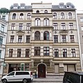
| Leibnizstrasse 34 (map) |
Residential building | 094 76668 | monument |
|
|
| Leibnizstrasse 35 (map) |
Residential building | 094 76669 | monument |

|
|
| Leibnizstrasse 42 (map) |
Residential building | 094 76670 | monument |

|
|
| Leibnizstrasse 43 (map) |
Residential building | 094 76671 | monument |

|
|
| Leibnizstrasse 44 (map) |
Residential building | 094 76672 | monument |

|
|
| Leibnizstrasse 45 (map) |
Residential building | 094 76673 | monument |

|
|
| Leibnizstrasse 46 (map) |
Residential building | 094 76674 | monument |

|
|
| Leibnizstrasse 48 (map) |
Residential building | 094 76675 | monument |

|
|
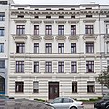
| Leibnizstrasse 49 (map) |
Residential building | 094 76676 | monument |
|
|
| Leibnizstrasse 51 (map) |
Residential building | 094 71450 | monument |

|
|
| Leiterstrasse 8 (map) |
gym | 094 76842 | monument |

|
|
| Leiterstrasse 9 (map) |
Luis School | Former secondary school for girls, initially built with two floors from 1846–1848, then added one floor each in 1860 and 1910/11 | 094 06342 | monument |

|
| Leiterstrasse 9 (map) |
School servants' house | 094 70906 | monument |

|
|
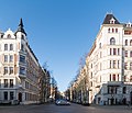
| Liebigstrasse 1–3, 4a, 4b, 5–9, 9a, 10–12 (map) |
Street train | 094 76771 | monument |
|
|
| Liebigstrasse 4a – b (map) |
Residential building | 094 16704 | monument |

|
|
| Liebigstrasse 6 (map) |
Residential and commercial building | 094 76772 | monument |

|
|
| Liebigstrasse 8 (map) |
Residential building | 094 16705 | monument |

|
|
| Liebigstraße 9, 9a, Schleinufer 18a (map) |
Residential building | 094 16706 | monument |

|
|
| Liebigstrasse 10 (map) |
Residential and commercial building | 094 16820 | monument |

|
|
| Liebigstrasse 11 (map) |
Residential building | 094 16708 | monument |

|
|
| Liebigstrasse 12 (map) |
Residential building | 094 16709 | monument |

|
|
| Listemannstrasse 6 (map) |
Telecommunications office | 094 17425 | monument |

|
|
| Lothar-Kreyssig-Strasse 1 (map) |
Bank building | It is the former Reichsbank building. It is located in the old town, southwest of Domplatz on Breite Weg in front of the western front of the cathedral between Lothar-Kreyssig-Straße and Danzstraße. | 094 82664 | monument |

|
| Materlikstrasse 1 (map) |
former train station | 094 82844 | monument |

|
|
| Max-Josef-Metzger-Strasse 2 (map) |
Residential and commercial building | 094 82787 | monument |

|
|
| Max-Josef-Metzger-Strasse 3 (map) |
Residential building | 094 82788 | monument |

|
|
| Max-Josef-Metzger-Strasse 5, 6 (map) |
Post office | 094 71431 | monument |

|
|
| Max-Josef-Metzger-Strasse 13 (map) |
Portal in front of the Roncallihaus | 094 82784 | monument |

|
|
| Max-Josef-Metzger-Strasse (map) |
church | Main church of the diocese of Magdeburg | 094 06286 | monument |

|
| Max-Otten-Strasse 11–15 (map) |
former hospital | monument |

|
||
| Max-Otten-Strasse (map) |
City wall Max-Otten-Strasse | Remnants of the city wall from around 1210 | 094 17402 | monument |

|
| Maybachstrasse 26 (map) |
Administration building Maybachstrasse 26 | Administration building from the 1960s | 094 18269 | monument |

|
| Maybachstrasse (map) |
Western fortress ring (Enceinte) | The western fortress ring with the Cavaliers IV, V, VI and the Ravelin II is located to the west of the old town and the facilities of the main train station. It was created between 1871 and 1874 and is largely preserved. | 094 06383 | monument |

|
| Maybachstrasse (map) |
Locomotive shed Maybachstrasse | Locomotive shed of a private railway from around 1873 | 094 18270 | monument |

|
| Neustädter Strasse 1 (map) |
St. Peter's Church | 094 06295 | monument |

|
|
| Neustädter Strasse 6 (map) |
church | 094 06292 | monument |

|
|
| Otto-von-Guericke-Strasse 5 (map) |
Institute building | 094 70017 | monument |
|
|
| Otto-von-Guericke-Strasse 6 (map) |
Clubhouse | 094 18026 | monument |

|
|
| Otto-von-Guericke-Strasse 27, 28 (map) |
Bank building | 094 16712 | monument |

|
|
| Otto-von-Guericke-Strasse 35 (map) |
Department store | 094 71501 | monument |

|
|
| Otto-von-Guericke-Strasse 41–46, 46a, 47–54, 54a, 55, 55a, 56, 56a – b, 57, 57a, 58, 59, 59a, 60 (map) |
Street train | 094 18276 | monument |

|
|
| Otto-von-Guericke-Strasse 41a (map) |
Residential building | 094 76755 | monument |

|
|
| Otto-von-Guericke-Strasse 42 (map) |
Residential building | 094 16713 | monument |

|
|
| Otto-von-Guericke-Strasse 42a (map) |
Residential building | 094 16714 | monument |

|
|
| Otto-von-Guericke-Strasse 45 (map) |
Residential building | 094 16715 | monument |

|
|
| Otto-von-Guericke-Strasse 46 (map) |
Residential building | 094 16716 | monument |

|
|
| Otto-von-Guericke-Strasse 46a (map) |
Residential and commercial building | 094 71405 | monument |

|
|
| Otto-von-Guericke-Strasse 48 (map) |
Residential building | 094 06373 | monument |

|
|
| Otto-von-Guericke-Strasse 49 (map) |
Residential building | 094 17889 | monument |

|
|
| Otto-von-Guericke-Strasse 50 (map) |
Residential building | 094 17890 | monument |

|
|
| Otto-von-Guericke-Strasse 51 (map) |
Residential building | 094 17891 | monument |

|
|
| Otto-von-Guericke-Strasse 52 (map) |
Residential building | 094 17892 | monument |

|
|
| Otto-von-Guericke-Strasse 53 (map) |
Residential building | 094 17893 | monument |

|
|
| Otto-von-Guericke-Strasse 54 (map) |
Residential building | 094 17894 | monument |

|
|
| Otto-von-Guericke-Strasse 54a (map) |
Residential building | 094 82830 | monument |

|
|
| Otto-von-Guericke-Strasse 55 (map) |
Residential building | 094 17895 | monument |

|
|
| Otto-von-Guericke-Strasse 55a (map) |
Residential building | 094 76756 | monument |

|
|
| Otto-von-Guericke-Strasse 56 (map) |
space | space | 094 77055 | Monument area |

|
| Otto-von-Guericke-Strasse 56 (map) |
Residential building | 094 17881 | monument |

|
|
| Otto-von-Guericke-Strasse 56a (map) |
Residential and commercial building | 094 76769 | monument |

|
|
| Otto-von-Guericke-Strasse 56b (map) |
Residential building | 094 16717 | monument |

|
|
| Otto-von-Guericke-Strasse 57 (map) |
Residential building | 094 16718 | monument |

|
|
| Otto-von-Guericke-Strasse 57a (map) |
Residential building | 094 16719 | monument |

|
|
| Otto-von-Guericke-Strasse 58 (map) |
Residential building | 094 16720 | monument |

|
|
| Otto-von-Guericke-Strasse 59, 59a (map) |
Residential building | 094 16721 | monument |

|
|
| Otto-von-Guericke-Strasse 60 (map) |
Residential building | 094 16722 | monument |

|
|
| Otto-von-Guericke-Strasse 64 (map) |
Society house | 094 16723 | monument |

|
|
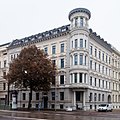
| Otto-von-Guericke-Strasse 65 (map) |
Residential building | 094 71459 | monument |
|
|
| Otto-von-Guericke-Strasse 66 (map) |
Residential building | 094 16725 | monument |

|
|
| Otto-von-Guericke-Strasse 68–73 (map) |
museum | 094 06371 | monument |

|
|
| Planckstrasse 1–10 (map) |
Street train | monument |

|
||
| Planckstrasse 1, 2 (map) |
Residential building | monument |

|
||
| Planckstrasse 4, 5 (map) |
Residential building | monument |

|
||
| Planckstrasse 7 (map) |
Residential building | monument |

|
||
| Planckstrasse 8 (map) |
Residential building | monument |

|
||
| Planckstrasse 10 (map) |
Residential building | monument |

|
||
| Prälatenstrasse 8 (map) |
Cathedral elementary school | monument |

|
||
| Ratswaageplatz 1 |
medieval cellar vault | monument | |||
| Ratswaageplatz 1 |
Heraldic panel | monument |

|
||
| Government Road 4-6 (map) |
Monastery of Our Lady | monastery | 094 06288 | monument |

|
| Government road (map) |
Basement of the guest house of the monastery of Our Lady | Gothic brick vault in the city wall | 094 06320 | monument |

|
| Remtergang 1 (map) |
Residential building | Canon Curia | 094 06337 | monument |

|
| Remtergang (map) |
Tatar tower | Defense tower | 094 06387 | monument |

|
| Remtergang (map) |
City wall, Romanesque wall remnants between Remtergang and Großer Klosterstraße | monument | |||
| Rötgerstrasse 8, 9 (map) |
Administration building | 094 17441 | monument |

|
|
| Schellingstraße 2-4 |
Street line | monument |

|
||
| Schellingstraße 2, Steubenallee 3 |
Residential building | monument |

|
||
| Schleinufer |
silhouette | silhouette | 094 76954 | Monument area | |
| Schleinufer |
bridge | bridge | 094 70976 | monument | |
| Schleinufer |
Railway system | Railway system | 094 76761 | monument |

|
| Schleinufer (map) |
Elbe promenade | The promenade opened on the banks of the Elbe in 1974 and declared a monument in 2017 | 107 25064 | monument |

|
| Schleinufer 12 (map) |
Residential building | monument |

|
||
| Schleinufer 13 (map) |
Residential building | monument |

|
||
| Schleinufer 14 (map) |
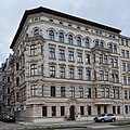
Residential building | monument |
|
||
| Schleinufer 18a (map) |
Residential building | Residential building | 094 76955 | monument |

|
| Schleinufer 19 (map) |
Residential building | monument |

|
||
| Schleinufer 20 (map) |
Residential building | monument |

|
||
| Schleinufer 21 (map) |
Residential building | monument |

|
||
| Schleinufer 23 (map) |
Residential building | monument |

|
||
| Schleinufer 24, east of the State Chancellery, |
Elbe shunting yard | former train station | 107 15022 | monument | |
| Schleinufer 24 m |
camp | 094 70730 | monument | ||
| Schleinufer 24 o |
former train station | 094 82767 | monument |

|
|
| Schleinufer 24 p |
Administration building | monument |

|
||
| Schleinufer 25 (map) |
Administration building | Administration building of the former Elblagerhaus AG | 094 82768 | monument |

|
| Schleinufer 26, 27, 28 (map) |
Storage | northern flat storage of the former Elblagerhaus AG | 094 82768 | monument |

|
| Schleinufer 30 |
Dandruff | Social building, goods or. Customs shed of the former Elbe shunting yard | 107 15021 | monument |

|
| Schleinufer |
city wall | monument | |||
| Schleinufer |
Gate system | monument | |||
| Schleinufer (map) |
Gate system | monument |

|
||
| Schleinufer (map) |
Lukasklause | Defense tower | 094 17439 | monument |

|
| Seumestraße 1–4 (map) |
Street train | 094 18284 | monument |

|
|
| Seumestrasse 1 (map) |
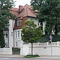
villa | 094 16734 | monument |
|
|
| Seumestrasse 3 (map) |
Residential building | 094 16735 | monument |

|
|
| Seumestrasse 4 (map) |
Residential building | 094 16736 | monument |

|
|
| Sternbrücke (map) |
bridge | 094 70975 | monument |

|
|
| Sternstrasse 2–11, 28–34 (map) |
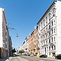
Sternstrasse | Sternstraße was built from the mid-1880s. It begins at Hasselbachplatz towards the south and forms a closed street scene in the Wilhelminian style. They are houses for apartments, some with stately claims. The facades are elaborately designed in the neo-renaissance style. | 094 82851 | monument |
|
| Sternstrasse 3 (map) |
Residential building | 094 82853 | monument |

|
|
| Sternstrasse 4 (map) |
Residential building | 094 82854 | monument |

|
|
| Sternstrasse 5 (map) |
Residential building | 094 82855 | monument |

|
|
| Sternstrasse 6 (map) |
Residential building | 094 82856 | monument |

|
|
| Sternstrasse 7 (map) |
Residential building | 094 82857 | monument |

|
|
| Sternstrasse 8 (map) |
Residential building | 094 82858 | monument |

|
|
| Sternstrasse 9 (map) |
Residential building | 094 82859 | monument |

|
|
| Sternstrasse 10 (map) |
Residential building | 094 82860 | monument |

|
|
| Sternstrasse 11 (map) |
Residential building | 094 82861 | monument |

|
|
| Sternstrasse 19-25 (map) |
Street line | monument |

|
||
| Sternstrasse 19 (map) |
villa | 094 16825 | monument |

|
|
| Sternstrasse 19a (map) |
Residential building | 094 16827 | monument |

|
|
| Sternstraße 19b |
villa | monument |

|
||
| Sternstrasse 21 (map) |
Residential building | 094 16738 | monument |

|
|
| Sternstrasse 22 (map) |
Residential building | 094 16739 | monument |

|
|
| Sternstrasse 23 (map) |
Residential building | 094 16740 | monument |

|
|
| Sternstrasse 24 (map) |
Residential building | 094 16741 | monument |

|
|
| Sternstrasse 28 (map) |
Residential building | 094 82862 | monument |

|
|
| Sternstrasse 29a-b (map) |
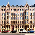
Residential building | 094 82863 | monument |
|
|
| Sternstrasse 30 (map) |
Residential building | 094 82864 | monument |

|
|
| Sternstrasse 31 (map) |
Residential building | 094 82865 | monument |

|
|
| Sternstrasse 33 (map) |
Residential building | 094 82866 | monument |

|
|
| Sternstrasse 34 (map) |
Residential building | 094 82867 | monument |

|
|
| Steubenallee 1–3 (map) |
Street train | monument |

|
||
| Steubenallee 1 (map) |
Residential building | The villa-like single-family house was built in 1924 for the factory director Otto Feßler in an expressionist style. Together with the house at Steubenallee 2, it forms a twin house. It is a two-story house with a flat hipped roof. | 094 16828 | monument |

|
| Steubenallee 2 (map) |
Residential and commercial building | 094 76829 | monument |

|
|
| Steubenallee 3 (map) |
Residential building | Residential building | 094 16737 | monument |

|
| Steubenallee (map) |
Steubenpark | Park | 094 76828 | monument |

|
| Steubenallee |
Southern railroad gate | Railway gate of the Magdeburg Fortress | 094 76645 | monument | |
| Steubenallee (map) |
bridge | bridge | 094 70986 | monument | |
| Steubenpark (map) |
memorial | The memorial was unveiled on May 8, 1965. The sculptor was Eberhard Roßdeutscher . It is intended to commemorate 62 Magdeburg resistance fighters who were murdered by the National Socialists. | 094 06156 | monument |

|
| Stresemannstrasse 6a (map) |
Residential and commercial building | Residential and commercial building | 094 76963 | monument |

|
| Stresemannstrasse 18, 19 (map) |
Administration building | The former provisions office and the military bakery were built at the end of the 19th century. The building on the left has five axes, the building on the right has seven axes, both are two and a half stories high. The upper floors are designed as mezzanines. They are cuboid buildings made of yellow bricks. The facade is structured by red bricks. The entrance to a depot was between the buildings. Other buildings belong to the monument. | 094 82183 | monument |

|
| Tränsberg |
city wall | city wall | 094 17437 | monument | |
| Tränsberg 21–23 (map) |
Officers' mess | The former officers' mess was built in 1863/1864 as part of the barracks of the 26th “Prince Leopold” regiment. The building is thus the oldest officers' mess in Magdeburg. It is a three-story building with a flat roof and 22 axes. On the left there is a side elevation with four axes and a triangular gable. Another risalit of the same width is located after the sixth axis from the right. The first and second floors are separated by a cornice. | 094 17442 | monument |

|
| Universitätsplatz 9 (map) |
theatre | The former central theater was built from 1905 to 1907 as an operetta stage. In 1990 the theater was badly damaged in a fire. In 1997 it was rebuilt. | 094 17417 | monument |

|
| Virchowstrasse 2, 3 (map) |
Administration building | 094 17404 | monument |

|
|
| Virchowstrasse 4 (map) |
Administration building | 094 76978 | monument |

|
|
| Wallonerberg 2–7 (map) |
Street train | 094 82875 | Monument area |

|
|
| Wallonerberg 2, 3 (map) |
Administration building | 094 82875 | monument |

|
|
| Wallonerberg 4 (map) |
Residential building | 094 16743 | monument |

|
|
| Wallonerberg 5 (map) |
Wall | 094 16744 | monument |

|
|
| Wallonerberg 6, 7 (map) |
Residential building | 094 82877 | monument |

|
|
| Weitlingstrasse 1a (map) |
Lodge house Ferdinand for happiness | Connection house, in the box building was formerly the Masonic lodge "Ferdinand zur Glückseligkeit". The house was built in 1902 in Art Nouveau style with baroque elements. | 094 81870 | monument |

|
| Weitlingstrasse (map) |
Fountain | The fountain was built in 1939, the sculptor was Fritz von Graevenitz . | 094 06184 | monument |

|
| Weitlingstrasse (map) |
House sign | on the west side of the bank building | 094 71138 | monument |

|
| Central square (map) |
Central place | The residential and commercial buildings around Central Square were built directly after the Second World War. | 094 70299 | Monument area |

|
Former cultural monuments
The following objects were originally also listed or listed in literature as cultural monuments. However, the monuments no longer exist today, their protection status has been lifted or they are no longer regarded as monuments.
| location | Official name | description | Registration number | image |
|---|---|---|---|---|
| Old Market 5 | Magdeburg Stock Exchange | Former stock exchange building, destroyed up to the first floor in an air raid in 1945, later demolished | ||
| Old Market 11 | House from 1719, destroyed in World War II | |||
| Old Market 14 | 17th century house, destroyed in World War II | |||
| Berliner Strasse 14 | built after 1728, destroyed in World War II | |||
| Broad way | Church of Saint Catherine | Protestant church, badly damaged in the air raid on January 16, 1945, later demolished |

|
|
| Broad way | Saint Nikolai Church | Armory museum, badly damaged in the air raid on January 16, 1945, demolished in 1956 |

|
|
| Wide way 12 | House, built 1725–1728, destroyed in World War II | |||
| Wide way 20 | To the turret | House from 1657, destroyed in World War II | ||
| Wide way 26 | House built after 1748, destroyed in World War II | |||
| Wide way 29 | Erected around 1765, destroyed in World War II | |||
| Wide way 30 | To the golden cross | Erected in 1745, destroyed in World War II |

|
|
| Broad way 57 | Brauhaus Zur golden Rose | Erected in 1676, destroyed in World War II | ||
| 148 | Residential house, facade with a mix of styles typical of Magdeburg, destroyed in World War II, portal built into the museum courtyard | |||
| Wide way 156 | Erected at the beginning of the 18th century, destroyed in the Second World War | |||
| Broad Way 165 | built between 1750 and 1765, destroyed in World War II | |||
| Broad Way 166 | built after 1742, destroyed in World War II | |||
| 167 | built after 1739, destroyed in World War II | |||
| Wide open 173 | destroyed in World War II | |||
| Great Way 174 | built around 1730, destroyed in World War II | |||
| Wide path 175 | built after 1730, destroyed in World War II | |||
| Wide path 177 | built in 1728, destroyed in World War II | |||
| 198 | built around 1750, destroyed in World War II | |||
| Cathedral Square | Cathedral organ | Organ in the remter of Magdeburg Cathedral , no longer listed as a memorial at least since 2015 | 094 06423 | |
| Dreiengelstrasse 28 | National Theater | Theater building, last used as a gym, badly damaged in an air raid in 1945, later demolished | ||
| Erich-Weinert-Strasse 25 | House of Young Talent | Culture house from 1914, removed from the list of monuments in 2003 | ||
| Ernst-Reuter-Allee 38, 40 | Hotel Gruener Baum | Hotel, the building complex built in 1871/1872 partly in half-timbered construction is still listed as a monument in the monument register as of April 1, 2009, but was no longer listed as a monument in the digital directory in 2010. | 094 71376 | |
| Ernst-Reuter-Allee | Saint Ulrich and Levin Church | Protestant church, badly damaged by air raid, blown up in 1956, foundation walls preserved, there is a private initiative to rebuild | ||
| Fürstenwallstrasse | city wall | at least since 2009 no longer listed as a monument | 094 06389 | |
| Fürstenwallstrasse 8 | Erected in 1721, destroyed in World War II | |||
| Fürstenwallstrasse 17 | Approved termination application from 1998 | |||
| Fürstenwallstrasse 19 | destroyed in World War II | |||
| Gouvernementstrasse 4 | Dompredigerhaus, built from 1768 to 1770, destroyed in World War II | |||
| Great Market Street | French Reformed Church | Church, badly damaged in the air raid on January 16, 1945, demolished in 1959 | ||
| Grosse Marktstrasse 8 | To the ark | built in 1757, destroyed in World War II | ||
| Grosse Münzstrasse 5 | built in 1694, destroyed in World War II | |||
| Grosse Münzstrasse 7 | The courtyard of the von Saldern family, badly damaged in the air raid on January 16, 1945, partially collapsed in 1953 and then demolished | |||
| Great Münzstrasse 13 | To the friendly face | built from 1722 to 1724, destroyed in World War II | ||
| Great Münzstrasse 14 | built from 1722 to 1724, destroyed in World War II | |||
| Great Münzstrasse 15 | built in 1723, destroyed in World War II | |||
| Grosse Schulstrasse 2c | Old Synagogue Magdeburg | Synagogue, destroyed during the Reichspogromnacht on November 9, 1938 | ||
| Holy Spirit Church | Protestant church, badly damaged in an air raid, demolished after reconstruction in 1959 | |||
| Holzhof 6 and 7 | built after 1767, badly damaged in an air raid in 1945, later demolished | |||
| Jakobstrasse | Saint Jakobi Church | Protestant church, badly damaged in the air raid on January 16, 1945, demolished in 1959 |

|
|
| Johannisbergstrasse 3 | Artus Court | destroyed in World War II | ||
| Kreuzgangstrasse 5 | Residential building at Kreuzgangstrasse 5 | former curia of the Nikolaistifts, half-timbered house from 1506, destroyed in the Second World War |

|
|
| Kreuzgangstrasse 7 | built after 1723, destroyed in World War II | |||
| Kreuzgangstrasse 10 | built in 1724, destroyed in World War II | |||
| Kreuzgangstrasse 11 | destroyed in World War II | |||
| Leiterstrasse 20 | To the King of Prussia | built in 1719, destroyed in World War II | ||
| Otto-von-Guericke-Strasse | City Theater Magdeburg | Theater, badly damaged in the air raid on January 16, 1945, later demolished |

|
|
| Ratswaageplatz 1, 2, 3, 4 | Hotel Ratswaage | Administration building, now used as a hotel, not listed as a monument at least since 2009 | 094 70016 | |
| Government Street 2 | built in 1723, destroyed in World War II | |||
| Government Street 3 | built in 1723, destroyed in World War II | |||
| Schleinufer | Railway system | at least since 2009 no longer listed as a monument | 094 76760 | |
| Schleinufer | Railway system | at least since 2009 no longer listed as a monument | 094 76762 | |
| Schleinufer 24m | Brewery building defeat Allendorff | Warehouse, approved demolition application from 2005 | 094 70730 | |
| Schwibbogen 7 | To the golden hammer | built between 1721 and 1725, destroyed in World War II | ||
| Steinstrasse 1 | To hunt | built after 1722, destroyed in World War II | ||
| Stephansbrücke 15 | built in the 18th century, destroyed in World War II | |||
| Stephansbrücke 23 | built around 1760, destroyed in World War II | |||
| Sternstraße 2, corridor: 153, parcel: 364/1 | House Fritze | Residential house, demolished in 2014 | 094 82852 |

|
| Sternstrasse 12 | Demolition for a planned new construction of a petrol station, approved demolition application from 1993 | |||
| Tischlerkrugstrasse 10 | built in the 18th century, destroyed in World War II | |||
| Warta 3 | Warthe house 3 | Romanesque house, damaged in an air raid in 1945, later demolished |

|
|
| Weinfaßstrasse 2 | probably built in 1683, destroyed in World War II | |||
| Werftstrasse 39 | New Packhof | Farm building, badly damaged in an air raid in 1945, later demolished | ||
| Werftstrasse 40 | Old Packhof | Farm building, badly damaged in an air raid in 1945, later demolished |
Legend
The columns contain the following information:
- Location: States the street name and, if available, the house number of the cultural monument. The list is basically sorted according to this address. The link "Map" leads to various map displays and names the geographic coordinates.
Link to a map view tool to set coordinates. In the map view, monuments without coordinates are shown with a red marker and can be set on the map. Architectural monuments without a picture are marked with a blue marker, architectural monuments with a picture are marked with a blue marker. - Official designation: Provides the name, designation or type of cultural monument as noted in the source.
- Description: Provides structural and historical details of the cultural monument, preferably the characteristics of the monument.
- Registration number: A 20-digit registration number is assigned to every cultural monument in Saxony-Anhalt. Currently the last twelve digits are each 0. Therefore, the last twelve digits are not shown here. The following icon can be found in this column
 ; this leads to information on this monument at Wikidata .
 - Type of identification: The classification of the monument according to § 2 Paragraph 2 DenkmSchG LSA
- Image: A picture of the memorial and, if applicable, a link to other photos of the cultural monument in the Wikimedia Commons media archive
literature
- State Office for Monument Preservation and Archeology Saxony-Anhalt (Hrsg.): State Capital Magdeburg. (= Monument Register Saxony-Anhalt , Volume 14.) Michael Imhof Verlag, Petersberg 2009, ISBN 978-3-86568-531-5 .
- Götz Eckardt (Hrsg.): Fates of German monuments in the Second World War. Henschel Verlag Kunst und Gesellschaft , Berlin undated (around 2000?), ISBN 3-926642-24-6 , volume 1, page 247 ff.
Web links
Commons : Cultural monuments in Magdeburg's old town - collection of images, videos and audio files
Individual evidence
- ↑ All buildings in the monument: Alter Markt 1, 1a, Breiter Weg 20, 21, 22, Ernst-Reuter-Allee 6, 8, 10, 12, 16, 18, 20, 22, 24, 26, 28, 30, 32 , Große Münzstraße 1, 3, 5, 7, 9, Hartstraße 1, Kleine Münzstraße 1, 2, Krügerbrücke 2, 4, 6, Otto-von-Guericke-Straße 10, 104-106, Schweriner Straße 6–8, Ulrichplatz 7 -9, 9a, 10
- ↑ Monument Directory Saxony-Anhalt, Volume 14, State Capital Magdeburg, State Office for Monument Preservation and Archeology, Michael Imhof Verlag, Petersberg 2009, ISBN 978-3-86568-531-5 , page 59
- ↑ Monument Directory Saxony-Anhalt, Volume 14, State Capital Magdeburg, State Office for Monument Preservation and Archeology, Michael Imhof Verlag, Petersberg 2009, ISBN 978-3-86568-531-5 , page 61
- ↑ The underpass is also listed in the monument register, probably by mistake, under registration number 094 71176.
- ↑ All buildings in the monument area: Bahnhofstrasse 35–37, 45, 46; Behringstrasse 1-4; Bölschestrasse 1a-b, 2, 3; Breiter Weg 227-229, 229a, 230-232, 232a, 233-256; Bürgelstrasse 1, 2; Danzstrasse 11, 11a, 12, 13; Einsteinstrasse 1-4, 4a, 5, 8-12; Haeckelstrasse 6, 7, 9, 9a; Hallesche Strasse 4; Hasselbachplatz 1–5; Hegelstrasse 1–10, 15–42; Heydeckstrasse 9-12; Keplerstrasse 2, 5, 5a, 6, 6a, 7, 7a, 8, 9, 9a, 10, 13; Leibnitzstrasse 16-28, 31-35; Liebigstrasse 1–3, 4a – b, 5–9, 9a, 10–12; Otto-von-Guericke-Strasse 41-46, 46a, 47-54, 54a, 55, 55a, 56, 56a-b, 57, 57a, 58, 59, 59a, 60, 64-66, 68; Sternstrasse 2–11, 28–34
- ↑ Monument Directory Saxony-Anhalt, Volume 14, State Capital Magdeburg, State Office for Monument Preservation and Archeology, Michael Imhof Verlag, Petersberg 2009, ISBN 978-3-86568-531-5 , page 129
- ↑ Monument Directory Saxony-Anhalt, Volume 14, State Capital Magdeburg, State Office for Monument Preservation and Archeology, Michael Imhof Verlag, Petersberg 2009, ISBN 978-3-86568-531-5 , pages 162–163
- ↑ Note: In the list of monuments as of April 1, 2009 not yet designated as a monument. The digital register of monuments has listed the property as a listed building since at least 2012.
- ↑ Monument Directory Saxony-Anhalt, Volume 14, State Capital Magdeburg, State Office for Monument Preservation and Archeology, Michael Imhof Verlag, Petersberg 2009, ISBN 978-3-86568-531-5 , page 190
- ↑ Monument Directory Saxony-Anhalt, Volume 14, State Capital Magdeburg, State Office for Monument Preservation and Archeology, Michael Imhof Verlag, Petersberg 2009, ISBN 978-3-86568-531-5 , page 203
- ↑ Monument Directory Saxony-Anhalt, Volume 14, State Capital Magdeburg, State Office for Monument Preservation and Archeology, Michael Imhof Verlag, Petersberg 2009, ISBN 978-3-86568-531-5 , page 203
- ↑ Monument Directory Saxony-Anhalt, Volume 14, State Capital Magdeburg, State Office for Monument Preservation and Archeology, Michael Imhof Verlag, Petersberg 2009, ISBN 978-3-86568-531-5 , page 212
- ↑ List of monuments Saxony-Anhalt, Volume 14, State Capital Magdeburg, State Office for Monument Preservation and Archeology, Michael Imhof Verlag, Petersberg 2009, ISBN 978-3-86568-531-5 , page 224
- ↑ Monument Directory Saxony-Anhalt, Volume 14, State Capital Magdeburg, State Office for Monument Preservation and Archeology, Michael Imhof Verlag, Petersberg 2009, ISBN 978-3-86568-531-5 , page 236
- ↑ Monument Directory Saxony-Anhalt, Volume 14, State Capital Magdeburg, State Office for Monument Preservation and Archeology, Michael Imhof Verlag, Petersberg 2009, ISBN 978-3-86568-531-5 , page 325
- ↑ Monument Directory Saxony-Anhalt, Volume 14, State Capital Magdeburg, State Office for Monument Preservation and Archeology, Michael Imhof Verlag, Petersberg 2009, ISBN 978-3-86568-531-5 , pages 328–329.
- ↑ Monument Directory Saxony-Anhalt, Volume 14, State Capital Magdeburg, State Office for Monument Preservation and Archeology, Michael Imhof Verlag, Petersberg 2009, ISBN 978-3-86568-531-5 , page 359
- ↑ Small question and answer Olaf Meister (BÜNDNIS 90 / DIE GRÜNEN), Wolfgang Aldag (BÜNDNIS 90 / DIE GRÜNEN), State Chancellery and Ministry of Culture 02/15/2018 Printed matter 7/2453 (KA 7/1372) Development of the Saxony-Anhalt monument register in the year 2017 , page 16
- ↑ Monument Directory Saxony-Anhalt, Volume 14, State Capital Magdeburg, State Office for Monument Preservation and Archeology, Michael Imhof Verlag, Petersberg 2009, ISBN 978-3-86568-531-5 , page 518
- ↑ Monument Directory Saxony-Anhalt, Volume 14, State Capital Magdeburg, State Office for Monument Preservation and Archeology, Michael Imhof Verlag, Petersberg 2009, ISBN 978-3-86568-531-5 , page 525
- ↑ Monument Directory Saxony-Anhalt, Volume 14, State Capital Magdeburg, State Office for Monument Preservation and Archeology, Michael Imhof Verlag, Petersberg 2009, ISBN 978-3-86568-531-5 , pages 527-528
- ↑ Monument Directory Saxony-Anhalt, Volume 14, State Capital Magdeburg, State Office for Monument Preservation and Archeology, Michael Imhof Verlag, Petersberg 2009, ISBN 978-3-86568-531-5 , page 531
- ↑ Monument Directory Saxony-Anhalt, Volume 14, State Capital Magdeburg, State Office for Monument Preservation and Archeology, Michael Imhof Verlag, Petersberg 2009, ISBN 978-3-86568-531-5 , pages 549-550
- ^ The Magdeburg Cityscape in Six Centuries, publisher: Kulturhistorisches Museum Magdeburg, 1961, page 38
- ↑ Short question and answer Olaf Meister (Bündnis 90 / Die Grünen), Prof. Dr. Claudia Dalbert (Bündnis 90 / Die Grünen), Ministry of Culture March 19, 2015 Printed matter 6/3905 (KA 6/8670) List of monuments Saxony-Anhalt , Harz no memorial.pdf, page 4645
- ↑ List of monuments, page 188 f.
- ^ Digital register of monuments of the city of Magdeburg
- ↑ Short question and answer Olaf Meister (Bündnis 90 / Die Grünen), Prof. Dr. Claudia Dalbert (Bündnis 90 / Die Grünen), Ministry of Culture March 19, 2015 Printed matter 6/3905 (KA 6/8670) List of monuments Saxony-Anhalt , Harz no monument.pdf, page 4646 f.
- ↑ a b Opinion 0144/12 of the state capital Magdeburg, Annex 1 Part 1, approved demolition applications 1993-2001
- ↑ Short question and answer Olaf Meister (Bündnis 90 / Die Grünen), Prof. Dr. Claudia Dalbert (Bündnis 90 / Die Grünen), Ministry of Culture March 19, 2015 Printed matter 6/3905 (KA 6/8670) List of monuments Saxony-Anhalt , Harz no memorial.pdf, page 4647
- ↑ Short question and answer Olaf Meister (Bündnis 90 / Die Grünen), Prof. Dr. Claudia Dalbert (Bündnis 90 / Die Grünen), Ministry of Culture March 19, 2015 Printed matter 6/3905 (KA 6/8670) List of monuments Saxony-Anhalt , Harz no memorial.pdf, page 4645
- ↑ Short question and answer Olaf Meister (Bündnis 90 / Die Grünen), Prof. Dr. Claudia Dalbert (Bündnis 90 / Die Grünen), Ministry of Culture March 19, 2015 Printed matter 6/3905 (KA 6/8670) List of monuments Saxony-Anhalt , Harz no memorial.pdf, page 4645
- ↑ Opinion 0144/12 of Magdeburg, Appendix 1, Part 2, approved termination requests by the upper conservation authority 2002-2010


