Mühlingen
| coat of arms | Germany map | |
|---|---|---|

|
Coordinates: 47 ° 55 ' N , 9 ° 1' E |
|
| Basic data | ||
| State : | Baden-Württemberg | |
| Administrative region : | Freiburg | |
| County : | Constancy | |
| Height : | 625 m above sea level NHN | |
| Area : | 32.67 km 2 | |
| Residents: | 2482 (December 31, 2018) | |
| Population density : | 76 inhabitants per km 2 | |
| Postal code : | 78357 | |
| Area code : | 07775 | |
| License plate : | KN | |
| Community key : | 08 3 35 057 | |
| LOCODE : | DE M6S | |
| Address of the municipal administration: |
Im Göhren 2 78357 Mühlingen |
|
| Website : | ||
| Mayor : | Manfred Jüppner ( CDU ) | |
| Location of the municipality of Mühlingen in the district of Constance | ||
Mühlingen is a municipality in the district of Konstanz in Baden-Württemberg in Germany .
geography
Geographical location
Mühlingen is located in the northeast of the Hegau , at the transition to the Swabian Alb in the north, the Linzgau in the east and the Lake Constance basin in the south. The Stockacher Aach flows through the municipality .
Steinbühl ( ), west of the center of Mühlingen, is 673 m above sea level. NHN the highest point in the Mühlingen municipality; the lowest point at about 550 m above sea level. NHN is located in the area of the federal highway 313 to the Stockach district of Hoppetenzell .
![]()
Neighboring communities
The municipality borders on the municipalities of Hohenfels (southeast), Stockach (south) and Eigeltingen (southwest), which belong to the district of Konstanz , on the municipalities of Emmingen-Liptingen (northwest) and Neuhausen ob Eck (north) in the district of Tuttlingen, and on the municipality of Sauldorf ( Northeast) in the district of Sigmaringen .
Community structure
The municipality of Mühlingen, with the formerly independent municipalities of Gallmannsweil , Mainwangen , Schwackenreute and Zoznegg, includes 27 villages, hamlets, farms and houses. The municipality of Mühlingen within the boundaries of 1973 includes the villages of Mühlingen and Hecheln (outer and inner), the Altschorenhof, Bushof, Glashüttenhof, Haldenhof, Hotterloch, Neuschorenhof, Oberweitfelderhof, Rehaldenhof (Rehalden), Reichlishardt, Reismühle, Schorenmühle and Unterweitfelderhof farms and that House Sägehof (saw mill) and the deserted areas of Etschreute and Grubenhof.
geology
Mühlingen is mainly located in the area of the Überlinger glacier tongue of the Rhine glacier ; In regional geological terms, this means: on the northern edge of the outer young moraine or the pre-Alpine Molasse basin .
From October 17 to November 11, 1966, the deeper subsurface of Mühlingen was explored through a deep borehole ( ) down to a depth of 874.6 meters. Since the goal of finding natural gas and oil here was not achieved, the well was abandoned and backfilled on November 23. However, the geological conditions of the subsoil could be described using the drill cores:
![]()

- -17.0 m - Quaternary : Ice Age moraines with gravels and clays
- -74.0 m - Tertiary : lime and sandstones of the Lower Freshwater
- -79.0 m - Tertiary: floor clay
- -429.0 m - Upper Jura ( Malm ): Limestone with occasional marl layers
- -653.0 m - Middle Jura ( Dogger )
- -718.7 m - Lower Jurassic (Lias)
- -867.0 m - Keuper
- -874.6 m - shell limestone
Some parts of the drill cores are exhibited and described in the entrance area of the Mühlingen town hall today.
Protected areas and natural monuments
In Mühlingen, the nature reserves Schwackenreuter Baggerseen-Rübelisbach and Sauldorfer Baggerseen , the FFH area Ablach, Baggerseen and Waltere Moor as well as eight natural monuments are designated.
history
Until the 19th century
Mühlingen was first mentioned in a document in 1275 as " Mulingen " in the tithe register of the Bishop of Constance .
From 1506 the place belonged to the Counts of Tengen-Nellenburg , but fell to the Counts of Hohenzollern as early as 1591 after their extinction .
Due to the land register of 1557, the rulers were entitled to the following taxes from the Mühlingen subjects as income: 126 chickens, 47 hens, 22 quarters and 50 pieces (= 600) eggs, 47 Malter and 7 quarters vesas and oats as well as 92 guilders , 8 chunks and 4 pfennigs.
In 1698 Johann Philipp Jakob Ebinger von der Burg (1672–1712) bought the manor of Mühlingen. His family had Mühlingen Castle built in 1730, which still exists today . In 1731 the land and local rule was sold to the Barons von Buol-Berenberg from Graubünden, who own the castle to this day. In 1747, as patron saints, they had the parish church consecrated to St. Martin built.
The until 1806 in the front Austrian County of Nellenburg preferred place Mühlingen came under the media coverage in 1806, first to the Kingdom of Württemberg and as part of an exchange area in 1810 to the Grand Duchy of Baden .
Administrative affiliation
Mühlingen initially belonged to the Stockach District Office (later Stockach District ). Since 1973 the community has belonged to the district of Constance .
Mergers
On January 1, 1974, the community of Mühlingen was re-formed by the union of the communities of Mühlingen, Mainwangen and Gallmannsweil. Today's community was created on January 1, 1975 when this community was merged with Schwackenreute and Zoznegg.
Religions
Mühlingen is predominantly Roman Catholic . Even today there is only one Catholic parish with one place of worship in Zoznegg, Mainwangen, Gallmannsweil and Mühlingen. The evangelical believers are looked after from Stockach.
Population development
- Only Mühlingen
- around 1800: 270
- around 1850: 510 in 104 families in 82 residential buildings
- 1900: 467
- 1945, December 22nd: 606 inhabitants
- 1947, April: 588 inhabitants, 549 Catholic / 39 Protestant
- 1950: 652
- 1961: 622
- 1965: 630
- 1969: 692
- 1970: 657
- 1996: 877
- Whole community
- 1987: 1,753 inhabitants ( census )
- 1988: 1,766 inhabitants
- 1991: 1,879 inhabitants
- 1995: 2,020 inhabitants
- 2000: 2,184 inhabitants
- 2005: 2,342 inhabitants
- 2007: 2,361 inhabitants (June 30)
- 2010: 2,312 inhabitants
- 2015: 2,319 inhabitants
- 2016: 2,346 inhabitants
politics
Municipal council
The local election on May 25, 2014 in Mühlingen led to the following official final result. The turnout was 51.9% (2009: 47.7%). The municipal council consists of the elected voluntary councilors and the mayor as chairman. The mayor is entitled to vote in the municipal council.
| Party / list | Share of votes | Seats | Result 2009 |
| CDU | 71.0% | 9 | 75.0%, 10 seats |
| FWG | 29.0% | 4th | 25.0%, 3 seats |
mayor
The self-government of the communities was expanded with the municipal ordinance of 1831, the Vogt was replaced by the mayor.
- before 1879 until after 1882: Mathä Traber
- 1927 to 1933: Johann Wegmann; resigned voluntarily from office at the compulsion of the NSDAP
- 10/1934 to 1935: Karl Kleiner
- 1935 to 1945: Richard Mayer ( NSDAP )
- 1945 to 1963: Peter Buhl († September 20, 1963, heart attack )
- November 25, 1963 to December 31, 1974: Gottfried Winkler
- Whole community
- January 1 to September 4, 1975 Official Administrator, September 5, 1975 (inauguration after the second ballot on June 22, 1975) to July 31, 1983 Mayor: Gottfried Winkler
- The Dipolm administrative specialist Manfred Jüppner ( CDU ) from Stockach was elected Mayor of Mühlingen on June 5, 1983 (771 of 1059 votes = 72.8%). He took office on August 1, 1983, when he was 30 years old.
coat of arms
The old Mühlingen coat of arms shows an eight-spoke golden mill wheel in red.
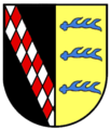
The new coat of arms is a symbiosis of the coats of arms of the formerly independent communities. The coat of arms, which goes back to a suggestion by district archivist Franz Götz, shows a curved red tip in which an eight-spoke golden mill wheel is split; in front a green fir tree in silver on a green three-mountain , behind in gold three four-ended blue deer sticks lying one above the other. On March 30, 1978, a vote was taken for this coat of arms, and it was not until eight years after the municipal reform that the municipality acquired the right to use the coat of arms with a deed of August 15, 1983.
Culture and sights
Structures (listed buildings)
- St. Barbara Church in Gallmannsweil
- Gallmannsweil rectory
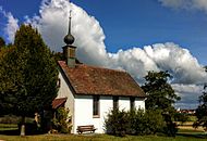
- Chapel St. Wendelin Hecheln (photos on the right)
- St. Vitus Church in Zoznegg
- Church of St. Martin in Mühlingen
- Our Lady Chapel in Mühlweiler
- Church of St. Peter and Paul in Mainwangen
- St. Otmar Chapel on the Madachhof
- Chapel of St. Anna in Schwackenreute
- Mühlingen Castle
- Several field crosses in exposed places, on hills and at forked roads in and around Mühlingen are now classified as small monuments by the preservation authorities and some are under monument protection .
music
- Mühlingen Music Association
- Zoznegg Music Association
- Youth music Mühlingen-Zoznegg
- Zoznegg accordion orchestra
- Church choir Mühlingen
- Church choir Zoznegg
Economy and Infrastructure
Mühlingen is still strongly influenced by agriculture . However, there are also a number of smaller industrial, craft, commercial and service companies.
The end of 2017 was one of four in the district Schwacke Reute hectares large greenhouse for organic vegetables from the marketing cooperative Reichenau vegetables commissioned. It is expected that 600 tons of tomatoes, around 170 tons of peppers and a million cucumbers will be harvested here every year.
post Office

- Before 1900
Before 1821, private individuals had to hand in their mail at the Stockach post office themselves. Then the establishment of an official messenger establishment made it possible for private individuals to hand over their mail to an official messenger. Initially, he brought the post to the Stockacher Post Expedition twice, later three times a week.
In the 1850s the official messenger agency was closed due to the steadily increasing correspondence, its services were transferred to the post office and on May 1, 1859 the rural postal agency was brought into being. Five messenger districts were set up in the Stockach district, of which messenger district No. II was obtained from the expedition in Eigeltingen . Every Monday, Wednesday and Friday the messenger set off from Liptingen via Schwandorf , Mainwangen to Mühlingen and via Gallmannsweil and Schwandorf back to Liptingen. Items of mail that had been thrown into the Mühlinger letter tray were given the clock wheel stamp “13” by the postman before they were forwarded .
The local post office is now in Zoznegg.
traffic
The district of Schwackenreute was a railway junction until 1971, where the Altshausen – Schwackenreute railway branched off from the Hegau-Ablachtal railway . In the 1970s, both lines were closed for passenger traffic and later the rails in the direction of Altshausen were dismantled, so that Schwackenreute no longer has a rail connection for passenger traffic today.
The Stockach – Mengen railway line was taken over by the Ablachtalbahn GmbH and expanded for freight traffic.
- Road network
The community is connected to federal roads 313 and 14 via several district roads .
- Bus transport
There is a bus connection via line 1000 (Stockach – Zoznegg – Mühlweiler – Mühlingen – Mainwangen – Gallmannsweil – Hecheln). For the RAB line 7391 Stockach – Sigmaringen there is the Mühlingen-Mühlweiler transfer point.
education
There is a primary school in the Mühlingen district and a community school in the Zoznegg district . There is also a kindergarten in each of the two districts .
Energy consumption and feed-in
Development of energy feed-in and energy consumption (in MWh ) in the community of Mühlingen
| year | 2015 | 2016 | 2017 |
|---|---|---|---|
| power consumption | 7,267 | 7,019 | 7.143 |
| Energy feed according to EEG | 22,562 | 20,894 | 20,359 |
Hiking trails
Along with some hiking trails signposted by the community, the " Heuberg-Allgäu-Weg " and the signposted from Engen to Stockach run through Mühlingen and the districts from Spaichingen on the western Swabian Alb through Upper Swabia and along Lake Constance to the Black Ridge in the Württemberger Allgäu " Hegau-Panorama-Weg ".
Personalities
Sons and daughters of the church
- Joachim Aberlin (born in Gallmannsweil; † after 1554), Evangelical Reformed pastor, teacher and hymn poet
- Kaspar Zeiler (1594–1681), vicar general and auxiliary bishop of Augsburg , was born in what is now Mainwangen
- Karl Ott (1873–1952), educator and politician , born in Mainwangen
Personalities who have worked on site
- Joseph Ignaz von Buol-Berenberg, Knight von und zu Mühlingen (1749–1817), military
- Stephan Schuhmacher (1819–1875) built the organ for the parish church of St. Peter and Paul in Mainwangen in 1854 together with Eduard Hieber .
- Maria Anna von Buol-Berenberg (1861–1943), noble mistress of Mühlingen, poet and writer
literature
- Wolfgang Kramer (Ed.): Mühlingen, a common local history of the Madachdörfer Gallmannsweil, Mainwangen, Mühlingen, Schwackenreute and Zoznegg. Hegau Library, Volume 135, ISBN 978-3-933356-48-2
Web links
- Website of the community of Mühlingen
- Virtual tour through the community of Mühlingen and its districts
Individual evidence
- ↑ State Statistical Office Baden-Württemberg - Population by nationality and gender on December 31, 2018 (CSV file) ( help on this ).
- ^ The state of Baden-Württemberg. Official description by district and municipality. Volume VI: Freiburg region Kohlhammer, Stuttgart 1982, ISBN 3-17-007174-2 . Pp. 793-795
- ↑ Conversion of the coordinates of right (3500310) and high value (5309125) at www.deine-berge.de
- ^ Matthias Geyer: Landscape and geology around Mühlingen in " Mühlingen, a common local history of the Madachdörfer Gallmannsweil, Mainwangen, Mühlingen, Schwackenreute and Zoznegg ", pages 12 to 17
- ↑ Wolfgang Kramer: Section “ The first documentary mention ” in the chapter “ The old history of Mühlingen and its districts ” in “Mühlingen, a common local history of the Madachdörfer Gallmannsweil, Mainwangen, Mühlingen, Schwackenreute and Zoznegg”, page 52f; Mühlingen 2007
- ↑ Wolfgang Kramer: Section “ The ownership situation ” in the chapter “ The old history of Mühlingen and its districts ” in “ Mühlingen, a common local history of the Madachdörfer Gallmannsweil, Mainwangen, Mühlingen, Schwackenreute and Zoznegg ”, pages 65 to 74; Mühlingen 2007
- ^ Federal Statistical Office (ed.): Historical municipality directory for the Federal Republic of Germany. Name, border and key number changes in municipalities, counties and administrative districts from May 27, 1970 to December 31, 1982 . W. Kohlhammer, Stuttgart / Mainz 1983, ISBN 3-17-003263-1 , p. 519 f .
- ↑ A community introduces itself - The image brochure of the community Mühlingen , page 13; Mühlingen, 1996
- ↑ Baden-Württemberg State Statistical Office ( page no longer available , search in web archives ) Info: The link was automatically marked as defective. Please check the link according to the instructions and then remove this notice.
- ↑ Herbert Berner: Heimat-Chronik 1975 in "HEGAU - Journal for History, Folklore and Natural History of the Area between the Rhine, Danube and Lake Constance", Volume 35, Page 288.
- ↑ Matthias Biehler: Mayor: There can only be one list . In: Südkurier of May 10, 2010
- ↑ Manfred Jüppner: The community reform and the development of the modern community Mühlingen in "Mühlingen, a common local history of the Madachdörfer Gallmannsweil, Mainwangen, Mühlingen, Schwackenreute and Zoznegg", page 252; Mühlingen, 2007
- ↑ Manfred Jüppner: Section “ Community coat of arms ” in the chapter “ The community reform and the development of the modern community Mühlingen ” in Mühlingen, a common local history of the Madachdörfer Gallmannsweil, Mainwangen, Mühlingen, Schwackenreute and Zoznegg , page 250; Mühlingen, 2007
- ↑ Reichenau vegetables: ten million euros for a modern organic greenhouse - the third plant on the mainland . In: Economy in the Southwest . No. 1/2018 . Media marketing auditor, January 2018, p. 41 ( treugast-hotellerie.com [PDF; 1.8 MB ; accessed on November 30, 2018]).
- ↑ Edwin Fecker: The rural postal district of Stockach . In: Circular letter of the "Arbeitsgemeinschaft Baden" in the Association of German Philatelists . No. 140 , 2004, p. 1713 ff . ( Arbeitsgemeinschaft-baden.de [PDF; 6.3 MB ; accessed on November 29, 2018]).
- ^ Official Journal of the Mühlingen municipality, 35th year, number 2, January 11, 2019


