Norwegian Scenic Routes
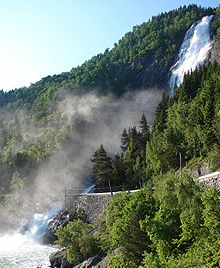
The Norwegian Scenic Routes ( Norwegian Nasjonale turistveger ) are 18 supraregional main and secondary roads in Norway that have been selected and upgraded by the Norwegian State Road Administration ( Statens vegvesen ) due to their picturesque landscape and tourist-friendly infrastructure of rest areas and viewpoints . The routes extend over a total length of 1850 km and run through all parts of Norway, with 12 of the 18 routes in the south-west of the country, which is particularly important for tourism. Several authorities coordinated the provision of accommodation, cultural activities, places to eat, shops selling local arts and crafts and nature experiences along the routes. The overall goal of the project is to strengthen tourism along these rather remote routes. It is worth mentioning the design of the individual rest areas by renowned designers and architects.
The Norwegian Scenic Routes have a length of 27 to 416 kilometers.
history
The project started in 1994 and was originally limited to the Sognefjellet , Gamle Strynefjellsvegen ( German Alte Strynefjell-Straße ), Hardanger and Helgelandskysten, the coastal road Fv17 through Helgeland . In 1997 these roads were officially designated as scenic routes and the following year the Norwegian Parliament decided to expand the project. Municipalities were asked to nominate appropriate routes, which resulted in 52 proposals with a total length of 8,000 km. Of these, 18 routes were then selected in 2004 with the aim of completing the necessary expansion measures by 2015 and opening the routes as landscape routes.
In the meantime (2017) all landscape routes are signposted and signposted as such. However, more rest areas are being planned and built (most recently the Utsikten viewpoint on the Gaularfjellet landscape route and an extensive renovation of the Vøringsfossen rest area on the Hardangervidda landscape route). The project should be finally completed in 2023. Then there will be over 200 resting and viewing areas along the routes.
layout
The expansion cost an estimated 800 million Norwegian kroner (approx. 100 million €) for the expansion of parking lots, rest areas, lookout points and landscaping. The architectural design of these places is intended to increase the visitor experience. While most of the architecture was designed by young Norwegians, the French-American sculptor Louise Bourgeois and the Swiss architect Peter Zumthor created rest stops in Varanger and Ryfylke . Works of art were installed in selected locations, including one by the US object artist Mark Dion . His work of art "DEN" stands at the rest area Vedahaugane and shows a bear lying in the affluent garbage.
As of 2012, all routes were signposted and officially opened. This year, the architecture magazine Topos honored the project with a special prize for its architecture and particularly emphasized that the public sector in particular had advocated aesthetic design.
Two routes are part of European routes : European route 10 through Lofoten and European route 75 through Varanger . Some mountain pass roads such as Sognefjellsvegen, Valdresflye and Trollstigen are closed in winter. Both sections of the Helgeland coastal route from Helgeland have two car ferries, whereas there is only one ferry on the Geiranger- Trollstigen route and three on the Ryfylke-Hardanger route. The routes from Andøya and Senja are connected by a car ferry between Andenes and Gryllefjord.
List of routes
The following list names the landscape routes that have been officially opened, are intended for this and will be expanded accordingly. The list contains the names of the streets, the beginning and the end of the route, their length and a brief description.
| Surname | photo | route | Provinces | Streets | length | description | Refs |
|---|---|---|---|---|---|---|---|
| Andøya |

|
Åkneskrysset– Andenes | North country | 974, 976, 82 | 51 km | The road runs along the west coast of Andøya , the northernmost island of the Vesterålen archipelago, with fishermen's huts between unpaved white sandy beaches. Norway's largest marshland is on the island; Whales, seals and bird rocks can be seen. The Senja landscape route can be reached by ferry. | |
| Atlanterhavsvegen |

|
Kårvåg– Bud | Møre and Romsdal | 64, 242, 663, 235, 238 | 36 km | Of Kårvåg according Vevang extending Atlantic Road between unprotected islands and warping is applied and connected by bridges, causeways and viaducts. The route continues along the coast of Hustadvika , known as the ship cemetery . | |
| Aurlandsfjellet |

|
Aurlandsvangen - Lærdalsøyri | Vestland | 243 | 47 km | The crossing of Aurlandsfjellet leads past the Lærdals tunnel , the longest road tunnel in the world. The barren mountain plateau offers a good view of the Aurlandsfjord, which is 600 meters lower . | |
| Gamle Strynefjellsvegen |

|
Grotli – Ospeli | Innlandet , Vestland | 258 | 27 km | The road, completed in 1894, connects the mountain villages of Skjåk municipality with the fjord settlements of Stryn . The route leads around glaciers in the east and over steep, furrowed topography in the west . Winter sports are possible well into summer. The street will not open until June. | |
| Gaularfjellet |

|
Balestrand –Moskog | Vestland | 13, 55 | 92 km | The route via Gaularfjellet offers an alternative between the Sogn district and the Sunnfjord. Starting from the Sognefjord , it leads past ponds, rapids and waterfalls, while the landscape changes from steep mountain slopes and fjords to protected valleys. | |
| Geiranger Trollstigen |

|
Langevatn – Sogge bru | Møre and Romsdal | 63 | 104 km | After climbing over the hairpin bends of the Trollstigen , the route descends again to the Geirangerfjord , a UNESCO World Heritage Site , until the road reaches Geiranger . | |
| Hardanger |

|
Halne - Steinsdalsfossen , Jondal - Utne , Kinsarvik - Tyssedal |
Vestland | 7, 550, 13 | 195 km | The route consists of three sections in Hardanger , which vary between fjords, moors, mountains and glaciers. The area is criss-crossed by waterfalls such as Vøringfossen and Steinsdalsfossen . The region is a trademark of Norwegian national romanticism . Traditional handicrafts and fruits are offered along the street. | |
| Havøysund |
|
Russelv– Havøysund | Troms and Finnmark | 889 | 66 km | While the route runs through arctic, unspoiled landscapes, the sea is on one side and the bare mountains on the other. The area is largely uninhabited with the exception of a few fishing villages such as Havøysund . | |
| lgelandskystene |
|
Stokkvågen – Storvika | North country | 17th | 129 km | An alternative to the European route 6 is the coastal north-south route through Helgeland . The lake side is lined with 14,000 islands, while the land side includes the Svartisen glacier and its side arm Engabreen, which drops from 1200 meters to the coast. To the north is the Saltstraumen Sound , the strongest tidal current in the world. | |
| Jæren |
|
Ogna -Bore | Rogaland | 44, 507 | 41 km | The route passes through on the coastline of Jæren along and offers a good view of sandy beaches and -dünen. Norway's largest plains are dominated by arable farming and well-kept cultivated landscapes . There are several lighthouses on the coast. | |
| Lofoten |

|
Fiskebøl– Å i Lofoten | North country | E10 , 82 | 164 km | The archipelago of Lofoten combines the open sea with straits, white beaches and steep, sharp mountains. The fishermen's hamlets not only contain manufacturing, but also preserve a living cultural heritage such as the Norwegian fishermen's huts known as rorbu . | |
| Rondane |

|
Ends - Folldal | Domestic | 27 | 48 km | The route has the Rondane National Park and the Rondane Massif on its east side and a cultural landscape on the west side. The well signposted mountains are dry and suitable for hiking and climbing. Also are on the route mines of Folldal . | |
| Ryfylke |
|
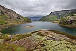
Oanes - Sauda - Horda | Rogaland | 13, 46, 520 | 183 km | The southern part of Ryfylke has a fertile landscape and archipelago that contrast with the rockfalls, cliffs, fjords and mountains. The landscape is supplemented by zinc mines in Allmannajuvet and the iron and steel industry in Sauda . The Pulpit Rock platform and its view of the Lysefjord are only a short detour away. | |
| Senja |
|
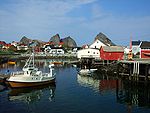
Gryllefjord – Botnhamn | Troms and Finnmark | 86, 862 | 84 km | The route follows the west coast of the island of Senja and crosses some fishing villages . It is connected to the Andøy landscape route via a ferry, which offers an alternative to European route 6 . | |
| Sognefjellet |

|
Lom - Gaupne | Innlandet , Vestland | 55 | 108 km | The Sognefjellet mountain pass is 1434 meters above sea level , making it the highest pass road in Northern Europe . The pass is only open in the summer months, as in May the snow is often still around 10 meters high on both sides of the road. Along the route you can see green mountain lakes, glaciers and mountain peaks fed by meltwater. The Jotunheimen and Jostedalsbreen National Parks can be reached via the route . | |
| Valdresflye |

|
Garli – Besstrond | Domestic | 51 | 37 km | Valdresflye is a mountain plateau whose roads reach a height of 1389 meters. From the plateau you have a view of the Jotunheimen National Park , while further down the road leads through a cultural landscape with alpine pastures . | |
| Varanger |

|
Varangerbotn– Hamningberg | Troms and Finnmark | E75 , 341 | 160 km | The route follows the east coast of the Varanger Peninsula and is bounded by the Barents Sea . In the south the road runs through protective birch forests and marshland, from the town of Vadsø the vegetation becomes rugged and barren. In winter, the coasts are ravaged by storms, freezing fog and arctic nights. In summer, the brief Siberian warmth mixes with the midnight sun . Cross-border trade has long been practiced in Varanger, mixing the cultures of Russians, Finns, Norwegians and Sami . |
Web links
- Official website
- Bernd F. Meier: Rest areas with art enjoyment . In: Manager Magazin . 15th July 2014.
- The Norwegian Scenic Routes . In: Elk burger .
Individual evidence
- ↑ a b c Bernd F. Meier: Norway's most beautiful streets: Art on the fjord. In: Der Spiegel . July 8, 2014, accessed December 13, 2014 .
- ↑ a b Om nasjonale turistveger. In: Norwegian Public Roads Administration. October 5, 2011, archived from the original on October 5, 2011 ; Retrieved December 23, 2018 (Norwegian).
- ↑ a b Dag Fonbæk: Her er de norske “Postkortveiene”. In: Verdens Gang . August 3, 2008, archived from the original on October 5, 2011 ; Retrieved December 23, 2018 (Norwegian).
- ↑ a b c d e f Robert Schäfer: The Norwegian National Tourist Routes (Norwegian) . In: Topos , August 6, 2012. Archived from the original on October 26, 2012. Retrieved on October 26, 2012.
- ^ A b Historikk ( Norwegian ) Norwegian Public Roads Administration. Archived from the original on October 5, 2011. Retrieved October 5, 2011.
- ↑ Nasjonale Turistveger: Frequently Asked Questions - National Tourist Routes. Retrieved December 19, 2017 .
- ↑ Bent Tanstad: Dette er dei vakraste vegan i lands (Norwegian) , Norsk rikskringkasting . July 1, 2012. Archived from the original on October 24, 2012. Retrieved on October 24, 2012.
- ↑ Hilde Mangstad Lorentsen: Ny internasjonal arkitekturpris til Norske turistveier (Norwegian) , NRK . September 27, 2012. Archived from the original on October 26, 2012. Retrieved on October 26, 2012.
- ^ A b Nasjonal turistveg Lofoten ( Norwegian ) Norwegian Public Roads Administration. Archived from the original on October 5, 2011. Retrieved October 5, 2011.
- ^ A b Nasjonal turistveg Varanger ( Norwegian ) Norwegian Public Roads Administration. Archived from the original on October 5, 2011. Retrieved October 5, 2011.
- ↑ a b Sognefjellet . Norwegian Public Roads Administration. Archived from the original on October 5, 2011. Retrieved October 5, 2011.
- ↑ a b Valdresflye . Norwegian Public Roads Administration. Archived from the original on October 5, 2011. Retrieved October 5, 2011.
- ↑ a b c Geiranger – Trollstigen . Norwegian Public Roads Administration. Archived from the original on October 5, 2011. Retrieved October 5, 2011.
- ↑ Helgelandskysten sør . Norwegian Public Roads Administration. Archived from the original on October 5, 2011. Retrieved October 5, 2011.
- ↑ a b Helgelandskysten north . Norwegian Public Roads Administration. Archived from the original on October 5, 2011. Retrieved October 5, 2011.
- ↑ a b Ryfylke . Norwegian Public Roads Administration. Archived from the original on October 5, 2011. Retrieved October 5, 2011.
- ↑ a b Hardanger . Norwegian Public Roads Administration. Archived from the original on October 5, 2011. Retrieved October 5, 2011.
- ^ A b Nasjonal turistveg Andøya ( Norwegian ) Norwegian Public Roads Administration. Archived from the original on October 5, 2011. Retrieved October 5, 2011.
- ^ Andøya . Norwegian Public Roads Administration. Archived from the original on October 5, 2011. Retrieved October 5, 2011.
- ↑ Nasjonal tu, ristveg Atlanterhavsveien ( nor ) Norwegian Public Roads Administration. Archived from the original on October 5, 2011. Retrieved October 5, 2011.
- ↑ Atlanterhavsveien . Norwegian Public Roads Administration. Archived from the original on October 5, 2011. Retrieved October 5, 2011.
- ^ Nasjonal turistveg Aurlandsfjellet ( Norwegian ) Norwegian Public Roads Administration. Archived from the original on October 5, 2011. Retrieved October 5, 2011.
- ^ Aurlandsfjellet . Norwegian Public Roads Administration. Archived from the original on October 5, 2011. Retrieved October 5, 2011.
- ^ Nasjonal turistveg Gamle Strynefjellsvegen ( Norwegian ) Norwegian Public Roads Administration. Archived from the original on October 5, 2011. Retrieved October 5, 2011.
- ↑ Gamle Strynefjellsvegen . Norwegian Public Roads Administration. Archived from the original on October 5, 2011. Retrieved October 5, 2011.
- ↑ Nasjonal turistveg Gaularfjellet ( Norwegian ) Norwegian Public Roads Administration. Archived from the original on October 5, 2011. Retrieved October 5, 2011.
- ↑ Gaularfjellet . Norwegian Public Roads Administration. Archived from the original on October 5, 2011. Retrieved October 5, 2011.
- ^ Nasjonal turistveg Geiranger – Trollstigen ( Norwegian ) Norwegian Public Roads Administration. Archived from the original on October 5, 2011. Retrieved October 5, 2011.
- ^ Nasjonal turistveg Hardanger ( Norwegian ) Norwegian Public Roads Administration. Archived from the original on October 5, 2011. Retrieved October 5, 2011.
- ^ Nasjonal turistveg Havøysund ( Norwegian ) Norwegian Public Roads Administration. Archived from the original on October 5, 2011. Retrieved October 5, 2011.
- ↑ Havøysund . Norwegian Public Roads Administration. Archived from the original on October 5, 2011. Retrieved October 5, 2011.
- ^ Nasjonal turistveg Helgelandskysten nord ( Norwegian ) Norwegian Public Roads Administration. Archived from the original on October 5, 2011. Retrieved October 5, 2011.
- ^ Nasjonal turistveg Jæren ( Norwegian ) Norwegian Public Roads Administration. Archived from the original on October 5, 2011. Retrieved October 5, 2011.
- ↑ Jæren . Norwegian Public Roads Administration. Archived from the original on October 5, 2011. Retrieved October 5, 2011.
- ↑ Lofoten . Norwegian Public Roads Administration. Archived from the original on October 5, 2011. Retrieved October 5, 2011.
- ^ Nasjonal turistveg Rondane ( Norwegian ) Norwegian Public Roads Administration. Archived from the original on October 5, 2011. Retrieved October 5, 2011.
- ↑ Rondane . Norwegian Public Roads Administration. Archived from the original on October 5, 2011. Retrieved October 5, 2011.
- ^ Nasjonal turistveg Ryfylke ( Norwegian ) Norwegian Public Roads Administration. Archived from the original on October 5, 2011. Retrieved October 5, 2011.
- ^ Nasjonal turistveg Senja ( Norwegian ) Norwegian Public Roads Administration. Archived from the original on October 5, 2011. Retrieved October 5, 2011.
- ↑ Senja . Norwegian Public Roads Administration. Archived from the original on October 5, 2011. Retrieved October 5, 2011.
- ^ Nasjonal turistveg Sognefjellsvegen ( Norwegian ) Norwegian Public Roads Administration. Archived from the original on October 5, 2011. Retrieved October 5, 2011.
- ↑ Nasjonal turistveg Valdresflye ( Norwegian ) Norwegian Public Roads Administration. Archived from the original on October 5, 2011. Retrieved October 5, 2011.
- ↑ Varanger . Norwegian Public Roads Administration. Archived from the original on October 5, 2011. Retrieved October 5, 2011.