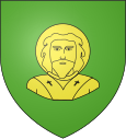
Saint-Rimay
| Saint-Rimay | ||
|---|---|---|

|
|
|
| region | Center-Val de Loire | |
| Department | Loir-et-Cher | |
| Arrondissement | Vendôme | |
| Canton | Montoire-sur-le-Loir | |
| Community association | Territoires Vendômois | |
| Coordinates | 47 ° 46 ' N , 0 ° 55' E | |
| height | 65-125 m | |
| surface | 7.36 km 2 | |
| Residents | 291 (January 1, 2017) | |
| Population density | 40 inhabitants / km 2 | |
| Post Code | 41800 | |
| INSEE code | 41228 | |
Saint-Rimay is a French municipality with 291 inhabitants (as of January 1 2017) in the department of Loir-et-Cher in the region Center-Val de Loire . It belongs to the arrondissement of Vendôme and is part of the canton of Montoire-sur-le-Loir .
geography
Saint-Rimay is located about 48 kilometers north-northeast of Tours and about 40 kilometers northwest of Blois on the Loir , which borders the municipality to the north and west. Saint-Rimay is surrounded by the neighboring communities of Lunay in the north, Thoré-la-Rochette in the east and northeast, Houssay in the south and east, Villavard in the south, Montoire-sur-le-Loir in the west and Les Roches-l'Évêque in the northwest .
history
Second World War
On May 1, 1942, a Führer headquarters under the name Wolfsschlucht III was established in Saint-Rimay . However, it was not used.
Population development
| 1962 | 1968 | 1975 | 1982 | 1990 | 1999 | 2006 | 2013 |
| 318 | 317 | 284 | 292 | 323 | 311 | 295 | 290 |
| Source: Cassini and INSEE | |||||||
Attractions
- Saint-Rimay church

