
Saint-Yon
| Saint-Yon | ||
|---|---|---|
.svg)
|
|
|
| region | Île-de-France | |
| Department | Essonne | |
| Arrondissement | Etampes | |
| Canton | Arpajon | |
| Community association | Entre Juine et Renarde | |
| Coordinates | 48 ° 34 ' N , 2 ° 11' E | |
| height | 52-154 m | |
| surface | 4.66 km 2 | |
| Residents | 894 (January 1, 2017) | |
| Population density | 192 inhabitants / km 2 | |
| Post Code | 91650 | |
| INSEE code | 91581 | |
| Website | http://www.mairiedesaint-yon.fr/ | |
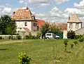
_mairie_1121.jpg) Saint-Yon town hall |
||

Saint-Yon is a commune with 894 inhabitants (as of January 1 2017) in the department of Essonne in the region of Ile-de-France ; it belongs to the arrondissement of Étampes and the canton of Arpajon (until 2015: canton of Saint-Chéron ). The inhabitants are called Saint-Yonais .
geography
Saint-Yon is located about 28 kilometers south-southwest of Paris on the Renarde River , which forms the western boundary of the municipality and where it meets the Orge . Saint-Yon is surrounded by the neighboring communities of Breuillet in the north and north-west, Égly in the north and north-east, Boissy-sous-Saint-Yon in the east, Saint-Sulpice-de-Favières in the south and Breux-Jouy in the west and south-west.
Population development
| year | 1962 | 1968 | 1975 | 1982 | 1990 | 1999 | 2006 | 2012 |
| Residents | 315 | 289 | 363 | 504 | 770 | 811 | 876 | 889 |
| Source: Cassini and INSEE | ||||||||
Attractions
See also: List of Monuments historiques in Saint-Yon
- Saint-Yon church
- Former infirmary from the 15th / 16th centuries Century, since 1979 Monument historique
- Wash house

Saint-Yon church
Old infirmary

Wash house

,_l%C3%A9proserie_de_la_Madeleine_3.jpg)
,_lavoir_pr%C3%A8s_de_la_mairie_2.jpg)
Personalities
- Bénédict Augustin Morel (1809–1873), psychiatrist
literature
- Le Patrimoine des Communes de l'Essonne. Flohic Éditions, Volume 2, Paris 2001, ISBN 2-84234-126-0 , pp. 892-893.