Angerville (Essonne)
| Angerville | ||
|---|---|---|

|
|
|
| region | Île-de-France | |
| Department | Essonne | |
| Arrondissement | Etampes | |
| Canton | Etampes | |
| Community association | Étampois Sud Essonne | |
| Coordinates | 48 ° 19 ′ N , 2 ° 0 ′ E | |
| height | 113-146 m | |
| surface | 25.83 km 2 | |
| Residents | 4,270 (January 1, 2017) | |
| Population density | 165 inhabitants / km 2 | |
| Post Code | 91670 | |
| INSEE code | 91016 | |
| Website | http://www.mairie-angerville.fr/ | |
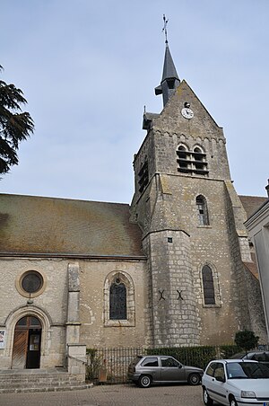
 Saint-Pierre-et-Saint-Eutrope church |
||
Angerville is a French village with 4270 inhabitants (at January 1, 2017) in the department of Essonne in the region of Ile-de-France ; it belongs to the Arrondissement of Étampes and the Canton of Étampes .
Neighboring municipalities of Angerville are Monnerville in the north, Le Mérévillois in the east, Autruy-sur-Juine in the south-east, Andonville in the south, Rouvray-Saint-Denis in the south-west, Gommerville and Intréville in the west and Pussay in the north-west.
Districts and settlements
- Dommerville (see Dommerville Castle )
- Villeneuve-le-Bœuf (see also St-Roch church )
- Brigeolet
- Les Hurepoix
- Les Tramways
- Quartier de l'Europe
history
The place was founded in the 12th century as villa nova by Abbot Suger of the Abbey of Saint-Denis .
Population development
| year | 1962 | 1968 | 1975 | 1982 | 1990 | 1999 | 2009 |
| Residents | 1781 | 1926 | 2597 | 2622 | 3012 | 3262 | 3573 |
Attractions
See also: List of Monuments historiques in Angerville (Essonne)
- Dommerville Castle , built from 1777 to 1782 ( Monument historique since 1977)
- Church Saint-Pierre-Saint-Eutrope (12th century)
- Church Saint-Germain in Dommerville (the 12th century)
- Chapel of Saint-Roch in Villeneuve (12th century)
Personalities
- Henri-Alexandre Tessier (1741–1837), medic, born in Angerville
- Charles Philippe Louis de Hallot (* 1709), Lieutenant General , built Dommerville Castle
literature
- Le Patrimoine des Communes de l'Essonne. Flohic Éditions, Paris 2001, 2 volumes, ISBN 2-84234-126-0 , pp. 627–634.
Web links
Commons : Angerville - collection of images, videos and audio files
