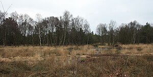
A Thousand Step Bog
|
A Thousand Step Bog
|
||
| location | Northwest of Haren | |
| surface | 65.5 ha | |
| Identifier | NSG WE 190 | |
| WDPA ID | 165840 | |
| Geographical location | 52 ° 49 ' N , 7 ° 11' E | |
|
|
||
| Sea level | from 8 m to 13 m | |
| Setup date | 17th December 1988 | |
| administration | NLWKN | |
The thousand step moor is a nature reserve in the Lower Saxony town of Haren (Ems) in the Emsland district .
The nature reserve with the sign NSG WE 190 is 65.5 hectares in size. It has been a nature reserve since December 17, 1988. The responsible lower nature conservation authority is the district of Emsland.
The two-part conservation area is located northwest of Haren (Ems). The smaller, eastern part of the protected area borders directly on the Haren-Rütenbrock Canal in the west , the larger, western part borders on the federal highway 408 in the northeast and on the district road 225 in the northwest .
The residue of a predominantly non-cultivated, but some is put under protection were dug bog area. The western region is doing after the rewetting of cotton grass and peat moss , as well as places also moorland with moor grass , broom and bell heather coined. Bog forest is developing in the eastern area . In the peripheral areas of both areas there are partly agricultural areas .


