Etang-sur-Arroux
| Etang-sur-Arroux | ||
|---|---|---|
|
|
||
| region | Bourgogne-Franche-Comté | |
| Department | Saône-et-Loire | |
| Arrondissement | Autun | |
| Canton | Autun-2 | |
| Community association | Grand Autunois Morvan | |
| Coordinates | 46 ° 52 ' N , 4 ° 11' E | |
| height | 266-433 m | |
| surface | 34.63 km 2 | |
| Residents | 1,858 (January 1, 2017) | |
| Population density | 54 inhabitants / km 2 | |
| Post Code | 71190 | |
| INSEE code | 71192 | |
| Website | http://www.etang-sur-arroux.fr/ | |
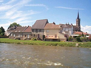
 View of Étang-sur-Arroux |
||
Etang-sur-Arroux is a French commune with 1,858 inhabitants (as of January 1 2017) in the department of Saone-et-Loire in the region of Bourgogne Franche-Comté . The municipality belongs to the Arrondissement of Autun and the canton of Autun-2 (until 2015: canton of Saint-Léger-sous-Beuvray ).
geography
Étang-sur-Arroux is located on the Arroux River , into which the Mesvrin flows, in the Morvan Regional Nature Park . Étang-sur-Arroux is surrounded by the neighboring communities of Laizy in the north, Mesvres in the east, La Chapelle-sous-Uchon in the south-east, La Tagnière in the south and south-east, Saint-Nizier-sur-Arroux in the south and south-west, Saint-Didier- sur-Arroux in the southwest and La Comelle in the west.
The former route nationale 494 (today's D994) runs through the municipality .
Population development
| 1962 | 1968 | 1975 | 1982 | 1990 | 1999 | 2006 | 2012 | |
|---|---|---|---|---|---|---|---|---|
| 1,587 | 1,524 | 1,567 | 1,760 | 1,835 | 1,836 | 1.927 | 1.936 | |
| Sources: Cassini and INSEE | ||||||||
Attractions
- former Saint-Pierre church from the 11th century
- five-arch bridge
- La Perrière Castle
- House Le Passeur
