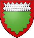
Auberchicourt
| Auberchicourt | ||
|---|---|---|

|
|
|
| region | Hauts-de-France | |
| Department | North | |
| Arrondissement | Douai | |
| Canton | Aniche | |
| Community association | Cœur d'Ostre event | |
| Coordinates | 50 ° 20 ' N , 3 ° 14' E | |
| height | 21-63 m | |
| surface | 7.12 km 2 | |
| Residents | 4,448 (January 1, 2017) | |
| Population density | 625 inhabitants / km 2 | |
| Post Code | 59165 | |
| INSEE code | 59024 | |
| Website | http://www.auberchicourt.fr/ | |
 Town Hall ( Hôtel de ville ) |
||
Auberchicourt is a French municipality with 4448 inhabitants (as of January 1 2017) in the department of Nord in the region of Hauts-de-France . It belongs to the Arrondissement of Douai and the Canton of Aniche . The inhabitants are called Auberchicourtois (es) .
geography
Auberchicourt is about twelve kilometers east-southeast of Douai . Auberchicourt is surrounded by the neighboring communities of Écaillon in the north and north-west, Bruille-lez-Marchiennes in the north and north-east, Aniche in the east, Émerchicourt in the south-east, Monchecourt in the south and south-west and Masny in the west.
The former Route nationale 45 (formerly Route nationale 43A, today's Départementstrasse 645) opens up the community.
history
In the documents of the Abbey of Saint-Sauveur of Anchin in 1079 Obercicurtis villa is mentioned.
Population development
| year | 1962 | 1968 | 1975 | 1982 | 1990 | 1999 | 2006 | 2017 |
| Residents | 5085 | 5369 | 5292 | 4826 | 4733 | 4556 | 4569 | 4448 |
Attractions
- Notre-Dame de la Visitation church from the 17th century
- Colliery No. 125A, Sainte Marie Ouest, has been part of the UNESCO World Heritage Site of Northern France Coal Mining District since 2012
- British military cemetery from October 1918
literature
- Le Patrimoine des Communes du Nord. Flohic Editions, Volume 1, Paris 2001, ISBN 2-84234-119-8 , p. 644.
Web links
- Monuments historiques (objects) in Auberchicourt in the base Palissy of the French Ministry of Culture

