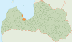
Engure district
| Engure district | ||
|---|---|---|
 |
||
| Symbols | ||
|
||
| Basic data | ||
| Country | Latvia | |
| Capital | Smārde | |
| surface | 397.9 km² | |
| Residents | 8045 (2010) | |
| density | 20 inhabitants per km² | |
| founding | 2009 | |
| ISO 3166-2 | LV-029 | |
| Website | www.enguresnovads.lv (Latvian) | |
Coordinates: 57 ° 4 ′ N , 23 ° 15 ′ E
The District Engure (Engures novads) is located in western Latvia on the Gulf of Riga in the historic landscape Semgallen .
geography
The area is located on the Bay of Riga between Lake Engure in the north and Lake Kaņieris in the southeast. This southeastern part belongs to the Ķemeri National Park . The Torņakalns – Tukums railway also runs through this part of the district. One of the highest mountains in Courland, the Hüningsberg ( Milzukalns in Latvian ) is also located in the district.
population
The district consists of the three municipalities (pagasts) Engure , Lapmežciems and the administrative center Smārde . 8045 inhabitants (2010) live in the Engure district.
