
Kettershausen
| coat of arms | Germany map | |
|---|---|---|

|
Coordinates: 48 ° 11 ' N , 10 ° 16' E |
|
| Basic data | ||
| State : | Bavaria | |
| Administrative region : | Swabia | |
| County : | Unterallgäu | |
| Management Community : | Babenhausen | |
| Height : | 545 m above sea level NHN | |
| Area : | 26.69 km 2 | |
| Residents: | 1754 (Dec. 31, 2019) | |
| Population density : | 66 inhabitants per km 2 | |
| Postal code : | 86498 | |
| Area code : | 08333 | |
| License plate : | MN | |
| Community key : | 09 7 78 221 | |
| Community structure: | 7 parts of the community | |
| Association administration address: | Marktplatz 1 87727 Babenhausen |
|
| Website : | ||
| Mayor : | Markus Koneberg ( Free Association of Voters ) | |
| Location of the municipality of Kettershausen in the Unterallgäu district | ||
  |
||

Kettershausen is a municipality and its main town in the Swabian district of Unterallgäu and a member of the Babenhausen administrative community .
geography
The village is located about 35 kilometers southeast of Ulm and 25 kilometers north of Memmingen in the Donau-Iller region in Central Swabia . The community area consists for the most part of open fields, in the west it includes parts of the Oberrother forest. The Günz flows through it in a south-north direction . The place Kettershausen has been structurally connected to the southern part of Bebenhausen since at least the 19th century. The federal road 300 crosses the municipality and the main town.
Parish parts
The municipality has 7 officially named municipality parts (former municipalities with their former districts) :
- the church village of Bebenhausen
- the parish village of Kettershausen
- the parish village of Mohrenhausen
- the parish village of Tafertshofen with the village of rivers and the wasteland of Gangwalden
- the parish village of Zaiertshofen
The former municipalities correspond to the current districts .
history
Until the church is planted
Kettershausen was first mentioned in a document in 1162. Since the late Middle Ages , the Roggenburg Abbey in particular can be traced as the owner of the places in today's municipal area . In the 15th and 16th centuries, the Lords of Freyberg and the Cistercian monastery in Stams in Tyrol also played an important role in the history of the community. From the 16th century, the Fugger-Babenhausen princes acquired most of the municipality. From 1556 to 1806 Kettershausen was the seat of an upper and lower court of the Fugger rule of the same name.
With the Rhine Confederation Act 1806, the place came to the Kingdom of Bavaria . In 1818 the political municipality was established.
Territorial reform of the 1970s
Until the regional reform in Bavaria , the community belonged to the district of Illertissen . On July 1, 1972, she joined the newly formed Illerkreis, whose name was changed on 1973 to Neu-Ulm district . In 1978 Kettershausen was reclassified to the Unterallgäu district.
On January 1, 1972, the previously independent communities of Mohrenhausen, Zaiertshofen and Tafertshofen were incorporated, Bebenhausen followed on May 1, 1978.
Population development
- 1961: 1724 inhabitants
- 1970: 1695 inhabitants
- 1987: 1621 inhabitants
- 1991: 1693 inhabitants
- 1995: 1716 inhabitants
- 2000: 1746 inhabitants
- 2005: 1747 inhabitants
- 2010: 1742 inhabitants
- 2015: 1745 inhabitants
Between 1988 and 2018 the community grew from 1596 to 1728 by 132 inhabitants or 8.3%.
politics
Mayoress
Markus Koneberg (Free Voting Association) has been mayor since May 1, 2020; he was elected with 88.9% of the vote. His predecessor was Susanne Schewetzky (* 1977) from May 2014 to April 2020, who did not apply for re-election.>
Municipal council
In the local elections on March 15, 2020 , the Free Voters 'Association Kettershausen won ten seats (83.4%) and the Free Voters' Association Tafertshofen two seats (16.6%). The distribution of seats remained unchanged as in the previous term from 2014 to 2020.
coat of arms
The municipal coat of arms was approved by the government of Swabia on June 7, 1983.
Blazon : "Under a blue shield head, inside three golden balls next to each other, in silver a looped blue tip, inside a golden heraldic lily, on the right of the red crook of an abbot's staff, on the left of a red rye ear." The coat of arms connects the coats of arms of the former owners , that of the Freyberg family (three golden spheres on a blue background) with the abbot's staff, which can be understood as a reference to the Stams monastery, and the rye ear from the Roggenburg monastery coat of arms. The golden heraldic lily in the blue field is taken from the coat of arms of the Fugger von Babenhausen. The design of the coat of arms comes from Pastor Johann Zahner from Kettershausen and the design was done by Peter Ziller from Tutzing.
flag
The flag is striped red, yellow and blue with the municipal coat of arms.
Culture and sights

- Catholic parish church of St. Michael with uniform, well-preserved neo-Romanesque furnishings from the 19th century
- Keltenschanze, about 2 km northwest on the road to Unterroth
Economy and Infrastructure
Economy including agriculture and forestry
In 1998, according to official statistics in the manufacturing industry 57 and in the trade and transport sector, there were no employees at work subject to social security contributions. In other economic areas, 17 people were employed at the place of work subject to social security contributions. There were 596 employees at the place of residence subject to social security contributions. There were none in the manufacturing sector and three in the construction sector. In addition, there were 81 farms in 1999 with an agricultural area of 1728 hectares, of which 918 were arable land and 810 were permanent green areas.
education
In 1999 the following institutions existed:
- Kindergartens: 50 kindergarten places with 56 children
- Elementary school: one with seven teachers and 140 students
Personalities
- Sixtus Bachmann (1754–1825) Baroque composer, Premonstratensian. Born in Kettershausen. Sixtus-Bachmann-Strasse in Kettershausen is named after him.
- Balthasar Gossner (1877–1937), mineralogist and crystallographer, born in Zaiertshofen

Bebenhausen

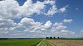
Günzstausee near Kettershausen
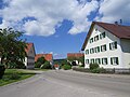
Main street in Kettershausen
Kettershausen from the south

Marienkapelle on the B 300 near Kettershausen

Mohrenhausen

Tafertshofen from the east

Zaiertshofen


Web links
- Entry on the coat of arms of Kettershausen in the database of the House of Bavarian History
- Kettershausen: Official statistics of the LfStat (PDF; 1 MB)
Individual evidence
- ↑ "Data 2" sheet, Statistical Report A1200C 202041 Population of the municipalities, districts and administrative districts 1st quarter 2020 (population based on the 2011 census) ( help ).
- ^ Community Kettershausen in the local database of the Bavarian State Library Online . Bavarian State Library, accessed on August 16, 2019.
- ^ Wilhelm Volkert (ed.): Handbook of Bavarian offices, communities and courts 1799–1980 . CH Beck, Munich 1983, ISBN 3-406-09669-7 , p. 488 .
- ↑ a b c Federal Statistical Office (ed.): Historical municipality directory for the Federal Republic of Germany. Name, border and key number changes in municipalities, counties and administrative districts from May 27, 1970 to December 31, 1982 . W. Kohlhammer, Stuttgart / Mainz 1983, ISBN 3-17-003263-1 , p. 790 .
- ↑ Second votes, according to the source www.wahlen.bayern.de, accessed on March 4, 2018

Amberg |
Apple trach |
Babenhausen |
Bad Grönenbach |
Bad Wörishofen |
Benningen |
Boars |
Boos |
Breitenbrunn |
Buxheim |
Dirlewang |
Egg an der Günz |
Eppishausen |
Erkheim |
Ettringen |
Fellheim |
Hawangen |
Heimertingen |
Holzgünz |
Kammlach |
Kettershausen |
Kirchhaslach |
Kirchheim in Swabia |
Kronburg |
Laughter |
Arbors |
Lautrach |
Legau |
Market Rettenbach |
Market forest |
Memmingerberg |
Mindelheim |
Niederrieden |
Oberrieden |
Oberschönegg |
Ottobeuren |
Pfaffenhausen |
Pleas |
Rammingen |
Salgae |
Sontheim |
Stetten |
Trunkelsberg |
Türkheim |
Tussenhausen |
Ungerhausen |
Unteregg |
Westerheim |
Wiedergeltingen |
Winter peace |
Wolfertschwenden |
Woringen
Municipality-free area in the district of Unterallgäu
Ungerhauser Wald