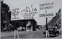
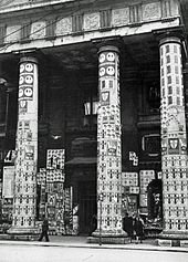
Trieste Free Territory
|
Free Territory of Trieste 1947–1954 Territorio libero di Trieste Svobodno tržaško ozemlje Slobodan teritorij Trsta |
|||||
|---|---|---|---|---|---|
|
|||||
|
|||||
| Constitution |
Permanent Statute of the Free Territory of Trieste (de jure, never entered into force) Provisional Statute of the Free Territory of Trieste (de facto) |
||||
| Official language |
Italian, Slovenian, Croatian, English (administrative only) |
||||
| Capital | Trieste | ||||
| Seat of government | Trieste ( Zone A ) Koper ( Zone B ) |
||||
| Form of government | federal , constitutional republic | ||||
| Government system |
Directory system (zone A only) (de jure) Military government (de facto) |
||||
| Head of state | Governor (never appointed) | ||||
|
Head of government (de facto) |
British military commander in Zone A Terence Sydney Airey (1947–1951) Thomas Willoughby Winterton (1951–1954) Yugoslav military commander in Zone B Mirko Lenac (1947–1951) Miloš Stamatović (1951–1954) |
||||
| surface | 738 km² | ||||
| Residents | 330,000 (1946) 375,000 (1947) |
||||
| Population density | 447 inhabitants / km² | ||||
| currency |
Trieste Lira Italian Lira (Zone A only) Yugoslav Dinar (Zone B only) |
||||
| founding | September 15, 1947 (signing of the treaties of the Paris Peace Conference 1946 ) |
||||
| resolution | October 5, 1954 (London Memorandum) |
||||
| National anthem |
Marcia Reale (1947) Viva San Giusto (1947–1954) |
||||
| Time zone | CET | ||||
|
|||||
Coordinates: 45 ° 38 ' N , 13 ° 48' E
The Free Territory of Trieste (official full form Free Territory of Trieste ) (abbreviation FTT ; Italian Territorio libero di Trieste , abbreviation TLT ; Slovene Svobodno tržaško ozemlje , abbreviation STO ; Croatian Slobodan teritorij Trsta , abbreviation STT ) was a constitutional republic in southern and central Europe on the Gulf of Trieste , which was militarily occupied and administered by the United States , the United Kingdom and Yugoslavia and was divided into two partially sovereign zones ( A and B ). The federal state was founded at the beginning of 1947 on the initiative of the Allies because of the Italian-Slovenian ethnic group conflicts and was at that time the largest of the seven European dwarf states in terms of area . The capital and largest city was Trieste .
Under international law, legitimized by the Paris Peace Conference in 1946 and a peace treaty between the Allies of World War II and the Kingdom of Italy (from June 1946 Republic ) the Free Territory of Trieste on 15 September 1947, as a representative democracy with a directorial system proclaimed. The never appointed governor was to serve as head of state and the people's assembly as a unicameral parliament.
The history and politics of the small state could be divided into three sections. From 1947 to 1948, the country was consolidated through the introduction of independent state institutions. In the course of the Cold War in 1948–1953, the occupying power in each case led to a comprehensive decentralization of the territory, which in fact prevented the emergence of a unified national territory. Thereafter, after mass demonstrations , which were brutally suppressed, from 1953 on the dissolution of the state appeared, which in October 1954 led to the division of the territory between Italy and Yugoslavia.
Country name
The official name of the state was Trieste in German Free Territory . The extended official full form was the Free Territory of Trieste .
The name goes back to the Paris Peace Conference of 1946. There the various parties declared Trieste to be a “free area” or a “free city” (like Danzig 1920–1939). The country name was only adopted when the state was founded in 1947. In order to express the sovereignty and neutrality of the state, the National People's Assembly decided to include the name Free Territory of Trieste in a permanent statute . However, this constitution never came into force.
Using the widespread abbreviation Trieste led to the mistaken idea that the territory was merely a city-state . Other unofficial names were Free Area Trieste , Free State of Trieste and Free City of Trieste .
geography
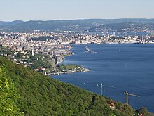
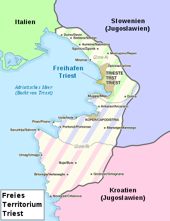
The Free Territory of Trieste formed a land bridge between Istria and the Italian city of Duino-Aurisina on the northeastern edge of the Adriatic Sea . It was geographically part of both southern and central Europe . The country bordered Italy to the northwest , Yugoslavia to the east and south, and the Adriatic Sea to the west.
The territory - de facto a small, neutral buffer state - was the largest of the then seven European dwarf states with an area of 738 km² . The country could be divided into two geographical regions. The Zone A , today province of Trieste , and Zone B , now part of the Slovenian region Obalno-kraška and the Croatian Istria . The two regions were then occupied by British and US soldiers (Zone A) and Yugoslav soldiers (Zone B), respectively.
Zone A was a stretch of coast up to Duino-Aurisina to establish a connection with Italy. It included the capital Trieste ( Trieste in Italian ) and its surrounding area. The region had an area of 222.5 km² and was 45 km long and about 5 to 15 km wide. In the north of the strip was the Karst (Italian: Carso ), a hilly landscape that was interspersed with many caves. The best known was the Grotta Gigante ("giant cave"). Zone B followed the border river Dragonja / Dragogna in the south . This area had an area of 515.5 km² and was located on the Istrian peninsula.
The main rivers in the country were Risana , Dragogna , Timavo , Rosandra and Quieto . The highest point was the Monte Cocusso / Kokos with 668 meters above the Adriatic Sea .
The northernmost point of the motherland of the territory was at Medjavas near Duino at 45 ° 48 ', the southernmost at Porto Quieto at 45 ° 18' north latitude . The westernmost point was the Punta Salvore at 13 ° 29 ', the easternmost point was at Gročana at 13 ° 55' east longitude .
history
Prehistory of the creation of the territory
Until the end of the First World War, the area of the later Free Territory of Trieste was part of a crown land of Austria-Hungary , the coastal country whose most important port was Trieste . The inhabitants of Trieste and the cities of Istria were mostly Italians , the rural areas of Istria and the Karst region around Trieste were mostly populated by Slavs , in the north by Slovenes and in the southwest by Croats . There was also a German-speaking minority in some cities, especially in Trieste . More than 80 percent of the FTT's residents spoke Italian, which also included Friulian and Venetian , 11% spoke Slovenian, 5% Croatian, and 1% German.
Istria, which was occupied by the Kingdom of Italy at the end of the war in 1918, was formally annexed with Trieste and parts of what is now Slovenia in 1921 . In 1925, the port city of Fiume, now part of Croatia, followed on the Kvarner Bay (Italian: Quarnero ), where the Free State of Fiume had existed a few years earlier . The neighboring Carniola and Dalmatia were largely absorbed in 1918/1919 in the newly founded Kingdom of Serbs, Croats and Slovenes ("SHS State", from 1929 Kingdom of Yugoslavia ).
With the division of the former Austro-Hungarian territories under Italy and the SHS state, a profound Italianization or Slavization by the governments under Mussolini and Karađorđević began. The respective linguistic minorities and their culture were massively oppressed and discriminated against by Italians and Yugoslavs in the 1920s and 1930s. This particularly affected the Slavic-speaking population on the Karst , the Italian in Dalmatia and the German-speaking minorities in Marburg and Gottschee . Again and again there were violent anti-Slav riots in Italy and anti-German and anti-Italian in the SHS state. On July 13, 1920 - one year before the area was formally annexed - the house of a Slovenian association ( Narodni dom ) in Trieste was burned down as a retaliatory measure after unrest in the Dalmatian port city of Split , which is part of the SHS state (Italian Spalato ) two Italian seamen were shot dead by Yugoslav security forces.
Many Slovenes and Croats emigrated to the Yugoslav SHS state, while others were involved in the Slavic terrorist organization TIGR ( acronym from Trst, Istra, Gorica in Reka - "Trieste, Istria, Gorizia and Rijeka") founded in 1924 , which in committed over 100 terrorist attacks in the 1920s and 1930s . Likewise, numerous Italian and German-speaking residents of Yugoslavia emigrated to Italy or Austria because they were also exposed to discrimination and persecution in the SHS state.
Italy fought on the side of Germany in the Second World War until the collapse of the fascist regime of Benito Mussolini in 1943 . After the capitulation of Italy in September 1943, the area of Trieste was occupied by the Wehrmacht and part of the Adriatic Coastal Operation Zone .
On May 1, 1945, Trieste was occupied by the Fourth Yugoslav Army and the Ninth Slovenian Corps. It was not until May 2nd that New Zealand and British units reached the city. The Yugoslav troops left Trieste on June 12th under international pressure.

Independence and consolidation of the state
On 10 January 1947, decided by the United Nations Security Council in Resolution 16 almost unanimously the creation of the Free Territory of Trieste. The date for the founding of the state was still open.
On February 10, 1947, representatives of the Allies of the Second World War signed a peace treaty with the new Italian republic in Paris , which provided for the establishment of the Free Territory for September 15, 1947. The territory should exist as a neutral state under the protection of the United Nations and be divided into two zones.
On September 15, 1947, the day the Italian-Allied peace treaty came into force, the Free Territory of Trieste was proclaimed by Terence Sydney Airey , the British governor of Zone A , with "Proclamation No. 1." There was a solemn military ceremony to mark the founding of the state and there were celebrations throughout the new state. On the same day, the provisional constitution of the area came into force with the Provisional Statute (officially “Document of the Provisional Government of the Free Territory of Trieste”). Then there was a comprehensive consolidation of the state. Switzerland with its directory system served as a structural model .
Between 1947 and 1948, the Trieste lira was introduced as its own currency , its own state symbols (flag, coat of arms and the national anthem Inno di San Giusto ), its own postal system , a banking system , a series of postage stamps , its own license plates , its own state railway company was established, and a comprehensive security apparatus was launched called and created its own parliament .
However, the establishment of the new territory soon took a hit. Between October 1947 and March 1948, the Soviet Union rejected the candidacy of 12 nominations for governor proposed by the United States, the United Kingdom and France . Since it was still not possible to agree on a governor afterwards, the two commanders of the zones Terence Sydney Airey (A) and Mirko Lenac (B) in their capacity as military governors with the establishment of a "provisional administration" for the period up to the appointment a governor appointed by the UN Security Council . In this way, they had actually been given the role of head of government . This temporary arrangement lasted until the territory was dissolved in 1954.
In the wake of the beginning of the Cold War and resurgent nationalist demands for the return of the entire Free State with the rest of Istria to Italy, which the country had to cede in 1946, tensions arose between the British and US administrations that supported Italy on the one hand, and the Yugoslavian, which received ideological support from the Soviet Union until Tito's break with Stalin in 1948 , on the other. Tito then pursued a policy of linking the entire territory to the Yugoslav state. Yugoslavia's governor Mirko Lenac then demanded more rights for Zone B and refused to give up any further power to the apparently western-dominated decentralized unitary state . With this he ended the efforts to create a unified state.
Decentralization and instability
The de facto Yugoslav termination of the unification process of the territory in 1948 led to a rethink in the United States and the United Kingdom. With the approval of the UN, the establishment of a constitution for Trieste, which was already ready with the permanent statute , was put on hold and the appointment of a governor was delayed.
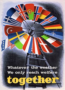
On June 28, 1948, increasing tensions between Yugoslavia and the Soviet Union led to Tito's break with Stalin. The attitude of the Yugoslav administration remained largely unchanged. Instead, it continued to isolate itself. Nevertheless, there was a certain amount of cooperation. After the Soviet-Yugoslav break, the USA supported the Free Territory and Yugoslavia with aid deliveries and generous loans from autumn 1948 as part of the Marshall Plan . For this purpose, Western European ships were also allowed to call at the port of Koper .
In June 1949 there were elections in Trieste. They were set by the People's Assembly in consultation with the British military commander Terence Sydney Airey . Although the entire population was supposed to participate, the elections only took place in Zone A. The conservative and pro-Italian Democrazia Cristiana emerged as the winner with 39% . The Partito Comunista del Territorio Libero di Trieste , which had already taken power in Zone B and was financially supported by Yugoslavia, received over 21%. The result of the elections reflected the internal instability of the territory. A government could not be formed because the various parties refused to work with other parties because of their ideology or their program. The Christian Democrats (Democrazia Cristiana) did not want to work with the Partito Comunista del TLT. The republicans refused to cooperate with the monarchists, who wanted to reestablish the Kingdom of Italy under the House of Savoy or at least demanded the creation of a new "Trieste monarchy". The three great successes of the monarchists in the territory were the installation of the Marcia Reale ("Royal March") as a short-term national anthem in 1947 and the proposed monetary system with the coins and notes of the two former kingdoms of Yugoslavia and Italy in 1948, which was adopted by the two occupying powers .
The elections of 1949, which were largely symbolic and politically inconclusive, finally led to the administrative loosening of the previous central state. The British-American and Yugoslav military administrations endowed the civil governments of the two zones with ever more powers. The power of the popular assembly, on the other hand, was undermined. The introduction of the two different nationalities TS (for zone A) and STT (for zone B) marked the high point of federalization . There was also an internal division economically. After the civil government of Zone A decided to recognize the Lira of the Republic of Italy as an equivalent currency in addition to the Trieste lira , whose coins and notes came from the time of the Kingdom of Italy , the Yugoslav military administration approved the introduction of the Yugoslav dinar as the second currency of the Zone B. So the territory had three currencies, only one of which was valid in the entire national territory.
population
According to estimates by the Allied Military Government, Zone A had 310,000 inhabitants in 1949, including 239,200 Italians and 63,000 Slovenes.
The Yugoslav census of 1945 showed a population of 67,461 for the later zone B, including 30,789 Slavs, 29,672 Italians and 7,000 inhabitants of unknown nationality. Today's Italian sources assume a significantly higher proportion of the Italian population - 54,000 Italians, 12,000 to 17,000 Slavs - while Slovenian sources speak of a higher proportion of the Slovenian population.
Data from 1946 assumed the following values for the entire territory: total population 330,000, of which 278,000 Italians (84%), 35,000 Slovenes (11%), 13,000 Croatians (4%), 4,000 Germans or German-speaking old Austrians (1%).
Geographical distribution of the language groups
Italian was mainly spoken in the capital and the most important places on the coast ( Duino , Grignano , Triest, Muggia , Capodistria / Koper , Isola / Izola , Pirano / Piran , Portorose / Portorož , Santa Lucia di Portorose / Lucija, Salvore / Savudrija , Umago / Umag , Daila / Dajla and Cittanova / Novigrad ), also in the hinterland of Muggia, Capodistria, Isola, Pirano, Buie and Umago. According to the last Austro-Hungarian census of 1910, between 98 and 100% Italians lived in the coastal cities. In Pirano and Isola, for example, not a single Slav was counted in 1910.
The majority of the Slovenian-speaking population lived on the karst plateau between Štivan / San Giovanni di Duino in the north and Šmarje in the south. In addition, after 1880, many Slavs came as guest workers to the mixed-language areas, to some parts of the city and the surroundings of the port and industrial city of Trieste (Barkovlje / Barcola, Sveti Ivan / San Giovanni and Škedenj / Servola), then above Muggia (Hrvatini / Crevatini, Škofije / Albaro Vescovà) and also into the hinterland of Koper / Capodistria. After Italian predominated in the urban centers, not least because of the previous Italianization during the 1920s and 1930s, most Slovenes also spoke Italian.
The Croatian- speaking population lived in the south of the territory and made up the majority in the villages of the Istrian Karst hinterland around Topolovec / Belvedere, while the German-speaking population was concentrated in Trieste.
Of the 18 municipalities, seven small rural municipalities had a Slovene-speaking majority in 1947: Nabrežina, Zgonik, Repentabor, Dolina (each in zone A), Marezige, Dekani and Šmarje (each in zone B). The remaining eleven communities had an Italian-speaking majority of the population. No municipality had a Croatian-speaking majority.
In the urban centers along the coast, the boundaries between the ethnic groups were generally clearly defined, with different linguistic usage and national sentiments as well as certain cultural characteristics. In the rural Istrian hinterland, on the other hand, the differences between the ethnic groups sometimes blurred. Part of the population in the hinterland spoke a mixed Italian-Slavic dialect with Venetian, Slovenian and Croatian elements. This mixture is due, among other things, to the fact that the Slavs living in the countryside in Venezia Giulia , Istria and Dalmatia have lived in a bilingual or multilingual environment for centuries. The economic and cultural dominance of the Italians at the time - among other things, arose from the supremacy exercised by the Republic of Venice in the Adriatic region until the late 18th century - was also expressed in the fact that the Slavic culture was completely ignored and practically by the Italian-speaking population nobody learned the languages of the Slavic neighbors - a trend that continues to this day.
Interzonal Migration
In the late 1940s, and in a further boost after 1954 hiked up to 40,000 people, mainly Italians, from the Yugoslavian controlled zone B into zone A . Some of them cited harassment and discrimination by the Slavs as the reason, others simply did not want to live in Yugoslavia. Conversely, however, the Slovenes did not migrate to Zone B.
The different perception of this movement was also reflected in the linguistic regulations: For example, the emigrants from Zone B in Yugoslavia were called " Optanten " (similar to the South Tyrolean Optanten ), while in Italy they were " Exiles " or " Expellees " (ital. Esuli ).
Politics and administration
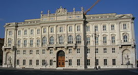
The territory consisted of two zones:
- Zone A with an area of 222.5 km² and 262,000 inhabitants mainly comprised Trieste and was occupied by British and US soldiers.
- Zone B with an area of 515.5 km² and 71,000 inhabitants comprised the north-west of Istria and was occupied by the Yugoslav People's Army.
This zoning prevented the actual emergence of a unified state structure, which it represented formally. The idea of the state found expression in its own Trieste currency , the Trieste lira, its own flag with a white halberd on a red background, its own international license plate (TLT) and its own state railway company, the Azienda autonoma delle ferrovie del Territorio libero di Trieste - AAFTLT.
The two military governments
Until the appointment of a governor - which never happened - the territory was provisionally ruled by the respective occupying power.
The commander of the British contingent was the military commander of Zone A - also known as the British-United States Zone or BUSZ - and was based at Duino Castle . The Allied Military Government (Allied Military Government, AMG) in Zone A was supported by two military contingents with 5,000 soldiers:
- the British contingent BETFOR (British Element Trieste Force) and
- the US contingent TRUST (Trieste United States Troops).
In Zone B , the commander of the Yugoslav contingent was the military commander. Below mentioned him Yugoslav military government (Svobodni Tržaški Teritorji - Vojna Uprava Jugoslovenske Armije, STT VUJA or Svobodni Tržaški Teritorji - Vojna Uprava Jugoslovenske Narodna Armije, STT VUJNA) was based in Capodistria / Koper .
Administrative division
The most important division in practice was that into the two zones A and B. The seat of the civil administration of zone A was in Trieste, that of the military and civil administration of zone B in Capodistria / Koper. The Yugoslavian administered zone B was again administratively divided, on the one hand into the Italian-Slovenian district of Capodistria, called Koprščina, on the other hand in the Italian-Croatian district of Buie, called Bujština. The border between these two military districts was formed by the Dragogna / Dragonja river , which still forms the border between Slovenia and Croatia today.
The territory consisted of 18 municipalities (ranked from north to south):
- Duino / Devin
- Nabrežina / Aurisina
- Zgonik / Sgonico
- Repentabor / Monrupino
- Trieste / Trst
- Muggia / Milje
- Dolina / San Dorligo della Valle
- Dekani / Villa Decani
- Koper / Capodistria
- Izola / Isola
- Pirano / Piran
- Marezige / Maresego
- Šmarje pri Kopru / Monte di Capodistria
- Umag / Umago
- Buie d'Istria / Buje
- Verteneglio / Brtonigla
- Grisignana / Grožnjan
- Cittanova d'Istria / Novigrad
safety
According to Article 3 of the Permanent Statute of the Free Territory of Trieste, the territory formed a neutral and demilitarized area. Accordingly, there was no separate Trieste military and there was also no conscription for the local population.
Until a governor and the government were appointed, the security of the territory was to be guaranteed by the stationing of 5,000 US, British and Yugoslav soldiers each, with the US and British units stationed in Zone A and the Yugoslav units in Zone B. . Then the troops should be withdrawn and the area permanently demilitarized.
In order to maintain public order and security inside, the territory had its own police forces and security services as provided for in Article 28 of the Statute:
- The civil police (Venezia Giulia Police Force, VGPF) was established in 1945 with a first parade of 700 police officers on October 13, 1945. It was organized on the British and American models and was soon considered to be one of the most modern police units on the European continent. In mid-1947 it had a manpower of 6,000.
- The Finance Guard (Guardia di Finanza) consisted of up to 1,200 police officers.
- The Administrative Police Corps (Polizia amministrativa) was established in 1949 and numbered around 300 men.
elections
The People's Legislative Assembly, consisting of a sixty-seat chamber, was elected by all citizens of the territory in accordance with Article 12 of the Statute, according to the principles of universal, equal, direct and secret suffrage. There were two elections, in 1949 and 1952, both in the A zone only. The campaigning parties achieved the following mandate levels:
| Political party | 1949 | 1952 |
|---|---|---|
| Christian Democrats ( Democrazia Cristiana ) | 25th | 28 |
| Communists (Partito Comunista del TLT) | 13 | 6th |
| Julian-Venetian Socialists (Partito Socialista della Venezia Giulia) | 4th | 5 |
| Independentists (Fronte Giuliano per l'Indipendenza di Trieste) | 4th | 5 |
| Neo-fascists (Movimento Sociale) | 4th | 4th |
| Republicans (Partito Repubblicano) | 3 | 4th |
| Monarchists (monarchici) | 3 | 1 |
| Liberals (Partito Liberale) | 1 | 3 |
| Slovenian lists | 1 | 1 |
| Titinian Communists (Comunisti titini) | 1 | 1 |
| Blocco Trieste / Unione Trieste | 1 | 1 |
| Socialists (Partito Socialista) | - | 1 |
economy
traffic
On September 19, 1947, responsibility for the territory's railway network was transferred to the newly founded Azienda autonoma delle ferrovie del Territorio libero di Trieste (Autonomous Railway Company of the Free Territory of Trieste - AAFTLT). The AAFTLT operated the following railway lines:
- from the Italian border at Duino via Barcola to Trieste Central Station (Trieste Centrale)
- from Villa Opicina / Opčine via Nabrežina and Barcola to Trieste Central Station
- from the Yugoslav border at Villa Opicina / Opčine via Guardiella to Trieste-St.Andrea
- from Trieste-Sant'Andrea via Servola / Škedenj to Aquilinia / Žavlje (near Muggia)
- the northern section of the connecting line between Trieste-St.Andrea and the Istrian Railway to Pula / Pola .
Postal services
The postal system reflected the internal division of the territory: In Zone A, the postal administration used Italian postage stamps on which the abbreviation AMG FTT (Allied Military Government Free Territory of Trieste) was printed. In Zone B, however, the Yugoslav administration introduced its own postage stamps with trilingual inscriptions (Italian, Slovenian and Croatian).
Tobacco monopoly
As in the rest of Europe, there was also a state tobacco monopoly in the Free Territory of Trieste . The prices were, however - also because of the numerous trade facilities granted by the Allies and the 20% lower taxes than in Italy - considerably lower than in neighboring countries. Cigarettes were on average 18% cheaper than in Italy.
media
Two radio programs were broadcast in the territory : Radio Trieste in Italian and Radio Trst A in Slovenian. In contrast, there were no radio stations in Croatian or German. However, the Croatian-speaking population was able to receive the Yugoslav media in their language.
The End
After the Allies had not been able to agree on the nomination of a governor in the UN Security Council, even seven years after the establishment of the territory , and the internal zoning of the territory had increasingly solidified against the backdrop of the Cold War , the attempt to establish a neutral one became apparent to create a multiethnic Free State of Trieste. Without a common governor, a uniform administration that was independent of the occupying powers could not be established. The Allies finally recognized this too - they ended the Trieste experiment.
On October 5, 1954, a memorandum was signed in London by the governments of Italy, Great Britain, the USA and Yugoslavia , with which the civil administration in Zone A was provisionally transferred to Italy and in Zone B to Yugoslavia; there were only minor border changes. Italy assured the continued existence of Trieste as a free port in accordance with the provisions of the peace treaty. The memorandum was also adopted by the UN Security Council. With the transfer of administration in Zone A to Italy by the Allied Military Government on October 26, 1954, the Free Territory of Trieste, administered by Great Britain and the USA, ceased to exist and on October 27, 1954, an Italian General Commissioner for the Free was made by an Italian decree Territory of Trieste established.
The area of the former Free Territory of Trieste was not finally divided between Italy and Yugoslavia until November 10, 1975 with the Treaty of Osimo .
See also
- Fiume Free State
- International conflicts in the successor states of Yugoslavia
- List of territorial disputes
Web links
Individual evidence
- ↑ Trieste Permanent Statute of FTT (English)
- ^ Worldstatesmen / Italy / Trieste by Ben Cahoon
- ↑ A / AC.25 / Com.Jer / W.4 . United Nations. Archived from the original on May 6, 2014. Retrieved June 5, 2013.


