Monthodon
| Monthodon | ||
|---|---|---|
|
|
||
| region | Center-Val de Loire | |
| Department | Indre-et-Loire | |
| Arrondissement | Loches | |
| Canton | Château-Renault | |
| Community association | Castelrenaudais | |
| Coordinates | 47 ° 39 ′ N , 0 ° 50 ′ E | |
| height | 115-172 m | |
| surface | 33.91 km 2 | |
| Residents | 631 (January 1, 2017) | |
| Population density | 19 inhabitants / km 2 | |
| Post Code | 37110 | |
| INSEE code | 37155 | |
| Website | http://www.monthodon.fr/ | |
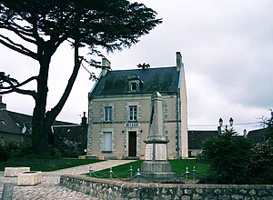
 City Hall (Mairie) of Monthodon |
||
Monthodon is a French municipality with 631 inhabitants (as of January 1 2017) in Indre-et-Loire in the region of Center-Val de Loire ; it belongs to the Arrondissement of Loches and the canton of Château-Renault . The inhabitants are called Monthodonnais .
geography
Monthodon is about 38 kilometers north-northeast of Tours . The Dême rises in the municipality . Monthodon is surrounded by the neighboring communities of Les Hermites in the north and west, Saint-Martin-des-Bois and Saint-Arnoult in the north, Prunay-Cassereau in the northeast, Authon in the east, Le Boulay in the south and southeast, Saint-Laurent-en- Gâtinais in the south and south-west and La Ferrière in the west and south-west.
history
In 1822 the previously independent commune of Le Sentier was incorporated into Monthodon.
Population development
| year | 1962 | 1968 | 1975 | 1982 | 1990 | 1999 | 2006 | 2013 |
| Residents | 701 | 673 | 579 | 560 | 547 | 559 | 621 | 598 |
| Source: Cassini and INSEE | ||||||||
Attractions
- Saint-Etienne church from the 11th century
- Old Saint-Pierre church in Le Sentier from the 12th century
- Protestant church in Le Sentier from 1896
- Two old wash houses
literature
- Le Patrimoine des Communes d'Indre-et-Loire. Flohic Editions, Volume 1, Paris 2001, ISBN 2-84234-115-5 , pp. 405-406.

