
Elsterheide
| coat of arms | Germany map | |
|---|---|---|

|
Coordinates: 51 ° 28 ' N , 14 ° 14' E |
|
| Basic data | ||
| State : | Saxony | |
| County : | Bautzen | |
| Height : | 128 m above sea level NHN | |
| Area : | 127.52 km 2 | |
| Residents: | 3463 (Dec. 31, 2019) | |
| Population density : | 27 inhabitants per km 2 | |
| Postal code : | 02979 | |
| Primaries : | 03571, 03564, 035722 (Geierswalde) , 035751 (Klein-Partwitz) | |
| License plate : | BZ, BIW, HY, KM | |
| Community key : | 14 6 25 120 | |
| LOCODE : | DE EHD | |
| Community structure: | 8 districts | |
| Address of the municipal administration: |
OT Bergen, Am Anger 36 02979 Elsterheide |
|
| Website : | ||
| Mayor : | Dietmar Koark ( CDU ) | |
| Location of the municipality of Elsterheide in the Bautzen district | ||
  |
||

Elsterheide , in Upper Sorbian , is the second largest municipality in terms of area in the Saxon district of Bautzen . It is located in the north of the district and belongs to the official settlement area of the Sorbs .
Geography and traffic
The community is located approx. 5 km northwest of Hoyerswerda and borders the state of Brandenburg in the north . Neighboring communities are New Zealand , Welzow and the city of Spremberg (all in Brandenburg) in the north, Spreetal in the east, the city of Hoyerswerda in the south, Lauta in the southwest and the city of Senftenberg (again in Brandenburg) in the west .
The federal highway 96 leads through the district of Nardt and the federal highway 156 through the district of Bluno .
The municipality is located in the Lusatian Lakeland . The Neuwieser See , the Blunoer Südsee , the Sabrodter See , the Geierswalder See , the Bergener See , the Partwitzer See , the Lugteich , the Kortitzmühler See and the Spreetaler See are in the municipality area. In total, more than half of today's municipal territory was changed by open-cast lignite mining. The Schwarze Elster flows through the village .
There is an airfield in the district of Nardt. The Knappenrode – Sornoer Buden railway is used exclusively for freight traffic.
history
The districts of Bluno, Nardt, Sabrodt and Tätzschwitz were "Germanized" in the course of the Germanization of Slavic place names by the National Socialists in 1936 and were called "Blunau", "Elsterhorst", "Wolfsfurt" and "Vogelhain" until 1945. After the end of the Second World War, the places got their original names back.
From 1938 to early 1948 was to Nardt that of the Wehrmacht built warehouse Elsterhorst that in World War II as an officers' camp was used then as a Soviet POW camp and as a transit camp for returning German soldiers and displaced persons.
The municipality of Elsterheide was created on July 1, 1995 from the once independent municipalities of Neuwiese, Sabrodt, Nardt, Klein Partwitz, Seidewinkel, Tätzschwitz, Bluno and Geierswalde. The district of Bergen was incorporated into Neuwiese on April 1, 1938.
Nardt

Oak in Nardt

War cemetery in Nardt


Population and language
According to statistics from Arnošt Muka from 1884/85, the population of today's districts of Elsterheide was almost exclusively Sorbian-speaking at that time. The Sorbian population was consistently over 98%. By 1956 it had dropped to 68.4% in today's municipality, with 83% of the inhabitants still speaking Sorbian in Klein Partwitz, while it was only 49% in Geierswalde. The language change to German took place mainly in the second half of the 20th century.
politics
Since the municipal council election on May 26, 2019 , the 16 seats of the municipal council have been distributed among the individual groups as follows:
- CDU : 8 seats
- Elsterheide electoral association: 6 seats
- Friends of the antenna community Bluno, Friends of the FFw Bluno, Friends of the LSV Bluno (Bluno): 2 seats
Community structure
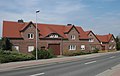
The following districts belong to the municipality of Elsterheide:
|
|
Culture and sights

- Half-timbered church in Bluno
- Easter egg museum
- Wassenburg, a former mill and a popular destination on the old course of the Black Elster
- Schrothholzscheune Bergen
- Tätzschwitz school room
- Sorbian farmhouse parlor Bergen
- Sabrodter Heimatstube
- Lusatian Lakeland
Regular events
- Easter market
- Easter fire
- Witch burning
- Potato ball
- Fair
- Maypole posts
- Maypole throwing
- Bird wedding
- Mardi Gras
literature
- Neumann: The place Bluno. in: Scholz: Heimatbuch des Kreis Hoyerswerda. Verlag Ziehlke, Bad Liebenwerda 1925, pp. 276–281 ( digitized version )
Web links
- Elsterheide
- Elsterheide in the Digital Historical Directory of Saxony
- Tätzschwitz
- Geierswalde
- Sabrodt
- Nardt
- Seidewinkel
- Lusatian Lakeland
Individual evidence
- ↑ Population of the Free State of Saxony by municipalities on December 31, 2019 ( help on this ).
- ↑ Saxon Sorbs Act , Annex to Section 3 (2)
- ↑ StBA: Changes in the municipalities of Germany, see 1995
- ↑ Ernst Tschernik: The development of the Sorbian population . Akademie-Verlag, Berlin 1954.
- ^ Ludwig Elle: Language policy in the Lausitz . Domowina-Verlag, Bautzen 1995, p. 249 .
- ↑ Results of the 2014 municipal council elections
- ↑ Results of the 2019 municipal council election, accessed on April 10, 2020
- ↑ Information from the Elsterheide municipal administration; As of December 31, 2016
- ↑ A look at the history of the Wassenburg Lausitzer Rundschau from November 15, 2007

Cities:
Bautzen (Budyšin) |
Bernsdorf (Upper Lusatia) |
Bischofswerda |
Elstra (Halštrow) |
Großröhrsdorf |
Hoyerswerda (Wojerecy) |
Kamenz (Kamjenc) |
Koenigsbrück |
Lauta |
Pulsnitz |
Radeberg |
Schirgiswalde-Kirschau |
Weißenberg (Wóspork) |
Wilthen |
Wittichenau (Kulow)
Municipalities:
Arnsdorf |
Burkau (Porchow) |
Crostwitz (Chrósćicy) |
Cunewalde |
Demitz-Thumitz |
Doberschau Gaussig (Dobruša Huska) |
Elsterheide (Halštrowska hola) |
Frankenthal |
Göda (Hodźij) |
Großdubrau (Wulka Dubrawa) |
Großharthau |
Großnaundorf |
Großpostwitz / OL (Budestecy) |
Haselbachtal |
Hochkirch (Bukecy) |
Königswartha (Rakecy) |
Kubschütz (Kubšicy) |
Laußnitz |
Lichtenberg |
Lohsa (Łaz) |
Malschwitz (Malešecy) |
Nebelschütz (Njebjelčicy) |
Neschwitz (Njeswačidło) |
Neukirch |
Neukirch / Lausitz |
Obergurig (Hornja Hórka) |
Ohorn |
Oßling (Wóslink) |
Ottendorf-Okrilla |
Panschwitz-Kuckau (Pančicy-Kukow) |
Puschwitz (Bóšicy) |
Räckelwitz (Worklecy) |
Radibor (Radwor) |
Ralbitz-Rosenthal (Ralbicy-Róžant) |
Rammenau |
Schmölln-Putzkau |
Schwepnitz |
Sohland on the Spree |
Spreetal (Sprjewiny Doł) |
Steina |
Steinigtwolmsdorf |
Wachau (Saxony)