Rivierenbuurt
| province |
|
| local community |
|
| Coordinates | 52 ° 21 ′ N , 4 ° 54 ′ E |
| prefix | 020 |
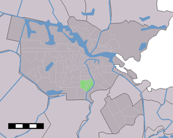
| Location of the Rivierenbuurt neighborhood in Amsterdam | |
The Rivierenbuurt ( German river district ) is a district in Amsterdam-Zuid ( province of North Holland ).
history
The Rivierenbuurt was created in the 1920s and 1930s and was part of “Plan Zuid” ( South Plan ) by the Dutch architect HP Berlage from 1905. Berlage's plan was partially implemented and in 1915 he submitted the second “Plan Zuid” at the request of the municipality with the facilities: hospital, church, schools, less green areas, university and fire station . This plan was then implemented, not only in the Rivierenbuurt , but also in what was then the Zuideramstel district .
The Berlagebrug ("Berlagebrücke") over the Amstel river has been located on the east side of the residential area since 1934 . On May 7, 1945, the Canadian armed forces came to Amsterdam over this bridge to liberate the city from the National Socialists . In 1958, the court Westerschelde Plein renamed Europaplein with the RAI - Convention Center . On the southern edge of the Rivierenbuurt is the "President Kennedylaan", formerly "Rivierenlaan", and the Martin-Luther-Kingpark . Since May 1st 2010, after the new division of the city districts and thus also the residential areas in Amsterdam, the Rivierenbuurt has been part of Amsterdam South. The tram -lines 4, 12 and 25 run through the district.
There are six schools and the Mirandabad and the Zorgvlied cemetery near the Scheldestraat shopping street . The Rivierenbuurt is in turn divided into the neighborhood quarter Remisebuurt, IJsselbuurt (with 2,395 inhabitants in IJsselbuurt West and IJsselbuurt Oost 2970), Scheldebuurt (with 4,435 inhabitants in Scheldebuurt West, Scheldebuurt Midden 3240 and Scheldebuurt Oost 2395), Weteringbuurt Zuid, Wielingerbuurt and Wolkenkrapperbuurt .
The most striking building in the Rivierenbuurt is the 'Wolkenkrabber' by JF Staal , a 12-storey high-rise. It was built as part of the residential complex around Merwedeplein by the Hilwis project development company, which went through several bankruptcies during the construction period.
In the 1930s, many were Jews from Germany to the Netherlands fled to the reprisals to escape the Nazis. The Dutch government at that time had decided to only accept Jewish refugees who were in "direct mortal danger" and they were not allowed to incur any costs to the Dutch state. When the Second World War broke out, there were around 80,000 Jewish residents in Amsterdam, a large number of whom lived in the Rivierenbuurt , including Anne Frank .
literature
- Ton Idsinga, Ingrid Oosterheerd (editor): Contrast en samenhang . Uitgeverij 010. Rotterdam 2009. p. 104. With CD . ISBN 90-6450-718-X
- Wil Swart: Schoonheid in verscheidenheid, de Rivierenbuurt in Amsterdam . Stadsdrukkerii Amsterdam 1998. ISBN 90-5366-087-9
Web links
- Rivierenbuurt Online , with details of all streets (Dutch)
Individual evidence
- ↑ See: Ton Idsinga, Ingrid Oosterheerd (editor): Contrast en samenhang . Quotation: “The Rivierenbuurt is an oude volksbuurt met vooral smalle straten, a few brede grachten en doorgaande because of. (…) In September 2000 the College van B en W de stedenbouwkundige visie van Krier voor de Rivierenbuurt vast. "
- ↑ Geheugen Van Plan Zuid . Article in De Tijd of 21 February 1916 to be served by Berlage plan Zuid 1915
- ↑ History of the Zuideramstel and Rivierenbuurt districts . Dutch, accessed January 18, 2013
- ↑ a b Kerncijfers wijken en buurten 2017 Centraal Bureau voor de Statistiek , accessed on April 26, 2018 (Dutch)
- ↑ Chronology of the persecution of the Jews . 13,000 murdered Jews in the Rivierenbuurt. With numerous photos. Dutch, accessed February 1, 2011


