Saravale
|
Saravale, Șarafola Sarafol Sárafalva Саравола, Saravola |
||||
|
||||
| Basic data | ||||
|---|---|---|---|---|
| State : |
|
|||
| Historical region : | Banat | |||
| Circle : | Timiș | |||
| Coordinates : | 46 ° 4 ' N , 20 ° 44' E | |||
| Time zone : | EET ( UTC +2) | |||
| Residents : | 2,670 (2013) | |||
| Postal code : | 307387 | |||
| Telephone code : | (+40) 02 56 | |||
| License plate : | TM | |||
| Structure and administration (as of 2016) | ||||
| Community type : | local community | |||
| Mayor : | Stoian Sava ( PSD ) | |||
| Postal address : | Str. Principală, no. 167 loc. Saravale, jud. Timiș, RO-307387 |
|||
| Website : | ||||
Saravale (colloquial: Șarafola , German: Sarafol , Hungarian: Sárafalva , Serbian / Croatian: Саравола , Saravola ) is a municipality in the Timiș district , in the Banat region , in southwest Romania .
Geographical location
Saravale is located in the west of Timiș County, on the DJ 682 county road, 65 kilometers from Timișoara , 50 kilometers from Arad and 10 kilometers from Sânnicolau Mare .
Neighboring places
| Hungary | Nădlac | Igriș |
| Sânnicolau Mare |

|
Periam |
| Tomnatic | Lovrin | Sânpetru Mare |
history
The first written mention of the place comes from the years 1333-1335, when the settlement appeared under the name Zarafola in the papal tithe lists and was inhabited by Romanians. In the following centuries, different spellings appear: 1557–1558 Csaranola , 1655 Szarafalu , 1723 Szaravolla , 1851 Szaravika . In 1926 the town was officially named Saravale
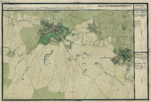
In 1508 the estate belonged to the Patocsi family. In 1529 the Turks completely destroyed the settlement. Then Francisc Patocsi settled the place with Serbs. The Serbs call the village Saravola . After the Peace of Passarowitz (1718), when the Banat became a Habsburg crown domain , Sarafol was part of the Temescher Banat . Romanians were settled here in the period 1723–1725. Later Germans from Tomnatic and Gottlob also settled. The village of Sarafal is noted on the Mercy map from 1723 .
On June 4, 1920, the Banat was divided into three parts as a result of the Treaty of Trianon . The largest, eastern part, to which Saravale also belongs, fell to the Kingdom of Romania .
The parish has emerged from the parish of Sânpetru Mare (Groß Sanktpeter) since 2004 .
Demographics
The population development of the municipality of Saravale:
| census | Ethnicity | |||||||
|---|---|---|---|---|---|---|---|---|
| year | Residents | Romanians | Hungary | German | Other | |||
| 1880 | 3606 | 1891 | 108 | 447 | 1160 | |||
| 1910 | 3944 | 2093 | 109 | 496 | 1246 | |||
| 1930 | 3714 | 2087 | 86 | 377 | 1164 | |||
| 1977 | 2804 | 2035 | 32 | 66 | 671 | |||
| 2002 | 2540 | 1943 | 17th | 18th | 562 | |||
Web links
- cjtimis.ro , Saravale on the Timiș County Council website
- ghidulprimariilor.ro , website of the Saravale City Council
- banater-aktualitaet.de , Through past German villages in the Banat: Sarafol
Individual evidence
- ↑ Mayoral elections 2016 in Romania ( MS Excel ; 256 kB)
- ↑ saravale.ro , Brief History of Saravale
- ↑ Information from the Romanian Parliament , accessed on September 7, 2018 (Romanian).
- ↑ kia.hu , (PDF; 982 kB) E. Varga: Statistics of the population by ethnicity in the Timiș district according to censuses from 1880–2002


